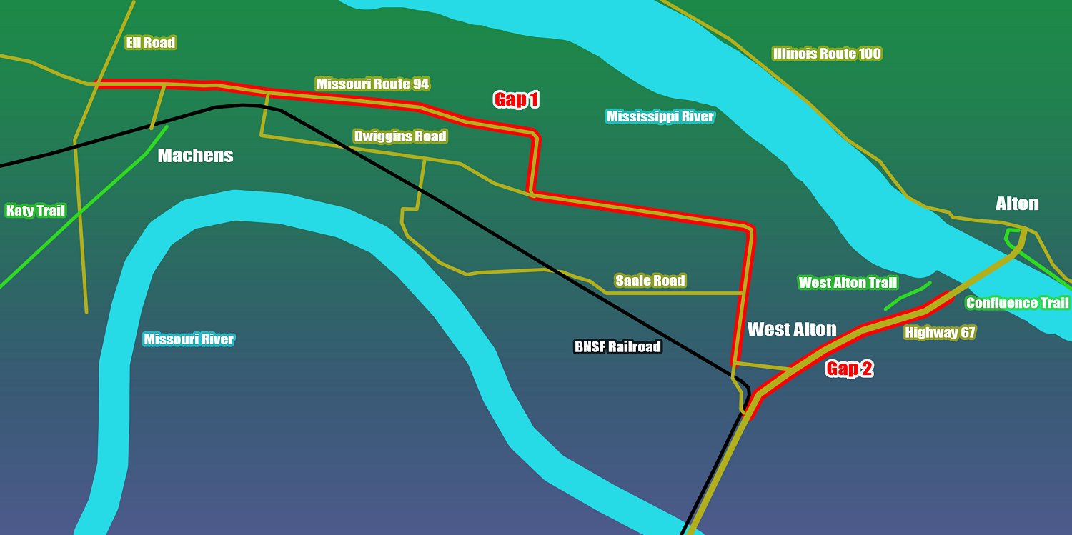
Gap 1: Machens to West Alton (HIGH Risk)
Riders wishing to continue east or south from the Katy Trail must exit the trail at Ell Road, heading north to Missouri Route 94.
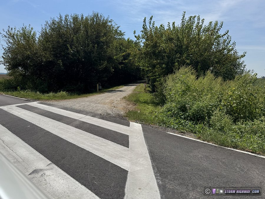 Katy Trail access on Ell Road west of Machens. Katy Trail access on Ell Road west of Machens.
Route 94 is a narrow, shoulder-less, high-speed (55mph speed limit) two-lane road running west out of West Alton. Actual vehicle speeds on this road average at least 60mph, and traffic levels are heavy (particularly during the morning/evening rush hours). It is not safe for cyclists.
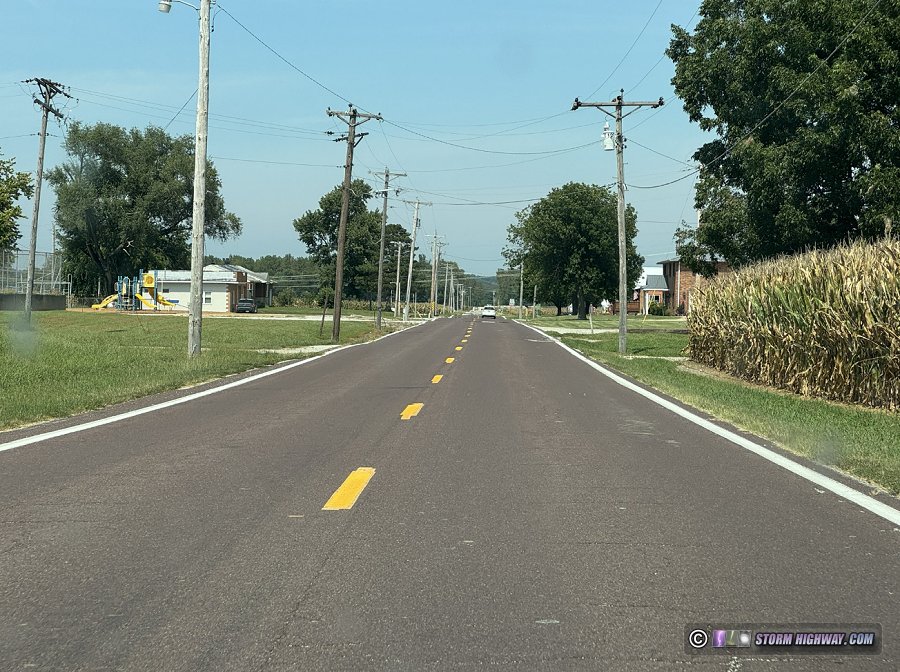 Route 94 in West Alton. Route 94 in West Alton.
Dwiggins and Saale Roads offer a safer bypass to avoid most of Route 94 between Ell Road and West Alton. While these roads are in the same configuration as Route 94 (narrow, no shoulders, high vehicle speeds), traffic is sparse on them.
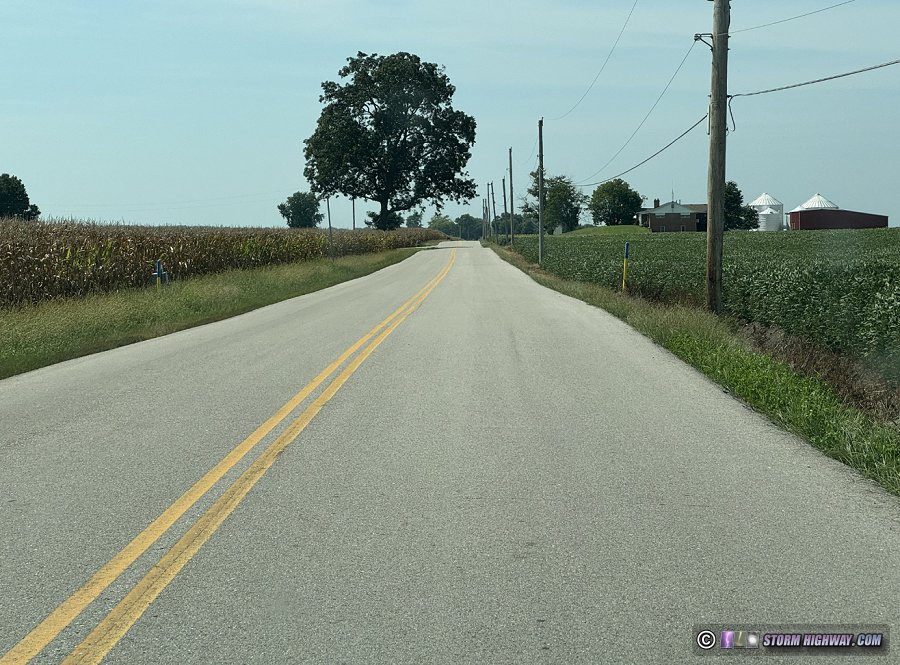 Saale Road west of West Alton. Saale Road west of West Alton.
Even when using Saale and Dwiggins Roads, two miles of riding on Route 94 are still necessary (between Ell Road and Dwiggins Road and again between Saale Road and West Alton). I don't believe the Route 94 dangers are worth the risk for cyclists to attempt. I personally will not ride this segment. Gap 2: West Alton to Alton (VERY HIGH Risk)
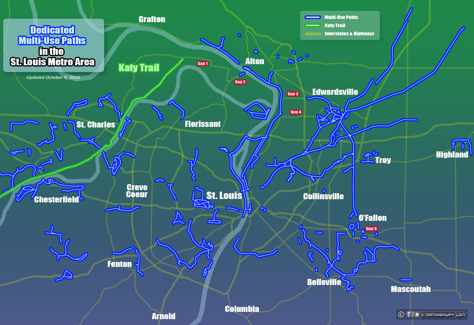
Prospects for a future trail are improved on the segment between West Alton, Missouri and Alton, Illinois. Great Rivers Greenway (a public trail development agency in St. Louis) and St. Charles County own parcels of land that together create a continuous strip from the Mississippi River all the way to West Alton along an old railroad right-of-way [ 2].
A multi-use path along this segment has been in the planning stage, and a short length of the path - named the West Alton Trail - has been built westward from the Lincoln Shields Recreation Area (a public park on the river across from downtown Alton). Plans are to extend the West Alton Trail all the way to its namesake town.
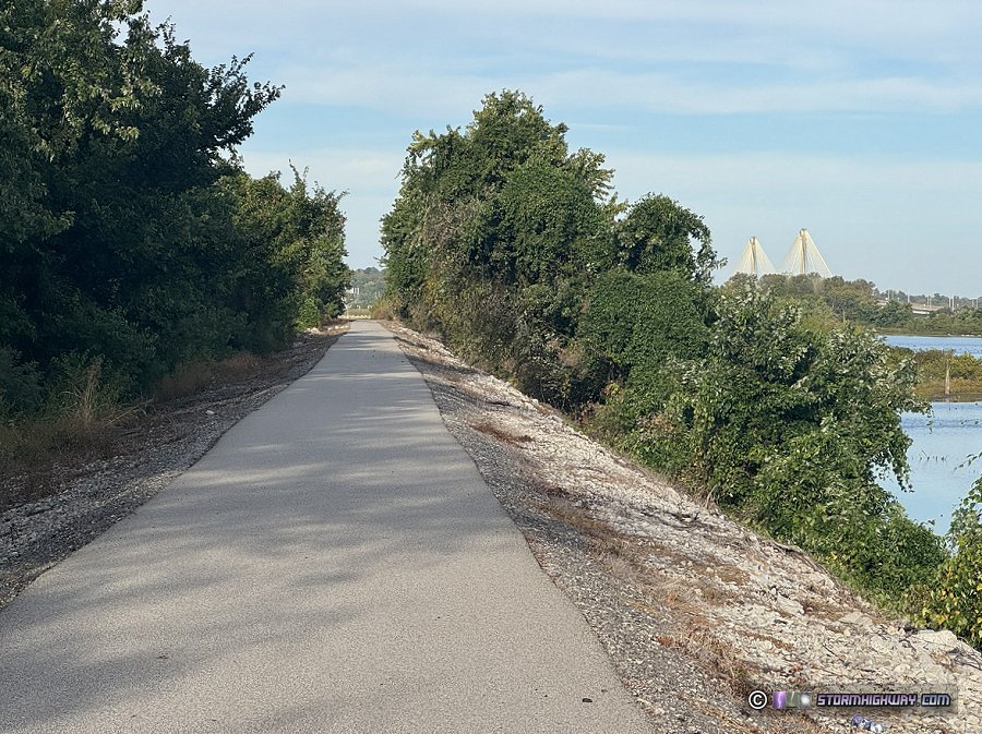 The wide and asphalt-paved West Alton Trail. The wide and asphalt-paved West Alton Trail.
Unfortunately though, the West Alton Trail does not yet create a usable connection for cross-country riders. The trail terminates into landlocked dense overgrowth approximately 1 mile from the Recreation Area, with no connections westward or to adjacent roads.
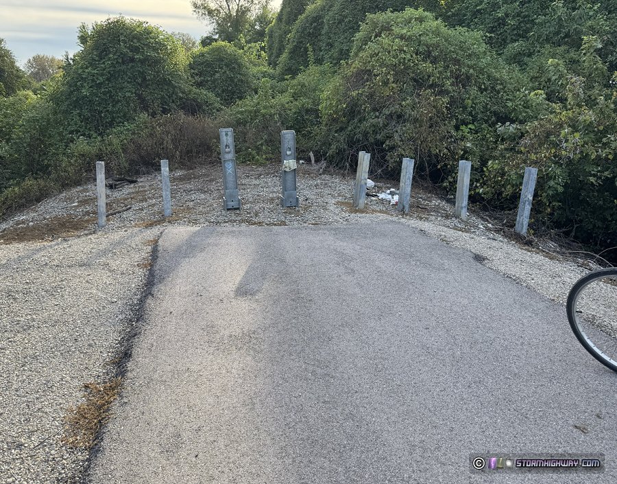 The current western end of the West Alton Trail. The current western end of the West Alton Trail.
Some maps show a trail exists past this point, but it is impassable due to overgrowth and is blocked by thick vegetation and a gravel berm at St. Charles Street.
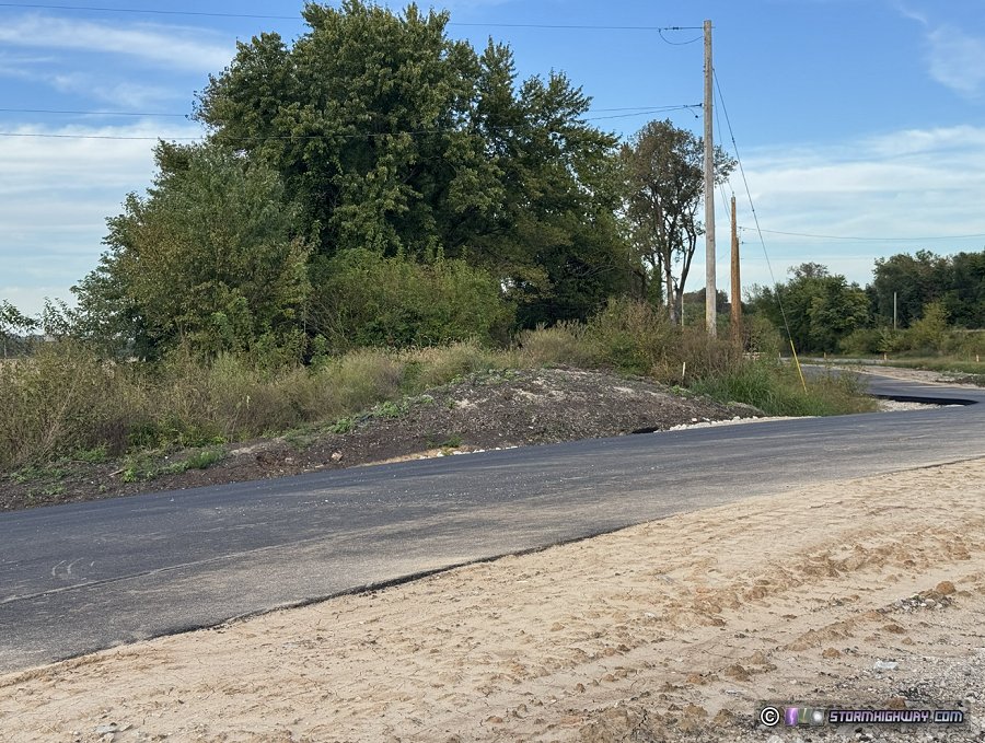 The future location of the West Alton Trail at St. Charles Street, currently inaccessible. The future location of the West Alton Trail at St. Charles Street, currently inaccessible.
Currently, the West Alton Trail unfortunately is of no use for cyclists riding to and from the Katy Trail. Riders must use the shoulder of US Route 67 on the segment between West Alton and the Clark Bridge. Unprotected bike lanes are in place on both sides of the Clark Bridge itself.
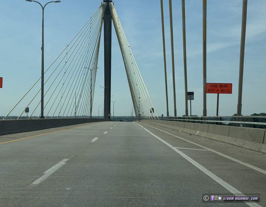 Southbound bike lane on US 67 on the Clark Bridge in Alton. Southbound bike lane on US 67 on the Clark Bridge in Alton.
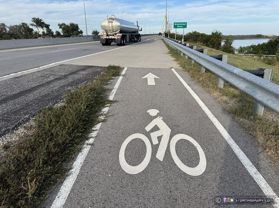 Start of the northbound bike lane on US 67 on the Clark Bridge in Alton. Start of the northbound bike lane on US 67 on the Clark Bridge in Alton.
South of the Clark Bridge, shoulders of the four-lane US 67 are in very poor condition for cycling. They have long sections covered with loose gravel, are narrow in spots and are not kept clean.
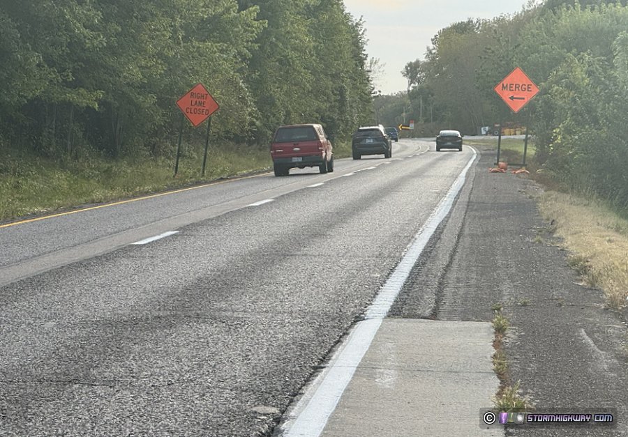 Shoulder conditions on US Route 67 southbound. Shoulder conditions on US Route 67 southbound.
The speed limit on this stretch of road is 55mph, but traffic is almost always very heavy and moving at 65mph or higher. Traffic conditions are the same as a four-lane interstate highway, and this stretch of road has a reputation for an abnormally high incidence of crashes, injuries and fatalities [12].
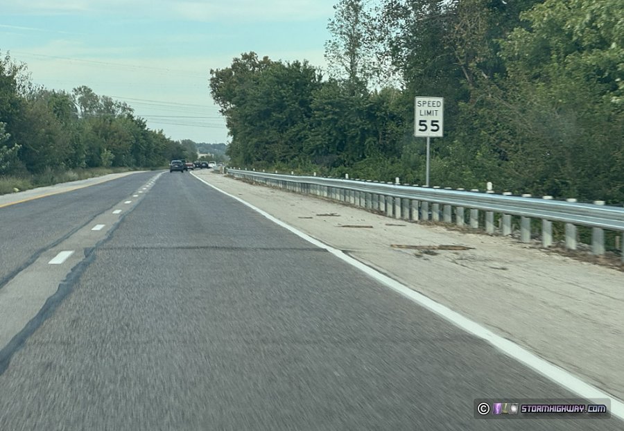 US Route 67 northbound. US Route 67 northbound.
The US 67 segment presents a rather extreme danger for cyclists, more so than the Route 94 segments. I personally will not ride this segment and do not recommend that cyclists attempt it. Gap 3: Madison Avenue in Roxana (Moderate Risk)
Most cross-country riders will elect to use the Confluence Trail southward from Alton to reach either St. Louis or points east in Illinois. The rest of the extensive Madison County trails network offers many options for eastbound-through-Illinois riders, but navigating a 3-mile gap via Madison Road in Roxana from the Confluence Trail is necessary [ 1].
Madison Avenue is a narrow two-lane road with little or no bikeable shoulders. It borders industrial facilities for much of its length, where any shoulders are uneven with loose gravel. Speed limits range from 45mph to 55mph, and actual traffic speeds are frequently faster.
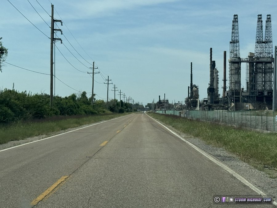 Madison Avenue between Roxana and Hartford. Madison Avenue between Roxana and Hartford.
The main mitigating factors are that it is arrow-straight and has lower traffic numbers outside of rush hour times. While not as dangerous as Gaps 1 and 2, I don't believe this segment is worth the risk for most riders. Gap 4: New Poag Road (Moderate Risk)
New Poag Road is an east-west road between the Mississippi River and Edwardsville, Illinois, south of and paralleling Madison Avenue. It is an alternative to Madison Avenue for reaching the rest of the Madison County Trail (MCT) network. Maps show it as an official bike route connecting the Confluence Trail to the MCT trail network in Edwardsville [ 1].
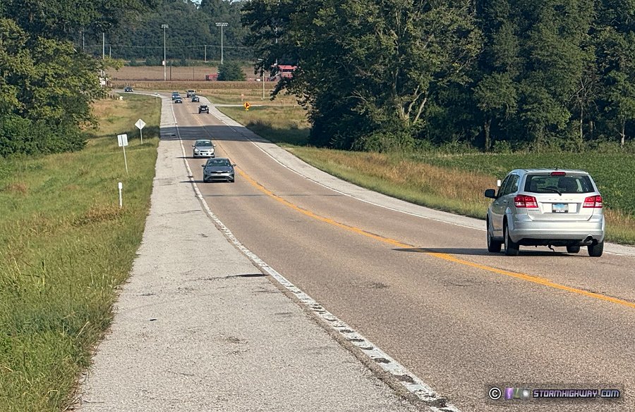 New Poag Road New Poag Road
New Poag is a 55mph two-lane road with high traffic levels. While it has wide shoulders that give room for a cyclist to not have to "take the lane", riders will still be in unprotected close proximity to heavy traffic traveling at speeds averaging over 60mph.
My personal risk tolerance would dissuade me from using this road as a regular cycling route. However, it is likely above-average in terms of roads that cross-country cyclists are used to. Gap 5: Highway 50 in O'Fallon (HIGH risk)
Cross-country riders opting to head east on the Highway 50, Highway 177 or Highway 161 corridors through Illinois would use the Goshen Trail to O'Fallon and then the MetroBikeLink trail to reach the east side of Silver Creek. This involves riding along Highway 50 from Weber Road to Shiloh Valley Township Line Road.
Highway 50 is a two-lane road with zero shoulders (the pavement ends with a drop-off into grass at the outside edge of the white painted line). Cyclists must ride in the traffic lane ("take the lane") on this segment. While speed limits on Highway 50 in this area are between 35mph and 45mph, traffic is very heavy at most times of day, with long lines of cars nearly continuous in both directions. Vehicles will be unable to pass cyclists at most times of the day thanks to continuous opposing traffic, which will lead to disruptive traffic backups and aggressive/unsafe passing attempts.
While there are a few side streets that riders can use to bypass short segments of Highway 50, most of it has no bypass options and riding on it is unavoidable. I will not attempt to ride on this segment of Highway 50 and I would not recommend that cyclists attempt it.
The good news is that a parallel multi-use path along this segment has been funded that, when constructed, will completely eliminate this gap. Groundbreaking is expected soon, with a planned completion sometime in 2027. Alternate Route: Grafton Ferry (Moderate Risk)
View this segment on Ride With GPS | Download GPX file
A common suggestion for riders heading east from the Katy Trail is to use the Grafton Ferry to cross the Mississippi River into Illinois. This is indeed the only cycling alternative to Route 94 and US 67.
The route from the Katy Trail to the Grafton Ferry is safer than riding on any length of Route 94. However, this far more circuitous path (25.6 miles as opposed to 12.6 miles via Route 94 and US 67) requires cyclists to ride on the Great River Road (Illinois Route 100) from Grafton to Alton.
From Grafton to Piasa Creek (roughly two-thirds of the way to Alton), some maps erroneously show the bike route as being on a separate/protected path. It actually consists of unprotected bike lanes on the shoulders of the four-lane, high-speed Great River Road.
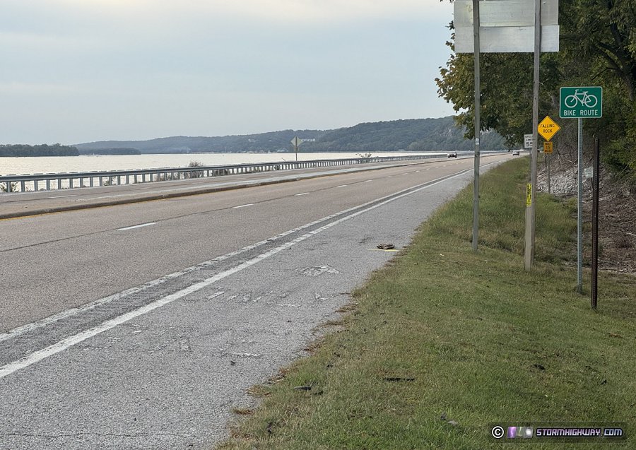 Northbound (westbound) bike lane on the Great River Road (Illinois Route 100) at Elsah. There is no separate/protected path on the east/north (bluffs) side of the road as some maps erroneously show. Northbound (westbound) bike lane on the Great River Road (Illinois Route 100) at Elsah. There is no separate/protected path on the east/north (bluffs) side of the road as some maps erroneously show.
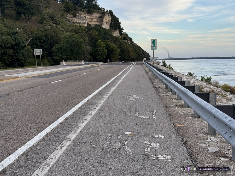 Southbound (eastbound) bike lane on the Great River Road at Elsah. Southbound (eastbound) bike lane on the Great River Road at Elsah.
Traffic is lighter than US 67, but excessively-speeding drivers are common despite the 55mph limit. Cyclists must ride between this high speed traffic and the guardrail along the riverbank. While nothing out of the ordinary for seasoned cross-country riders, many who are accustomed to trails do not feel safe riding on the Great River Road, and I tend to agree.
A dedicated multi-use path, the Sam Vadalabene Trail, runs 5.6 miles from Piasa Creek to the western outskirts of Alton (at Piasa Park), covering roughly one-third of the 15 miles from Grafton. Unfortunately, this trail is prone to standing water, fallen trees and rockfall debris from the bluffs above it. It is not rigorously maintained.
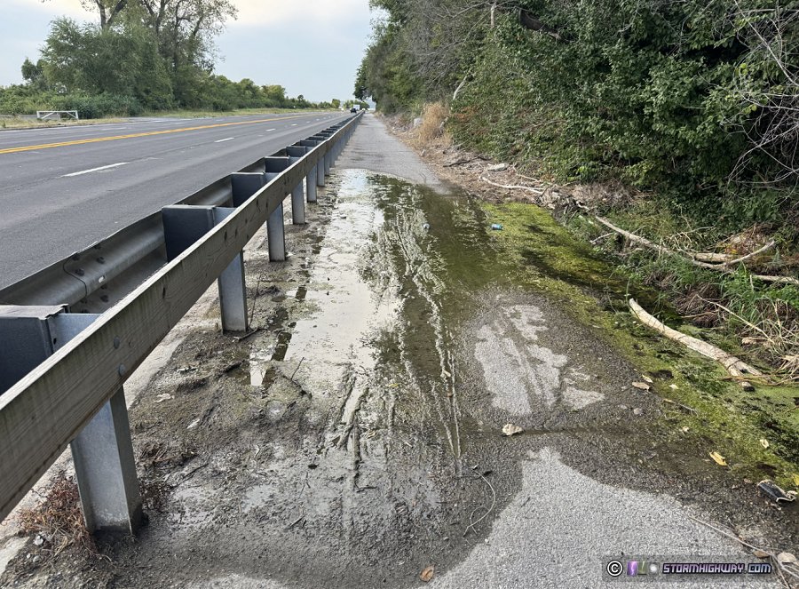 An area of persistent algae-covered standing water across the Sam Vadalabene Trail An area of persistent algae-covered standing water across the Sam Vadalabene Trail
Again, some maps show the Sam Vadalabene trail as a separated multi-use path going all the way to Grafton, which is not accurate. It only exists as unprotected bike lanes between Grafton and Piasa Creek.
After the Sam Vadalabene Trail ends at Piasa Park, riders face a 0.7 mile transit on the remainder of the Great River Road into Alton. This segment has little to no shoulders in the tight space between the railroad tracks and the river. The speed limit is 35mph here, though most drivers go much faster as is the case on the rest of this road.
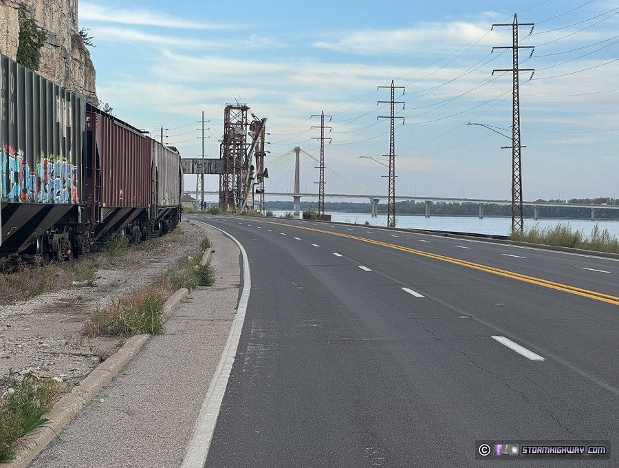 The Great River Road between the Sam Vadalabene trailhead at Piasa Park and downtown Alton. The Great River Road between the Sam Vadalabene trailhead at Piasa Park and downtown Alton.
Conclusion: Arrange a shuttle between Machens and Alton
My current opinion on the best plan for a long-distance rider continuing a cross-country ride from the Katy Trail: Arrange a shuttle for you and your bike from Machens to Alton (or have a friend with a pickup truck give you a ride). There are business in the area offering this type of service to Katy Trail riders.
I would highly discourage trying to ride on Route 94 or US 67. You of course can make your own decision. I'd recommend at least driving these segments first to see them for yourself before deciding to ride a bicycle on them. Google Street View can also give you a good feel of what they are like. Final thoughts
Thankfully, trail development agencies in the area are aware of the desire and need for these gaps to be bridged. I'm fairly certain there has already been a lot of behind-the-scenes work in progress.
The possibilities opened up by a complete through-route in this area are interesting to ponder. Could we one day see the new eastern terminus of the Katy Trail at the Mississippi River waterfront at the Lincoln-Shields Recreation Area? Could West Alton become a new hotspot for businesses serving cross-country riders like so many along the trail in Missouri? Could Alton, Edwardsville, O'Fallon or even the Gateway Arch in downtown St. Louis become the new starting or ending point for Katy Trail expeditions to/from Kansas City? Could such a connection encourage the development of a new Great American Rail-Trail-like route across the USA through St. Louis?
I think the development of this corridor will be interesting to watch. I'll do my best to update this page as new information becomes available.
Sources and References
 About the Author: Dan Robinson has been a storm chaser, photographer and cameraman for 34 years. His career has involved traveling around the country covering the most extreme weather on the planet including tornadoes, hurricanes, lightning, floods and winter storms. Dan has been extensively published in newspapers, magazines, web articles and more, and has both supplied footage for and appeared in numerous television productions and newscasts. He has also been involved in the research community, providing material for published scientific journal papers on tornadoes and lightning. |
Home | The Message | Contact | Youtube
|

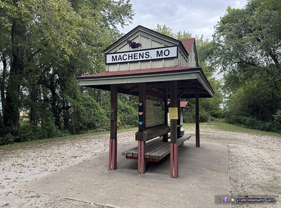 The eastern terminus of the Katy Trail at Machens, Missouri.


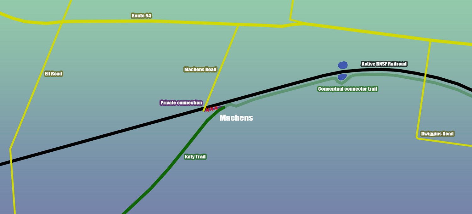
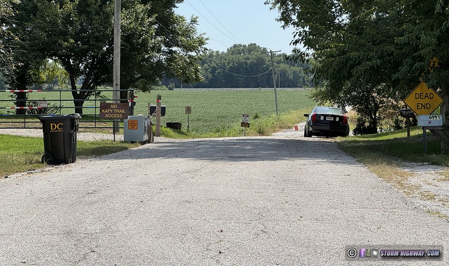 Private property blocks access to the eastern terminus of the Katy Trail from Machens Road.
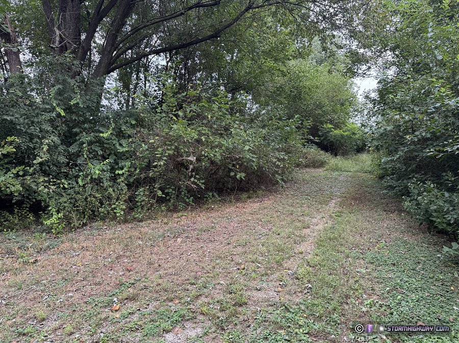 The original path on private land from the end of the trail to Machens Road (shown on some maps) is overgrown, impassable and closed to the public. A private driveway to Machens Road crossing the trail just to the west is also not open to the public.
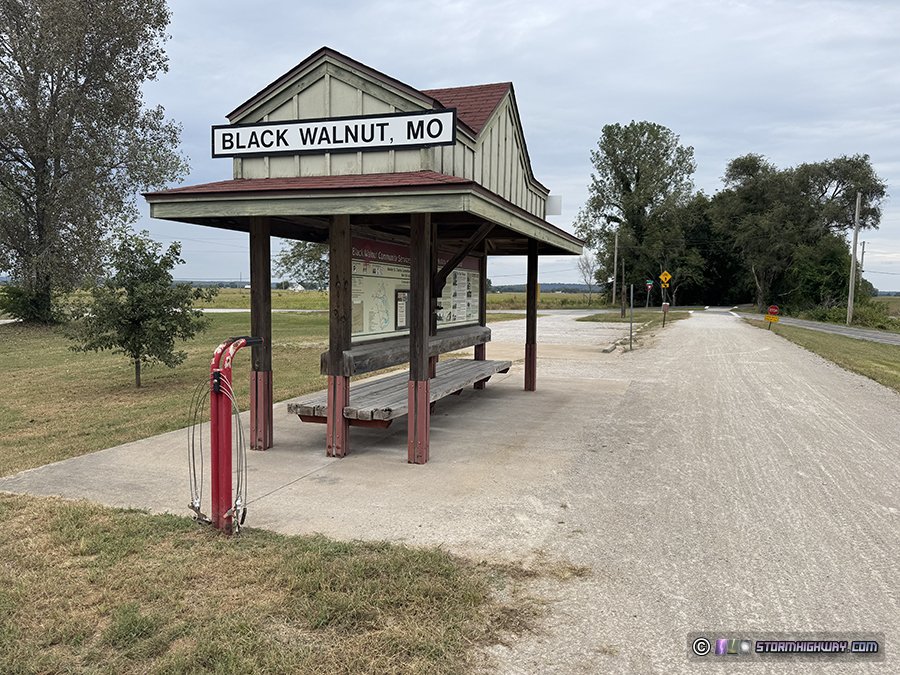 The Black Walnut trailhead is the last access point on the Katy Trail with public parking.