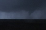
DAY 7: May 30 - Colorado tornado
Video capture - click to enlarge
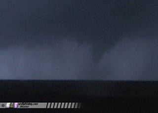
Tornado near Pritchett, Colorado on Monday
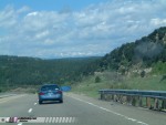
Monday, May 30 - Started the day in foggy Clayton, headed north to Raton, NM and eventually Trinidad, CO. On the way, the scenery along the edge of the Rockies was spectacular -and we even caught a glimpse of the snow-capped mountains. Snow was definately not something I expected to see on a storm photography expedition in late May.
Digital photos - click to enlarge
  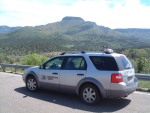
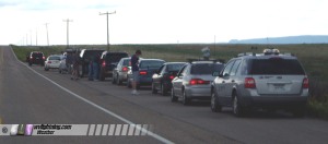
We met up with a 11-vehicle caravan of storm photographers, the longest convoy I've traveled in.
Digital photo - click to enlarge
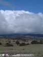
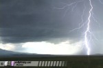
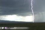
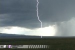
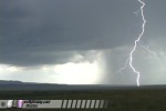
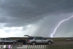
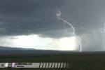
Storms fired on the mountains by early afternoon, and we moved just northeast of Trinidad to watch the development for the next few hours. Lightning activity was spectacular:
Video captures - click to enlarge
As we headed east to stay with the storms, Amos hit a deer with his 4Runner at 70MPH, heavily damaging the front end.
Video captures - click to enlarge
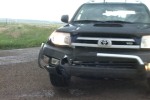 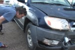
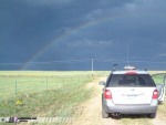
After a brief assessment of the situation, we decided that the car was still drivable, and continued on. The storm to our south looked very impressive on radar, so we dropped south to near the NM/CO border to get a view of the updraft base. As we stopped to watch, the storm produced a persistent funnel for several minutes, but quickly fizzed with a rainbow developing to the east.
Digital photos - click to enlarge
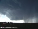 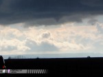 
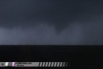
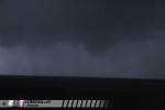
The storms evolved into a line of four supercells to our east, so we moved to keep up - initially targeting the northernmost storms. The southern two cells became dominant and were moving our way, so we stopped to let them catch up. As they did, they intensified rapidly. Tornado warnings were issued based on sightings to our southwest, but we couldn't see anything from our vantage point. Unpaved roads limited our mobility, so we waited for the updraft to reach the main road. As it did, it continued to intensify. Inflow was strong and low clouds raced into the circulation. We carefully approached from the east until we saw rapid rotation and upward motion directly in front of us. We stopped quickly and began filming the wall cloud, which was now just north of the road and moving northeast. We were very close and could hear the whooshing sound from the rain curtains wrapping around the circulation. After about two minutes, a funnel formed quickly and developed 3/4 of the way to the ground. A small debris whirl on the surface lasted less than a minute as the tornado touched down. It lifted just as quickly as it had formed.
Video captures - click to enlarge
It was getting dark and difficult to see storm features, so we decided to call it a day. We stopped briefly twice to observe strong circulations that were showing up on radar, but with nightfall it was nearly impossible to see. At our last pull-off, we were stopped at the intersection of a very slick muddy road. While attempting to turn around, Jason's car slid off the steep edge of the road and got hopelessly stuck. But with a tow strap and Amos' four wheel drive, we were able to pull the car out and get back on the road.
We stopped in Dalhart, Texas for the night. We're now heading south to the Lamesa, Texas area for another round of severe storms on Tuesday.
GO: Home | Storm Expeditions | Photography | Extreme Weather Library | Stock Footage | Blog
Featured Weather Library Article:
|