Home | Blog Index | Blog Archives | Christianity & Faith Essays | Storm Chasing Essays
Dan's Blog: Extreme Weather, Storms, Photography and Videos
This is an index of my most recent posts, in chronological order. You can also subscribe to the Blog RSS/XML feed or view the post archives page.
Latest Blog Posts Index:
July 26:
On Sunday, July 26, the dewpoint at Lambert Airport reached 81°F, setting the all-time record for that location. At 1PM, the dewpoint was 86°F at Washington, Missouri (KFYG) and 85°F at Scott AFB/MidAmerica Airport (KBLV), both potential records for those locations as well.

Read full post >> |
July 19:
The St. Louis metro area has one of the best network of bike trails in the Midwest. This is particularly true of the Illinois side of the metro area (the STL "Metro-East") with the expansive and growing Madison County Transit and MetroBikeLink trail systems.

Read full post >> |
July 13:
Back in 2020, I put together an article detailing the (lack of) bicycle-safe commuting routes around Scott Air Force Base and O'Fallon, Mascoutah and Lebanon, specifically, the missing link of a safe way to cross the barrier of Silver Creek. Six years later, that missing link has been built! On June 27, the St. Clair County Transit District officially opened the latest extension to the MetroBikeLink trail system to MidAmerica Airport. This trail was built in tandem with the Metrolink light rail extension to the airport, paralleling the tracks from the Shiloh/Scott station to the airport.

Read full post >> |
June 30:
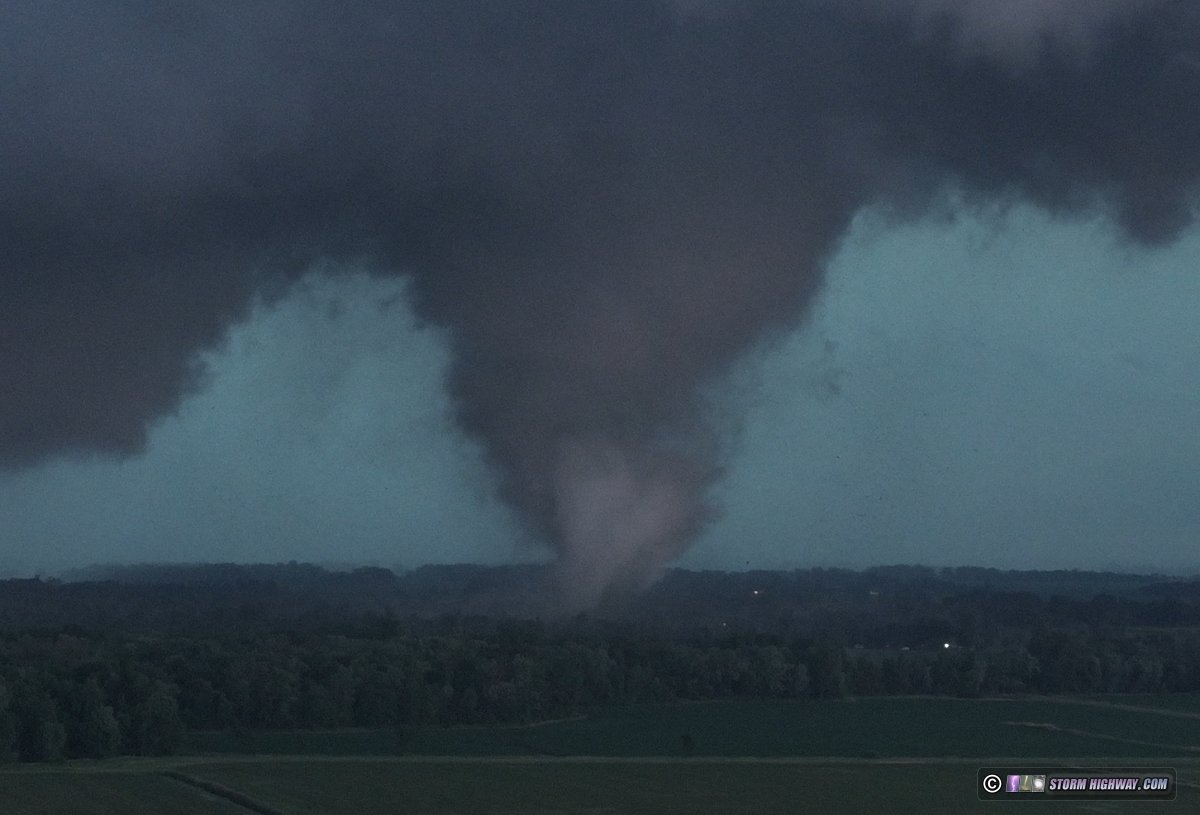
The peak tornado season in May and June of 2026 featured a prolific series of tornado outbreaks in the Midwest.
Read full post >> |
June 25:
What a strange and remarkable spring this was! It was a much longer season that normal, with much of the action away from the typical areas.
Read full post >> |
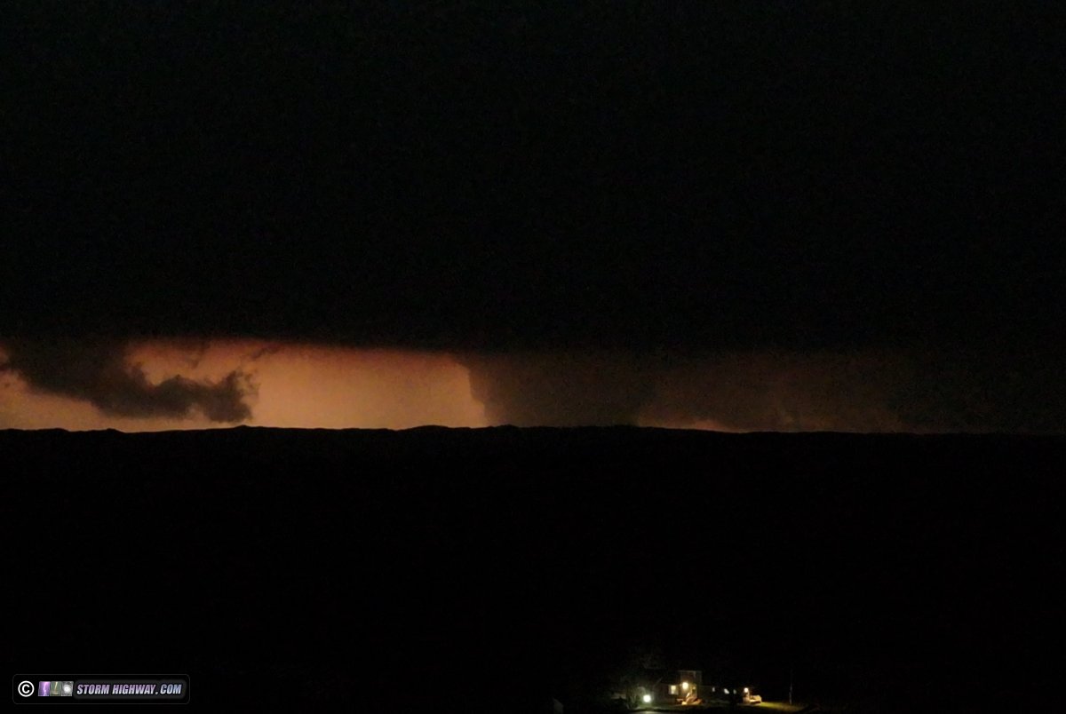
June 11:
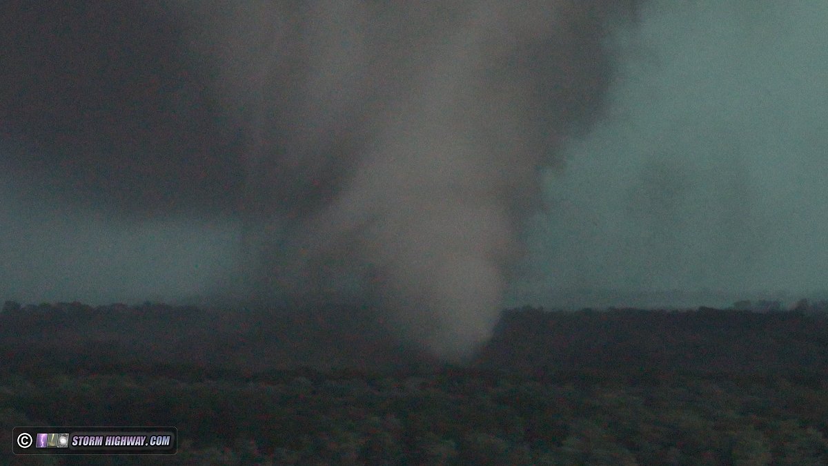
I observed three tornadoes during a historic outbreak in northern Illinois and Indiana.
Read full post >> |
May 26:
As part of my larger page on the copyright infringement issue, I put together this calculator and data table to educate social media users how much money their posts earn for the platform, and how much is taken from creators when their videos are stolen. This information is based on current data (as of May 26, 2026) on advertising rates and CPM, some of which are estimated averages.

Read full post >> |
May 22:
As we move into the climatological peak of tornado season - late May - things are not looking good for storm chasers virtually anywhere in the central United States.

Read full post >> |
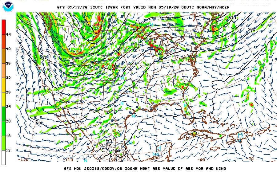
May 13:
I've you've followed my chase forecast blog updates over the years, you know why I don't go very far beyond 7 days in terms of chase trip planning. That's because the springtime jet patterns over the USA are notoriously difficult to forecast very far in advance.
Read full post >> |
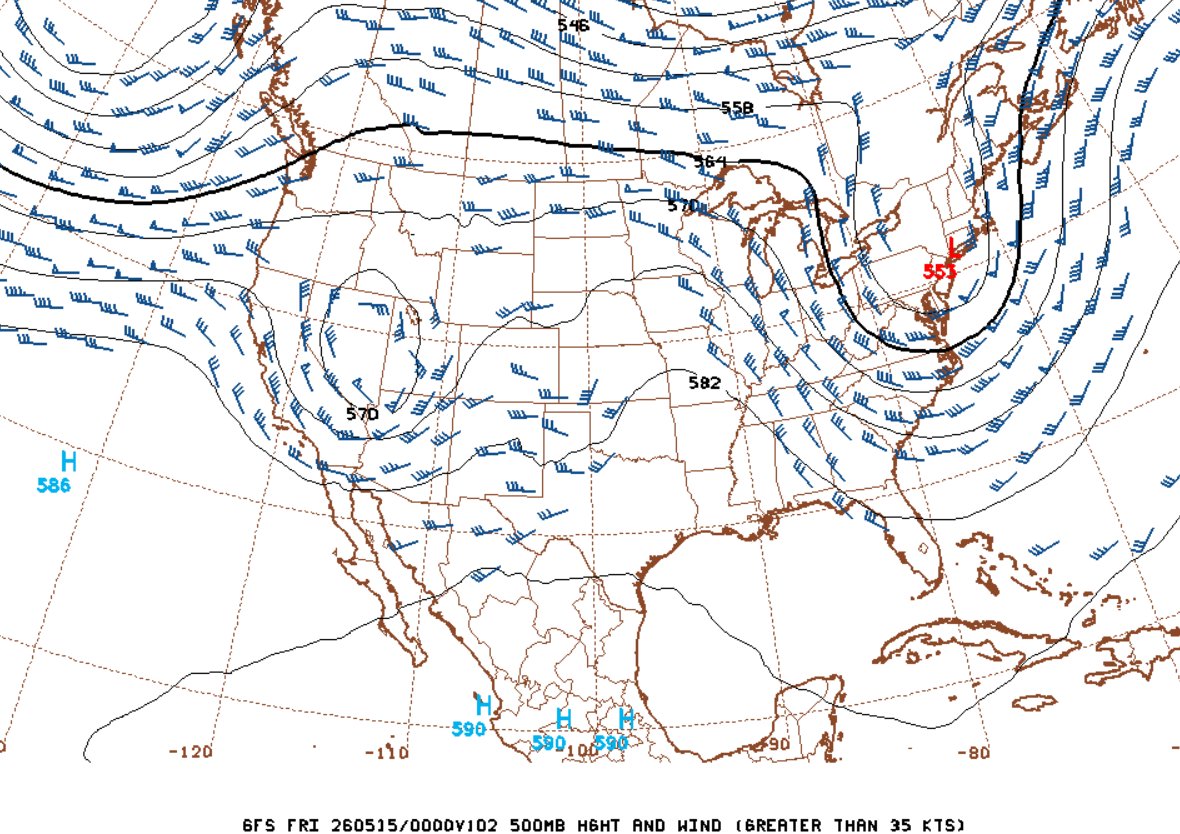
May 10:
Medium-to-long range models continue to paint a well-below-average picture of severe storm activity in the Great Plains and Midwest for as far out as we can reasonably forecast (roughly 10 days out).
Read full post >> |
April 30:
March and April of 2026 were very active months for storms in the Midwest. Despite my limitations for chasing out of the area, I was able to observe and capture several memorable events.
Read full post >> |
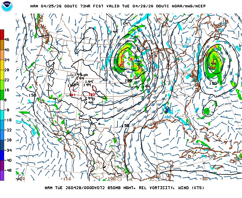
April 25:
Another pair of classic Plains supercell tornado days looks to be on tap for today (Saturday) and tomorrow (Sunday) before the ejecting wave brings the final events of the sequence to the Midwest on Monday and Tuesday:
Read full post >> |
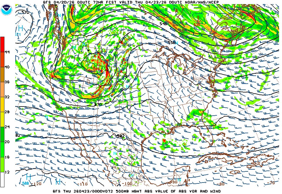
April 20:
Models continue to show a somewhat active pattern across the southern Plains and Mid-South as moisture and fast upper-level flow are colocated.
Read full post >> |
April 13:
We've had many discussions on Stormtrack about how much of the 1990-2010 era of storm chasing has vanished from the internet. This is happening as more and more chaser web sites go offline and modern-day chasers exclusively do little more than make fleeting posts on the unsearchable abyss of social media.
Read full post >> |
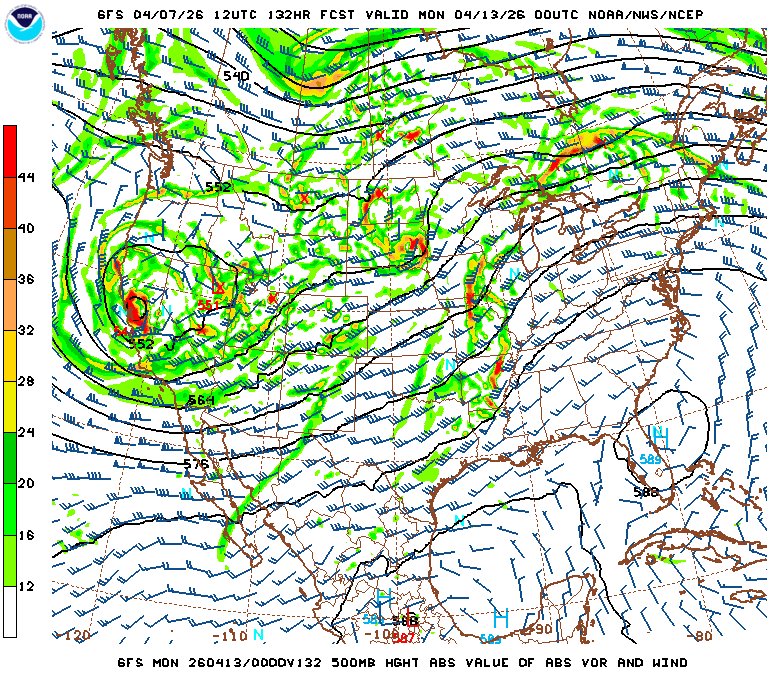
April 7:
Models indicate a return to western upper troughing for at least 5 days starting this weekend, with attendant Gulf moisture return northward into the Great Plains. A sharpening dryline is shown by Sunday the 12th as the first of several shortwaves ejects out over the Plains/Midwest.
Read full post >> |
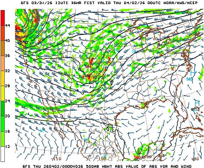
March 31:
Peak tornado season is finally upon us here in the Plains and Midwest. As anticipated a week ago, we're entering a brief active interval as a couple of shortwave troughs eject across the country over returning Gulf moisture.
Read full post >> |
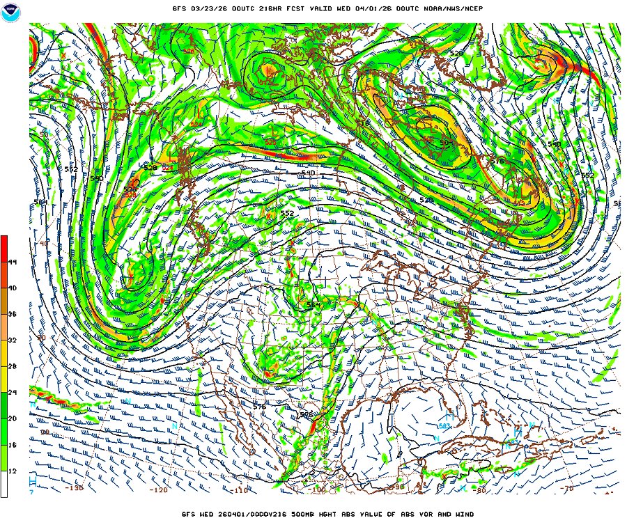
March 23:
As we advance another week into March, the first days of April are beginning to move into the 10-day window of reasonable long-range forecasts.
Read full post >> |
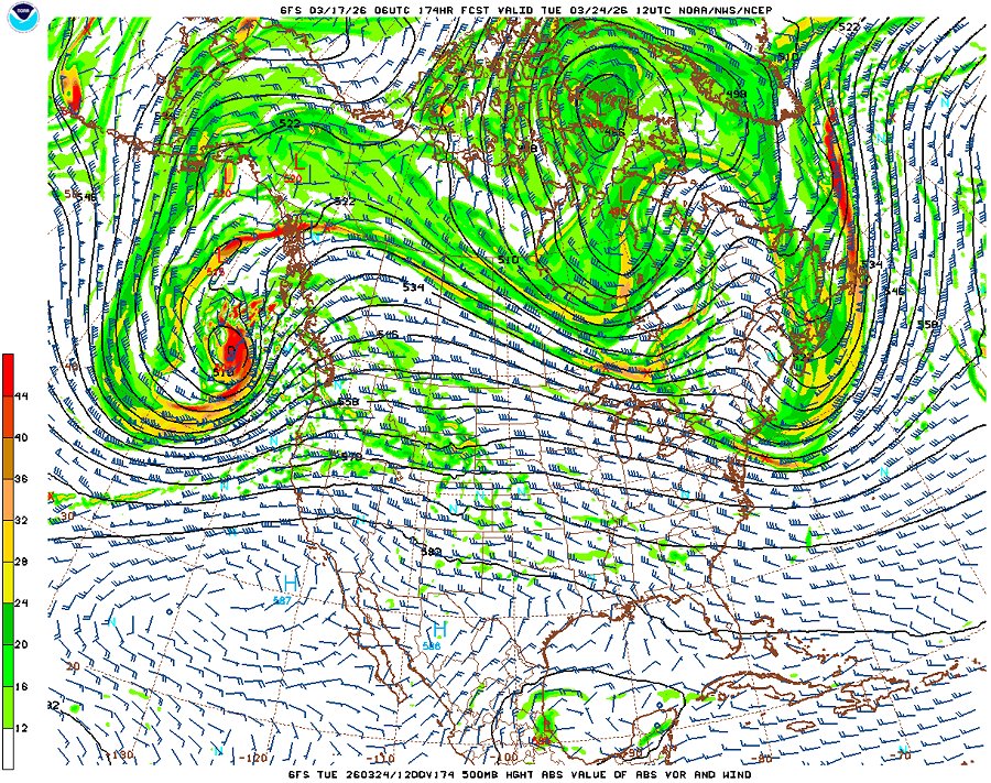
March 17:
As is often the case with early active severe weather patterns, we'll 'pay for it' with an extended period of downtime afterward.
Read full post >> |
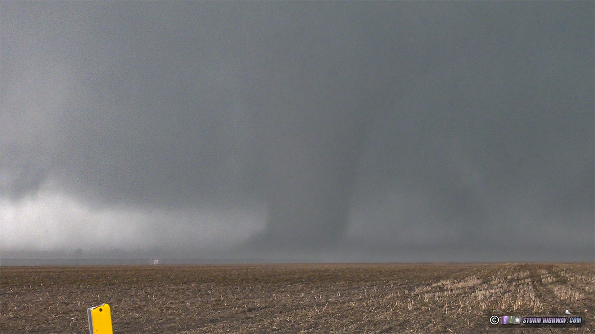
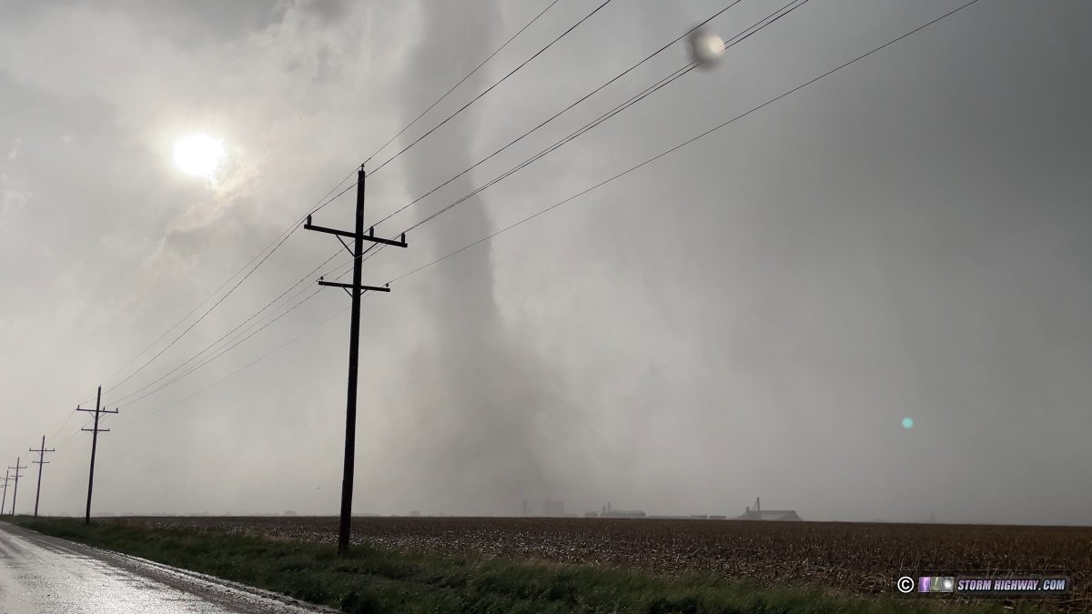
March 10:
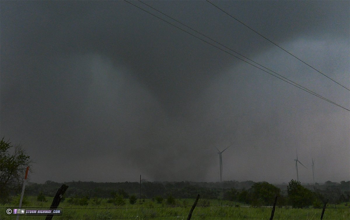
I observed four tornadoes from Pontiac, Illinois to near Knox, Indiana on Tuesday, March 10, including a significant tornado on the south side of Kankakee.
Read full post >> |
March 1:
It's that time of year again! We've made it through another long winter to the date storm chasers around the world celebrate: the start of meteorological spring and severe storms season in the Great Plains and Midwest. The green trees, warm temperatures and open roads of the Plains await us - and of course, the most spectacular storms on the planet!
Read full post >>
|
November 30:
The past two months have been mostly quiet, with a couple of nice events in middle November.
Read full post >> |
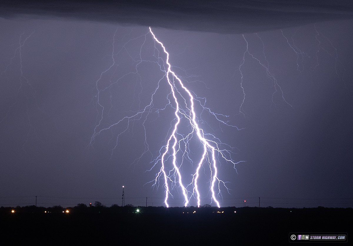
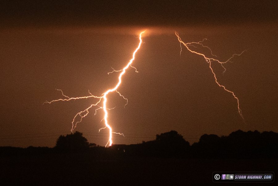
September 22:
The end of summer 2025 also marked the end of my professional storm chasing/TV cameraman career. This distant lightning, viewed from just outside of my town of New Baden, Illinois on September 21 was a fitting metaphor for the dream that has become a memory, fading away into the night.
Read full post >> |
June 30:
The peak of spring severe weather season this year was a challenging one, with several big misses and no "catch of the year" to speak of. Despite that, several tornado intercepts and high-speed lightning captures made it a productive 2 months.
Read full post >> |
June 16:
It feels a little strange publishing my end-of-season Plains recap on the same day as one of the better tornadoes of the decade in western Nebraska, but that's storm chasing for you.
Read full post >> |
GO: Home | Storm Chase Logs | Photography | Extreme Weather Library | Stock Footage | Blog
Featured Weather Library Article:
|