Forsan, Texas tornadoes - May 17, 2021

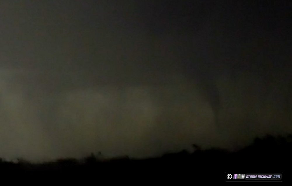
ABOVE: The Forsan tornado and supercell on May 17, 2021
4K EXPEDITION VIDEO: Slow motion lighting near Abilene, TX: Watch Video
Click any thumbnail on this page to view a larger version.
I went to bed in Liberal, Kansas late on May 16, expecting a decent setup for tornadoes from Amarillo to Lubbock in the Texas panhandle the next day. However, when I awoke in the morning of the 17th, I saw that an overnight MCS had shunted the good moisture all the way down to the I-20 corridor, with the obvious play being the outflow boundary-dryline intersection in the Midland-Odessa area. The situation was similar to the Elmer, Oklahoma day in 2015, where I went to bed in North Platte expecting to be targeting Nebraska the next day - only to wake up to MCS-scoured moisture way down to the Red River. In that case, I had an impossible 9-hour drive to get south into position, obviously not making it in time and missing the tornadoes by several hours.
Unlike the Elmer day though, this time I was in better shape. I had awakened earlier and had only a 6 and a half hour drive to get into position. I made it just in time as my target storms fired at Midland (my farthest-south spring tornado target).
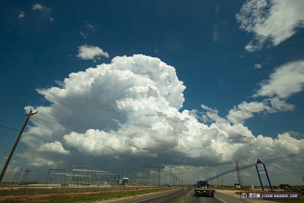
It took a bit of time for these to finally organize into a supercell south of Big Spring. The problem along and south of I-20 in Texas is that the terrain is hilly and low scrub/trees are fairly constant everywhere, meaning there are very few nice, open views. The road network is also more sparse, with much fewer areas to pull over. But I felt that the potential here was worth those trade-offs.
I watched the storm slowly approach at Forsan. The first RFD cut of the day formed quickly in the storm's massive rain-free base, and I had a good view at my location. A wall cloud and funnel formed, and those closer to it confirmed a ground circulation. Soon, baseball-sized hail began crashing around me. Even though I have hail guards on my vehicle, I'm still skittish about remaining in hail that is already that large that far away from the tornado.
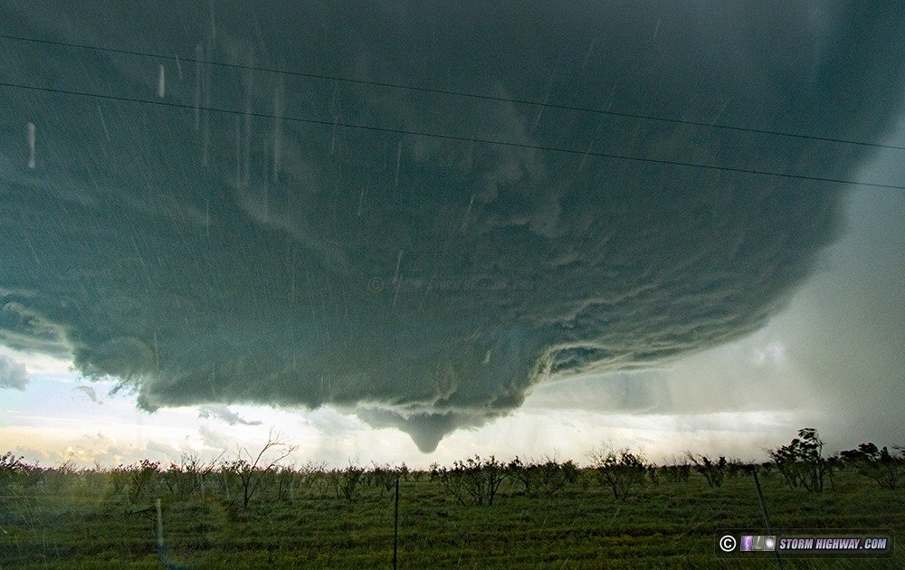
There were only two viable roads to keep up with this storm - one to the south moving southeast, the other due east - and both several miles apart. Neither were ideal, as the storm was moving just south of due east. When the next meso wrapped up and became imminently tornadic, it was in no-man's land with no trustworthy roads available to get closer. I managed to find a less-blocked-by-scrub-and-trees view on a gravel road and watched the tornado develop, on a hair trigger to move if the giant hail made a return.
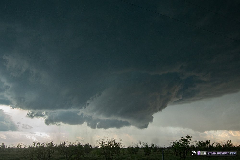
The scene was quite spectacular, with a sculpted supercell and tornado due south:
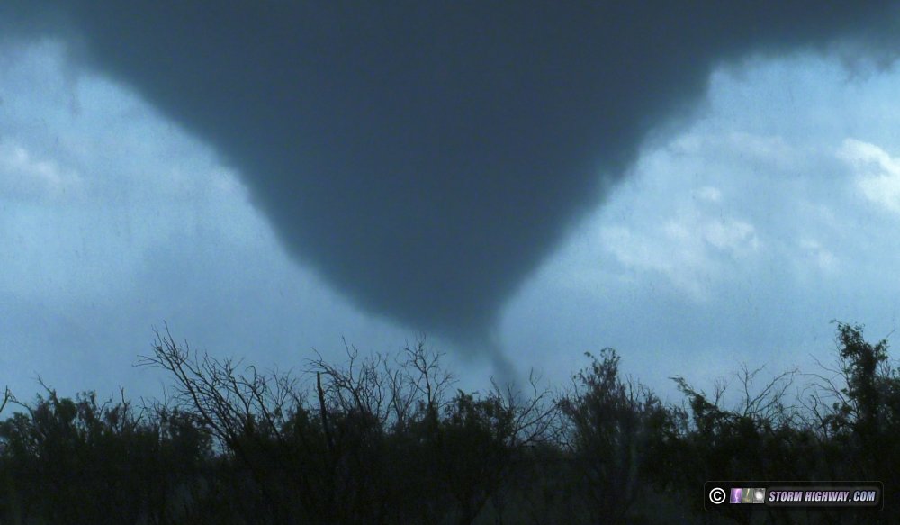
Once the tornado moved east of me and precipitation started ramping up, I moved east to the north-south Highway 163 to get a chance at a road-crossing shot. But by now, the tornado was completely rain-wrapped and I wanted nothing of the sort, especially with the bad views and no escape routes. While on the trek southbound to move south ahead of the storm, a brief snaky satellite tornado spun up to the southeast of the main tornado (also heavily shrouded in rain).
Once I was out of the RFD south of the storm, the road options continued to be problematic with only one - Highway 158 out of Sterling City - providing any real continued view of the storm. By now however, the storm was visually becoming more linear, and it was clear the tornado show was over. Lightning on the front side of the storm had not been very photogenic, so I turned north at Robert Lee in order to get to the back side of the storms on I-20.
I located a tall TV tower in the Abilene market located near Trent that I thought would be good for upward lightning. While on the south I-20 frontage road searching for a spot to set up my cameras, I hit an unexpected speed bump - yes, an actual, on-purpose speed bump *on a frontage road* - at 35mph, causing a violent jolt that rocked the entire vehicle. I stopped to assess the damage, finding one of the hinge bolts for the rear window hail guards completely sheared, and the other bent. This meant that the rear window guards were no longer safe to leave mounted, so I had to remove them and store them inside until I could make repairs. I was not expecting any further large hail encounters this trip, thankfully.
After dealing with the hail guard situation, I looked some more for upward lightning viewing spots - but the tower (visible to the south) had not produced any upward discharges. So, I decided to call it a day and head to Abilene for the night. As I arrived on the outskirts of the city, a flurry of positive CGs began firing off to the north. I was able to stop and grab a nice high speed shot of one of them before turning in for the night.
GO: Home | Storm Expeditions | Photography | Extreme Weather Library | Stock Footage | Blog
Featured Weather Library Article:
|