|
Home | Blog Index | Blog Archives | Christianity & Faith Essays | Storm Chasing Essays
May-June 2023 storm chasing roundup
Here's a summary of events covered during May and June in the Plains and Midwest.
May-June 2023 Event List
- May 1: Illinois blowing dust
- May 6: Troy, Missouri bust
- May 7: St. Louis metro hail and lightning
- May 8: Storms from Mascoutah to Venedy, IL
- May 10: Lightning at St. Robert, MO (Plains trip false start)
- May 13: Lightning from St. Peters, MO to Lively Grove, IL
- May 14: Storms from Troy, IL to St. Louis: lightning and overhead funnel
- May 23: Convection at Lebanon, IL
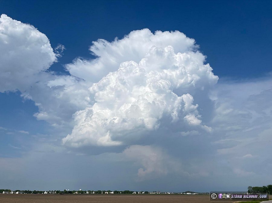
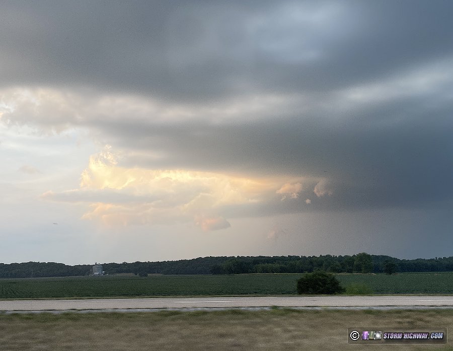
- June 11: Transient supercell near Tilden, IL
- June 15: Southern Oklahoma supercells
- June 16: La Junta to Springfield, Colorado supercells
- June 17: Balko, Oklahoma to Oklahoma City tornado, supercell and derecho
- June 18: Springfield, Missouri to St. Louis thunderstorms
- June 22: Convection at Mascoutah, Illinois
- June 24: Supercells from Pella, Iowa to Bowling Green, MO
- June 25: Supercells from Loogootee, Indiana to Louisville, Kentucky
- June 29: Central Illinois derecho
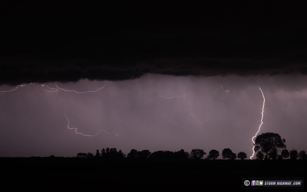
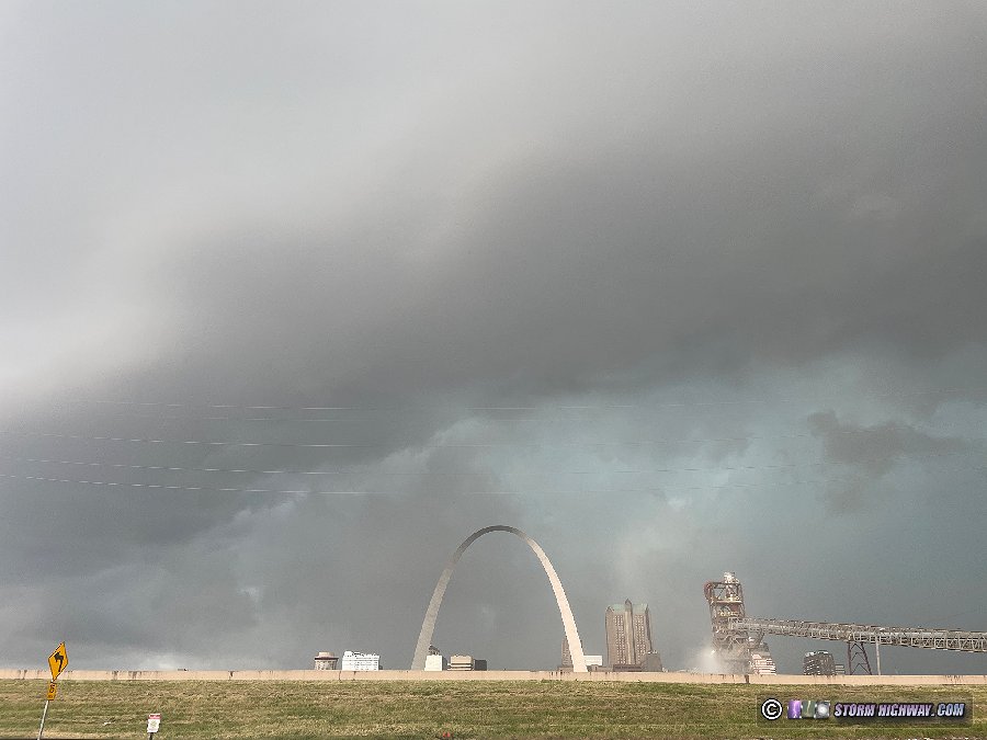
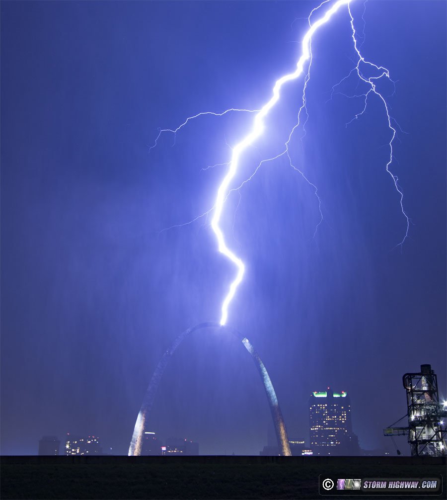
- June 30: St. Louis lightning barrages and Arch strike
 May 1: Illinois blowing dust May 1: Illinois blowing dust
After hearing the reports of the ongoing dust storm and resulting pileup only 50 miles north of here, I went out for about an hour to Highland and back to see if similar conditions were in progress around the metro area. Despite the newly-plowed fields and sustained strong winds, thankfully I didn't see anything other than a slight haze of dust kicking up from the fields in the area.
 May 6: Troy, Missouri bust May 6: Troy, Missouri bust
I had prior obligations this day, and couldn't leave until 4pm. This was inconsequential for me, as the setup was not one that I will normally drive far to see. The primary target was too far away (a 6 hour drive) in northwestern Missouri, and furthermore there was some supercell tornado potential existing here in the St. Louis metro. So, the plan was to intercept the expected northern Missouri supercells late as they approached Highway 61, somewhere around Hannibal or Bowling Green. I was also watching for storms to form farther south along I-70 that would clip the northwestern St. Louis metro area at about the same time. If a storm could get going in that area, it would have a great supercell environment to take advantage of. I headed up to Troy, MO to position and wait for either scenario. After some time, the lack of robust cumulus made it apparent that the southern storms were not happening. Not only that, the northern Missouri supercell was still several hours away, and models hinted that it would likely weaken well before then (not to mention being well after dark). I decided I didn't want to drive the extra distance and have such a late arrival time home for what would likely be a struggling nighttime storm by the time I could see it. So, at 7PM, I gave up on the day and headed home.
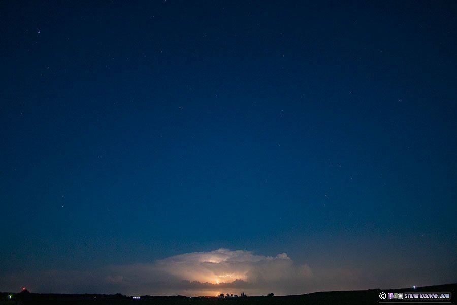
  May 7: St. Louis metro hail and lightning May 7: St. Louis metro hail and lightning
This wasn't a great setup, but deep-layer shear meant there would be a chance for a few supercells. The problem was that the first storms fired just after noon, way too early. I was only home for a few minutes after church before I had to run right back out to intercept a storm developing right over town. I stayed with this storm along I-64 to Woodlawn, noting nickel-sized hail and panicking drivers stopping on the interstate at Okawville. The storm had some decent lightning, but was frustratingly uncooperative with producing bolts while I had the high-speed camera on it. I expected (hopefully) better storms over St. Louis later, so I left these storms go at Woodlawn as they congealed into a line.
Back home, an outflow boundary from the storms was stalling and looked like it could provide some tornado potential if a new storm could go up on top of it. A tornado-warned storm up near Springfield seemed to validate this potential, and the environment here was similar. But alas, new surges of westerly outflow from the storms to the east kept pushing the boundary west away from developing cumulus congestus.
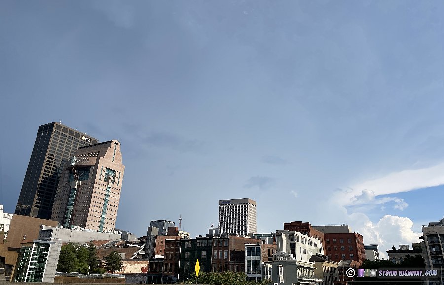
The boundary stalled again for about an hour over downtown St. Louis with vigorous cumulus above it, so I camped out downtown in case a storm went up. This almost happened as a healthy base consolidated just southwest of downtown, but quickly fell apart. Meanwhile new storms to the east were producing one-inch hail in O'Fallon, but I held my ground downtown. Another big surge of westerly outflow arrived and started moving the boundary west again, and this time the cumulus above it was fizzling. I called it a day before sunset and headed home, keeping a close watch for renewed activity on the boundary when the low-level jet ramped up after dark. The LLJ activity never happened.
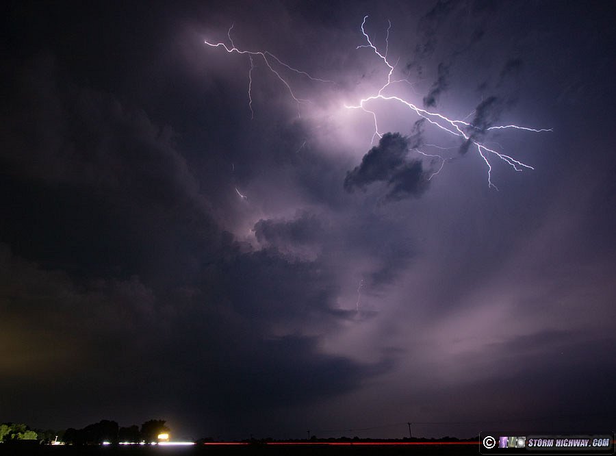
Just before midnight, I went out to try to shoot sprites over a second MCS to the north as it slowly approached, but clouds blocked that view. These storms sent a fresh strong outflow moving southward, with new storms going up along it. Eventually this activity moved overhead, so I went out for about 2 hours to investigate. There were a few bursts of lightning, but again it was all uncooperative for my cameras. Here are two illustrative examples: the only in-frame bolt happened as I gave up and started taking down the tripod, the other was mostly out-of-frame:

Models backed off of the expected stratiform precip area behind a third complex of storms moving in from the northwest, and radar trends seemeed to concur. So, I didn't stay awake for the storms' arrival in the metro at dawn.
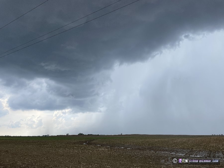
 May 8: Storms from Mascoutah to Venedy, IL May 8: Storms from Mascoutah to Venedy, IL
Another slight risk setup with good instabilty and decent upper flow. This time, the best parameters were in the jungles of the Missouri Ozarks southwest of St. Louis, though some potential existed in the St. Louis metro that would preclude traveling out of the area. The Ozark storms developed as expected, but several attempts at storm initiation east of the city close to home before sunset were unsuccessful. The anvil blowoff from the Ozark storms overspread southern Illinois, killing our destabilization.
After dark, I could see the lightning from the ongoing Ozarks storms about 50 miles south of home, and could even hear the thunder at that distance. I tried shooting the lightning from just south of town, but all of the infrequent visible bolts were uncooperative. Finally, after 9PM the northern segment the complex managed to build northward to within 10 miles of home. I went down to south of Mascoutah as this shelf cloud advanced northward, though the lightning here was limited to only flashes and no visible channels.
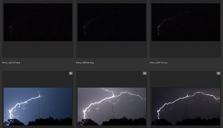
I drove east to Venedy to shoot the back side of the dying storms. A couple of visible bolts finally cooperated, breaking the 3-day streak of lightning eluding in-frame captures. These were about 20 miles to the south of me, shot on the 50mm lens. The lightning was too distant to attempt shooting with the high speed camera.
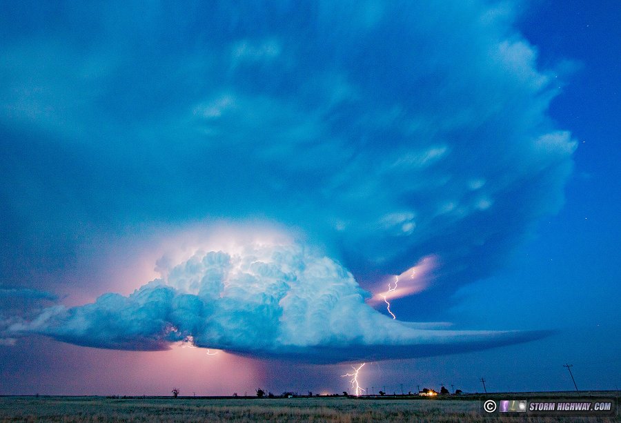
May 10: Lightning at St. Robert, MO (Plains trip false start)
I wasn't very impressed by the midweek system in the Great Plains. Although it provided a series of supercell opportunties from May 9 through the 11th, it wasn't quite up to my normal standards for a trip. I had already decided not to travel to the events in northeastern Colorado/northwestern Kansas on the 9th and 10th, but was eyeing the setup in Oklahoma on the 11th for the first Great Plains chase of 2023. The main impetus for making a trip was the prospect for the Plains to shut down for an extended period afterward - possibly through peak season, making it seem like a "it's-now-or-never" question. I was still undecided by mid-afternoon, but nonetheless I packed up all of my gear and headed out to get a needed oil change, intending to make the go/no-go decision sometime later.
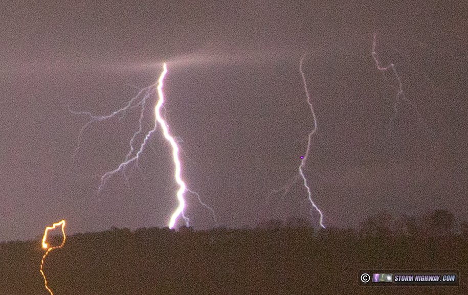
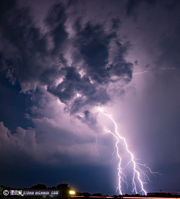
After my oil change was done, a cluster of strong thunderstorms in central Missouri prompted me to go ahead and begin the drive southwest on I-44. At least I'd have some lightning to shoot on the way. I arrived on these storms at St. Robert. Although they had weakened considerably, a persistent electrified stratiform precip region continued to produce horizontally-extensive lightning flashes every few minutes. I found a tower near the interstate that was at borderline height for upward lightning initiation, and stopped for about an hour to shoot this with the high speed camera. No upward flashes occurred, but I captured this negative cloud-to-ground flash that was at a distance to discern the upward propagation of the return stroke current pulse at 6,002fps.
After the lightning activity ceased, I continued my trip southwest toward Oklahoma. It was 11pm when I stopped at Mount Vernon (west of Springfield) for gas and to review the latest data. At this point I noticed even more negatives for the Oklahoma setup. The best upper support would be arriving too late and would be too far west, meaning any supercells would likely be heavily HP (high-precipitation) despite the good low-level shear. That meant even though there would be a decent shot at significant tornadoes, they'd likely be too rain-wrapped to see easily. And the upper wave itself would be weakening. Of more concern was the increasing morning/midday convection and clouds showing up over the target area, meaning that now the instability itself (one of the bigger pluses of the setup) was in question.
I really didn't like what I was seeing in Oklahoma, so I switched my focus to the two Kansas targets that were available: the arc of dryline storms extending back toward Dodge City that would be underneath of the better upper support, and the cold core low region up near Colby. Though I felt the cold core option looked worthy, neither appeared appealing enough to make the long drive necessary to reach either of them. So, I did something I'd never done after this long of a drive to the Plains: I got on I-44 east and headed back home, arriving at 3AM. I'd turned around once before after driving 90 minutes west when new data discouraged me on a Plains setup, but 4 hours was a new personal record for length of a "false start" or "check swing" Plains trip drive.
It turns out it was a big mistake to back out of the Plains trip. Every target produced tornadoes, some very photogenic and memorable. Unfortunately that's the way it goes sometimes.  May 13: Lightning from St. Peters, MO to Lively Grove, IL May 13: Lightning from St. Peters, MO to Lively Grove, IL
My low expectations for this day sunk even lower when the expected storms northwest of St. Louis fired well before noon, long before peak destabilization could take place. Nonetheless, the storms had several intense intervals, all of which occurred when I was either driving to them or had already left them. I arrived on the first storm of the day in St. Peters, which promptly went from visible-lightning-barrage to no-visible-lighting after I'd parked and started recording it. I stayed just ahead of this storm to Pontoon Beach, but it never provided me with another interval of visible lightning.
I left this storm and headed to downtown St. Louis for new development on the southern flank of the previous storm. I arrived just as this storm sent a strong outflow through the city, kicking up dust.
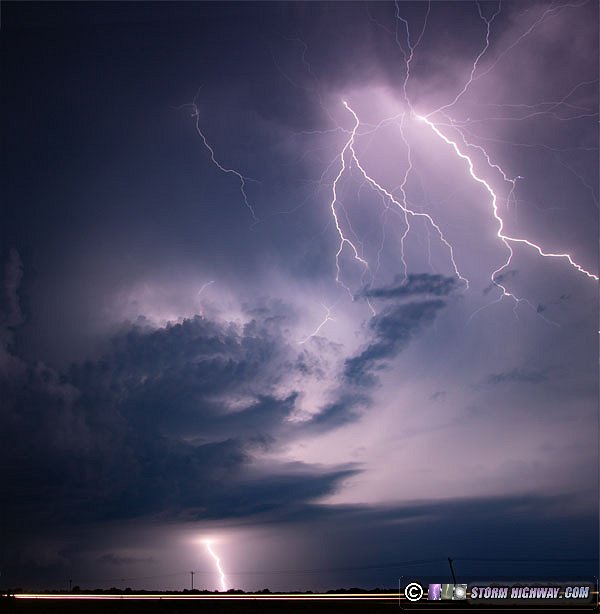
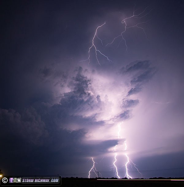
All of the storms were behind the gust front and therefore had little tornado potential. I stayed downtown shooting lightning for another 30 minutes, then eventually decided to position to south of Belleville to get ahead of a newer area of storms just ahead of the gust front. This nearly completely fizzled just as I exited the precip and got ahead of it south of Mascoutah. I headed back south to St. Libory for a newly-active cell producing a steady but slow volley of bolts every couple of minutes. This was predictable enough to capture a couple of 6,000fps high speed shots, though the best bolts happened while I was moving to stay ahead of the heavy rain. I gave up on the storm when it stopped producing cloud-to-ground bolts at Lively Grove.
May 14: Storms from Troy, IL to St. Louis: lightning and overhead funnel
Yet another low-expectations day that actually surprised me with a few interesting phenomena. I started on the first storm to fire in the St. Louis region in Troy, Illinois, staying with it to New Baden as new storms formed around it and slowly moved south-southeast. There was no visible lightning, no low-level organization and not much of any visual interest aside from a short-lived downburst at Lebanon with a weakly-defined precip foot curl.
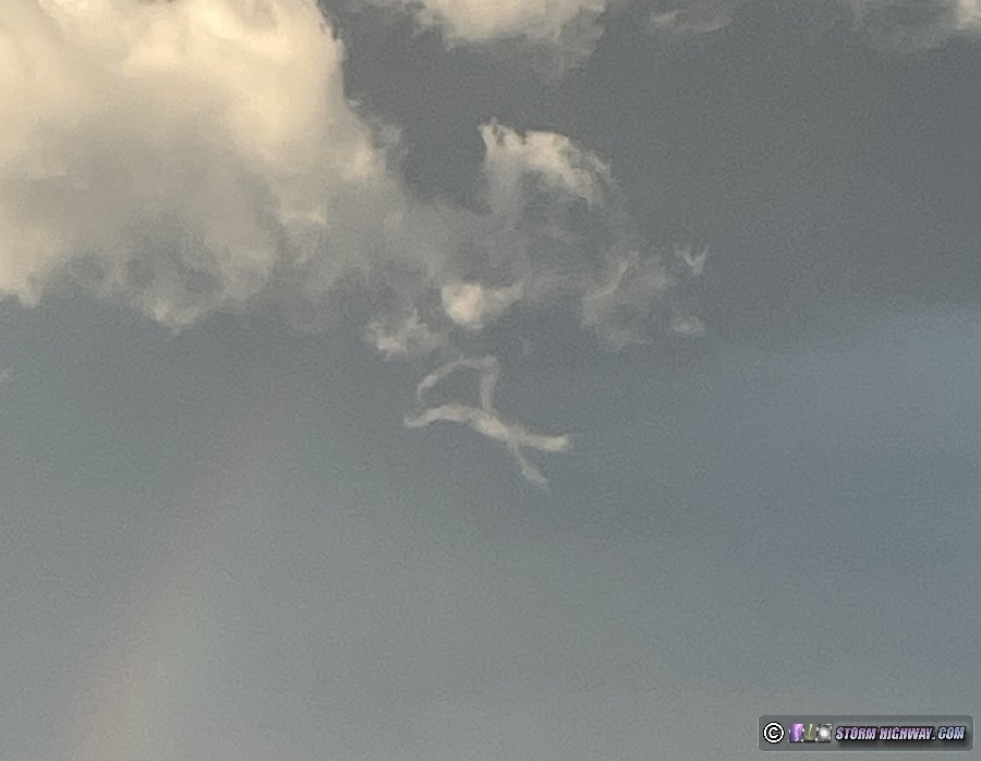
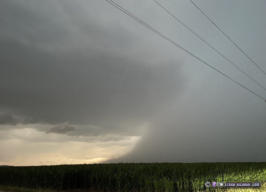
Disappointed with this storm's non-lightning production, I dropped southeast to Mascoutah for what data indicated was the lone regular lightning producer in the cluster. While the storm stopped producing bolts as I arrived on it, I got out of the car to look at the base to see a well-defined funnel spinning directly overhead. Strong northerly outflow underneath of it meant that this circulation had almost no chance of reaching the surface, but kept my head on a swivel on the ground around me while shooting just in case.
This feature lasted nearly 5 minutes, long after I was forced to get back into the car by the arrival of the rain. I stayed ahead of the storm to St. Libory, but it never recovered its previousl levels of organization. I headed back into St. Louis as a stronger line of lightning-active storms was arriving from the west. I set up for a short time downtown, shooting both stills and high-speed video. After the core of the storms arrived downtown, the presence of a trailing stratiform region behind them prompted going to the usual Brentwood spot for upward lightning from the TV towers. Two upward flashes occured, both fast positive leaders from all three Shrewsbury towers (this video is included in the above-linked clip).
 May 23: Convection at Lebanon, IL May 23: Convection at Lebanon, IL
Upper-level flow and decent instability have been absent across the Midwest in the last half of May, with Tuesday the first time the St. Louis region has seen even convection in 9 days. The parameters didn't warrant going out for more than an hour 10 miles from home as some towering cumulus bubbled up north of I-64 near Lebanon, IL, eventually growing into a 25-minute heavy rain shower with no lightning or hail to be seen.
Not even a rainbow appeared as the direct sunlight shone on the precip toward the end of the cell's life cycle, then after dark, I missed a brief lightning-active storm that fired just to our southwest after I'd returned to work. It was symbolic of a Midwestern peak season that has so far been eluded by impressive and/or cooperative storm phenomena.
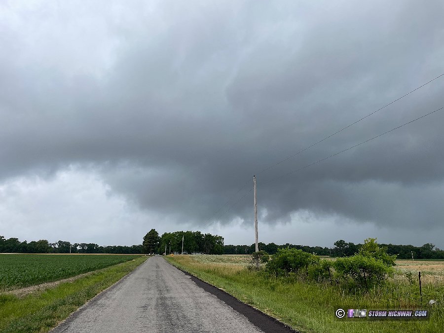
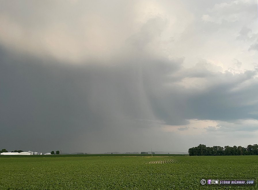
 June 11: Transient supercell near Tilden, IL June 11: Transient supercell near Tilden, IL
A surface low or MCV was tracking east across the region, giving us our first tornado risk in over a month. It was doing so at one of the worst times of day for good storms: early in the morning. However, there was enough of a dry slot that the early-day sun was able to poke through and provide a tiny amount of low-level instability near the core of the low southeast of St. Louis. At 8am, I headed down to Tilden to intercept an isolated cell in this environment that briefly wrapped up and exhibited a wall cloud, clear slot and inflow bands. This quickly fell apart as additional cells formed to the south and east, turning everything into a rainy mess. I broke off of the storms at Lively Grove. Data showed some lightning strikes with these storms, but I didn't see any of it nor did I hear any thunder.
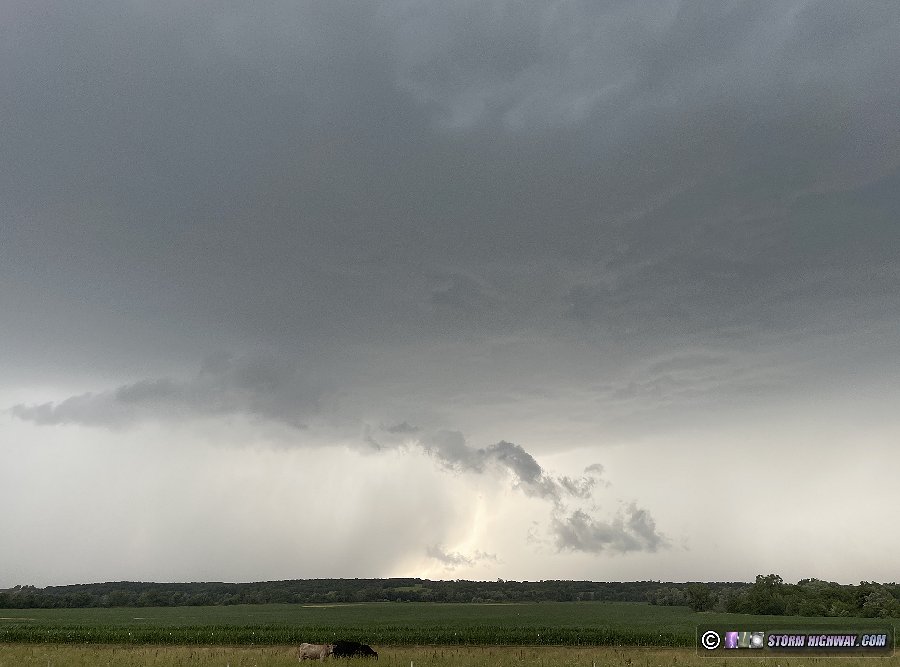
June 22: Convection over Mascoutah, Illinois
A short outing to watch some weak convection pass by near Mascoutah, IL. The cell had strong reflectivity at a couple of points, but I didn't find any hail nor did it produce any lightning. This was the view of the rain shaft south of town.
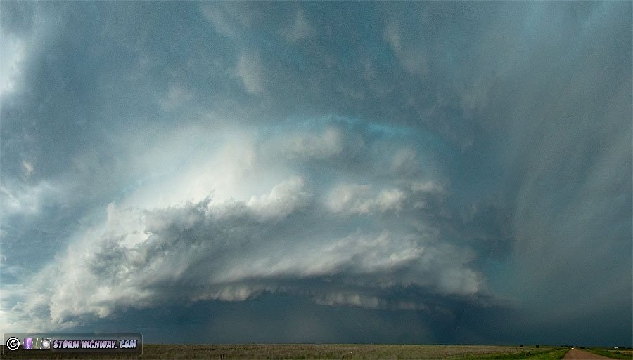
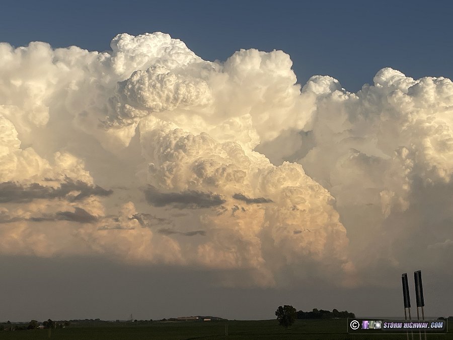
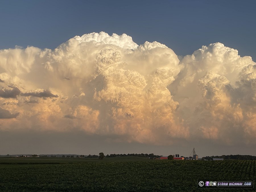
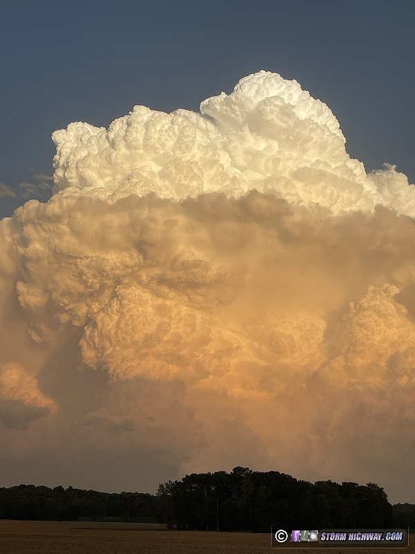
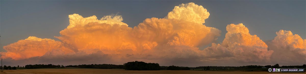
June 24: Supercells from Pella, Iowa to Bowling Green, Missouri
I was not very excited about this day's prospects. It had looked much better up until 2 days beforehand, when LCLs had become sky-high and instability had trended downward. I was also in a discouraged mood after missing a rare quality tornado day in southeast Colorado/southwest Kansas that I had been watching for days prior. I had decided (wrongly) that it looked too much like a cap bust for such a long one-day venture. Now things just felt like one of those Plains-day-followed-by-Midwest-day setups that would see the Plains event that I missed go big and the two Midwest events that remained go to trash. Nonetheless, with the event being on a weekend, I dragged myself out of bed early to pack up and get on the road toward Iowa.
I was originally hoping for supercells that models had suggested might form closer to I-70 in central Missouri and track into the St. Louis area. However this scenario was seeming less and less likely, so the only play appeared to be central Iowa. But there, persistent cloud cover was already fouling destabilization in the primary target area, but I pressed onward toward my target of Des Moines. The cloud cover was only breaking up in extreme southern Iowa, well south of I-80. Surface winds were also backed here with decent-enough speeds. I was hoping for an isolated storm in this area. As I arrived at Ottumwa, a cluster of storms had already fired near I-35, much farther south than I'd originally expected. This meant that I would have a shorter distance to drive to intercept well southeast of Des Moines.
I arrived on the first supercell evolving out of the cluster at Pella, but it was decimated by what would be an ongoing problem this day: new storms firing just south of existing storms and merging with them just as they were maturing. Sometimes these cell mergers can be helpful if they happen more into the forward flank of the primary storm, but these were merging right into the developing mesocyclones and were therefore destructive mergers in every case.
I hopped further south cell-after-cell as the destructive mergers continued, finally ending up on a storm that was fighting its southern fouling cells enough to maintain its identity. But when I finally got a visual on the base south of Ottumwa, it was hopelessly high-based with nothing but outflow scud down below.
After the next storm to the south suffered a similar development at Eldon, I decided I was done with the Iowa play. I wanted to be able to make it into St. Louis for storms shown by models as moving through around midnight, as well as catching a few supercells firing near the Mississippi River near Hannibal on the way.
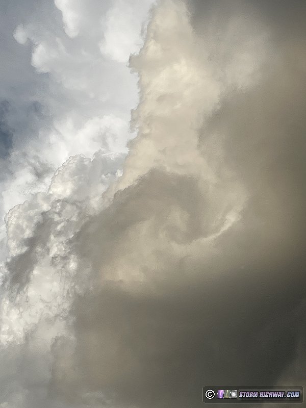
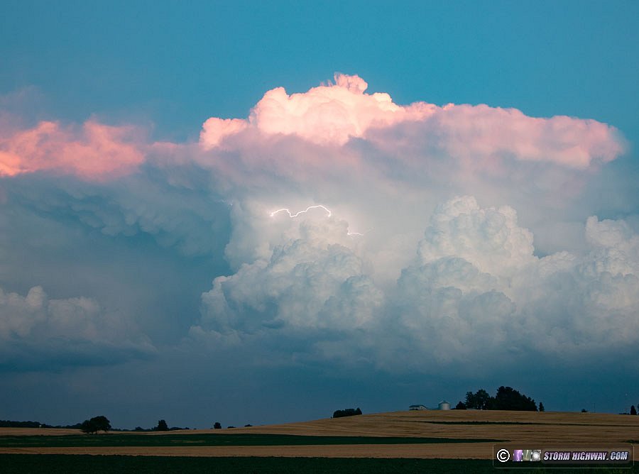
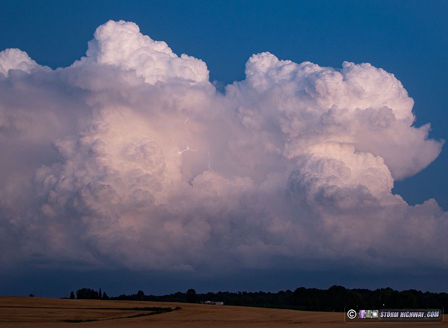
I arrived on a new supercell developing east of Quincy that exhibited a large rain-free base and cloud-to-ground lightning barrage. None of the bolts were cooperative for the high-speed camera. I let the storm go after it crossed Highway 61, but it had some interesting features viewed from the back side. A turbulent roll cloud developed on the RFD gust front, out of which emerged an impressive horseshoe vortex that was long enough to form several bends into a bowtie formation.
Two small RFD occlusion attempts were apparent, with a small funnel visible on one of them.
 |
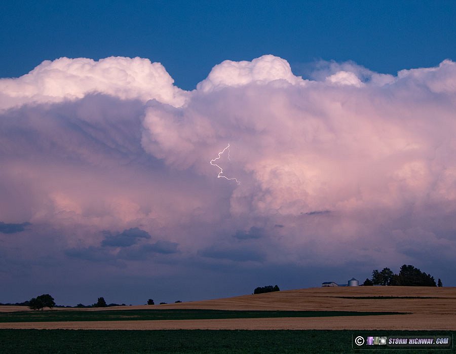
I followed this storm across the river on I-72 as it developed an impressive clear slot and suspicious-looking lowerings, but motion was weak and lightning activity was fading.
I turned my attention to new storms developing to the west. I watched this storm on the Illinois side, but again, the bases were high and undercut with outflow.
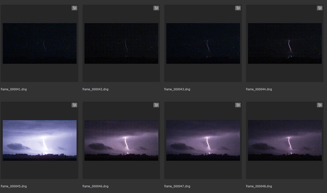
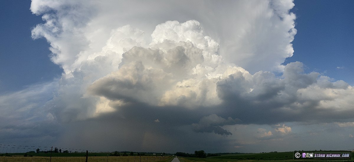
After these crossed the river, I continued back into Missouri and down Highway 61. At Bowling Green, a new supercell developed on the western flank of the earlier storms and started producing a good barrage of tall cloud-to-ground bolts in the vault region. I stopped and shot this on stills and high speed video.
After this moved too far east to keep shooting, I continued toward St. Louis as some convection to the southwest threatened to break out upstream of the metro area. This never materialized, and models had now backed off of any storms developing that far south. With the next day's trip in Indiana looming, I decided to not stay awake to watch for this area to develop - thankfully it didn't.
June 25: Supercells from Loogootee, Indiana to Louisville, Kentucky
In an all-too-familiar turn of events for Midwest storm chasers, this day was also not looking as good as it had earlier in the week. The main feature was a strong westerly midlevel jet overspreading very moist and unstable air at the surface, a rare combination this time of year in this region. The problem was that deep-layer flow was unidirectional, with the most veering-with-height restricted well below 850mb. Also, outflow from overnight convection was still fresh and on the move at mid-morning across the primary target area. This boundary finally stalled in southern Indiana, but in a perfectly north-south orientation that was not good for storms to move along it. The entire action area would be east of this boundary into the cooler outflow, which was slow to heat up. Worse yet, convection was already firing on the cold front at noon, about 90 minutes ahead of model forecasts - meaning storms would have 90 minutes less of daytime heating than originally expected. There was very little cumulus in this outflow area downstream of the storms, indicating weaker destabilization.
I decided to target storms from the Vincennes area into Louisville, as it seemed these would be more likely to stay discrete and would have better access to higher instability as the afternoon wore on. I headed to Washington, Indiana, arriving at 1pm just as storms begin firing along the Illinois/Indiana border. The main problem with this target was the Hoosier National Forest, which is entirely unworkable for observing storms. I would have to see what I could west of it, break off of the storm and get across the forest to re-intercept on its east side.
As storms approached me at Washington, it was clear they were going to likely mature either just west of, or over, the forest. I didn't want to get trapped on the winding 2-lane roads in the forest trying to prevent getting run over by a hail core. At Loogootee, I decided to bail east through the forest to wait for them on the east side. I arrived at Mitchell just as the storms evolved into impressive supercells and became tornado warned. I was able to position ahead of the southernmost cell at Ramsey. When it came into view, structure was very impressive, but all cloud material under the base was racing southward: the storm was suffering from outflow dominance and was not establishing a good channel of air flow into the base at the surface.
The storm's status still struggled with outflow dominance as I maintained position on it into Corydon. Here, the road network necessitated moving east on I-64 into Louisville and re-intercepting south of the city. The storm's low-level inflow and tornado prospects continued to deteriorate as it entered the Louisville metro. This was a good thing, by the way. I don't want to see tornadoes in populated areas.
In the meantime, a new trailing supercell had developed and become tornado warned, but it was entirely behind the RFD gust from of the lead cell and unlikely to produce. The terrain and road network south and east of Louisville is not good for observing storms. Considering this fact and the storms' general character up to this point, I decided to let the storms go, call the day and start heading home, snapping this on the way back through downtown Louisville.
As I drove back west through southern Indiana, new storms were firing just ahead of the slowly-advancing cold front along and south of I-64.

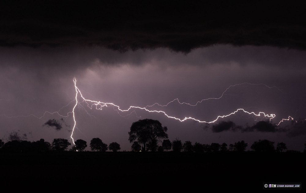
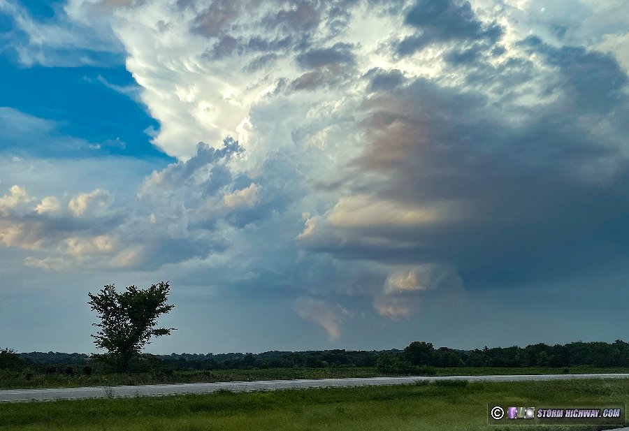
This ended up being a nice show of cumulonimbus towers and lightning at sunset as the storms moved over Evansville into Kentucky, which I spent an hour shooting with all 3 cameras near Cynthiana.
 |
After dark, I tried shooting for sprites over the large complex of storms in Kentucky to the east, but saw none.
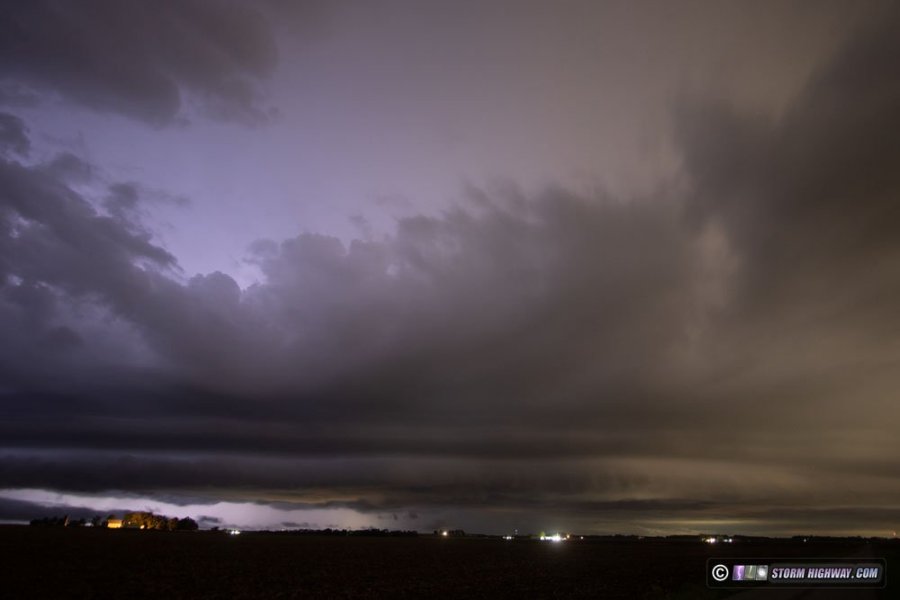
 June 29: Central Illinois derecho June 29: Central Illinois derecho
This day did not go as planned due to my own scatterbrained-ness. Models had been very unreliable leading up to this event, but it was somewhat certain that a significant severe squall line would ride the instability gradient southeast through central and southern Illinois. Models hitnted at supercell development on the trailing portion of the line close to home, but I was skeptical as I'd never seen a big, fast squall line do that before. Given my initial disregard for the southern supercell potential and the fact I have a new fisheye lens for my high-speed camera, my intention with this day was to shoot upward lightning at towers in Springfield, Illinois.
The squall line had been in progress all night, so evaluating the morning data was pretty straightforward: just be where the squall line followed the main boundary southeast for some high winds and maybe a embedded circulation or two, then move to the towers for upward lightning. I departed and headed north. At Raymond, to my chagrin I discovered I had somehow left my fisheye lens at home. I already have plenty of upward lightning video on my high speed camera with my current lens, meaning the trip to Springfield would be a waste of gas. I turned around and decided to just see what the southern segment of the squall line would do. Again, derechos like this are simply pushing outflow too hard to allow a supercell to get good surface infow anywhere, so I knew my day was going to be pretty much a wash. Nonetheless, I stairstepped down to I-64 Mount Vernon to stay ahead of the tail end of the line. I just hoped it would surprise me with something interesting.
Due to some road map errors involving roads that didn't exist in reality, the line caught me a couple of times as I moved south, once at Vandalia and again at Salem. I got comfortably ahead at Mount Vernon, and watched the action area pass by to the north. As expected, tornado potential was non-existent thanks to the gust front leading the updrafts by 2 or 3 miles.
At Wayne City, the tail-end cell started intensifying enough to produce some nice lightning. However, I could not find a clear spot to shoot before the action moved too far away, forcing me to get back on I-64 east to catch back up again. I got back into position at Burnt Prairie, but by now the cell had weakened and the lightning had stopped completely.
An excellent event with top-tier lightning in the St. Louis metro, including barrages downtown that resulted in a Gateway Arch strike. This event has its own page here.
< April-May 2023 Recap | All Storm Chase Logs | July-August 2023 Recap >
GO: Home | Storm Chase Logs | Photography | Extreme Weather Library | Stock Footage | Blog
Featured Weather Library Article:
|
|


