EF3 and EF4 tornadoes at Red Oak, Villisca and Corning, Iowa - May 21, 2024
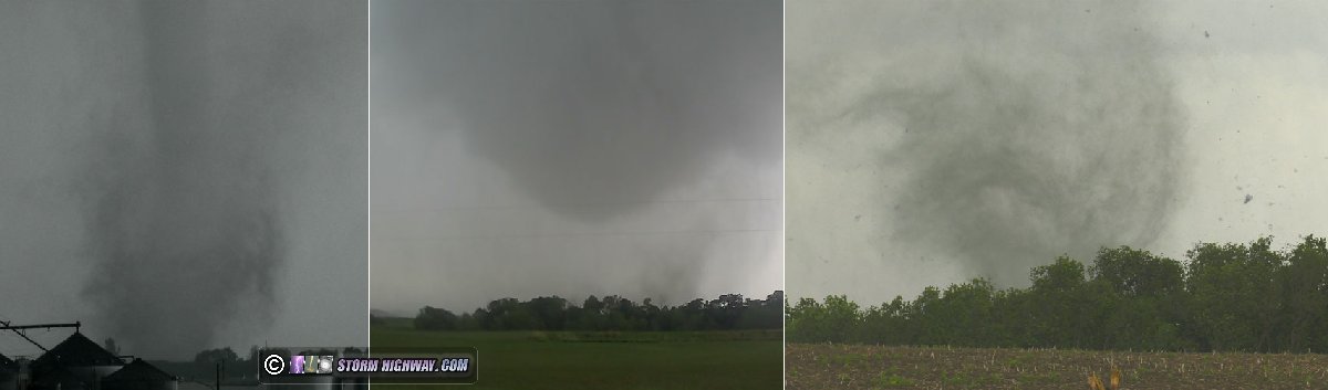
ABOVE: Southwestern Iowa tornadoes on May 21, 2024
I observed four tornadoes in southwestern Iowa on Tuesday, May 21, 2024, including the EF4 that struck the town of Greenfield. The following is a log of the day's chase. Video of all of the notable sights from this day:
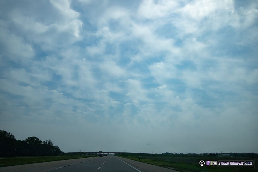
I started the day in Grand Island. I needed an oil change, so I got that done in Lincoln before heading east on I-80. Storms had already fired and were passing to the west, but these were elevated north of the warm front and were not a tornado threat. As I passed the exact spot where I'd shot the Waverly tornado less than a month earlier, I took this picture of "jellyfish clouds" (altocumulus with virga streaks) overhead:
I was initially pessimistic about this day's potential since the storms had been expected to form right on a surging cold front. Fast-moving cold fronts usually undercut supercell updrafts and disrupt their low-level organization, even if a potent tornado environment is present. So, my plan for the day was to see what the first cold frontal storms south of the warm front near Omaha looked like, and if they were undercut, head farther east for potential storms that models showed firing well ahead of the cold front. I stopped at Glenwood, Iowa to wait on new storms that just fired to the southwest. As the lead one approached, it appeared messy and potentially undercut already. Another supercell to its south was taking shape and had no other storms south of it, so I decided that this would be the last one before I would head east for the expected storms ahead of the front.
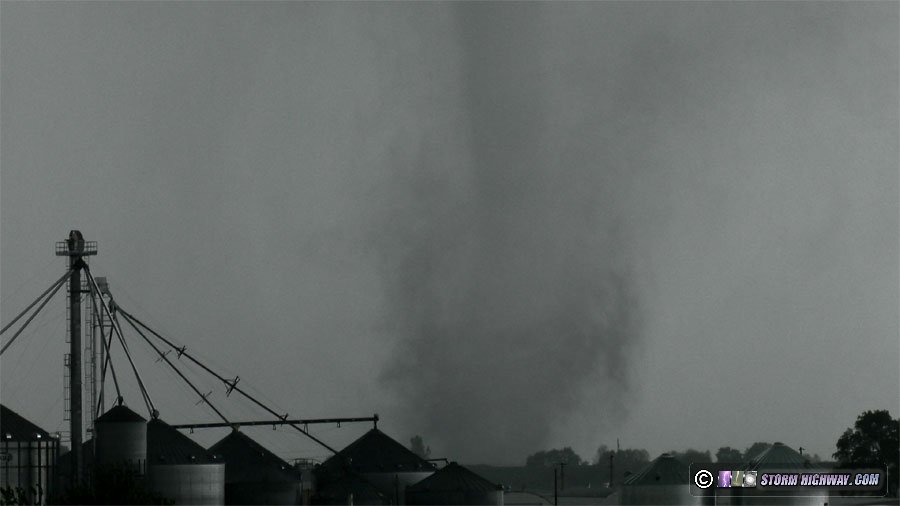
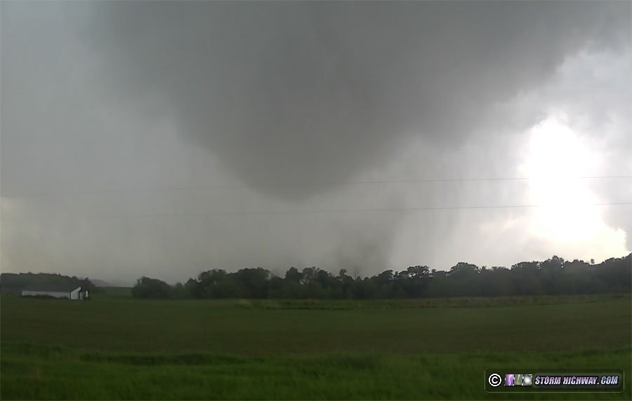
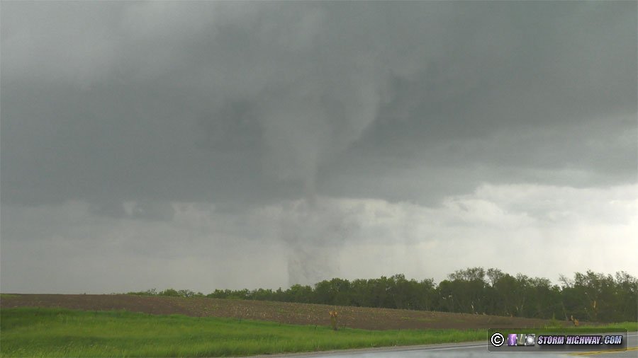
This second supercell displayed more classic radar presentation and looked like it might be just far enough ahead of the front to potentially do something. As I reached a viewing spot east of Red Oak, a strong circulation developed to the southwest of town. I went back west to get a better view, and saw a fast-moving tail cloud racing into a mesocyclone with rotating rain curtains. I started recording this, and it didn't take long for the tornado to develop:
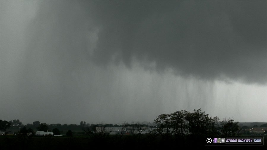
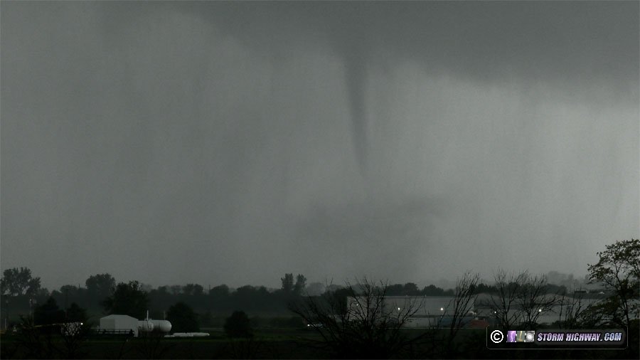
I stopped recording long enough to report the tornado, then resumed filming as it grew into a nice fully-condensed stovepipe with a dense debris cloud:
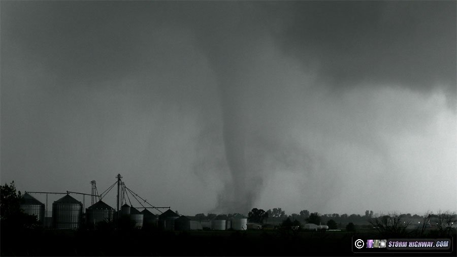
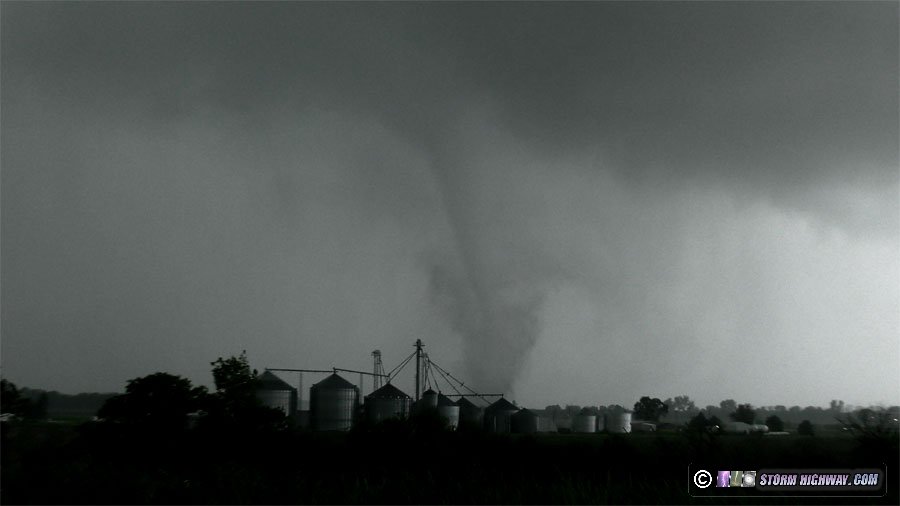
I headed back into town and south to see if I could manage a closer approach while the tornado thankfully roped out before entering town:
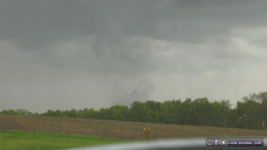
It was clear that the cold front was far enough west to not affect these storms! I continued east on Highway 34 to intercept the next storm, passing through its forward flank. When I emerged from the rain near Villisca, I could see another tornado developing to the south. This was the beginning of the long-track EF3 tornado that tracked near Carbon:
I was in a good position to drone this tornado, so I stopped and sent it in the air. As the tornado passed to the southeast, inflow winds into it increased at my location just seconds after takeoff. The drone, which normally should hold its position without control inputs, started getting rapidly pulled toward the tornado. I applied aft control inputs to counter this, but it was still moving southeast toward the tornado. It was completely unstable and at the brink of being out of control, much less able to get any usable video. This was the only clear still frame I was able to pull from the drone's video later:

I decided to abort the flight and descend immediately. The drone came down as commanded, but it hovered above the tall grass and would not land. And, it was still getting pulled southeast (slowly at this point thankfully) by the tornado's inflow. I tried the stick command to kill the motors, but it was not working and I had no to time to troubleshoot. I had to run after the drone and manually push it down into the grass. When I got back to the car, blood was everywhere. One of the props had cut an eighth of an inch off of my left middle fingertip during that move. I have a first aid kit, but it was in the back of the car and I didn't have time to get it with a big tornado a half-mile away:
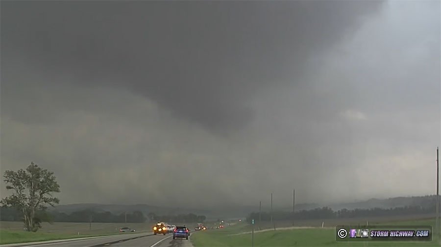
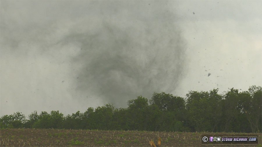
I didn't have any time to even look at my finger. I wrapped it in paper towels and got back on the road. As the tornado moved north of the highway, another was rapidly forming just to its south and would cross the road ahead. With my finger wrapped in bloody paper towels, I headed east to intercept the next tornado. This was the beginning of the EF4 that struck Greenfield:
This tornado crossed the road about a mile ahead of me:
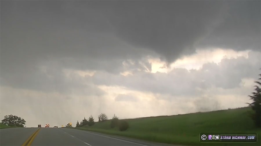
I continued on to a better viewing spot to shoot the tornado moving off to the northeast, as it lofted trees into the air and displayed multiple vortices:
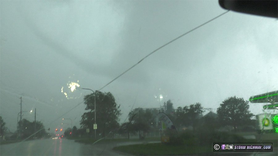
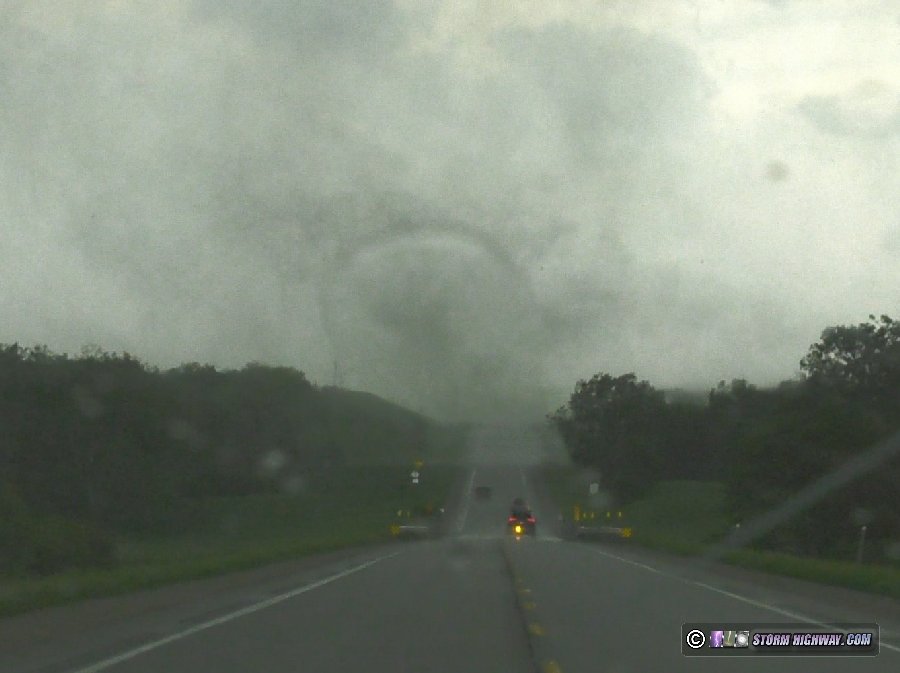
Still more supercells were organizing to the south, so there wasn't any time to spare. I headed east through Corning to intercept a new circulation getting started. I wanted to be east of this one for better lighting, so I drove east of where the circulation would cross. The RFD was full of heavy rain, however - and quickly obscured the circulation as it crossed the road to my west. About a minute later, I could see the tornado through the rain:

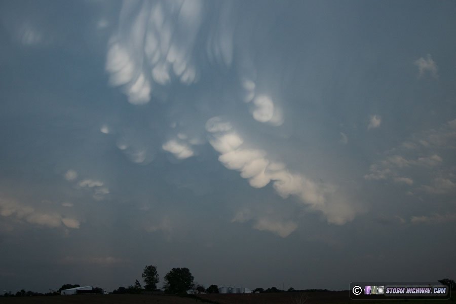
Again, there wasn't time to stop, as the road ahead turned northeast with the storm's hail core rapidly approaching the road. This caught up to me as I passed through Creston, but I was able to get back ahead when the road turned east. I finally had time to stop to tend to my finger in Ottumwa. I intercepted a few additional supercells between Creston and Mount Pleasant, none of which looked close to producing a tornado. I encountered more weakening supercells between Keokuk and La Grange, Missouri which were all on a rapid downturn with shriveling bases. The cloud features, however, were very photogenic at the sunset hour. First, these mammatus clouds appeared to the north of Keokuk:
Then at La Grange, Missouri, this LP supercell was putting on quite a sunset display with anticrepuscular rays, lightning and storm structure. It was good enough that I stopped and set up several cameras.
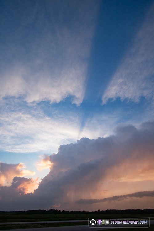
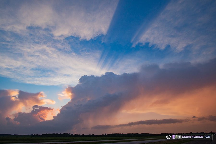
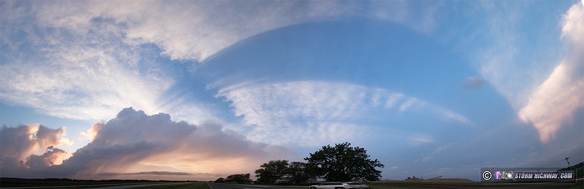
7-frame vertical panorama stitch showing the storm's shadow cast on cirrus to the east:
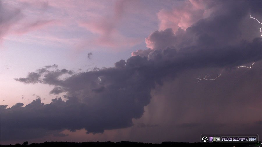
Lightning flickered in the forward flank precip and the top of the updraft:
More storms fired along Highway 61 as I entered the St. Louis metro area, but none were apparently producing anything photogenic to warrant stopping again. I made it home at 11:30pm, bringing the memorable and eventful Plains chase expedition #4 for the season to a close.
As for the drone incident, I am still not sure what caused the malfunction. It may have been that it lost its GPS reception for some reason, preventing it from holding position in strong winds. I've flown in strong winds before, during both test flights and actual storms without this issue happening. The tornado's inflow winds were strong at my location, but not to the point that would have made flying risky at that spot. You can clearly see from other chaser drone videos that they are more than capable of not only holding position in those conditions, but holding a steady shot. My prop injury is going to take a long time to heal (and I may not have a fingerprint there any longer) but it certainly could have been a lot worse!
GO: Home | Storm Expeditions | Photography | Extreme Weather Library | Stock Footage | Blog
Featured Weather Library Article:
|