My work is, at this very moment you are reading this, generating the most income it ever has in my career. Yet, I was forced to shut down the professional side of my successul operation, against my will, due to one cause alone: 95% of that revenue is being stolen by piracy and copyright infringement. I've lost more than $1 million to copyright infringement in the last 15 years, and it's finally brought an end to my professional storm chasing operation. Do not be misled by the lies of infringers, anti-copyright activists and organized piracy cartels. This page is a detailed, evidenced account of my battle I had to undertake to just barely stay in business, and eventually could not overcome. It's a problem faced by all of my colleagues and most other creators in the field.
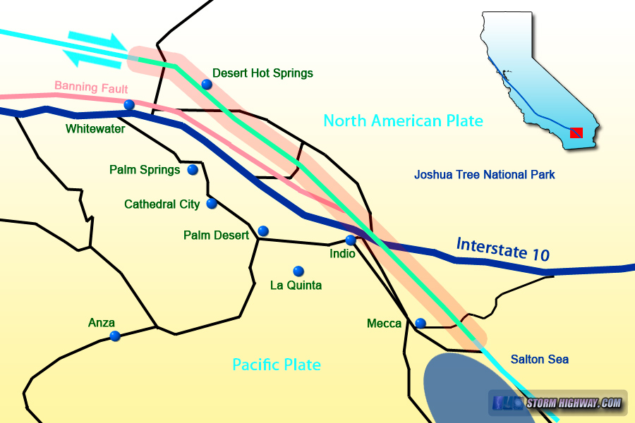
After arriving in San Gorgonio Pass, we've made it to the last segment of our San Andreas Fault tour. In this area, the San Andreas branches from east to west into a complex network of multiple faults (or strands), all of which accommodate the plate movement to varying degrees (1). On this tour, we will be following the conventionally-mapped main strand (sometimes referred to as the Mission Creek fault) through Desert Hot Springs. The other recognized major strand of the San Andreas, known as the Banning fault, runs several miles to the south closer to I-10.
Map of this segment of the tour
Desert Hot Springs, California
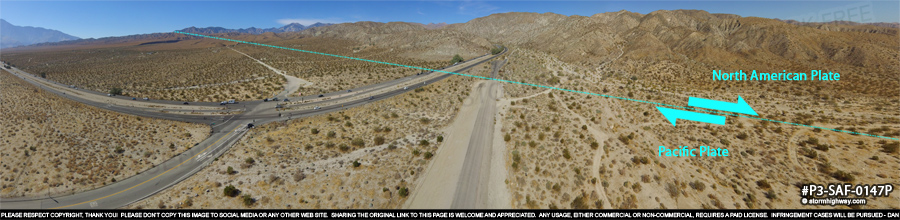
Our next stop is along Twentynine Palms Highway where the San Andreas crosses near the intersection with North Indian Canyon Road. This view looks west:
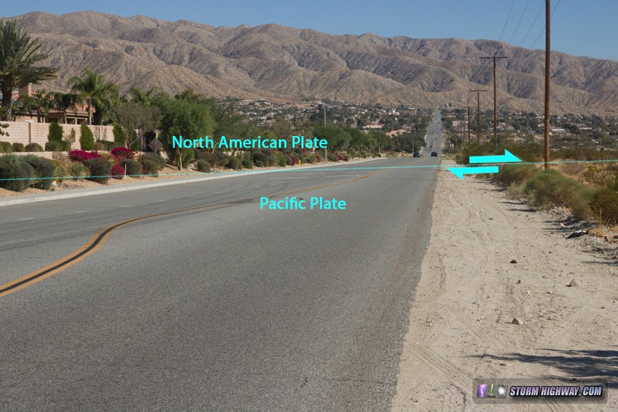
After crossing US Highway 62, the San Andreas takes a sharp turn southeast toward downtown Desert Hot Springs. Like the trace through San Bernardino, there are countless streets and residential properties overlying the fault in this city:
San Andreas Fault zone in Desert Hot Springs, CA
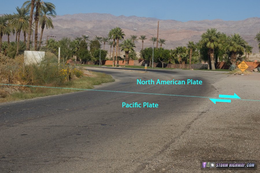
The fault zone cuts right through downtown Desert Hot Springs:
San Andreas Fault zone in Desert Hot Springs, CA
Then crosses Dillon Road on the southeast side of town:
San Andreas Fault zone in Desert Hot Springs, CA
Southeast of Desert Hot Springs, the San Andreas begins to make itself known visually again in the form of linear hills, scarps and contrasting soils:
We'll continue down past the town of Mecca to our final stop along the fault.
Mecca, California
Here at the fault's crossing of Box Canyon Road, we are only a few more miles from the northern shores of the Salton Sea and the southern terminus of the San Andreas. The eroded cliffs of "fault gouge" are the prominent feature at this location.
About the Author: Dan Robinson has been a storm chaser, photographer and cameraman for 34 years. His career has involved traveling around the country covering the most extreme weather on the planet including tornadoes, hurricanes, lightning, floods and winter storms. Dan has been extensively published in newspapers, magazines, web articles and more, and has both supplied footage for and appeared in numerous television productions and newscasts. He has also been involved in the research community, providing material for published scientific journal papers on tornadoes and lightning.
My work is, at this very moment you are reading this, generating the most income it ever has in my career. Yet, I was forced to shut down the professional side of my successul operation, against my will, due to one cause alone: 95% of that revenue is being stolen by piracy and copyright infringement. I've lost more than $1 million to copyright infringement in the last 15 years, and it's finally brought an end to my professional storm chasing operation. Do not be misled by the lies of infringers, anti-copyright activists and organized piracy cartels. This page is a detailed, evidenced account of my battle I had to undertake to just barely stay in business, and eventually could not overcome. It's a problem faced by all of my colleagues and most other creators in the field.
Web Site Design and Internet Marketing by CIS Internet
From Dan: Please Read
To my regular readers, I offer my apologies for this heavy-handed notice. Unfortunately it has become necessary, so please bear with me!
Please don't copy/upload this site's content to social media or other web sites. Those copies have been a critical problem for me, seriously harming this site and my photography/storm chasing operation by diverting traffic, viewers, engagement and income. "Credit" and "exposure" does not benefit this site or my operation, rather they threaten my ability to cover my operating expenses. Please read my full explanation for this notice here.
Before continuing, check each box to agree to and acknowledge these two statements:
Click this button to finalize this acknowledgement:
This chase was a routine television assignment in my role as a cameraman. As a result, many of these don't have a dedicated chase log.
This chase was only recorded in my mileage reports, no detailed log was written for it.