
|
||||||||||||||||
4K CHASE VIDEO: Oakville, MO and Mascoutah, IL tornadoes Note: This is a combination storm chase log/unofficial damage survey. The location of each damage photo is notated on the map shown. I observed two nighttime tornadoes in the St. Louis metro on Friday night. The first was a rain-wrapped tornado producing power flashes in Arnold and Oakville, Missouri. The next was the start of a significant tornado in Mascoutah, Illinois that passed within 2 miles of home.
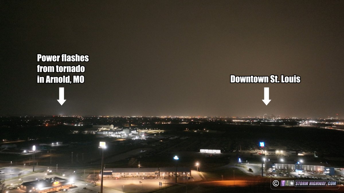
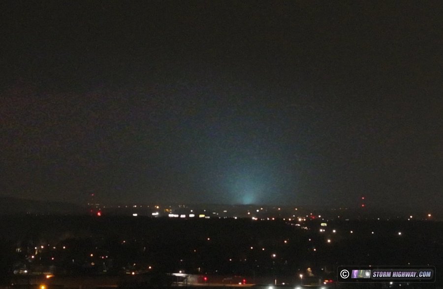
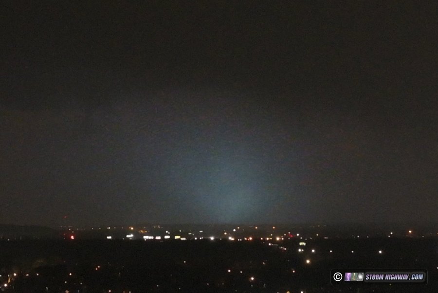
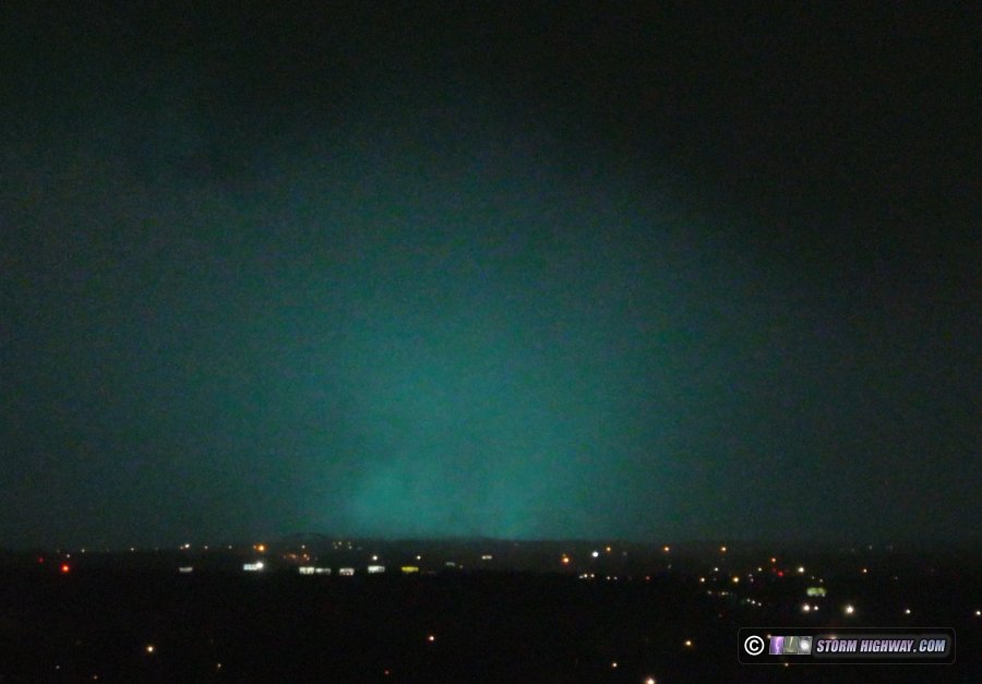
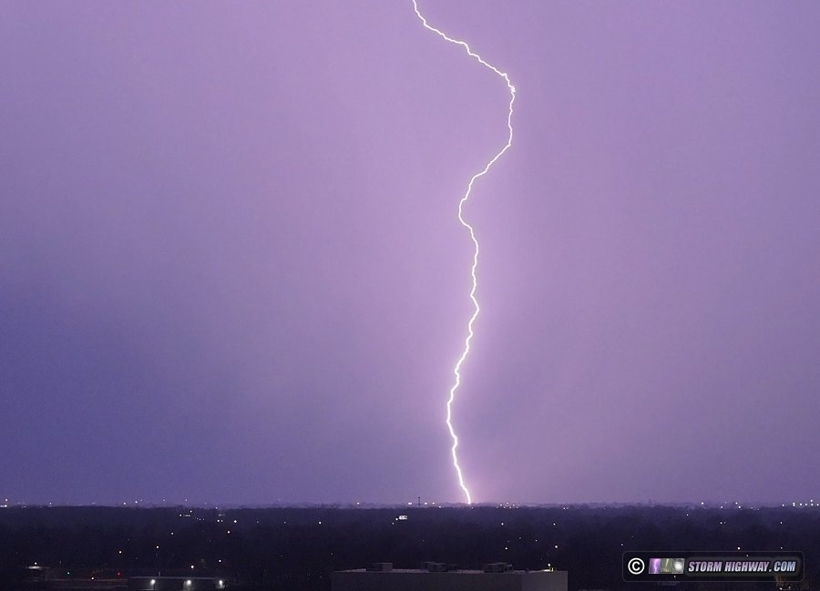
With storm speeds expected to be 65-70mph, my plan was to simply wait for storms to arrive in the St. Louis metro area. When storms are moving that fast, there is a big risk of them getting ahead of you if you try to intercept them early. I decided to start in O'Fallon, Missouri to watch the evolution of the storms in western part of the state. Eventually, the target storm emerged near Springfield, tracking along I-44 toward the St. Louis metro area after sunset. I pondered the idea of heading west on I-44 to intercept, but I felt there would be little to gain by doing that. The terrain is difficult for visibility there, and once I intercepted the storm, I'd only be 10-15 minutes ahead of it after driving east at interstate speeds for an hour! I really wanted to prioritize catching storms in the metro area, and that early intercept attempt would risk forfeiting that for very little to gain. As the storm closed in, I moved to my downtown intercept spot and waited. I was too far away to see the mostly rain-wrapped tornadoes the lead storm produced in Villa Ridge, Chesterfield northward into Alton. This storm was moving north-northeast and would pass well to the west of downtown. I would have moved west to intercept that if it had not been for a second storm rapidly developing to its south headed in the general direction of downtown. Eventually it became clear this storm's meso would pass east of downtown somewhere between East St. Louis and Caseyville. I hedged on the safer option of Caseyville, as it was outside of the difficult-to-get-drone-clearance Class D airspace of St. Louis downtown airport, and I'd have no issues monitoring the incoming storm with the drone. I launched the drone near I-64 and watched the storm approach. Power flashes were soon visible from the EF2 tornado in Arnold and Oakville. Lightning was also frequent and intense:
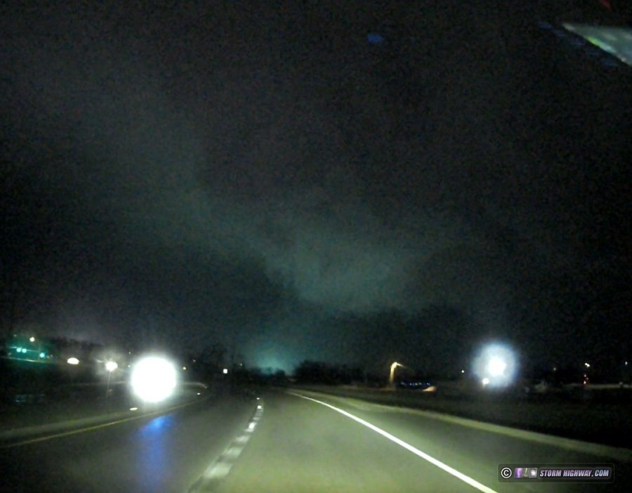
 This tornado was rated EF2 by the National Weather Service. The main meso ended up tracking on the western side of my earlier estimates in East St. Louis, but it was not recycling a new circulation. As the RFD precip rapidly approached, I moved east on I-64 to get out of its way and to intercept the next storm in the line. I awaited the third storm at Rieder Road, then moved east to Highway 4 to intercept a new circulation that was developing. As soon as I exited the interstate and turned south on Highway 4, nearly continuous power flashes began exploding as a tornado rapidly developed just south of MidAmerica Airport.
 I turned around at the new Boeing plant to attempt to get back to I-64 to stay with this, but the precip caught me at the airport entrance. This was suddenly filled with wind-blown nickel sized hail that looked large enough to break my side windows (I did not have my hail shields mounted for this chase). I pulled off of the road and angled the car into the wind to protect my side windows until the hail slowed. This meant I had to let the tornado go. I got back onto the interstate eastbound, slowed by hail still covering the road. After passing the rest areas, I encountered a large swath of debris that included both structural roof pieces and toppled trees:
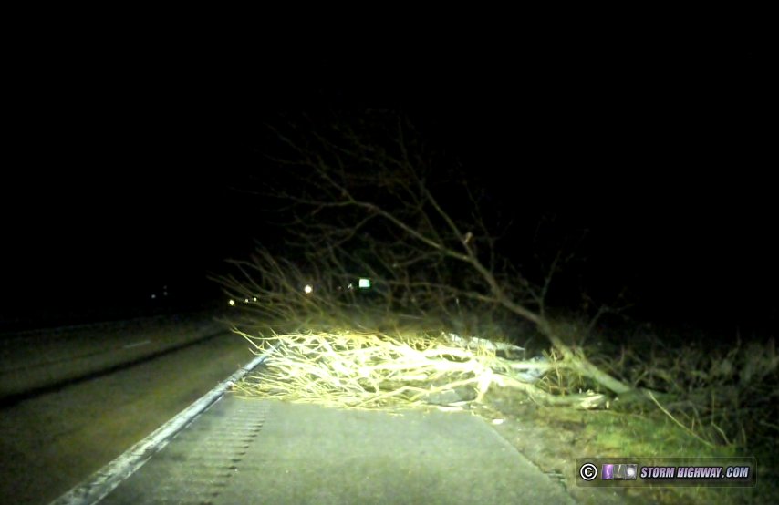 Location 5: Toppled trees on the shoulder of eastbound I-64. A semi was toppled on the westbound side, with a second trailer damaged (this is from dashcam video the next day):
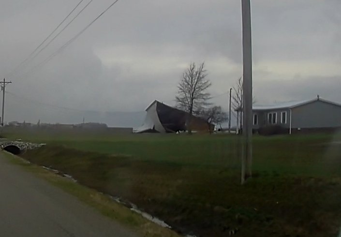
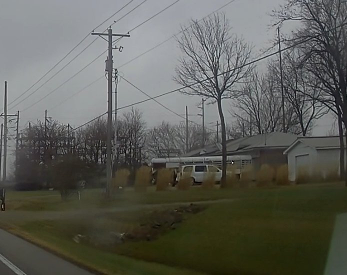
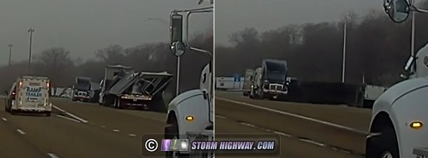 Location 4: Damaged/flipped semis at I-64 westbound Gateway Rest Area Power was out at the gas stations and McDonald's on IL 161. I went home to check for RFD damage, but surprisingly our part of town still had power and was unscathed. I then returned to Mascoutah via Highway 161 to look for damage. I found a shed in the middle of Fuesser Road on the north side of Mascoutah (Location 1 on the map).
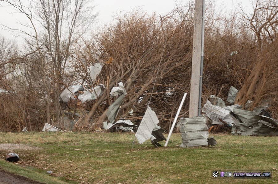
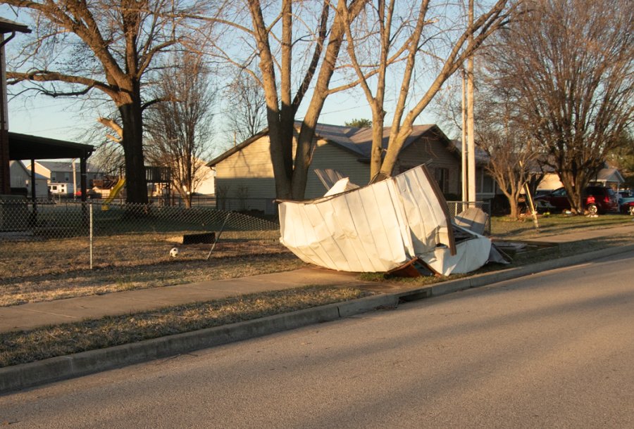 Location 1: Shed blown into Fuesser Road (moved off of the road at the time of this photo) Tree damage resulted in large branches on Highway 161 (Location 2 on the map). A railroad crossing gate on Highway 4 was broken:
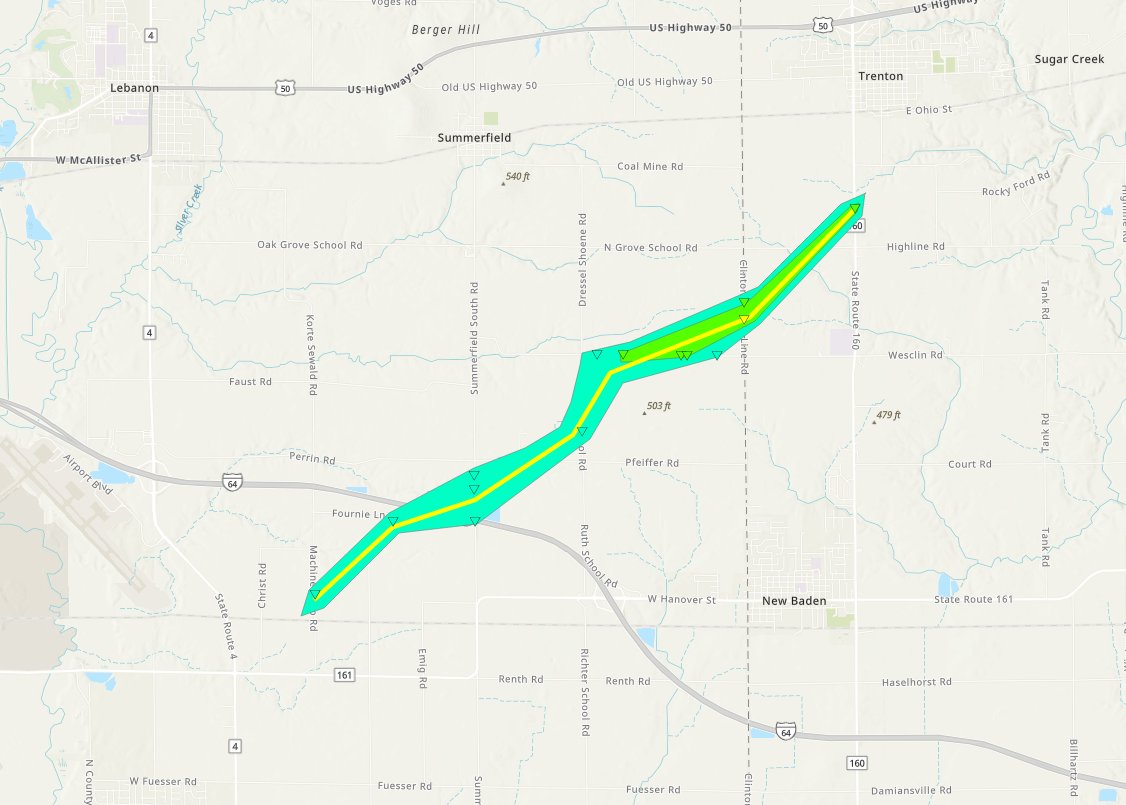
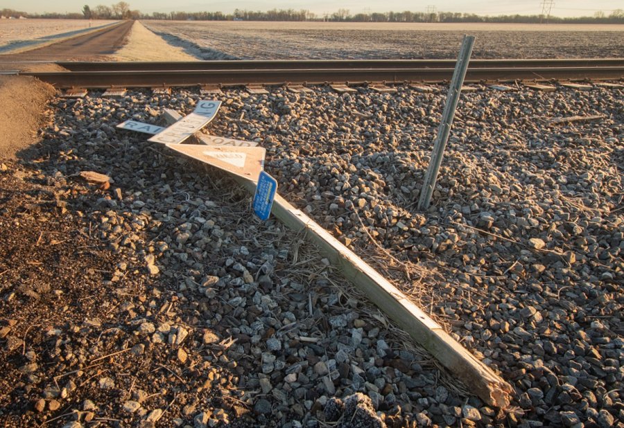
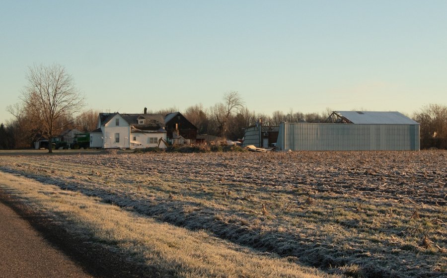
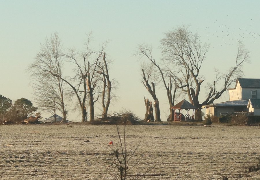
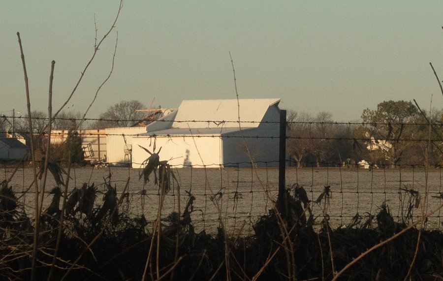
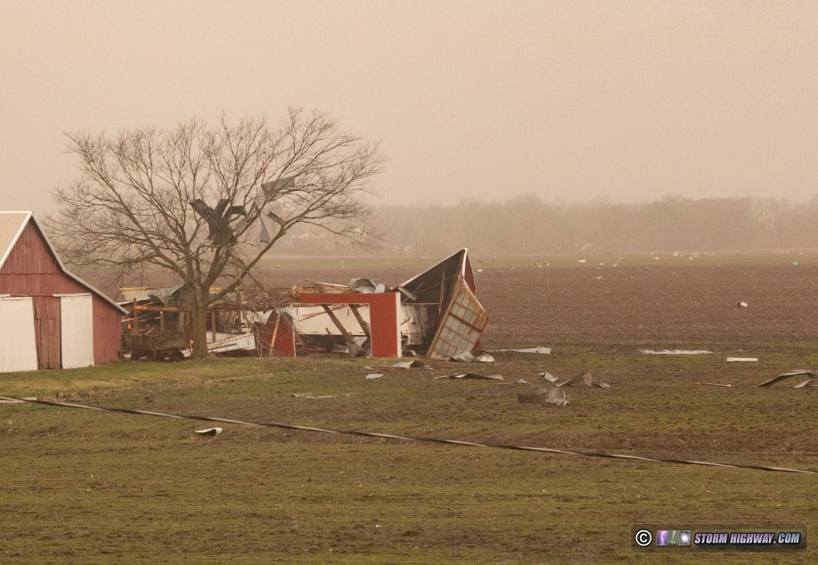
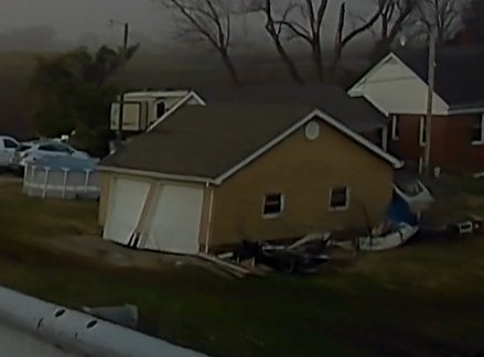
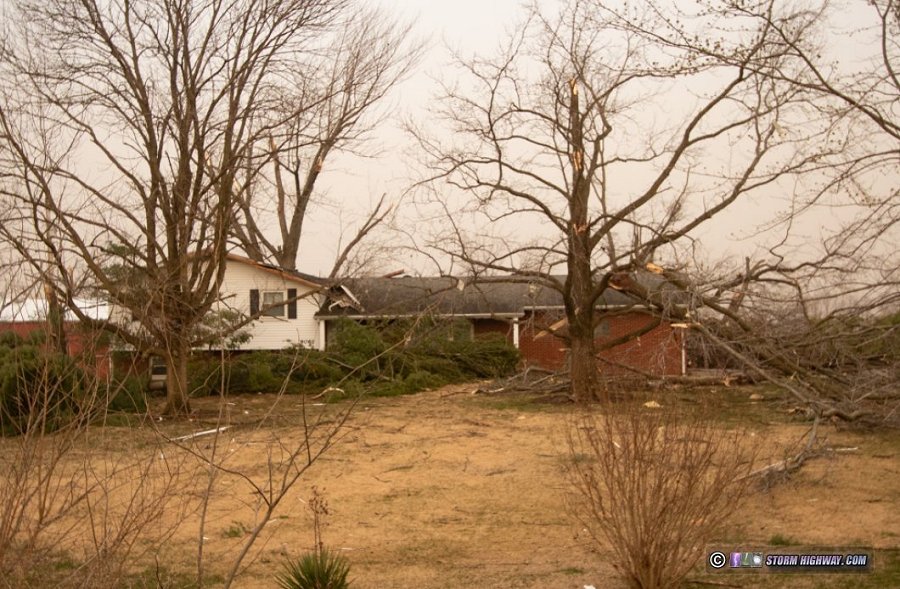
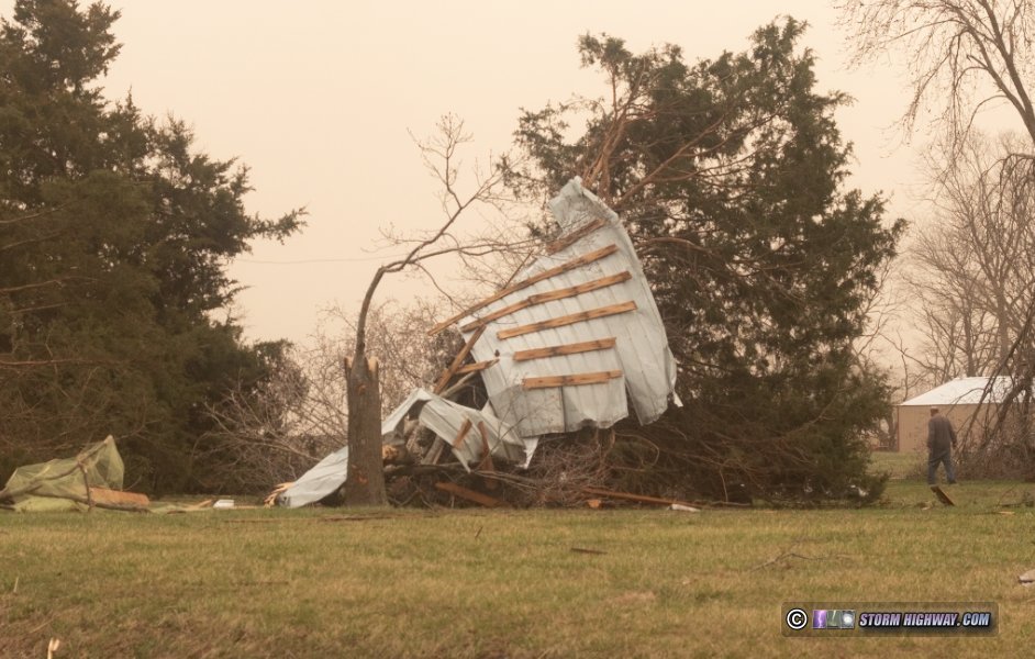
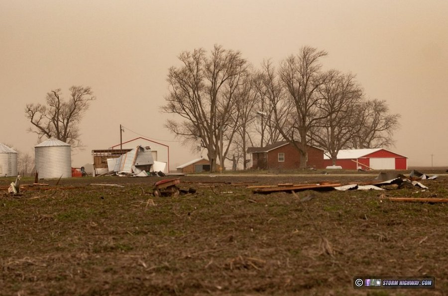
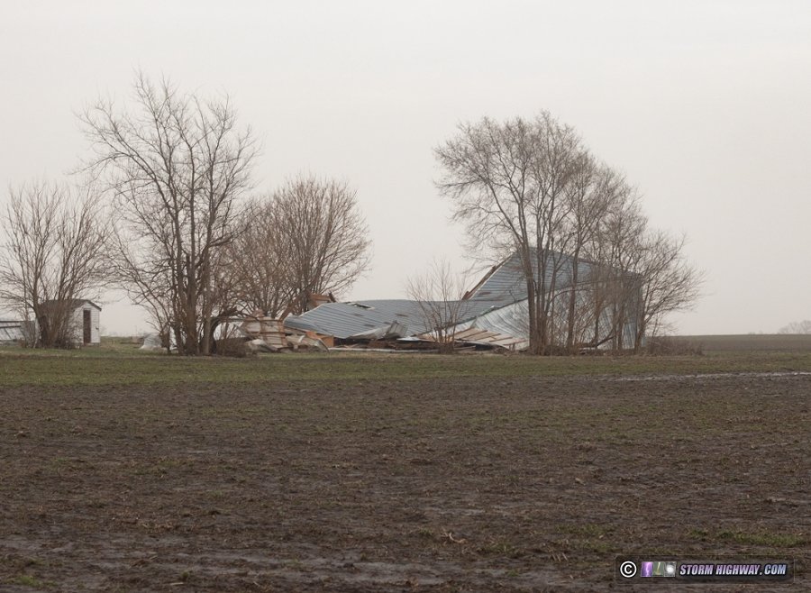
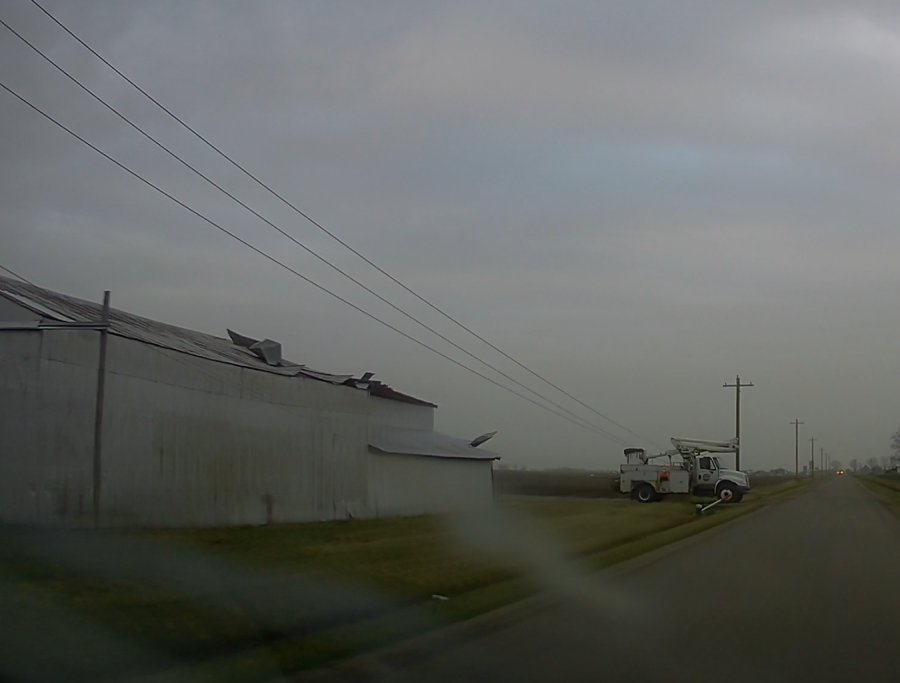
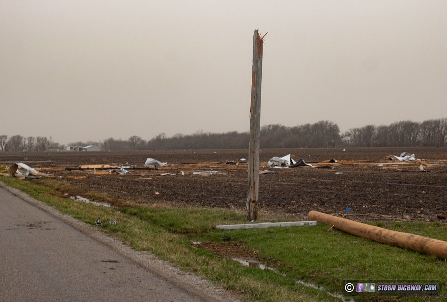
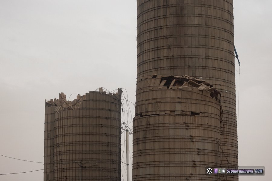
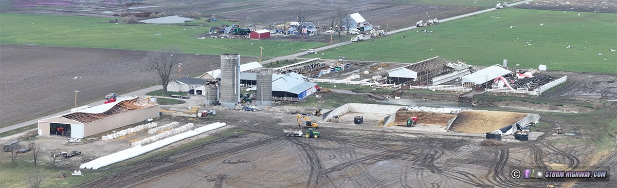
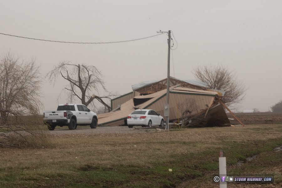
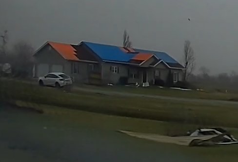
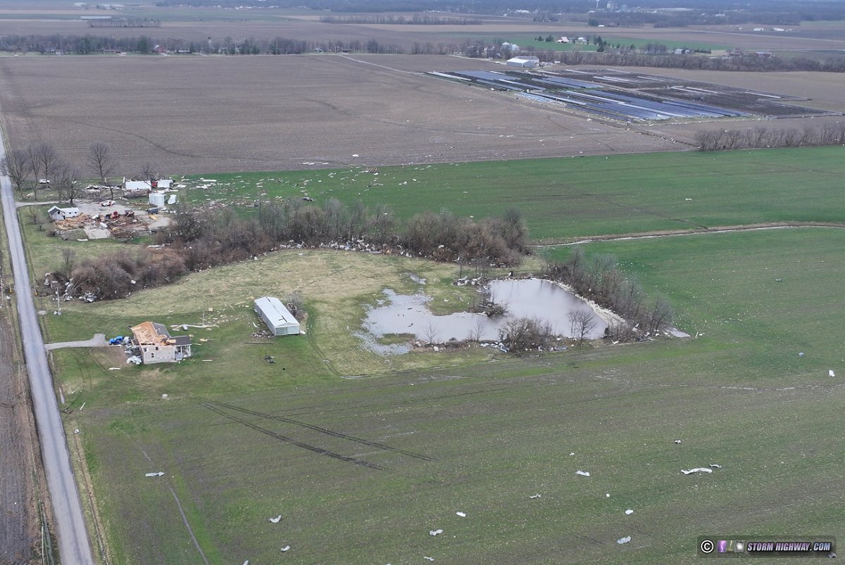
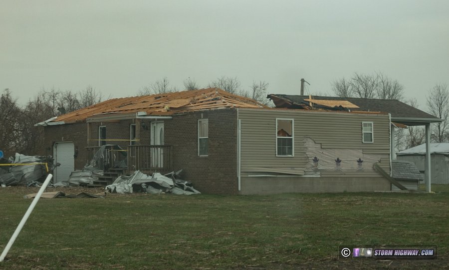
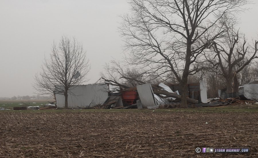
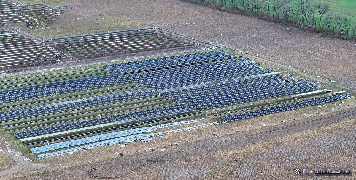
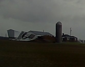
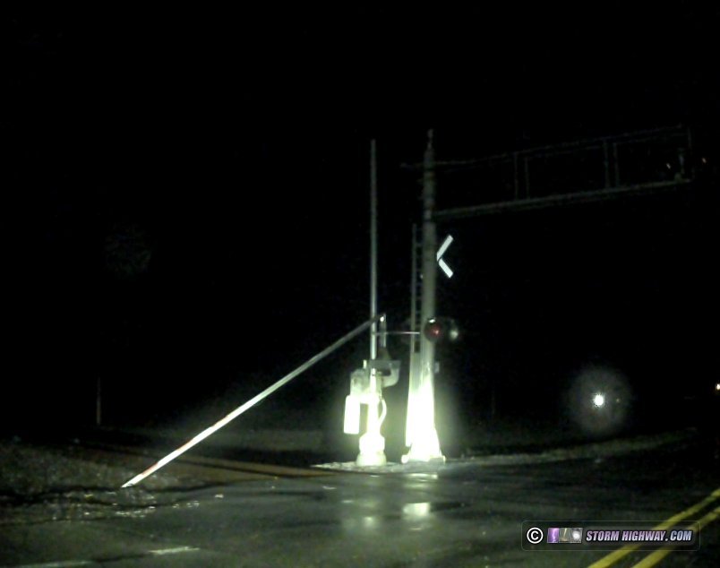 Location 3: Broken Nortfolk Southern railroad crossing gate on Highway 4 A fourth storm followed the third by about 20 minutes, heading for New Baden. A visible-on-radar gust front led this storm by about 4 miles, so I did not expect it to be a tornado threat. It passed through town uneventfully. A few more non-severe storms moved past with occasional lightning. I tried unsuccessfully for a few shots 1/2 mile down the road from home, after which my chase was over. On Saturday and Sunday, I did a complete (unofficial) survey of the entire tornado path. The damage was much worse north of the interstate. The tornado destroyed several barns and damaged many homes along Summerfield Road and to the northeast. The worst damage I saw was on Luettinger Road, where more than 1/2 mile of power lines were down with many snapped poles. The Kehrer Brothers Dairy Farm suffered catastrophic damage, with every structure on the property either damaged or destroyed. A home along County Line Road lost its entire roof (the EF2 damage that resulted in the tornado's final official rating). The new solar farm south of Highline Road suffered extensive damage. At Highway 160 and Highline Road, extensive power line damage was causing a traffic jam. The worst damage I saw, in the vicinity of Luettinger Road and County Line Road north of New Baden, was confirmed to be EF2 intensity by the official NWS survey. Before the official survey was done by the NWS, I performed an unofficial survey of the entire path of this tornado. I put together this map that shows the locations of damage I observed:
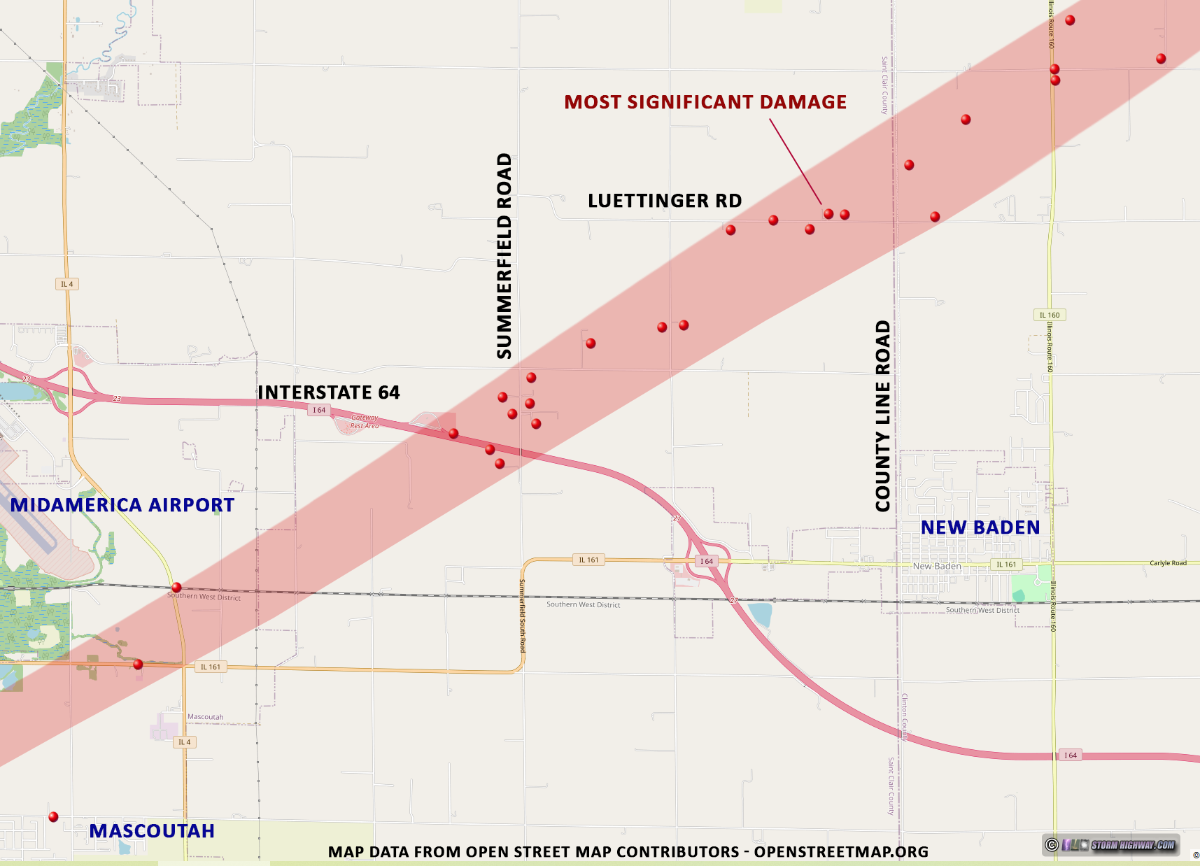 Click map to download full size version
 Click map to download full size version |
||||||||||||||||


Web Site Design and Internet Marketing by CIS Internet