 April Departs: Red House, WV, - April 30, 2003 - 2:00PM to 3:00PM April Departs: Red House, WV, - April 30, 2003 - 2:00PM to 3:00PM
LOCATION: Putnam County, WV 20 miles west of Charleston
EXPEDITION VIDEO 1: Hail on Grandview Ridge
EXPEDITION VIDEO 2: Lightning in Putnam and Kanawha counties
After small storms began firing 70 miles to the east of here along the high ridges of the Appalachians, GOES 12 satellite showed a small area of clearing
beginning to come alive with bubbly cumulus clouds directly over Putnam and Cabell counties.
Stepping outside for a look showed the cumulus (Cu) field growing rapidly into towering cumulus (TCu), and I decided to head out. As the TCu developed further, a few dominant updraft bases were visible. I latched onto one just southwest of Winfield and followed it northeast.
It rapidly intensified, developing a strong rain shaft a few minutes later and finally began dropping cloud to ground lightning not long after that.
I pulled over on a ridgeline road near Red House, WV to film it as the fireworks show was just getting started:
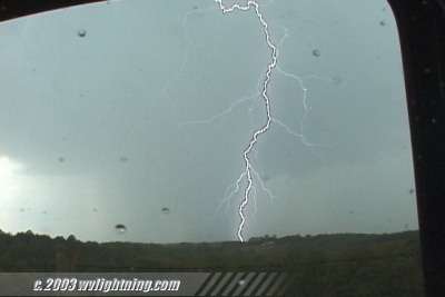
The storm was sparking nicely as it moved off to the NE:
Watch a GIF Movie, 1.2MB of the above strikes.
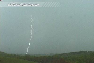
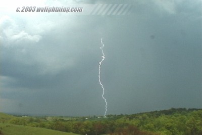
Too bad it wasn't nighttime, these would have made good 35mm shots. As the first cell moved off, a new cell to the south was just beginning to drop a faint rain curtain. Within minutes, it too developed a dense rain shaft with lightning as it drew closer. None of these new strikes would cooperate though. The heavy precipitation core then swept over with copious dime to nickel-size hail:
Hail Video: RealVideo, 8.3MB
Digital Video: Sony DCR-TRV900 3CCD MiniDV, 720x480 NTSC
|


