In September of 2025, my work is generating the most income it ever has in my career. Yet, I'm being forced to shut down my successul operation, against my will, due to one cause alone: 95% of that revenue is being stolen by piracy and copyright infringement. I've lost more than $1 million to copyright infringement in the last 15 years, and it's finally brought an end to my professional storm chasing operation. Do not be misled by the lies of infringers, anti-copyright activists and organized piracy cartels. This page is a detailed, evidenced account of my battle I had to undertake to just barely stay in business, and eventually could not overcome. It's a problem faced by all of my colleagues and most other creators in the field.
Yesterday's event had slight 'cold core' tornado potential, with an offset surface/upper low approaching from northwestern Missouri along with a warm front in Illinois, an occluded surface front in central Missouri and another weak boundary apparent on satellite and radar in the western St. Louis metro. A plume of surface moisture and CAPE was rapidly moving north along the Mississippi valley, with SBCAPEs of around 1000 j/kg across the entire region. I chose to target the boundary west of St. Louis near Dardenne Prairie, as it was on the nose of a CAPE axis and agitated cumulus seemed to be focused there.
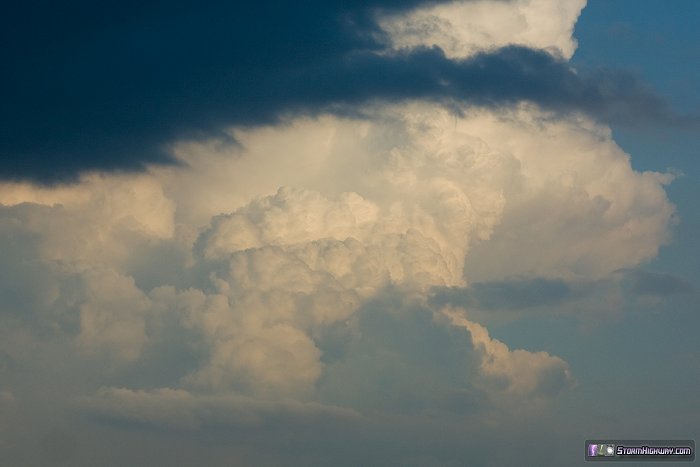
My target ended up busting, with the cumulus fading by late afternoon. Meanwhile, a strong storm blew up on the east side of the CAPE max about 12 miles from my apartment in New Baden. With the main occluded front to the west not due in the area until well after dark, I forged my way back east through St. Louis rush hour traffic into Illinois to catch up with the activity there (barely missing getting caught in a massive traffic jam on I-70 east). This was the view of an updraft east of Okawville, viewed from Fairview Heights:
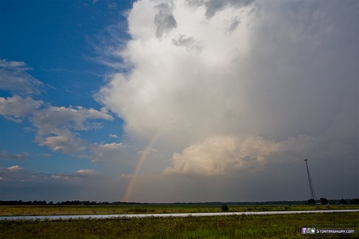
This rainbow north of I-64 near Okawville formed at the edge of a weakening precip core:
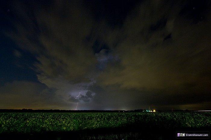
I ended up all the way in Mount Vernon, IL, arriving at a storm there just as it dissipated. With sunset past, I headed home to await the arrival of the main activity in St. Louis. Soon after, storms fired just to my north and raced away. This was one of only two distant lightning bolts I saw from near Lebanon:
Lightning continued in this activity, but I wasn't motivated to drive north after it. The activity to the west of St. Louis dissipated long before reaching the metro.
Web Site Design and Internet Marketing by CIS Internet
From Dan: Please Read
To my regular readers, I offer my apologies for this heavy-handed notice. Unfortunately it has become necessary, so please bear with me!
Please don't copy/upload this site's content to social media or other web sites. Those copies have been a critical problem for me, seriously harming this site and my photography/storm chasing operation by diverting traffic, viewers, engagement and income. "Credit" and "exposure" does not benefit this site or my operation, rather they threaten my ability to cover my operating expenses. Please read my full explanation for this notice here.
Before continuing, check each box to agree to and acknowledge these two statements:
Click this button to finalize this acknowledgement: