|
Home | Blog Index | Blog Archives | Christianity & Faith Essays | Storm Chasing Essays
August 2024 Storm Chasing Recap
August 2024 wsa mostly a quiet one in the Midwest, punctuated by a few systems providing photo opportunities. This recap chronicles events covered during the month.
August 2024 Event List
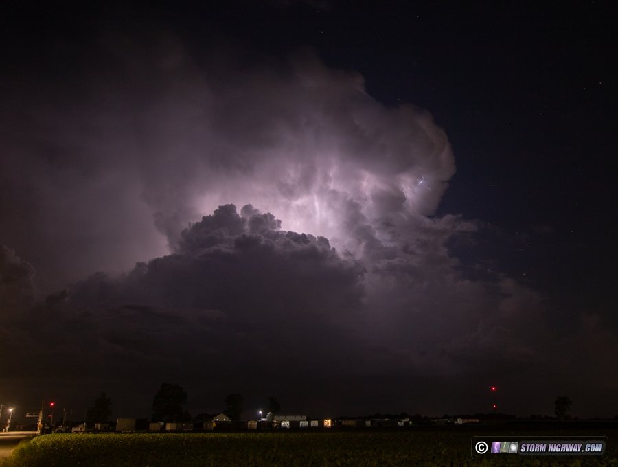
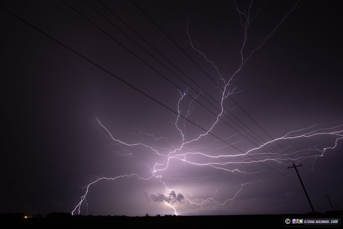
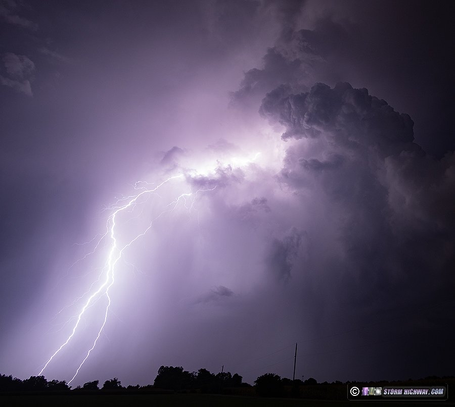
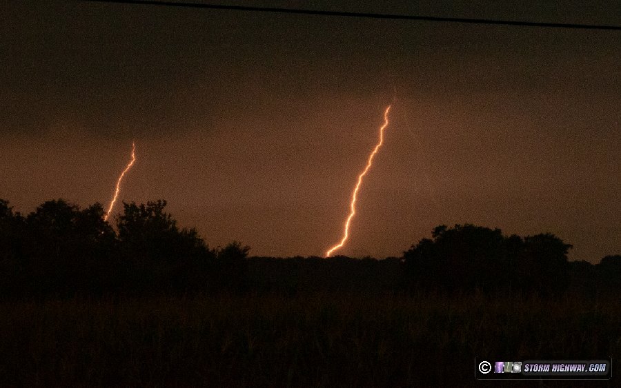
 August 1: New Baden, Illinois lightning August 1: New Baden, Illinois lightning
Isolated storms developed by late evening in the St. Louis metro. After dark, the lightning was good enough to go out and set up for a while. This storm about 20 miles south of New Baden was very lightning-active with intracloud flashes. I framed the cameras for a bolt-from-the-blue, but none happened. The DSLR captured a decent timelapse-able sequence.
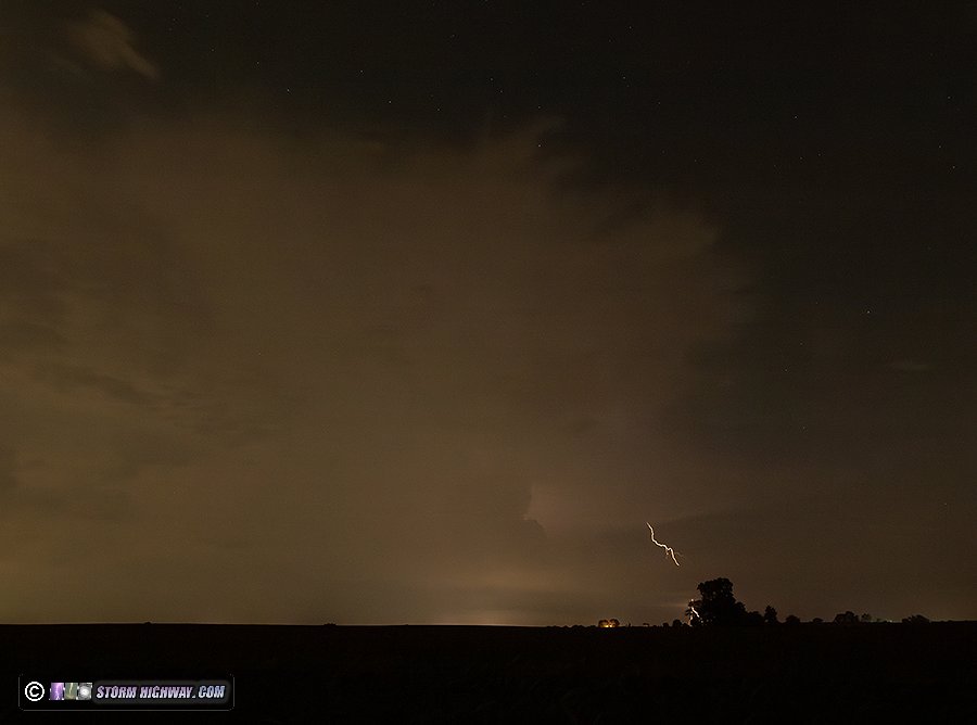
 August 12: O'Fallon, IL aurora bust August 12: O'Fallon, IL aurora bust
Clouds completely blocked any view of this night's aurora show from the St. Louis metro area. I went out after midnight for about 25 minutes doing some test exposures to see if I could get even a hint of color to show in the clouds, but there was none.
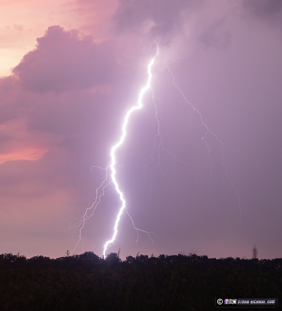
August 15: New Baden, Illinois morning lightning
I decided not to stay awake for these daybreak storms that models had been hinting at. I was awakened at 6AM by a close lightning strike from the storms that, as it turned out, developed right overhead. They were not cooperative, however, sending thick low level stratus in front of the areas of cloud-to-ground lightning. This is the only bolt I saved on the high speed camera, looking south from New Baden.
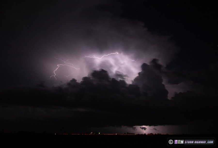
 August 15: St. Louis metro bolts-from-the-blue August 15: St. Louis metro bolts-from-the-blue
This day's model depiction of potential for supercells and tornadoes decreased in the 36 hours preceding it. As the day got going, low-level shear was lacking, and airmass recovery in the wake of the morning activity didn't look as strong. The best supercell potential would be down in southern Illinois, and I didn't think it would be worth going that far. I decided it would be best to stay local and focus on bolts-from-the-blue, which was what I felt this day might excel in.
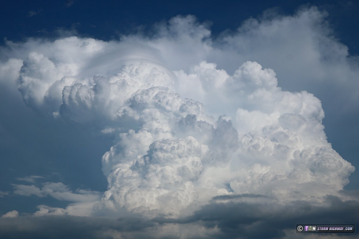
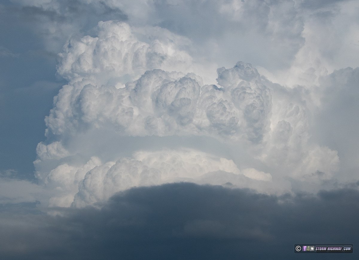
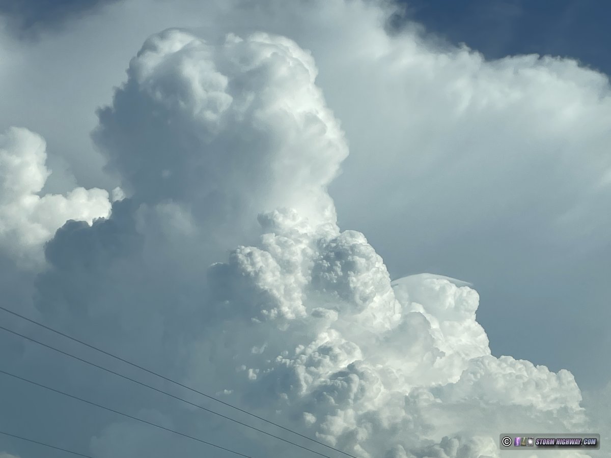
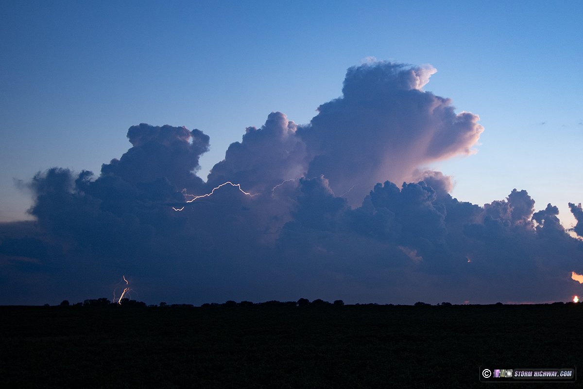
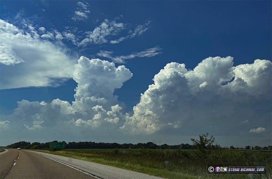
I started by going down to Freeburg where a pre-existing boundary intersected outflow moving west from the storms in southern Illinois. This impressive cumulonimbus tower developed near Sparta, exhibiting pileus and midlevel knuckling:
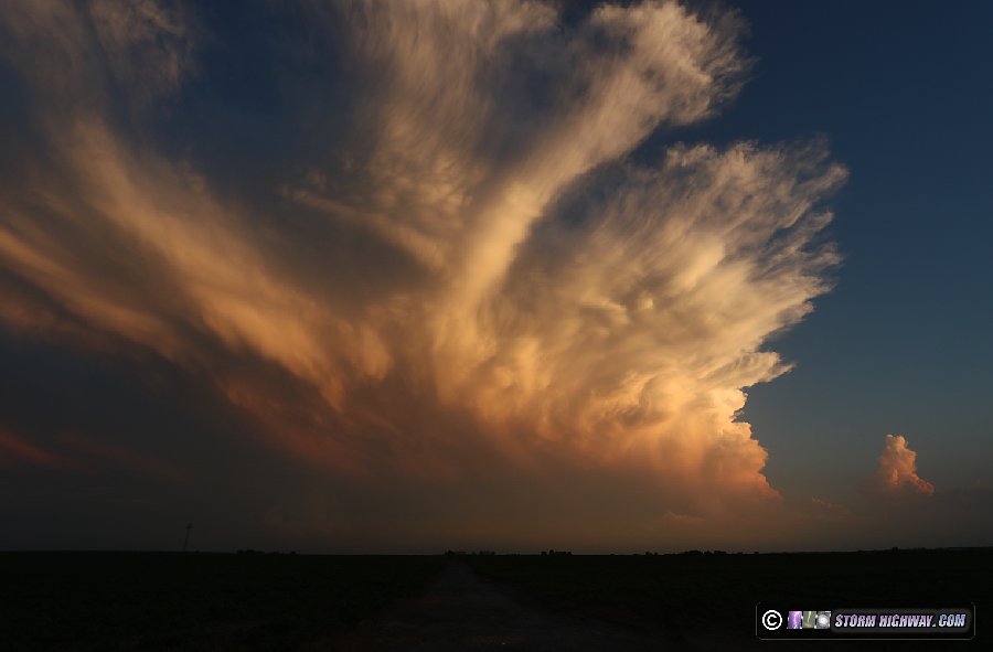
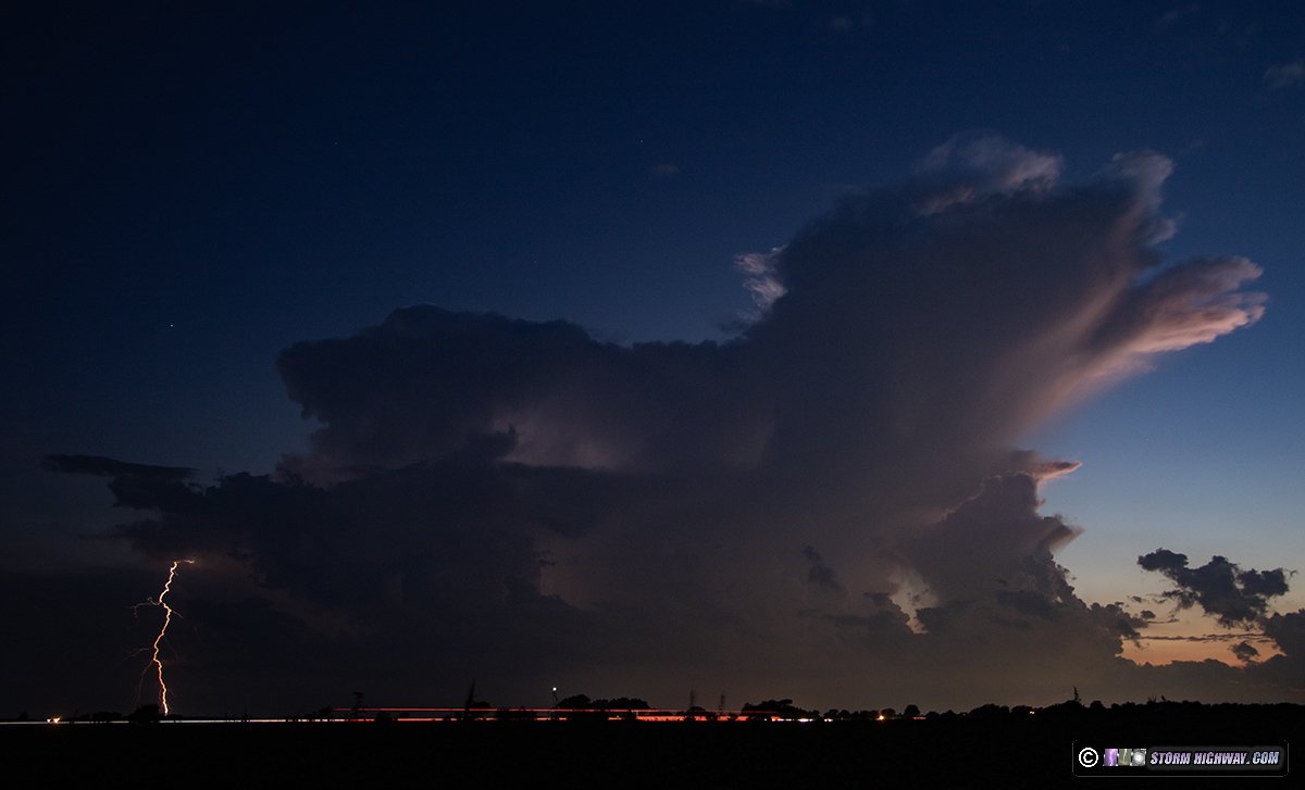
I waited for a new storm to go up at the boundary intersection near Smithton, but this wasn't happening: not even a hint of cumulus at that location. I returned home to await late evening activity that models had started locking on to. I was only home a short time as the western edge of the southern Illinois storms began backbuilding to the west, I went just south of town to set up for a timelapse of these, framing for a bolt-from-the-blue from the westernmost storm, While none of those happened, the sunset colors from the storm along with mammatus in the anvil made for a nice scene. I kep the DSLR timelaps going until the last bit of sunlight was gone.
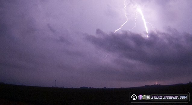
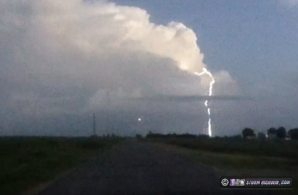
Agitated cumulus finally began appearing on the earlier outflow boundary right over St. Louis, so I started the drive into downtown. Right as I did this, the southern storm I'd been shooting for the past hour produced a bolt-from-the-blue. My rear dashcam was the only thing that caught it:
I stopped and got my cameras on this again, but it would not give me another one. Meanwhile, the storms over St. Louis began producing bolts from the blue. The saving grace for me is that they were south of downtown and already crossing the Mississippi River at this point, leaving no good compositions with the city. I decided to just shoot these from where I was at home as they slowly tracked toward me. Again though, they wouldn't produce a good bolt-from-the-blue from my vantage point. Others captured the more classic views of those from the west and south. These were the only two I managed onm the DSLR:
As additional storms began approaching St. Louis from the southwest, I went into downtown. The view from the east of the departing storms was nice, with near-constant lightning behind the Arch:
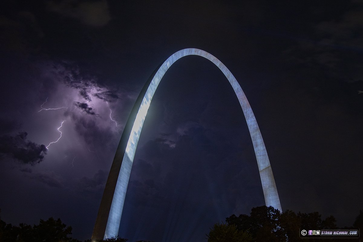
4K video of this scene:
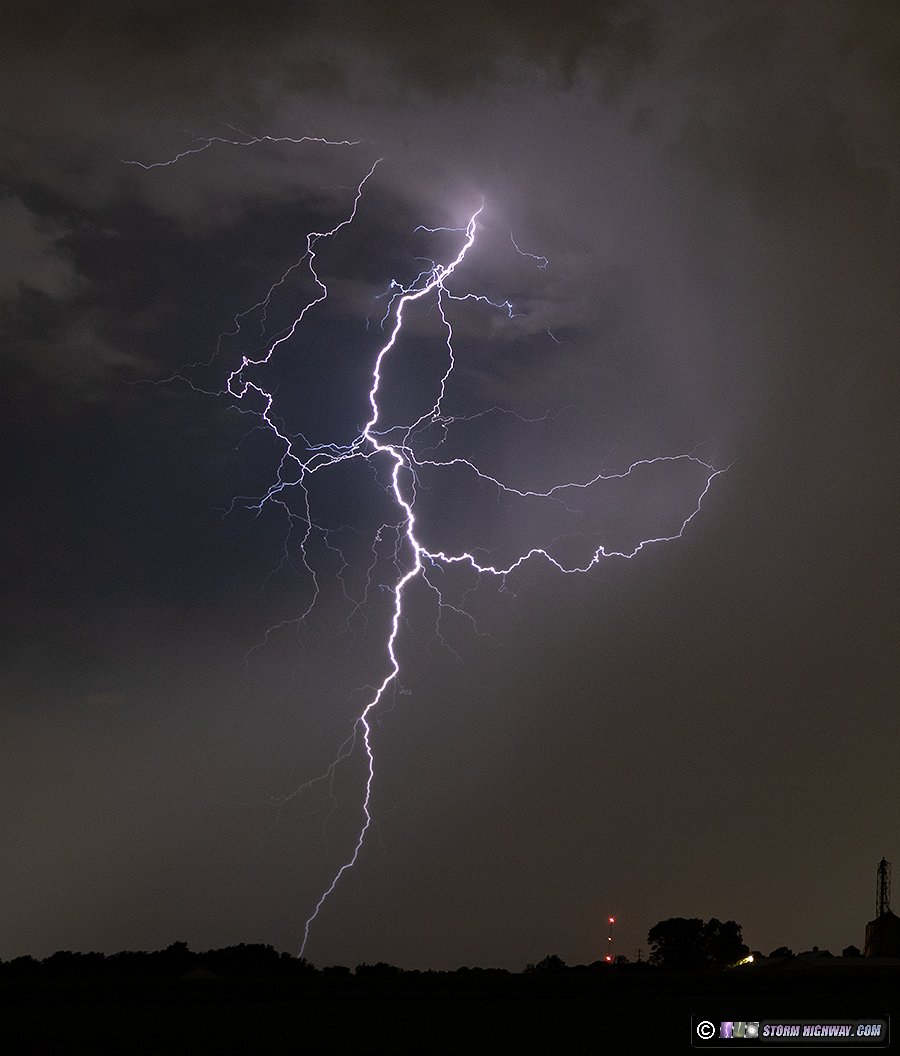
I followed these east to Fairview Heights, then returned to downtown for the storms moving in from the southwest. These did not have much visible from my downtown vantage points. After they moved east of the city, I headed back toward home. I caught up to the storms as they arrived in New Baden. By now, they were weakening but putting on a spectacular show of "anvil crawlers" that rivaled many of the better ones I've seen. I shot with the DSLR and the high speed camera.
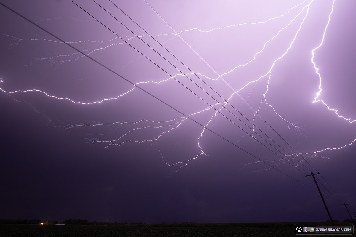
I captured this complex flash on both cameras. It began with a positive CG (the ground connection on the right), followed by vivid positive leaders expanding toward me. Finally, a negative leader sprouted off of the far end of the positive leader tree and terminated at ground for a negative CG return stroke (the left ground connection here). The high speed camera shot of this flash was a whopping 8,797 frames long at 6,002fps, by far the largest high speed sequence I have on that camera to date.
As this moved off and weakened, new storms continued to develop to the northwest, nort and due west right over St. Louis again. I framed for bolts-from-the-blue on the westernmost cell, but none occurred. I finished with the night's shooting after 1AM.
August 27: St. Louis storm bust
Models indicated that storms might fire before sunset in the metro area along a boundary moving northwest through the area. Visible satellite didn't show any cumulus on the boundary north of a Perryville-Carbondale line through sunset, so I didn't go out during the daylight hours. At sunset, I could see towering cumulus finally going up on the boundary near Fenton and Glen Carbon. I favored the closer one, heading up to the New Poag road exit on I-255 to await further development. Instead, this activity faded entirely. Clouds moving in from the complex to the north also ruled out any sprite opportunities, so I returned home after only an hour.
August 28: St. Louis predawn lightning
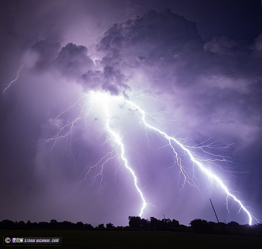
Models had backed off of their previous idea of overnight storms, and based on the previous evening's fare, I wasn't expecting anything. I started heading into the office at 1AM. On the way west on I-64, I saw the first flash from a new cell that had gone up just south of downtown St. Louis. I continued west into the city. The storm crossed the river as I arrived, so I moved back into Illinois ahead of it, stopping north of Fairview Heights to set up. The cell was a typical low-shear pulse storm with a large precip shaft curling outward near the ground, and tall cloud-to-ground bolts mostly in its core. Eventually, a bolt-from-the-blue emerged from the south side of the storm, terminating in the curling rain foot - unfortunately on the leftmost edge of the frame:
I subsequently aimed both cameras at this area. The storm, not being cooperative, then proceeded to produce a very nice, tall mostly-out-of-the-rain bolt on the right side of the precip, right on the edge of the frames of both the still and high speed cameras. At least the still got most of it. The 6000fps high speed shot only caught the left-most bolt. This flash was of much greater intensity compared to the previous ones, so the still shot was blown out.
The storm produced a few more bolts deep in the rain before weakening.
Storms were now going up all over the bi-state region on both sides of the river as a major outflow bore from storms to the north was arriving. These were not fruitful, as the best activity stayed with storms farther away from me and not with the ones I was closer to. I saw a few more bolts-from-the-blue as I made another trek into downtown and back, but I didn't catch anything else of note. This bolt-from-the-blue was from a distant storm behind the one I was focused on near Highland:
I made it home after sunrise as the activity moved off to the east and out of my range.
August 28: St. Louis sunset lightning
Storms overperformed from expectations this day, firing right around town at sunset behind northward-moving outflow from cells in southern Illinois. Once again, the bolts were not very cooperative and were more intense than usual, causing the one I did catch on the DSLR to again be blown out even at F9. There weere quite a few nice bolts, but none would happen where I had the high spoeed camera pointed.
August 30: Troy, Illinois lightning
With today being a work day and models showing a disorganized pulse-storm environment, I wasn't planning on doing much with this event. As I headed toward the office, storms erupted across the metro area. These were visible north of I-64 along I-270:
I diverted toward the city for a storm that had gone up in South County and slowly drifted toward downtown. When I finally had a good visual on it at Caseyville, I could see it no longer had an updraft and was in the process of raining itself out. It was classic 'pulse storm' behavior when the rain falls basically straight down through the updraft, killing it. I turned north on I-255 toward the healthier-looking storms along I-270, but they were already beginning to suffer the same fate.
I could see a solid new updraft base emerging near Troy in between two of the earlier cells, so I moved in closer. It started dropping bolts before I could find a view (the tall corn this time of year makes finding vantage points hard). By the time I got set up, the precip had already started falling through the base, quickly becoming a huge, dark mass with most of the bolts now inside of it. I got one good bolt outside of the rain at 6,002 FPS before the storm started raining itself out as the others had done:
Once this storm was finished, there wasn't anything else happening in the metro area. I went in to the office for the evening, noting a strong gust front from storms to the distant west approaching. Convection began trying to fire behind this boundary well after dark. I took two short breaks for these. The first cluster produced no lightning, while the second's occasional bolts were either distant or in the middle of heavy rain. This was near Fayetteville, IL, looking south from Highway 161 near Scott AFB:
I'd finally had enough of with fighting the rain for infrequent low-quality lightning, and wrapped up all shooting before midnight.
< July 2024 Recap | All Storm Chase Logs | September-Octoboer 2024 Recap >
GO: Home | Storm Chase Logs | Photography | Extreme Weather Library | Stock Footage | Blog
Featured Weather Library Article:
|


