 A Monday Evening Show: Charleston, West Virginia - July 7, 2003 - 7:00PM A Monday Evening Show: Charleston, West Virginia - July 7, 2003 - 7:00PM
Any weather enthusiast in the Charleston area who didn't go outside and look to the north on Monday afternoon will regret ignoring this day's events. Even though these severe thunderstorms passed well to the north of town, they put on a show for the city that was nothing short of incredible.
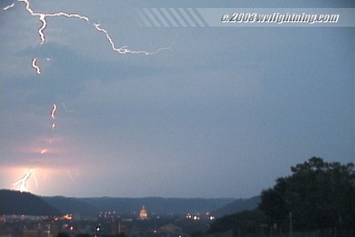
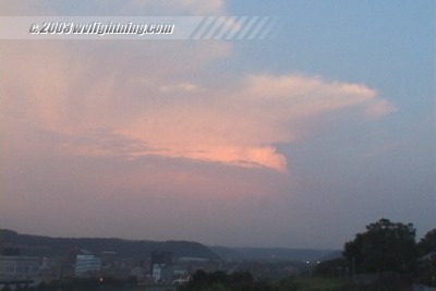
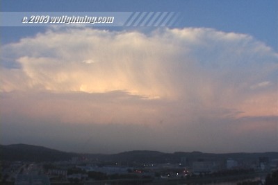
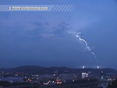
The spectacle began before sunset as the tail end of the line of storms to the north began to 'backbuild' into Roane County (expand westward, opposite the movement of the main storm complex), with new convective towers exploding skyward behind the initial cells passing through Clay County. As these new storms approached maturity, the setting sun cast a golden glow on the massive clouds in the distance. Occasionally, a bright 'positive flash' cloud-to-ground lightning strike leaped out of the top of the clouds and arced its way toward ground, clearly visible despite being 20 to 30 miles distant and surrounded by sunlit clouds.
I watched most of this activity on I-64 as I tried to get up to Fort Hill to set up the cameras. By the time I arrived, the setting sun had dimmed somewhat - but bright positive-flash lightning strikes continued for the next few minutes before I decided to try and get closer. A WSAZ TV cameraman was also filming on Fort Hill this evening.
After leaving Charleston, a trip southeast to Oak Hill was successful in catching one of the cells, but by then it had weakened considerably. I shot several exposures in the New River Gorge which will be developed soon. Several stray cells continued to fire and dissipate north of Charleston for the rest of the evening.
Frames from Video: Sunset-illuminated thunderstorms, and lightning in the distance over Charleston at dusk:
Digital Video: Sony DCR-TRV900 3CCD MiniDV, 720x480 NTSC
35mm Camera/Lens/Film: Pentax K1000 SLR, 28mm lens, Fuji Sensia 100 slides.
35mm Exposure: 1/60 second @ F8 |


