Storm Highway by Dan Robinson
Storm chasing, photography and the open roadClick for an important message
Storm Highway by Dan RobinsonClick for an important message
Home | Blog Index | Blog Archives | Christianity & Faith Essays | Storm Chasing Essays

                   Tuesday, June 30, 2026

May-June 2026 Storm Chasing Recap

By DAN ROBINSON
Editor/Photographer
Important Message 30 Years of Storm Chasing & Photography Dan's YouTube Video Channel Dan's RSS/XML feed

The peak tornado season in May and June of 2026 featured a prolific series of tornado outbreaks in the Midwest.

May-June 2026 Event List

May 3: St. Louis metro lightning

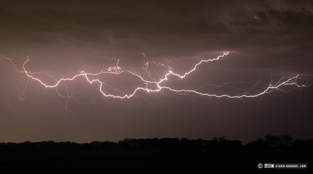
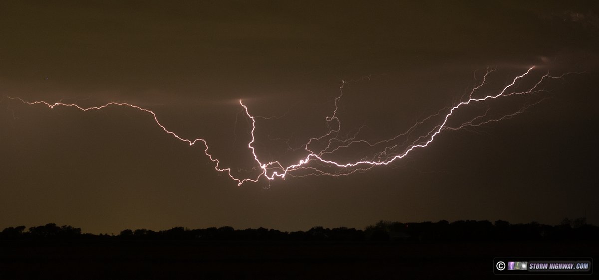
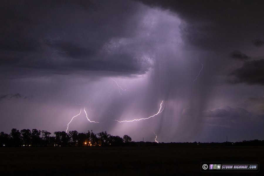
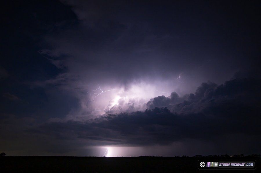
Finally glad to be off of a 2-week interval of midnight shifts, my return to normal was welcomed by these storms moving through the northern St. Louis metro area after dark. I didn't think these would be worth driving far for, so I decided to shoot them with the 50mm lens from town at whatever distance they ended up being. The storms were high-based and the lightning very photogenic and visible for great distances. The flashes featured extensive vivid negative leader trees below cloud base.

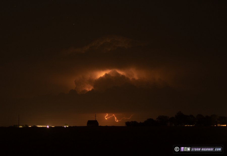
This distant cell, 62 miles away just west of Effingham, showed the structure of the lightning flashes with these storms. The positive end of the bidirectional leader tree was inside of the cumulonimbus tower, with the negative end poking down below the cloud bases.

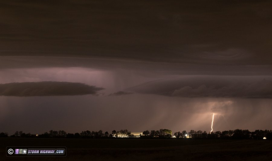
A second round of storms developed just south of I-72 and slowly dropped southeast. Lightning was not as photogenic with this round, but there was some interesting structure with striations along the outflow:

Slow Motion Lightning CaptureMay 4 (midday): Lightning initiation captured at St. Morgan, IL

Another low-expectations day produces several good captures! Models had indicated that evening supercells were a possibility in the metro area on the remnant outflow from the previous night's storms. Instead, storms developed much earlier at noon, mostly dashing those chances.

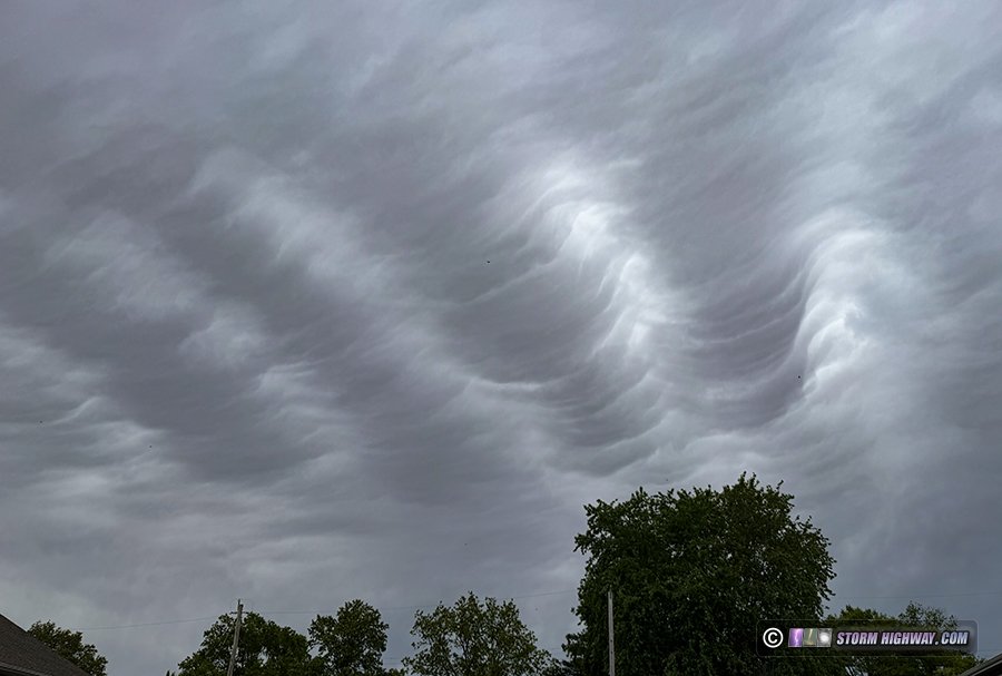
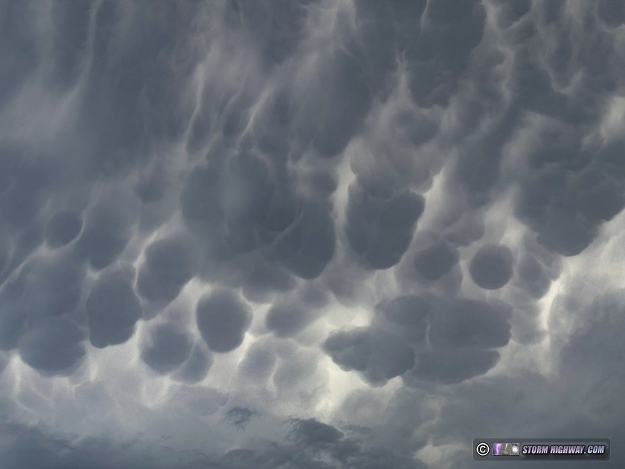
The initial line of storms did not look like anything high-quality. But they were already sending mammatus undulatus to the east overhead, a rare cloud type I'd not observed before:

As these storms approached, I decided to just go outside of town to see what the lightning looked like. It was suprisingly good, with many complex intracloud/cloud-to-ground discharges of both polarities with extensive leaders below cloud base. I captured a couple of really nice 6,000fps sequences at St. Morgan. One of these flashes had not one, but *three* examples of the initiation of a bidirectional leader - the birth of a lightning flash:

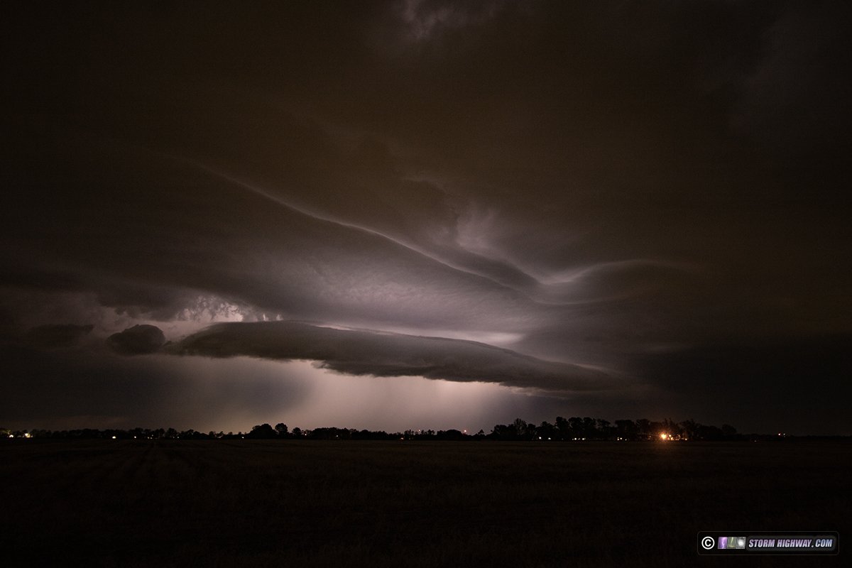
Stronger storms were developing to the southwest and heading in this direction. I positioned south of New Baden to watch these approach as they coalesced into a supercell south of Mascoutah, apparently riding the old outflow from last night. A rear-flank downdraft developed and began wrapping around a weak high-based mesocyclone, never a real threat for a tornado but certainly more than I'd expected to see this early in the day. A heavy precip core continually developed in the forward flank, with multiple dense blobs descending on the south side. I stayed ahead of this to Addieville, stopping a few times to attempt lightning shots.
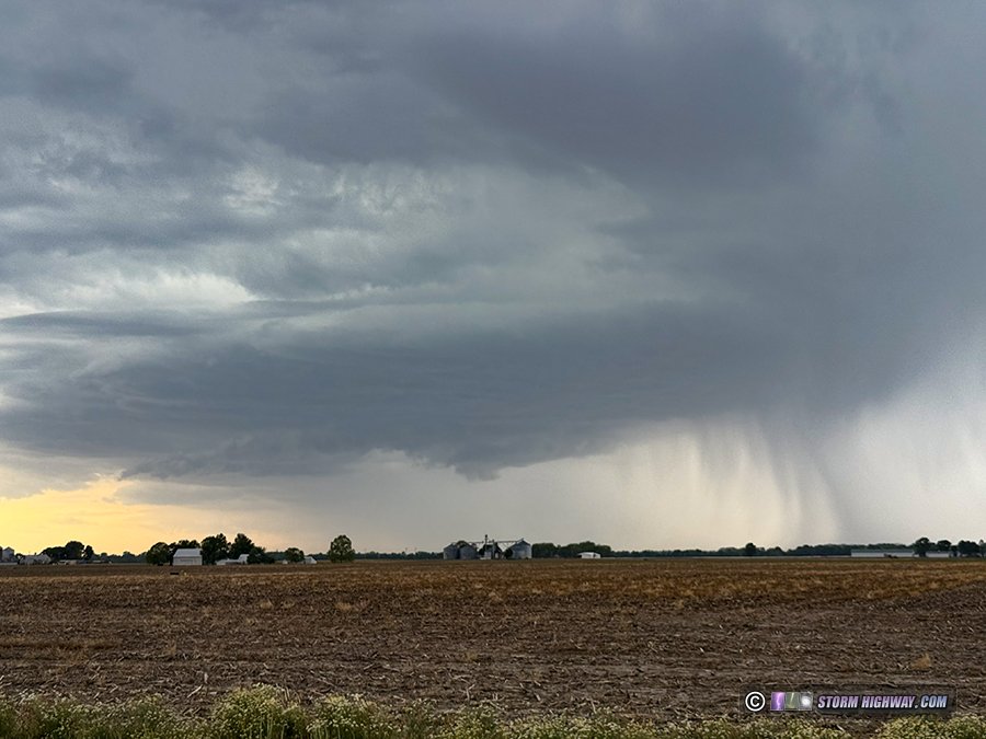
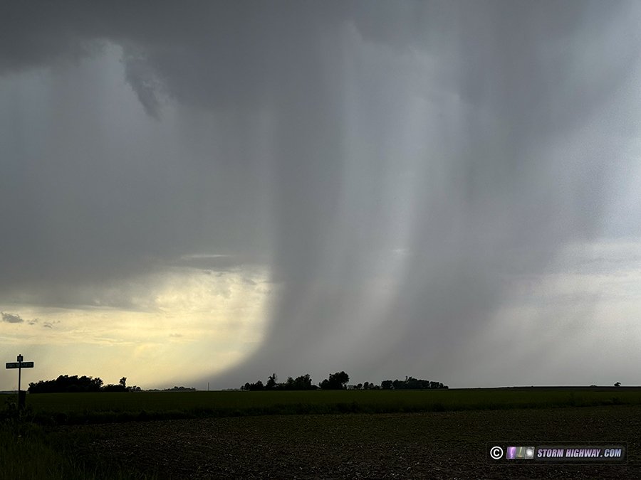
The supercell slowly lost its punch after passing Okawville, and a trailing cell near St. Libory was trying to take over. Despite some good lightning for an interval, this storm too eventually faded as it approached Lively Grove.

Slow Motion Lightning CaptureMay 4 (evening): Alhambra to Greenville, Illinois hail and lightning

The midday storms cleared out early enough in the afternoon. This allowed a period of sun to recover some instability for the originally-expected round of St. Louis metro supercells in the evening. A new storm went up near Godfrey and slowly intensified, and I made the easy jump up to Alhambra to get ahead of it. After a few cycles, the storm began a rapid intensification just before crossing I-55 at Livingston. The core expanded south and overtook me as a barrage of negative CG lightning started. I captured two nice 6,000fps shots here (these are included with the other shots from easlier in the day int he Youtube video linked above).

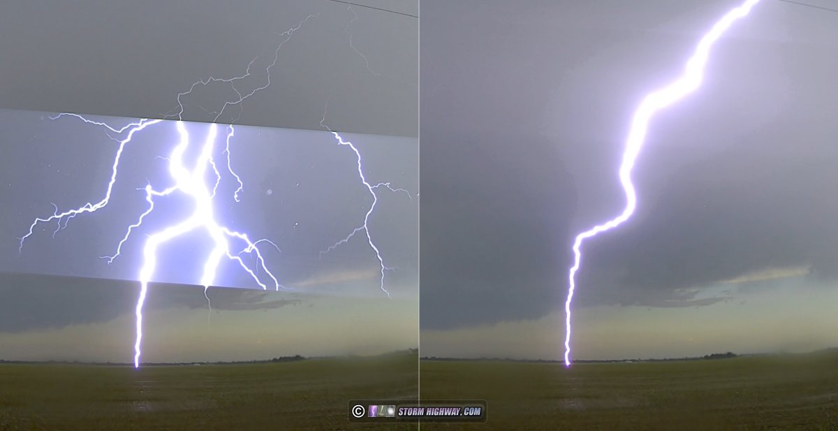
As the precip arrived, a multiple-ground-connection bolt hit in the field just to my east, the rolling shutter of the dashcam only captured part of the first return stroke:

After this burst of lightning ended, I moved east just behind the storm to Greenville, where large-looking hail was visible dotting the grass. As I pulled over to investigate, a single stone probably in the 2-inch range slammed loudly into my windshield with enough force to break it - but the glass thankfully remained intact.

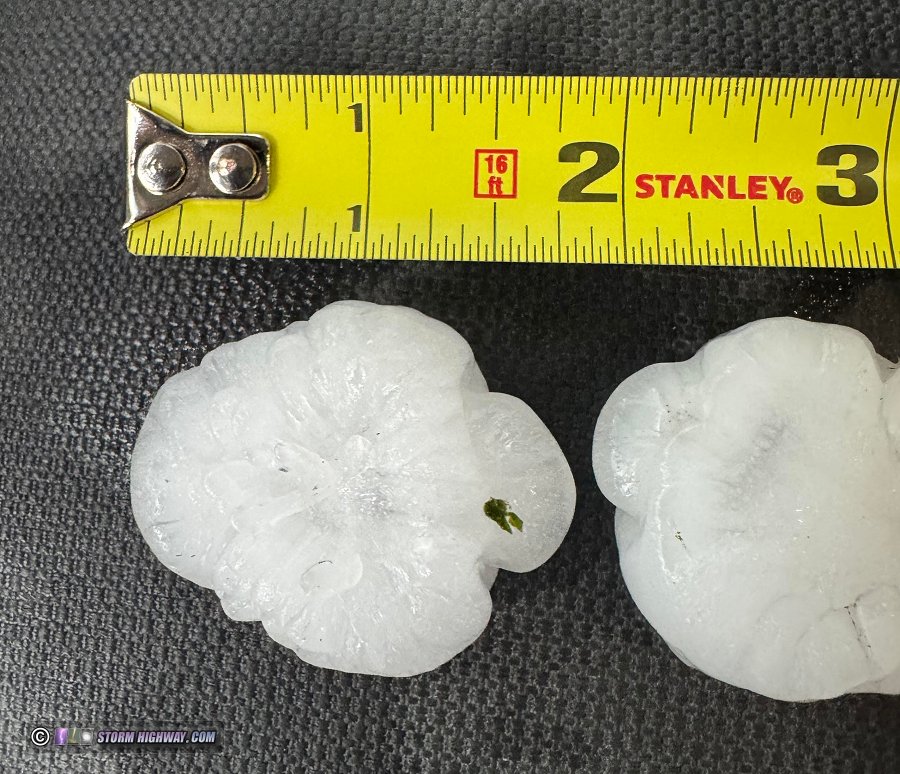
Most of the hail was in the one-inch diameter range, but I found several 1.75" stones in downtown Greenville (reporting this to the NWS):

Cloud Type ObservationMay 17: Supercell and Mammatus near Lincoln, Kansas

This log is on the 2026 Great Plains logs page.

Tornado ChaseAerial Drone Storm ChaseMay 18: Palmer, Blue Rapids and Holton, Kansas tornadoes

This log is on the 2026 Great Plains logs page.

Slow Motion Lightning CaptureJune 1: New Baden, Illinois bolts from the blue

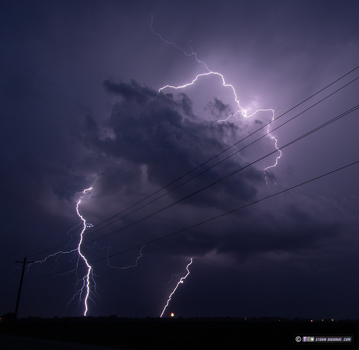
Model depictions of storms this night did not inspire confidence that they'd offer much worth shooting. A few cells fired far to the south before midnight, but weren't producing many bolts. After I got home from work at 1AM, more towering cumulus was going up along the remnant outflow from the previous day that had advanced northeastward to right overhead. Storms soon fired on this boundary across the metro area. At around 3AM, these underwent a rapid intensification and began producing bursts of nice lightning in mosty random locations. Due to the transient and random nature of these, I decided to not chase anything and just shoot anything that happened to go up near town.

This cell near Scott AFB pulsed and produced a flurry of bolts, shot from New Baden:

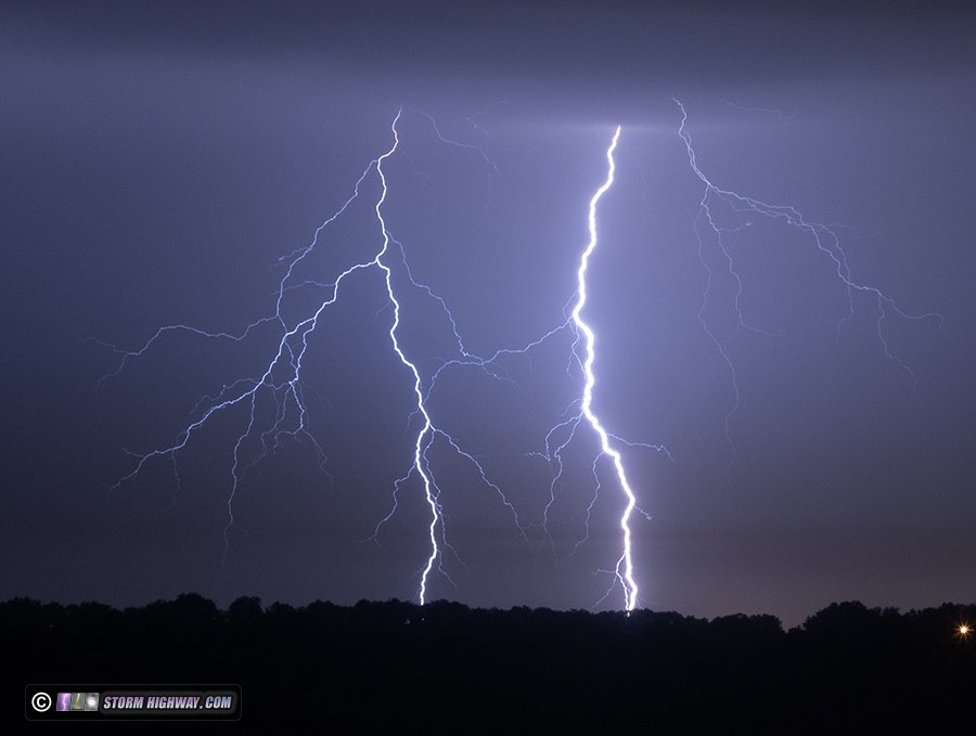
Storms soon filled in along the entire boundary from Troy, Missouri down through Chester, Illinois. Many of the more isolated cells were producing intense, repeating bolts-from-the-blue from a common initiating point in the cells' vault regions. Most bolts were going straight down through the vault, but a few would arc out way ahead of the updrafts. This flash did both:

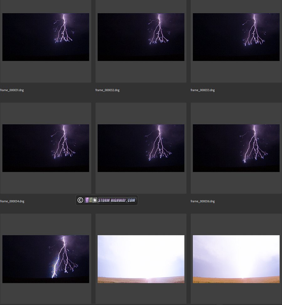
I framed for a high-speed shot of this cell, which produced a bolt in frame for a very nice 6,002 fps capture of the bright negative leader tree descending (indicating the return stroke would have a high peak current):

While this was occurring, a stronger line of severe storms was moving into the metro from central Missouri. I went downtown to capture this arriving over the city, but the outflow boundary line of storms to the east and north sent a strong outflow back west, fouling the view with tons of low clouds. More new storms were going up in the gap between the outflow boundary line and the incoming line from the west, ending all hope of anything photogenic over downtown.

The western line had a nice electrified stratiform region, so the Brentwood spot to shoot upward lightning was the next subject. The lightning in the stratiform region ended up being sparse and scattered, and I didn't see any upward flashes to the towers. I arrived home after 8:30AM.

Supercell ChaseJune 8: Supercells from Woodston to Woodbine, Kansas

This log is on the 2026 Great Plains logs page.

Slow Motion Lightning CaptureAerial Drone Storm ChaseJune 10: Chicago severe storms and lightning

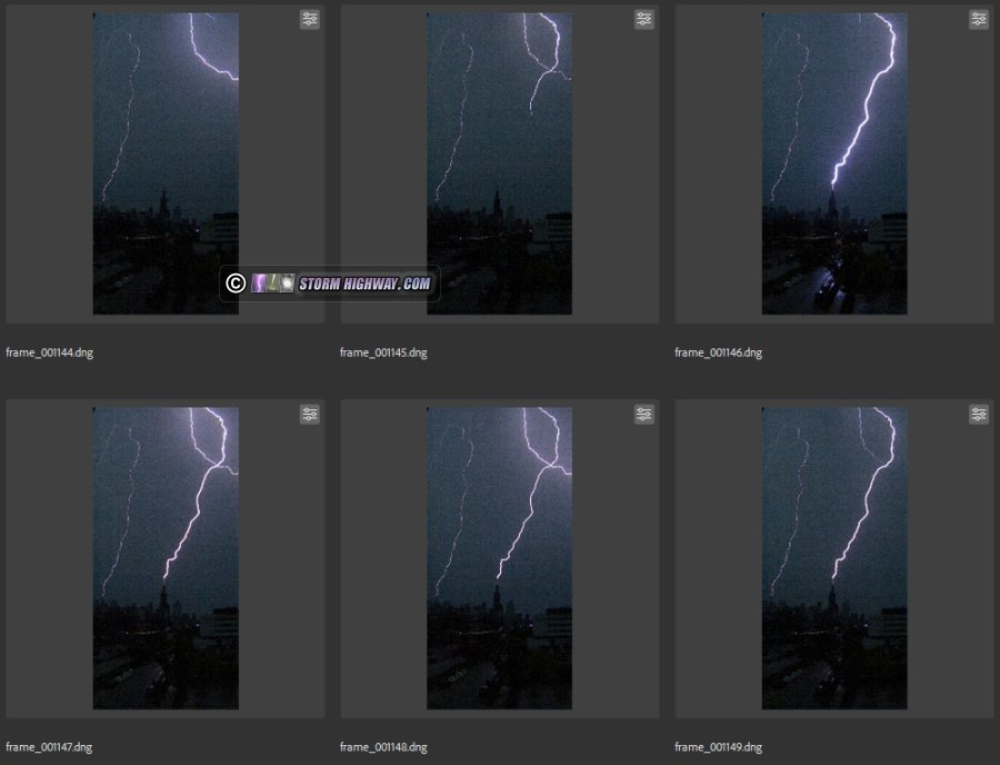
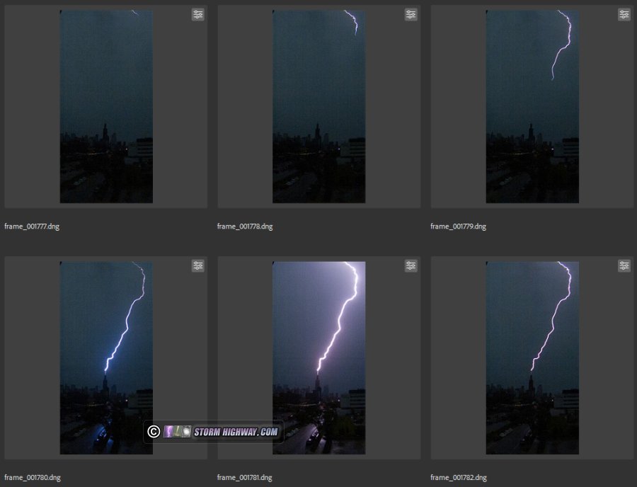
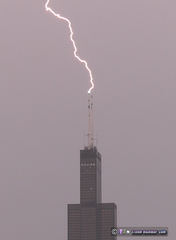
Chicago lightning expedition #25 resulted in a couple of good captures. I wanted to try something different this time, mainly cropping the high speed camera sensor down from the typical 1280x720 to a vertical 400x828 view of the Sears Tower. This allowed a full-height frame to capture at 4,003 frames per second. I captured two upward flashes to the Sears, one with many dart leader+return strokes. The higher framerates allowed a good capture of 2 to 4 frames of dart leader propagation with each one.

This grab is from the 4k cam:

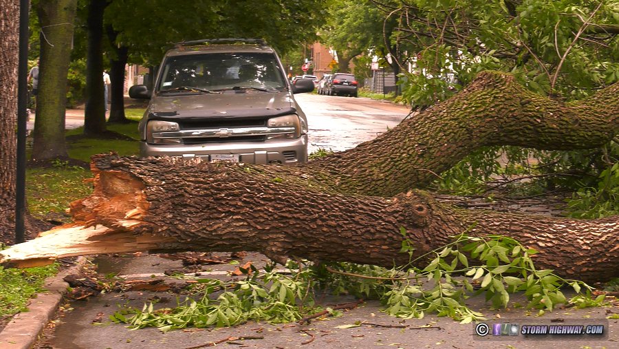
The leading cores of the storms were in the form of a bow echo that produced widespread damage across Chicagoland. Nearly every block had at least one large tree branch broken. This large tree snapped off at the trunk 20 feet up:

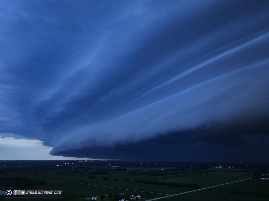
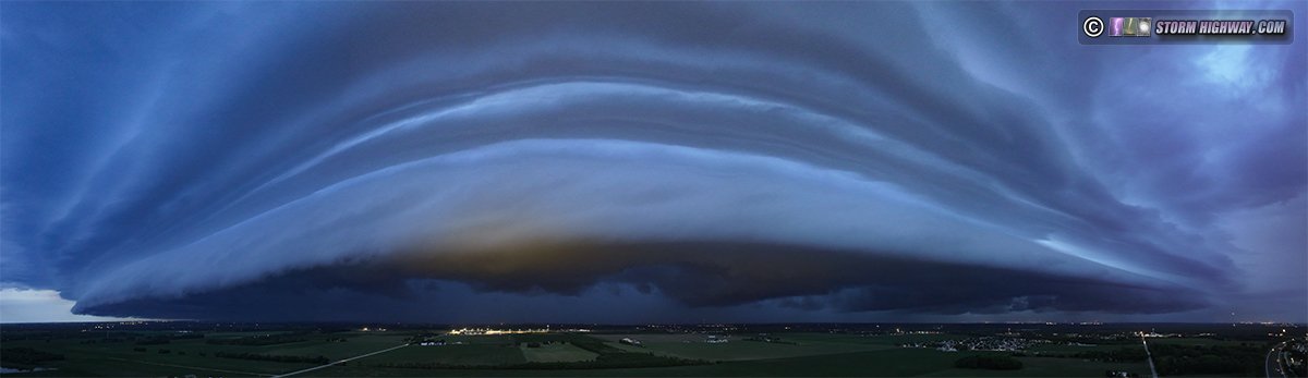
As the high speed camera does not capture nighttime cityscapes well enough, I didn't stick around for the second round after dark. I instead met this line at Briarwood, stopping to send the drone up to capture the very impressive multi-tiered shelf cloud on the leading edge:

Video from the day, including part of one of the 4,000fps high speed captures:

I'm working on a explainer video for the rest of the high speed sequences, to be posted when I have time to work on it.

Tornado InterceptAerial Drone Storm ChaseJune 11: Illinois and Indiana Tornado Outbreak
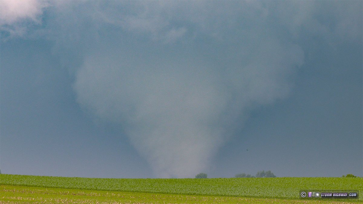
This event has its own page here.

Drone video of the Hebron, Indiana tornado:

Bust ChaseJune 13: Troy, Illinois sprites bust

The strong thunderstorm complex in western Missouri and clear skies overhead at sunset had me hopeful that we'd get a good sprite photography opportunity once it got dark. When I left work at 10PM, I could see the anvil cirrus from the storms was already too high in the western sky. However, I could still see Venus shining through those clouds lower on the horizon, so I started heading up to Hamel to get the St. Louis city lights out of the way. By the time I got to Troy, Venus was blocked and the cirrus now hopelessly blocking any sprite views.

Aerial Drone Storm ChaseJune 14: Cycloidal scars in soybean field from Dwight, Illinois tornado

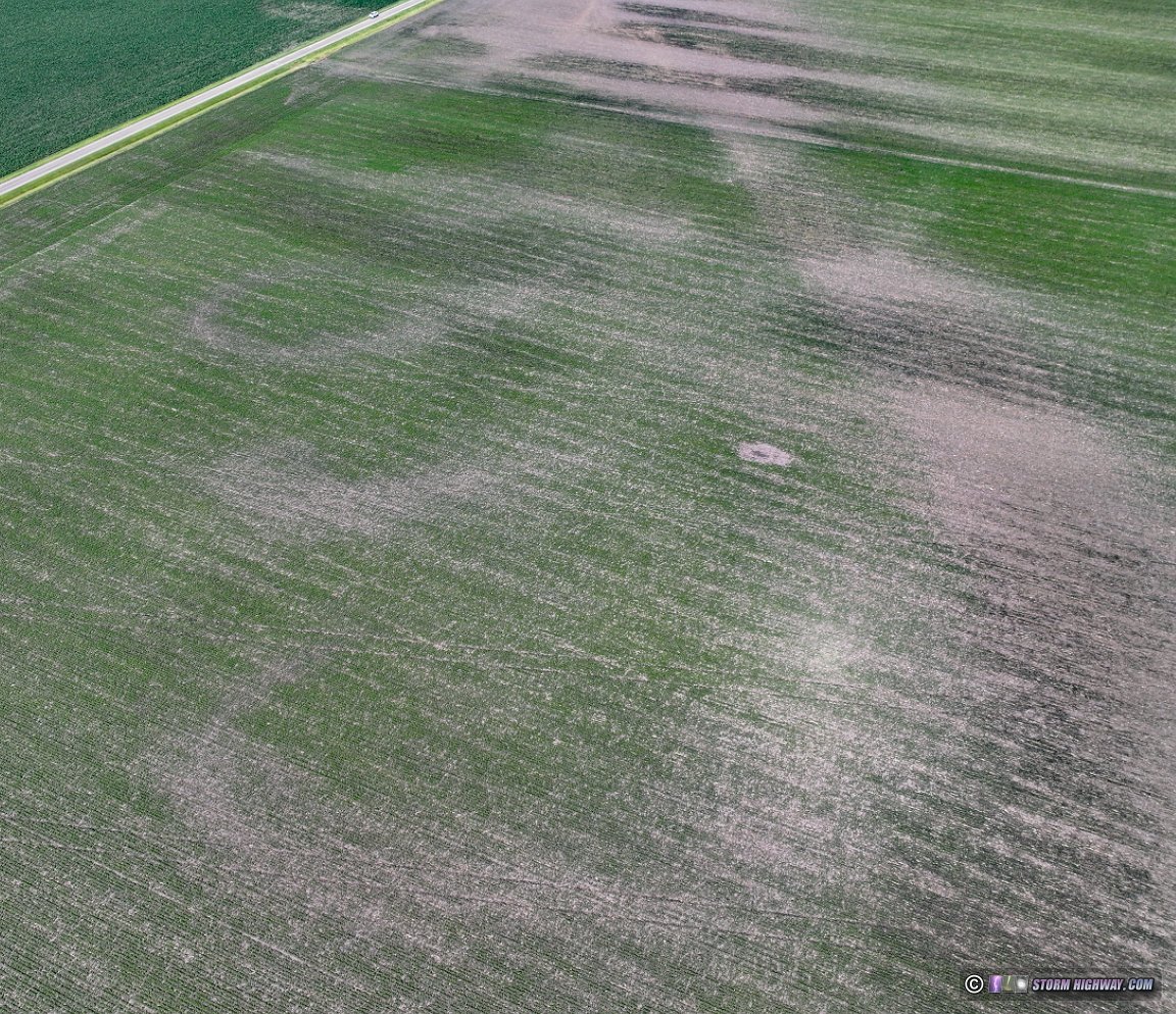
I had always wanted to observe and photograph cycloidal scars in fields left by a strong tornado, but there just hadn't been any close enough to take an afternoon to go see. It turns out that the Dwight tornado on June 11 left a good example of these, and since I'd also caught that tornado, it would be worth making another trip upstate to round out that event's documentation.

Supercell ChaseJune 17: Hillsboro, Illinois supercell

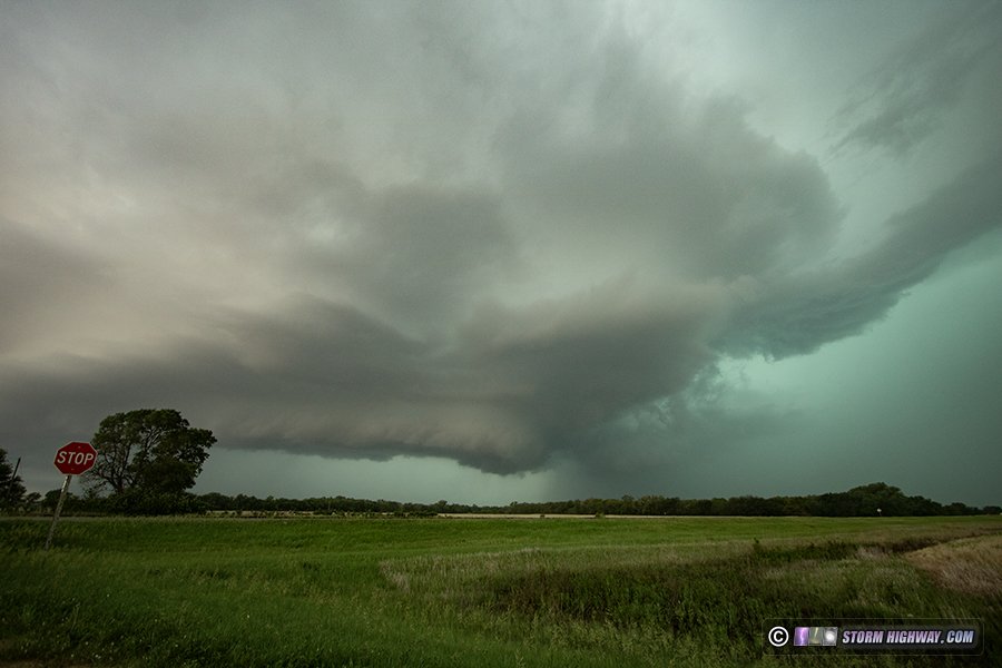
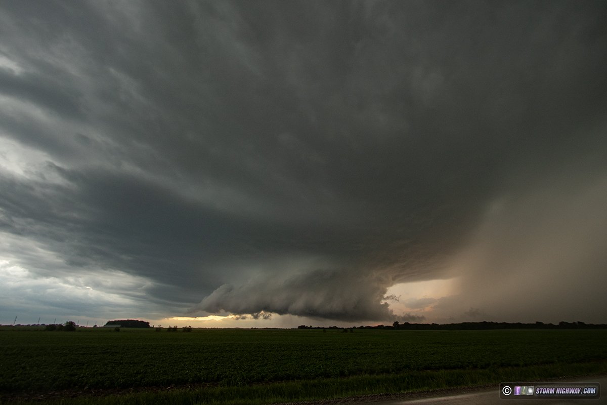
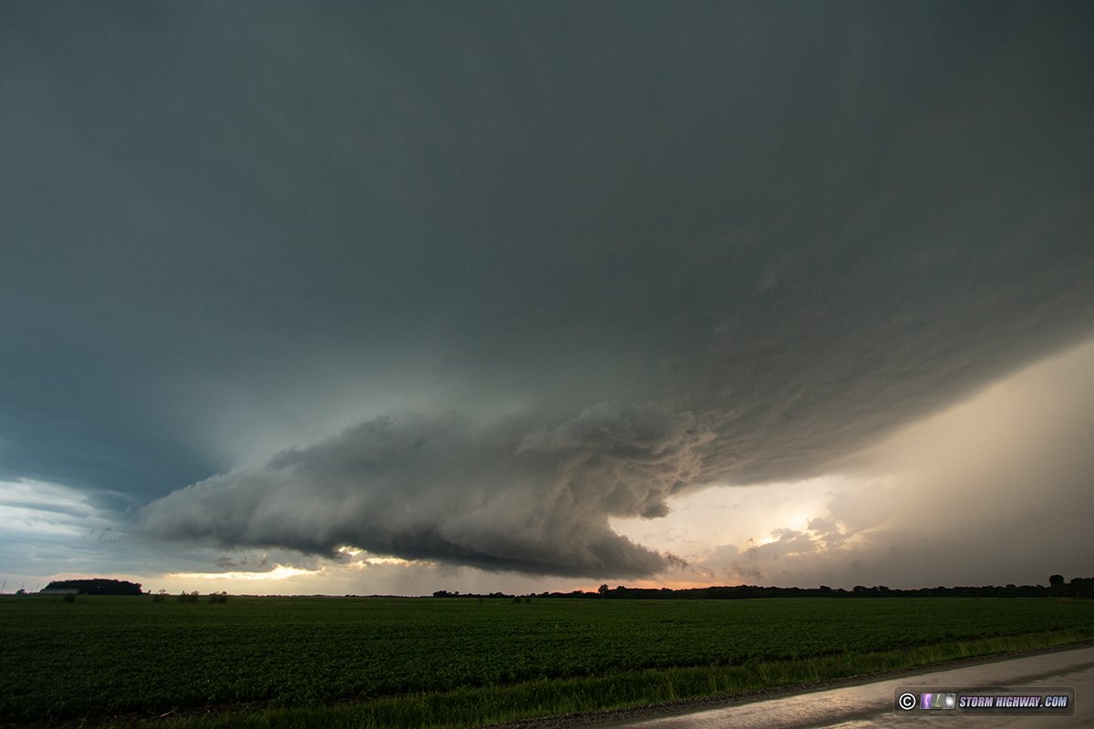
I decided to stay close to the St. Louis metro today with the threat of tornadic supercells in the area. I intercepted this structured storm at Hillsboro after 8pm:

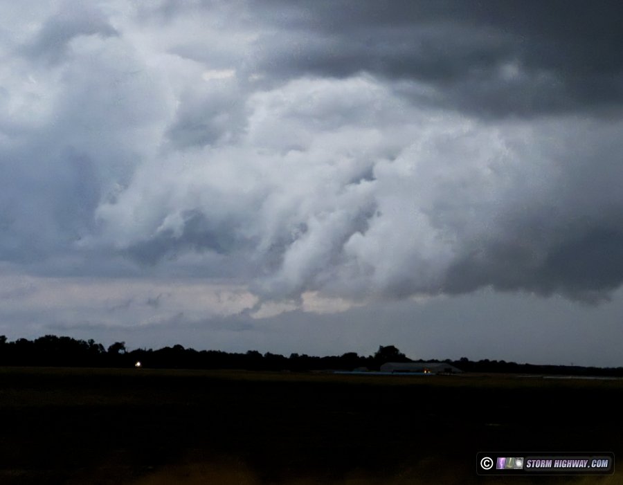
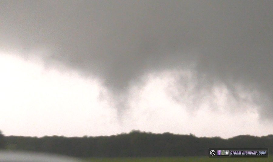
This storm likely produced a tornado north of St. Elmo. I'm awaiting confirmation before officially counting it. This occlusion had two rapidly-rotating funnels extending partway to the ground as they roped out:

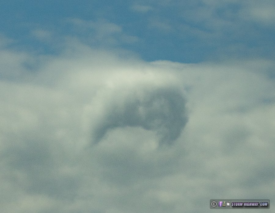
Earlier in the afternoon, I encountered this oddity: a large-diameter horseshoe vortex. "Croissant vortex" should be the name of these if it hasn't already been coined:

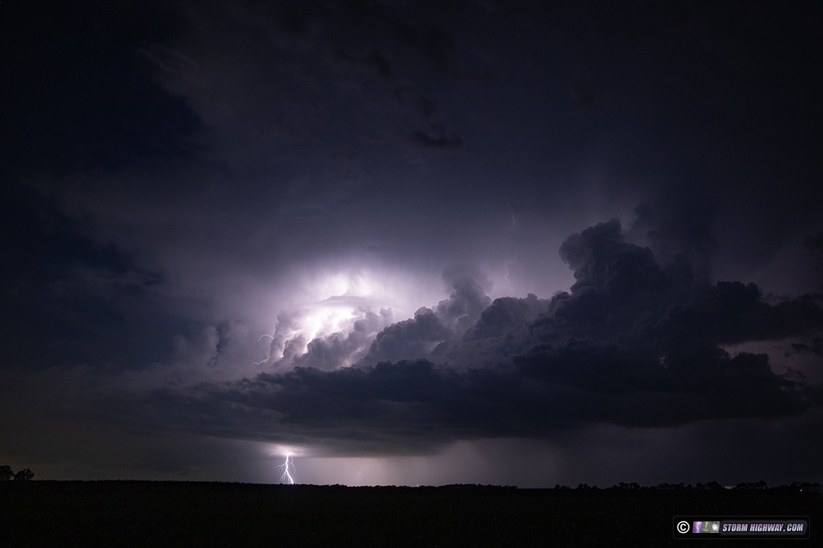
After I arrived home at 10PM, new storms went up on the cold front in the metro. These were producing some decent lightning. This was looking north from just outside of town:

Cloud observationJune 18: Asperatus clouds over New Baden, IL

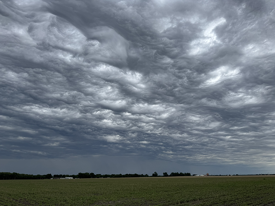
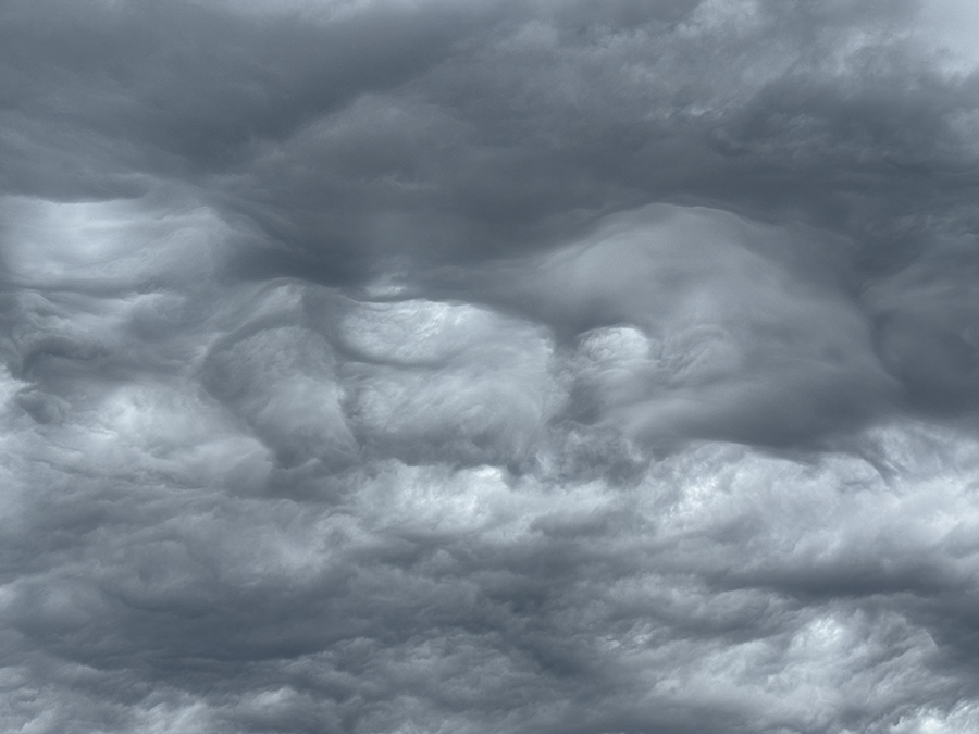
These asperatus clouds moved over town ahead of a line of showers at 1pm:

Tornado InterceptIllinois and Indiana Tornado Outbreak (Round 2)

I observed two tornadoes during yet another 2026 Illinois and Indiana outbreak. This was a difficult and long chase documenting eight different supercells from Collinsville to Shobonier, then from O'Fallon to Salem, then from Mount Vernon to Carmi. My imagery and video of this day is poor due to the fast storm motions, me staying close to the action areas and the storms simply not producing while I was in the best positions and lighting.

I started the chase in downtown St. Louis, waiting to see if a supercell would emerge from the rapidly-reintensifying convection just to the west. This indeed happened, but the storm was already crossing the river to the south once it began to coalesce into a coherent storm. With downtown in the clear, I moved up to I-70 and Highway 4 near Marine to position ahead of this.

This storm had a menacing appearance as it approached, with an RFD surge evident and rapid upward motion in cloud tags under the base. A lightning barrage began, but only a single bolt barely landed in frame:
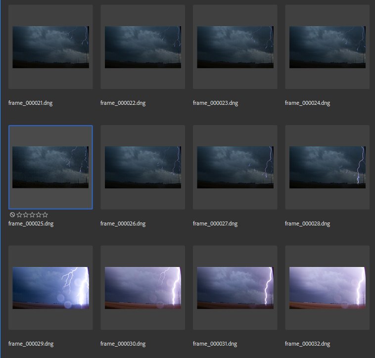
A second storm was rapidly organizing just southeast of this one, choking off the first storm's inflow. I moved east on I-70 to Pocahontas to get in position on this. This new storm did not have the good look the initial one did. Meanwhile, a lead storm that had gone up farther ahead of the line was crossing just ahead at Vandalia. I didn't make it to this storm's crossing of the interstate, but it was not looking organized. Once all three storms were north of I-70, they seemed to not be taking off, so I paused to take a closer look at data.

The southern end of the MCS was not very far to the south, and it was quickly crossing I-64 northbound. As this was happening, a trailing storm was getting organized near Highland. Surface obs suggested the southerly surface winds were making it north behind the MCS to this storm, so I headed west to intercept it at Pocahontas right as it became tornado warned.

I arrived under the meso to find a healthy RFD surge and very rapid motion in progress. The rapid motion, funnels and overall look of this feature suggested a tornado may have been in progress this entire time. Despite me being almost directly underneath of this, I did not see any evidence of a ground circulation - mostly thanks to the numerous trees.
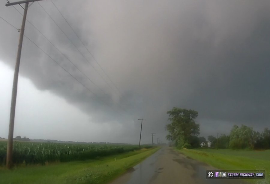
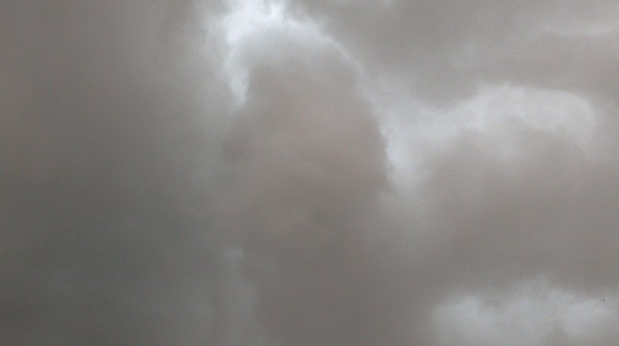
The view looking nearly straight up:

I was moving east at 35-40mph to stay with this area, not able to stop for more than 30 seconds at a time. As I passed Hookdale, a weak funnel finally reached the ground:

Carlyle Lake was just ahead, necessitating a detour around the north side. This road was beginning to develop numerous areas of field flooding, reducing my speed to 35mph. There would be no way to keep up with the storm.

At Shobonier, I headed south. New convection was going up back home in St. Louis, so I began heading that way in case it managed to develop further. As I passed through Carlyle, the cell just west of downtown had "the look": a classic cyclonically-curved reflectivity signature. It was also tracking along the outflow boundary from the earlier storms. I pulled up the Arch webcam to see the base already had a lowering. It looked like I was going to miss another tornado behind the skyline, and this time, it was going to be a highly-photogenic one. There's no way I would make it. Heart attack time. I pressed on westbound, looking at the Arch webcam every few minutes - finally with relief as the storm lost its classic look and the updraft uneventfully moved off to the north of the city.

This storm did begin to intensify after crossing the river, and I intercepted it north of O'Fallon right as it became tornado-warned. The lowering didn't yet have a focused circulation:
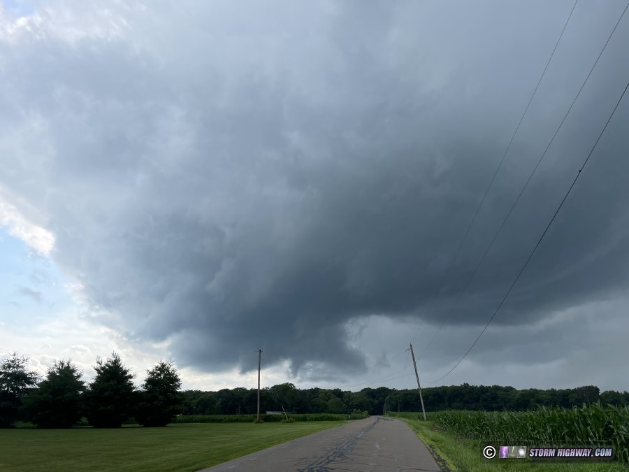
I stayed with this easily on the county roads eastbound. Rotation in the base peaked just north of Lebanon, but did not progress further. At St. Rose, the foward flank outflow and RFD gust fronts merged into a single front undercutting the updraft, and the storm was done with tornado potential. I followed it all the way west to Salem, but it never recovered a good surface inflow channel. A lightning barrage started at Sandoval, but none of the bolts cooperated with the high speed camera.

When I reached I-57, I decided to drop south to see if the storms down along I-64 would be as productive as they'd already been (I'd now heard about the tornado east of Mount Vernon). The three supercells I observed on my way south had the same issues as the Salem storm did, outflow-dominant with very little in the way of a focused low-level meso.

I was able to get back in front of the leader of these three storms at Mill Shoals. At first the structure looked impressive, but when I made my way under the base at Barnhill, I found more of the same issues the other storms were having: outflow just obliterating everything down low. The second cell to the west was already behind the composite RFD/outflow from the lead storm, and wasn't going to be a tornado threat.

I couldn't figure out why my storms weren't producing. Every other storm in the area, it seemed, was producing strong tornadoes. The one to the east crossing in Indiana looked crazy on radar, with a debris ball indicating another tornado. Surely storms over here should do the same, as the environments were virtually identical. I hoped that maybe low-level jet time starting soon would change things.

A third cell to the southwest looked best-poised to take advantage of these factors, so I dropped to southwest of Springerton to intercept it. This storm, at first, seemed to be suffering from the same outflow undercutting as all the others. But I stayed with it.

Finally, just north of Enfield, I got out and looked up to see a perfectly-rounded "mothership" updraft had taken shape overhead. My winds turned easterly instead of the northerly outflow like before.
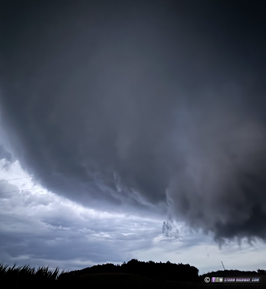
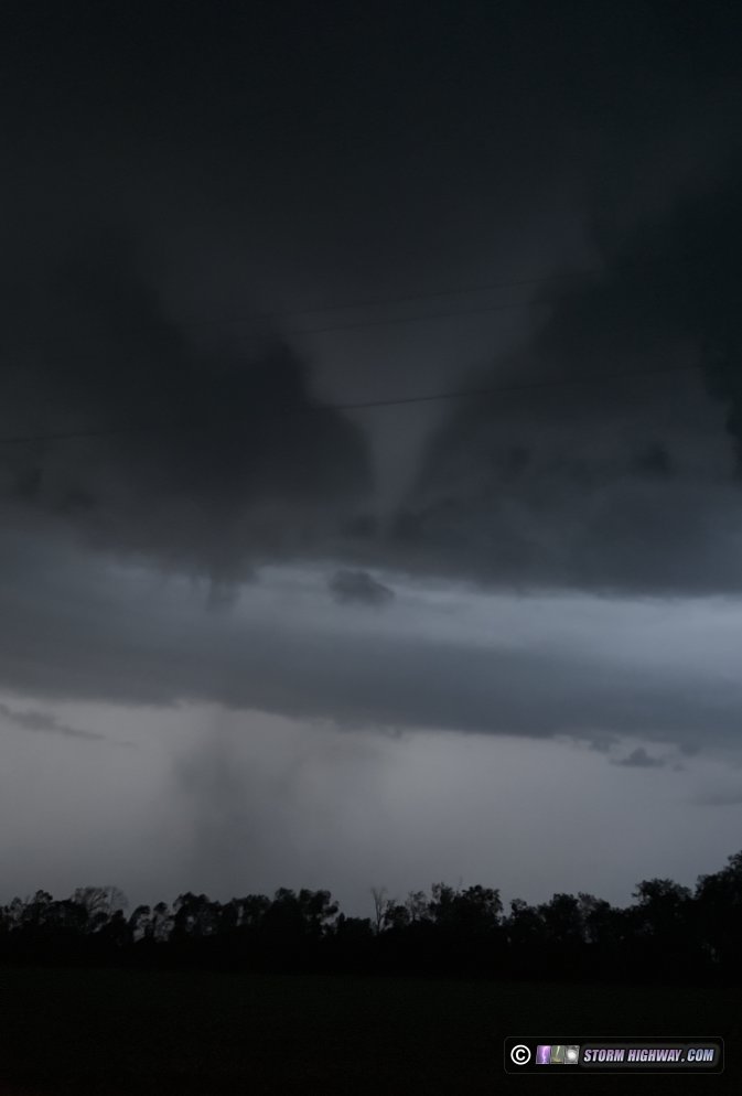
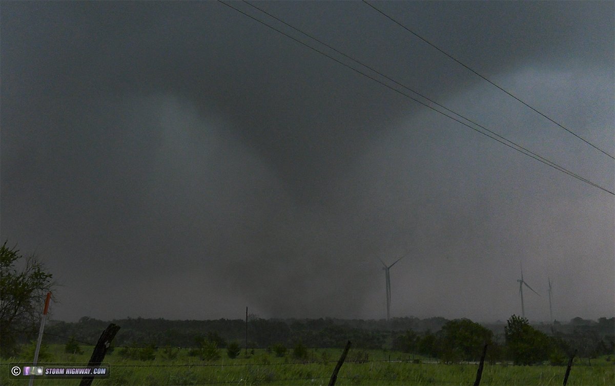
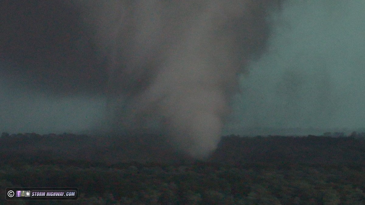
A cylidrical circulation developed just to my south, and condensation fingers reached the ground: tornado. I moved east then south to make a close intercept. The tornado crossed the road as a bowl funnel aloft, then condensed a cone about a third of the way to the ground as the snapping and popping of trees could be heard among the rushing wind in the debris cloud just to the east of the road:

Here is the Youtube edit of this:

I was able to get back ahead of this northeast of Carmi, but with it now being nighttime, I could not see much even with lightning flashes. Once the storm crossed the road and into Indiana, I decided it was time to let it go as I had to get back and work a midnight shift this night. This storm went on to produce additional tornadoes in the Evansville area. I arrived home for a few minutes before 11pm, then headed straight to work.

Bust chaseJune 26: St. Louis metro storms bust

This day's potential in my home area fell apart before it got started, thanks to all-day rain and clouds preventing destabilization. A better outflow boundary target existed from Sikeston, MO to Paducah, KY, but I didn't think it was good enough to go all the way down there (2+ hours) where roads and terrain make chasing difficult.

The target in the St. Louis area was an east-west stationary frontal boundary draped from around Bowling Green, Missouri to Litchfield, Illinois. A couple of storms went up on this boundary after 5pm, and I headed up to Marine to position in front of the lead storm. The trailing storm to the west managed to wrap up a broad circulation with a mild hook on radar near the Mississippi River, but there just wasn't enough instability for things to go very far. My storm fell apart before crossing I-55. The western storm faded soon therafter, and I headed home at sunset, never picking up a camera.

Bust chaseJune 28: New Baden, Illinois lightning bust

Models agreed on the low-level jet firing thunderstorms in the St. Louis metro after midnight. This convection initiated right on schedule at 1AM directly overhead of home. I went out for about an hour just outside of town. The cells didn't start producing any lightning - not even a single in-cloud flash - until it they were 25 miles to the east.

Lingering low clouds, followed by a weaker line of showers passing overhead, blocked the view of the active storm at that distance. Lightning data suggested the storm was likely producing bolts-from-the-blue out of its south side, but I couldn't see any of it. It didn't appear I had any hope of getting the pesky clouds out of the way, so I didn't try pursuing the storm away from home.

< March-April 2026 Recap | All Storm Chase Logs | July-August 2026 Recap >

View 1,625 storm chases in 34 years:

by year: 
by type: 
Tornado ChasesLightning ChasesTropical Cyclone ChasesSlow Motion LightningSt. Louis StormsHail ChasesChicago Lightning ChasesAstrophotography ChasesSupercell Chases
Aerial Drone ChasesWinter Weather ChasesCloud FormationsIce StormsFlood ChasesEarthquake ChasesWest Virginia Storms and LightningRainbow EventsWind Events

30 Years of Storm Chasing & Photography
Important Message
Dan's YouTube Video Channel
Dan's RSS/XML feed

GO: Home | Storm Chase Logs | Photography | Extreme Weather Library | Stock Footage | Blog

Featured Weather Library Article:

How lightning works
Does it go up or down? A detailed description of lightning from start to finish.
More Library Articles

All content © Dan Robinson. All usage requires a paid license - please contact Dan for inquiries.

Web Site Design and Internet Marketing by CIS Internet