|
Home | Blog Index | Blog Archives | Christianity & Faith Essays | Storm Chasing Essays
Heart-of-the-season starts: Plains forecast update 4, for March 31
Peak tornado season is finally upon us here in the Plains and Midwest. As anticipated a week ago, we're entering a brief active interval as a couple of shortwave troughs eject across the country over returning Gulf moisture. Moisture quality is looking a little better than it did a few days ago, with more abundant zones of 60°F+ dewpoints spreading north in advance of this first notable incoming wave. So much so that tomorrow's setup in the Plains looks quite good for late March, with most of the basic ingredients you'd want to see as a chaser: 60°F+ dewpoints, workable low-level shear, a jet streak impinging on the dryline by mid-afternoon and most models initiating storms during the daylight hours.
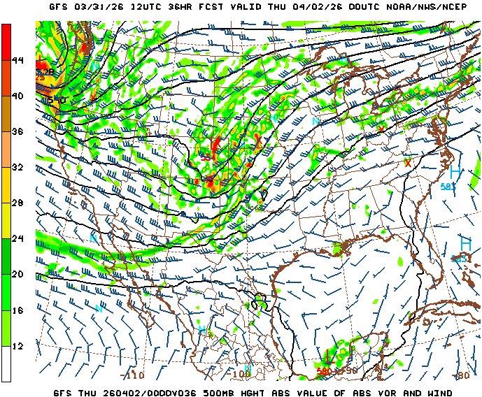
GFS 500mb forecast for 7pm Wednesday evening
Unfortunately (or fortunately, depending on how you look at it) for out-of-area chasers with limited travel budgets, this one-and-done system doesn't strike me as a must-be-there, use-up-May-and-June-travel-funds type of event. Early upscale growth into line segments looks likely in many areas, though we've seen plenty of these setups overperform in the past. For me personally, even though this event has viable Plains targets within striking distance of an out-and-back day trip, I'm leaning more toward staying home. That's mostly because a warm front will exist here as a subtle lead wave (shown on the chart above) may be moving over the Midwest. Models aren't sold on storms, but they aren't doing great with the details at the moment. If we wake up to clear skies in the morning, the Midwest might actually be the better target if enough moisture can pool on the boundary. For someone that lives here, that makes a trip west a little more complicated.
Looking ahead, things aren't very clear after this week's waves depart. Models agree on a monster cold front scouring the moisture USA-wide into the Gulf by the beginning of next week. The upper pattern is in question after this. There are some indications of another longwave western trough setting up by next weekend, with workable moisture managing to recover in advance of these features to bring about another one or two day sequence. That's just too far in the future to get excited about, however.
And so, Plains expedition probabilities will be elevated for tomorrow's event alone, and following that, I'll give a 30% shot for a possible weekend system to garner my interest.
The following table plots the probabilities of a Great Plains chase expedition taking place for the date ranges shown:
| 2026 Plains Chase Expeditions - Probabilities as of March 31 |
| April 1 | 45% | |
| April 2-8 | 2% | |
| April 9-13 | 30% | |
|
GO: Home | Storm Chase Logs | Photography | Extreme Weather Library | Stock Footage | Blog
Featured Weather Library Article:
|


