| Home | Blog Index | Blog Archives | Christianity & Faith Essays | Storm Chasing Essays
April 3: American Midwest sky canvas; forecast update
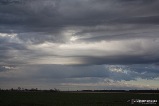
Spring continues to bring more benefits of living in the Midwest. The return of convection means that the 'sky canvas' above the flat prairies begins to come alive - even weak showers can put on a show, without storms and severe weather being necessary. Today was a great day for these atmospheric works of art - part of the reason I love the Plains-like landscape found in the central USA.
First is this line of high-based, low-topped convection about 60 miles east of New Baden this evening, showing the current location of the weakening cold front.
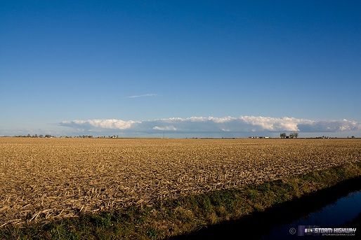
click to enlarge
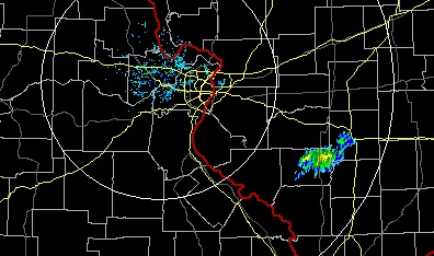
Radar at the same time:
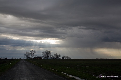
Just after sunrise this morning, the cold front kicked off weak convective showers around New Baden, with displays of laminar cloud features and rain curtains:
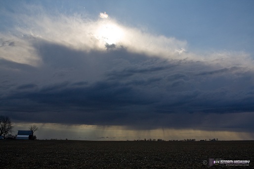
click to enlarge
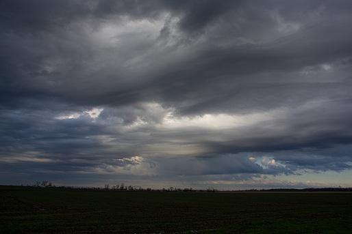
click to enlarge
click to enlarge
click to enlarge
Sunday-Tuesday chase updates
Specifics are still very much up in the air about the severe weather setups from Sunday through Tuesday, but it's safe to say I'll likely be out chasing all three days. The big question is where. Sunday afternoon/evening could be a nice lightning photography event across Missouri and even here in St. Louis, as the low-level jet gets cranking bringing moisture back into the region.
On Monday, strong instability will exist at the triple point and down the dryline in Kansas, which in most Plains setups, would be the no-brainer target. However, strong capping (700mb temps above 8°C) may prevent storms from developing at all in this region. Moisture will be there, but its depth is still in question, due to the still-cold Gulf of Mexico (a problem I fear will persist for some time in the next few weeks). Strong capping is a good thing, but you really need equally strong instability from a proportionately deep layer of surface moisture. Storm initiation looks more likely on the warm front, now forecast to be along the Missouri-Iowa border into western-central Illinois by Monday afternoon. Low-level shear (from the surface to 850mb) is a little more favorable for tornadoes in this area, though this potential target could be a mess of widespread convection. A compromise may be somewhere along the warm front in the central/western MO/IA borderland, where the stronger cap may keep storms more discrete.
If a storm or two can fire on the dryline and triple point in Kansas on Monday afternoon, that will be a great place to be. And if I lived closer to that target, I'd choose it with little hesitation. However, the questions of storm initiation in that area, coupled with a more certain prospect of storms in a decent environment for tornadoes closer to here, makes me lean heavily on choosing the warm front. As I said before, my 'local bias' is influencing that decision a little, but for good reason: it's still early in the season, and chase funds are not unlimited!
Tuesday is still a mess as far as model guidance is concerned, particularly regarding a focus for a chase target. There should be a broad warm sector in place on Tuesday, with a very large potential tornado/severe weather threat area from Oklahoma and Kansas into the Midwest. Like Monday, there will probably be several options for a target - with again, one likely in the Midwest region that would not require a long trip. Time and the next few model runs will tell!
GORGEOUS.
- Posted by Jes from Charlie West | |
Thanks Jes!!
- Posted by Dan R from New Baden, IL | |
|


