
|
||||||||||||||||||||||||||||||||||||
4K VIDEO: Lightning barrages north and east of St. Louis, June 11 I had originally not planned on going out this day, as models had been keeping storms far to our east and west. But as the day dawned, short-term models began picking up on storms forming during the late afternoon north of St. Louis and tracking through the metro area toward sunset. Mesoanalysis showed some respectable parameters in place for storms: nearly 4,000 j/kg of surface-based CAPE and 30 knots of bulk shear. Visible satellite showed a synoptic boundary or front stretching from near Hannibal, MO southeast through Mount Vernon, IL, and an outflow boundary from previous night's storms was draped east-west across the St. Louis metro. Surface observations showed backed surface winds areawide. By 3PM, agitated cumulus was in progress along these boundaries all the way up to I-72. That is not a scenario to ignore in the Midwest, especially in June! My primary interest was where the old outflow intersected the synoptic boundary near Mount Vernon, but since storms seemed imminent in the St. Louis metro and the cumulus field was not impressive to the east, I did not leave home right away. Eventually, a storm went up far to the north along I-72 west of Jacksonville, IL and became tornado warned as it slowly moved southeast along the synoptic boundary. Seeing no reason to not jump on this one, I headed up to Medora, IL - north of Alton - to meet it. Storms were also finally initiating on the east-west outflow at Hamel, IL and near Vandalia on I-70. The Medora storm was more organized, so I stayed on it. When I arrived on the storm, it had near-supercell characteristics with strong rising motion under a rounded/partially sculpted updraft.
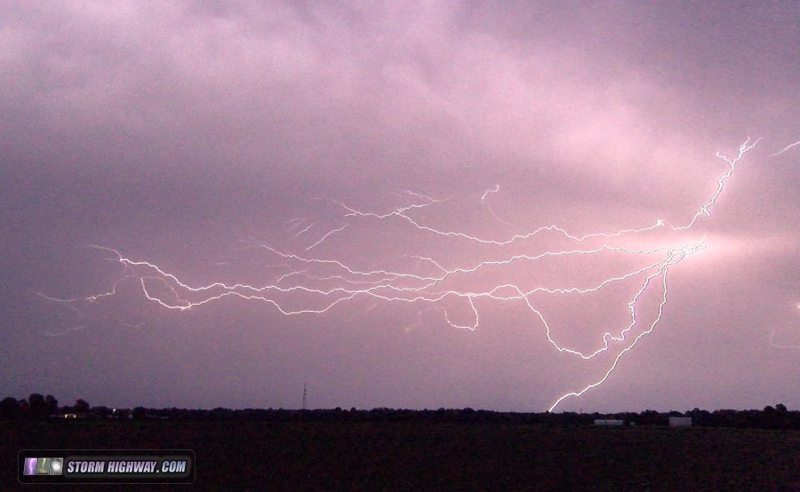
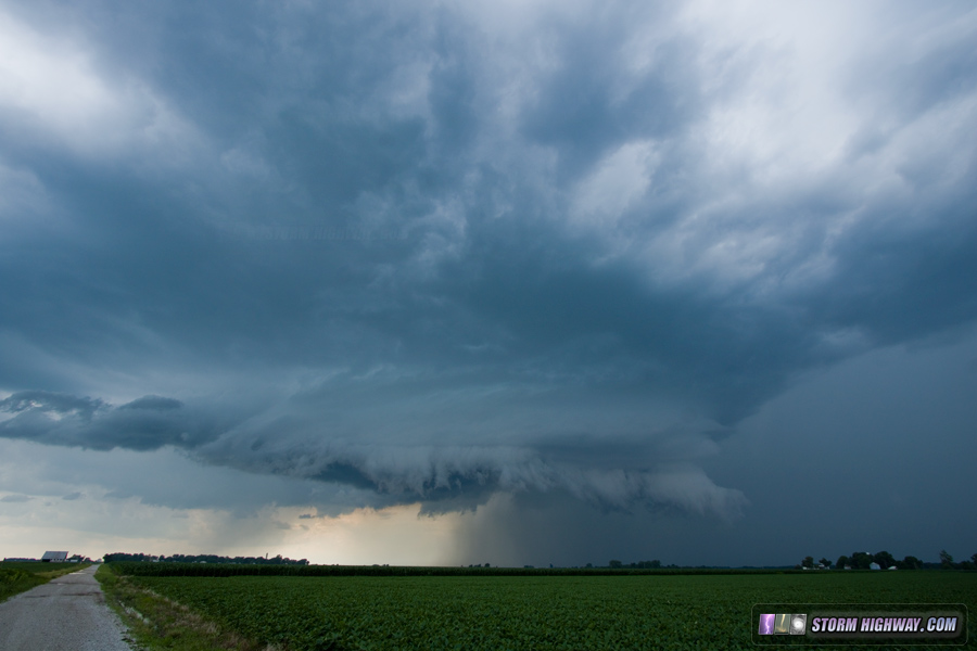 However, forward-flank outflow and RFD winds were undercutting the updraft, with the gust front pushing far ahead. Lightning activity was frequent and intense, remaining this way the rest of the day.
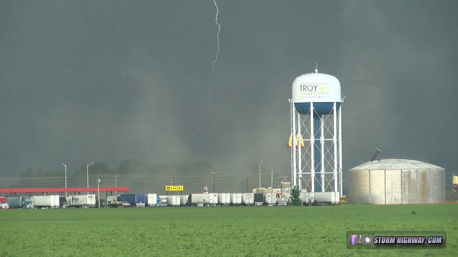
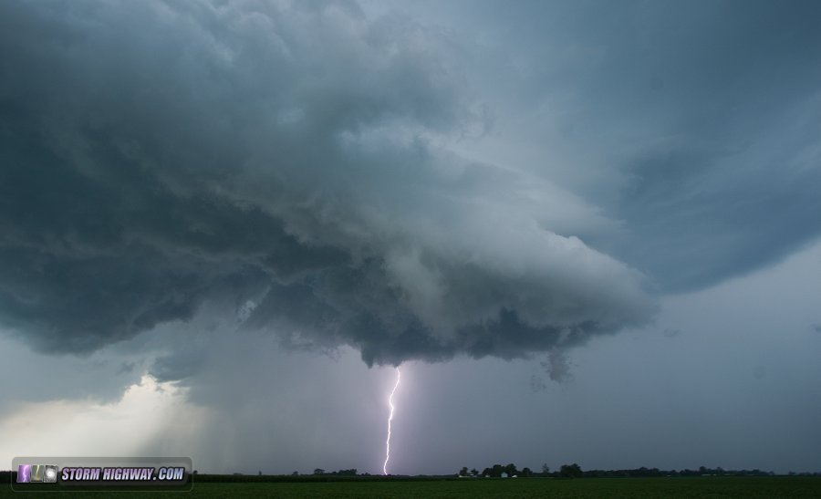 A close strike near Bunker Hill hit within a tenth of a mile, captured on both 4k video and dashcam - this is included in the video edit for the day. I stayed ahead of this storm to Livingston before dropping south to in front of new convection on the fresh outflow at Alton. These storms also went outflow-dominant quickly, pushing strong gust fronts out ahead that kicked up dust at Troy.
 Hoping for a rainbow-lightning combo, I went west to Pontoon Beach as the sun began shining on the departing storms, now a large squall line. Thick cirrus in front of the sun in the western sky foiled the rainbow, but the lightning remained active.
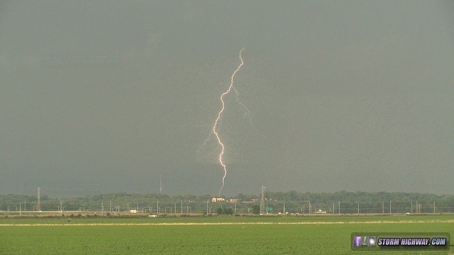 Back near home, I grabbed a few more shots of large discharges in the trailing stratiform region as darkness fell:
GO: Home | Storm Chase Logs | Photography | Extreme Weather Library | Stock Footage | Blog
Featured Weather Library Article:
|
||||||||||||||||||||||||||||||||||||


Web Site Design and Internet Marketing by CIS Internet