MYTH: A funnel cloud needs to touch the ground to be a tornado, OR the visible funnel is the tornado.
|
My work is, at this very moment you are reading this, generating the most income it ever has in my career. Yet, I was forced to shut down the professional side of my successul operation, against my will, due to one cause alone: 95% of that revenue is being stolen by piracy and copyright infringement. I've lost more than $1 million to copyright infringement in the last 15 years, and it's finally brought an end to my professional storm chasing operation. Do not be misled by the lies of infringers, anti-copyright activists and organized piracy cartels. This page is a detailed, evidenced account of my battle I had to undertake to just barely stay in business, and eventually could not overcome. It's a problem faced by all of my colleagues and most other creators in the field. |
TRUTH: A tornado is defined by wind, not by a cloud. Wind - even damaging wind - is not always visible! A damaging circulation of air at ground level underneath of a storm cloud [1] is all that is needed to meet the definition of "tornado". The funnel cloud is an incidental/secondary feature of a tornado that usually is there, but sometimes is not!
VIDEO: Do tornadoes need funnel clouds?
Many tornadoes have funnels that do not reach all the way to the ground:
Tornado with a funnel only partway to the ground near Ingersoll, Oklahoma
In the above image, the debris cloud indicates that the damaging circulation is at ground level, even though the funnel does not extend all the way down.
Some tornadoes do not have funnels at all:
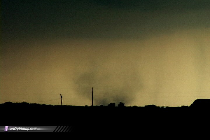
Tornado without a funnel near Fort Dodge, Iowa
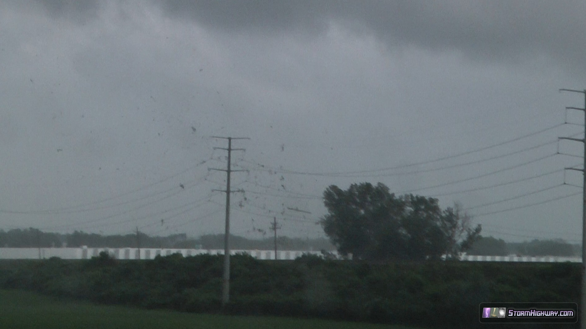
Tornado without a funnel in the St. Louis metro
Again, the rotating debris cloud indicates that the tornado is in progress.
The funnel often does not indicate the true size of the tornado. Damaging tornadic winds usually extend some distance outside of the visible funnel:
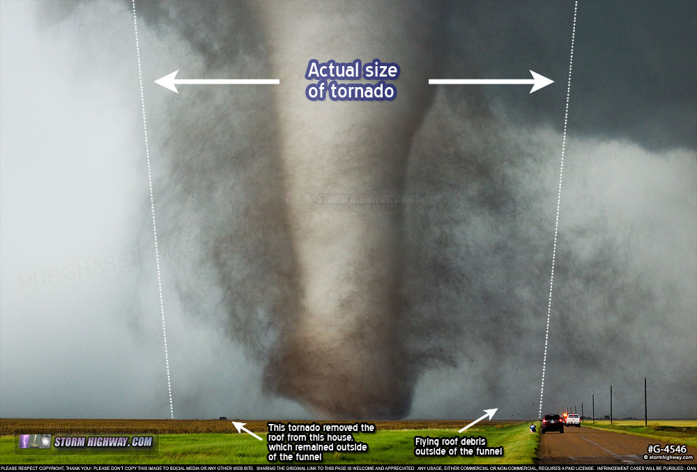
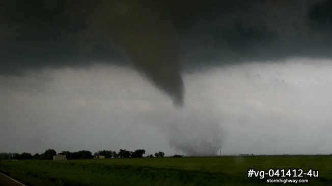
Tornado near Dodge City, Kansas
The tornado pictured above had damaging winds in an area more than three times wider than the funnel! The tornado has removed the roof off of the house on the left - pieces of the roof are flying through the air well outside of the visible funnel.
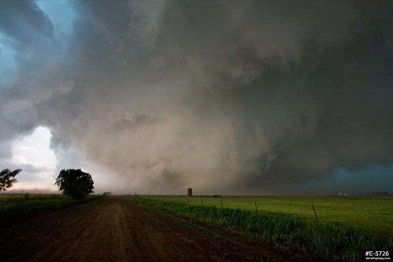
Tornado at El Reno, Oklahoma
The very strong tornado pictured above was a record 2.6 miles wide, with peak winds measured at EF-5 intensity. Its visible funnel was very large, but the damaging tornadic winds extended out far from the funnel. Damage surveys and radar showed that the location where this photo was taken was inside the tornado, despite being well outside of the visible funnel.
So what creates the funnel of a tornado? Funnel clouds are a factor of BOTH the pressure drop inside of a tornado and the relative humidity of the air flowing into it. For any given tornado - if the air is drier, the funnel may be narrower, not reach all the way to the ground, or not be present at all. If the air is more humid, the funnel may be larger, wider and reach the ground earlier/quicker.
This means there can be weak tornadoes with very wide funnels:

Wide but weak tornado near Cooperton, Oklahoma
... and strong tornadoes with narrow funnels:
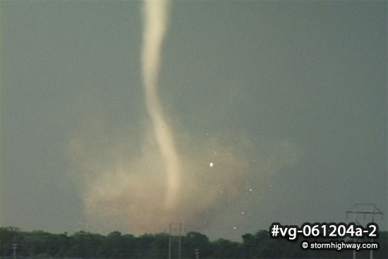
Narrow but strong tornado at Mulvane, Kansas
The bottom line is the shape and size of a funnel cloud is not always an indicator of the strength and true size of a tornado, and a tornado does not depend on a funnel cloud.
Storm chasers regularly observe that most of the time, funnels that extend at least a third of the way below cloud base typically have some sort of visible circulation at the surface, and therefore are tornadoes. If no dense source of debris is available for the tornado to pick up, the debris cloud may only be visible if the observer is very close.
READ: More Weather Myths | Weather Library Home
 About the Author: Dan Robinson has been a storm chaser, photographer and cameraman for 34 years. His career has involved traveling around the country covering the most extreme weather on the planet including tornadoes, hurricanes, lightning, floods and winter storms. Dan has been extensively published in newspapers, magazines, web articles and more, and has both supplied footage for and appeared in numerous television productions and newscasts. He has also been involved in the research community, providing material for published scientific journal papers on tornadoes and lightning. |
| View 1,599 storm chases: |
| by year: |
|
| by type: |
|
|
|
|
My work is, at this very moment you are reading this, generating the most income it ever has in my career. Yet, I was forced to shut down the professional side of my successul operation, against my will, due to one cause alone: 95% of that revenue is being stolen by piracy and copyright infringement. I've lost more than $1 million to copyright infringement in the last 15 years, and it's finally brought an end to my professional storm chasing operation. Do not be misled by the lies of infringers, anti-copyright activists and organized piracy cartels. This page is a detailed, evidenced account of my battle I had to undertake to just barely stay in business, and eventually could not overcome. It's a problem faced by all of my colleagues and most other creators in the field. |
GO: Home | Storm Chase Logs | Photography | Extreme Weather Library | Stock Footage | Blog
Featured Weather Library Article:
|


