
 Severe weather strikes southern Appalachians: Flooding, hail reported from Alabama to Kentucky: March 27, 2005 Severe weather strikes southern Appalachians: Flooding, hail reported from Alabama to Kentucky: March 27, 2005
ABOVE: Lightning flickers above Knoxville, Tennessee on Sunday night.
VIDEO: Sights and sounds during a storm chase to Alabama and Tennessee on Sunday: RealVideo, 7.5MB
HUNTSVILLE, AL - While an expected outbreak of severe weather did not turn out to be as significant as expected, the system still brought its share of problems to areas of the southeast and southern Appalachians. Flooding turned out to be the primary danger from this storm as opposed to severe weather, with heavy rain overspreading much of Tennessee, Georgia, Alabama and North Carolina. Hail reports were scattered, and one tornado was reported in southern Alabama. The following is a log of the day's chase. Photos may be enlarged by clicking on the thumbnail image.
With an ominous setup for severe storms looming as far north as southern Kentucky on Easter Sunday, I left Charleston at 6PM EST on Saturday evening with an initial target of Nashville, Tennessee. The plan was to cover the northern extent of the outbreak associated with a warm front that would be lifting northward across central and eastern Tennessee. I arrived in Nashville at 1:30AM EST (12:30AM local time) just after light rain with sporadic lightning flashes had moved through:
Digital photo:

After spending the short night just outside Nashville, I checked data again in the morning and decided to head southeast on I-24 toward Chattanooga. Although the city is just inside the storm chaser-unfriendly Appalachian mountains, Chattanooga offered quick Interstate highway options to the southeast, southwest and back northwest. As the morning wore on, I became concerned about the amount of cloud cover over southern Tennessee and decided to drop due south at Murfreesboro on Route 231 before reaching Chattanooga. I had some time before church to catch two trains passing in the small town of Wartrace, TN:
Video captures:
 
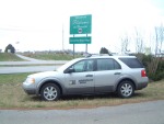
After leaving church in Shelbyville, I was back on the road and crossing the Alabama border by 2PM CST:
Digital photo:
Cloud cover was still heavy but broken in northern Alabama, and things were warming up nicely. Temperatures rose quickly from the upper 50s in southern Tennessee to the mid 70s just across the state line. A tornado watch had already been issued for northern Alabama and Georgia, and with the low just to the west, I felt that the Huntsville area would be a good compromise target as opposed to driving into better conditions further south.
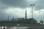
As I arrived in Huntsville, cells were already beginning to explode to the southwest and south. One cell appeared to be trying to isolate itself and organize just northwest of Birmingham, so I chose it as my target storm, passing the NASA rocket propulsion center/museum on the way:
Video capture:
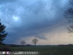
I would remain with this storm along I-65 for the rest of the afternoon, as it was slow-moving, within easy reach, in a favorable wind field and moving through chaseable terrain. I stayed with the storm from the Lewis Smith Lake area back into Huntsville as it unsuccessfully tried time and time again to develop a stout core. The cell never developed any organized structure and was continually battling a weaker area of convection just to its south. On several occassions, low-level inflow would briefly become apparent, racing northwest into the updraft, before quickly dissipating. CG activity intensified two or three times, but lightning overall was very minimal.
At 6PM, it was obvious that this system was suffering from too many storms firing too close together. Nothing could get organized for any length of time, and the day was coming to an end. I started the long drive back home with no real catches to show for the trip. At one point, sun rays shone through a break in the storm while lightning flickered overhead near New Market, AL. I stopped to film this feature but it vanished before I could set up:
Digital photo:
At this point, storms were weakening, it was obvious that the chase was over. I plotted a course home via Knoxville and Wytheville along I-40, I-81 and I-77 - hoping to encounter some residual lightning from the developing MCS to the east. Storms moving through Chattanooga caused a major traffic jam on I-24 which slowed my homeward progress considerably. I encountered a final brief burst of lightning in Knoxville, but the storm was largely uncooperative:
Video capture:

Heavy precipitation plagued the rest of the trip home through northeastern Tennessee, Virginia and West Virginia, reducing travel speeds. Arrival time back in Charleston was at 9:30AM on Monday morning, completing the 1,135 mile, two-day, six-state trip.
GO: Home | Storm Chase Logs | Photography | Extreme Weather Library | Stock Footage | Blog
Featured Weather Library Article:
|


