 Moderate Risk Chase: Morehead, Lexington, Louisville, & Bowling Green KY, Charleston, WV, - May 5, 2003 - 12:00AM-10:00PM Moderate Risk Chase: Morehead, Lexington, Louisville, & Bowling Green KY, Charleston, WV, - May 5, 2003 - 12:00AM-10:00PM
EXPEDITION VIDEO: All-day Kentucky severe weather: Realvideo, 2.9MB
VIDEO FRAMES: Lightning over Interstate 64 in Morehead, Kentucky: GIF Movie, 1.3MB
A historic tornado outbreak occurred on Sunday afternoon across Missouri and eastern Kansas. The same potent system was expected to produce a second round of severe weather from Indiana and Kentucky down into Mississippi and Arkansas.
With a possible second tornado outbreak anticipated, I decided
to head out late on Sunday night. At midnight on 5-5-03, a large widespread
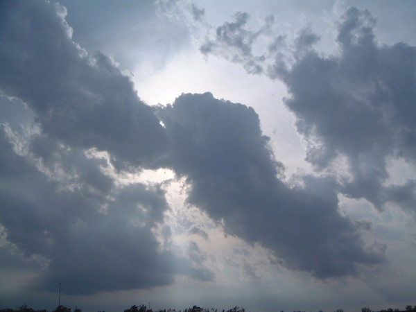
MCC (Meso-Convective Complex, a large complex of pesistent thunderstorms) was already in progress covering much of KY, IN and TN, moving east.
Plan was to leave at midnight for Indiana, shoot lightning in the MCS on the
way in KY, camp in Indiana for a few hours and then refine the target area
in the morning.
That's basically what happened, except for the sleep. New cells were
developing out ahead of the big complex, and I ran into a few at Morehead,
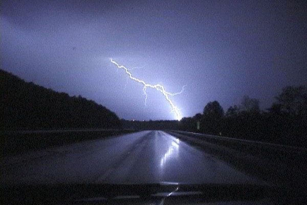
Kentucky spitting out absolutely beautiful CGs ahead of the rain shaft.
There was a distant CG followed by two immaculate, fairly close bolts that
struck in front of me as I approached the Morehead offramp less than 10
seconds apart. I got them with the camcorder on the dash mount:
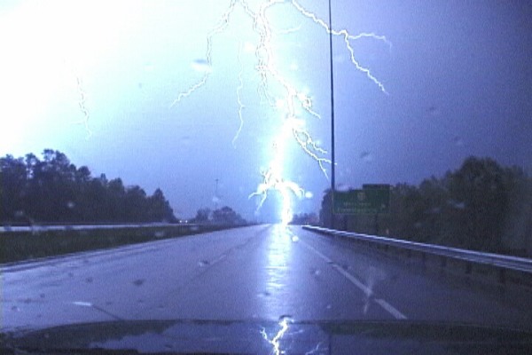
Watch this GIF Movie, 1.3MB of the above strikes.
I immmediately exited the interstate to set up for 35mm shots, but BAM- the
precip core hits fast and heavy. I decided to just keep going west due to
the rain and the CG activity dissipating. I encountered a few other cells
on the way but none were 35mm-shootable. I didn't get out of rain all the
way across KY and set up camp in IN just west of Louisville.
I never got much sleep in Indiana because it stormed constantly all night
into the morning. Mostly intracloud lightning, didn't catch anything out of
these. (Should have just gone to sleep.)
At 7:30AM, Bill calls and relays the news that the tornado risk has
increased, but is way, way south in TN, AR and MS. At this point I am
running on 1 hour of broken sleep and in that state I didn't want to
compromise safety to make the drive. I had to get some rest, so I pulled
into a rest stop south of Louisville and slept soundly until 11:00AM.
I had that gut-wrenching feeling about the situation, but I headed south on
I-65 anyway. The main tornado risk was 6 to 7 hours to the south, in awful,
unfamiliar chase territory. Most likely I wouldn't make it in time either.
I also couldn't go that far since I had only taken Monday off from work, and
I didn't want to be far from home at nightfall. After hearing some more
discouraging info on the NWR, I changed my mind at Bowling Green and headed
back north, stopping to video a few small cells that were dropping frequent
CGs and small hail. I was resigned to the impending bust and decided to
head home, at least I'd get back before dark.
Upon reaching the Bluegrass Parkway, I switched on the NWR to hear about a
new tornado watch just issued for my area, so I decided to stay in the area
and play with any cells that decided to fire. They fired, but had trouble
initially. Lots of scuddy Cu/Tcu clouds everywhere, very hard to see
anything. Cells that did go up were struggling with weak ragged-edged
updrafts. Finally, through the mess, I could make out a nice hard-edged
tower to the SE that looked decent.
The drive southeast to catch the cell was surprisingly easy considering
still being in Appalachia. The roads were OK, not too curvy, rolling hills
with plowed fields and few trees - excellent visibility. Nothing like the
caprock, but if this storm had produced, I might have actually been able to
see it. I could soon see the sort-of-rain-free base under the struggling
flanking line. No obvious lowerings. Finally caught up to the cell near
Summersville, KY and had a good view of the featureless base. The cell
eventually went on east and went severe, several warnings were issued. I
could not keep up to it as the roads/visibility became worse and worse as I
headed deeper into the hills. SPC storm reports show a tornado was reported
by law enforcement from this storm not too far after I left it.
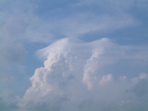
Continuing the trek home, I ran into some decent cells north of Lexington
around 6:30PM that were producing pileus:
(View timelapses in the Realvideo file)
Shear was evident by watching small, tilted turkey towers grow/dissipate:
(View timelapses in the Realvideo file)
Southerly wind was very strong in Lexington, steady 20mph or more. A call
from Bill revealed a new tornado threat was evolving to the north in extreme
SE Ohio, and a new TOR watch issued. These few cells had lined up and were
training due east, right along my drive home on I-64. I used them as all
the more reason to keep heading home instead of investigating cells further
southwest. Caught up to this 'mini-line' near Morehead, and was in a
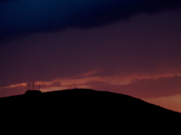
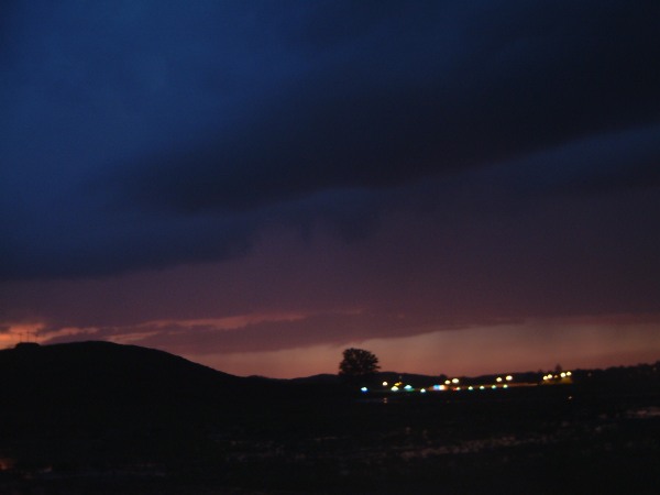
position to shoot the diminishing lightning near Grayson. The cells were
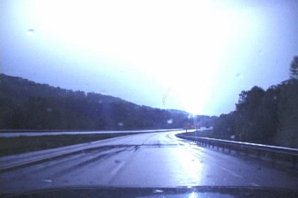
weakening rapidly at 8:00PM but were producing a spectacular sunset behind
rain curtains (see Realvideo clip).
Arrived home 720 miles and 22 hours later. As always a big
thanks to Bill Coyle from providing nowcasting and data. Great to have that
support when you're without mobile data.
35mm photos coming soon.
Digital Video: Sony DCR-TRV900 3CCD MiniDV, 720x480 NTSC
Digital Camera: Fuji FinePix 4700, 2400x1800
|


