|
Home | Blog Index | Blog Archives | Christianity & Faith Essays | Storm Chasing Essays
July-August 2026 Storm Chasing Recap
The summer months of July and August of 2026 were a fairly busy period for storms in the St. Louis area.
July-August 2026 Event List
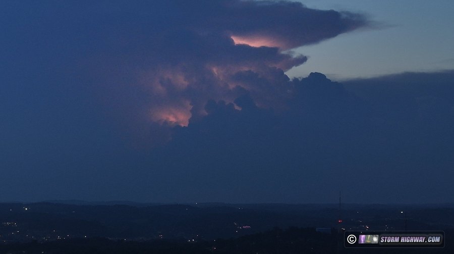
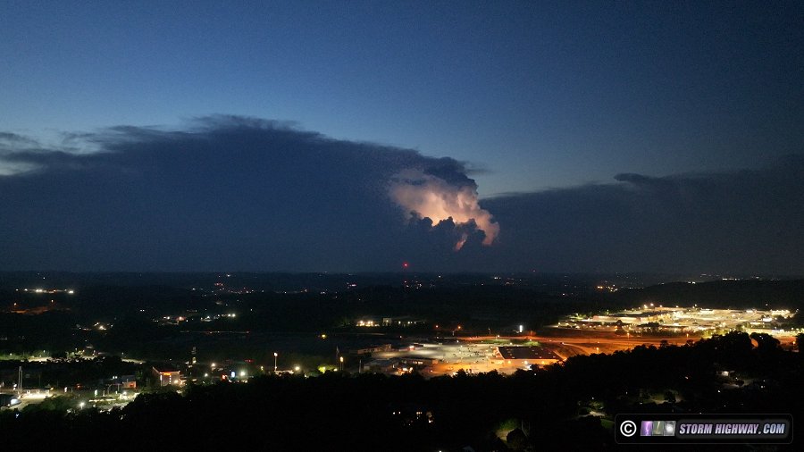
 July 3: Distant lightning north of Pittsburgh, PA July 3: Distant lightning north of Pittsburgh, PA
These thunderstorms flickering with visible lightning in the distance moved north of Pittsburgh at sunset as the (illegal) fireworks dotted the landscape, viewed via drone at 400 feet in Washington:
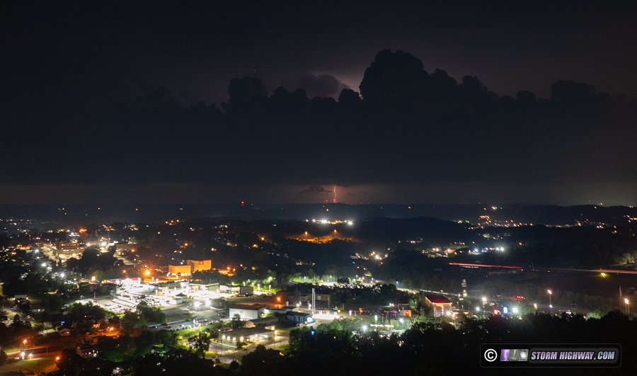
As the outflow marched southeast toward Washington, a few bolts appeared to the northwest:
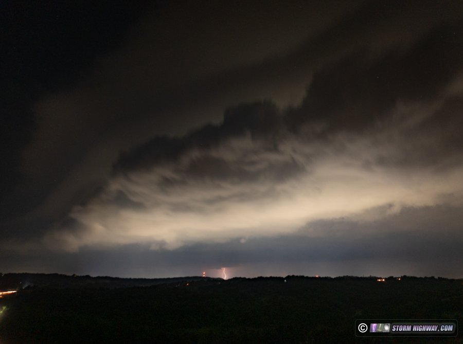
A decent shelf cloud moved overhead with the outflow as it arrived, with a few bolts in the background:
July 4: Lightning and thunderstorms around Washington, PA
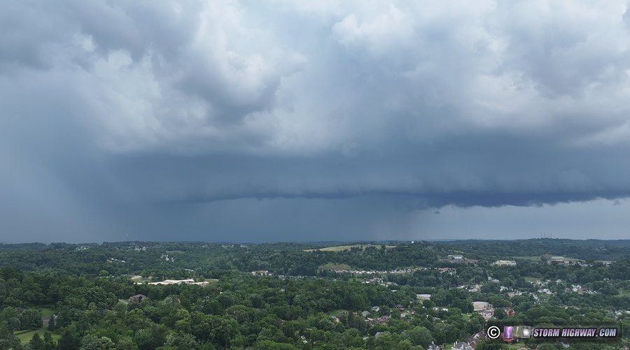
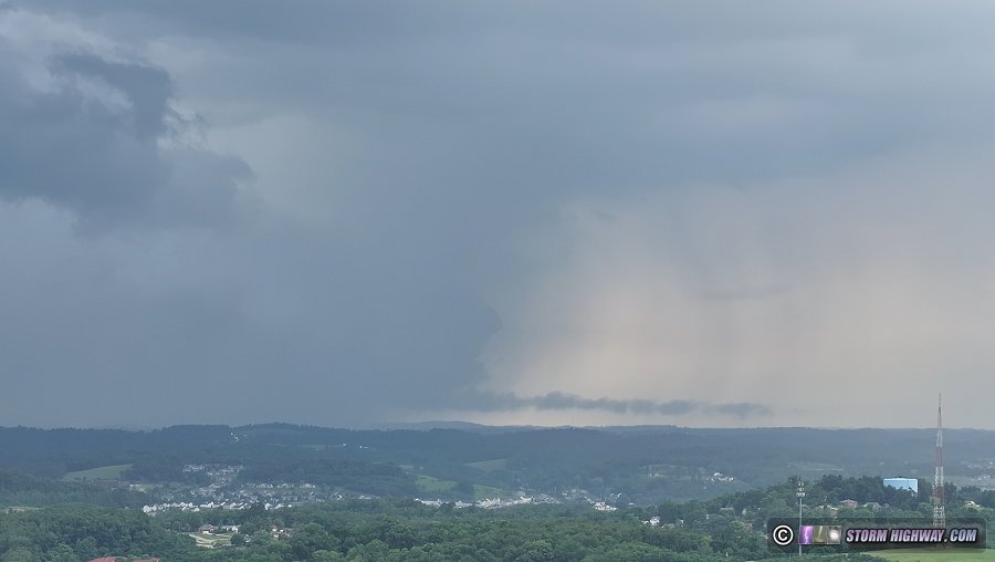
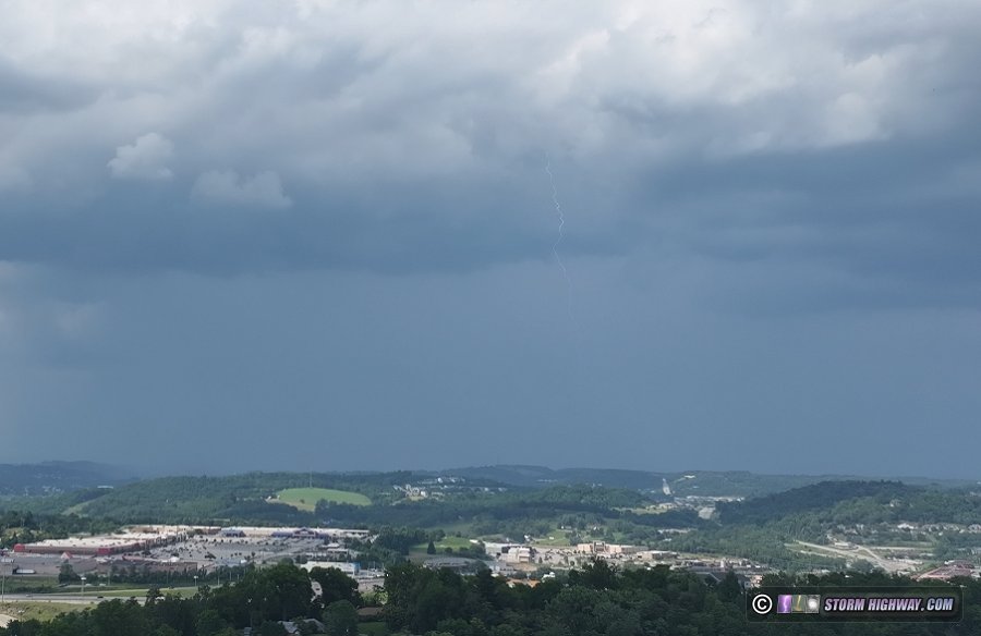
Storms fired in the Pittsburgh area again on the 4th. These drone views show several storms surrounding Washington as an advancing outflow triggered new storms around town during the late afternoon:
July 5: Thunderstorms over Washington, PA
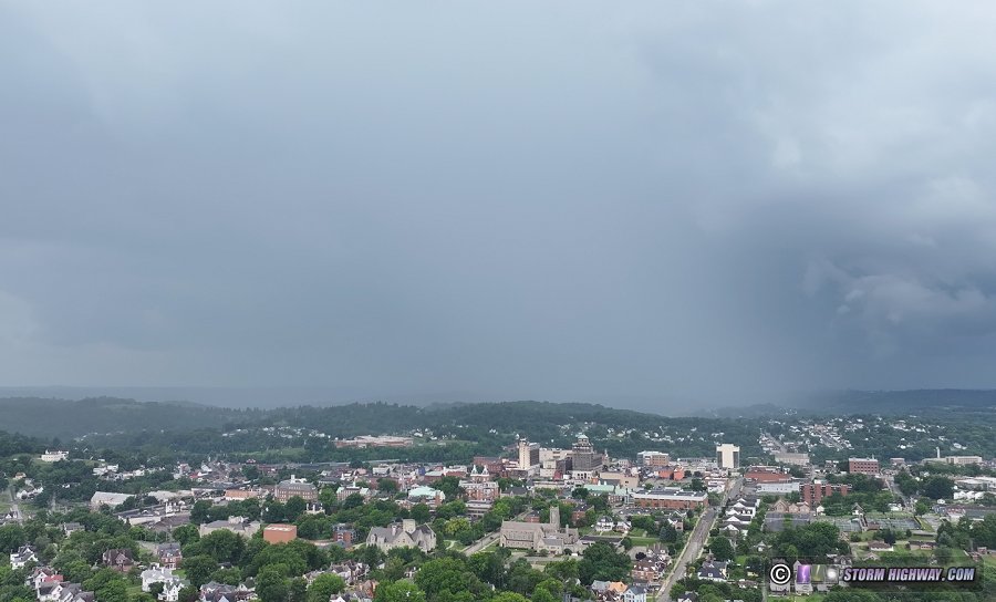
This storm's rain shaft advanced over downtown Washington, PA early in the afternoon as storms developed in southwestern Pennsylvania for the third straight day. The cloud-to-ground lightning was uncooperative before the rain arrived and ended this drone observation:
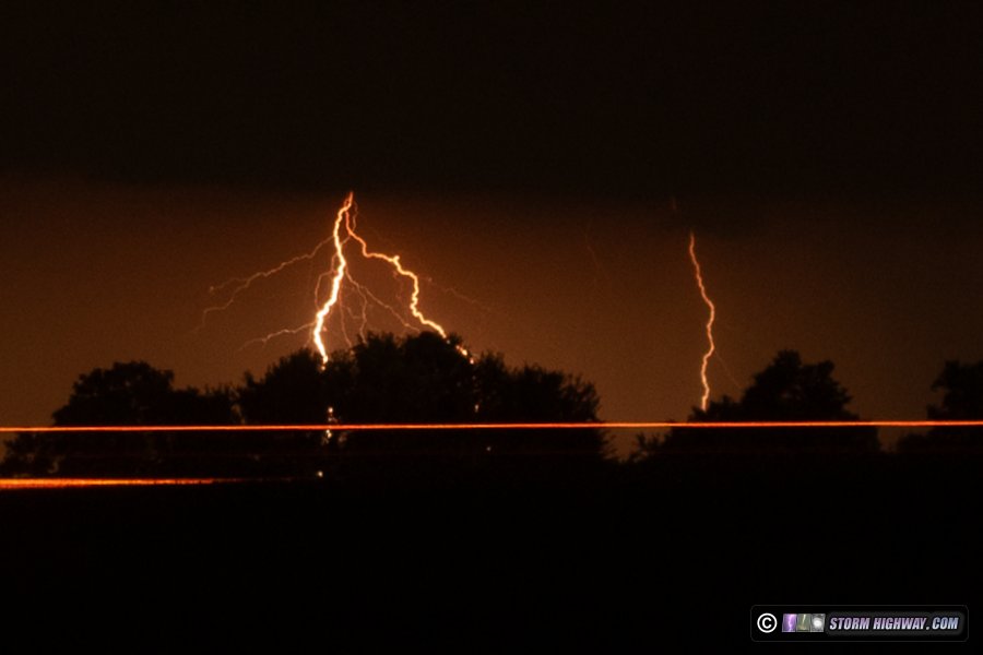
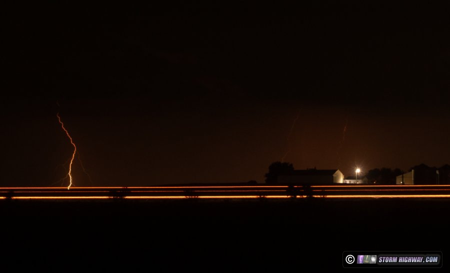
July 7: Distant lightning near Sparta, Illinois
A short outing before midnight to shoot distant lightning about 30 miles south of New Baden with the 50mm lens. These storms were down near Sparta. The traffic streaks are on I-64.
 July 8: Lightning around New Baden, Illinois July 8: Lightning around New Baden, Illinois
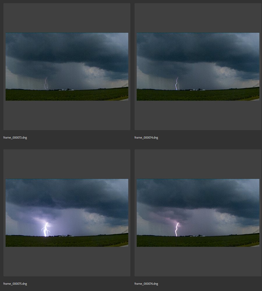
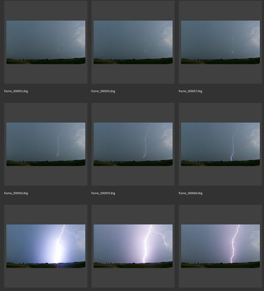
Another day of summertime pop-up thunderstorms around the St. Louis metro, the type that typically isn't worth doing much with chase-wise unless they're right overhead. Several of these cells developed around town and produced random bursts of lightning. I captured a couple of high-speed sequences of negative CGs.
July 9: Lightning near Darmstadt, Illinois
These storms developed south of the metro area at 10pm. I drove the 20 miles down to Darmstadt to see if the lightning was worth shooting. The storms were uncooperative, with the best lightning occuring behind low stratus clouds, during wind-blown rain, in poor road options and/or in the midst of tall corn. I only captured a single still shot with a visible lightning channel just before these developing low clouds blocked the entire sky:
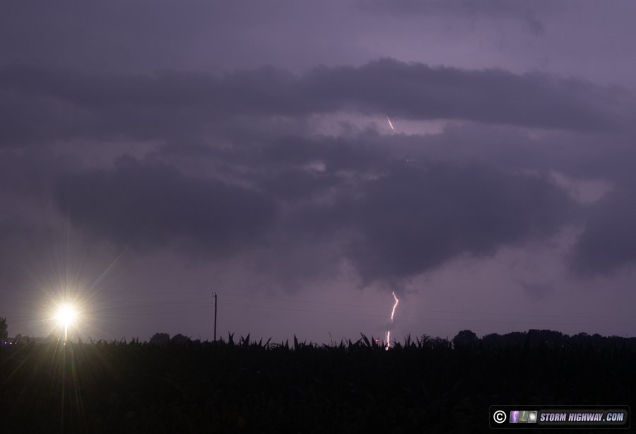
July 10: Southern Illinois storms and lightning
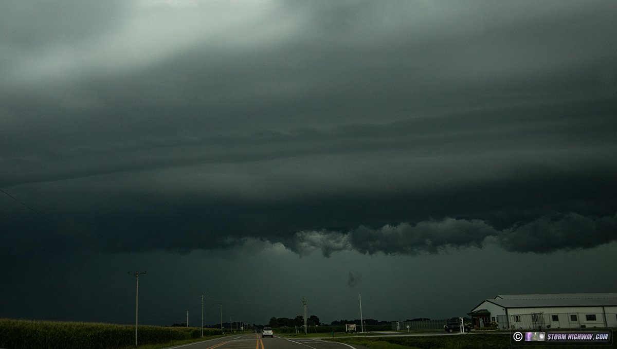
This day featured multiple rounds of storms that were mostly fruitless in terms of imagery and video. The initial storms of interest were a supercell cluster that spun up a potent-looking mesocyclone down near Sparta. I got a late start leaving, and the precip core cut me off on Highway 4 south of Mascoutah. The tiered shelf cloud on the north side of the cores featured Kelvin-Helmholz waves:
I arrived on the storm south of Coulterville, finding nothing but a long gust front out ahead of the faded circulation. Meanwhile, a potent bow echo had just passed through Columbia, Missouri and was racing toward St. Louis. I decided this would be the better play, so I turned around and scurried back north. On the way, new storms went up everywhere in the metro area ahead of the bowing line, eliminating any hope of a nice shelf cloud over the city.
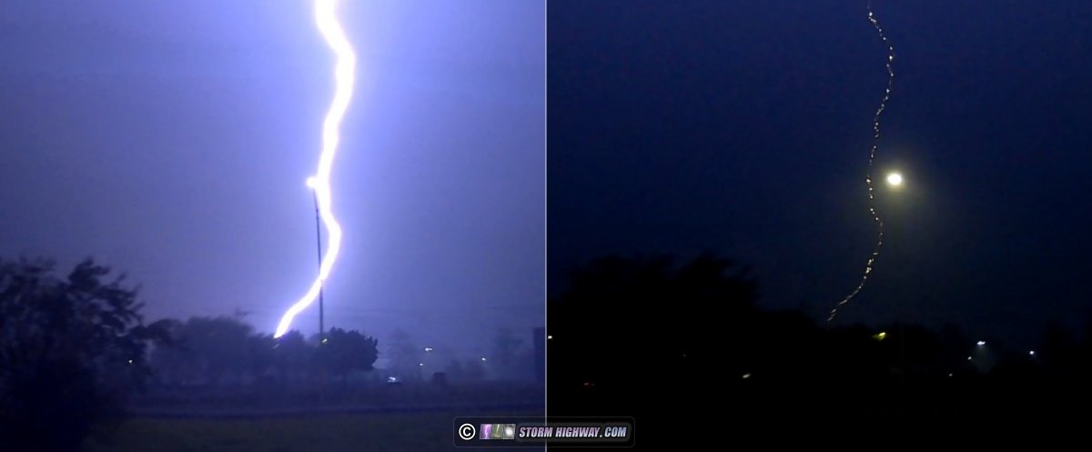
I went downtown anyway to see if anything would materialize. The gust front from the original bow echo was buried in these new storms, which themselves were heavy-rain producers with mostly in-cloud lightning. There were relatively few cloud-to-ground bolts, desipite what data was showing. One of the few CGs I saw was this intense beading bolt that hit close to I-64 in Fairview Heights on my way into the city:
The situation in the city was so devoid of anything photogenic that I didn't even go to my normal setup spots, I just circled through downtown and got right back on the highway eastbound.
New backbuilding convection was continually developing on the western flank of the complex, but this also wasn't producing much in the way of cooperative photogenic lightning. I decided I was done with everything at 9:30.
At close to midnight, I went back out to take another look at things. An electrified stratiform region had developed in eastern Illinois into Indiana, and skies overhead were clear. Such a sprite opportunity in the Midwest in mid-summer is almost unheard of, so I set up for this and fired off about 70 frames looking east. No sprites occurred over the stratiform region, which was slowly losing its strength. Eventually, it stopped producing lightning altogether.
Meanhile, the backbuilding convection had continued to the south of the metro area and was actually extending in a line all the way back toward Springfield, Missouri. Another new cluster of cells had also developed west of St. Louis. All of these cumulonimbi were flickering with frequent lightning in the distant south, southwest and west. There were no bolts-from-the-blue, though. I was more interested in the sprite opportunity, so I didn't turn the camera on any of the distant storms.
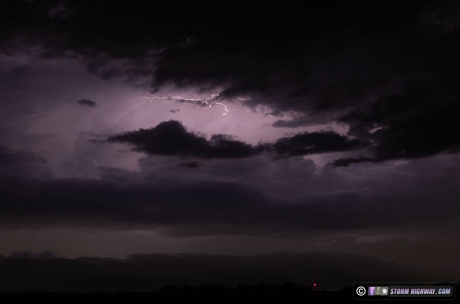
Once it was apparent the sprites hope was busting, I decided to try for a few frames on the approaching western cells. This year is one where the crop in the vast majority of the Midwestern fields is corn - as in 9 out of 10 fields. Typically, less than half of the fields are corn. Usually, they are on a four-year cycle of corn, soybeans, winter wheat and an off-year (usually with wildflowers) to recover. Most years, you'll have plenty of soybean, winter wheat and wildflower fields to view storms. I don't know why everything is corn this year, but it sure is making storm chasing difficult this summer. I had to drive 5 miles nearly to Summerfield to find a clear view to the northwest. By then, the incoming storms were dying. There was only one final intracloud flash after I got set up:
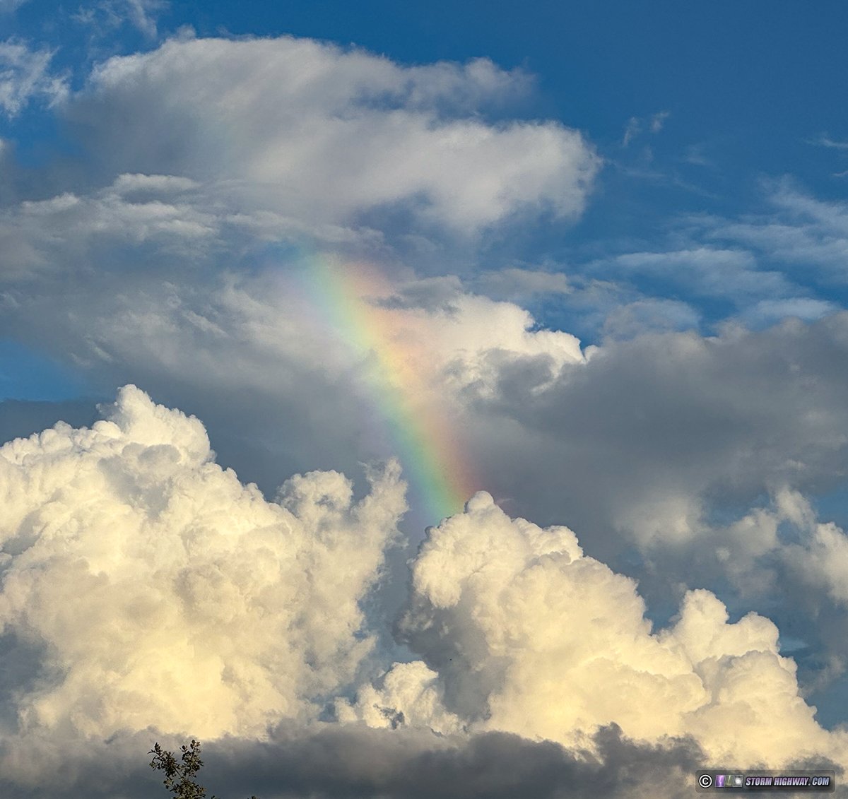
July 11: Mascoutah, Illinois high-altitude rainbow
An unusually-positioned rainbow appeared above a cumulus congestus over Mascoutah thanks to the adjacent lingering precip from another recently-dissipated updraft:
This marginal setup - on the back side of an MCV - managed to produce a fully-condensed tornado down near Valmeyer. I never would have seen that coming, and would have missed it even if it had been right out of my back door. Such is the Midwest's tornado activity sometimes!
July 26: Record-high dewpoints in the St. Louis area
Dewpoints ranged from 81°F to 86°F in the St. Louis metro area this day, with at least the Lambert Airport weather station recording an all-time record high dewpoint of 81°F. I measured an 85°F dewpoint outside of New Baden with my handheld Kestrel (the camera lens was fogging instantly after being in the air-conditioned car):

 July 26: Lightning and rainbow from severe storm near Alma, Illinois July 26: Lightning and rainbow from severe storm near Alma, Illinois
The aforementioned record-high dewpoints resulted in 7,500 j/kg of surface-based CAPE (instability) east of St. Louis. A differential heating boundary and a good stream of upper support overhead meant that supercells were possible along the boundary, which was draped from roughly Decatur down to Evansville, Indiana. Storms fired along I-70 west of Effingham and coalesced into what appeared to be an incipient supercell, and I drove east on Highway 50 to intercept it.
By the time I reached the storm south of Kinmundy, it had already developed a forward flank outflow surge that raced far ahead. This dashed any supercell or tornado prospects for the day. However, the storm was rather cooperative with a few good save-worthy captures.
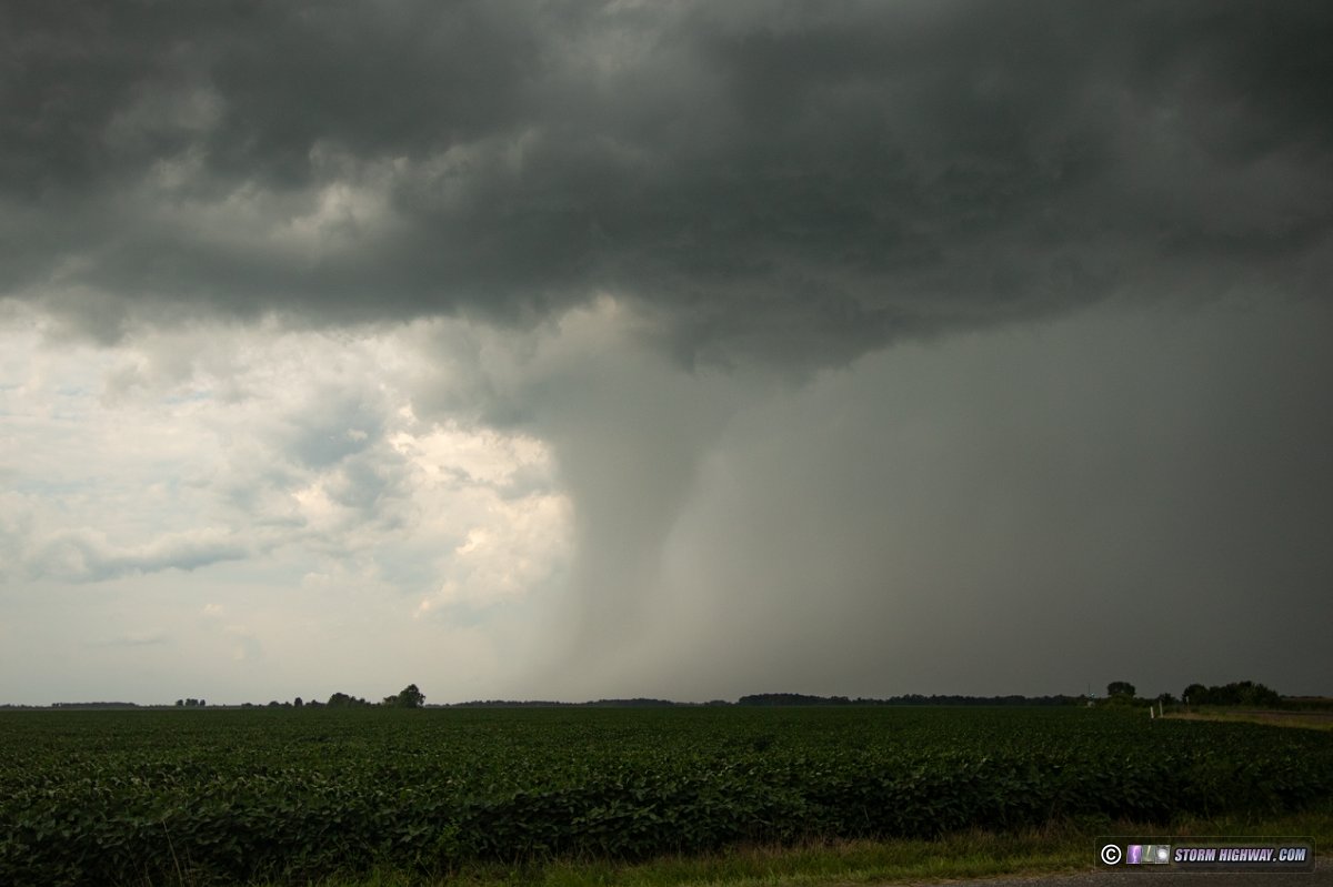
This conical rain shaft is another good example to add to the "tornado look-alike" collection, even a clear slot-like feature is visible:
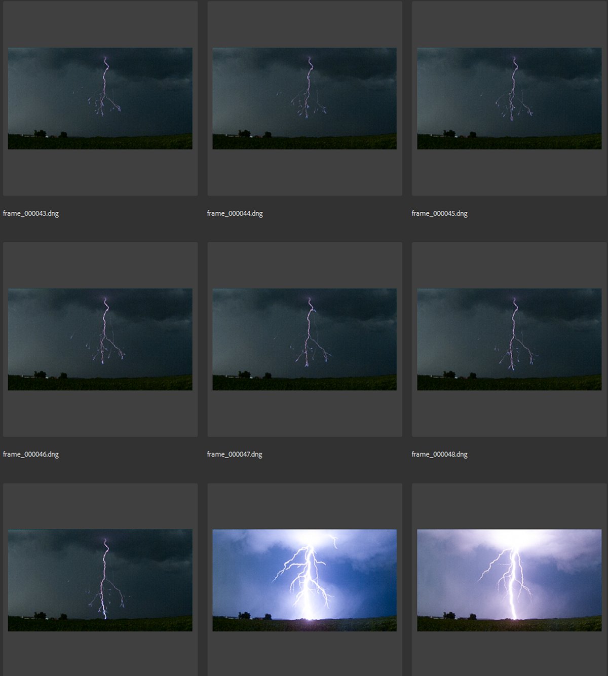
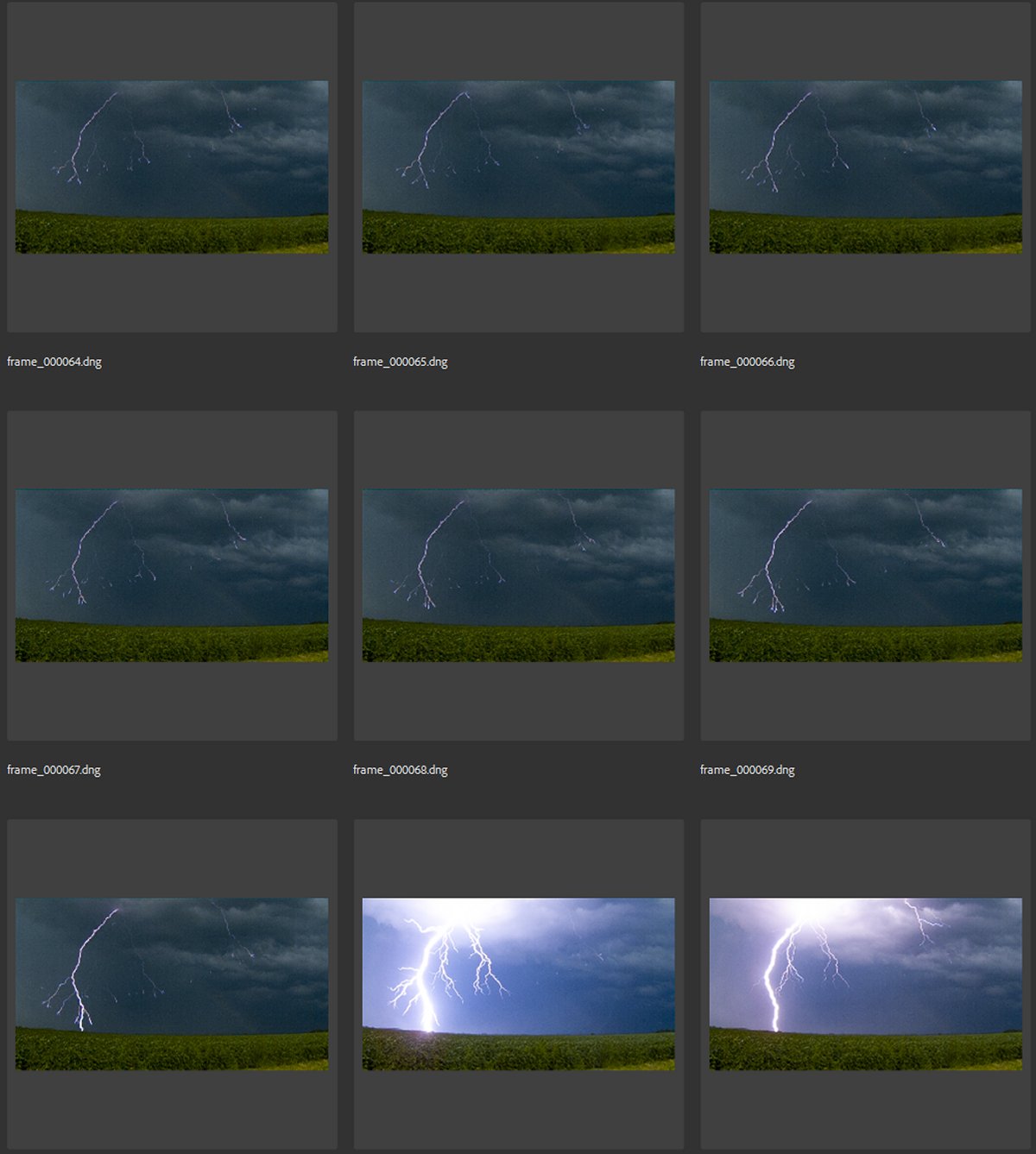
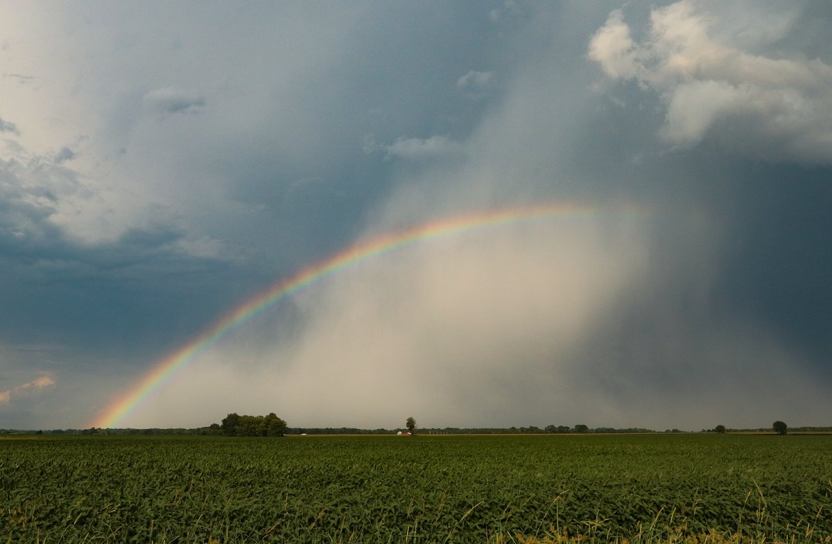
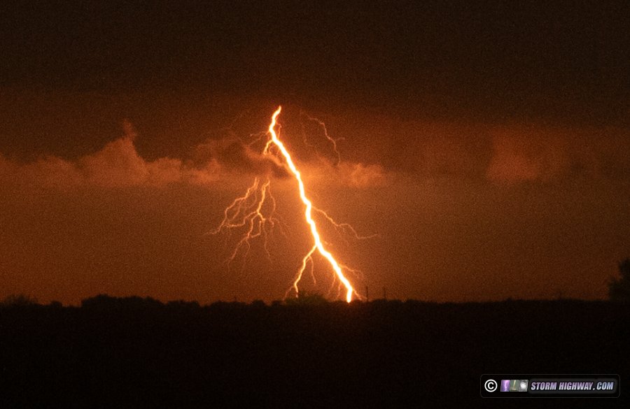
The storm then proceeded to produce a nice lightning barrage, during which a rainbow appeared. Two of the best bolts were framed just right on the high speed camera capture at 6,002fps. These are actually two of my favorite captures in recent years, just great scenery, color, lighting and very crisp and interesting bolts:
The lightning eventually tailed off, but a dense rain shaft and rainbow remained to produce this scene:
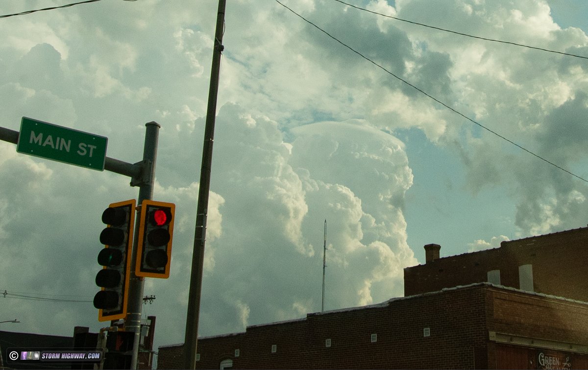
I broke away from this cell at Highway 50 and went west then south to intercept some new convection going up on the first storm's outflow. This dramatic pileus cap appeared over downtown Salem:
I ended the chase at Mount Vernon and headed home in case the models were correct about new storms after sunset in the St. Louis metro area. These storms never developed. The boundary to the east continued to produce storms throughout the overnight hours, but overcast ruled out any sprite visibility and I could not see any distant lightning worth staying out and shooting. These storms ended up producing a westward-moving outflow that reached St. Louis around 2AM, cooling things off to the point I was able to get a 23-mile bike ride in.
July 31: Weak tornado near Oak Hill, Missouri
This was a low-effort, low-expectations chase that resulted in a low-quality barely-tornado. It's never good having to add so many qualifiers and explain why this is a tornado, but that's chasing sometimes.
I drove to Fenton early in the day and waited on a target to emerge. It seemed like early storms along a convergence zone around Columbia were going to be the first potential tornado producers, but I really didn't feel like going all the way up there (the I-70 widening construction is really bad right now) and it looked like there might be a chaser horde up there already. I also wanted something closer to the metro area. Winds were backed nicely down here, and clearing had allowed the air to recover behind the early-day rain. Finally, convection began firing north of Rolla far ahead of everything else, heading for the Union/St. Clair area. This eventually developed a hook echo and a low-level meso. That was just what I was looking for: something decent down here all to myself.
I arrived on this first storm south of Owensville right as it completely dried up. The instability drop-off here was fairly abrupt, and I was concerned that every storm would be doing this. New storms developed just behind the first, but these were not only maintaining, but intensifying further. The second cell began producing frequent lightning and had a healthy look on radar. I arrived on this along Highway 19 at Oak Hill, about halfway between Owensville and Cuba.
This part of Missouri is pretty much a drone-only storm observation zone. I don't think I would have even tried chasing here this day if I didn't have my aerial vantage point available. I definitely wasn't finding any ground-based views of these storms where I was. I launched at the intersection of 19 and Highway C to find a healthy-looking updraft base just to the west:
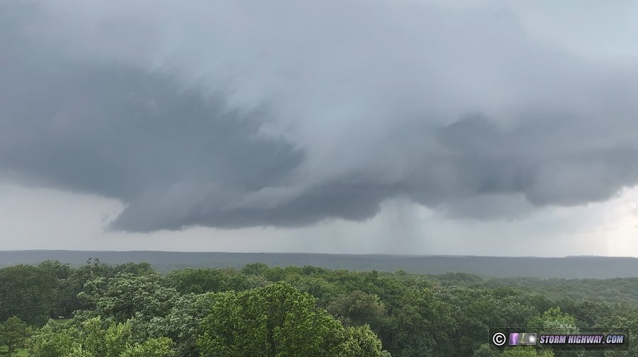
The velocity couplet on radar was not very impressive, but the storm's visual apperance was progressing in classic fashion: cascading downward motion on a surging RFD wrapping around a meso to the southwest. Condensation tendrils began rising from the ground under the meso:
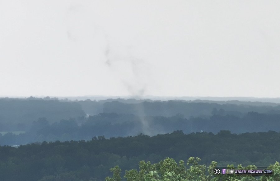
This condensation wasn't a vortex, rather the outer edge of a tornado circulation akin to what you see with a condensing collar cloud. A distinct circulation can be seen to the right of this, with the cloud fragments moving in opposite directions. The low-level air here was close to saturation, and you can see in the video (linked below) that there were multiple non-tornadic areas of fog rising off of the treetops in the surrounding area. The motion is the key here. This becomes clearest when the camera zooms out: you can see the classic bowl funnel above rotating strongly:
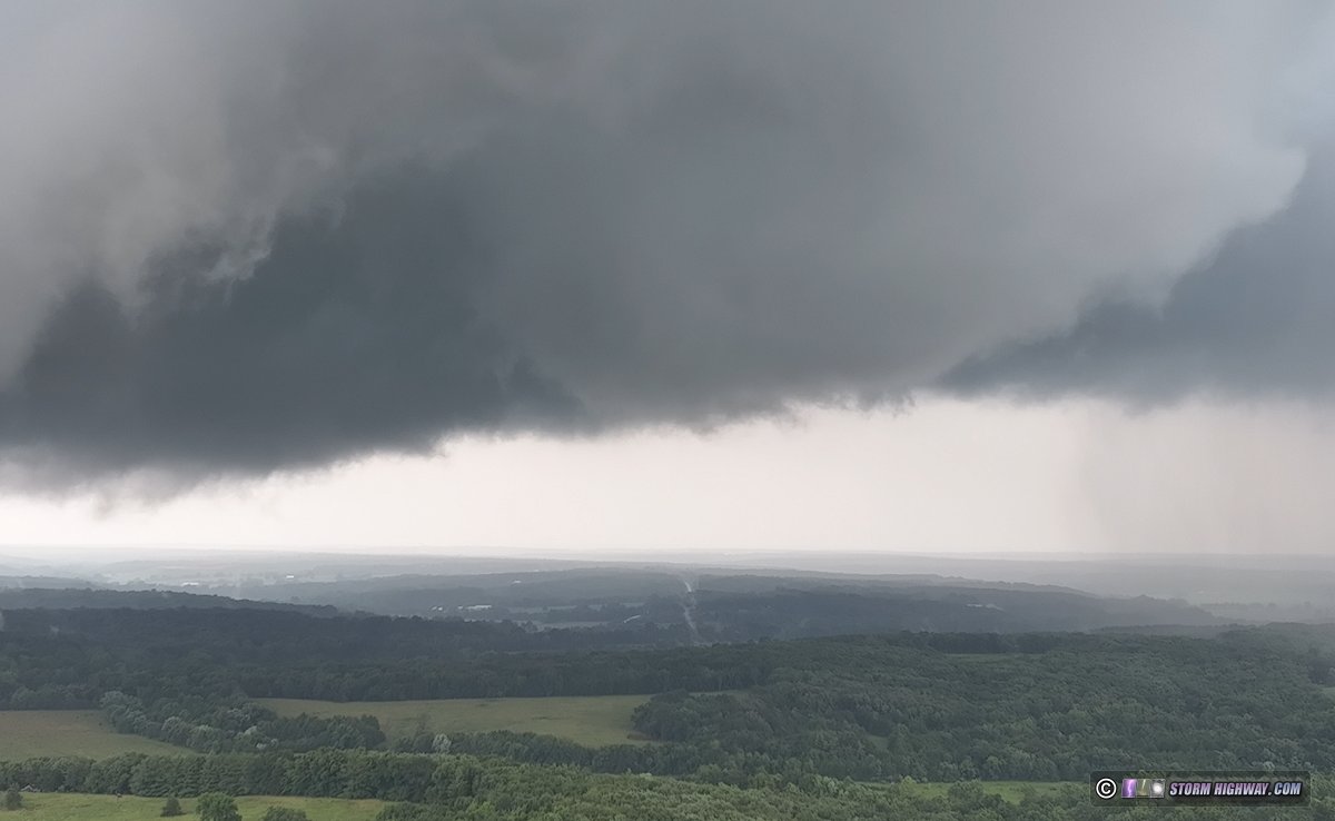
Here's the video:
The storm underwent a few more cycles with strongly-rotating wall clouds, this one just north of Cuba being the most impressive of the day:
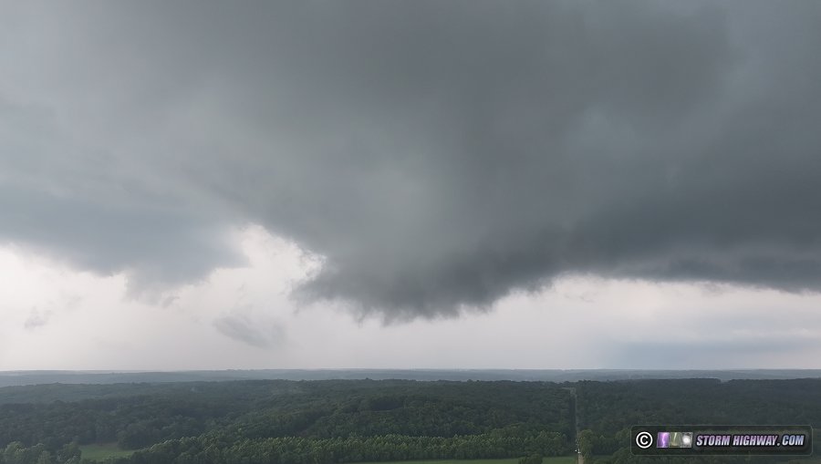
I made one more flight at Bourbon to watch this storm move across I-44, but didn't observe anything else of note. A potent squall line to the northwest was racing toward these cells and looked to overtake them, and I didn't have a good way to get back out ahead on the curvy 2-lane roads away from the interstate. I decided to switch to lightning mode at St. Clair and see if any visible channels of the frequent flashes would start revealing themselves. I saw a few nice bolts in the distance south of I-44, but low clouds blocked most of the view. I called the chase at sunset and began heading home.
A stratiform region developed over the St. Louis metro, connected to the leading cores. This started producing horizontally-extensive lightning flashes over the city with upward lightning potential, but again, low clouds blocked most of it. I didn't think it was worth staying out any longer, arriving home at 9:30pm. August 6: Morning lightning in St. Louis
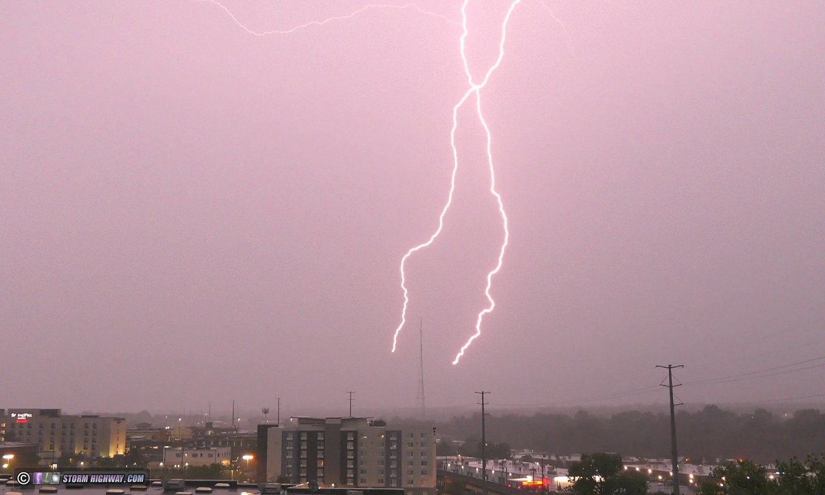
I headed to Brentwood to shoot upward lightning with thunderstorms moving through the city at daybreak. This beading positive CG hit right after I'd set up the 4k camera and 30 seconds before I was rolling on the high speed cam:
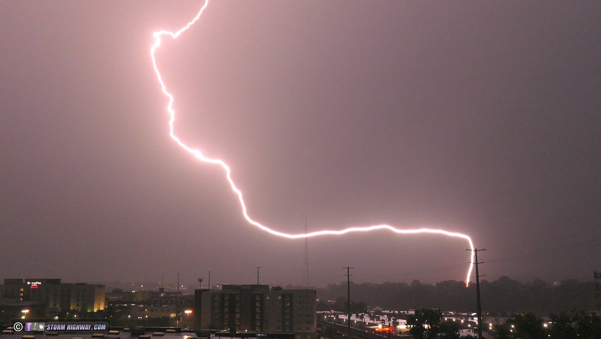
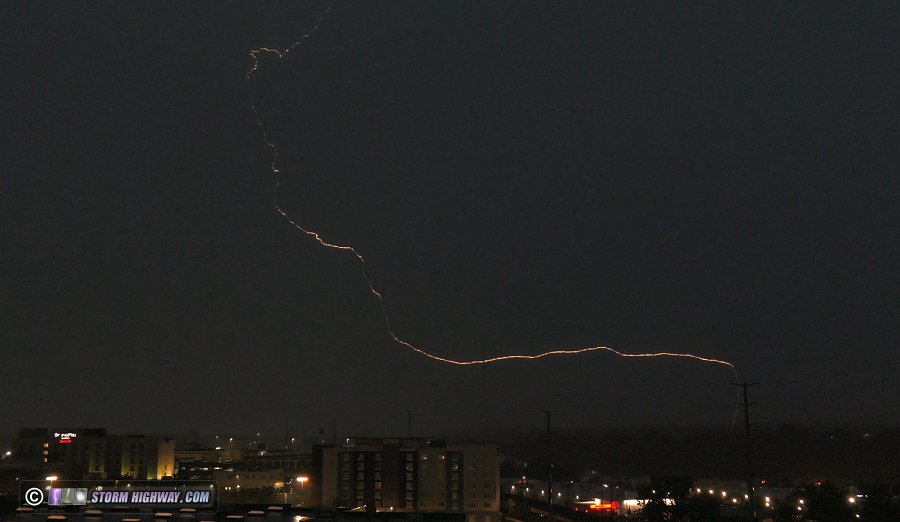
Only one upward flash occurred to the towers. The high speed shot was not very interesting (single-channel fast positive leaders with weak branching and no return strokes), but I saved it anyway. The 4k cam got the better exposure:
August 11: Chicago lightning trip #26
I went up to Chicago after work on Monday night to set up for these storms on Tuesday morning. A hole deveoped in the stratiform region over the city just behind the leading cores of the storms, eliminating the potential for upward flashes for most of the event. Only one upward flash occurred to the buildings after a tiny active lobe of the stratiform shield moved across the north side of the city. This was a single slow positive strike to the Hancock with numerous return strokes:
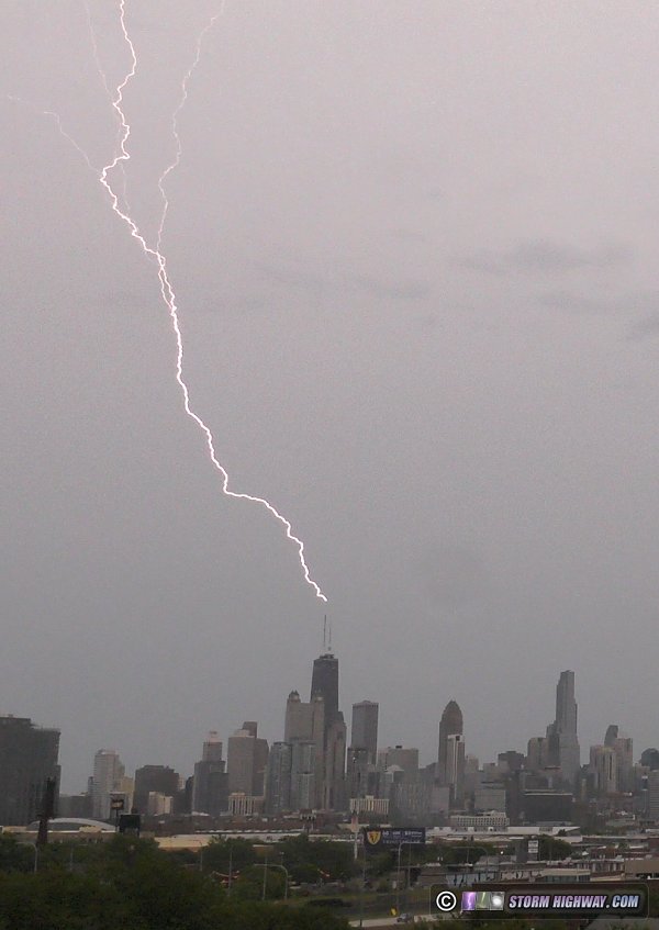
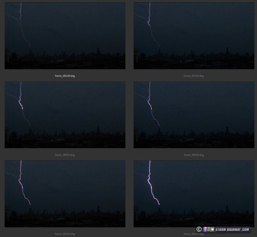
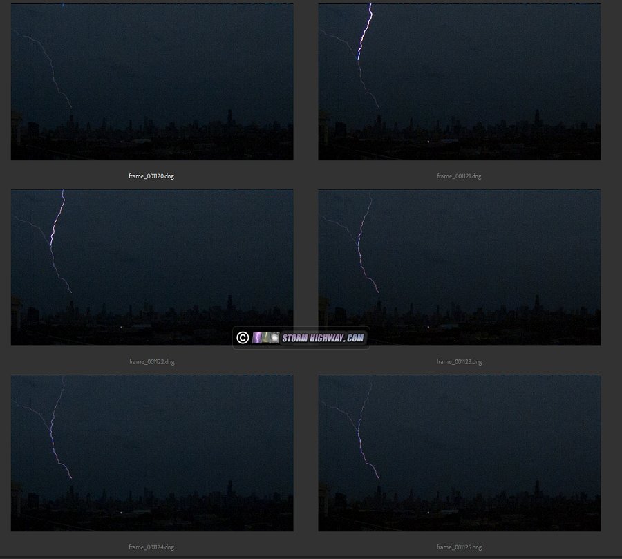
The 6,002 fps shot of this showed a few interesting features, with dart leader-initiated return strokes originating on multiple branches. Some of the dart leaders featured short propagations back up another branch, something I hadn't seen before:
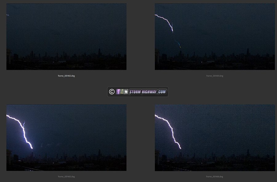
Here's the video:
August 12: Southern Illinois storms
Outflow from overnight storms moved uneventfully through the St. Louis metro at midday. This boundary stalled a couple of counties south of I-64, becoming the focus for new storms by the late afternoon. I went down to Sparta to intercept the first storms to go up along the river. These briefly had a supercellular look, but quickly became outflow dominant. Outflow raced ahead of this storm east of Sparta.
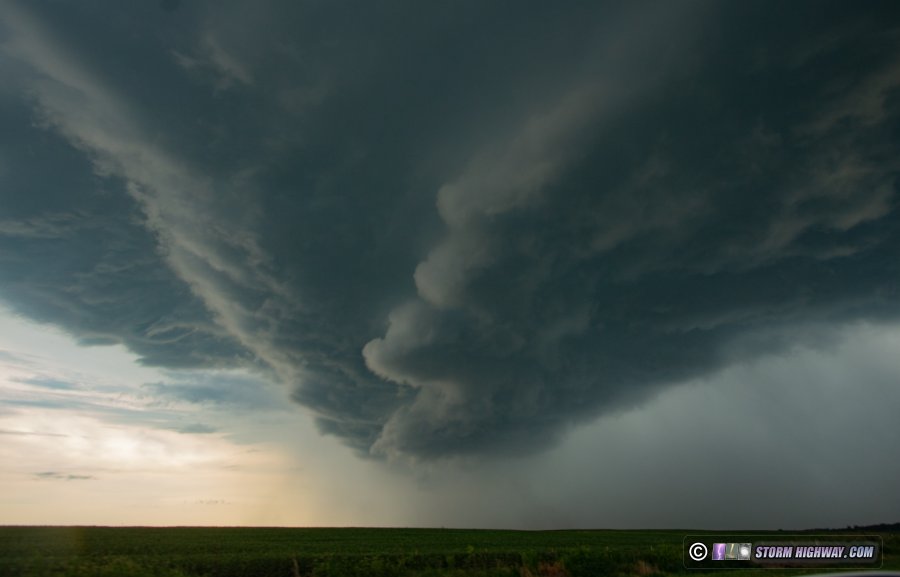
North of Cutler, the winds kicked up thick clouds of coal dust at the Knighthawk Prairie Eagle coal mine. The terrain and corn made good views sparse, but I managed a 6,002 fps high speed shot of a bolt behind this scene:
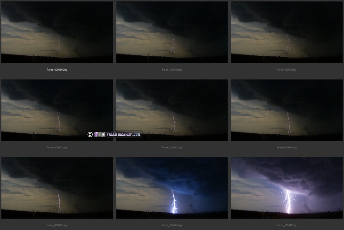
These storms sent a strong outflow surge northward. Meanwhile, storms northwest of St. Louis had produced a new outflow that was racing south. The two outflows would collide somewhere around Waterloo to Red Bud, so I headed over there to await the collision-triggered storms. These happened as expected, but once again, I could not find a clear view among the fields when the best bolts were in progress (again, this year it seems that more than 90 percent of the fields are corn). I decided to not follow these southward. I arrived home at 6:30pm.
The sunset then peeked under the anvils of the storms to the south, with some cumulus to the west producing crepuscular rays. I walked across the street for this view:
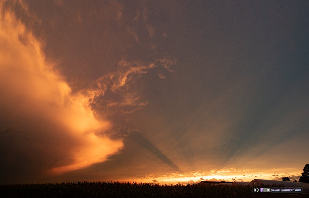
August 13: Lightning from Belleville to Mascoutah, Illinois
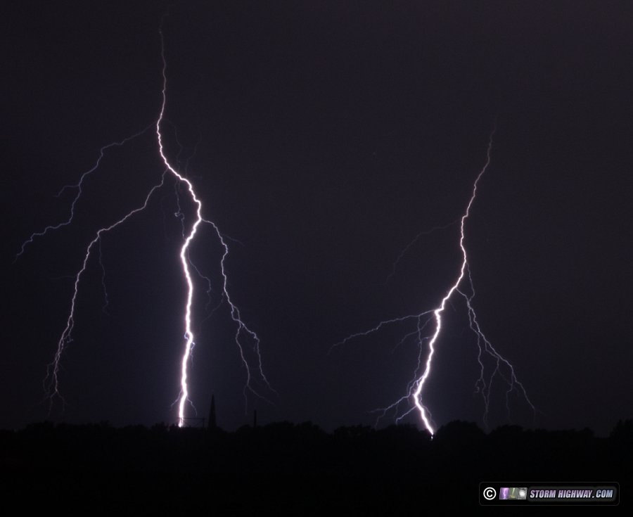
After work, I was greeted by these new storms that continually developed across the metro area after midnight, mainly on the Illinois side. I set up to do an old-school "stills-only" lightning photography session near Mascoutah for over an hour. Most of the visible bolts were on the south side of the cores, making them elusive until a new cell went up to my due west over Fairview Heights. This new storm produced a couple of nice clear-air bolts over Belleville before the rain arrived:
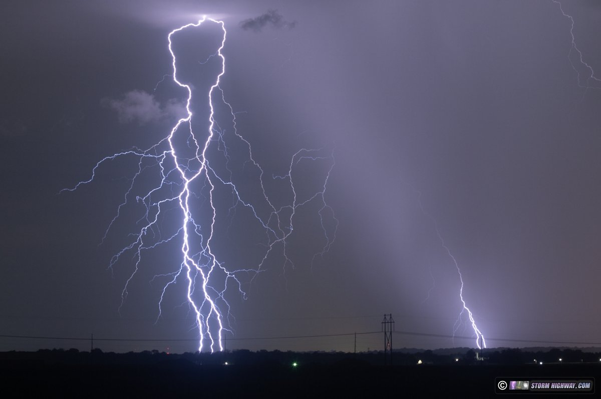
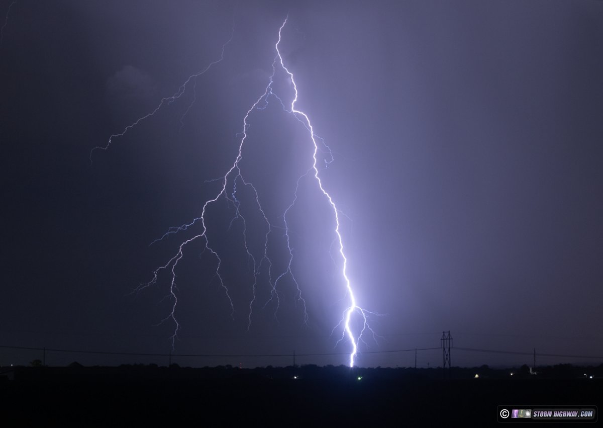
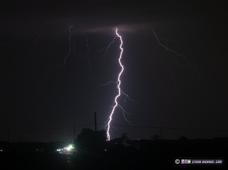
Earlier, all of the storms had been remaining to the south, with most bolts deep in the cores or on the other side of them. A few times, bolts would peek out around the dense rain shafts:
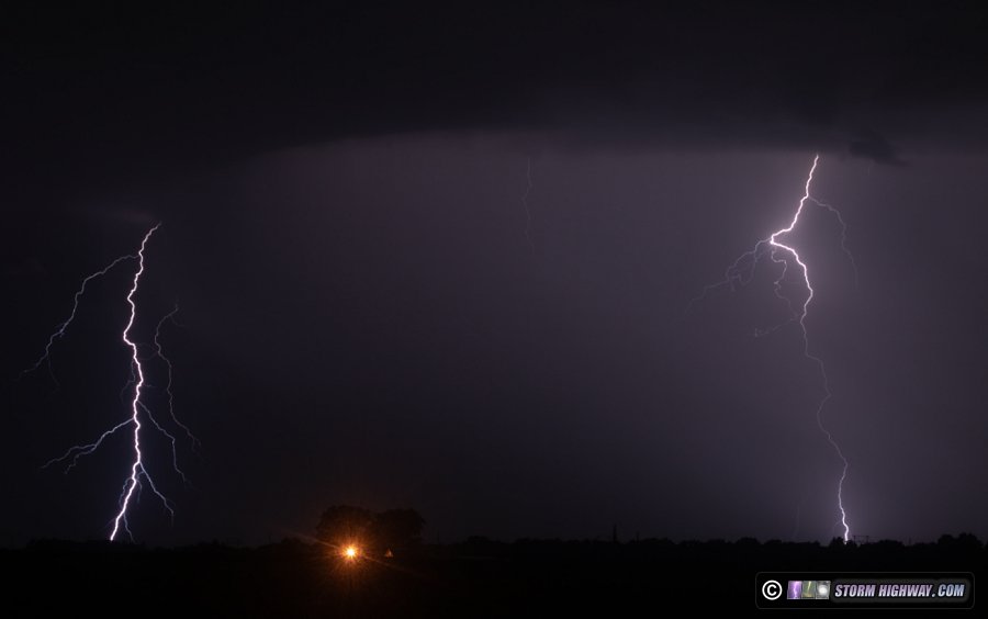
August 14: Sprites over northeastern Illinois (bike chase)
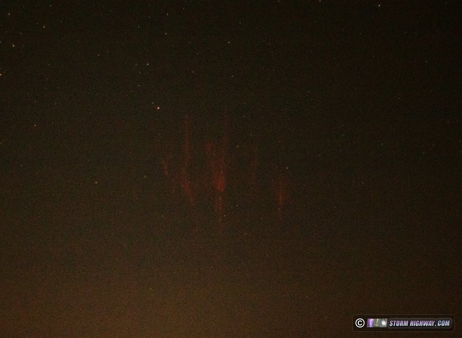
I took my camera with me on this night's bike ride in case sprite viewing conditions materialized from ongoing storms in northern Illinois. About an hour into the ride east of New Baden, radar showed a stratiform region had developed in northeastern Illinois. I set up the camera and fired off exposures over this area for about 20 minutes. A single sprite occurred during this interval:
August 15: Summerfield, Iliinois sprites bust
For the second night in a row, a thunderstorm complex developed to the north of the area. I wasn't off of work until 3AM, and by then, the southward-creeping anvil cirrus from the storms had almost completely blocked the view of the best sprite-producing regions. Nonetheless, I spent about 20 minutes firing off some exposures near Summerfield hoping for some sprites to peek overtop of the edges of the cloud deck, but that didn't happen.
August 16: St. Louis lightning
This was a frustrating night. I wasn't able to leave work until 8:30pm. Storms had developed to the north along the I-70 corridor about 20 minutes before I left. These cumulonimbus towers were flickering against a deep blue twilight sky, and as I walked outside to my car, the storm directly to the north was already producing bolts from the blue. It took me 15 minutes to get to an open view at Rieder Road to set up, and by then, a low stratus deck had moved in and completely blocked the view of the entire line. I'd missed all of the bolt-from-the-blue action.
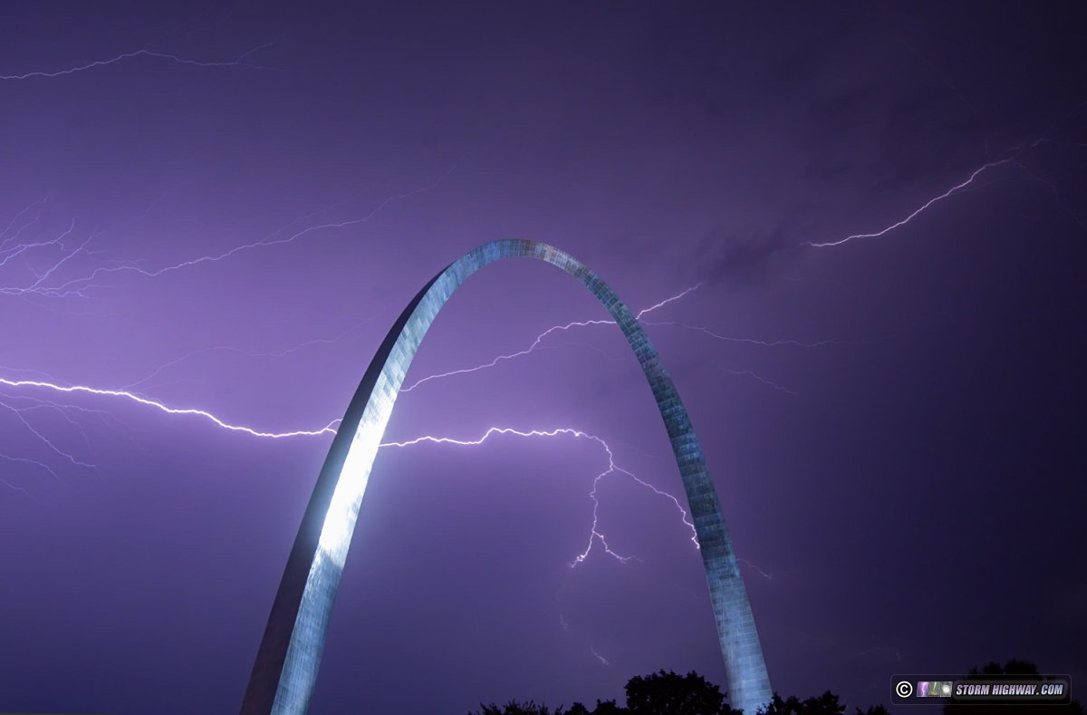
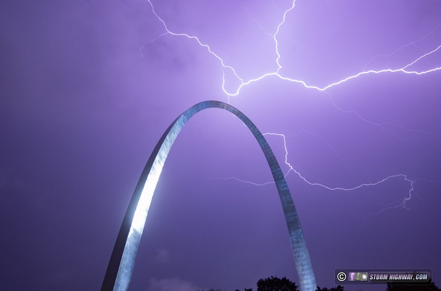
I then headed downtown for the storm to the west, navigating through East St. Louis around the complete I-64 construction closure. I arrived in plenty of time, but this severe-warned storm wasn't producing any visible lightning on its front side. I then moved over to the Missouri side of the river to set up looking east for a second storm passing mostly to the south. This one again had very little in the way of cloud-to-ground activity on its leading side over the city, but the back side lightning in the stratiform region was quite spectacular. I captured these two stills:
After the second storm moved off, a third line had developed and was coming into the city. However, it was only producing a flash of lightning every 3 or 4 minutes or so. The first two rounds had just finished using up the instability in the immediate area, and I figured the third would be marginal and not worth spending another 45 minutes with the cameras out in the rain downtown. I packed up and went home.
My next radar check revealed the third line behind me had started producing more frequent cloud-to-ground bolts right over downtown St. Louis, and lightning data showed a strike directly over the Arch. It's common for Radarscope to plot an in-cloud flash as a ground strike point, so I don't know if it was actually an Arch strike. If it was, it would be quite typical of the Arch lightning strikes I've come to know: mostly happening in storms that seem unfavorable for them and give no indication they're about to produce one. The consolation here is that any strike would have occured in the core of heavy rain, making it difficult or impossible to get a raindrop-free shot.
After arriving home, I went back out to shoot high speed of some of the continuing sky-filling lightning, but the ones that occurred were not interesting enough to save. A fourth line of storms moved through after midnight, with not enough lightning to warrant going back out.
Here's the video from downtown:
August 19: St. Louis upward lightning
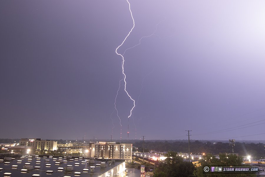
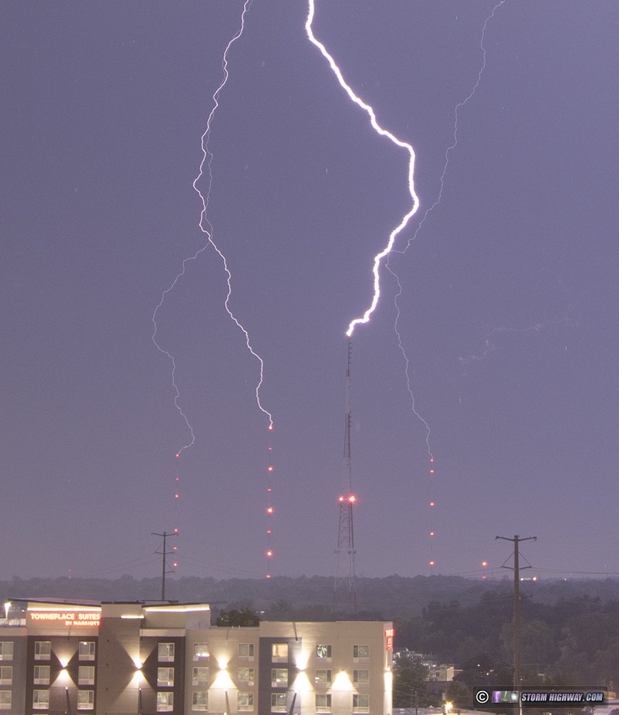
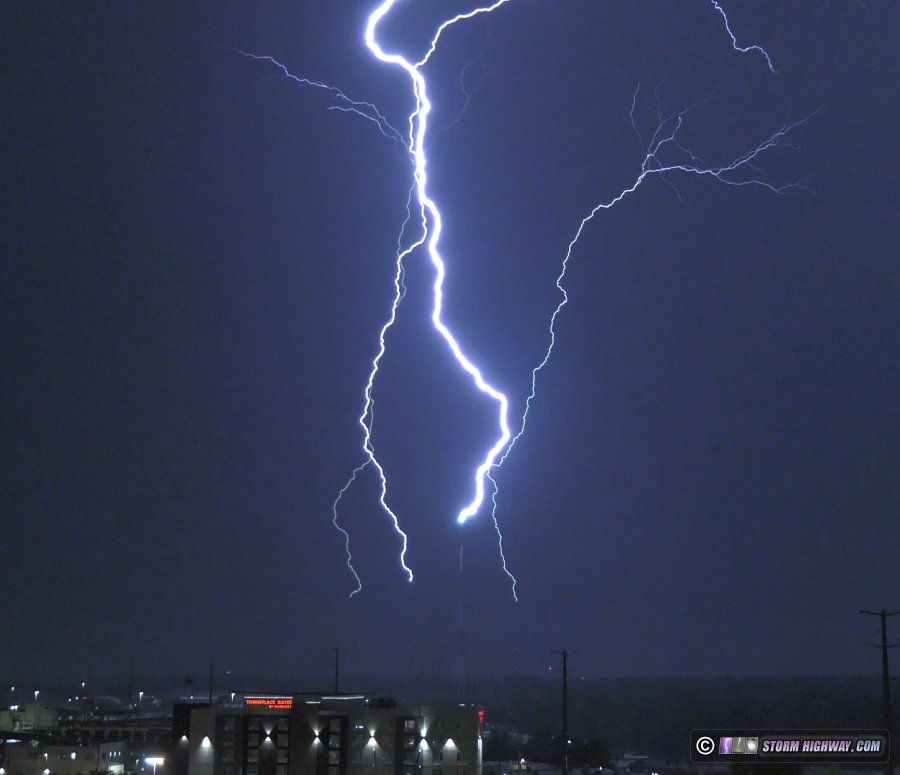
I went out at 3AM to set up for this stratiform region of storms passing to the south of the metro. Two upward flashes occurred to the towers, the first to the more distant towers to the southwest, then this one to all three Shrewsbury towers and the freestanding tower at Hanley and Manchester. The first two images here are the DSLR still (full frame and crop) and the third is the frame from the 4k video camera (I liked this exposure better). This upward flash was triggered by a positive CG just out of frame to the southwest. I captured this at 6,000fps, but the leaders were all single-channel with no return strokes or recoil/dart leaders.
August 20: Distant southern Illinois lightning
Thanks to clouds and precip lingering late into the afternoon, a huge hole in regional instability was centered right over the St. Louis area. This promised to shut us out of any good storm potential this day. Prospects for storms out of the area were not very appealing, so I didn't plan to chase.
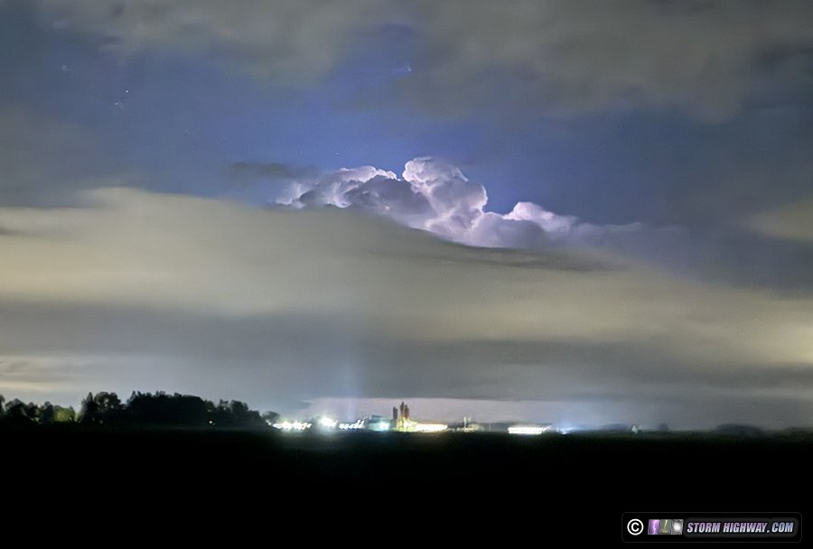
During my late-night bike ride, storms began to be visible flickering to the distant south, followed by new cells going up along I-70 to the north. This is a mid-bike ride cell phone snap of a storm up near Highland, mostly blocked by low clouds:
Toward the end of my ride, skies had cleared out considerably overhead. When I arrived home, satellite showed the anvil cirrus from storms to the east and south was pulling away. An active stratiform region was positioned between Paducah and Evansville, just the right distance away for sprites. It appeared to be the best sprite photography setup I'd had in a long time here.
But when I went out just outside of town to set up for this, perplexing blobs of cirrostratus began developing overhead and to the southeast, eventually completely blocking the view of any sprites.
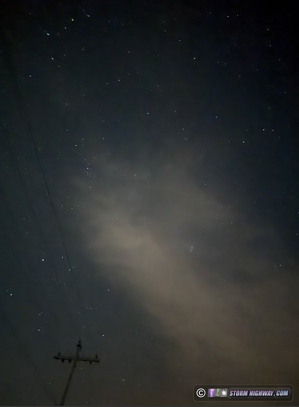
I don't know what these were. They weren't connected in any way to the anvils of the storms and weren't moving in from the west, rather they continually backbuilt overhead. It appeared to be a result of some type of standing wave in the jet. Whatever it was, it was the latest in the Midwest's notorious reputation for finding novel ways to produce sprite-blocking cloud decks.
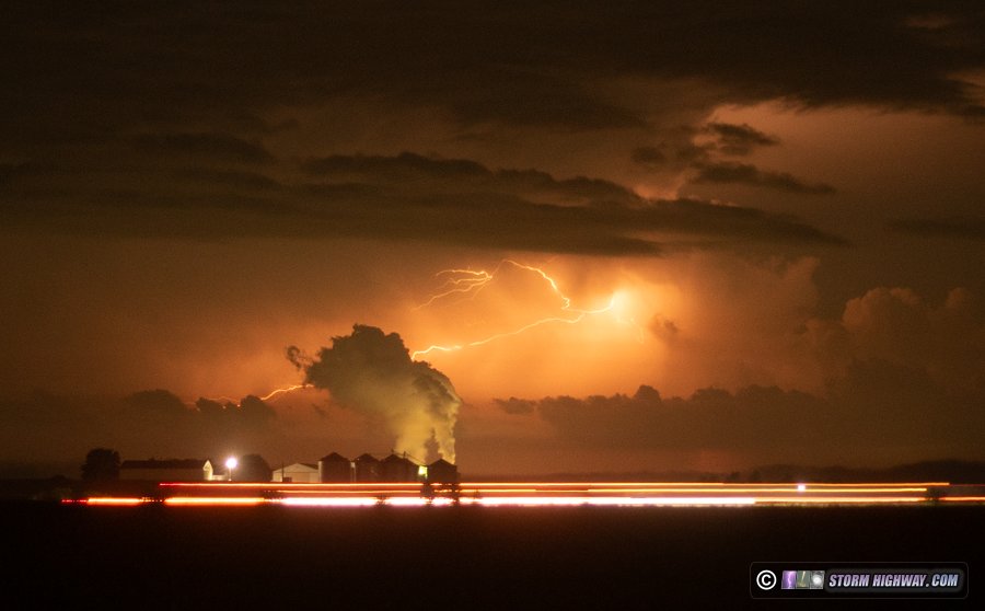
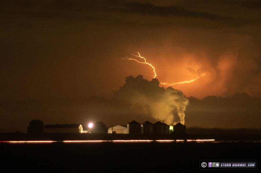
Meanwhile, the storms between Cape Girardeau and Paducah were producing visible bolts despite being 90 miles to the south. I gave up on sprites and turned the camera on these for a few minutes before heading home. The Prairie State power plant's plumes are visible here, with I-64 traffic streaks in the foreground:
August 22: Supercell lightning over Highland, Illinois
This day was an overperformer, with supercells producing a significant-looking tornado up near I-80 and persisting all the way down into the eastern St. Louis metro area. I didn't chase, as I never caught wind of the potential up north and didn't expect the storms to last enough to make it here. After 2AM, I checked radar and was surprised to see the storms were still going strong as they approached I-70.
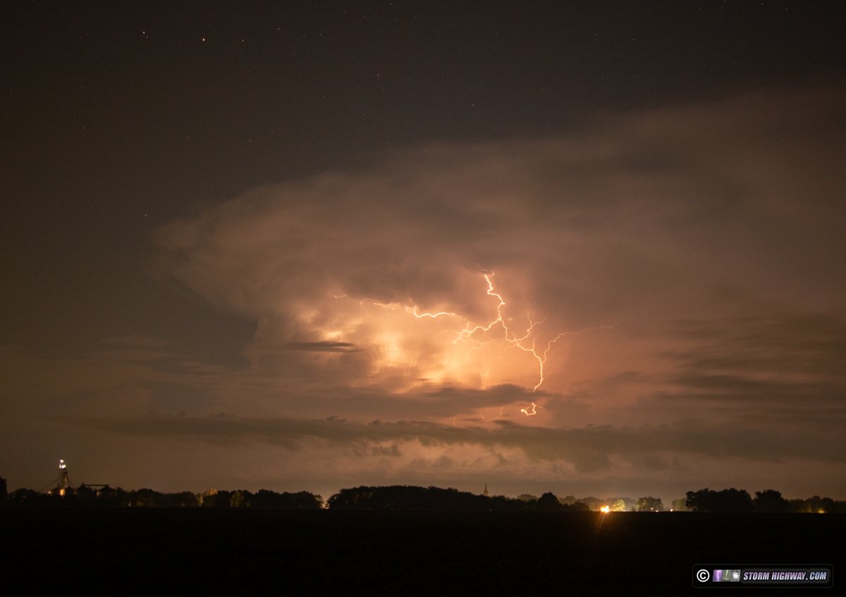
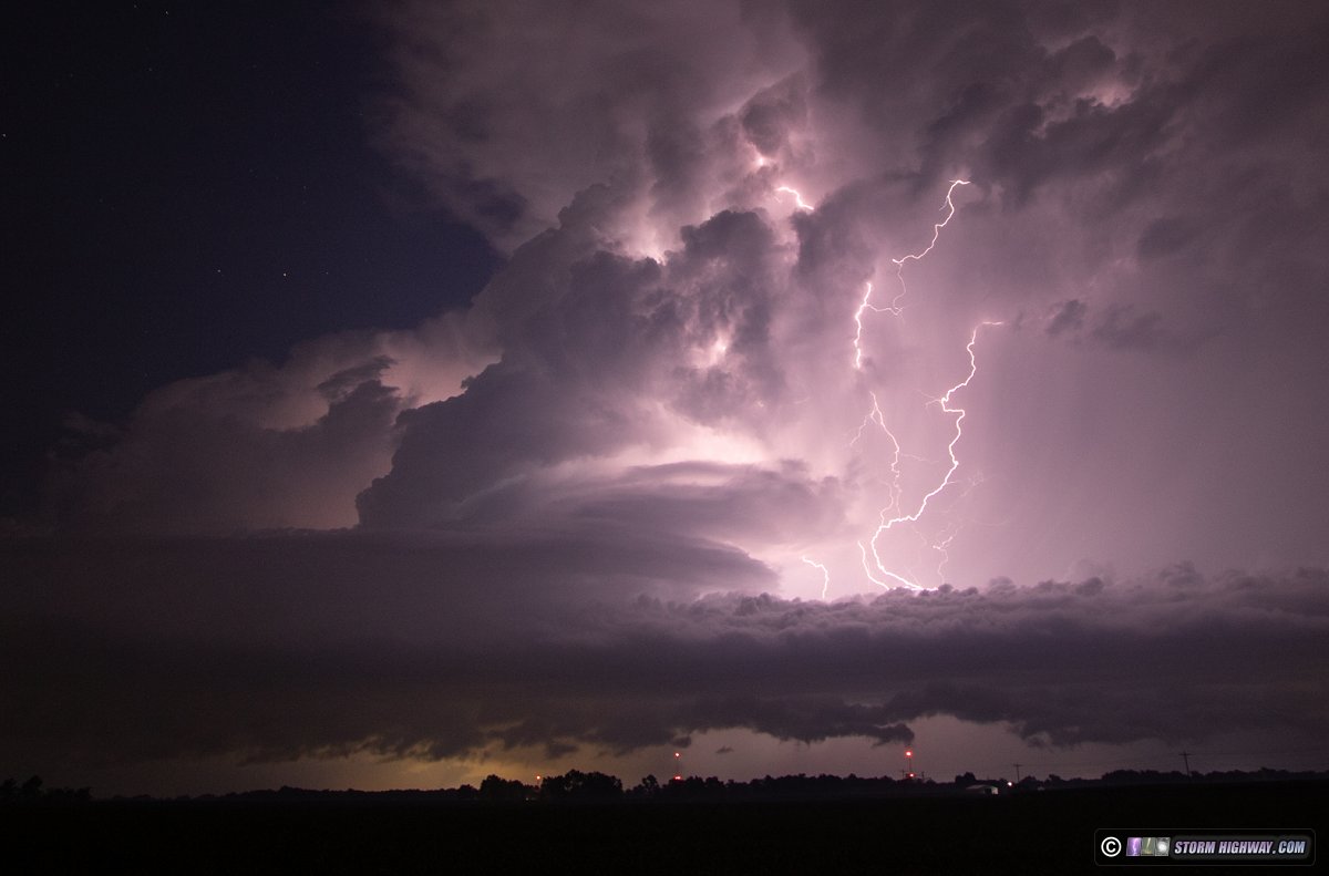
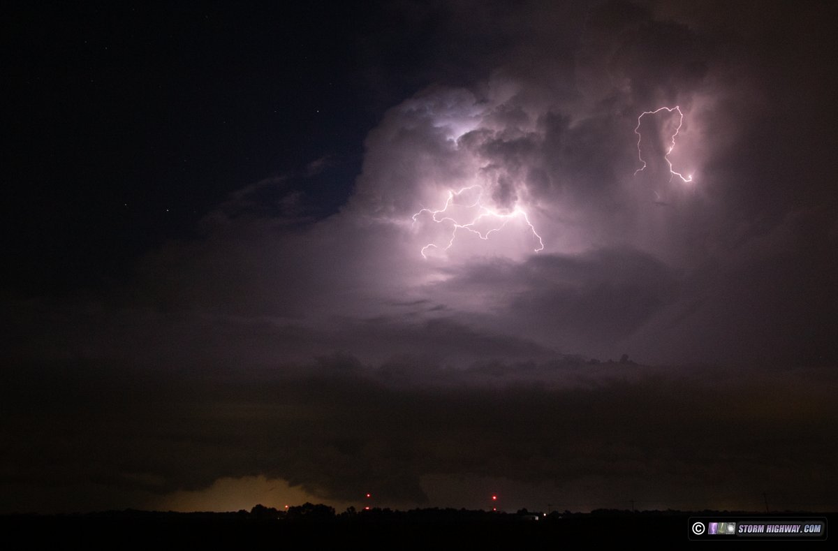
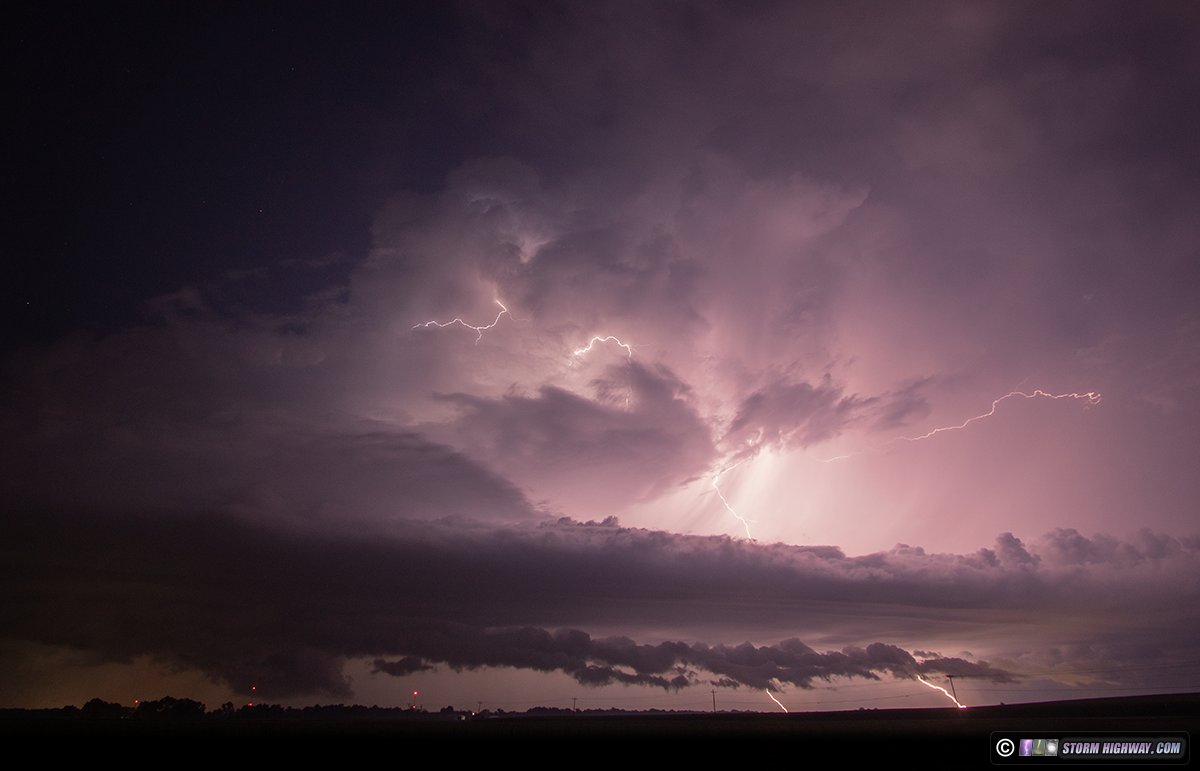
I went just outside of town to take a look, and was further surprised to see nearly continuous lightning flickering in the cumulonimbus of the supercell that had maintained itself as it approached I-70. There were visible-channel intracloud flashes in the main updraft every 2 to 3 seconds, along with tiny "anvil zits" near the top of the cumulonimbus (which I've only seen before with intense supercells in the Plains). These are a few of the frames captured as the storm moved over Highland and passed just to my east between 2:30AM and 3:30AM. The storm produced 2-inch hail during this interval:
August 26: Distant lightning from New Baden, Illinois
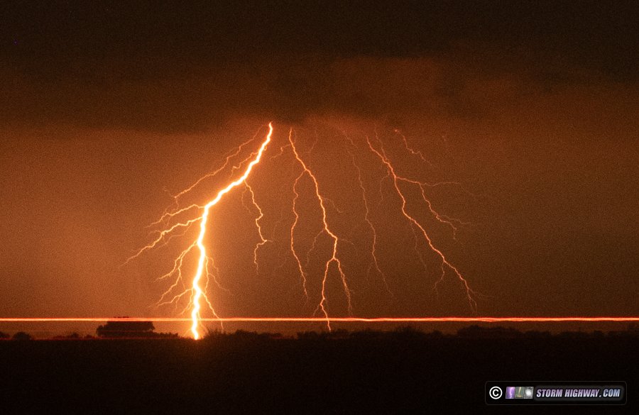
Models had completely flipped on storms this night. Tuesday evening's runs showed a strong overnight thunderstorm complex in southeastern Missouri, but newer runs diminished this potential - eventually showing virtually zero precipitation in these areas. It turned out the earlier runs were correct. Lightning was visible from the storms 70 miles to our south. These bolts were near Farmington, Missouri, about 60 miles southwest of my vantage point in New Baden, Illinois with the 50mm lens.
< May-June 2026 Recap | All Storm Chase Logs | September-December 2026 Recap >
GO: Home | Storm Chase Logs | Photography | Extreme Weather Library | Stock Footage | Blog
Featured Weather Library Article:
|











 Ipods & lightning