
|
||||||||||||||||||||||||||||||||||||
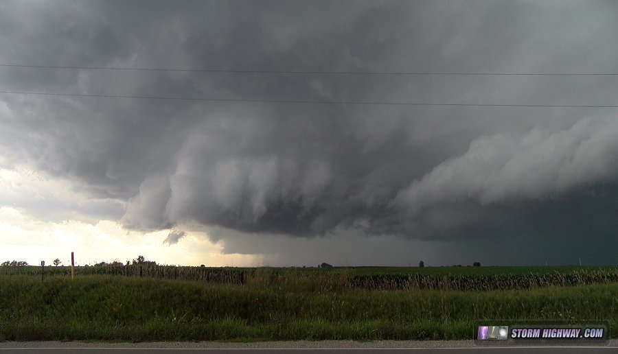
Thursday's setup (the 19th) originally featured a respectable supercell/tornado threat in the St. Louis metro with flow aloft from a very unusual July upper-level trough, a warm front and strong instability from Iowa down through southern Missouri. The sweet spot looked to be near the surface low in Iowa where a wedge of strong instability would make its way up closer to the low. This would have been an obvious reason to leave early in the day to head up to Iowa, but with the threat existing the St. Louis metro, I did not initially plan for it (I always choose a local target if it exists than one hours away). As the day arrived on Thursday, it was apparent the St. Louis regional play was completely hosed. A decaying MCS (storm complex) was moving east toward the metro, spreading thick clouds that would prevent destabilization in the afternoon. With the local storm chasing target decimated, I began heading up to Iowa after noon. Models had indicated that convection would hold off until around 5pm up there, so even though I'd likely be 30-45 minutes late, I felt I'd have enough time for a storm to mature before tornadoes began. Instead, at 2pm, a storm developed right in the target at Des Moines, and tornado reports began flooding in almost immediately. I wasn't even at Hannibal yet, still more than three hours away. In retrospect I should have just turned around and went home, but I felt that the storm might track along the front well into the evening hours, giving me a chance to see something. I arrived on the storm west of Fairfield, Iowa at around 6PM, and visually it was obvious that the storm was finished with tornadoes. Outflow dominant with nothing feeding into the storm from the surface, this once-prolific tornado machine was never going to recover as it bowed out into a straight-line wind producer:
 I abandoned the storm and dropped south to a new isolated cell going up at Memphis, Missouri, witnessing a couple of small but intense gustnadoes on the way (video here). The Memphis storm had a great look initially - a large, strong updraft base with RFD punching in, and a lowering along the RFD with wild motion that suggested it was about 10 to 15 minutes away from a tornado.
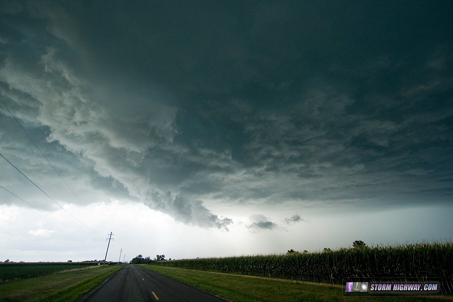 The RFD carved out this occlusion that looked like one you'd see with tornado in progress, but motion underneath was weak:
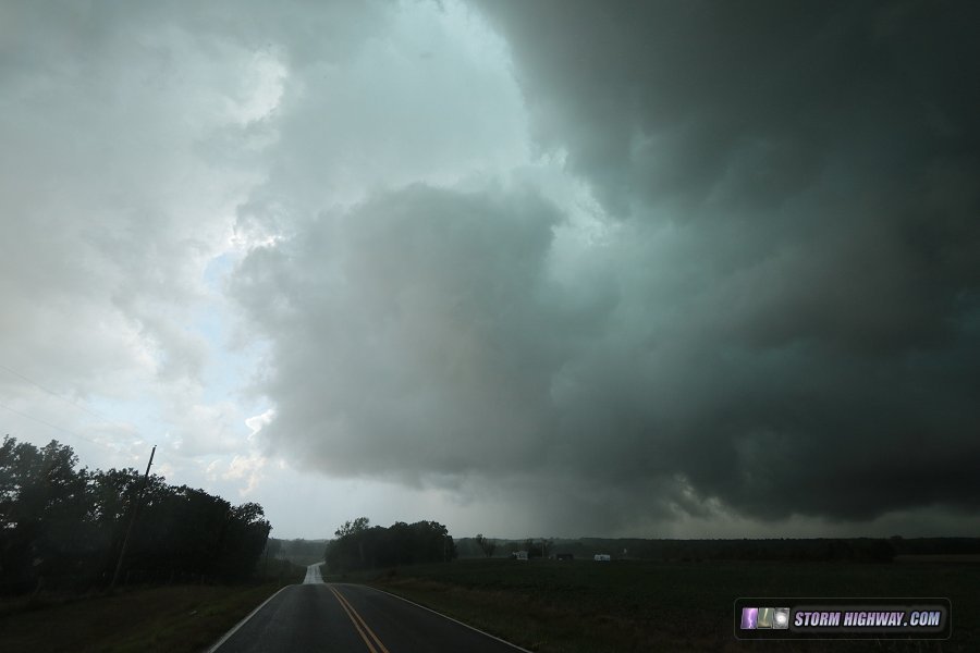 Soon after this, the outflow from the original storm to the north began undercutting the new updraft, turning the entire thing into one solid gust front ahead of both storms.
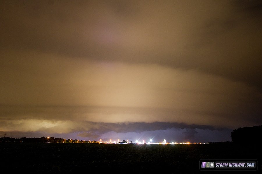
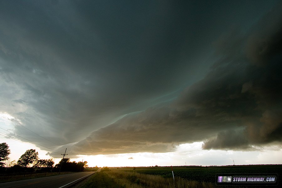 The movement of the storms initially looked like they might head toward St. Louis, so I turned my attention to getting back home ahead of them. The now-linear complex eventually turned more easterly, barely grazing Troy, Illinois northeast of St. Louis. I set up a brief timelapse here as the gust front arrived with northerly winds, then surface winds turned 180 degrees back north - something I'd never witnessed before.
 Video of this is included here.
GO: Home | Storm Chase Logs | Photography | Extreme Weather Library | Stock Footage | Blog
Featured Weather Library Article:
|
||||||||||||||||||||||||||||||||||||


Web Site Design and Internet Marketing by CIS Internet