|
Home | Blog Index | Blog Archives | Christianity & Faith Essays | Storm Chasing Essays
2018 Great Plains season: Final chase accounts and Epilogue
It's a wrap - the annual summer ridge of high pressure has arrived in the central US, which means the 2018 Great Plains tornado chasing season has come to a close. This was one of the more difficult seasons in storm chasing history. Tornadoes were very hard to come by, especially when it came to classic events that produced good results. Nearly all of the season's best tornadoes were unconventional in one way or another, happening outside of the classic Great Plains region or in secondary target regions.
Despite all that, I don't think this season was as bad as it could have been. Unlike a 2006-style season, storms and supercells were plentiful on the Plains this spring. The May 28 landspout event was rare in its own right, and was at least not a complete "sleeper" that none of us could have seen coming fast enough to get there. I am very thankful and happy to come away from this challenging season with 7 tornadoes, including a couple of memorable photogenic ones.
Below is a list of chases during my season's three chases to the Plains. Each linked item leads to a final account page for that day, with lots of photos, videos, GPS tracks and details about the day's chase.
As always, your readership during this season was greatly appreciated! Until next spring, stay tuned for summertime storms in the Midwest and other sky shows the atmosphere throws our way.
Marginal supercells from Clinton, Oklahoma southeast to Chickasha, with a short stop in Oklahoma City for an attempt at upward lightning photos.
  Day 2 - May 3: Claremore, OK to St. Louis Day 2 - May 3: Claremore, OK to St. Louis
Travel day back to St. Louis from Oklahoma.
Severe storms quickly go linear on southeast Kansas and head across Missouri.
 Travel day from St. Louis to central Kansas, with sunset storms on the way.
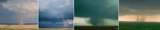
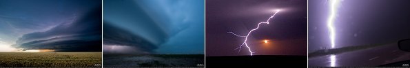
 The best day of the season, with multiple photogenic tornadoes in eastern Colorado.
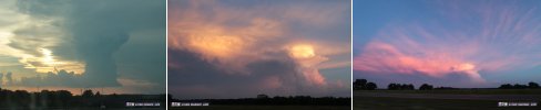
 An HP supercell in northwestern Oklahoma produces one short-lived tornado plus some nice sunset lightning.
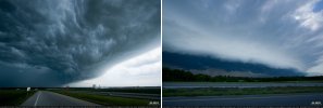
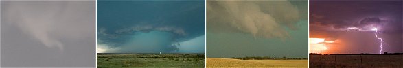 Severe storms produce great structure and close lightning from the Texas Panhandle through western Oklahoma.
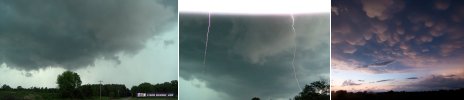
 Supercells in southeastern Missouri produce close lightning.
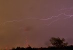
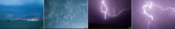
 Linear severe storms in Nebraska produce a visible QLCS tornado at Ord, and later a show of upward lightning near Lincoln.
 Day 10 - June 2: Nebraska City, NE to St. Louis
The final travel day of trip #3 from Nebraska to St. Louis, and the last of my Great Plains storm season.
GO: Home | Storm Chase Logs | Photography | Extreme Weather Library | Stock Footage | Blog
Featured Weather Library Article:
|


