
|
||||||||||||||||||||||||||||||||||||
4K VIDEO: Close lightning strike near Winona, MO WINONA, MO - Thursday, May 31 was the fourth storm chase day of my third Great Plains trip for 2018, and overall Day 8 since the start of the season. Models had indicated supercell and tornado potential in the St. Louis metro on this day, Thursday the 31st. Therefore, my intention was to basically follow storms on my way home. There was a potential setup in Nebraska the following day, but I initially was not impressed enough with it to go back. Because I was storm chasing in the Texas panhandle the previous evening, that meant a very short night's sleep at the hotel in Claremore, Oklahoma. I arrived at the hotel at 3:30AM, and had to wake up at 8:30 to get back on the road to make it into St. Louis before storm time. However, as I drove east toward home across Missouri and periodically stopped to do my data checks, I could see that due to a morning complex of storms and midday clouds, the St. Louis metro was essentially out of play for tornadoes. The tornado threat instead was becoming more focused in southern Missouri along the remnant outflow from the same storm complex, where skies were also clear and southerly surface winds afforded a better low-level wind profile. GPS LOG: May 31, 2018 trip path I diverted from the trip home at Rolla, heading south on US 63 to meet the lead cells in a group of several storms east of Springfield. The challenge in this area is the rugged terrain of the Ozarks, closely resembling some parts of West Virginia: mostly forested terrain with very few roads with usable views for storms. I made it ahead of this cluster on US 60 at Mountain View, where the lead updraft slowly became dominant. This storm was thankfully tracking along the highway. At Winona, the storm began intensifying with scud being pulled upward into the updraft at a rapid pace, all while fighting off outflow from the forward flank. Finally the storm began pulling in inflow from the surface, rotation increased and it appeared to be minutes away from producing a tornado.
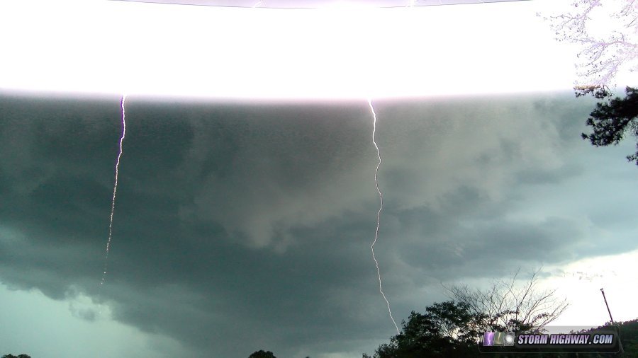
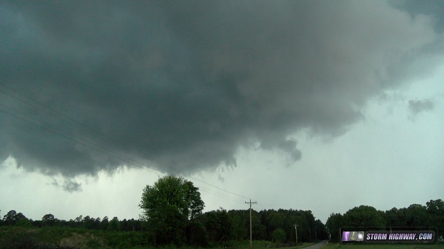 While standing outside filming a slowly rotating lowering east of Winona, a two-channel cloud-to-ground lightning strike hit with one channel less than 50 yards away - with instant thunder (video from this is here).
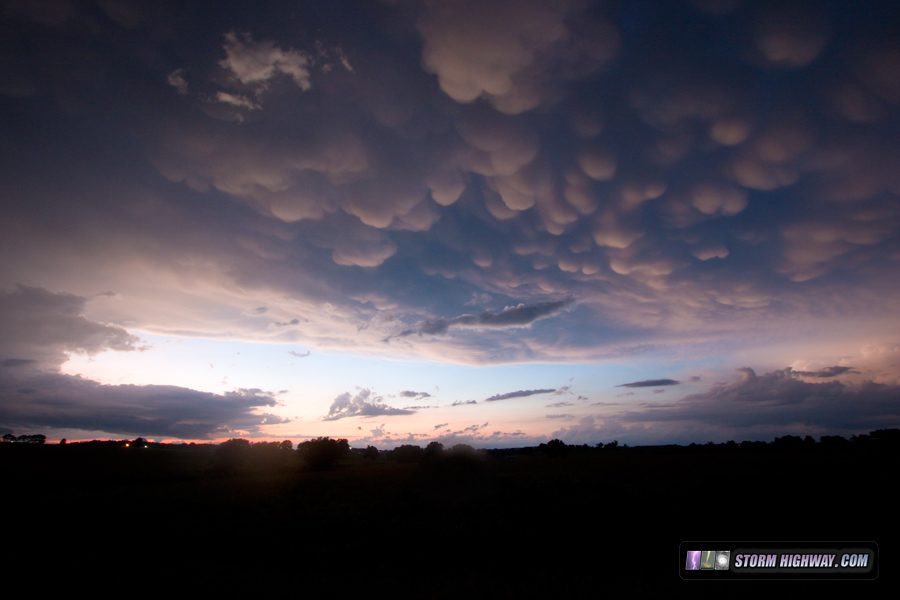
 After this, the storm's precip core was overtaking US 60, and I was forced to take a heavily-forested road 27 miles to US 160 to stay south of the storm. During this time I lost visual of the storm, and when I finally caught back up to it at Poplar Bluff, it had completely dissipated. Meanwhile, a new storm just to my northeast along the Mississippi River near Cape Girardeau produced a very photogenic tornado as it crossed into Illinois. That storm was moving into an area of backed winds into a barely-recovered air mass after the morning storms, something I did not see happening. At Poplar Bluff, I reviewed the latest data on the Nebraska setup for the next day (June 1), and decided it looked good enough to return to the Plains. I drove back west on US 60 to Springfield, then north to Clinton, Missouri for the night. On the way, I drove through a few transient supercells that were essentially unchaseable due to the lack of good roads. One had some high-contrast mammatus near Mountain Grove:
 I arrived at my hotel in Clinton just before midnight. NEXT PLAINS CHASE: Day 9: Severe storms and tornado at Ord, Nebraska >
GO: Home | Storm Chase Logs | Photography | Extreme Weather Library | Stock Footage | Blog
Featured Weather Library Article:
|
||||||||||||||||||||||||||||||||||||


Web Site Design and Internet Marketing by CIS Internet