
|
||||||||||||||||||||||||||||||||||||
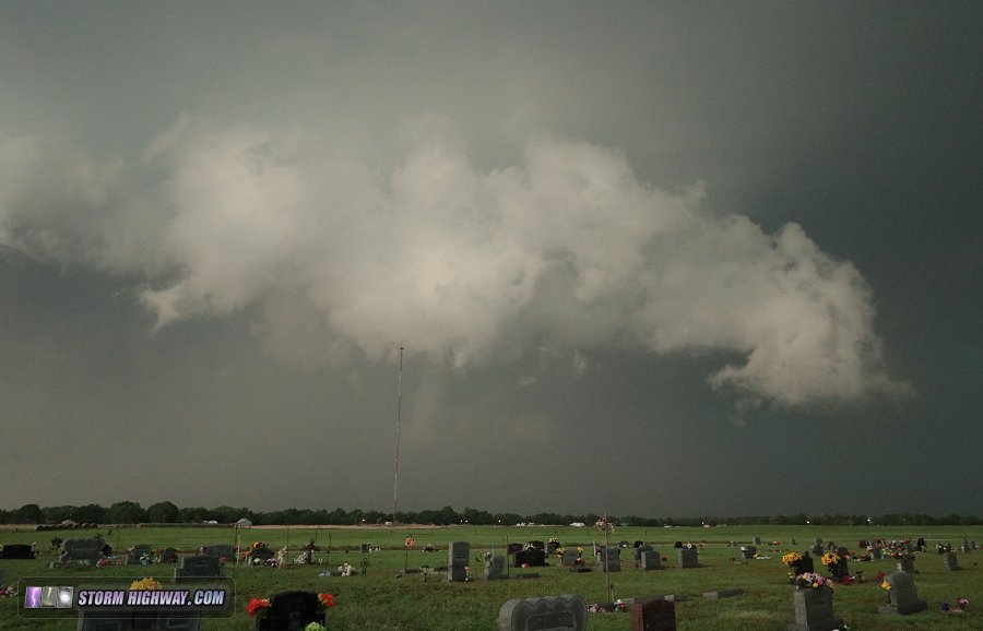
4K Video: 4-way dashcam timelapse of the chase WAYNOKA, OK - Tuesday, May 29 was the second storm chase day of my third Great Plains trip for 2018, and overall Day 6 since the start of the season. I started the day in Colby, Kansas. The relatively clear-cut target was an outflow boundary from overnight convection located down in northwestern Oklahoma, about 4 hours' drive to the south. GPS LOG: May 29, 2018 trip path I was on the first updrafts of a supercell that developed on the boundary near Buffalo, Oklahoma by late afternoon. Right off the bat, a challenge was present: the Cimarron River meandered just ahead of the storm and along its track, and only two river crossings were available - both a good distance away. As the storm began wrapping up and turning right with the first big RFD cycle, I was only able to chase it for about 20 minutes before the river would cut off the ability to keep up with the storm. At this stage, rotation increased and several well-defined funnels developed.
 Immediately after this, the RFD precip wrapped around the circulation, blocking it from view as the storm moved east of the avaialbe road network west of the river. From here, the only option was to continue south about 12 miles to the river crossing, then another 10-12 miles back north to re-intercept the storm (of course, hoping it would not do something interesting during that time). During the river crossing maneuver, the RFD precip area enlarged, turning the storm fully HP. I drove up into the notch at Lookout, finding a low tail cloud rapidly feeding into the updraft, but nothing imminently tornadic.
 After this, I bailed south to avoid the RFD precip rapidly encroaching the road. At this stage, the storm was a huge HP blob with not much in the way of an imminent tornado threat, at least not one that would be photogenic or even easily viewable. So, I chose to get far ahead at Freedom for a wider view. A couplet on radar indicated the possibility of something deep inside the rain, but I could not see it from this eastern vantage point and had no desire to venture into the core.
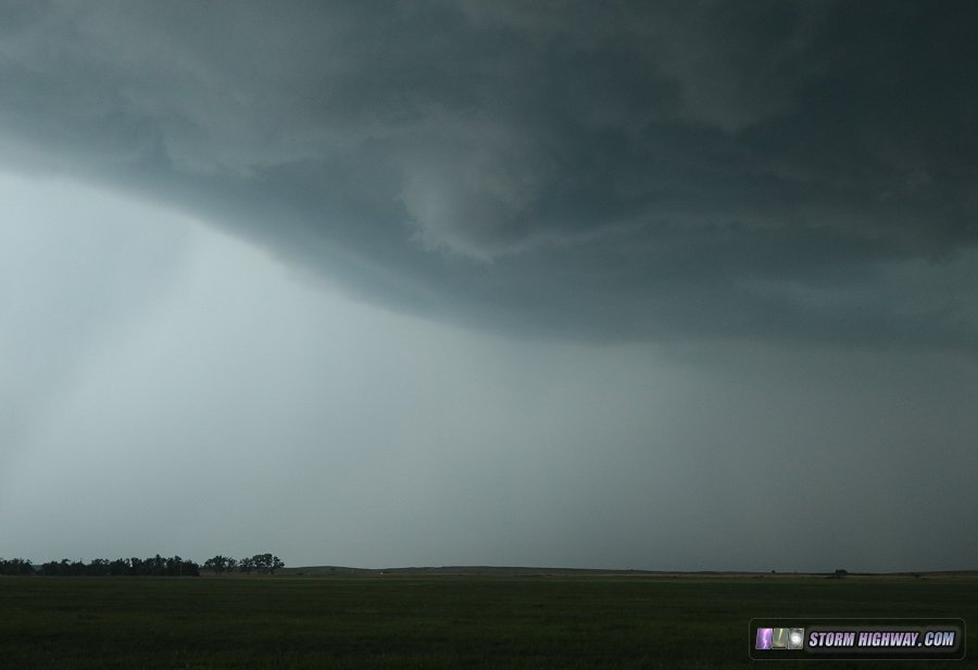
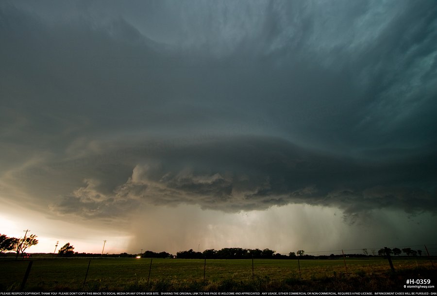
 click to view full screen From here, I stayed just ahead of the storm to Waynoka, where its visual appearance and surface inflow increased dramatically, with several areas of rotation threatening to produce.
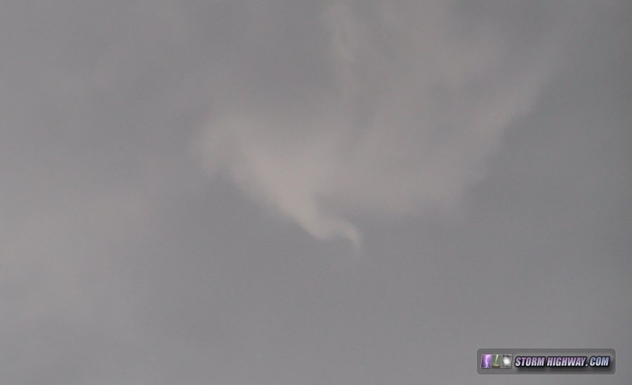
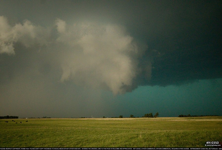 click to view full screen Finally, the northernmost one sent a narrow rope funnel to the ground that only lasted a few seconds. I could not get the camera on it in time, and it was too thin to show up well on the dashcams:
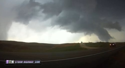
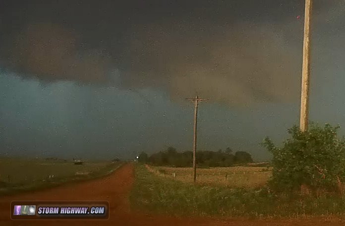 Other storm chasers nearby captured better imagery of this feature. This same area produced several funnels before being undercut by outflow:
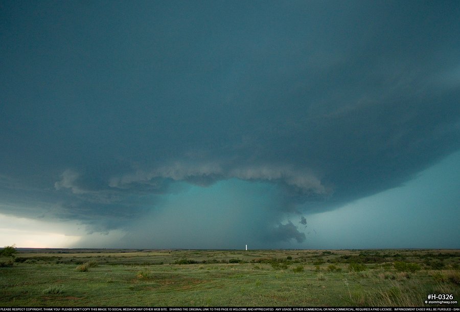
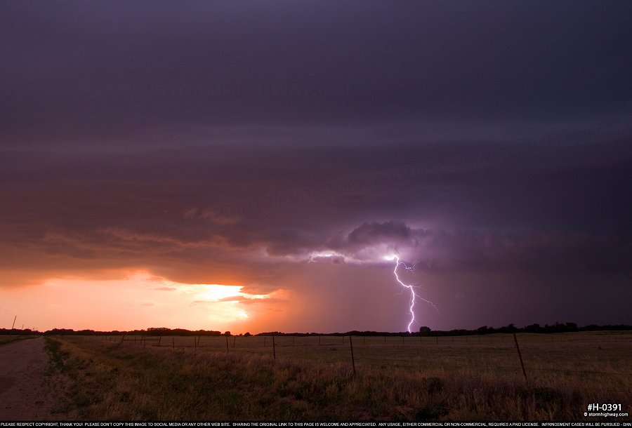
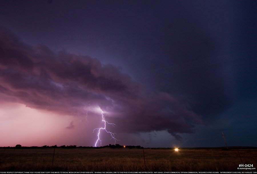
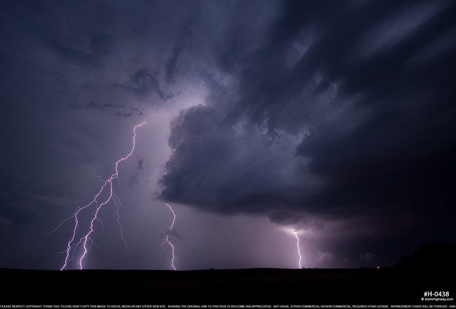
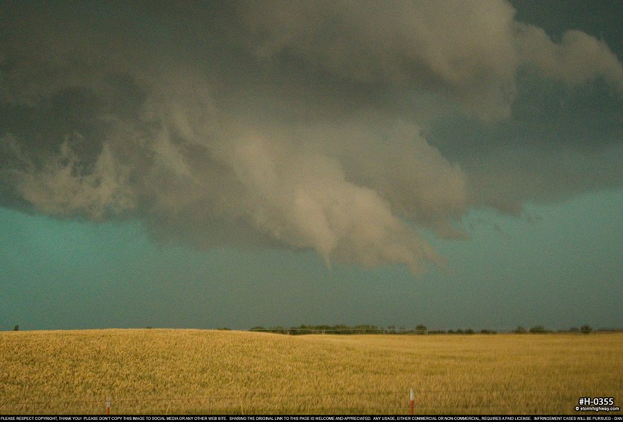 click to view full screen After this brief intensification phase, the storm became outflow dominant and remained this way for the remainder of its life as it tracked east toward Enid:
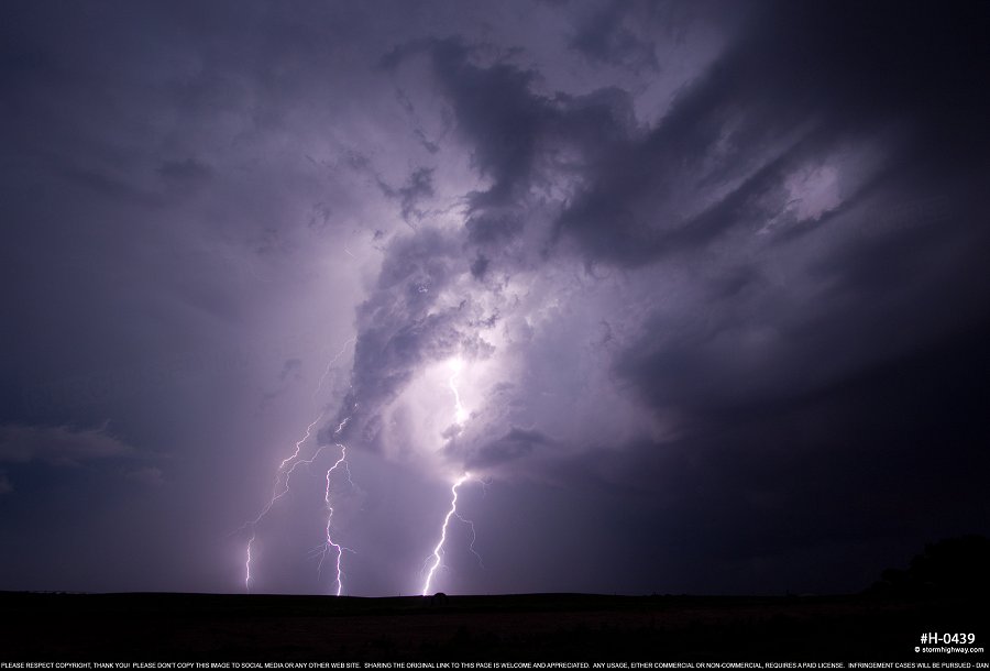
 click to view full screen It did provide some sunset lightning and storm structure opportunities during this time:
 click to view full screen
 click to view full screen
 click to view full screen
 click to view full screen I booked a hotel in Enid and arrived shortly thereafter to end the day. NEXT PLAINS CHASE: Day 7: Texas Panhandle & Oklahoma severe storms, close lightning >
GO: Home | Storm Chase Logs | Photography | Extreme Weather Library | Stock Footage | Blog
Featured Weather Library Article:
|
||||||||||||||||||||||||||||||||||||


Web Site Design and Internet Marketing by CIS Internet