
|
||||||||||||||||||||||||||||||||||||||
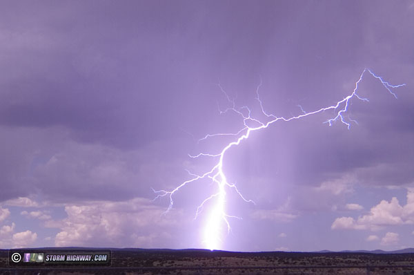
VIDEO: Magnitude 4.5 earthquake in Ridgecrest I embarked on my first earthquake chase in Ridgecrest, California from July 14-22. The trip was amazing, with not only some spectacular fault surface rupture sights and photo opportunities, but my first earthquake experience: a magnitude 4.5 quake on Tuesday the 16th! I have been waiting for a worthy event to make my first trip to chase and capture an earthquake. The magnitude 6.4 Ridgecrest, California quake on July 4 met that criteria, but I had just arrived at the beginning of a family event in Pennsylvania that is important to me, so a trip across the country would have to wait. Thus, I missed the magnitude 7.1 event that followed along with countless big aftershocks. My earthquake trip was delayed further by the air conditioner compressor bearing on my car going bad, requiring another 2-day delay for the repairs. Finally, on Sunday the 14th, I was on the road west. My plan for an earthquake chase has been to immediately jump on a plane the same day a major quake strikes, putting me in position for the biggest aftershocks and possibly another major quake in the sequence. Since I had missed that opportunity with this event, I decided to drive. You can't take rental cars off of paved highways without voiding the insurance, and an earthquake trip requires lots of miles on rough dirt and gravel roads to visit the best surface rupture sites. That makes the flying option problematic. With my car, I can not only go wherever I want, but I can take all of my gear with me as well as have all of my normal pre-installed vehicle equipment like my dashcams, laptop mount, power circuits and more. The only drawback with driving is that it's a 26-hour trip from St. Louis, a drive that must be done over the course of two days. Since I'd missed the heart of the aftershocks of the Ridgecrest event, there was not the urgency needed to fly at that point. So, the first day of the journey was the 13 hour leg from St. Louis to Tucumcari, New Mexico on Sunday, with the rest of the drive to Ridgecrest on Monday the 15th. I encountered my first monsoon thunderstorms near Grants, NM on this second day, I stopping for 20 minutes to capture a single strike:
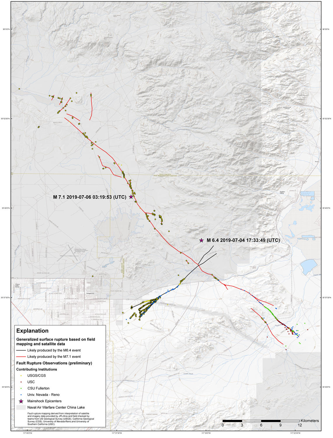
 Once I arrived at my hotel in the Ridgecrest area, I immediately set up two static cameras in my room that record 24/7 - aiming them at two water bottles on a table and a coat rack with hangers, items that would readily show various types of seismic shaking. Monday morning, I made my way over to the surface rupture trace of the magnitude 7.1 event that occurred on the 5th. Thanks to the arid desert climate here, the rupture features were still pristine - aside from some footprints and the main highway break on Route 178 already paved over. Unfortunately, most of the surface rupture trace, including the biggest offsets of 6 feet, is inside the Naval Air Weapons China Lake military base and therefore inaccessible to the public. I was, however, able to cover the most dramatic publicly-accessible surface rupture right up to the fenceline of the base. This USGS map shows the surface rupture trace from both the M 6.4 and M 7.1 events. I focused on the southern section of the M 7.1 trace, the only part outside of the China Lake military base.
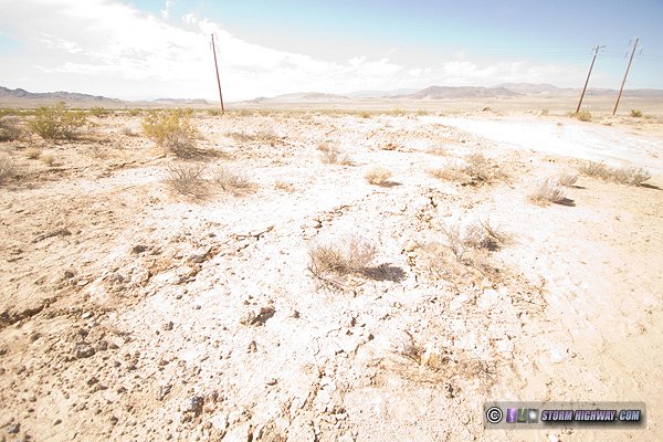
 Ridgecrest and the surrounding area is all arid desert country. With it being midsummer, temperatures stay well over 100°F for most of the day. This limited my outdoor time and kept me either in my car or at the hotel for most of the daytime hours. Magnitude 4.5 quake on July 16I spent the most time outside on my first day, which had me in position right on the fault trace during a M 4.5 earthquake at 1:15pm on Tuesday, which I experienced from inside my car. This was my first earthquake, ever. It felt like three large gusts of wind rocking the car from back to front. I jumped out to see if I could feel anything while standing on the ground, but it was over in just three seconds.
With that, the "earthquake chase" was a success! Magnitude 2.9 quake on July 19I spent the days following between the hotel and the area above the southernmost cluster of aftershocks, hoping for one that I can feel either standing on the ground or sitting at my hotel. Most of my "outside on the fault" time was in the evenings after sunset with this setup:
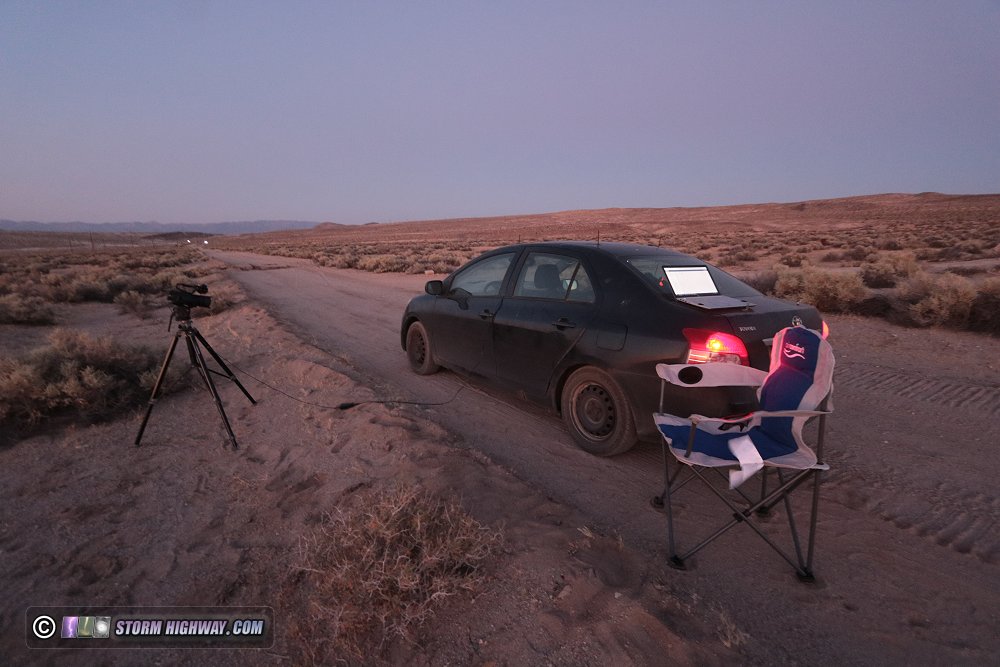 The goal was simply to get a few earthquakes as close as possible (while standing or sitting in a chair right on the ground surface). I spent about 4 hours per evening here from around 8PM to 12AM PDT. Only once did an earthquake occur during this time frame, on the 19th - my last night there. It was a magnitude 2.9 quake centered about a mile away. I did not feel any shaking, but there was a clearly-audible roar coming from the direction of the quake. It was a low-frequency heavy-bass sound that was very close in character to the roar produced by the violent EF4 Solomon, Kansas tornado - simply incredible! Earthquakes captured by the hotel camerasThere were a couple dozen magnitude 3 events and many more M 2s during my stay in Ridgecrest. I did not feel any of these, and only the M 2.9 on the 19th did I hear a sound. An M 4.6 on the 17th occurred while I was driving to my hotel, as well as another magnitude 4.4 that also occured while I was driving - both of which I missed experiencing. This was not unexpected, and I'd planned for it with two "earthquake cameras" I set up in my hotel room to capture detectable shaking from any quakes that happened while I was there. Camera #1 recorded two water bottles on a table, items that would readily show higher-frequency seismic shaking. Camera #2 was pointed at coat hangers on a rack, objects which would show lower-frequency shaking.The hotel cameras captured six visually detectable earthquakes during my stay, listed here in order of magnitude with epicenter distance and hypocenter depth. The links on each go to the USGS online record for the quake.
I put together this compilation video showing these events. You can see how the distance to the quake and its depth in part determines how strong the shaking will be at any given location. The M 4.6, for example, had much weaker shaking than the M 4.5 due to being more than twice the distance away. Rupture orientation also affects shaking intensity at a given location, as the strongest seismic waves will propagate in the direction of slip on the fault.
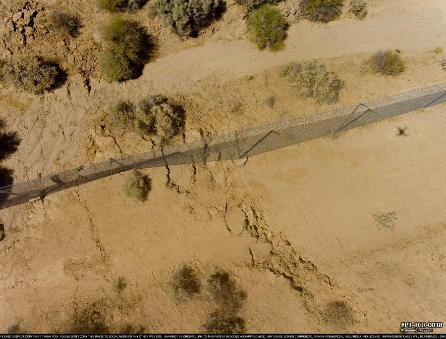
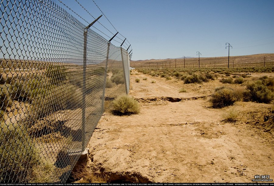
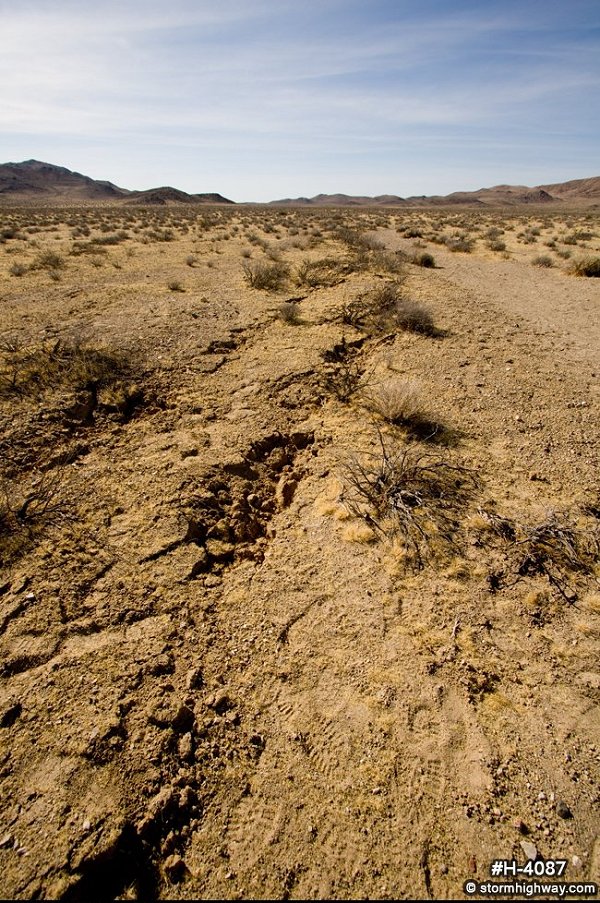
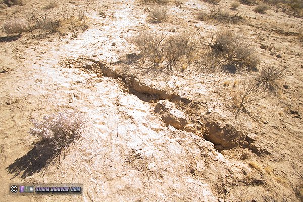
Magnitude 7.1 event surface rupture photos(click on any image to view in full screen)Most of my time was spent photographing the M 7.1 event surface rupture. Again, the biggest offsets from this event were inside of the China Lake military base and therefore inaccessible, but there was plenty to see in the segments to the south. FULL GALLERY: Ridgecrest Earthquake Surface Rupture Photo Gallery My favorite image of the trip is this drone shot of the M 7.1 surface rupture crossing the chain-link fence along Route 178 east of Ridgecrest. There is nearly 3 feet of horizontal (right-lateral) offset and about 8 to 10 inches of vertical on either side of the fault, shifting and bending the fence in dramatic fashion. The clearly-visible broken ground along the fault extends in both directions for miles, with many cracks, scarps and most dramatially, offsets wherever it crosses a dirt road, dry creek bed or offroad tire tracks.
 Ground-level view of the fence:
 Low-angle close-up:
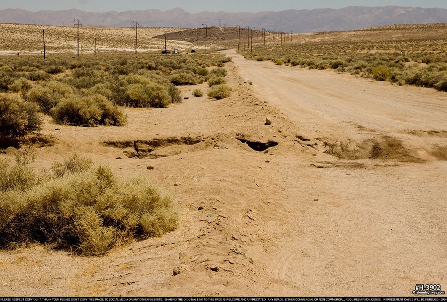
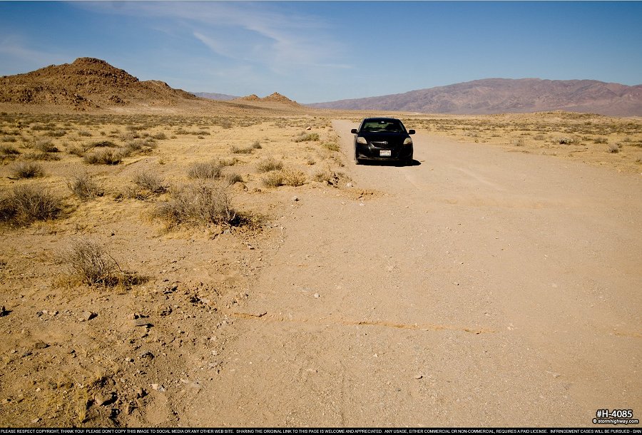
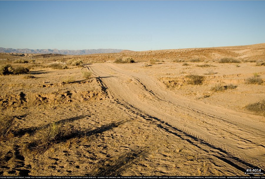
 This dirt road experienced an offset of three feet horizontally and over a foot vertically, creating a precipitous drop that surprises drivers (including me!).
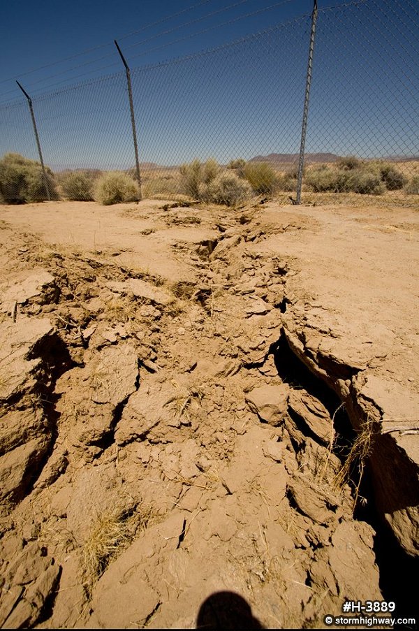
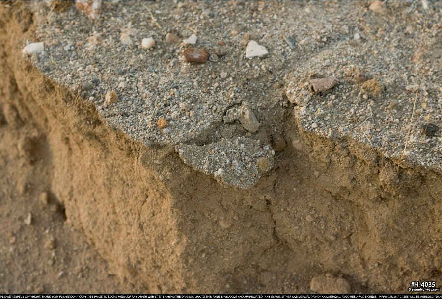
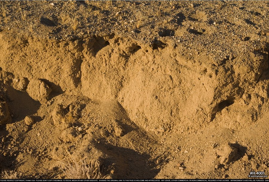
 One to two-foot high scarps like this are a common sight along the surface rupture trace:
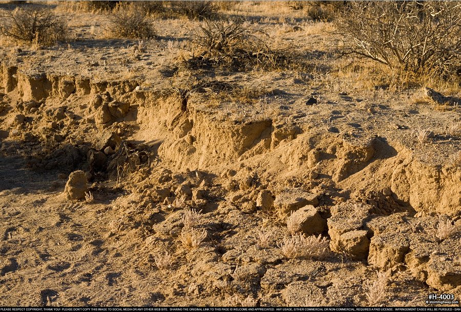 In some places, the ground fractures are more complex, with two or three scarps:
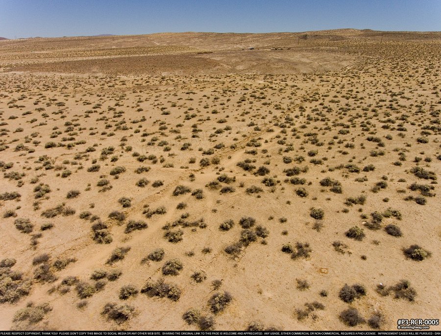
 Drone shot showing the surface rupture trace through the desert:
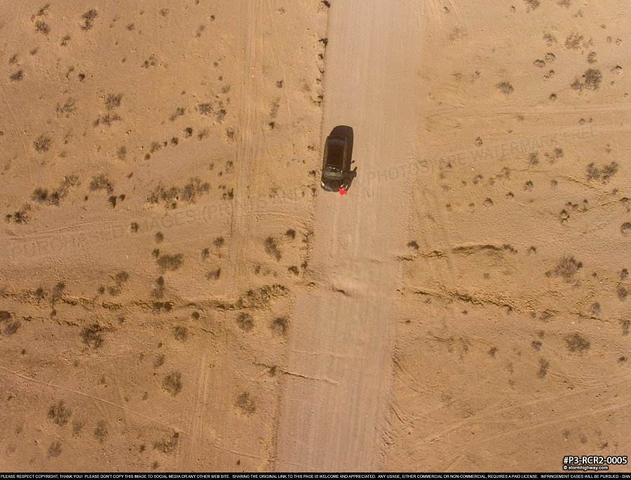
 Another dirt road offset of nearly 3 feet horizonally near Trona Pinnacles:
 Drone aerial view of the above:
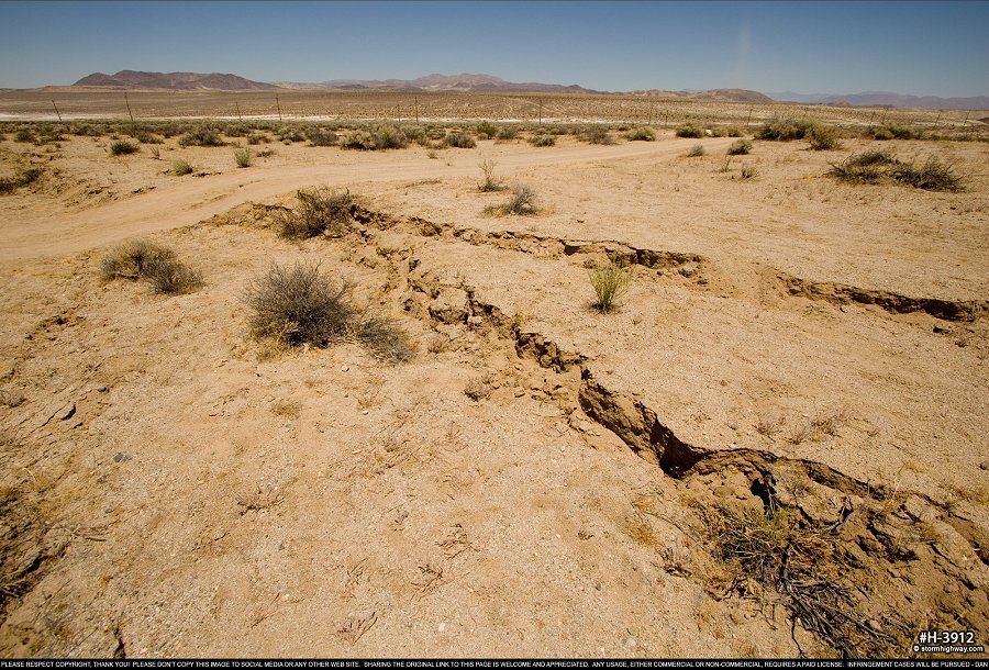
 Close-up of the fault scarp near Route 178:
 More shots of the surface rupture across the desert floor:
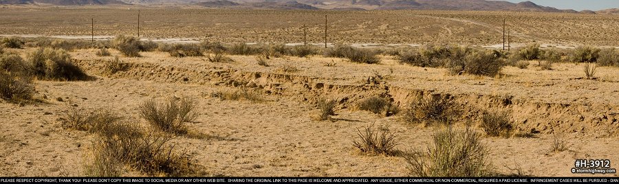
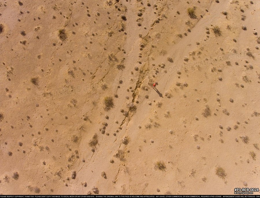
 Near Trona Pinnacles, the rupture went from a continuous path to an "echelon fracture" pattern as viewed in this drone aerial:
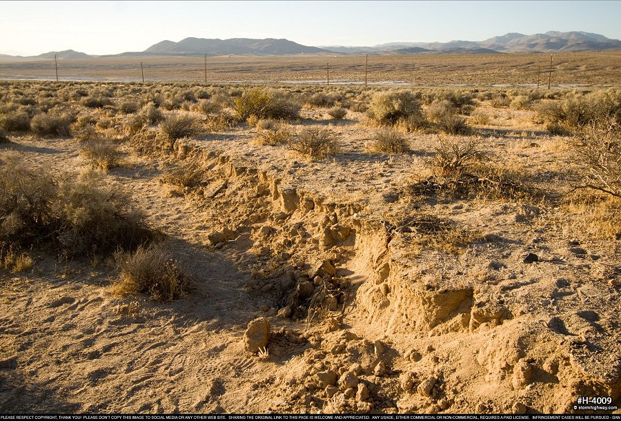
 This dirt road was originally level here. The fault surface rupture created a two-foot drop. Heavy traffic here from researchers and sightseers since the earthquake has already erased the horizontal offset visual, but the vertical movement across the fault is still dramatic.
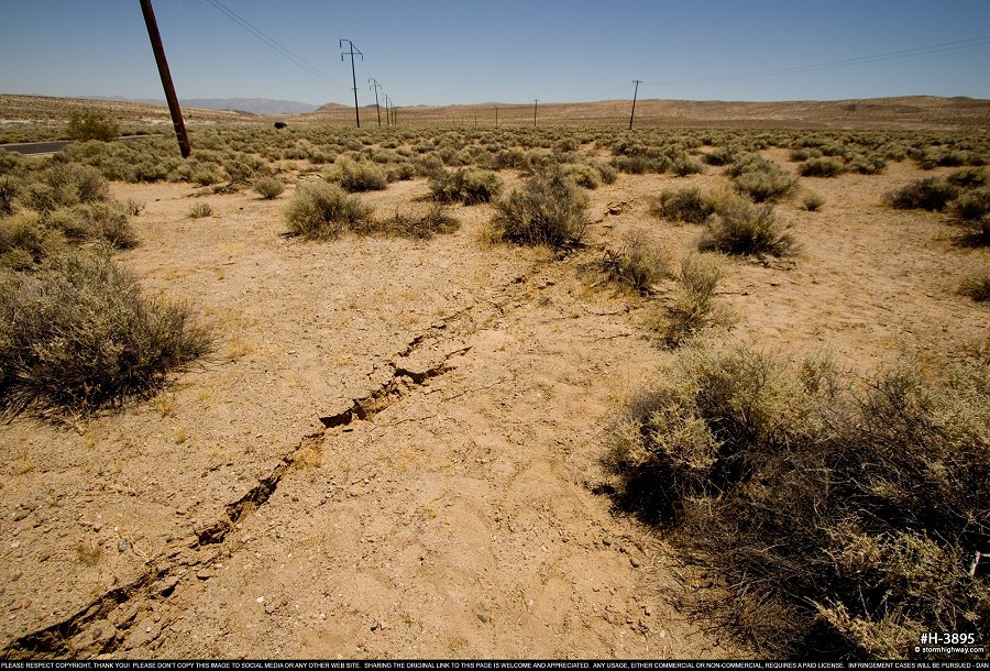
 Magnitude 6.4 event surface rupture photosI didn't spend much time on the M 6.4 surface rupture trace, as there was plenty to see with the much more dramatic and impressive M 7.1 rupture. On top of that, I had my camera on twilight photography settings (high ISO and open aperture) when I did make the quick stop to get some photos of the M 6.4 rupture south of Route 178. Here are those (overexposed) images:
 The rate of aftershocks was visibly diminishing by the 20th, with no magnitude 4+ events since the 17th and very few magnitude 3+ quakes below the regions outside of the miltary base that I had access to. With that, I decided to end the "chase" on Saturday the 20th and begin the trek home. I stopped for the night east of Albuquerque, and was home after 3AM Monday.
GO: Home | Storm Chase Logs | Photography | Extreme Weather Library | Stock Footage | Blog
Featured Weather Library Article:
|
||||||||||||||||||||||||||||||||||||||


Web Site Design and Internet Marketing by CIS Internet