
|
|||||||||||||||||||||||||||||||||||||||
|
|||||||||||||||||||||||||||||||||||||||


 May 28: Central/northern Illinois storms
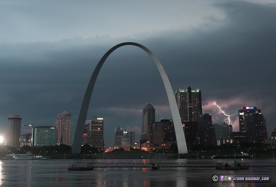


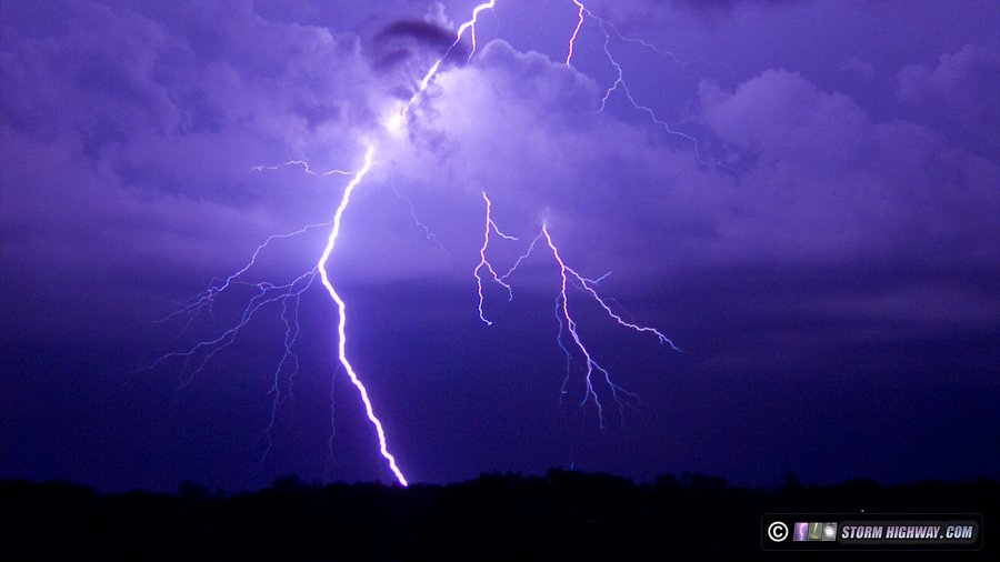
 June 16: Severe storms from Bartelso to Fairfield, IL; STL night storm
A marginal day with some upper support for supercells resulted in a few severe storms I tracked east of home to Fairfield, IL, but nothing worth shooting photos or videos presented itself. Later that night, some strong storms moved into the St. Louis metro with decent but very uncooperative lightning.
 June 17: St. Louis storms
Storms in the metro at midday fail to produce anything photogenic.
June 19: Trenton, IL storm
Storms between Trenton and Highland again prompt a chase, but fail to deliver..
June 21: STL metro storms
Like a broken record, storms use up half a day's worth of time but produce only one decent bolt of lightning - which a camera malfunction missed.
June 22: South St. Louis storms
Rinse and repeat: more St. Louis storms this day with completely uncooperative lightning.
 June 23: Chicago lightning bust
Another trip to Chicago for storms that fizzle.
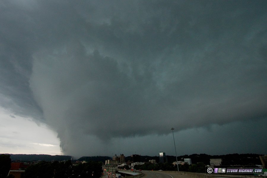
 June 24: Tornadic supercell in downtown Charleston, WV
In a surreal circumstance on the way to my uncle's funeral in North Carolina, I ended up passing through my old hometown of Charleston right as a tornadic supercell moved through. This was an exceptionally rare event for the city. The storm produced a highly visible tornado tracking through the Southridge shopping center along Corridor G, but the circulation became completely rain-wrapped before reaching downtown. I at first thought I was looking at a new tornado on a kink in the RFD gust front, but later data disproved that first assumption. The storm structure over downtown was something I hadn't seen in all my years I'd lived there between 1997 and 2010, and I heard tornado sirens downtown for the first time.
The storm's RFD produced significant wind damage, including in my old neighborhood of Shadowlawn and right in front of my old house. Video is below.
June 27-28: Chicago lightning bust
Another trip to Chicago (coming straight from North Carolina), this time a two-day stay with no results to show for it.
June 30: Chicago lightning
Yet another trip to Chicago for lightning. A storm finally produced a building strike, but only one.
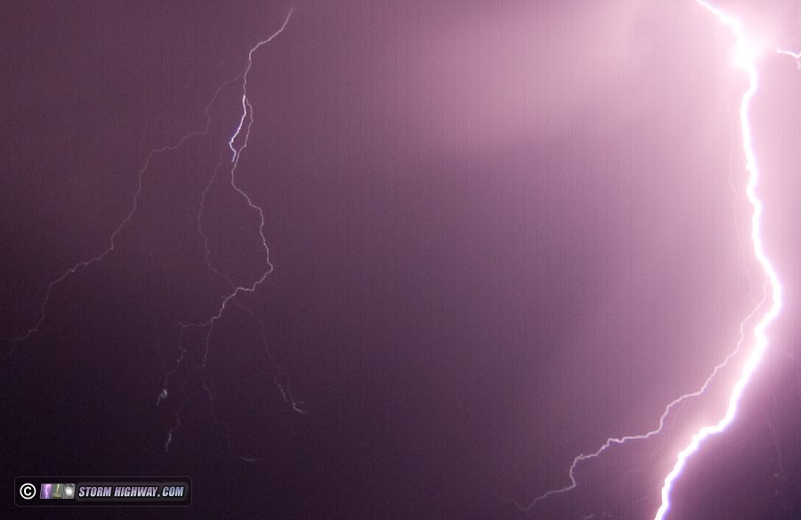
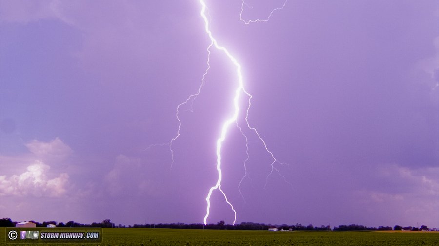
 July 1: Trenton, IL lightning
Finally, a storm cooperates with the best cloud-to-ground lightning show of the year so far near Trenton, IL.
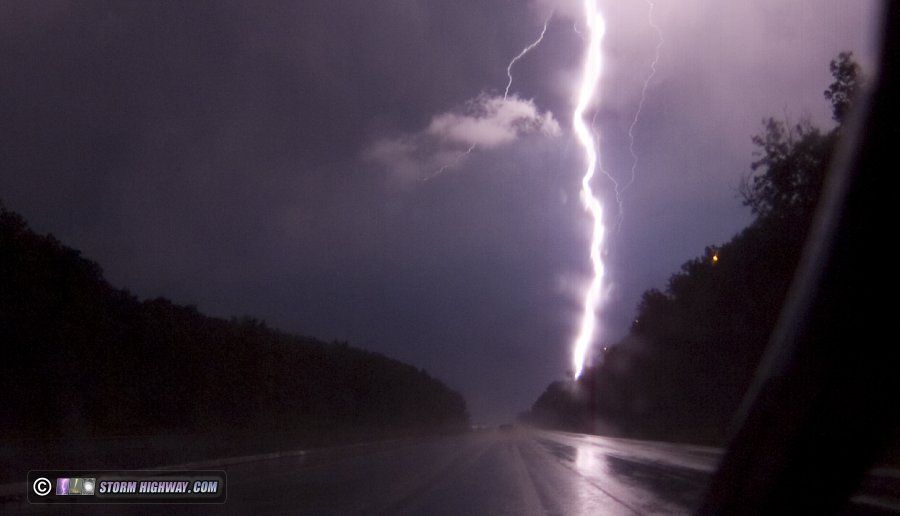
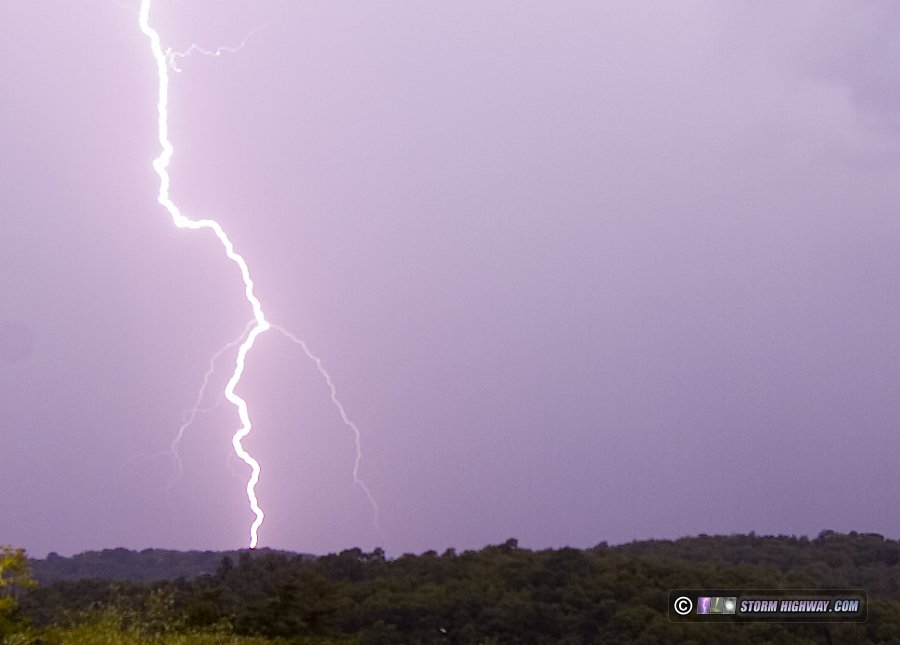
July 2: Lebanon, IL lightning
Another cooperative storm with some nice daytime lightning near Lebanon, IL.
July 5: Washington, PA lightning
A storm south of Pittsburgh produces a few nice bolts, though the camera focus was off due to a backfocus ring coming loose.
July 10: St. Louis metro storms
A round of slow-moving summer storms produces no photogenic lightning.
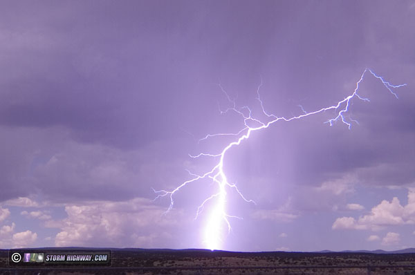
July 15: New Mexico monsoon storm
A monsoon storm (my first) produces a daylight bolt near Grants, New Mexico on the way to California.
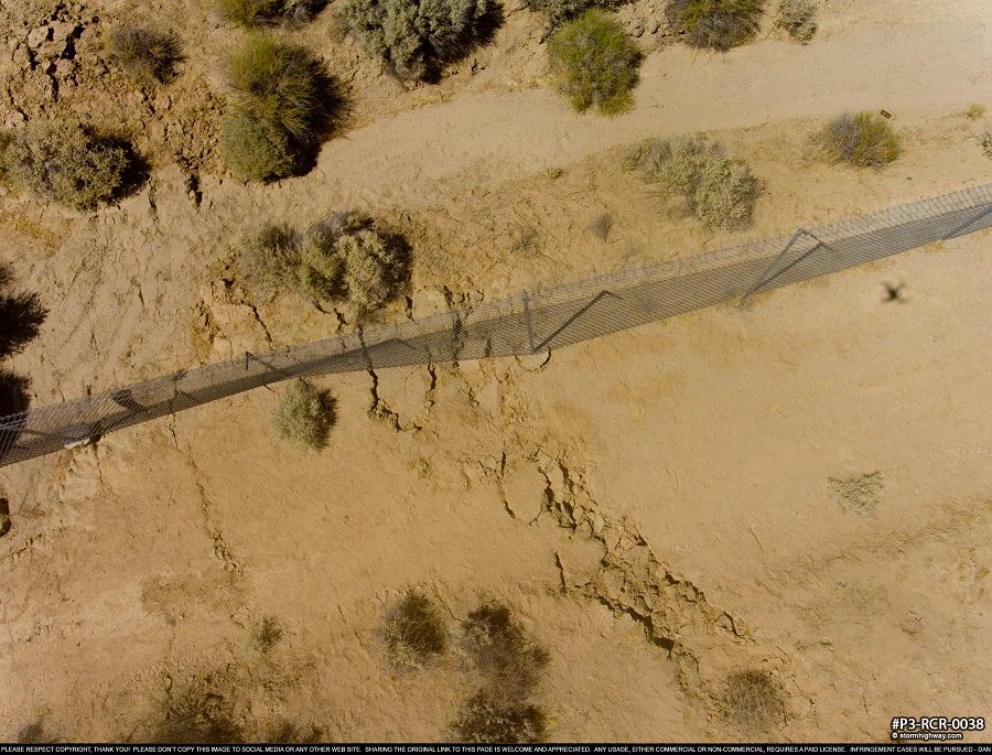
 July 14-22: California earthquake chase
A trip to California to document surface rupture and aftershocks of the M 7.1 Ridgecrest earthquakes.
July 21: Joplin, MO severe storms
A stop on the way home from California to shoot storms moving into Joplin, MO yields no photo or video captures.
July 29: St. Louis metro storms
A five-hour chase from downtown St. Louis to St. Libory, IL for, you guessed it, uncooperative storms. There was very little in the way of visible lightning bolts. Dying storms fired right over downtown 20 minutes after I left. Near St. Libory, I hit a large sinkhole on the edge of the road when pulling over, and then hit a deer 5 minutes later. The deer broke my car's bumper tabs, causing me to have to manually reattach it with cable ties.
|
||||||||


GO: Home | Storm Chase Logs | Photography | Extreme Weather Library | Stock Footage | Blog


Featured Weather Library Article:
Anvil crawlers, bolts from the blue, sheet, ribbon and bead lightning. Learn how to identify each! |  |
| More Library Articles |
Web Site Design and Internet Marketing by CIS Internet