
|
||||||||||||||||||||||||||||||||||||
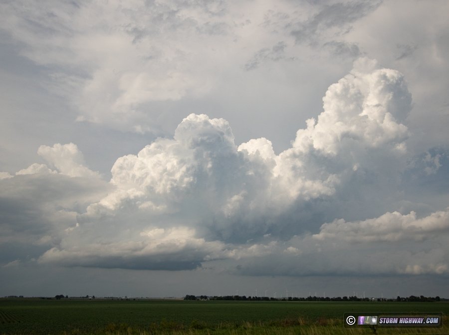
VIDEO: Hebron, Indiana tornado via drone HEBRON, IN - I observed three tornadoes during a historic outbreak in northern Illinois and Indiana. The following is a log of the day's chase. I wasn't sure if I was going to chase out of the St. Louis metro area this day. I'd arrived home from yesterday's Chicago chase in the early morning hours, and didn't get to bed until 5AM. I didn't set an alarm. I was expecting to just go out and watch storms move into St. Louis in the late afternoon/evening. Models had the right entrance region of the jet max just west of St. Louis, so I thought there would be a small chance for a strong supercell or two just west of the metro. I woke up at 1pm. After looking at all available data, it was apparent that the metro area would see very little in the way of a viable supercell/tornado threat. The right entrance region of the jet was now lagging to the west, and with the surging cold front, line segments looked to be the only thing we'd see. Could I make it north in time? It appeared I'd be able to get to Bloomington just ahead of any lead supercells, so at 2pm, I headed north. What looked like the main action area was organizing to the west along the Mississippi River. My original intent was to head up I-39 to position for this activity. But new storms were also developing along I-39 from Peoria down to Lincoln as I continued north on I-55 out of Springfield. The southernmost cell had a good look to it, with an excellent tilted updraft. This was the storm that went on to produce tornadoes from Pontiac through Dwight and Manteno:
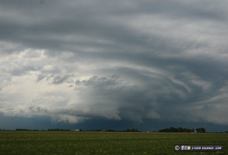
 I initially was impressed enough with this new cell to change my I-39 plan to stay with it along I-55 northeast. But just as I approached the interchange, the look of this storm diminished. The updraft appeared to be struggling in the midlevels and the base was not lowering, so I chose I-39 north as originally planned. As I approached Morton on I-39, I could see the impending storm of the day just to the north. It was firing off a ton of CG lightning strikes in its forward flank, but the base in the distance looked flat and elongated. It also appeared cloudy and cooler to the north, and I feared that storm was already out of the better instability. Meanwhile, the original supercell to the southwest looked like it was fighting a linear transition. New storms going up ahead of this seemed to be the new target, so I moved back south on I-39 to position for these. When I pulled over to do another data check, I saw the tornado warning for the storm to the north and what appeared to be a new cell going up just south of it. But it didn't take me long to realize that wasn't a new cell: it was the debris ball of an already-violent tornado with almost no reflectivity in the hook connecting it to the main storm. I couldn't believe it: I'd had a visual on the storm's base just 25 minutes earlier! I then realized that the original storm I'd left at Lincoln was getting the same type of look, and that I needed to get to it ASAP. I only had a short distance to get back over to I-55 at Bloomington, so I immediately began heading that way - not sure if I'd make it in time. After I rounded the last sharp curve on I-55 out of Bloomington-Normal, the storm developed a strong velocity couplet west of Pontiac. I was only 30 miles away, but couldn't see it at all. The overcast above was making the view of the storm very low contrast from a distance. Evan as I arrived in Pontiac with the storm at O'Dell, I could barely see the storm:
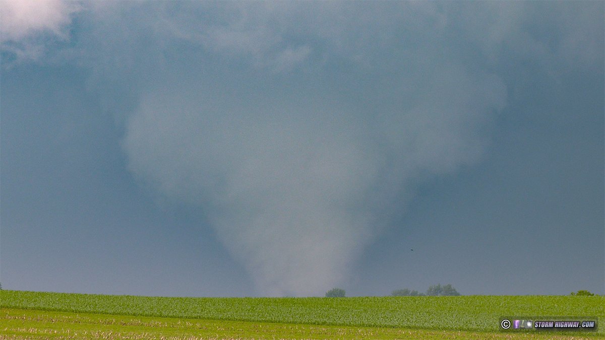
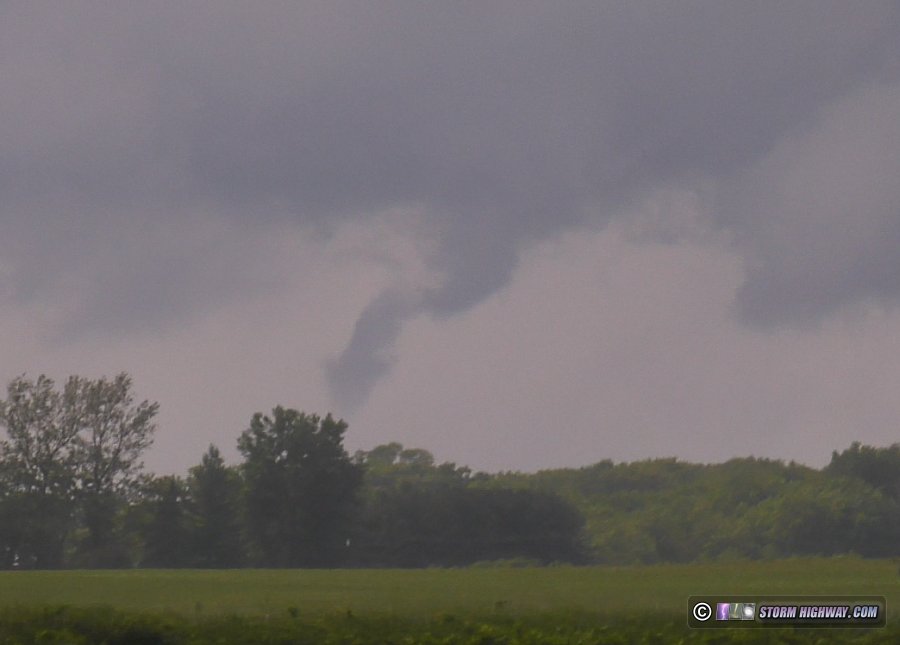
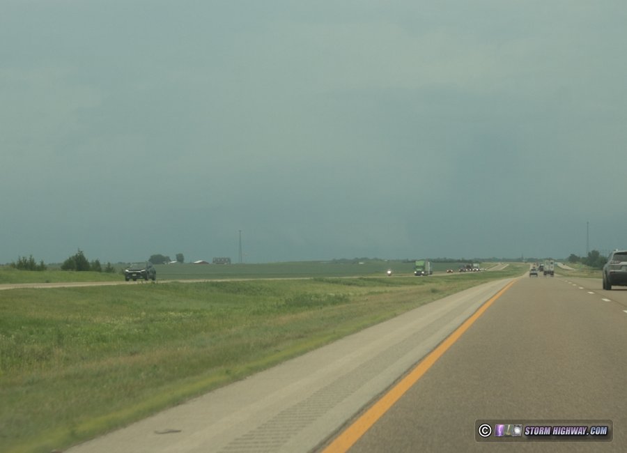 Just before O'Dell, I encountered a problem that nearly cost me the chase. Most drivers on I-55 were slowing/pulling over after they entered the tornado warning polygon (understandably so), creating a traffic jam that got worse with each mile. Instead of being able to intercept the storm along I-55 as planned, the traffic forced me to exit at O'Dell and head east on the county road grid. I was now north of the RFD gust front and could see the storm structure now, but I was still behind the storm and not in a great viewing position A new meso was ramping up to the north, which rapidly produced a large tornado that I viewed from about 7 miles south:
 It was now clear that the storm was moving fast enough that I didn't have any hope of getting ahead on the north-south east-west road grid, especially now that I had to cross the damage path of this tornado to do it. Newer storms to my south were in a similar environment, and I could see the updraft base of the cell down along I-57 near Clifton that appeared very healthy. This was within intercept range if I continued east, so I broke off of the Dwight storm and headed east on Highway 17 east of Kankakee, using some of the same roads I did on March 10 of this year. The Dwight storm had impressive structure to the north:
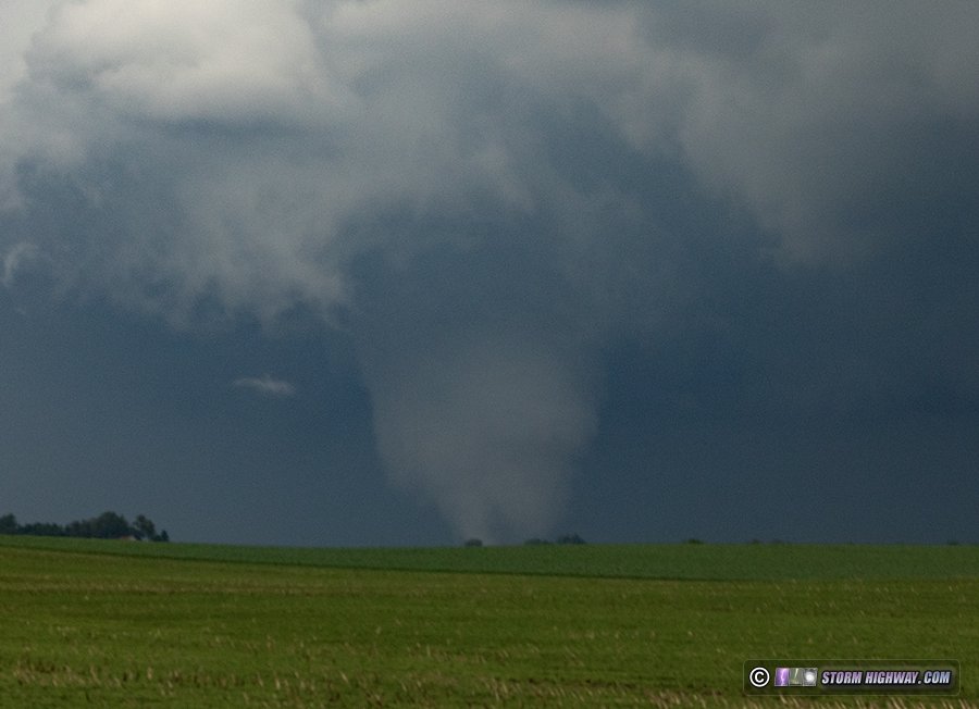
 The main RFD/meso on the new storm to the south was to my southeast, but a trailing meso appeared to be organizing to my south. Despite several good attempts of this area lowering, it was too close to the RFD of the lead meso. Just before I entered the precip of this storm, I narrow tornado appeared along the RFD gust front of the original Dwight storm, now crossing I-57 to my north at Manteno:
 I punched through the last of the RFD precip at the Indiana state line, getting this view as I moved out ahead:
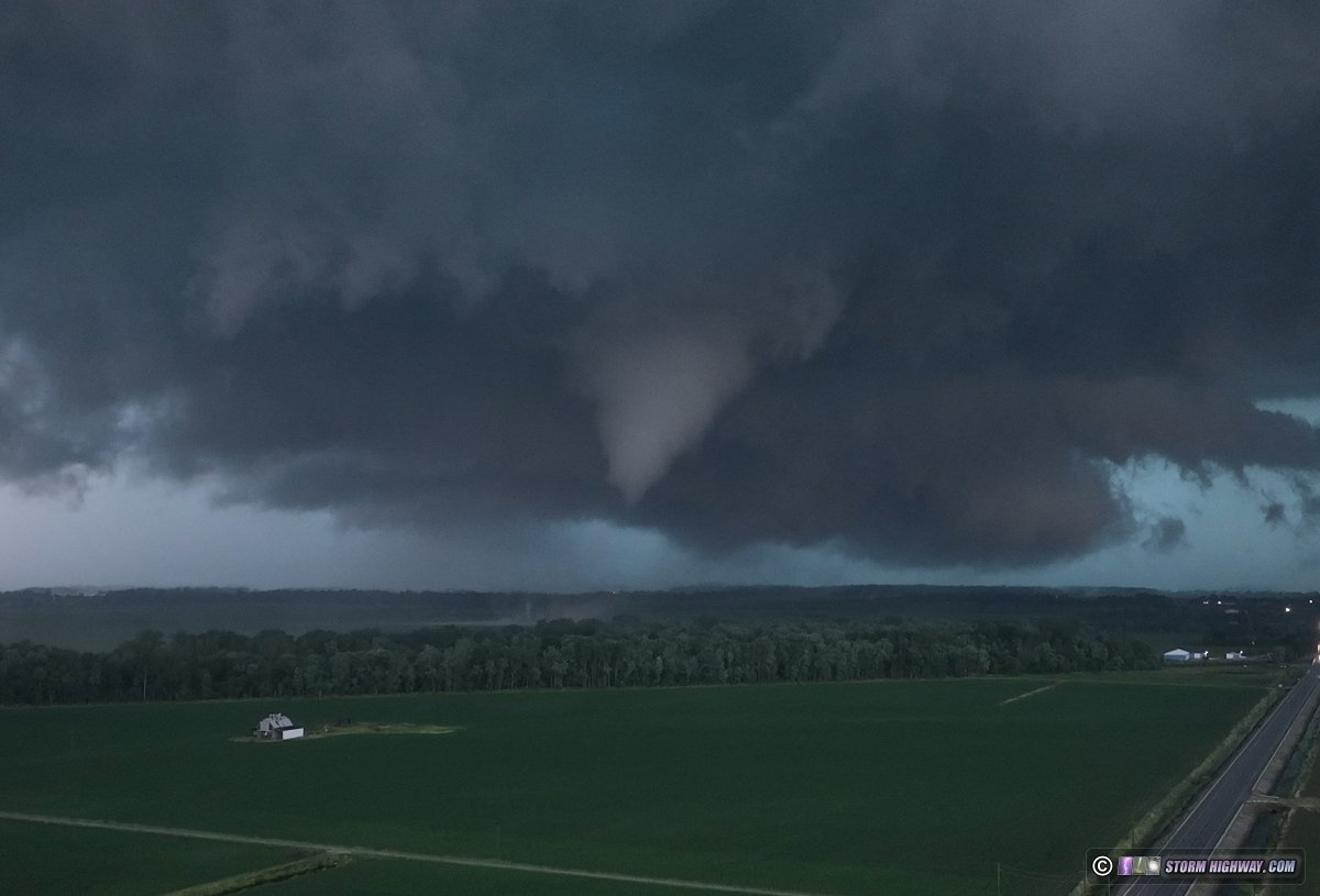
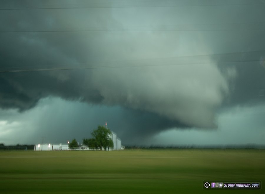 As I turned north through De Motte, I finally had a good view of the storm's meso, albeit through gaps in the trees. It was very healthy looking and I though it might already be producing a tornado by its look on radar, but I could not see well enough under the base to say for sure. Finally, I broke out into a wide view - and there it was:
 I moved north to as close as I felt safe for a aerial launching point, and sent the drone up:
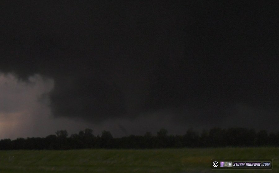
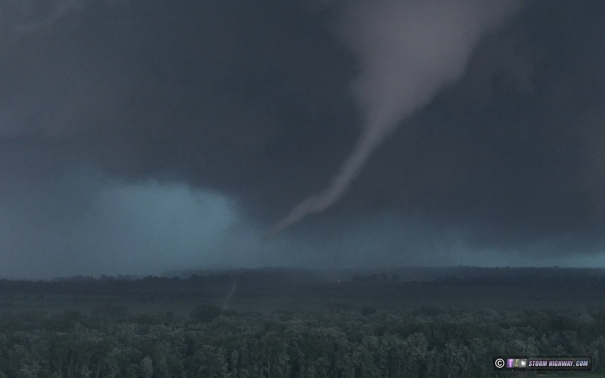
 This tornado put on quite a show of multiple vortices and various vortex dynamics as it moved through mostly wooded areas:
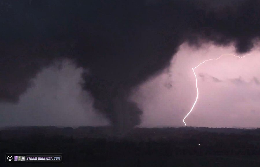
 There were several positive CG lightning strikes behind the tornado:
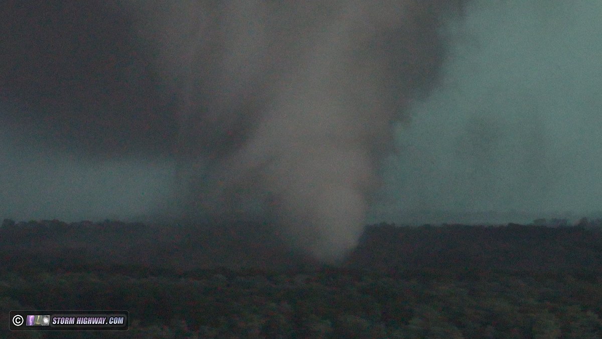
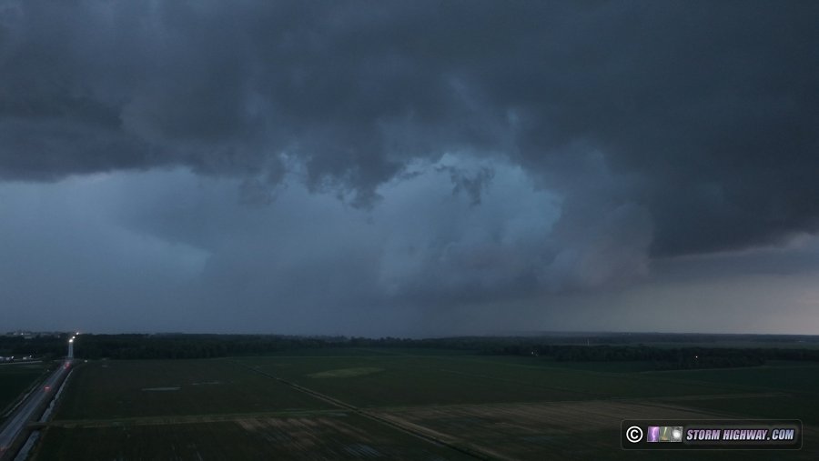
 Zoomed-out shot showing the RFD clear slot and horseshoe updraft as the tornado dissipated:
 This was career tornado #200 for me, quite a way to reach that milestone! I didn't think I'd be able to get ahead of the storm again with the its 40mph speed and increasing urban areas in its path. I went back into De Motte to fuel up, fearing that the incoming squall line with multiple mesovortices might cut power soon. These were uneventful from my vantage point, and I didn't encounter any more than small tree branches down on the road where the strongest-looking couplet crossed south of town. I started the drive home, arriving at 3am.
GO: Home | Storm Chase Logs | Photography | Extreme Weather Library | Stock Footage | Blog
Featured Weather Library Article:
|
||||||||||||||||||||||||||||||||||||


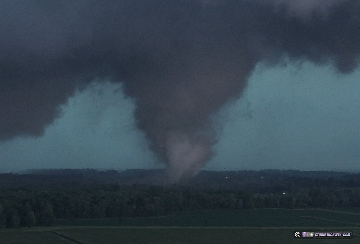
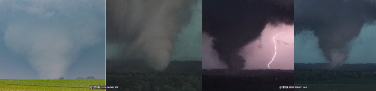 ABOVE: Tornadoes at Dwight, Illinois and Hebron, Indiana - June 11, 2026


Web Site Design and Internet Marketing by CIS Internet