|
Home | Blog Index | Blog Archives | Christianity & Faith Essays | Storm Chasing Essays
Connecting safe cycling routes in the St. Louis metro east: Scott AFB, O'Fallon, Shiloh and Mascoutah, Illinois
UPDATE (July 2026): The bike/pedestrian trail across Silver Creek to MidAmerica Airport is now OPEN! Click for details.
NEW: Katy Trail Connector Bike Route from New Baden, IL
Scott AFB Bike Commuter Routes from New Baden, IL: Cardinal Creek Gate | Main Gate
The St. Louis metro area has one of the best network of bike trails in the Midwest. This is particularly true of the Illinois side of the metro area (the STL "Metro-East") with the expansive and growing Madison County Transit and MetroBikeLink trail systems [10].
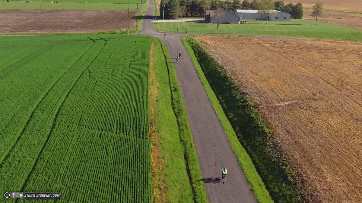
I have been a regular cyclist on the county roads mainly east of Illinois Highway 4 in eastern St. Clair and western Clinton Counties. These lesser-traveled, straight, flat and open paved roads (as in the header image above) offer a web of relatively safe cycling route options around the rural eastern fringes of the St. Louis metro in between Mascoutah, Summerfield, Highland, New Baden, Trenton and beyond.
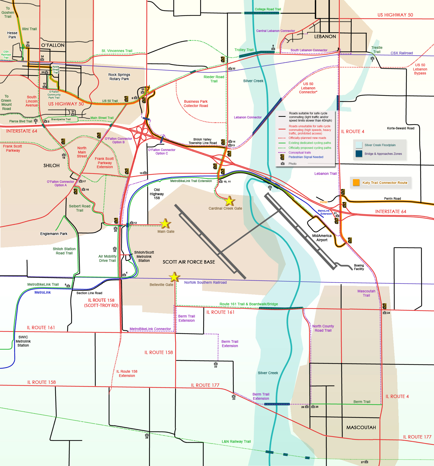
With knowledge of the local road network and cycling experience on many of them, I created this map of the region (map last updated on August 3, 2026). The main points of this map are to show the current gaps in cycling-safe routes around the region along with the existing and officially-planned dedicated trails. Roads shaded in red are unsafe for cycling due to combinations of high speed, heavy traffic and/or prohibited access. The roads shown in black are relatively safe to use as part of a cycling route due to low speed limits and/or sparser traffic. Click on the map to view the full-size version in a new tab. |
Please Note:
- The trails shown in purple on this map are purely conceptual and have NOT been officially proposed or surveyed.
- Not all streets and roads are shown. Most of the unmapped residential streets in the towns and cities shown can be assumed to be "cyclist friendly" (shaded black on the map).
Trail descriptions, photos and news (Updated August 2026)
The following trails and their features and details are shown on the map above:
- Air Mobility Drive Trail: A completed shared-use path along Route 158 (Scott-Troy Road) connecting the Seibert Road Trail with the mainline MetroBikeLink trail.
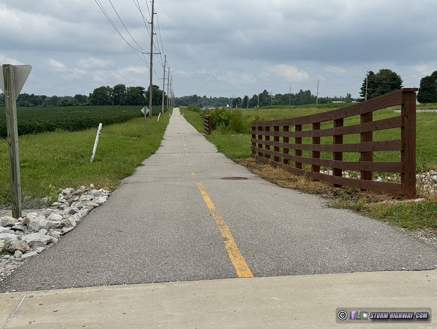 Fig. 30: Air Mobility Drive trail along Highway 158 Fig. 30: Air Mobility Drive trail along Highway 158
- Apple Street Trail: A short completed shared-use path from O'Fallon Community Park to East 1st Street in O'Fallon.
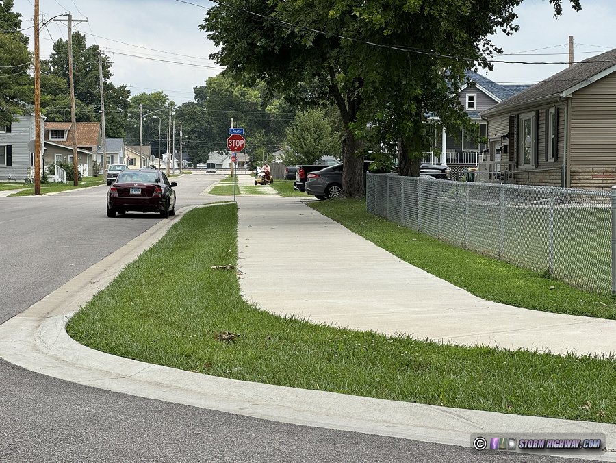 Fig. 20: Apple Street Trail in O'Fallon Fig. 20: Apple Street Trail in O'Fallon
- Berm Trail: A completed paved shared-use path running east-west across nearly the full width of the town of Mascoutah between Lake Road and North Jefferson Street (State Route 4).
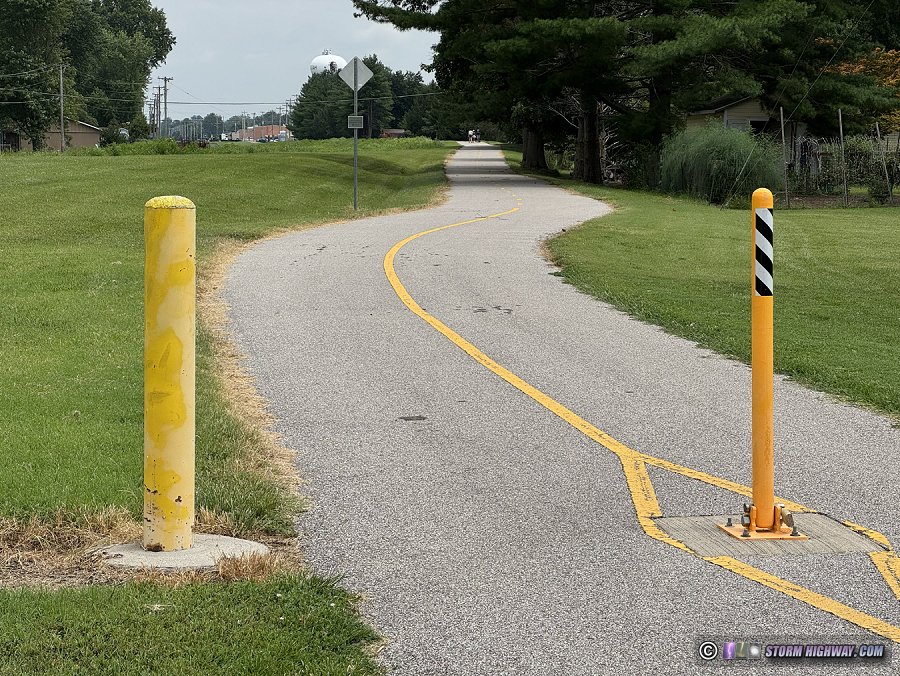 Fig. 20: Berm Trail at North County Road in Mascoutah Fig. 20: Berm Trail at North County Road in Mascoutah
- Berm Trail Extension: A conceptual shared-use path extending the Berm Trail in Mascoutah west across Silver Creek to the Scott AFB Belleville Gate via Keck Road and Old Highway 158/Carlyle Avenue, accomplishing Mascoutah's connection to the base and the existing trail network. While still requiring bridges across Silver Creek, this path would involve a considerably shorter length of new trail construction than the combined Route 161 Boardwalk & Trail and North County Road Trails. More importantly, the trail would cross only one existing driveway near Keck Road and Illinois Route 177, and have virtually no other obstacles other than the Silver Creek crossing. The existing Keck Road and Old Highway 158/Carlyle Avenue segments carry almost no regular vehicle traffic and would not need parallel trails for a safe bike route.
With the simple addition of a pedestrian signal at the already-signaled Old Highway 158/Illinois Route 161 intersection near the base gate, a far safer cycling/pedestrian highway crossing point would be accomplished - rather than the North County Road intersection, where vehicles speeds are high and there are no pre-existing traffic signals.
The Berm Trail Extension would also effectively accomplish the SWIC campus connection via the short MetroBikeLink Connector segment, without the need for the extensive, costly and complex right-of-way acquisition for the L&N Railway Trail.
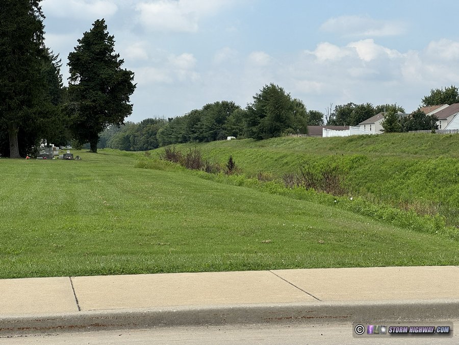 Fig. 26: Corridor of a conceptual Berm Trail Extension west of North County Road in Mascoutah Fig. 26: Corridor of a conceptual Berm Trail Extension west of North County Road in Mascoutah
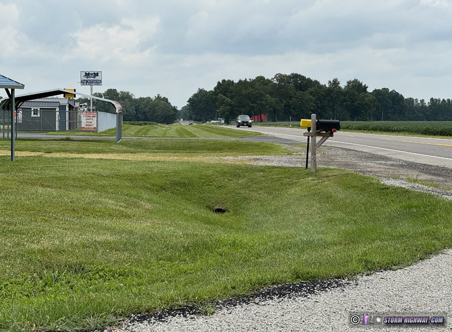 Fig. 23: Corridor of a conceptual Berm Trail Extension along Route 177 at Keck Road Fig. 23: Corridor of a conceptual Berm Trail Extension along Route 177 at Keck Road
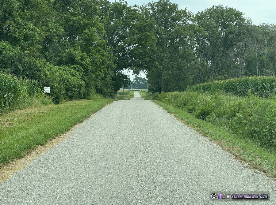 Fig. 22: Corridor of a conceptual Berm Trail Extension at Ash Creek along Keck Road Fig. 22: Corridor of a conceptual Berm Trail Extension at Ash Creek along Keck Road
- Brandywine Trail: A completed shared-use path extending east along I-64 from South Lincoln Avenue in O'Fallon, with spurs connecting to the adjacent residential neighborhood streets at De Soto Drive, Matthew Drive and Edgewood Street. The planned Main Street Trail will connect the Brandywine Trail with North Main Street.
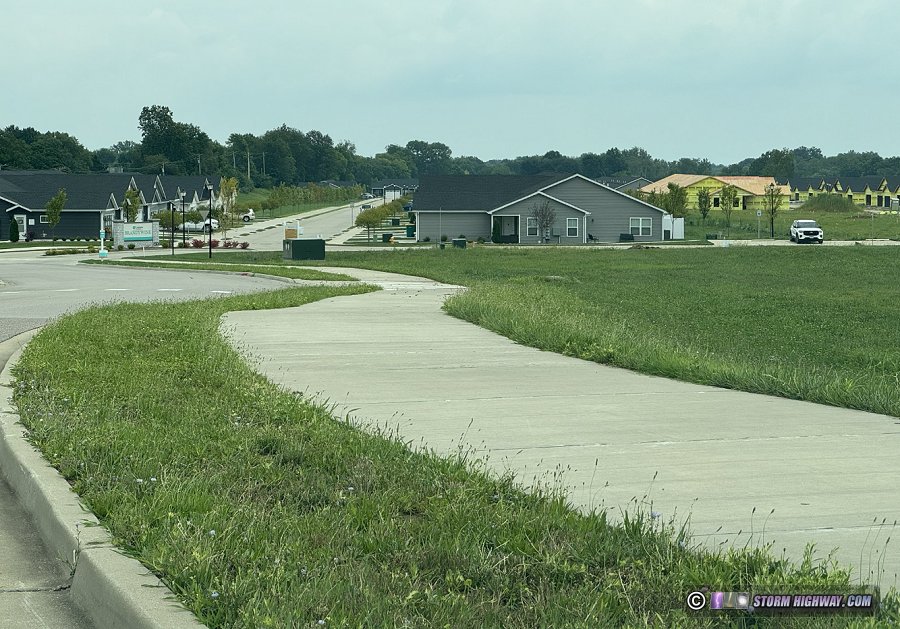 Fig. 2: Brandywine Trail at South Lincoln Drive in O'Fallon Fig. 2: Brandywine Trail at South Lincoln Drive in O'Fallon
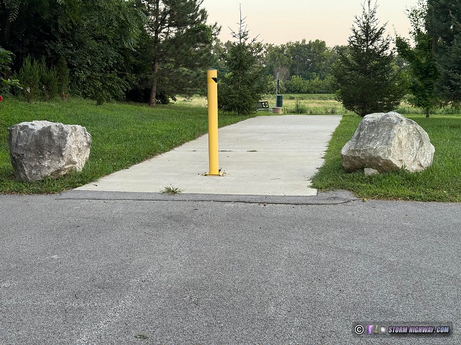 Fig. 31: One of the spurs of the Brandywine Trail connecting to Matthew Drive in an adjacent O'Fallon residential neighborhood Fig. 31: One of the spurs of the Brandywine Trail connecting to Matthew Drive in an adjacent O'Fallon residential neighborhood
- College Road Trail: An officially-proposed shared-use path and bridge across Silver Creek connecting the west end of College Road in Lebanon to Reider Road [16].
- Community Park Trail: A shared use path around the perimeter of O'Fallon Community Park.
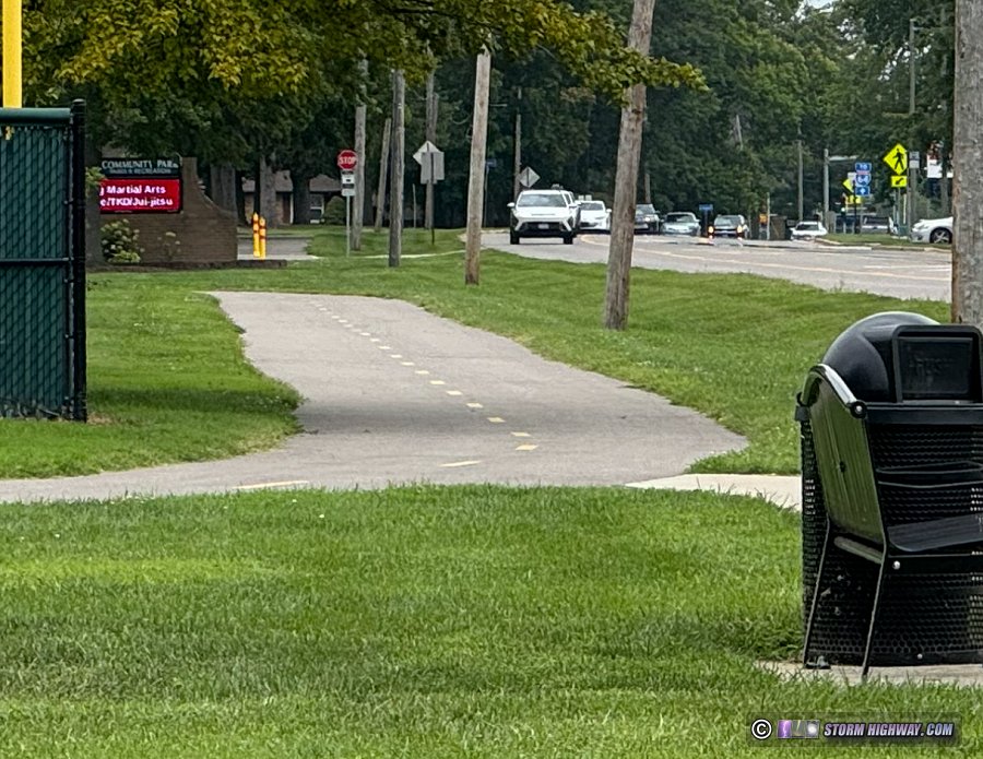 Fig. 19: O'Fallon Community Park Trail along Highway 50 Fig. 19: O'Fallon Community Park Trail along Highway 50
- CSX Railroad/CSX Railroad Trail: In 2015, CSX took the "Illinois Subdivision" (their designation for the St. Louis to Vincennes, Indiana line) out of service due to the lack of on-line shipping customers and through traffic. This included the deactivation of all grade crossing signals, removing sidings, spurs and switches and physically cutting the rails at either end of the out-of-service portion of track.
These events prompted speculation that the line could be formally abandoned at some point in the future, and accordingly, state and local officials have expressed interest in using the line as a major rails-to-trails project across southern Illinois if that occurs. However, CSX has gone on the record stating they have no intention of selling or abandoning the line, and there have been talks with short line rail operators taking over the line's operation, returning it to service and growing its on-line customer base.
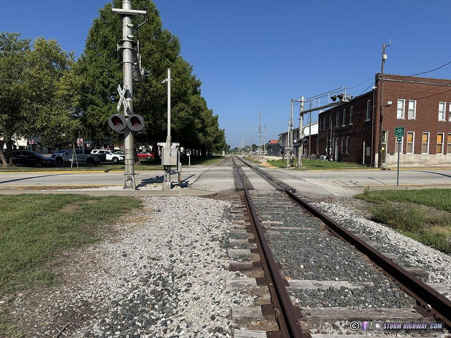 Fig. 34: Out-of-service CSX Illinois Subdivision in downtown O'Fallon Fig. 34: Out-of-service CSX Illinois Subdivision in downtown O'Fallon
Should the Illinois Subdivision ever be abandoned, the implications would be far-reaching and transformative for the trail network in St. Clair County as well as in southern Illinois. A continuous east-west trail across the state would be a major development, no doubt becoming a centerpiece of the trail network in O'Fallon, Lebanon, Trenton and beyond. Lebanon's long-sought-after connection to the west would be accomplished without the need for costly new bridges across Silver Creek, additional right-of-way acquisition and the complexities of a trail along Highway 50. O'Fallon and Lebanon would become destinations for cross-counrty riders.
Rumors surfaced in late 2025 suggesting the line could be reactivated between Shattuc (just east of Carlyle) and Vincennes for a double-stack container/intermodal connecting route. However, no official news or any substantiating information from CSX has been publicly announced. Even if that were true, it's unlikely that the west end of the line would be affected by such a change.
At this time, it appears unlikely that CSX will fully relinquish the line. Notwithstanding, this situation is one that cyclists and trail advocates in our region should be keeping an eye on.
The City of O'Fallon has planned a rail-with-trail style shared use path adjacent to the tracks from downtown to O'Fallon Family Sports Park [3]. The main challenge for this plan is CSX's official policy of prohibiting rail-with-trail paths within the railroad right-of-way [18]. Currently, the parallel streets themselves along the tracks in this area (State Street and Karl Place) are either partially or completely within the railroad right-of-way [14]. This means virtually the entire route a trail would need is inside of CSX's exclusion zone. A short line takeover of the route would improve parallel trail prospects, as these smaller companies tend to be more friendly and willing to work with communities on trail projects.
- Highway 50 Trail: An officially-planned shared-use path along Highway 50 from O'Fallon Community Park to at least Quarry Road or the future Trolley Trail [12]. A short segment of this trail is complete along Highway 50 and Scott-Troy Road between the ends of Rec Plex Drive. Construction on the portion of the trail between O'Fallon Community Park and Rec Plex Drive has been funded by the State of Illinois with an expected completion in 2027 [13].
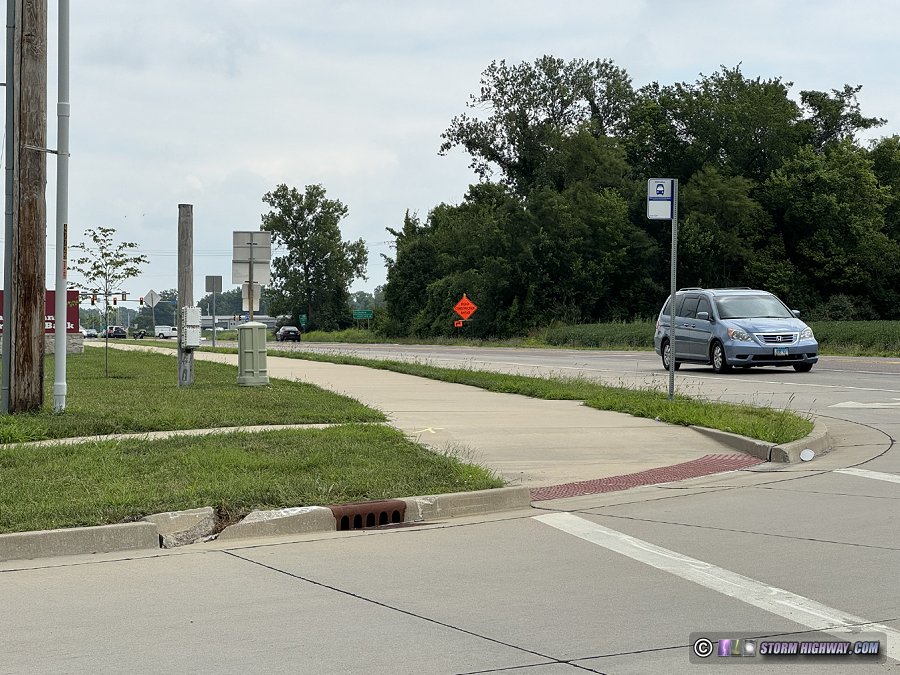 Fig. 6: Highway 50 Trail at Rec Plex Drive in O'Fallon Fig. 6: Highway 50 Trail at Rec Plex Drive in O'Fallon
- Illini Trail: A shared use path between State Street and Illini Drive in O'Fallon.
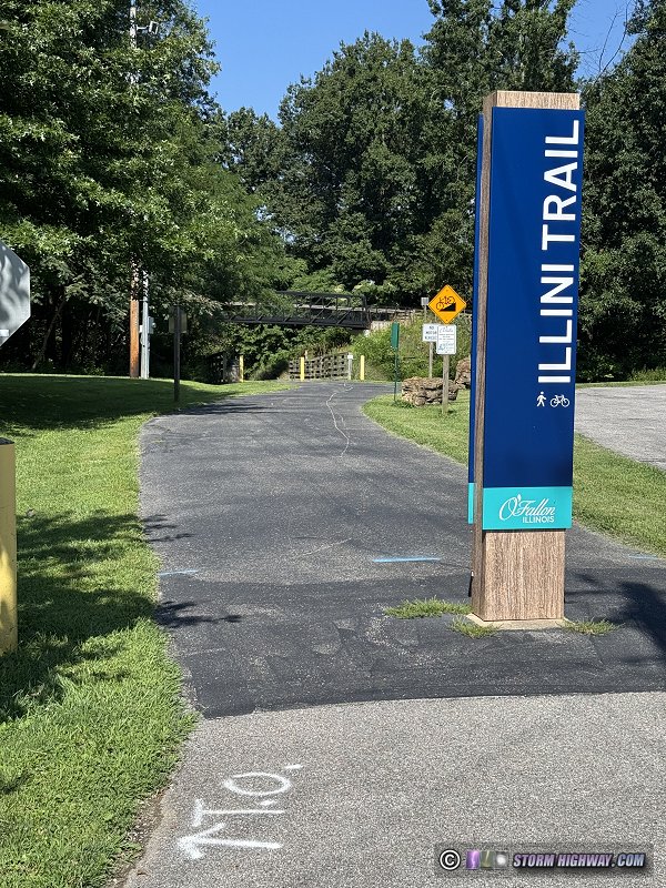 Fig. 35: Illini Trail access spur at West Madison Street in O'Fallon. The main trail passes over the access spur on the bridge in the background. Fig. 35: Illini Trail access spur at West Madison Street in O'Fallon. The main trail passes over the access spur on the bridge in the background.
- Lebanon Connector: The state's original plan for Highway 50's routing was for its western terminus to be at Interstate 64 at the Illinois Route 158 interchange, but this was eventually abandoned. With the finalization of the Highway 50 Lebanon Bypass plans between Summerfield and Illinois Route 4 (with construction expected to begin in coming years), state and local officials have reportedly discussed some interest in renewing the idea of a direct I-64 connection. As most of this potential route is on privately-owned land, the eventual path this connection may take is unknown, and no other details or surveys have been released or discussed publicly [14].
Even if this does become an official plan, it would likely be 10 to 15 years or more before construction would begin (given the typical timelines of these projects). The counter to that is the route this segment would take is all undeveloped farmland or forest, with only the Silver Creek crossing as a physical obstacle. The route shown on the map above is not based on any official plans, as currently there are none.
Should this segment of road ever be built, it would be well-suited for a parallel shared-use path connecting Lebanon with the rest of the MetroBikeLink network.
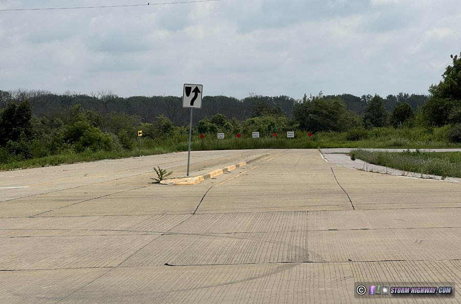 Fig. 13: Stub end of Shiloh Valley Township Line Road east of Rieder Road, marking a possible location of an I-64 connection of Highway 50 Fig. 13: Stub end of Shiloh Valley Township Line Road east of Rieder Road, marking a possible location of an I-64 connection of Highway 50
- Lebanon Trail: A conceptual (not yet officially proposed) shared-use path beginning at MidAmerica Airport, paralleling Illinois Route 4 northward across Interstate 64 and on to Lebanon.
- L&N Railway Trail: An officially-planned shared-use path along the old Louisville and Nashville railroad grade linking Mascoutah with the SWIC (Southwestern Illinois College) campus [12].
The western end of the L&N line into St. Louis is now permanently occupied by the Metrolink light rail system. This meant that instead of the remaining line's right-of-way being preserved (railbanked), all of the land and right-of-way was sold or relinquished to adjacent landowners. This means that negotiating right-of-way and/or property acquisition will be necessary from a multitude of private landowners on the route before a trail could be built, which is a formidable and complex obstacle to overcome. The city of Mascoutah owns the right-of-way up to the first Silver Creek Bridge [14].
In the decades since the railroad was abandoned, the condition of the old right-of-way has deteriorated considerably. In most places, it is difficult to even discern where it is. Grading work and clearing of full forest growth will be needed for a large portion of the route to restore a path for a trail.
The segment of the trail in the town of Mascoutah is currently under construction with a planned completion in 2027. No further plans for the rest of the trail have been made public [12].
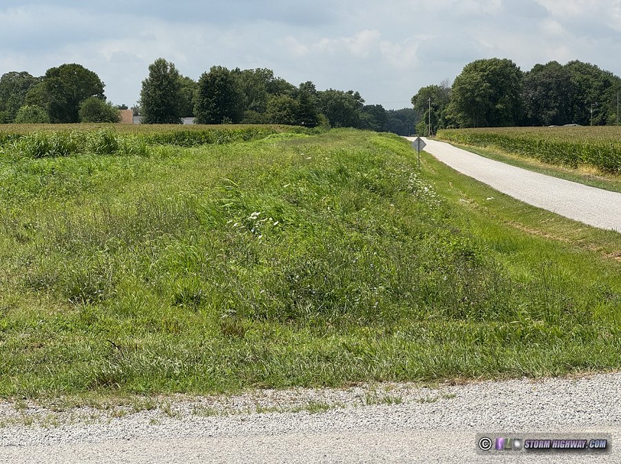 Fig. 28: Old Lousville and Nashville Railroad Grade at Rentchler Road Fig. 28: Old Lousville and Nashville Railroad Grade at Rentchler Road
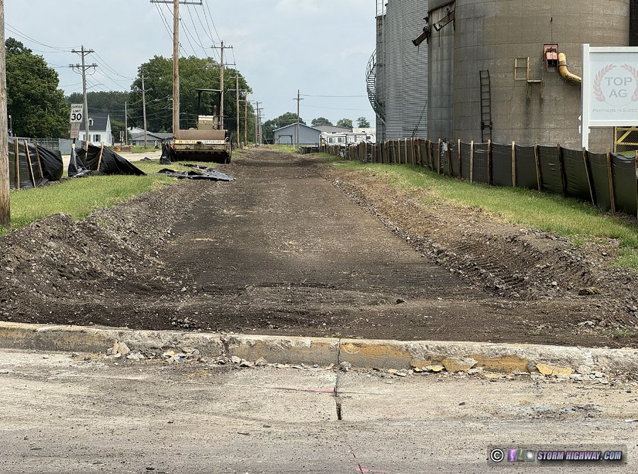 Fig. 27: L&N Railway Trail under construction at South Railway Street in Mascoutah Fig. 27: L&N Railway Trail under construction at South Railway Street in Mascoutah
- Main Street Trail: An officially-planned shared-use path along North Main Street in O'Fallon extending from Highway 50 to the Shiloh village limits just south of I-64. A branch of the trail will extend west to the Brandywine Trail. [17]
- Mascoutah Trail: A conceptual (not yet officially proposed) continuation of the MetroBikeLink Trail from MidAmerica Airport to Mascoutah, following Illinois Route 4 on the east side of MidAmerica Airport.
- MidAmerica MetroBikeLink Trail Extension (now open!): The extension of the MetroBikeLink shared-use path along the light rail tracks from the Shiloh/Scott station to MidAmerica Airport, first planned in 2011. Like most of the MetroBikeLink trail, the MidAmerica MetroBikeLink Trail Extension shares the right-of-way with the light rail tracks, including road, bike and rail bridges across Silver Creek. Silver Creek was the costliest obstacle to overcome in constructing a cycling path accessible to communities east of Scott AFB.
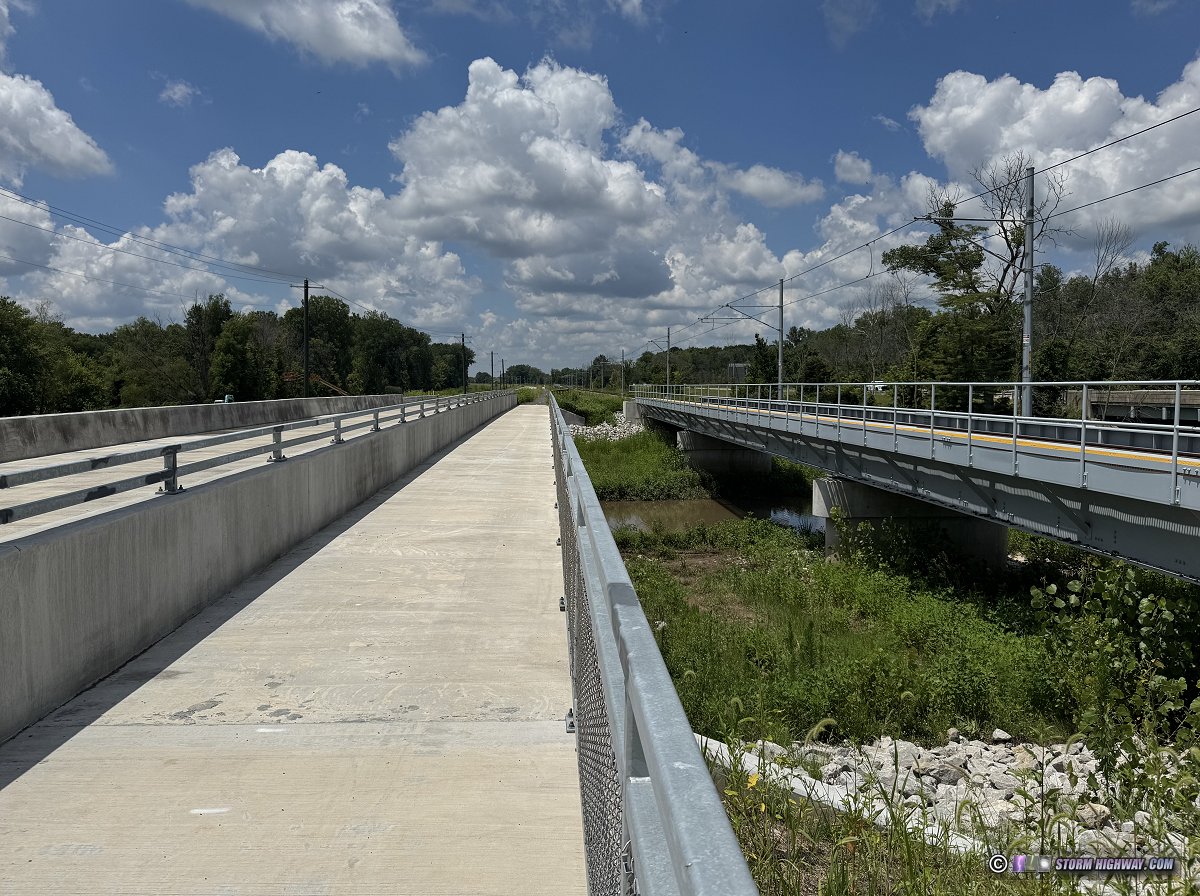 Fig. 9: Silver Creek bridges on the new MetroBikeLink trail extension to MidAmerica airport Fig. 9: Silver Creek bridges on the new MetroBikeLink trail extension to MidAmerica airport
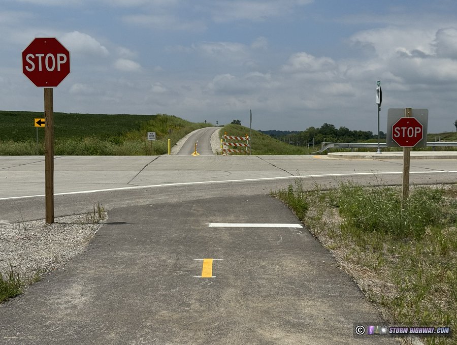 Fig. 10: MetroBikeLink Trail intersection with Rieder Road. Fig. 10: MetroBikeLink Trail intersection with Rieder Road.
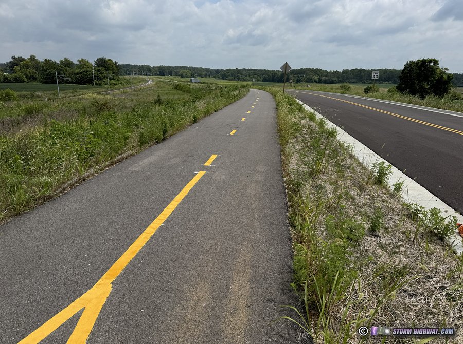 Fig. 11: Looking east toward Silver Creek from Rieder Road: Metrolink tracks (left), MetroBikeLink Trail (center), frontage road (right). Fig. 11: Looking east toward Silver Creek from Rieder Road: Metrolink tracks (left), MetroBikeLink Trail (center), frontage road (right).
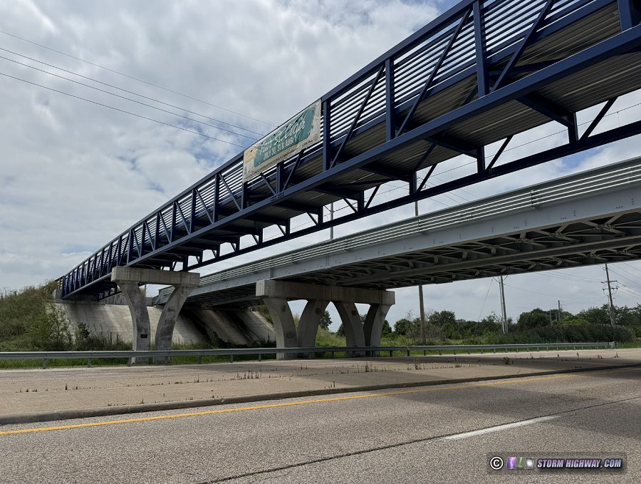 Fig. 12: MetroBikeLink Trail and Metrolink light rail bridges over Seibert Road. Fig. 12: MetroBikeLink Trail and Metrolink light rail bridges over Seibert Road.
- MetroBikeLink Connector: A conceptual (not yet officially proposed) shared-use path connecting the Route 161 Boardwalk and Trail with the MetroBikeLink trail. The connector would begin at the Route 161/Route 158 intersection and continue west along the south side of Scott AFB to Section Line Road. Cyclists would then use Section Line Road to reach the MetroBikeLink trail at Shiloh Station Road. The connector, along with the Route 161 Boardwalk and Trail, would give Mascoutah cyclists access to Belleville and its system of trails.
- MetroBikeLink Trail: A completed, paved, dedicated bike/pedestrian shared-use path built along the Metrolink light rail tracks from Belleville to MidAmerica Airport. The trail parallels the tracks for most of its length [7].
 Fig. 5: Metrolink tracks and MetroBikeLink trail at Shiloh Station Road Fig. 5: Metrolink tracks and MetroBikeLink trail at Shiloh Station Road
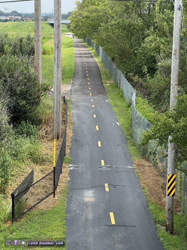 Fig. 4: MetroBikeLink trail at Route 158
Pierce Boulevard Trail: A currently under-construction shared-use path along Pierce Boulevard in O'Fallon, connecting South Lincoln Avenue near the Brandywine Trail with Green Mount Road. [15] Fig. 4: MetroBikeLink trail at Route 158
Pierce Boulevard Trail: A currently under-construction shared-use path along Pierce Boulevard in O'Fallon, connecting South Lincoln Avenue near the Brandywine Trail with Green Mount Road. [15]
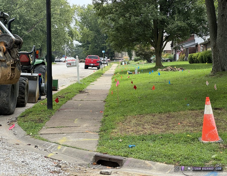 Fig. 3: Pierce Boulevard Trail in the early stages of construction in O'Fallon Fig. 3: Pierce Boulevard Trail in the early stages of construction in O'Fallon
- Rieder Road trail: An officially-proposed shared-use path from Wherry Road and I-64 northward to US Highway 50, paralleling its namesake road [1]. The main obstacle to a trail on this road is the narrow one-lane CSX railroad underpass near Highway 50. Highway 50 itself is a high-speed road that would require a pedestrian signal for the connection to the Highway 50/Trolley Trail.
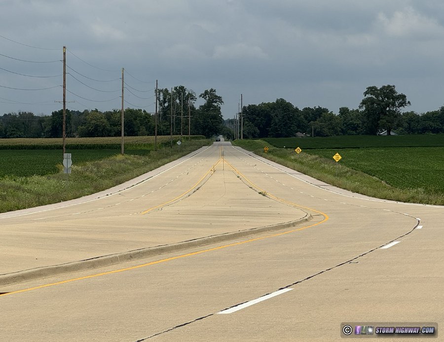 Fig. 14: Rieder Road north of Interstate 64 Fig. 14: Rieder Road north of Interstate 64
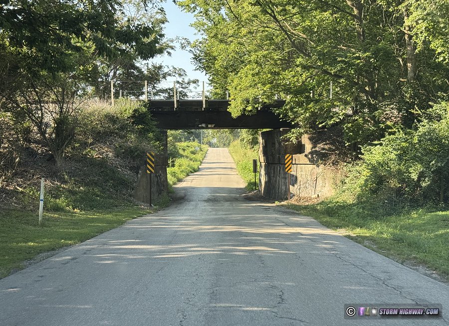 Fig. 32: Rieder Road one-lane CSX railroad underpass near Highway 50 Fig. 32: Rieder Road one-lane CSX railroad underpass near Highway 50
- Route 161 Boardwalk and Trail: An officially-proposed shared-use path from Mascoutah to the southern gate of Scott AFB, paralleling its namesake highway and including a dedicated bridge across Silver Creek [1].
- Shiloh Station Road Trail: A completed shared-use path connecting Englemann Park with the mainline MetroBikeLink trail.
- Siebert Road Trail: A paved shared-use path running from Scott-Troy Road (Route 158) along Siebert Road to South Main Street in Shiloh. Official plans are to extend the trail east across Route 158 to the Scott AFB gate.
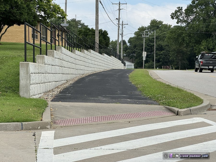 Fig. 16: Seibert Road Trail in Shiloh Fig. 16: Seibert Road Trail in Shiloh
- St. Vincennes Trail: An officially-proposed shared-use path built parallel to Old Vincennes Trail, a street on the east side of O'Fallon. [1].
- Trestle Trail (currently closed): A completed shared-use path on the southeastern edge of the town of Lebanon, IL, named for the CSX railroad bridge it passes under. This short but important trail connects the dead-ends of East McAllister Street and Korte Sewald Road, providing the first cycling-safe link to the county road network south and east of Lebanon.
The Trestle Trail was legally built on an existing Lebanon Township right-of-way where an unpaved road previously ran, with the township's permission and blessing. In the state of Illinois, public rights-of-way/easements are only relinquished to adjacent landowners via a formal abandonment process, which did not occur for this road. Other than the road's culvert over the creek, the road was not maintained and was not in a passable state for larger vehicles prior to the construction of the trail, mainly due to the low clearance under the railroad bridge.
Unlike the vast majority of other trails in the St. Louis metro area, the Trestle Trail was completely funded, built and maintained by a non-government entity. Gateway East Trails (GET) was a private non-profit 501(c)(3) trail building and cycling advocacy organization consisting entirely of unpaid local volunteers. GET raised the money to build the trail and pave it with concrete, and its volunteers kept it cleared and mowed. Funding for the trail came from the proceeds of GET's annual Tour de Stooges bike race held in May of each year.
In 2021, an injury accident occurred when a trespasser walking on the railroad tracks fell through the CSX trestle's deteriorated wooden walkway. The trespasser subsequently sued the railroad, the township and GET. GET's insurance company opted to settle the lawsuit in 2026, resulting in the loss of the trail's insurance coverage and GET's complete dissolution.
Lebanon Township assumed responsibility for the Trestle Trail after GET's cessation of operations, but was forced to close it after they too were unable to secure insurance coverage for the trail. GET passed the Tour de Stooges bike race to Trailnet in early 2026 [19], and the ride's proceeds are no longer funding the trail. The trail's well-built concrete surface is still in good condition, but it is not being actively maintained. Overgrowth and fallen trees from storms have blocked parts of the path.
No plans for the future of the Trestle Trail have been made public. It is hoped that when the US 50 bypass is constructed near the trail's southern end, provisions will be kept for maintaining this important bike route connection for a possible future reopening or expansion.
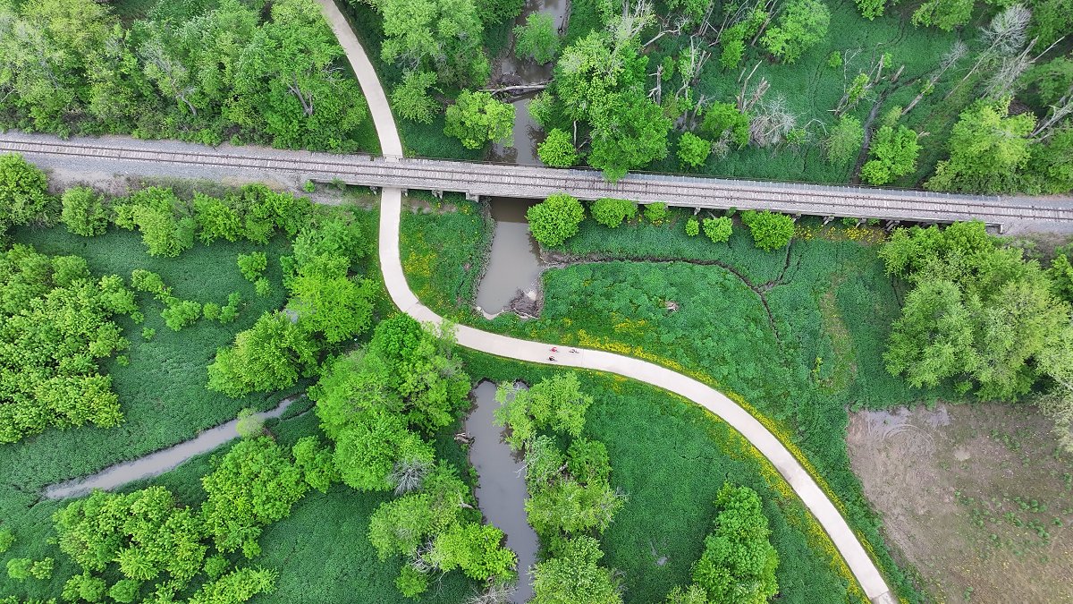
Fig 7: Trestle Trail in Lebanon (currently closed), connecting the town with the cycling-safe county road grid to the south and east.
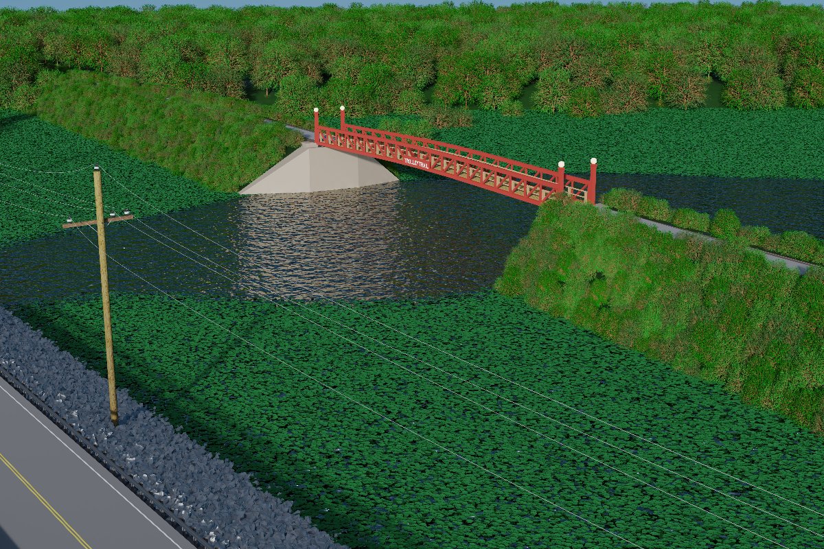
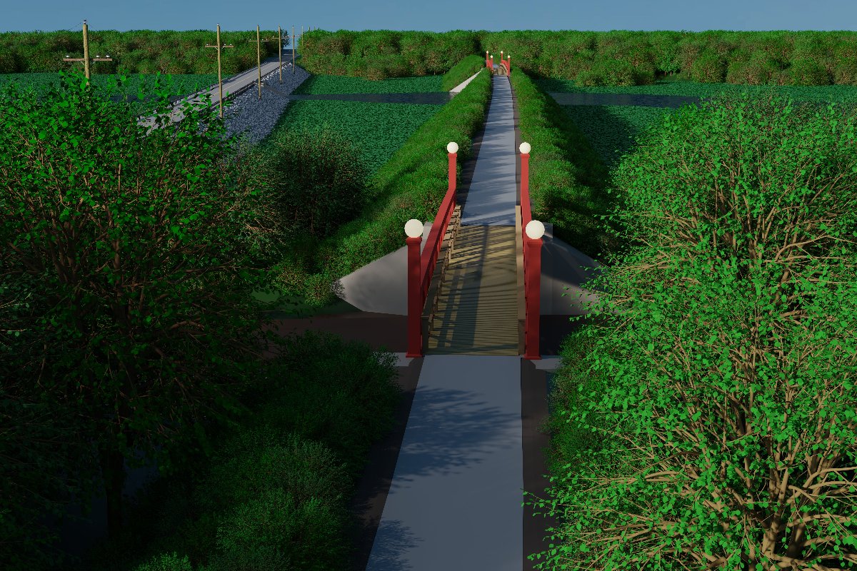
- Trolley Trail: An officially-planned shared-use path from Borchers Lane east of O'Fallon to Belleville Street in Lebanon, paralleling US Highway 50. Also referred to as the US 50 Bypass Trail on some maps, this path follows an old interurban trolley line. This trail would provide a safe cycling connection from Lebanon to O'Fallon via Borchers Lane and the proposed St. Vincennes trail. A conceptual Central Lebanon Connector would parallel Belleville Street to Wakanda Drive, with an additional segment between Perryman Street and James Street/Mary Jane Street to complete the connection to the Lebanon street grid. A conceptual South Lebanon Connector would parallel Highway 50 to True Value Drive, a frontage road along Highway 50 and Highway 4 on the south side of Lebanon.
Gateway East Trails (GET) made progress toward the initial surveying and design work on the Trolley Trail, with a $900,000 grant secured from the state of Illinois in 2023 [17]. However, Illinois requires that state grants for public infrastructure projects must go to a government entity. As a private volunteer organization, GET itself did not qualify as a recipient of the funds. Unfortunately no local, county, city or regional government entities were willing to accept the funds and the adjacent liabilities and responsibilities of managing the project, so the grant was put on hold.
As of July 2026, no plans for any further progress on this trail have been made public.
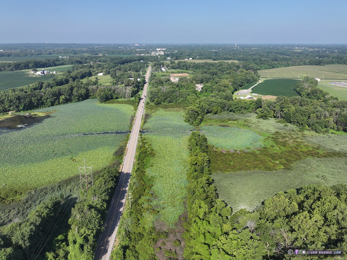
Fig 8: Silver Creek at the location of the planned Trolley Trail west of Lebanon, looking west toward St. Louis. The old interurban line roadbed embankment that the trail will follow is visible to the right of Highway 50.
BELOW: 3D concept renderings of the Trolley Trail along Highway 50 by Gateway East Trails.
Priority Trails
At minimum, shared-use paths connecting the residential street grids of O'Fallon, Lebanon and Mascoutah to the existing network are the essential pieces remaining to complete a safe commuting and long-distance cycling infrastructure for the local population.
With that goal in mind, priority trails for funding would be:
- Priority #1: O'Fallon Connection: Any one of the three O'Fallon Connector options shown on the map above would be the most impactful new trail route, giving the greatest number of people safe access to the MetroBikeLink trail network and to Scott AFB.
- Priority #2: Mascoutah Connection: Either the Berm Trail Extension or Route 161 Boardwalk & Trail across Silver Creek would serve the entire population of Mascoutah with a safe connection to Scott AFB. The MetroBikeLink Connector would complete Mascoutah's link to the rest of the trail network.
- Priority #3: Lebanon Connection: Either the Trolley Trail or the College Road Trail would accomplish the vital Silver Creek crossing for Lebanon cyclists, with any of the proposed O'Fallon trails (namely the Highway 50 trail extension to Reider Road) providing the rest of the connection to O'Fallon.
Regional bike/pedestrian trail notes
- Lebanon Connection Notes:
- The non-profit Gateway East Trails (GET) was an influential and impactful organization made up of dedicated, unpaid volunteers that not only managed to independently build the Trestle Trail, but secure $900,000 of state funding for the first stages of development of the Trolley Trail. Despite that fact, shared-use trail development to serve Lebanon residents has faced considerable headwinds and roadblocks. If you are a Lebanon resident and support the idea of safe cycling and walking infrastructure for your community, it's important to let your elected officials know (city, township, county and state).
The current climate of trail development in the St. Louis Metro-East region is very positive, with significant progress being made in St. Clair and Madison counties. However, opposing voices and circumstances have been successful in bringing the previously-promising trail development for Lebanon to a complete standstill, possibly long-term in ways that may be difficult to ever get going again.
If you are a Lebanon resident who supports bike-and-pedestrian-safe connections in your community, it is important for your elected officials to know that kind of support exists during our current era of favorable trail building conditions. Lebanon's current trajectory could end up with the town being completely left out of any future trail development, making it less attractive than neighboring towns to future homebuyers and businesses. Only the voices of residents has a chance to influence if and where trails to and in Lebanon will materialize.
- The College Road Trail would be a more circuitous route for resident cyclists in the southern half of Lebanon traveling to O'Fallon, Scott AFB or the MetroBikeLink trail network. The Trolley Trail route, in tandem with the Central Lebanon Connector segments, would provide the entire city of Lebanon the most direct route to those aforementioned destinations and connections.
- Mascoutah Connection Notes: St. Clair County owns all of the land on either side of Route 4 from Interstate 64 to Route 161 [14], meaning the county has the complete freedom to build a trail of any type, configuration and routing from I-64 and the airport to Route 161. The flat terrain along Route 4 means that almost no grading work will be needed. The Norfolk Southern railroad tracks will likely need a pedestrian/bike trail crossing configuration similar to what is in place at Shiloh Station Road. The segment from Route 161 to the Berm Trail will have to cross several business and residential driveways.
The government also owns most of the land on the north side of Route 161 between Scott AFB and Highway 4 [14].
- Dedicated pedestrian/cycling bridges at the following locations may be needed to complete cycle-safe commuting routes:
- On South Lincoln Drive across Interstate 64 in O'Fallon
- On North Main Street across Interstate 64 in O'Fallon
- On Highway 50 over the CSX Railroad
- Across Interstate 64 and Route 158 in the vicinity of the interchange of both highways
- Across Route 158 at Seibert Road
Route 158 is a busy, high-speed four-lane highway that is not safe to cross as a cyclist or pedestrian, even at signaled intersections.
For O'Fallon, the ideal location of the I-64 crossing would be just east of the Route 158 interchange, with the Route 158 bridge crossing just north of the interchange. As these bridges would need to be long enough to span the 6 lanes of I-64 and the 4 lanes and wide median of Route 158, they would be significant expenses, possibly exceeding the combined cost of most of the existing and future trail system around Scott AFB.
- Adding pedestrian signals at the following intersections may be a sufficient solution if dedicated bridges are impractical:
- At the intersection of Highway 50 and Route 158 (Scott-Troy Road)
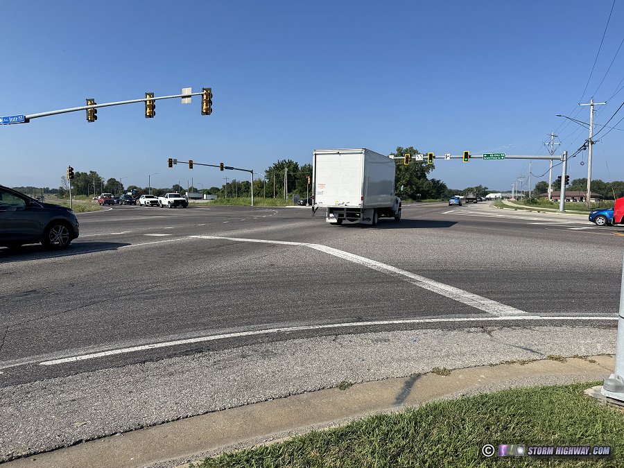 Fig. 33: Highway 50 intersection with Scott-Troy Road (Route 158) in O'Fallon Fig. 33: Highway 50 intersection with Scott-Troy Road (Route 158) in O'Fallon
- At the intersection of Highway 50 and North Main Street
- At the intersection of Seibert Road and Route 158 (Scott-Troy Road)
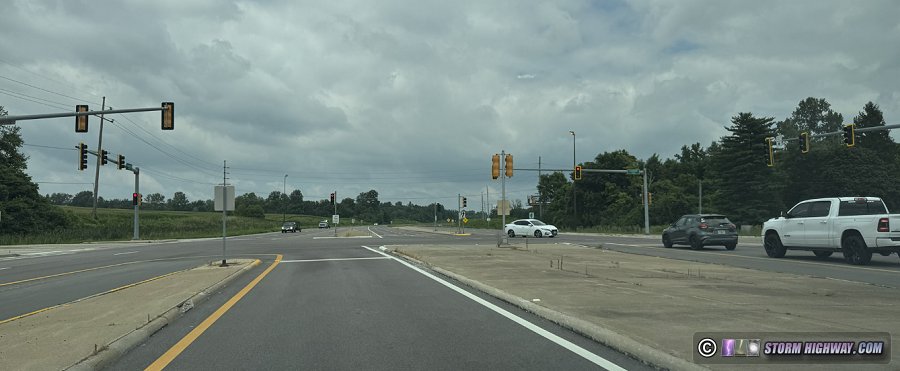 Fig. 29: Route 158 at Seibert Road Fig. 29: Route 158 at Seibert Road
- On both the eastbound and westbound ramps from Highway 4 to Interstate 64
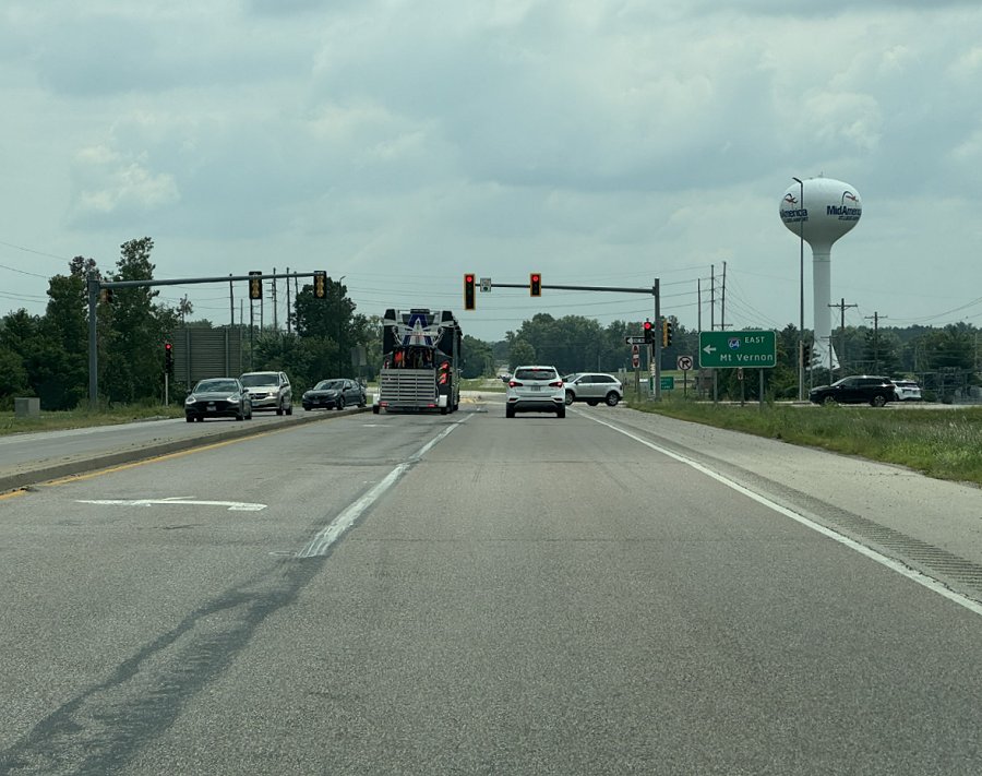 Fig. 21: Route 4 at eastbound I-64 ramps Fig. 21: Route 4 at eastbound I-64 ramps
- On both the eastbound and westbound ramps from Rieder Road to Interstate 64
- At the intersection of Route 4 and Route 161 in Mascoutah
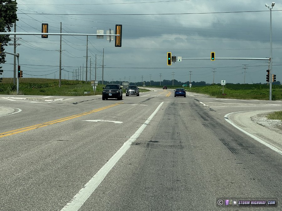 Fig. 24: Intersection of Route 4 and Route 161 in Mascoutah Fig. 24: Intersection of Route 4 and Route 161 in Mascoutah
The pedestrian signal cycle should be triggered by a manual button by riders and pedestrians, and the road signals should be configured to address the risk of turning vehicles when pedestrians have the right-of-way.
- The closest Madison County Trail network connections [8] to Scott AFB and the areas east of Silver Creek are the Goshen Trail in O'Fallon (about 10 miles from the base) and the Madison County Transit Heritage Trail in Marine (22 miles north of Mascoutah). As this article has already covered in detail, prior to 2026 there was no safe cycling route to reach the Goshen Trail from Scott AFB nor the communities east of Silver Creek. East of Silver Creek, prior to 2026 the Goshen and Heritage Trails could be reached safely by bike only via a lengthy route on county roads. Before the MidAmerica trail connection, from Mascoutah, the shortest county road (cycle friendly) route to the Heritage Trail was about 30 miles, while the closest safe route to the Goshen Trail was 27-mile path via the Trestle Trail and county roads north and south of Lebanon.
Now that the MidAmerica MetroBikeLink Trail Extension has been built, the connection to the Madison County trail network has been reduced in length by nearly 20 miles (coming from Mascoutah)!
- The Katy Trail's eastern terminus at Machens, Missouri can be reached via the Madison County Trail network, though some riding on highways west of Edwardsville and in West Alton, MO are required. O'Fallon cyclists can start a ride to the Katy Trail from the Illini Trail to the Goshen Trail. For the first time, a Katy Trail ride can be started east of Silver Creek using the new MetroBikeLink trail extension to MidAmerica Airport (More info on this route).
Conclusions
The Heartlands Conservancy study made a thorough and convincing case for developing cycling and pedestrian routes around Scott AFB. Closing the cycling-unfriendly route gaps between these communities and the robust trail systems in the Metro-East would provide not only attractive bicycle-commuting options for residents, but could effectively make the Metro-East the new eastern terminus for internationally-renowned Katy Trail through-rides.
Update: The MidAmerica MetroBikeLink Trail Extension is OPEN!
In July 2021, the St. Clair County Transit District confirmed as part of a news report (1, 2) that the MetroBikeLink trail will be extended across Silver Creek to MidAmerica Airport as part of the Metrolink extension to the airport. This trail was completed in 2026 and is now open.
Sources and References
GO: Home | Storm Chase Logs | Photography | Extreme Weather Library | Stock Footage | Blog
Featured Weather Library Article:
|
|




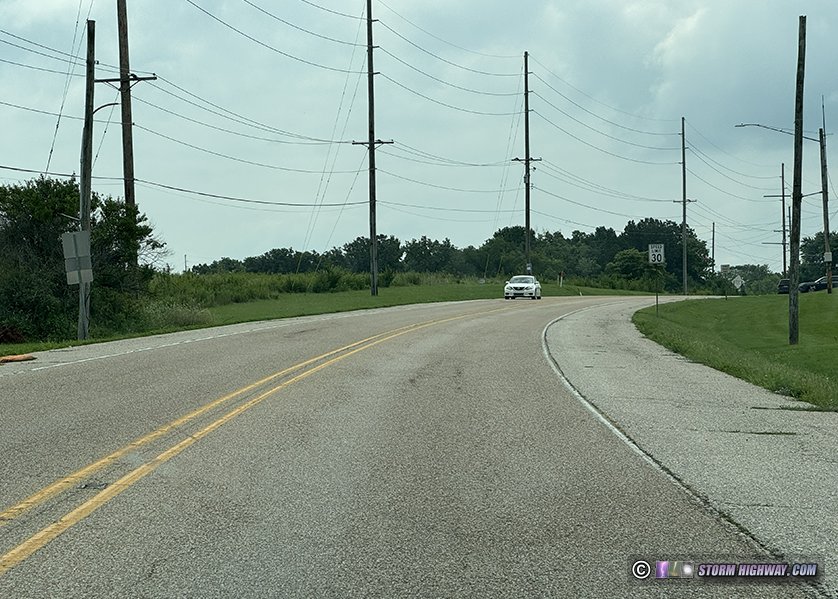 Fig. 18: Current state of South Lincoln Drive in Shiloh
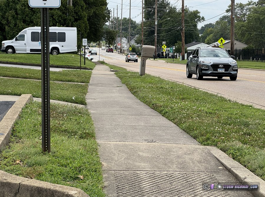 Fig. 17: An O'Fallon trail connection's path along Main Street in Shiloh would involve widening the existing sidewalk to shared use path standards.
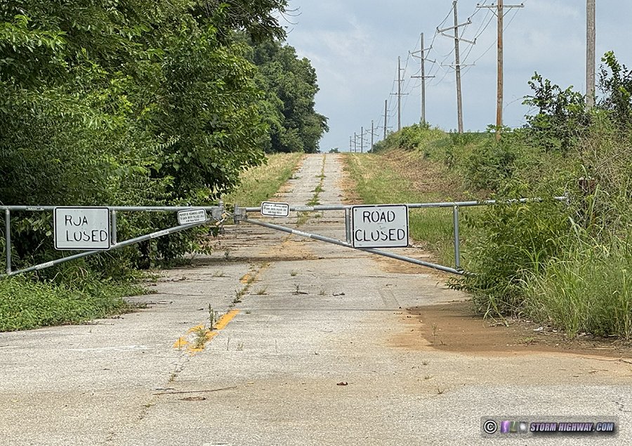 Fig. 15: An O'Fallon connector trail could use the Old Highway 158 corridor north of Wherry Road