Outflow-dominant storms in Oklahoma: May 12, 2010 Outflow-dominant storms in Oklahoma: May 12, 2010
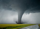
ABOVE: Storm near Burlington, OK on May 12, 2010.
Click any thumbnail on this page to view a larger version.
BURLINGTON, OK - Wednesday, May 12 was a little similar to Tuesday, in that upper support, extreme instability, shear and moisture were present for supercells. The main problem today was that a cold front was poised to overtake the dryline, causing linear development before supercells could develop. It was a risky setup with a decent payoff possible if it worked out. So despite the fact that I was already in northeastern Oklahoma prepared to drive home to St. Louis (and cover the warm front risk on my way), I chose to do yet another 180 and make a third drive into central/western Oklahoma in as many days - caravanning this time with Greg McLaughlin, Jospeh Tyree and Keith Minor.
To make a long story short, the cold front did indeed surge ahead, quickly unzipping a long line of undercut convection from Kansas down through western Oklahoma. We ended up in Burlington, in far northwest Oklahoma on the central-southern portion of the line. Though I saw some attempts at organization, there was never any well-established inflow into any of the areas of interest. Lightning was also very meager. However, I took a few 'scenic' shots of the storm and a few of its interesting cloud features.
   
This day was rare in that things looked so bleak, I called off the chase at 5PM and began the long drive back to St. Louis. In the Plains, that is rare indeed! As I passed Wakita en route toward home, I checked radar and saw several potent supercells down on I-40 near Elk City that looked like viable players. However, it was 6PM and I was more than 2 hours away from intercept, which would place me there right as darkness fell. I felt that the storms might also go linear quickly as the northern ones did - that and the fact that I didn't want to delay my trip home by another 5 hours made me decide to forego trying to catch the I-40 cells. Although I did miss a twilight tornado near Clinton as a result of that choice, I was definitely glad to get back home sooner after an exhausting four back-to-back days of storm chasing.
And such, Plains trip #2 came to a close. As always, a big thanks to my friends for the company on the chases, and particularly to Justin Teague for the generous offer of lodging in Tulsa.
NEXT EVENT: Still to come.... >
GO: Home | Storm Chase Logs | Photography | Extreme Weather Library | Stock Footage | Blog
Featured Weather Library Article:
|