|
Home | Blog Index | Blog Archives | Christianity & Faith Essays | Storm Chasing Essays
Summer 2017 storm chasing roundup
As you've noticed if you're been a longtime reader, sadly I have been slowly moving away from doing a blog post right after every storm event. As a traditional "night owl", my 5:30AM daily wakeups for work leave me exhausted by evening time, shortening and many times eliminating what has historically been my most productive blog post writing window. Furthermore, this summer has been below-average in terms of worthy opportunities and/or photogenic storms close to or in the St. Louis metro. Case in point, I have set up for lightning photography downtown only twice this summer.
So, with a rare free weekend at my disposal, here are the highlights of storms and weather events chased since my Great Plains storm season ended on June 13.
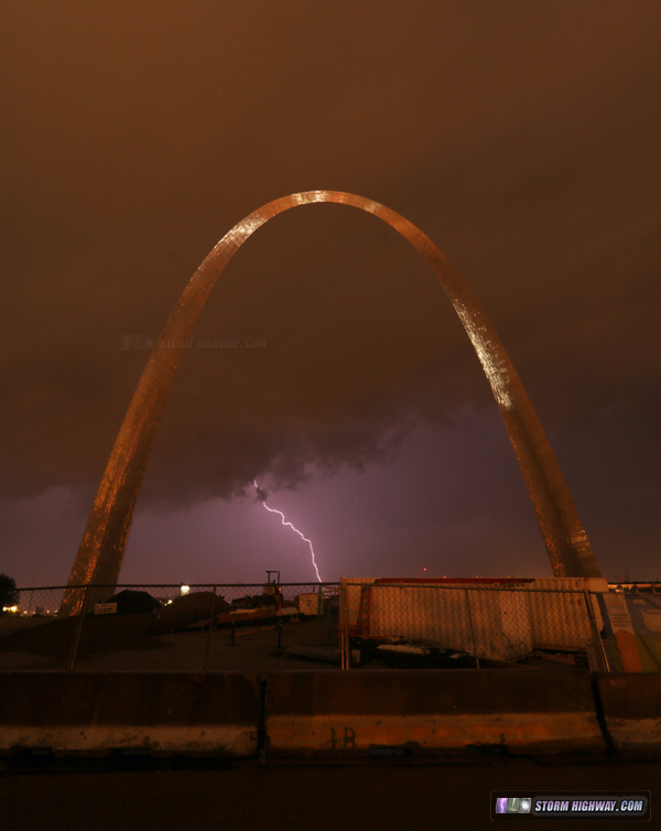
June 18: "Meh" nighttime storm in St. Louis
I have actually not been too discontent about the lack of good storms in St. Louis this year, as most of the prime photo locations have been rendered useless by the ongoing Arch grounds construction. At night, large cranes are left fully extended, with no way to frame a shot without them blocking some part of the structure. That's in addition to the foregrounds being decimated with high fences, dirt piles and random pieces of equipment and materials. Thankfully, this work is all slated to be complete in October, so next year's storms should have clean and photogenic scenes again.
This storm on June 18 was generally uncooperative, aside from one distant bolt over the construction mess:
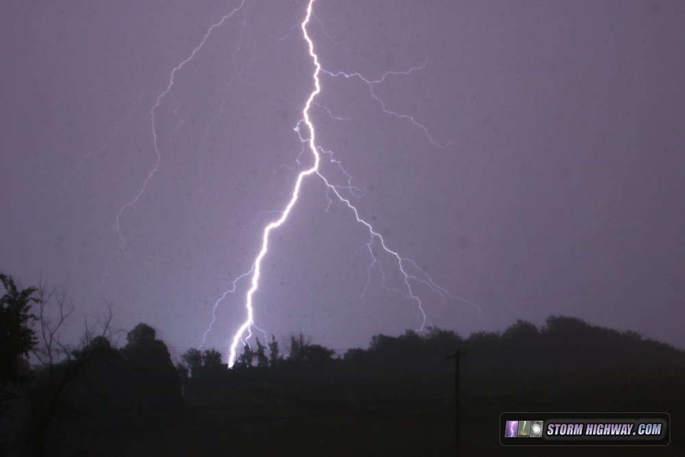
 July 13: Overnight storms near Pittsburgh
During the week of our annual Robinson family summer get-together, several non-severe thunderstorm events brought some nice lightning displays to southwestern Pennsylvania. I only went out on a chase for one of them, a middle-of-the-night storm cluster moving east along I-70 from Wheeling, WV to New Stanton, PA. I only caught one interesting photo near Elizabethtown of a CG triggering a power flashover (the source of the faint blue glow near the ground):
Some of the other storms during the day were nonetheless enjoyable, as my nieces and nephews had fun watching the radar and Blitzortung lightning maps as the bolts flashed outside. July 21: Illinois supercell, tornado and lightning barrage; Chicago lightning
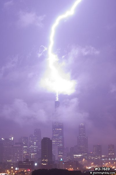
The "big storm chase day" for me this summer was on July 21. My primary focus was for the MCS upward lightning potential in Chicago. Models had consistently shown a mature MCS moving over the city after dark, with a trailing stratiform region good for upward lightning strikes to the 3 tallest buildings. On the way there, an isolated storm developed near Dwight, with a visibly very strong, persistent updraft.
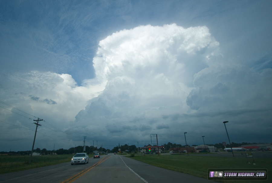
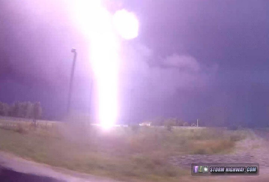
Since this storm was entering a diffuse warm frontal zone and the Chicago storms were still about 3 hours from the city, I deviated from the original plan and headed east to intercept the storm. It exceeded my expectations, with a top-5 lightning barrage (many close strikes and about 15-20 wind turbine strikes). During one 10-minute interval, every CG was hitting the wind turbines! When the storm was over the wind farm, more bolts were hitting turbines than hitting the ground.
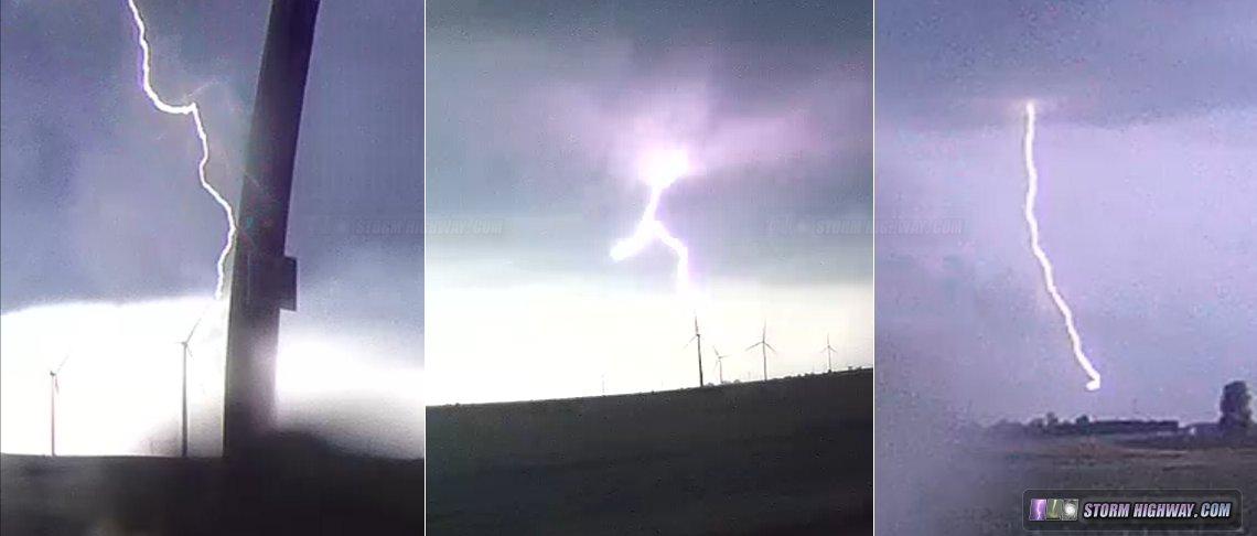
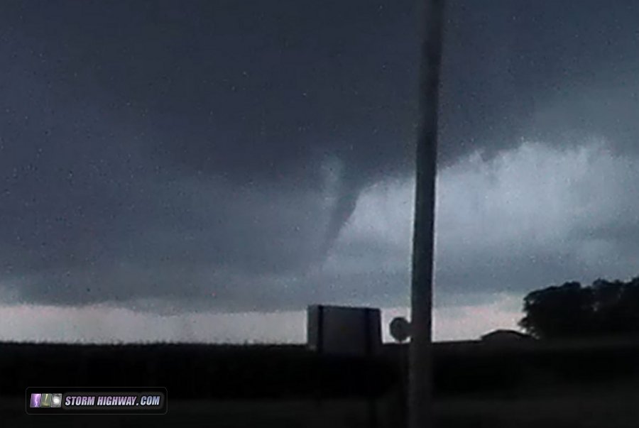
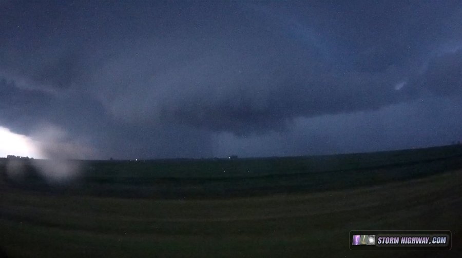
Eventually, the storm began a sustained period of organization as inflow increased and a large RFD surge cut in. Low-level motion into the meso was very rapid, and as the RFD made its way around, a brief small tornado developed with condensation 3/4 of the way to the ground:
The storm continued to show dramatic structure, though it was increasingly getting choked off by precip falling into the inflow region and increasingly rain-filled RFD.
The lightning produced by this storm was in my top 5 in terms of the number and frequency of close strikes. Two of the bolts were within 100 feet. This video is a compilation from the 4 dashcams.
After this storm crossed I-57 and weakened, I continued into Chicago per the original plan. While there were some upward lightning flashes to the buildings, southerly flow brought a thick layer of low clouds over the city that obscured most of the action.
View larger
Here is the video from this part of the event.
The four-way dashcam timelapse from this chase is here. August 16: St. Louis storms
An trip into the city for a round of thunderstorms. No footage or photos captured.
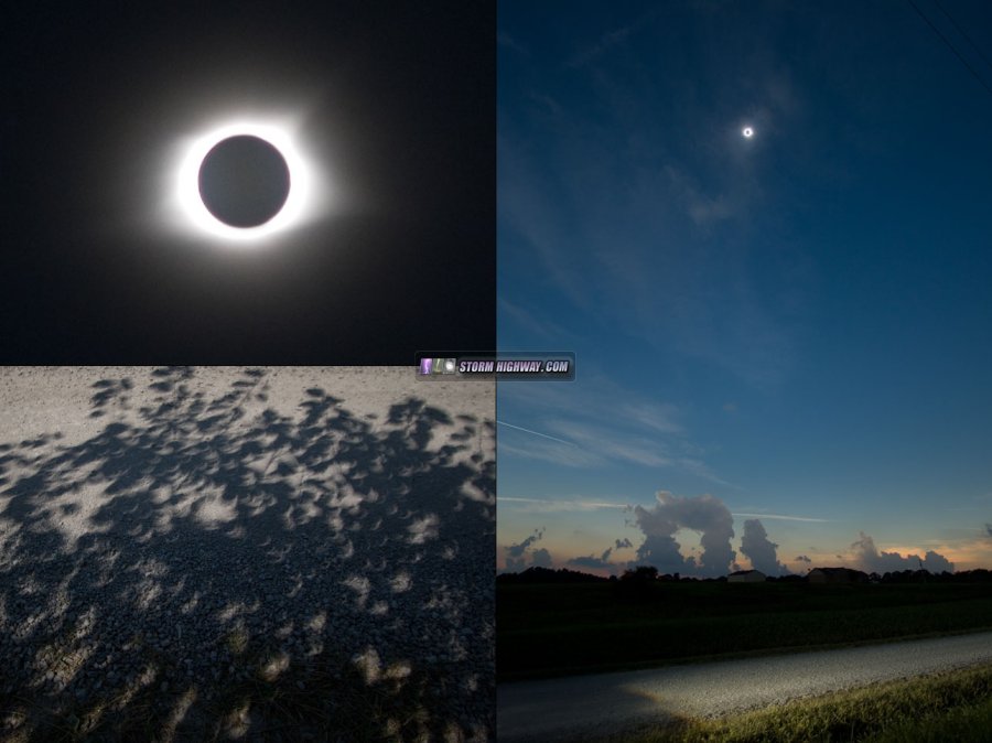
August 21: Total solar eclipse
The page for the biggest event of the summer (and arguably the year) is here.
Yes, that's it for the only blog-worthy events I've seen this entire summer. Aside from the eclipse and July 21st, the Midwestern skies have been generally quiet. We are entering our fall minor "second peak" of severe weather, so a couple more chase-worthy storm events are likely before winter arrives. Stay tuned!
GO: Home | Storm Chase Logs | Photography | Extreme Weather Library | Stock Footage | Blog
Featured Weather Library Article:
|


