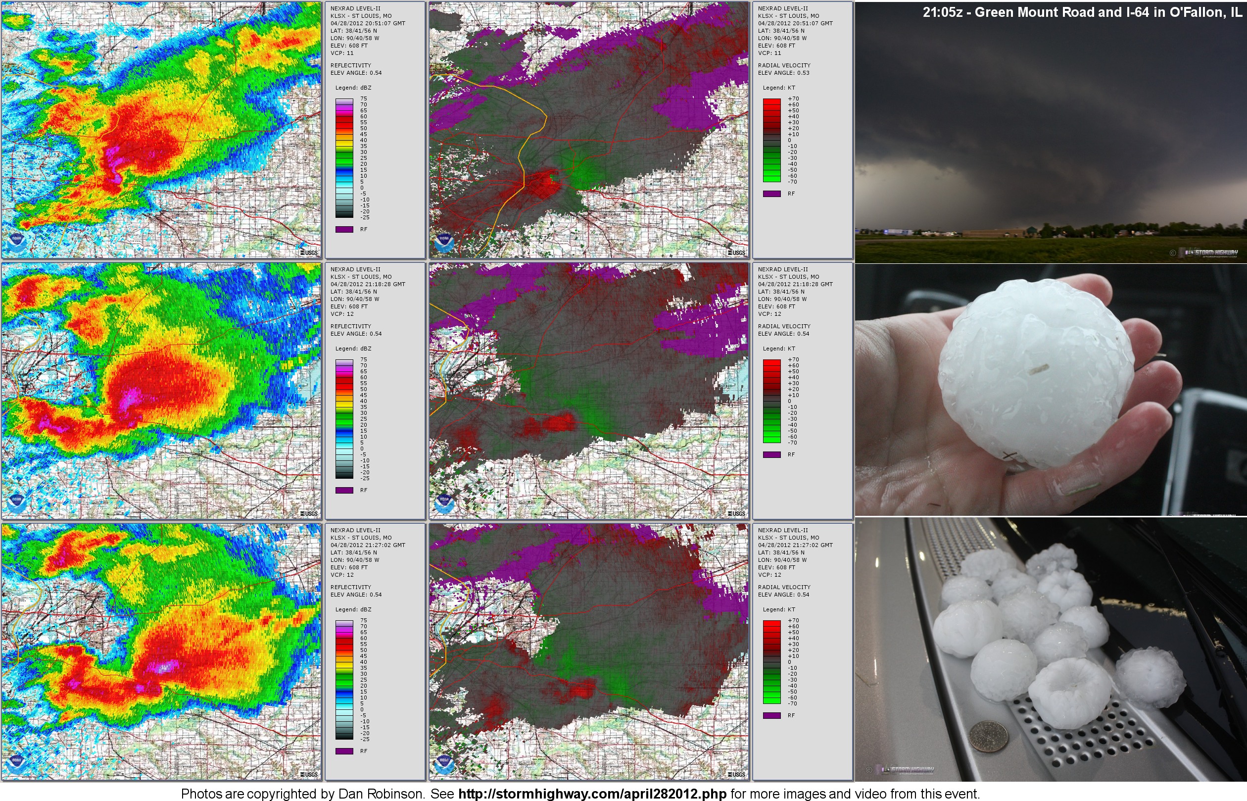 
  Major hail-producing supercell in St. Louis metro: April 28, 2012 Major hail-producing supercell in St. Louis metro: April 28, 2012
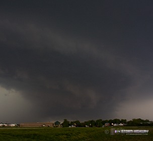
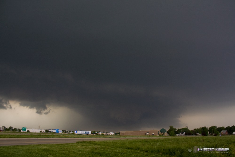
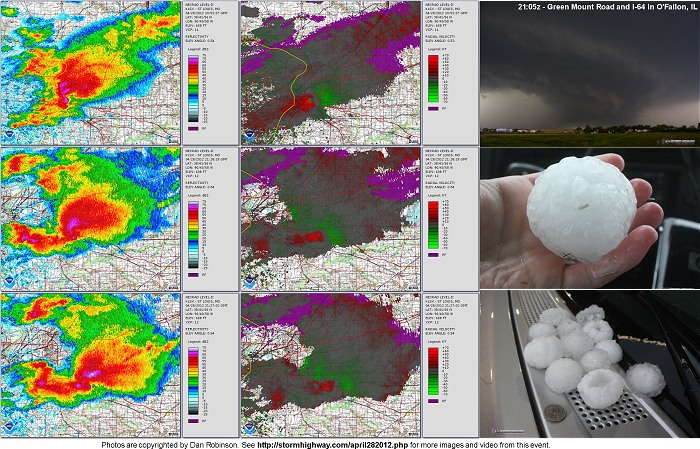
ABOVE: Supercell and its large hail in O'Fallon, Illinois on April 28, 2012.
HD EXPEDITION VIDEO: Supercell with large hail in O'Fallon, Illinois on April 28, 2012: Watch Video
CCTV VIDEO: Large hail in New Baden, Illinois on April 28, 2012: Watch Video
Click any thumbnail on this page to view a larger version.
O'FALLON, IL - An intense, long-lived supercell traversed the entire width of the St. Louis metro area from west to east on Saturday, April 28, 2012, producing major damage from large hail across a wide swath of the city and its suburbs.
HD EXPEDITION VIDEO: Large hail in O'Fallon, Illinois on April 28, 2012
CCTV VIDEO: Large hail in New Baden, Illinois on April 28, 2012
UPDATE: This storm is now ranked as the second most costly hail event in US history with losses of $1.6 billion!
(Photos below!) Today's setup was of the circumstance I feared the most, a potent severe weather event in or near St. Louis happening on a day I could not take a day off of work (this has occured twice now this season). Fortunately, that scenario worked out for the better today.
Saturday's setup was a bit of a surprise. I had expected the surface boundary to be much farther south, and based on previous days' models, had anticipated storms firing early in the morning and being well south and east of STL by afternoon. I awoke to find the boundary much farther north, with a quite potent supercell environment taking shape over the metro area. As a storm chaser, my heart sank. When the storm first fired about 50 miles west of Wentzville right before I left for work, I was horrified. I knew this thing was going to be a monster, and there was nothing I could do to be able to go after it. I am, thankfully, allowed to freely check weather data at work. I watched helplessly as the storm intensified and began hooking, moving along I-70 on a similar track to last year's Good Friday supercell. Thankfully, the storm never developed a very strong low-level circulation and therefore was not a big tornado threat. However, VILs were off the charts (completely maxed out), suggesting that this thing was likely producing significant hail.
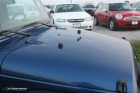
I expected the storm to begin turning right and start tracking due east just south of I-70, which it did. As a storm chaser, this was a very sick feeling seeing a storm like this going through my town and not being able to be there. But then the storm did me a huge favor. It began turning *hard* to the right, directly toward O'Fallon. At this point, it looked like it would pass close enough for me to take an early lunch break and go out to at least watch it go by to the north. With a VERY short 'leash', I headed out to Scott-Troy Road and I-64 to hope to see some storm structure to the northwest. I could make out a base to the west, but visibility at my location was poor. I hopped on I-64 down to the next exit at Green Mount Road, which has better visibility. When I got there, I had a good view of the storm structure. Before I got out to shoot a few pictures, the storm developed a low-level circulation and became tornado warned. The sirens in O'Fallon began blaring.
 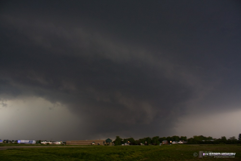
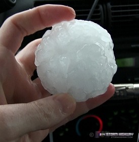
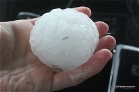
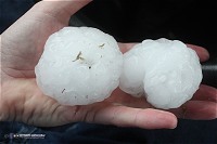
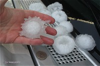
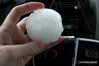
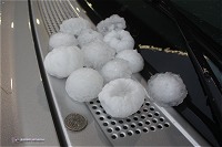
The meso of the storm was rain-wrapped and hard to see, but I didn't see any rapid rotation/motion suggesting it was threatening to produce. At this time I could see on radar that the storm was turning even harder to the right, heading straight for me. VILs were still maxed out, so I returned to Scott-Troy road and parked under the Moto Mart gas station canopy to await the likely huge hail. In a few minutes, the hail arrived. Chaos ensured as drivers scrambled to get their cars under cover. I shot video here for a few minutes (link is above). As soon as the hail subsided, I ran out to grab some samples to photograph. When I arrived back at work, I walked around for a couple of minutes collecting some of the hail that had fallen there. Nearly all of the cars were dented, and at least one had a cracked windshield.
My being stuck at work today ended up working in my favor. Had I been free to travel, I would have stayed just ahead of the storm along the I-64 corridor to keep its base in view in case it tornadoed. Had I done that, I would have not only seen nothing, but I would have missed the hail. As it turned out, despite the storm's intensity and at times ominous radar signatures, it never came close to producing a tornado. I never saw any good low-level velocity couplet on the storm (the best I saw was when I was viewing it in O'Fallon), and no tornadoes were reported. Several storm chasers were on the storm (according to Spotter Network) and I only saw a wall cloud report, ironically from New Baden.
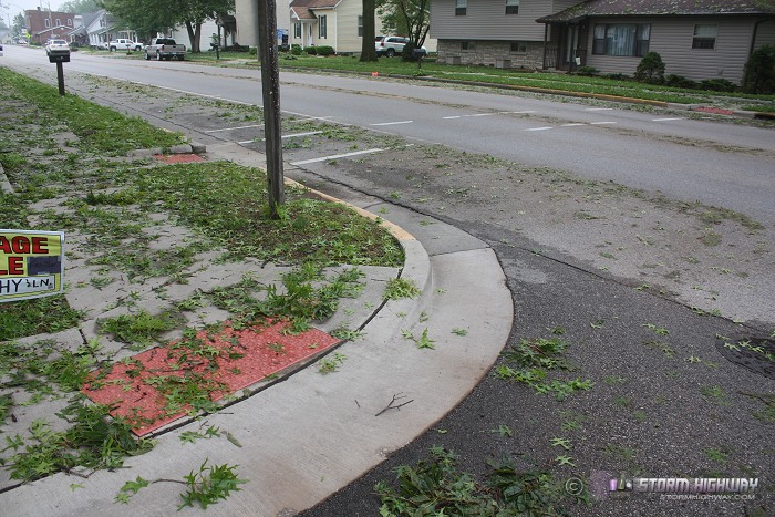
Here are some aftermath photos from New Baden. The eastern part of town was hit hardest, with a higher number of broken vehicle windows:
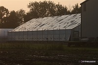
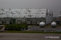
The worst damage I saw was to the glass greenhouses at Ahner Florist, on the west side of town (I live a couple of doors down from Ahner's):
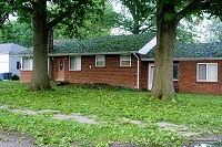
Tree defoliation/shredding was severe everywhere in town - it looks like autumn, but with green leaves on the ground:
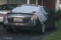
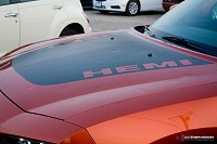
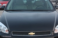
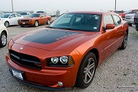
The Reno Guthrie Chevrolet dealership on the west side of town suffered extensive damage to every vehicle on the lot, mostly body damage:
My CCTV system at home caught some interesting video of the hail in New Baden (the same storm), with trees being shredded and a couple of my cameras getting whacked pretty hard out of alignment: Watch CCTV video
Sadly, this storm collapsed a party tent in downtown St. Louis, causing casualties. It appears this, like the Indiana State Fair disaster last year, was caused by the flimsy construction of the tent that was unable to withstand typical severe thunderstorm winds. Wind-wise, this storm was not remarkable - I did not witness any winds greater than 40 or 50mph in O'Fallon, and I was positioned where the highest winds in the storm likely should have been. There were also not an abnormally high number of reports of wind damage metro-wide.
Other chaser accounts from this event:
Radar imagery
|