May 18: Forecast update, chase tracker page and vehicle photos
Not much new to report on the severe weather outlook for next week. Monday still looks like the day, unless the models completely bust their forecasts. In fact, there could be a few expedition-worthy events starting on Saturday. But, because we thought the weekend looked quiet a couple of days ago, we opted to make other plans for things like work schedules over the weekend. So, Monday morning is the earliest we can leave. We may head out on Sunday night if everyone is up to it, just to get a 2 or 3 hour jump on the distance we need to travel.
As I type this, West Virginia is finding itself under a marginal storm risk, with severe thunderstorm watches already in effect. We could see a small amount of hail today and possibly some decent lightning, but not much else.
Based on the current outlook, this probability table charts the chance of our trip starting on a particular date:
| 2006 Storm Photography Expedition - Departure Date Probability as of May 18 |
| May 18-19 | 0% | |
| May 20-27 | 95% | |
| May 28-June 4 | 4% | |
| No trip | 1% | |
|

Join us on a virtual storm chase! Our new, improved Live Event Tracker Page features a live webcam from onboard our vehicle, a live GPS feed showing our location in real time, and a live feed from our onboard weather station showing current conditions from wherever we are. Our tracker page will go live as soon as we depart for our Tornado Alley storm photography expedition. Stay tuned!
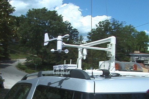
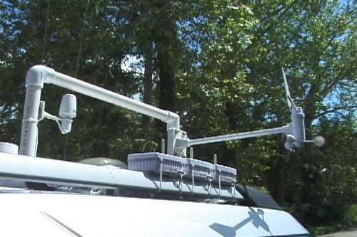
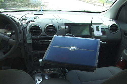
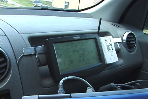
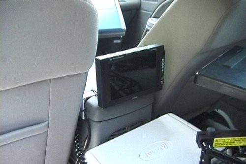
May 18 vehicle photos: As promised, here are a few photos of the additional equipment we installed on the expedition car this week. We added a fourth LCD monitor for the second-row passengers, and a complete wireless weather station that records wind speed & direction, dewpoint, barometric pressure and rainfall rates. I have to add the disclaimer that such mobile use of these weather stations is somewhat controversial in storm photography circles, as they are not designed for this type of application - and consequently their accuracy can suffer. Things like the airflow patterns over the vehicle and temperature fluctuations on paved surfaces tend to skew some of the readings, so many times these factors must be taken into account when observing the data. However, the data from the instruments will be at the very least interesting to observe as we traverse the country, crossing fronts, drylines and other boundaries and entering and exiting storm environments.
GO: Home | Storm Expeditions | Photography | Extreme Weather Library | Stock Footage | Blog
Featured Weather Library Article:
|