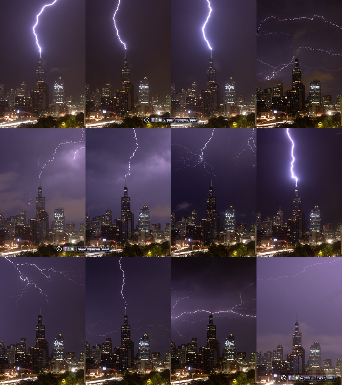
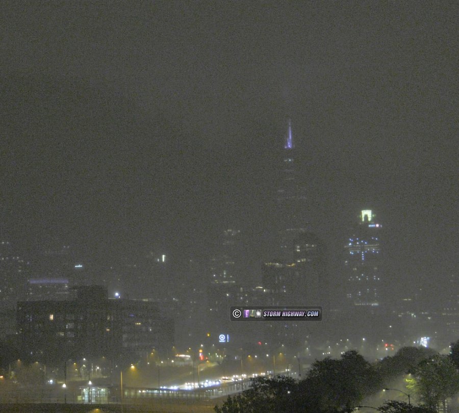
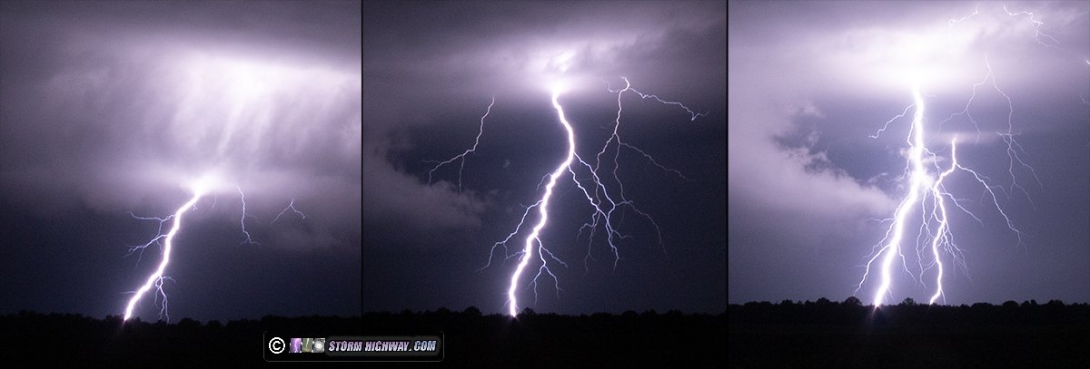
A stack of the above images:
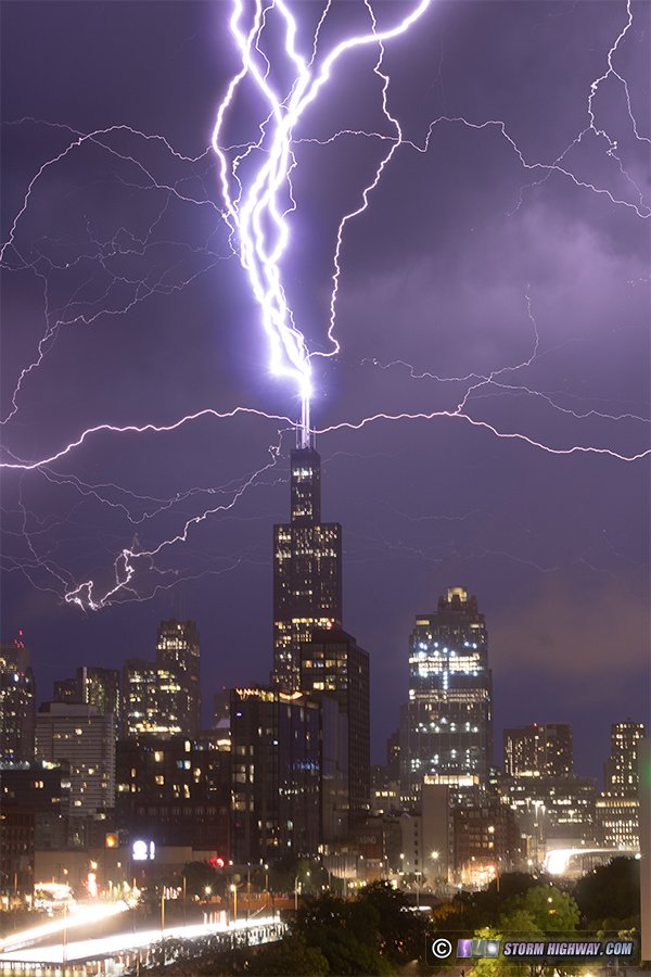
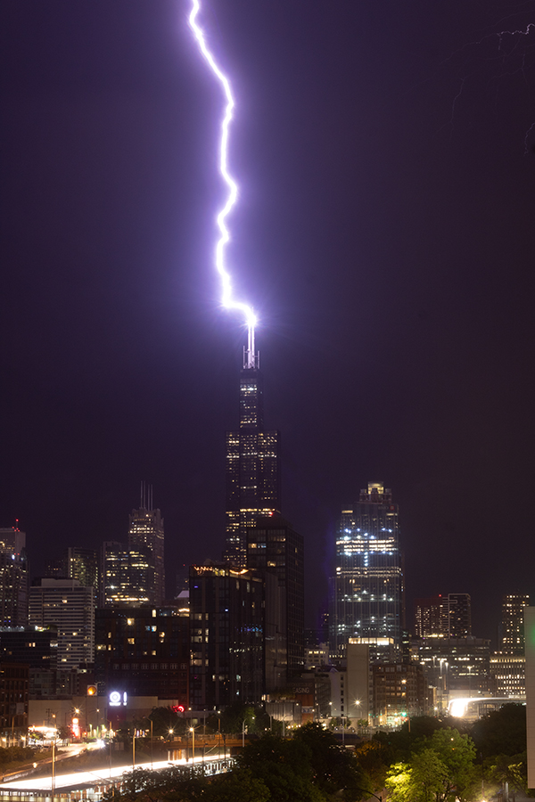
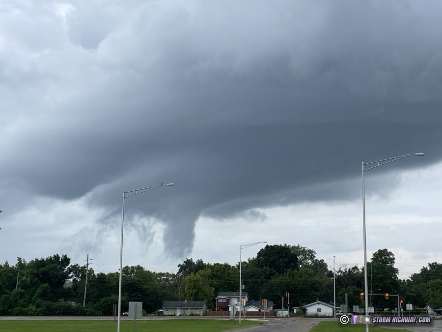
Several mesovortices on the leading edge of the line prompted tornado warnings with sires sounding downtown, and this possible funnel appeared over the syline:
Video:
 July 15: Downtown Chicago tornado
Tornado behind the Chicago skyline during a derecho event. This chase has its own page
here.

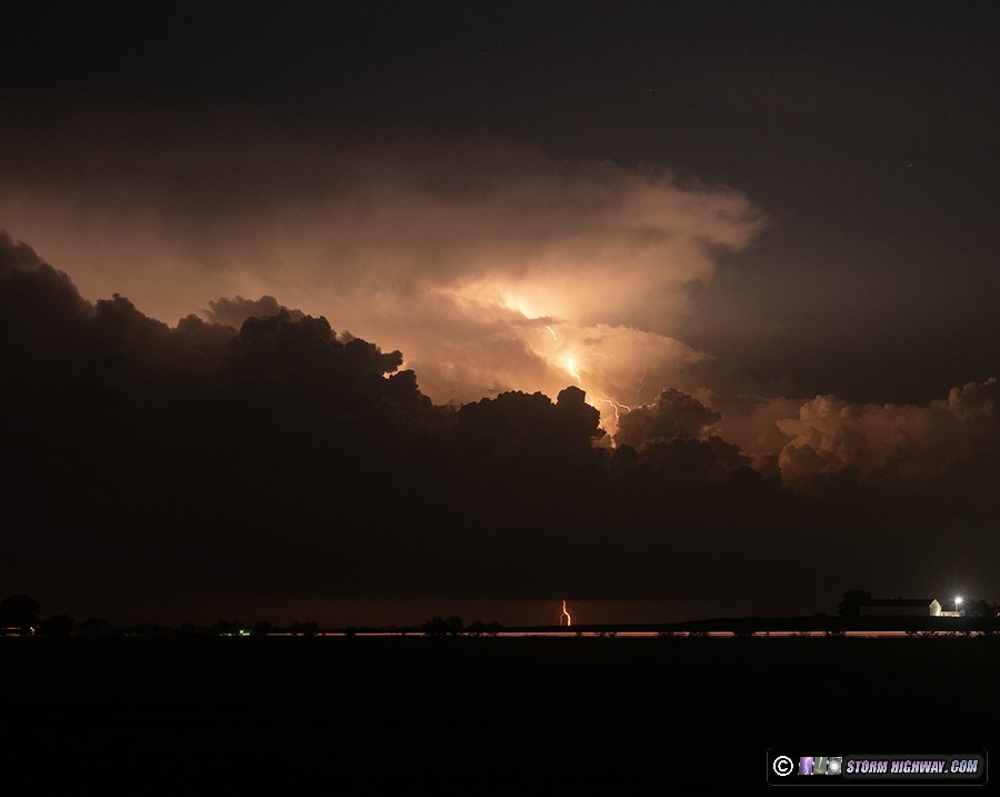
 July 16: St. Louis metro-east lightning and flooding
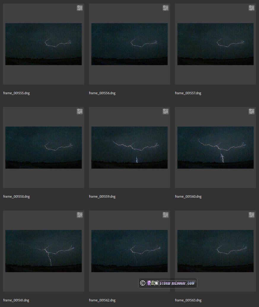
I left Chicago early on the morning of Tuesday the 16th, but did not make it south in time for most of the flooding thunderstorms that persisted through midday in mostly the eastern St. Louis metro. By the time I got to Lebanon, the waters had mostly receded. Getting over to shoot the closed section of I-64 past Nashville was going to be impossible at that late of a point, so I just stayed near home and shot some high-speed lightning video. I captured an interesting intracloud-to-ground flash southeast of New Baden at 6,000fps:
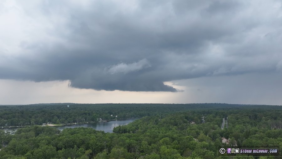
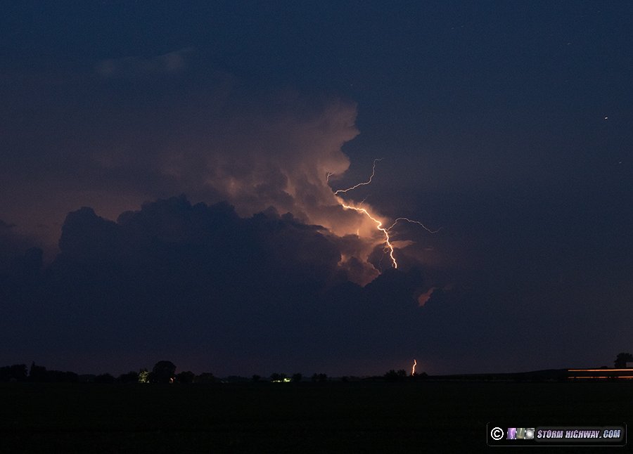
 July 17: Distant southern Illinois lightning
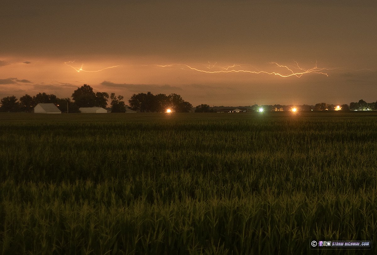
Thanks to the St. Louis and I-64 corridor storms lasting so long, they pushed outflow far to the south, much farther than models had predicted. This meant that instead of another possible big storm day in the metro area, activity would be too far south and displaced from the upper-level support to be worth traveling out of the area for. I went out to look at the storms after they fired on the boundary after midnight, trying for a few stills with the 50mm lens from New Baden. Bolts were visible in the stratiform region of the storms down near Carbondale and Marion, 65 miles away.
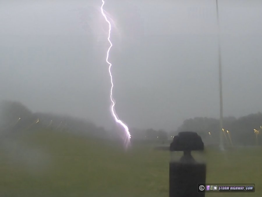
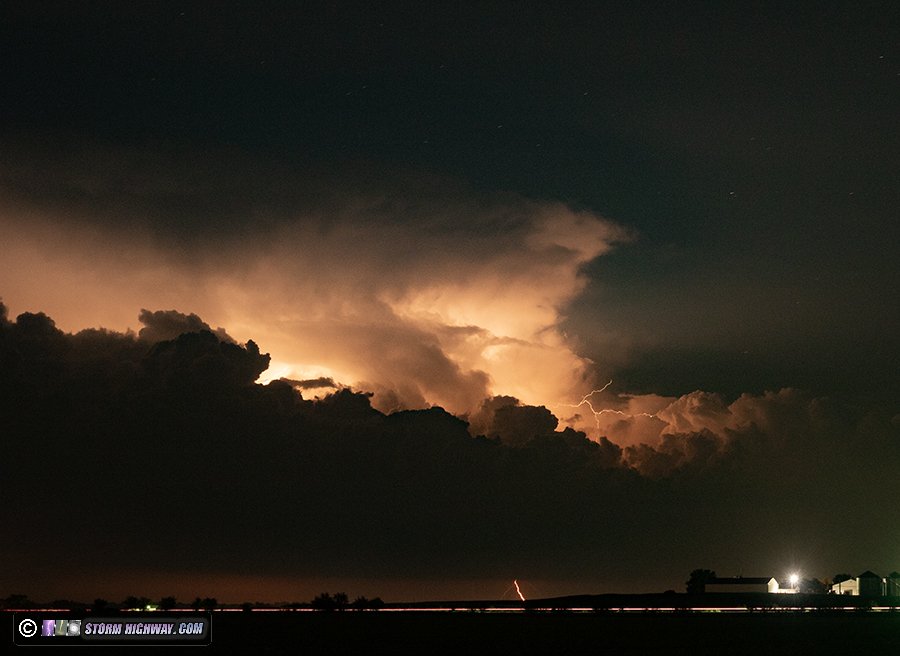
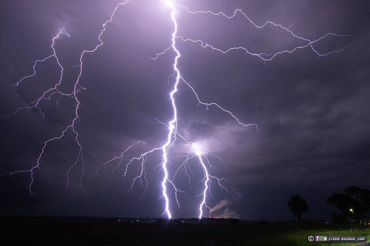
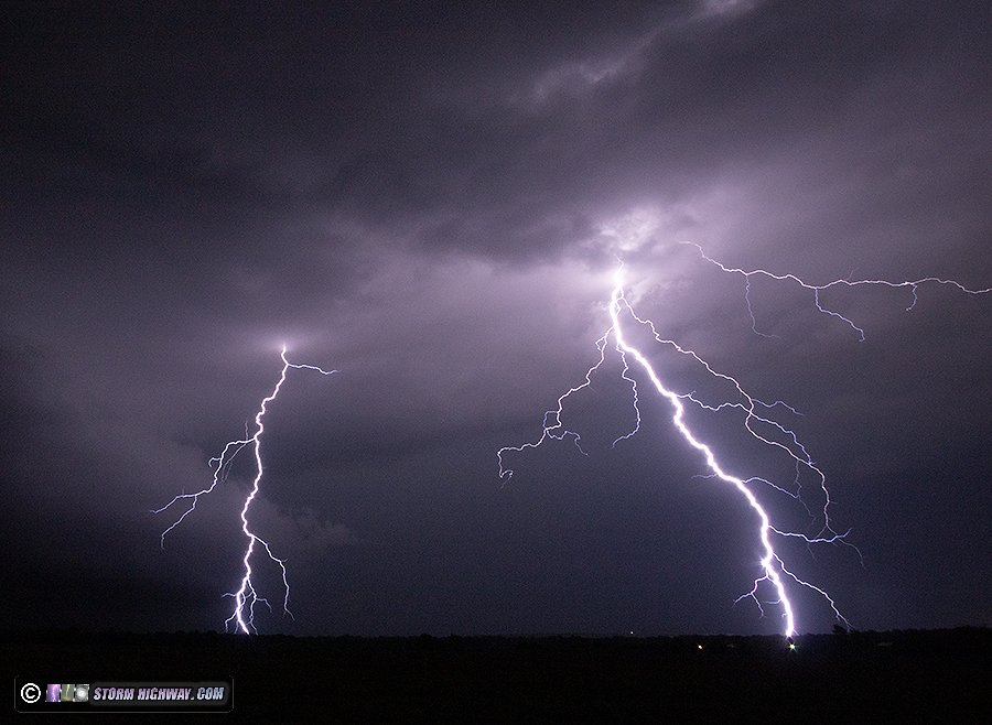
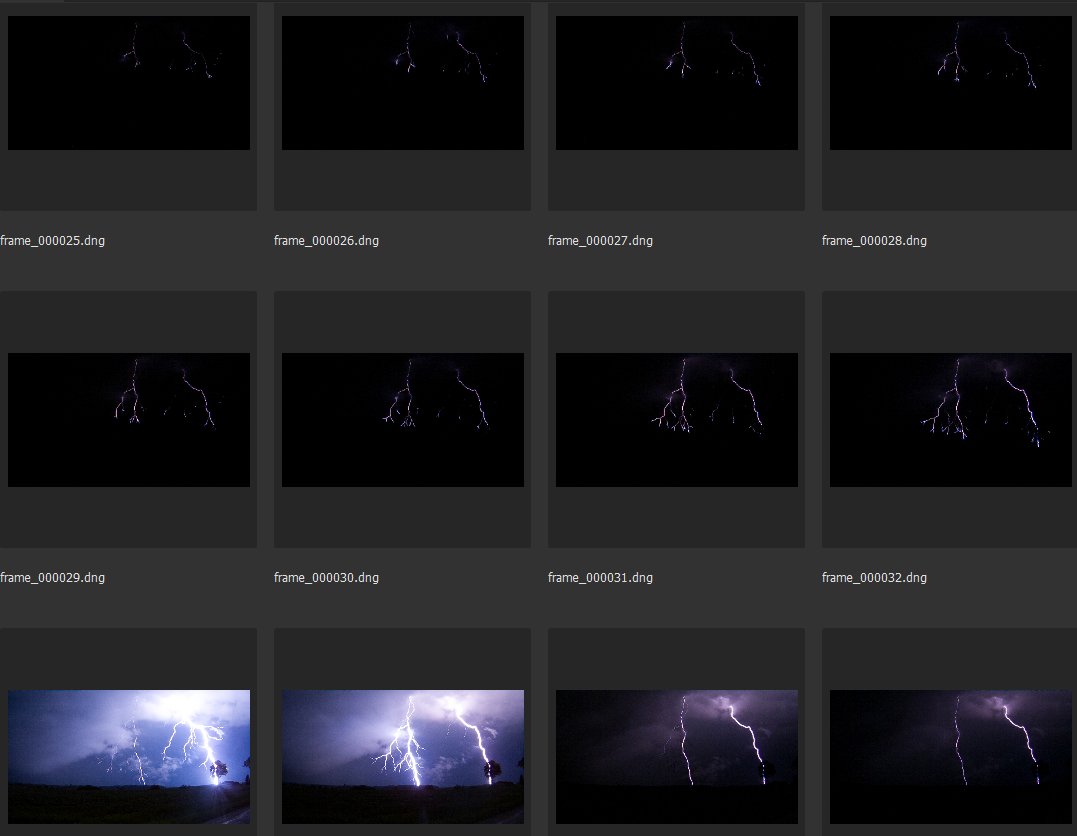
July 23: New Baden, IL close lightning
This was one of our typical instability-but-no-shear summer storm days where there was nothing to warrant going out more than a couple of miles from home. When some updrafts started going up outside of town, I went out with just my phone and high speed camera, not expecting much. After a few storms cycled up and down around town for an hour with only a single cloud-to-ground bolt produced, I wasn't very motivated to get a camera rolling until this core started intensifying right over New Baden:
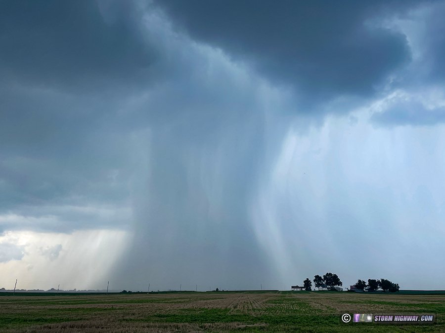
Even though it hadn't produced any lightning up to this point, I aimed the high speed camera at it and started shooting, expecting a couple of bolts due to how strong the core looked on radar. After several minutes of this, the rain started catching up to me. I put the camera down preparing to move east to stay out of the rain, then *boom*, this happened (this is the view from my dashcam):
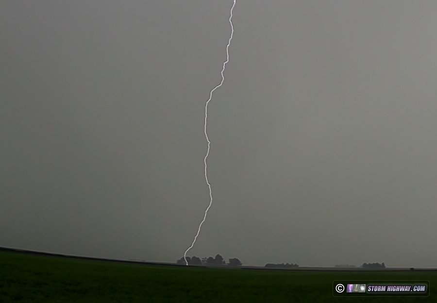
That was right in the center of where I'd been shooting with the high speed camera a few seconds earlier. It would have been one of the better high speed captures of the year if I'd held the shot for another 15 seconds. That's just how it goes in chasing, more often than not. I moved east with the storm for the next 20 minutes as it continued producing a few nice bolts, but none would land in frame. This was the only high speed capture I saved: stepped leaders from a bolt that struck just out of frame to the left.
From radar and lightning data indications, this was actually the best storm in the St. Louis metro area this day in terms of the number/frequency of bolts. Although it was uncooperative camera-wise, it was nice to get it in my literal backyard.
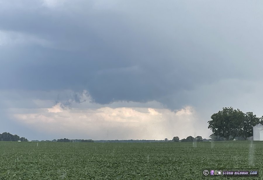
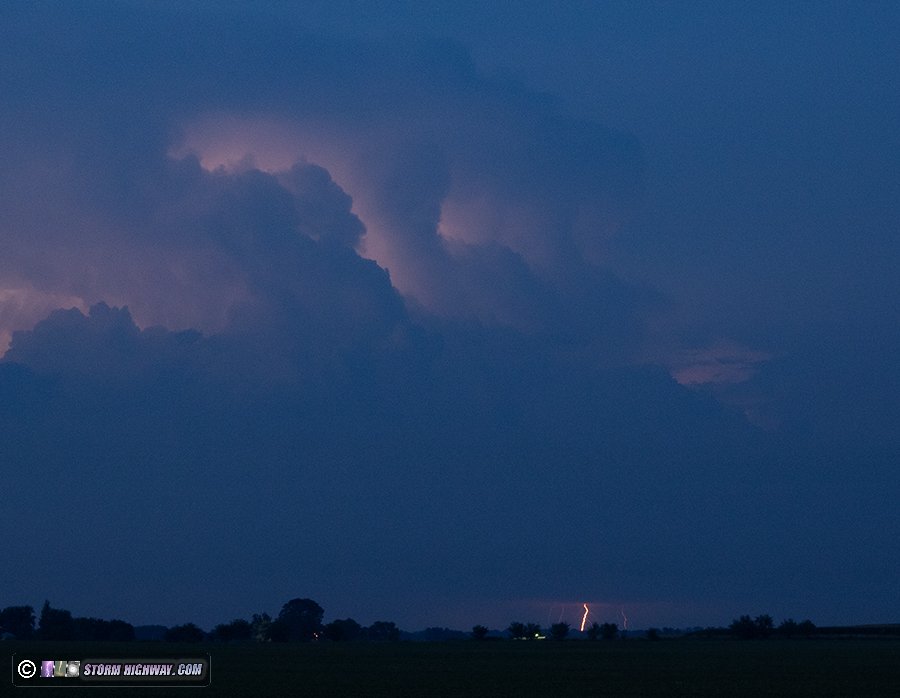
July 27: St. Louis low-topped supercell
A "spinny thing" (surface low, MCV or upper low) moving through the Midwest in the summer is never something to ignore, so this was a day to watch as an upper low made its way north through the St. Louis region. I started in Wentzville at the
Metro St. Louis Storm Chasers picnic keeping an eye the event on radar with several fellow chasers. We watched radar as a couple of the storms developed some brief but strong-looking velocity couplets, one near St. Clair, MO and another south of Waterloo, IL, the former which was headed in our general direction. As some other cells approached us, we got a view of them via drone, but didn't see anything of much interest.
On the way back home, I intercepted the Illinois storm near Dupo after it had weakened considerably, but still had surprisingly nice-looking LP-ish structure with an ominous but harmless tornado look-alike below the rounded base:
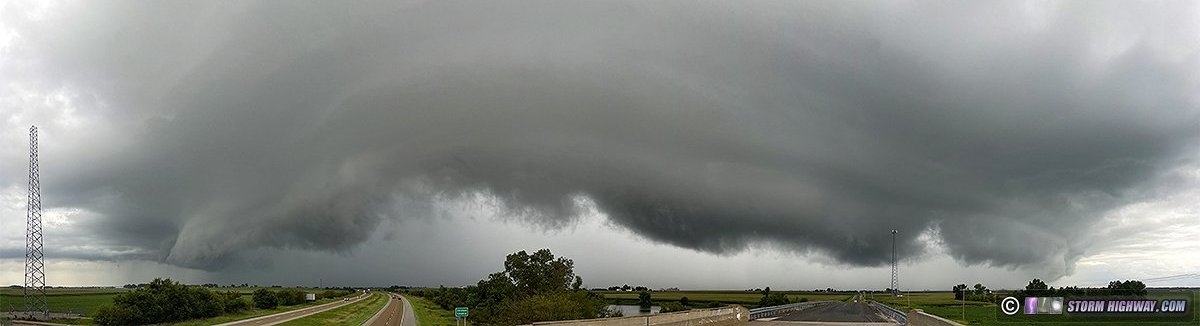
This storm continued to weaken as it passed behind downtown, so I went back home to New Baden where a linear segment was approaching with a decent shelf cloud. This panorama is looking southeast from the County Line Road bridge over I-64 south of town:
 July 29: St. Louis morning storms
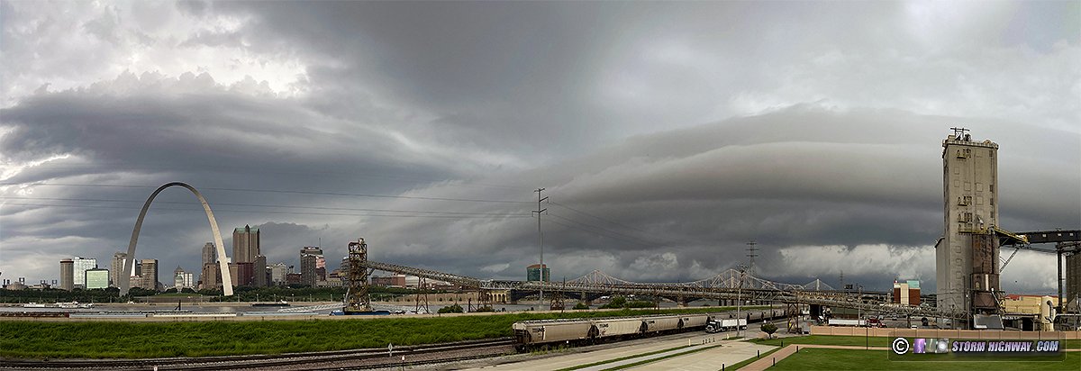
I woke up early to go downtown and await storms moving in from the west, hoping for a nice shelf cloud over the city. I set up the DSLR to do a timelapse. The better shelf cloud passed over to the east of downtown, leaving nothing of photogenic value over the city. This is a phone panorama of the overall scene:
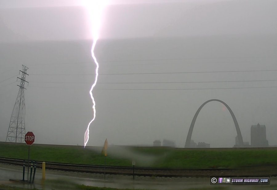
Lightning was lackluster with this storm, and the dense low clouds behind the outflow were mostly obscuring the very infrequent bolts I did see. So, I chose to not stay downtown for a second cell heading right for the city that had formed farther southwest. This was a mistake, as it went absolutely nuts with lightning in what was probably the best Arch strike chance we've had so far this year. Lightning data did not show an Arch strike, so I don't think it happened. Again, the low clouds were so bad that catching it would have been difficult anyway.
July 29: Southern Illinois supercells and close lightning
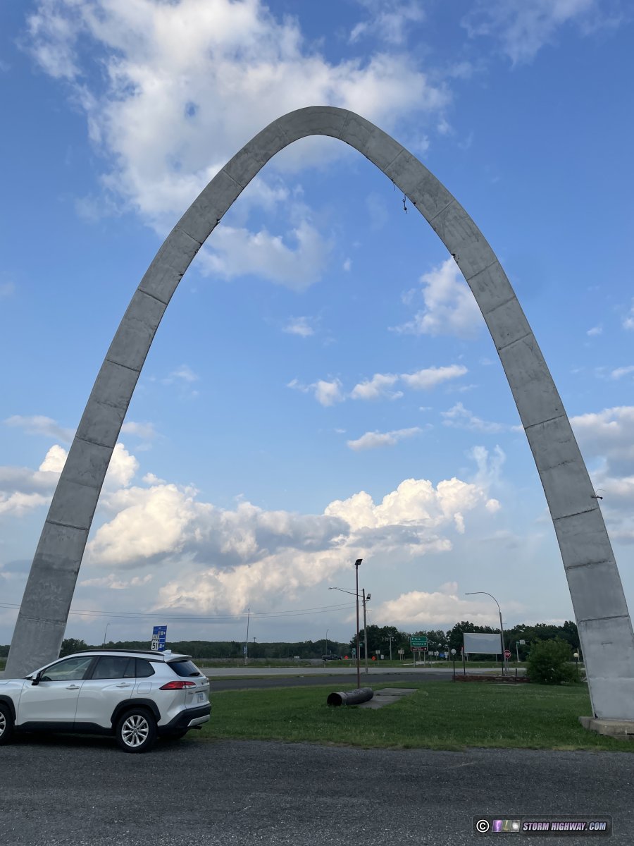
This was shaping up to be a decent northwest flow supercell event with some tornado potential. Models hinted at storms possibly developing as far west as St. Louis, so I didn't want to go all the way to Effingham where the best overall environment looked to be. I took I-70 to Vandalia and waited, watching some tilted updrafts go up behind the town's miniature version of the Arch.
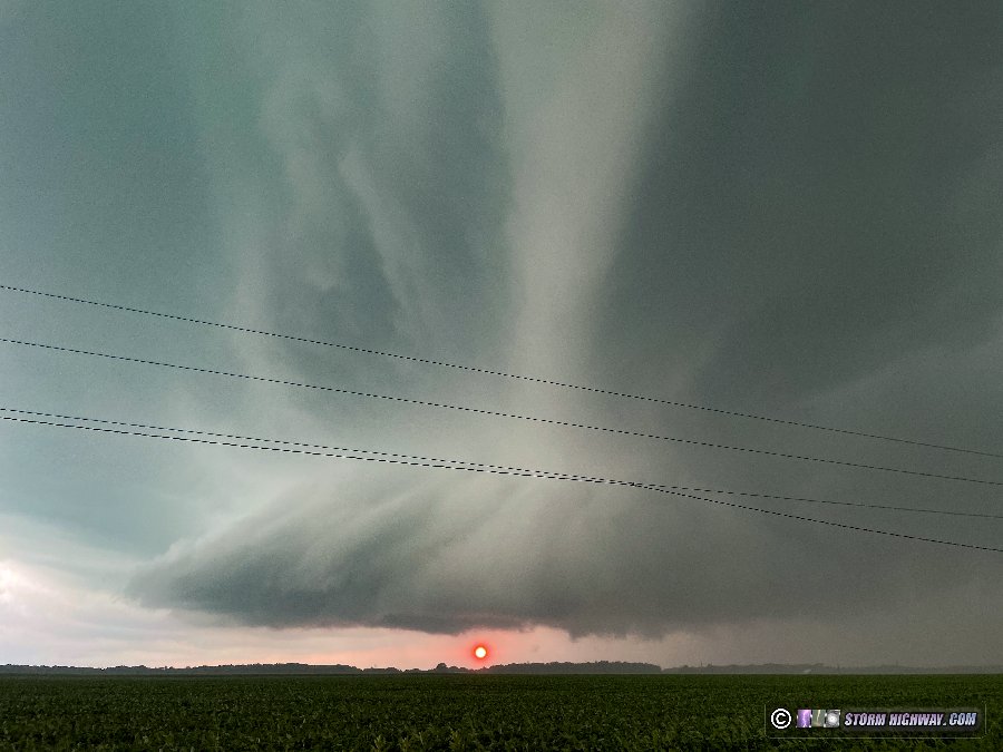
Storms finally began to take root just south of Springfield, so I went north toward Pana to intercept the initial dominant cell. This became tornado-warned, but the two storms to its south were also beginning to rapidly intensify. Instead of going all the way to the first, I diverted west to Fillmore to intercept the southernmost storm that looked like it was taking over as the main show. When I arrived on its base west of town, everything was rapidly pushing south at the surface - the storm was completely undercut by outflow. Here, the setting sun peeks underneath the wall cloud - again, everything was northerly outflow here and thus tornado potential was very low:
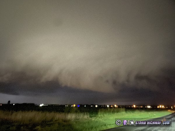
A new supercell was taking shape along I-55 headed right for home, so I blasted west to get in front of it, intercepting it at Highland as it became tornado warned after sunset. Like the Fillmore storm, this one was also outflow-dominant. I watched the wall cloud move over the east side of town, again with near-zero tornado potential thanks to the cold northerly outflow undercutting it.
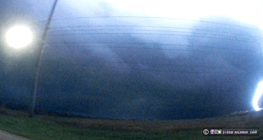
Yet another supercell developed northwest of this one, so I went north of Marine to watch it approach. Another chaser reported a rope tornado just to the north near Alhambra, but I did not see it. This storm also displayed strong outflow, but this time more easterly from the forward flank core shifting to northerly as the meso passed overhead. Still more development was unzipping to the northwest, but now all behind the outflow from the earlier storms. It looked like the tornado portion of the event and chase was finally done.
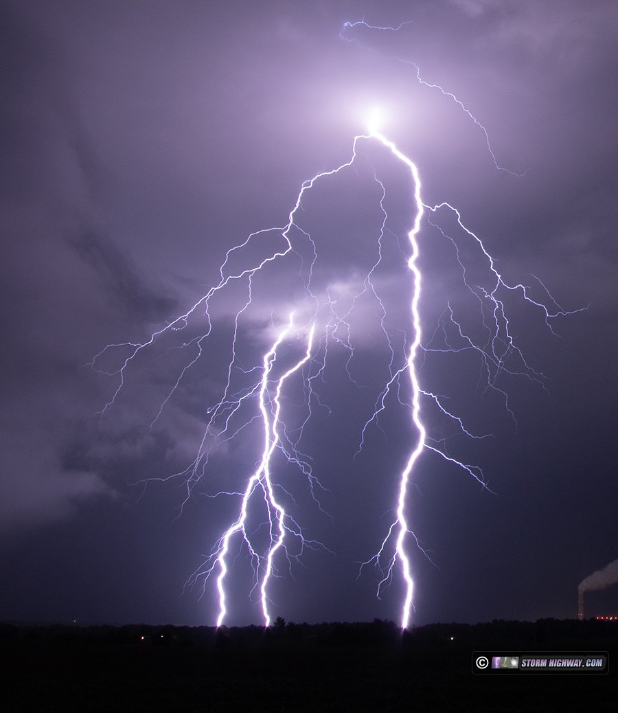
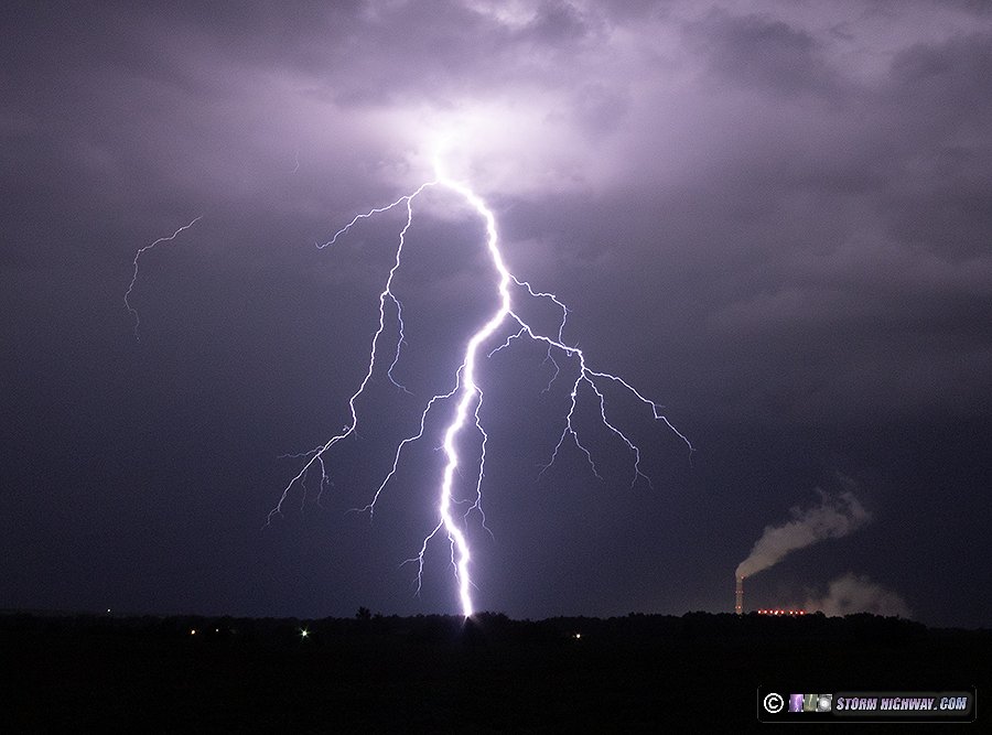
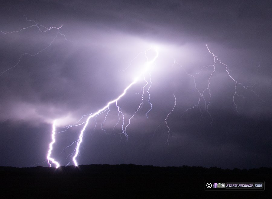
I had originally planned to try for bolts-from-the-blue from these storms once the tornado potential looked to be over. However, it appeared that low stratus would make visibility of the cumulonimbus towers from a distance difficult. So, I went over to Highway 4 south of I-70 to attempt some lightning shots closer to the storms. At this point, most of the bolts were in the cores and not very photogenic. I stayed with the storms, moving southeast with them toward home. By the time I reached Summerfield, not much had happened lightning-wise and I was ready to call it a day (I'd been awake since 4AM). But just before I reached Highway 50, yet another supercell developed at the western edge of the ongoing cluster of storms near Edwardsville. Unlike the others, this one was producing an intense barrage of highly visible cloud-to-ground lightning both in the storm's forward flank and ahead of the updraft in the form of bolts-from-the-blue. I dropped south to I-64 at O'Fallon to get ahead of it, but once I was stopped and set up, the bolts just stopped completely!
I moved south down Green Mount Road and set up again. The storm still would not produce another one of the big clear-air bolts-from-the-blue. As the precip arrived, I moved south again - at which time the storm started producing the clear-air bolts again. Some real spectacular ones, too. But the bolts weren't even being cooperative with my dashcams either. This bolt-from-the-blue three miles ahead of the storm was right at the edge of the frame on my driver's side camera:
As the barrage continued, I made it to a spot at Highway 158 and got set up again. Another close bolt-from-the-blue landed to the south, out of my camera's frame. Other than that, the storm just stopped producing bolts again. The rain caught me once more, so I had to move south on Route 15. I stopped several more times from Freeburg to Fayetteville, but the storm just refused to give me one of the great vivid clear-air bolts.
I made it to a new spot just north of Marissa and set up on this storm for the seventh time. Finally, it began producing a new barrage of bolts. The best ones landed outside of my camera's frame, but I got one of the bolts-from-the-blue way out ahead of the updraft. This was a rare-in-intensity barrage, so much so that I left the DSLR outside (with the cable release locked down) and got back inside the car to shoot with the high speed camera. I captured five good 6,000fps high speed shots of these negative CG bolts and several nice stills, a couple of them on both cameras.
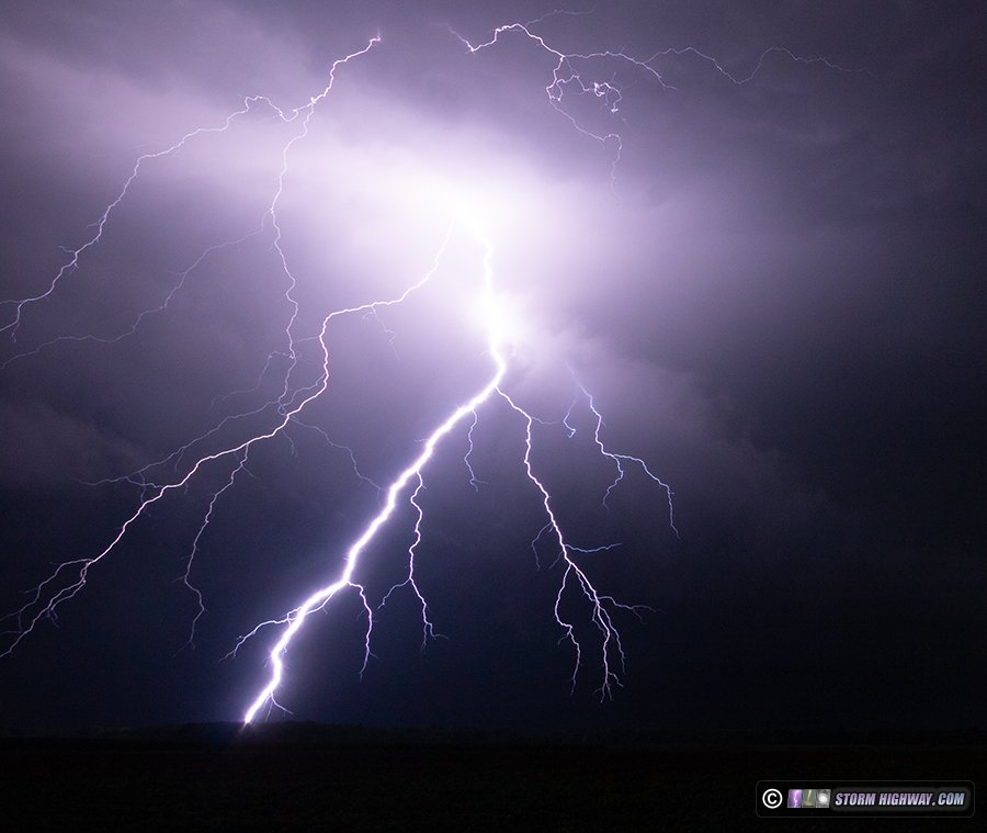

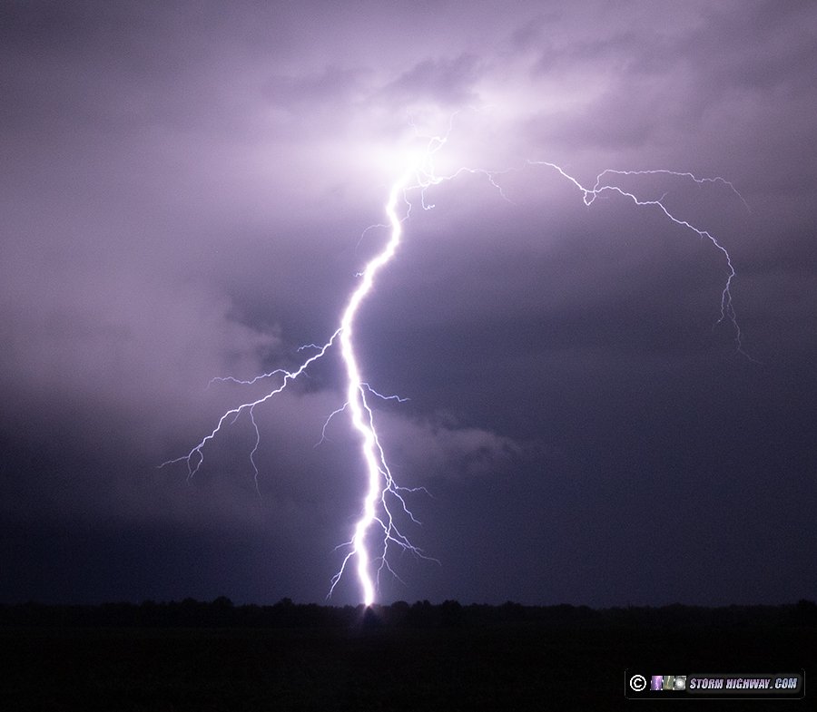
It takes a long time to save captures on the high speed camera, which means during a barrage like this there is no way to catch all of them. 5 or 6 bolts were happening while I was going through each save-to-disk operation. That means that I'll wait for a really good one before I save. In this case, I was waiting for a bolt to hit the Prairie State power plant smokestack - so I chose to not save several good ones that happened in that general direction in case the stack strike happened (it did not).
After the precip caught me again, I moved down to south of Coulterville, but the storm began what appeared to be a permanent weakening trend both visually and on radar. The terrain and visibility this far south also gets more difficult, and by the time I found another good view, the storm wasn't producing the nice bolts any longer. Exhausted from the long day that started before sunrise, I turned around and made it back home after 2AM.
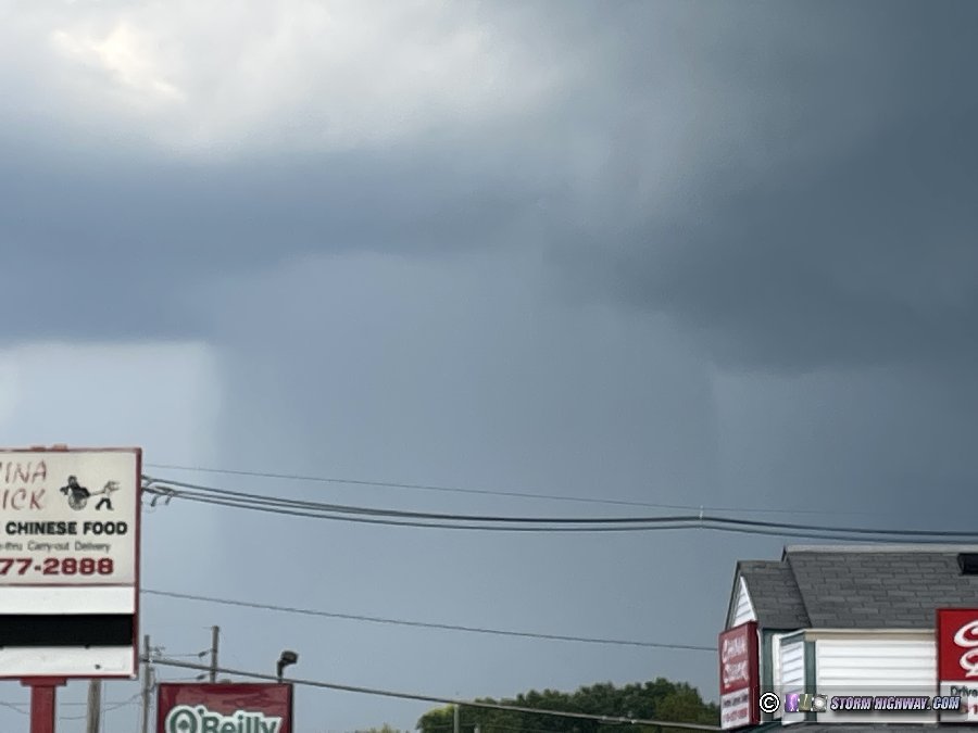
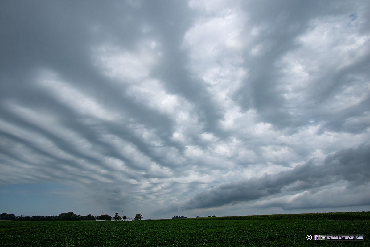
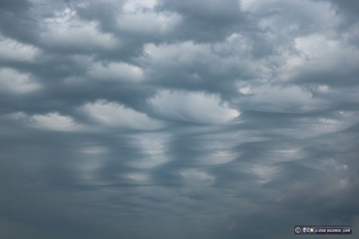
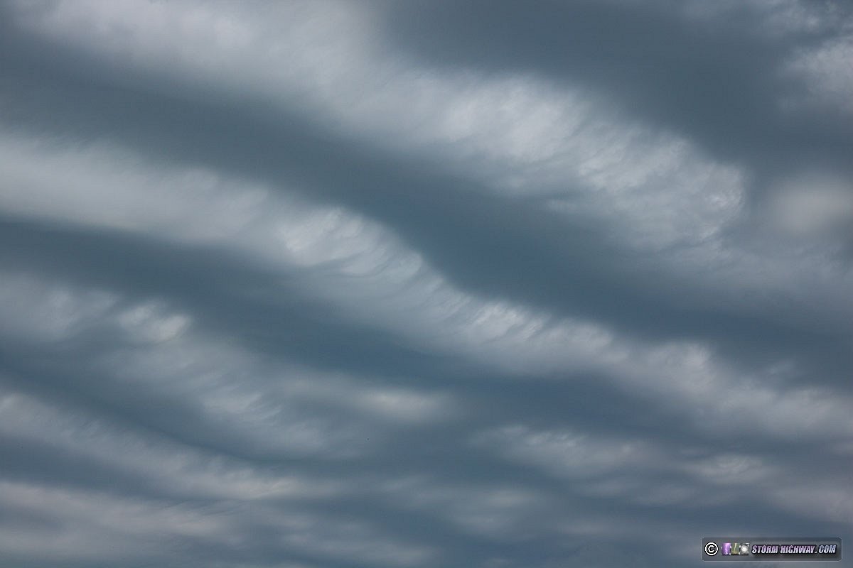
 July 31: Undulatus asperatus over St. Rose, IL
Outflow from thunderstorms along the I-72 corridor moved south through the St. Louis metro in the morning hours. There were multiple roll clouds and some nice undulatus asperatus. This is at St. Rose:
 July 31: St. Louis metro lightning bust
Strong instability and a boundary were both present in the St. Louis metro this night, and models showed one of two chaseable scenarios: either an ongoing storm complex in western Missouri would ride the instability gradient through the metro overnight, or the low-level jet would fire new storms on the boundary before midnight, possibly right in the metro. I went west to Weldon Spring to await either of these. After a couple of hours, radar trends showed the western Missouri storms weakening considerably, and no cumulus was present on the boundary farther east. I went home at 1AM.
< June 2024 Recap | All Storm Chase Logs | August 2024 Recap >
GO: Home | Storm Chase Logs | Photography | Extreme Weather Library | Stock Footage | Blog
Featured Weather Library Article: