|
Home | Blog Index | Blog Archives | Christianity & Faith Essays | Storm Chasing Essays
June 2024 Storm Chasing Recap
June was a much-less active stretch in the Midwest, with no major out-of-area trips specifically for storms.
June 2024 Event List
 June 1: Southern Illinois low-topped storms June 1: Southern Illinois low-topped storms
Despite marginal instability and weak upper-level support, surface and upper lows spinning over the St. Louis metro meant this would be a day to go out and track any storms that managed to form. I went out and made several back-and-forth treks in the eastern metro area covering multiple rounds of storms from Okawville to Marine, through Trenton, Albers, Lebanon, Damiansville and St. Jacob. The storms displayed interesting structure at times, and I observed broad rotation near New Baden at one point - but no tornadoes, funnels or even lightning/thunder were noted. There were plenty of tornado look-alikes.
 June 4: New Baden, IL lightning bust June 4: New Baden, IL lightning bust
A line of storms had been shown by models to pass by to our north during the early afternoon. Despite a shortwave trough passing over, instability was weak. I worked a string of late nights this week, and I didn't think this event looked good enough to take PTO and sacrifice sleep to cover. That being said, I did wake up a few times to look at radar. The expected storms developed as models showed, but were a little stronger and extended in a line a little farther south than forecast. The closest lightning strikes were only about 20 miles to the north, so I went out for about 10 minutes north of town to see if the line would develop any farther south near home. They didn't, and since low clouds blocked the view of the weakening storms to the north, there wasn't anything photogenic worth staying out for.
June 8: St. Louis metro storm bust
A strong convective complex in Kansas and Nebrasks had been shown by models to outrun the instability long before reaching the St. Louis metro on Saturday morning, with only a stratiform rain shield passing over. The line of storms attached to this area seemed to be holding on long enough that there was a chance for upward lightning to happen in St. Louis at daybreak, so I went down to Mehlville to await that possibility. The electified portion of the stratiform area only made it to Union, Missouri before fizzling out. One distant flash of lightning to the south was the only thing I saw before heading home at sunrise.
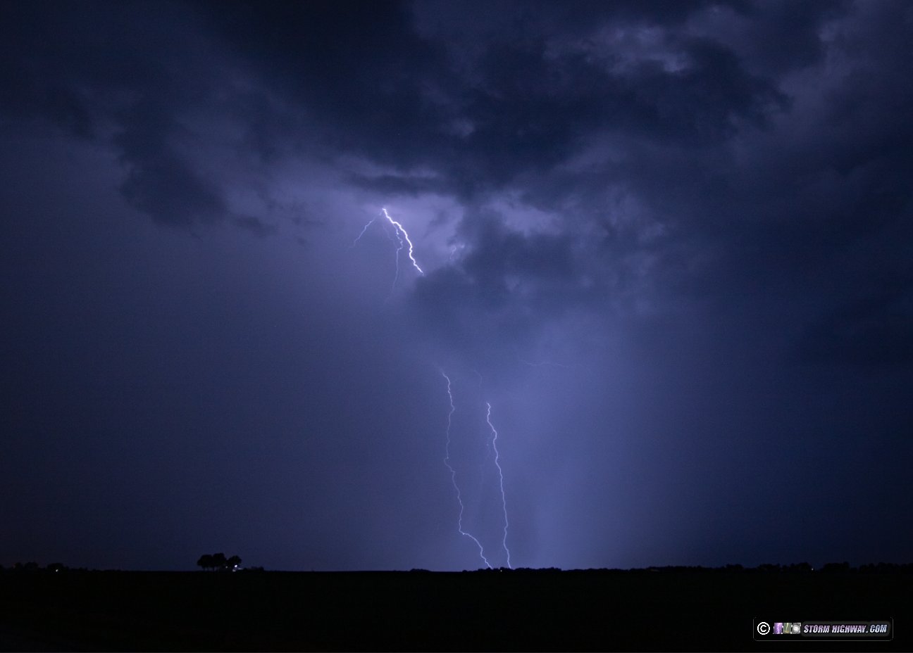
 June 8: Lightning south of New Baden, IL June 8: Lightning south of New Baden, IL
This had originally been expected to be a big day for either the St. Louis metro area or just south of it as supercells developed on an outflow boundary in the evening. However, as the previous night's convective complex moved across Missouri and weakened (see my previous entry), it became apparent that the outflow would push much farther south and leave us mostly high and dry for evening/after dark storms. I didn't leave home until 8:30pm, and it was just to go a couple of miles south of town to see if any lightning was visible with a small cluster of storms that had fired down near Marissa. There were some distant CGs and a few visible negative-leader "anvil crawlers", but stratus moving northward quickly blocked the view as the storms weakened. These two were the best I saw.
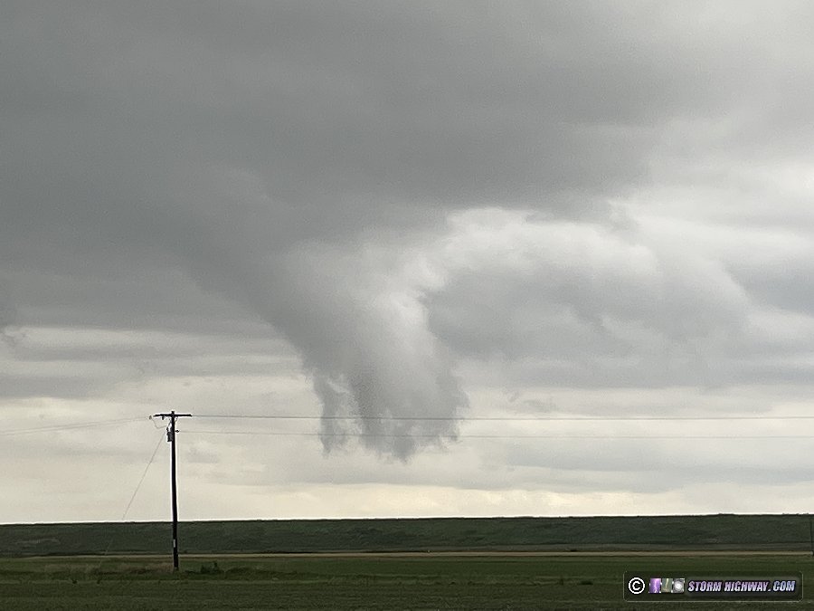
June 15: Western Missouri bust
I had been watching this day for a week prior, as models were in good agreement for a shortwave upper trough to pass over the Plains with good moisture in place. It appeared to be the last decent setup of the season south of the Nebraska-South Dakota border, and since it was on a Saturday, it would not require any PTO to cover. As the event drew to within a day, I was still undecided on whether it would be worth the 7-hour drive (each way). It did not appear to be a "slam dunk" for tornadoes: a strong cap, the wave arriving/departing early, morning storms potentially fouling the target and messy storm modes were all concerns. On Saturday morning, I woke up early to look at things, and was not impressed with what I saw. A large complex of storms was hanging on just south of the primary target area, and thick cloud cover extended to the north across that region. Models were also not robust on tornadic supercells within the range I could fit into an out-and-back day trip. After considering all of that, I made the no-go call by mid-morning.
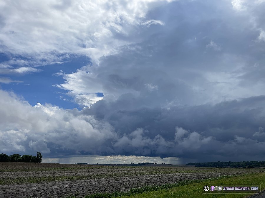
Just before noon, I took another look at the visible satellite imagery to see the outflow boundary from the morning storms had pushed south of Kansas City, and had cumulus bubbling up along and south of it as the skies cleared. It was a classic satellite signature that is a beacon for a storm chaser. The boundary in that region was also oriented more east-west, which would allow a northeastward-moving storm that was able to track along it to have good deviant motion/storm-relative helicity into the southeasterly surface winds. Wind profiles along the boundary looked great for supercells, with the upper level flow from the shortwave still overhead through the evening. Models were not very optimistic that a storm would sustain in that area, but if one did, it would likely produce a tornado. With this target less than 4 hours away and within easy range of a day trip, I decided it was worth going to take a look at it. Farther north into Nebraska, the parameters looked good for tornadoes also, but concerns about storm mode remained - and I really wasn't feeling up to that longer drive that would likely require an overnight stay somewhere afterward.
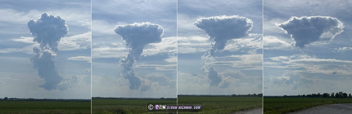
I left home at noon. I was pleasantly surprised to see relatively low daytime traffic levels on the normally-maddening I-70 across Missouri. Two storms fired over the northeast side of the Kansas City metro at 2pm, at about the time I was passing through Columbia. I went northeast toward these at Auville. The storms dried up as their updrafts vanished, leaving an "orphan anvil". An orphan anvil is a failed thunderstorm in which the initial updraft makes it to anvil level, then dries up to leave nothing but the anvil itself. A new updraft began taking shape near Lexington, so I stopped on the north side of the Missouri River to watch it approach.
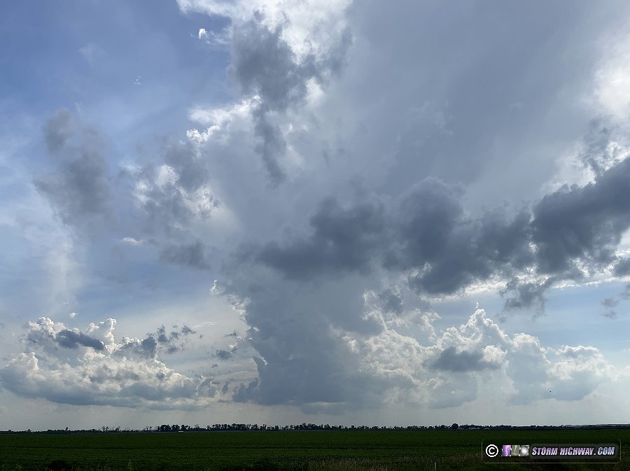
This too suffered the same fate as the first storms, squashed by the strong cap. Another updraft near Richmond made another attempt at a storm, but it too was cut off by the cap. This sequence of stills of this last one shows how the orphan anvil forms after the original updraft tower dries up. Many times, these will still have radar echoes that make it look like a storm is still present. If the updraft is gone, the storm is too - and the radar echo will eventually fade as well.
It wasn't long before I started seeing the tornado reports (decent ones at that) from northeastern Nebraska in an area that was even farther away than what I'd been looking at originally, one which would have required a 9-hour one-way trip. It's doubtful I would have been up to going that far even if I'd chosen to go to Nebraska. As my cumulus field near Kansas City continued fading, I called the chase at 6PM and started the drive home.
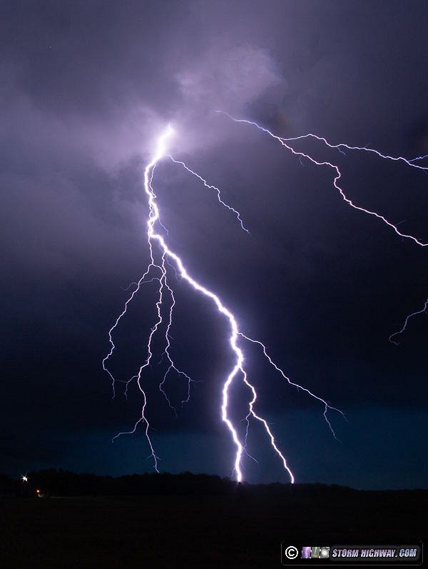
June 23: New Baden, IL lightning
For this event, models had consistently indicated weakening to nonexistent storms by the time they arrived in the St. Louis metro overnight. I wasn't expecting them to be worth spending any time (or lack of sleep) on after another late night at work. After I got home, I checked radar a few times before bed to see that convection was starting to bloom in the metro beyond what models had shown. I went north of town to shoot one of the stronger cells that was producing a few cloud-to-ground bolts. They were mostly buried deep in the rain.

The top of this bolt was above and outside of the curving rain shaft, showing how the clarity and "crispness" of lightning channels is degraded when they are deep in the middle of a core of heavy rain:
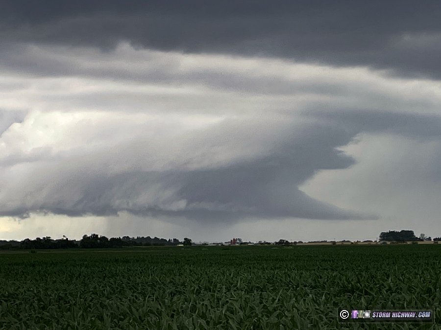
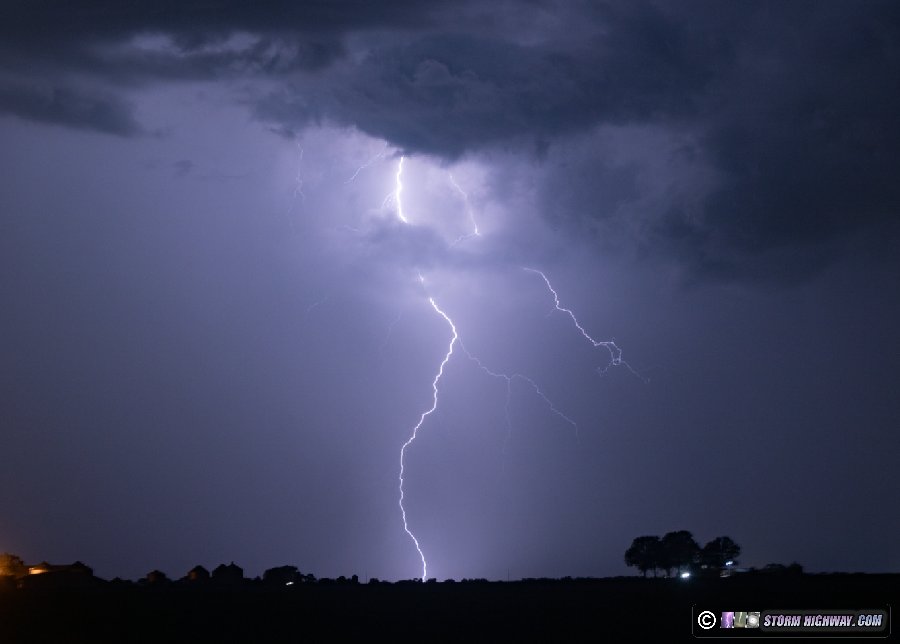
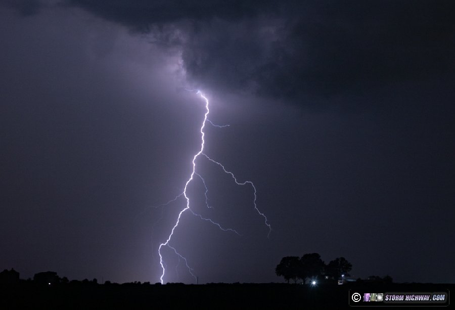
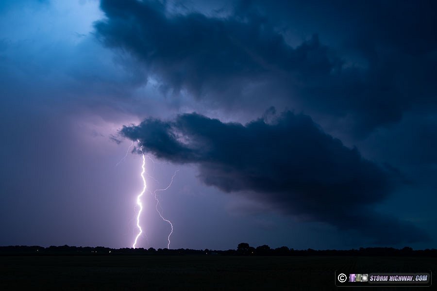
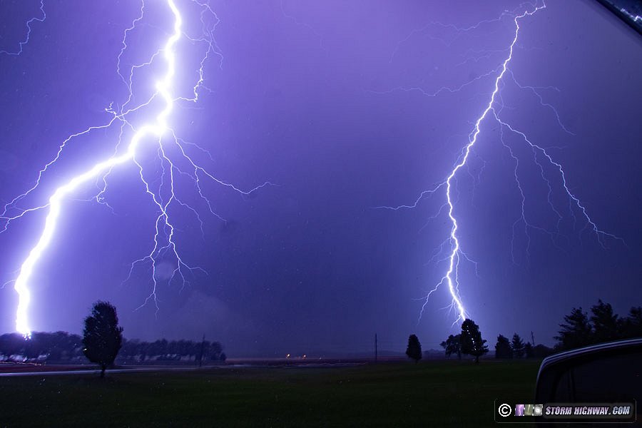
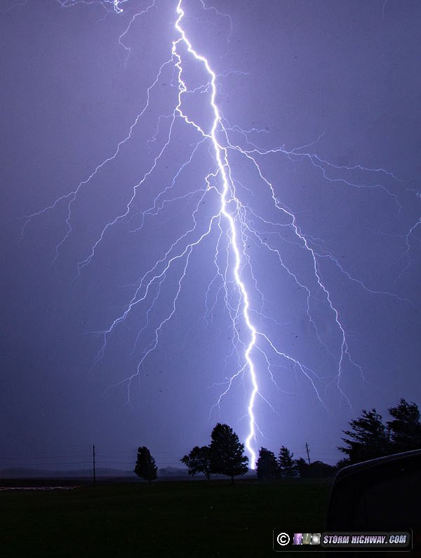
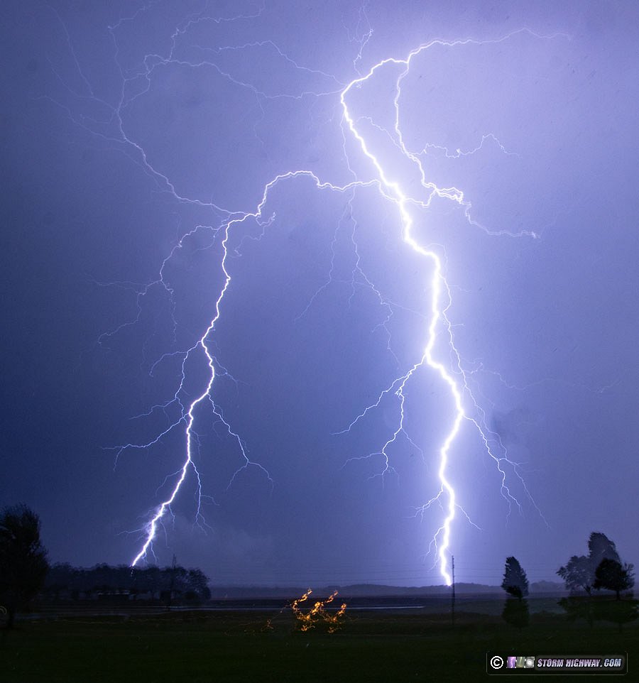
 June 25: Pinckneyville, IL intense lightning barrage June 25: Pinckneyville, IL intense lightning barrage
I was not anticipating a good event this day. Moisture was expected to mix out along the river during the afternoon with no upper support to give storms a boost in the St. Louis metro area. An outflow boundary from earlier storms pushed through the metro by late afternoon, with pulse-type storms going up just behind it. At 5PM, these were in progress across the metro area, so I drove over to Collinsville and Cahokia to take a look at a few of them. None of the storms were producing much lightning and seemed to be congealing mostly south of the city, so I went back home
30 minutes later, I went south for a new area of cells that were going up near Venedy. A much more lightning-active cluster was crossing the river near Festus, and since the area south of I-64 had not seen much activity, I figured storms might have enough instability to sustain. I headed down to Tilden where the active storms were approaching. New cells were beginning to fire out ahead of it. Some of these leading cells starting producing visible bolts, so I set up both the DSLR and the high speed camera. None of the bolts were showing very well on either camera.
Soon, another new cell went up nearly overhead with a few close bolts out of the rain. I didn't have time to get the DSLR on these, but caught a couple on the high speed camera at 6,000fps.
As the gust front from the original storm cluster arrived, I moved east to stay ahead. One cell north of Coulterville started producing a flurry of bolts, so I stopped and set up. It only produced one more after I got the camera tripoded and the shutter open.
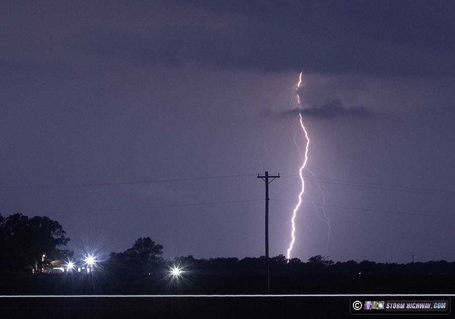
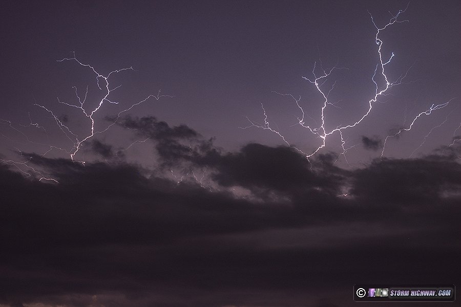
The rain caught up to me, so I was forced to move southeast. Additional new storms began firing along the advancing gust front. These started producing a near-nonstop barrage of vivid cloud-to-ground bolts out of the rain (what chasers call "clear-air" bolts, the best for photography). I made it ahead of the rain again northwest of Pinckneyville, but only had time to get the DSLR set up for a few frames before the rain hit again. Close bolts were crashing down all around me, but none would hit where I had the camera pointed, even with the 10-22mm lens set wide at 10mm. Two bolts finally landed in frame, but they were right at the edge - a theme that would continue the rest of the night.
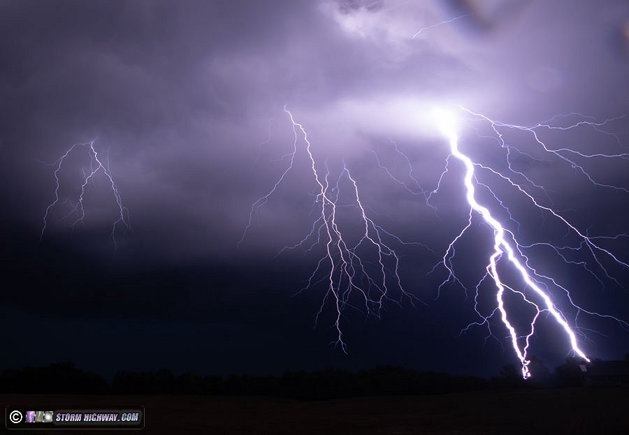
The storms had up to this point been moving at a crawl, but now they were pushing east quite rapidly with the surging outflow. I was not able to get out of the rain again before I ran out of east roads at Highway 127. I made another stop shooting handheld out of the window with the driver's side angled away from the wind, but the continued barrage of bolts still would not put one in frame of my cameras. As the storm's core of heavy rain arrived, I gave up and headed north toward I-64. Near Rice, another barrage of bolts began on the western end of the cores, so I stopped again and shot out of the driver's side window handheld as before. I finally got one bolt to land in the center of the frame, but still the others - including the closest bolt - stayed either out of frame or right on the edge.
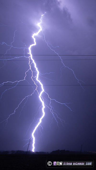
That last one - the lone center-of-frame bolt - I also captured at 6,000fps, the only one I managed to get on both cameras this night.
This was an incredible storm, ranking up there with one of the best I've seen in terms of the number and frequency of close bolts. The barrages lasted over 45 minutes. Unfortunately, it was all frustratingly uncooperative for my cameras, leaving me with no "prize" shot to take home this night.
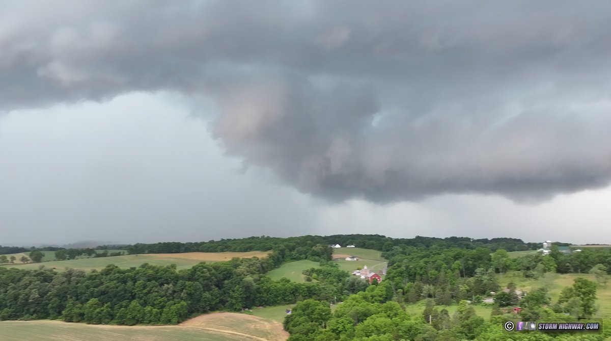
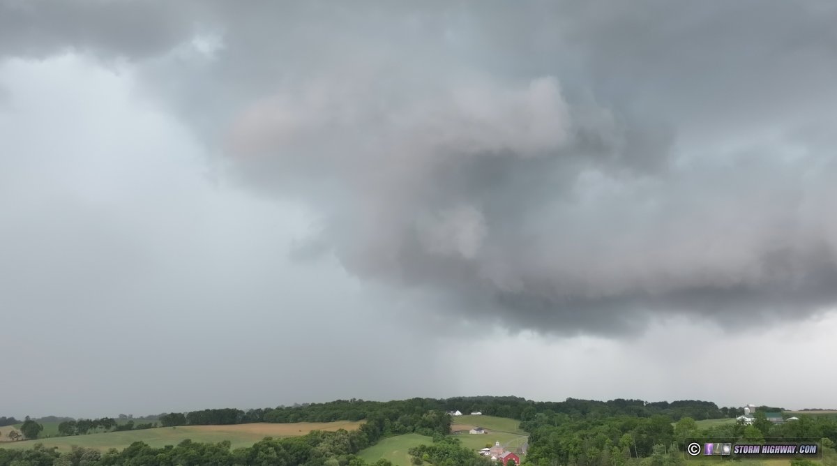
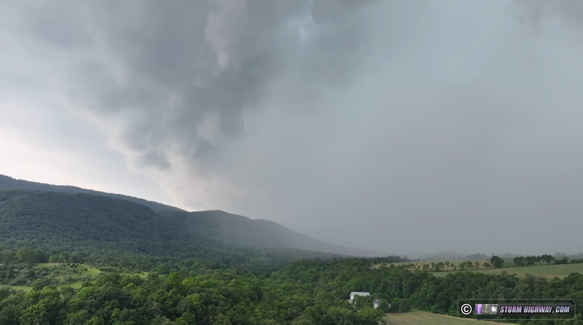
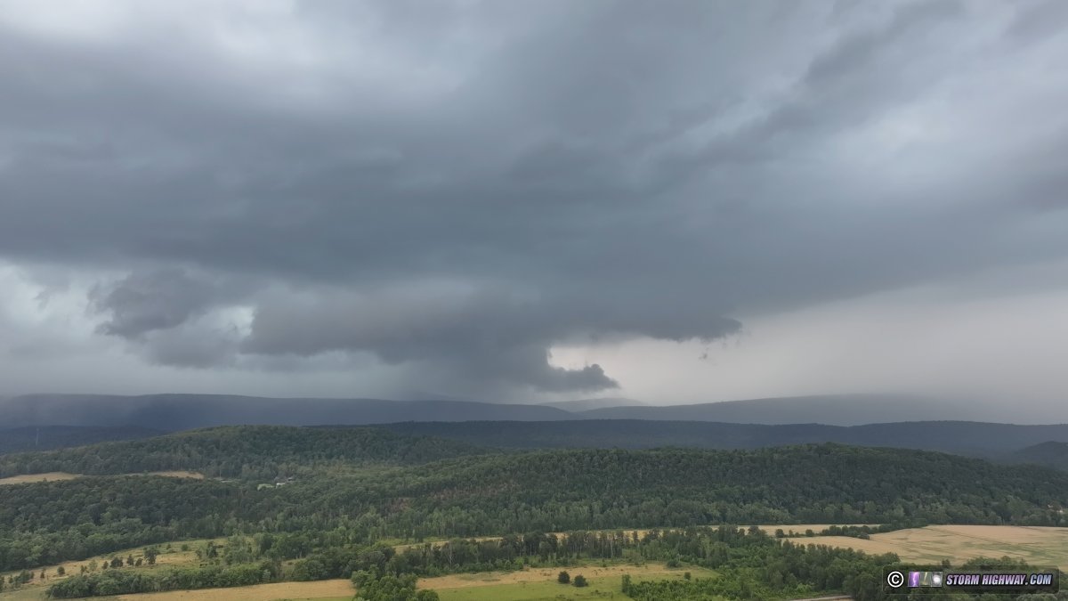
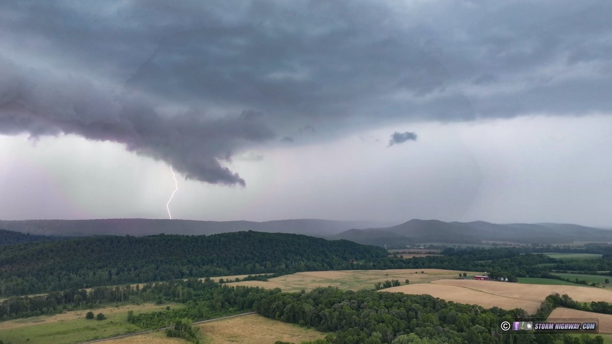
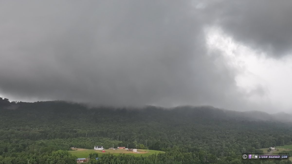
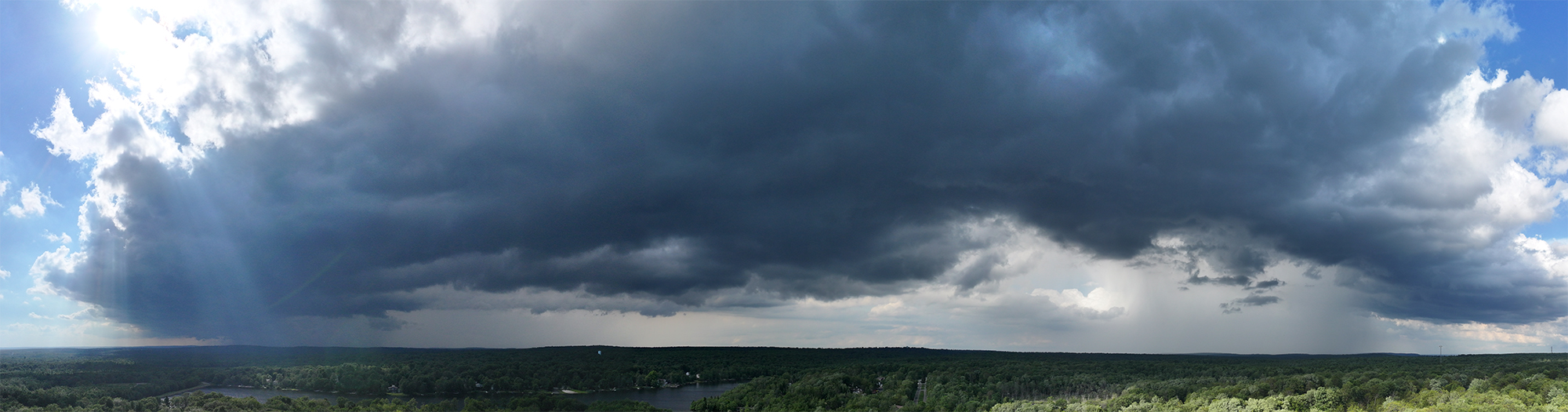
 June 29: Central Pennsylvania supercells June 29: Central Pennsylvania supercells
I was traveling through Pennsylvania this day, and was able to make a chase out of it. Decent supercell wind fields associated with a passing shortwave in mean 30-40kt 500mb flow would be juxtaposed with some instability across the state of PA. I managed to get on the only two tornado warned supercells in the region in difficult terrain and road networks, having to mainly rely on my drone to get views of the storms. I started in State College, intending to focus on an area of clearing that visible satellite showed nosing northeastward into the central part of the state. Storms started initiating in southwestern PA by early afternoon and moved northeast. I intercepted the first storms at Phillipsburg, which were outflow dominant.
I dropped south to an isolated storm moving south of Tyrone. I set up ahead of it at Arch Spring. It had a large RFD surge that was curling in on the north side into a slowly-rotating circulation. |