|
Home | Blog Index | Blog Archives | Christianity & Faith Essays | Storm Chasing Essays
March-April 2025 Storm Chasing Recap
The first two months of meteorological spring in 2025 were among the most active March/April periods in my career. Chase days comprised half of the month of April! The first Great Plains chase expedition of the year took place on April 27-28, then the month ended with a literal "backyard" supercell that produced one of the best storm structure shows in recent years.
March-April 2025 Event List
- April 2: Elberfeld, Indiana tornado
- April 3: New Baden, Illinois thunderstorm
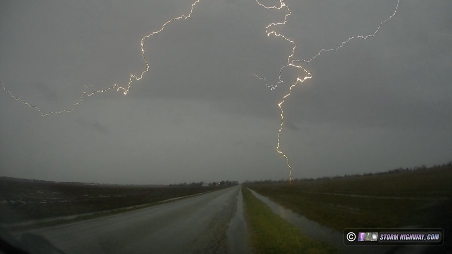
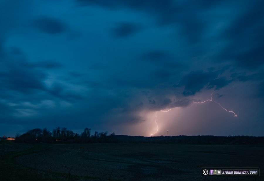
- April 4: Supercell lightning barrage at Delta, Missouri
- April 9: St. Louis lightning bust
- April 10: St. Louis storms
- April 15: New Baden, Illinois aurora bust
- April 17: St. Louis lightning bust
- April 19: St. Louis lightning
- April 20: Fulton, Missouri tornado
- April 24: Shiloh, Illinois lightning bust
- April 25: Alorton, Illinois lightning bust
- April 27: Cherry County, Nebraska tornado
- April 28: Abilene to Topeka, Kansas supercells
- April 29: St. Louis lightning
- April 30: Supercell from Hecker to Carlyle, Illinois
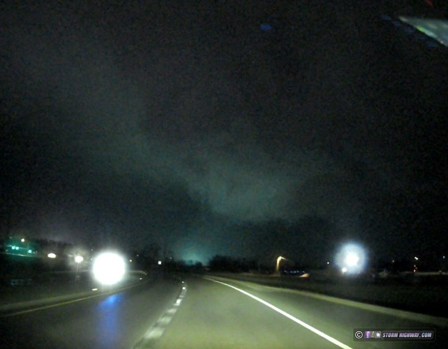
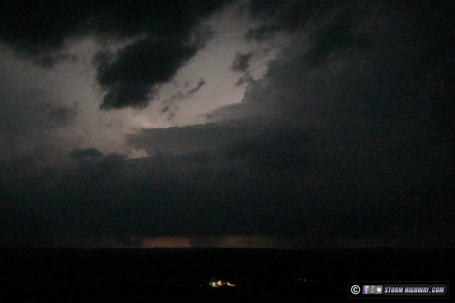
 March 14: Tornadoes at Oakville, MO and Mascoutah, IL March 14: Tornadoes at Oakville, MO and Mascoutah, IL
I observed two nighttime tornadoes in the St. Louis metro on Friday night. This event has its own page here.
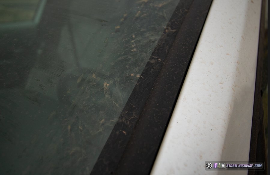
 March 15: Southern Illinois muddy rain from Texas dust storm March 15: Southern Illinois muddy rain from Texas dust storm
On Saturday morning, I decided to forego chasing the messy-looking High Risk in the South and instead attend the Tri-State Tornado 100th Anniversary event put on by the Paducah National Weather Service office down in Murphysboro, IL. On the way home, I drove through some light stratiform rain that was so saturated with dirt from the Texas dust storm that my car looked almost like I'd just driven on a dirt road in the Plains! This was yet another effect from this powerhouse upper trough that brough two days of tornadoes to the Midwest and South.
  March 19: Severe storms from Charleston, Illinois to Terre Haute, Indiana March 19: Severe storms from Charleston, Illinois to Terre Haute, Indiana
I had been expecting this next trough ejection to produce some lightning photo opportunities, but within 48 hours of it, some real tornado potential became evident as increasing amounts of moisture were forecast. The primary chase target of this system was the northern half of the arc of supercell thunderstorms expected across northern and central Illinois, where vorticity close to the surface low would promote rotating updrafts. Models also indicated tornado potential farther south along the Illinois-Indiana border where better moisture was expected, still within a high-shear environment as the main upper jet core nosed in.
This system was generating quite the buzz in the chase community, with some even flying in from across the country. Wanting some storms to myself, I persistently leaned toward the secondary target along the state line - finally committing to it by noon.
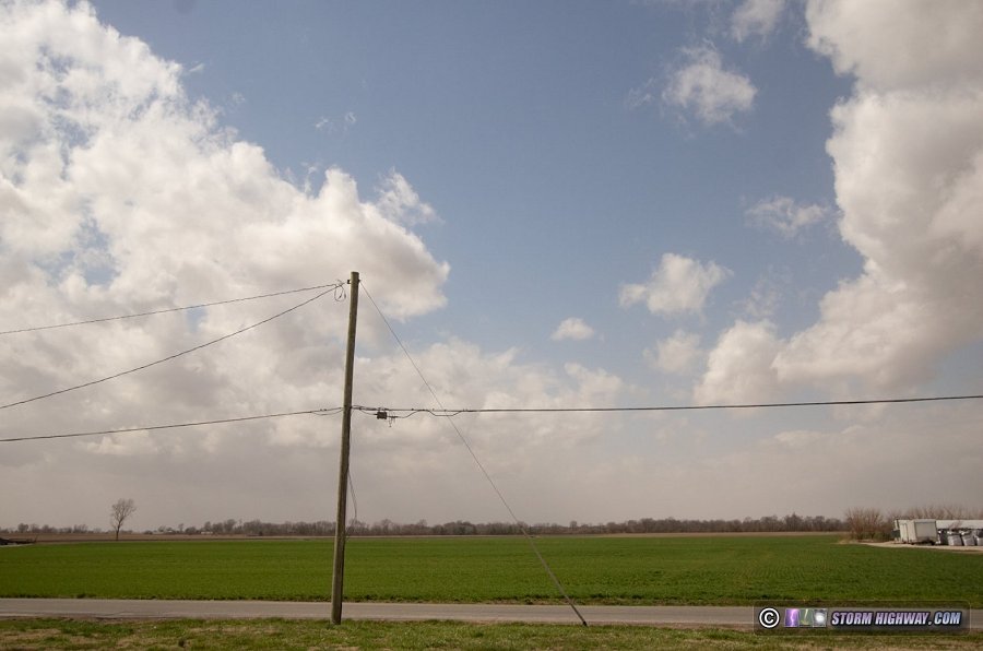
The morning of the event began with a thick orange overcast to the skies over the Midwest, with the same sun-blocking effect as thick clouds.
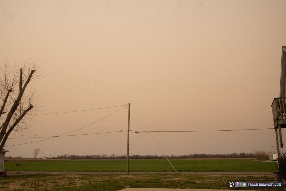
This was dust and dirt lofted from New Mexico and Texas, transported all the way into the Great Lakes by the upper trough's powerful winds. The visible satellite imagery shows this very clearly:
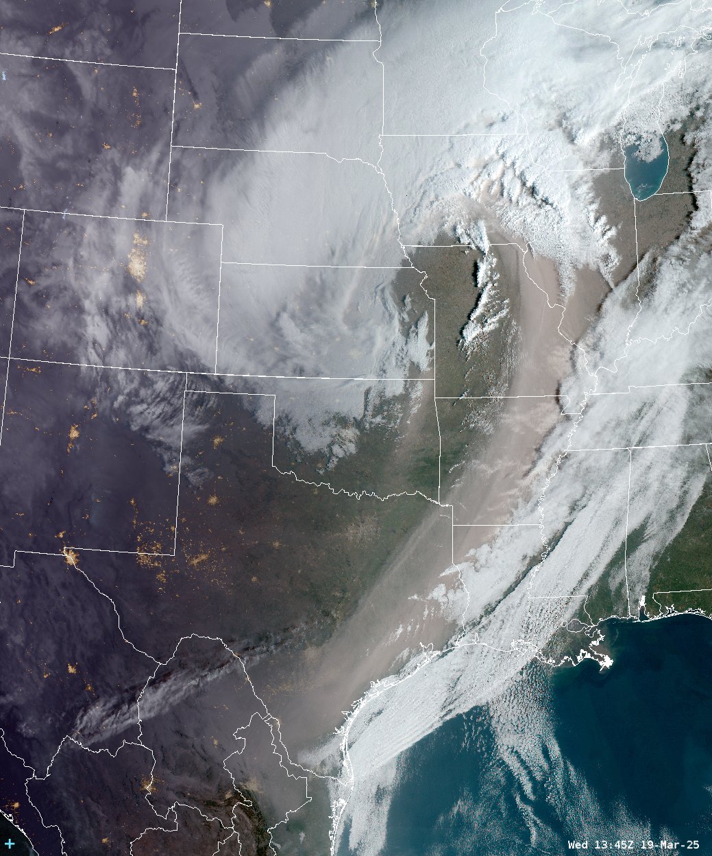
NOAA visible satellite image from GOES-East
I was concerned that this would hinder destabilization, though a sliver of clearer air existed behind the dust plume where storms were beginning to fire west of St. Louis by 1PM. This clearer air arrived at New Baden by 1PM - much better than earlier, but still with a lingering dust in the lowest couple thousand feet:
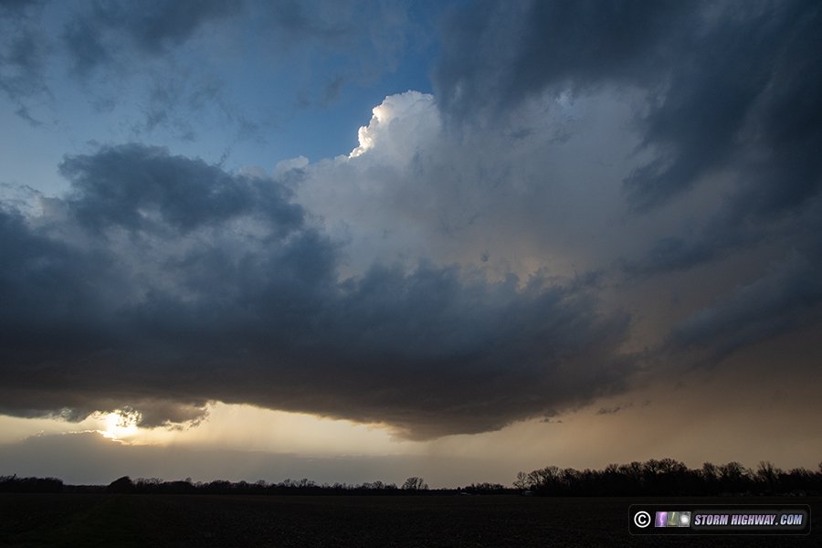
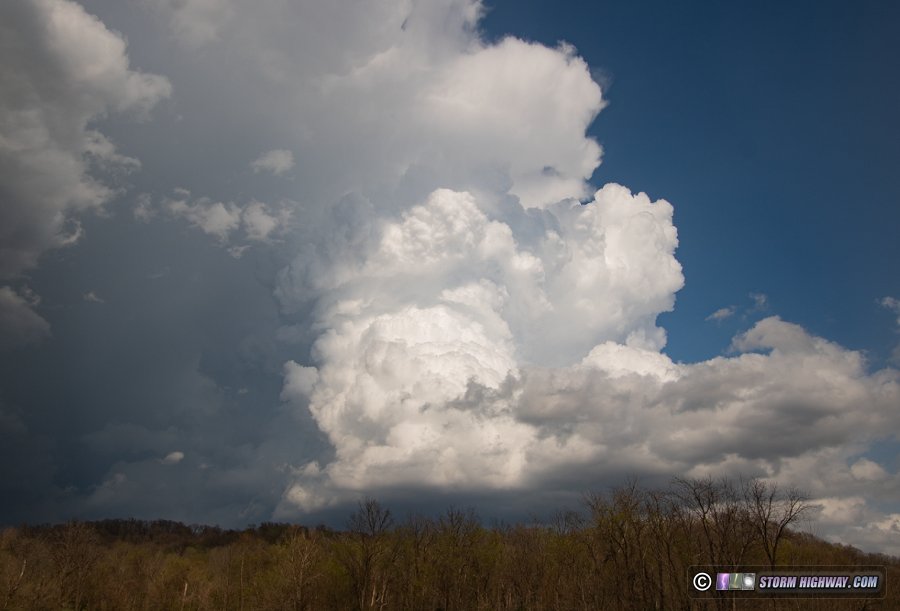
I left just after 1PM and headed to Effingham as convection grew into thunderstorms in the St. Louis metro. These storms would need time to organize and would be moving very fast (as with the event on the 14th), so I wanted to stay well ahead of them. I eventually moved north to Charleston to position for a couple of new storms that looked promising. These coalesced into a single large updraft over Charleston with what first appeared to be a developing RFD cut. The New Mexico/Texas dirt was still thick enough to give the entire storm structure a brownish tint:
This was tornado-warned minutes afterward, but I did not see any evidence of a low-level meso. With this storm racing away quickly, I moved east through Paris to position in front of the next cell in the line at Terre Haute. As is the case with super-fast moving storms, this one beat me there thanks to my road not continuing due east across the Wabash River, forcing a long southward jog into north Terre Haute. I had to let this storm go and focus on getting ahead of the third cell in the line which was heading straight for downtown Terre Haute. This was the view coming southbound into downtown:
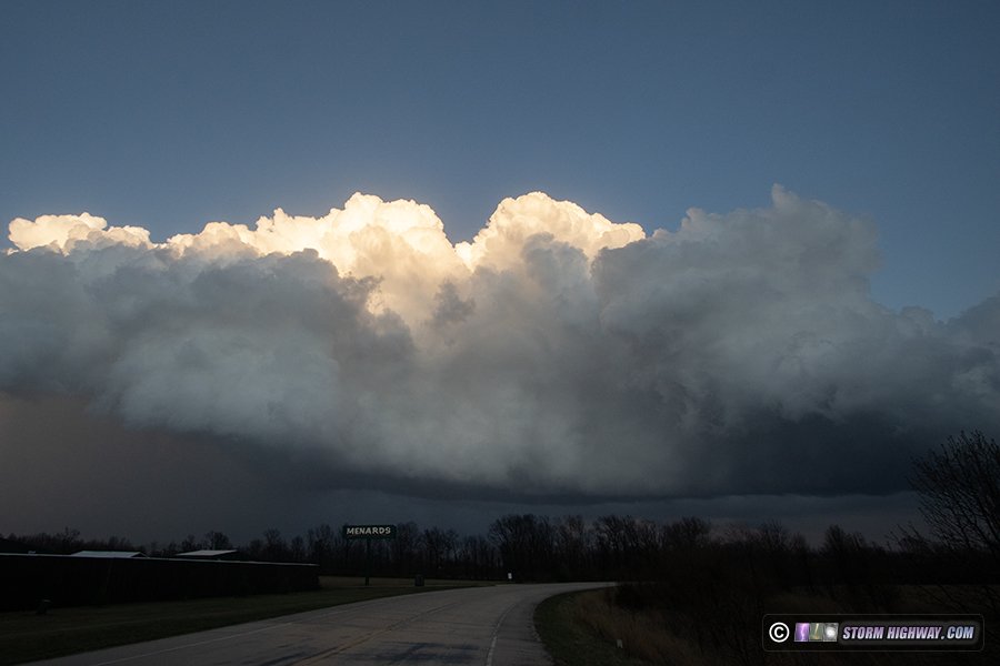
I wasn't going to beat the storm to I-70, so I turned east on Route 40 to stay ahead. Alas, several long traffic lights bogged me down and allowed the storm to overtake me on the east side of the city. The storm was bowing out eastward in a configuration that I had no hope of getting out ahead of, so I gave up on it and headed south for the next band of activity. This was far enough to the southwest that I had plenty of time to intercept it in Farmersburg. I arrived to find a "whale's mouth" gust front leading the tail-end supercell, meaning tornado potential was zero. The whole thing put on a decent show as the sun set. First, the "whale's mouth" with the supercell behind it in the distance:
Then the supercell updraft as it moved closer:
One last view of the storm as it moved east through Terre Haute before dissipating:
With that, the tornado part of the chase was done. I got back on I-70 west to head home. I went through one more line of severe storms at dusk that covered the interstate with hail for about 10 minutes. I stopped at Martinsville for a few minutes to shoot some stills and high speed video of the lightning in the storms to the east as they moved away:
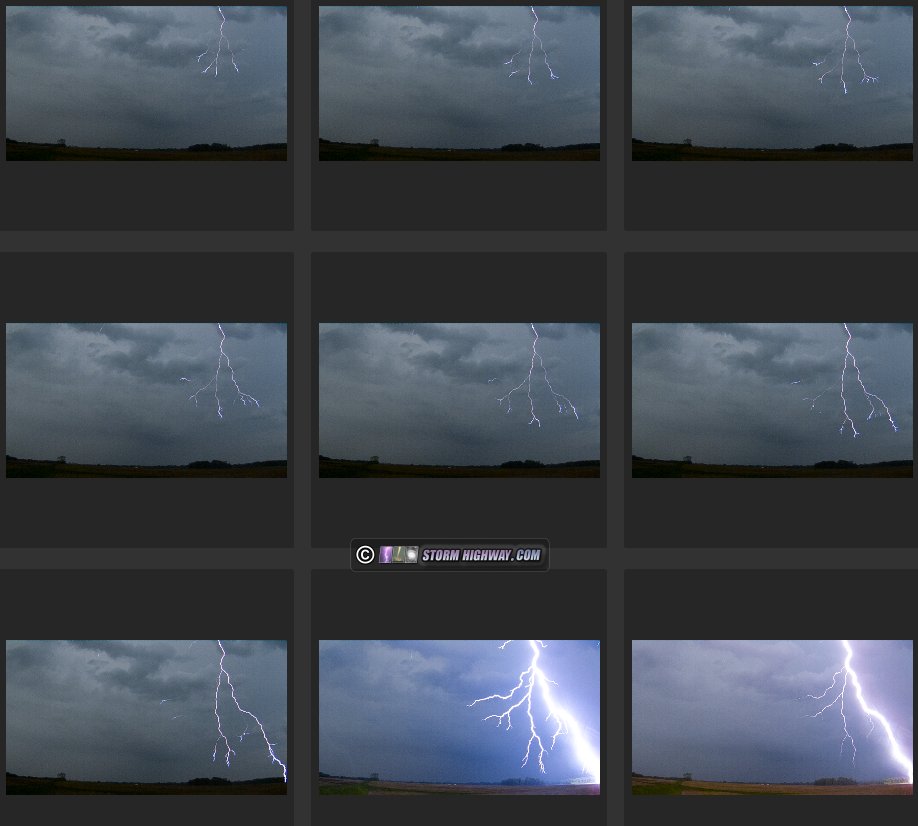
March 23: Lightning initiation captured with close bolts in New Baden, IL
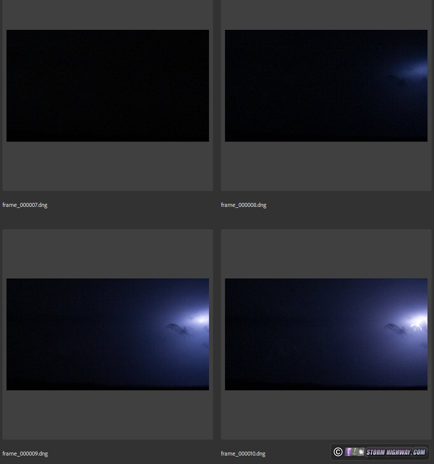
I nearly didn't get out of bed for this storm coming through right at dawn following a late work night. I only went out because it was coming straight for town, and I'd only need to go south a couple miles to get into position to shoot high speed video. The storm ended up providing a couple of rare captures of the birth of a lightning flash on the high speed camera at 6,002 FPS: the initiation of the "bidirectional leader" just above cloud base. In the first event, the flash initiates just 3 frames before the negative leaders emerge from cloud base:
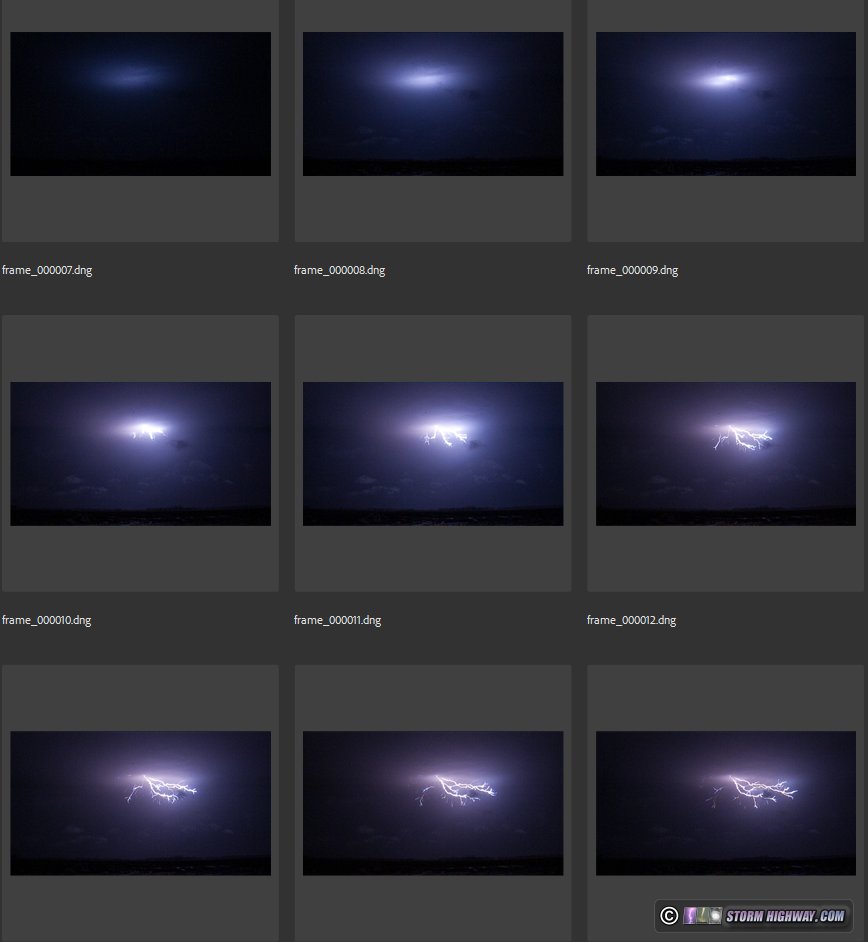
In the second event, the leaders emerge from cloud base just *one* frame after flash initiation, providing a rare look at a brand-new lightning leader tree:
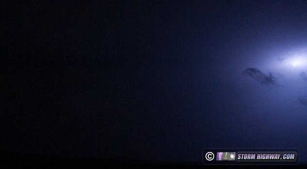
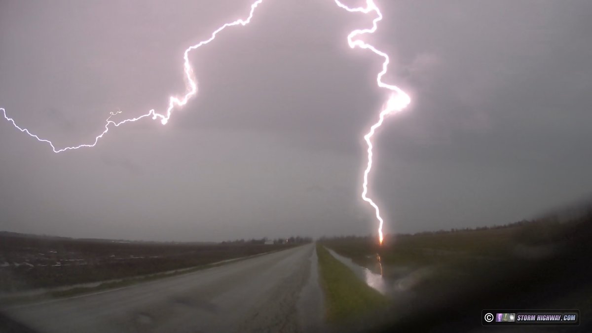
One branch of the negative leader tree of this second flash terminated to ground (making the event a "CG" flash) less than a half-mile to my north! I had been shooting with the high speed camera facing northwest, so it missed this component of the flash. My front dashcam captured it:
I have several lightning science videos in the works that this video will definitely make an appearance in. Standalone high speed videos tend to not get any views on Youtube, so I've mostly stopped posting them as they are detrimental to my main channel - though I've been considering starting a second channel just for those. Stay tuned!
March 28: Lightning from Fairview Heights to Highland, Illinois
One of the biggest things you can learn about the weather is that no matter how experienced you think you are, you still don't really know what's going to happen. Such was the case this day that ended up one of my best in terms of high-speed lightning captures. After models had trended so far downward for this setup, I wasn't planning on chasing even though I had the day off from work.
Warm advection (that is, the northward surging of warm, moist air) from the approaching upper system was originally shown firing thunderstorms along a lifting warm front during the early morning hours on Thursday, lasting through the entire day and overnight into Friday morning. The initial activity after midnight Wendesday night was disappointing, with meager lightning popping off in infrequent and random locations among the blooming showers in northeastern Missouri. I decided not to stay awake for this as it moved into the St. Louis metro area. I woke up once to check radar at 7am, seeing nothing that warranted interrupting sleeping in on my day off.
After I woke up, models had almost completely eliminated thunderstorms with the second round of precip after sunset, instead focusing this activity on the warm front which would be in Chicagoland and northern Illinois by that time. Down here, only a few spotty short-lived showers were shown, with the MUCAPE axis retrograding west through the evening. I assumed the reason these showers were showing at all was the remnant outflow from the overnight/morning activity, but that boundary seemed to be washing out by mid-afternoon. As a side note: MUCAPE or most-unstable CAPE is essentially the absolute maximum amount of instability available throughout the vertical atmospheric profile. That is, you can still have enough MUCAPE for lightning even if there is little or no SBCAPE (surface based) or MLCAPE (mixed-layer) instability. Thunderstorms can develop and sustain in areas with at least 100 J/kg of MUCAPE.
The showers did develop well west of St. Louis, and as I'd expected, they were producing the same amount of lightning as the ones the previous night (that is, not very much). But at 11pm, a couple of the cells were holding together as they slowly approached downtown, so I figured since it was my day off, I'd go take a look. Had this been a workday, I'd likely not have even had my cameras with me thanks to the way this setup had been looking.
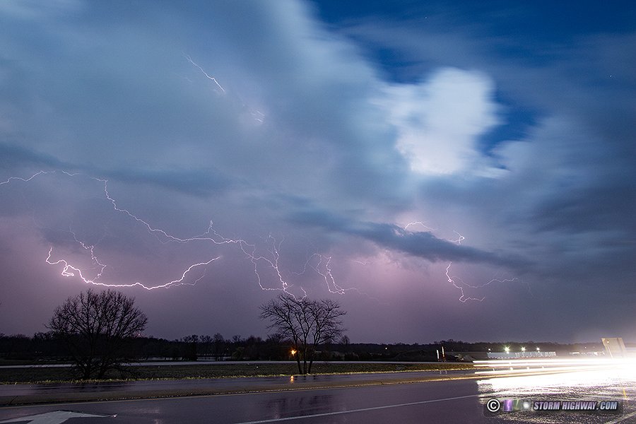
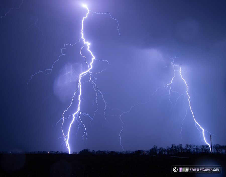
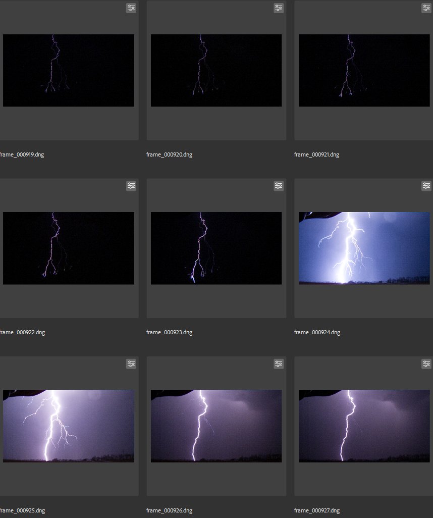
I made my first stop at Caseyville as the cells crossed the river downtown. They then suddenly became very healthy-looking on radar - and at the same time, lightning activity began ramping up markedly. This intensification continued as the storm moved into Fairview Heights, and I moved east with it, stopping to set up and shoot every 5-10 miles, through back home in New Baden, then ending at Highland. During this 2-hour period, the storms really put on a show of uncharacteristically-cooperative lightning. With the few lightning events where I manage to get high speed captures, I mostly end up with 1 or 2 worth saving. This night, I ended up with 13 captures at 6,002 FPS! The only challenge was the outflow turning winds westerly/northerly, meaning the rain was being blown out of the direction I needed to shoot. These raindrops marred the DSLR still of the closest bolt I got near New Baden, but all of the high speed shots were mostly unaffected. Here is a sampling:
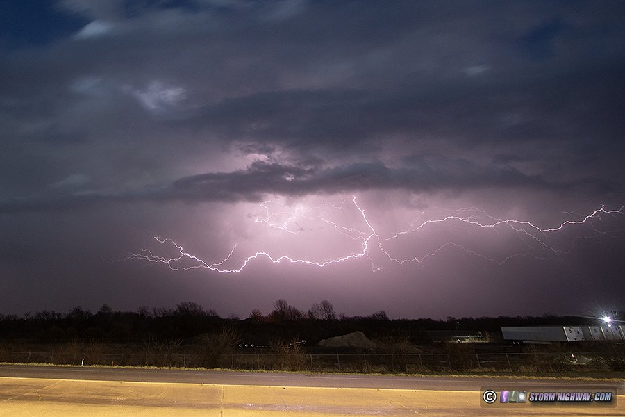
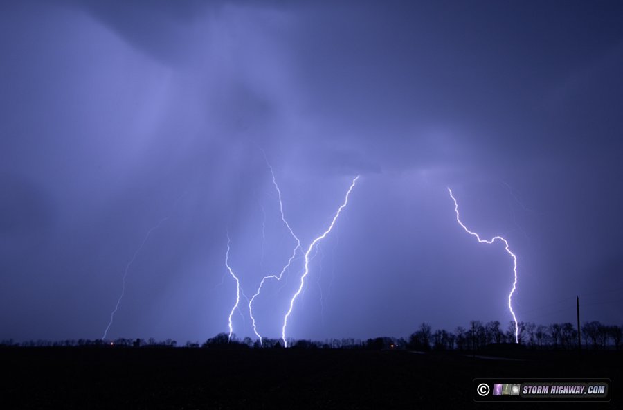
This was one of two favorites from this night: this flash at Fairview Heights featured multiple ground connections, including one from a new negative leader branch that sprouted from an existing channel to land squarely in the middle of the frame:
DSLR still of the closest bolt in New Baden, then a closer crop of the same. I could not keep the lenses raindrop-free thanks to the northwesterly winds:
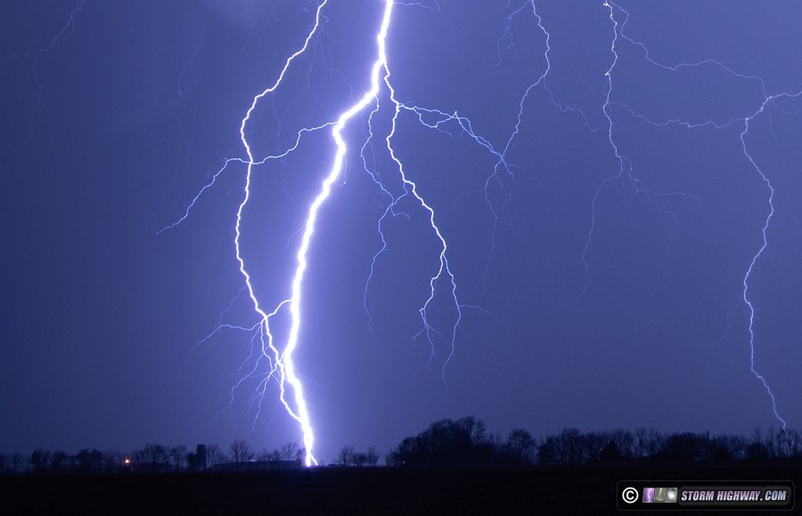
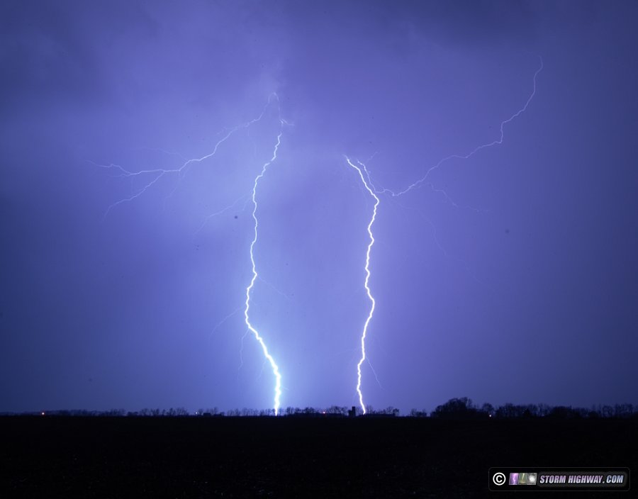
The high-speed shot of this event was less affected by the raindrops. The closest bolt landed right in the middle of the frame. It's my other favorite from this storm:
DSLR shot of another multiple-ground-connection CG flash among curving rain shafts (also captured on the high speed camera):
Another DSLR shot from New Baden:
The high speed video will be posted eventually. I have enough new material from that camera to do a March 2025 compilation video!
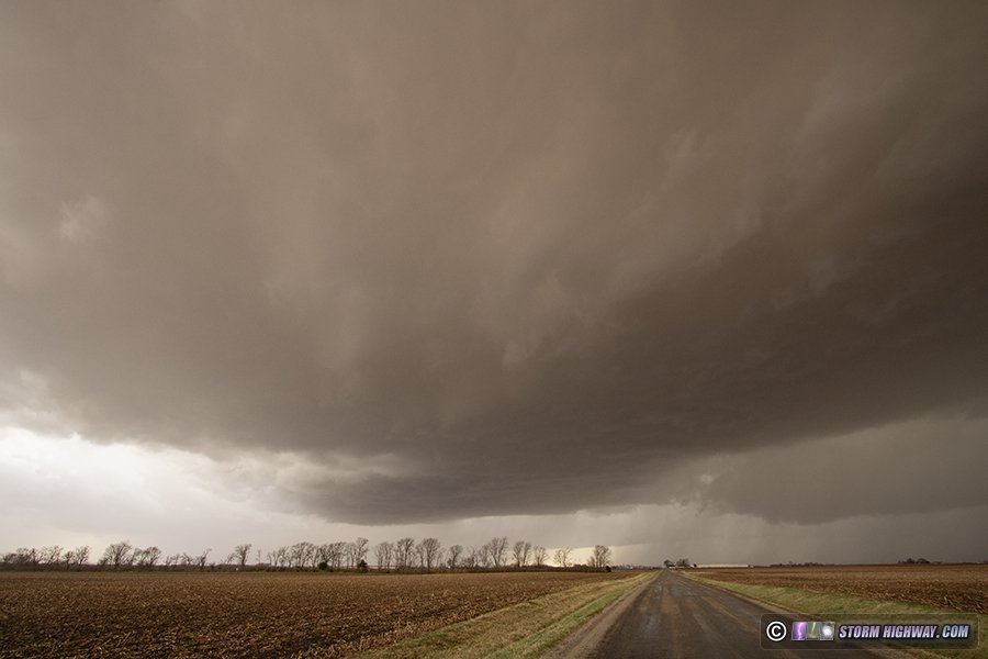
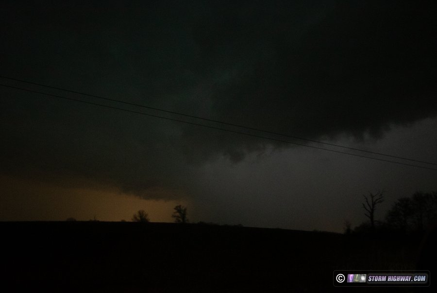
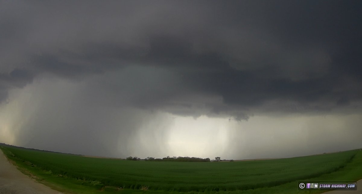
 March 30: Supercells from Steeleville, Illinois to Portageville, Missouri March 30: Supercells from Steeleville, Illinois to Portageville, Missouri
This event was originally expected to have a potent component in the St. Louis metro and southern Illinois, so I was initially planning on this being a local chase. But the first few radar images and satellite pictures of the day revealed that our environment here for supercells and tornadoes was looking much less optimal. The cold front was rapidly moving into the metro area by 10am, with thunderstorms firing well ahead of the front before noon - which usually means the day will be messy and a wash for any highly-visible tornadoes or storm structure. The early storms quickly went outflow dominant with gust fronts leading the cores by miles. Just behind this initial line, a gap remained ahead of the front with clearing skies, but the window for recovery was just too short. Furthermore, surface winds ahead of the front were veered (southwesterly), meaning storms would have less low-level shear to work with and struggle to maintain low-level circulations.
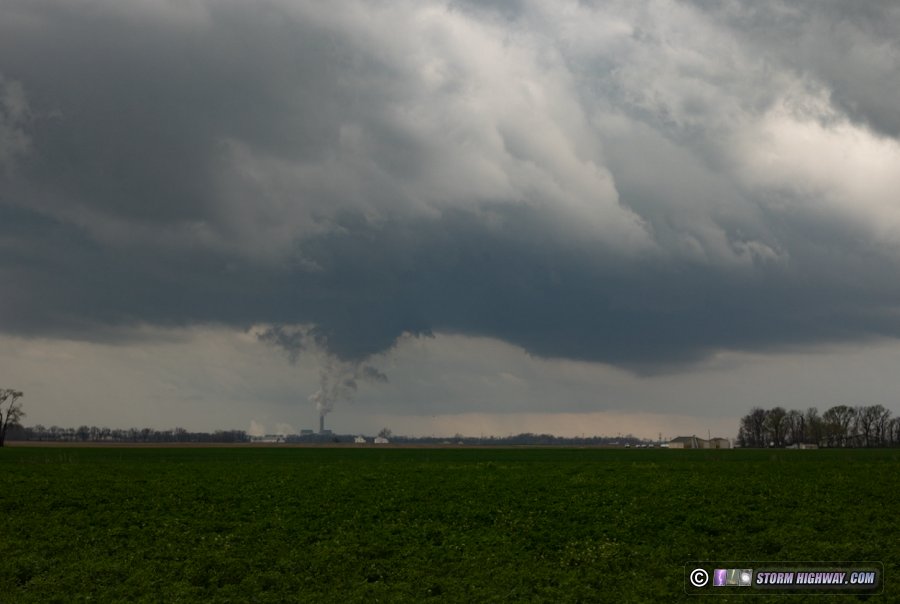
It didn't take me long to decide to give up on the metro area storms and start heading south. When I passed the Prairie State power plant at Marissa, it was doing its typical thing of producing fake lowerings in the base of a small updraft:
A healthy-looking-on-radar supercell was crossing the river near Chester, so I went down to meet it near Steelville. When I got a visual on the updraft base, it was narrow and high with cold outflow blasting east ahead of it. Most of the time, the first supercell you observe in a day will give you an idea of what to expect with everything else in a 150-mile or so radius. If the day is going to go big with tornadoes, storms will just have that "look" early on, even at their start before they produce. If the first storm I intercept doesn't have the "look" during an expected big outbreak, I'm usually very pessimistic about the rest of the day. Such was the case here. Despite that, I forged on southward on the Illinois side of the river, hoping that surface winds would back some more before the next round of storms moving through southern Missouri.
I intercepted a couple of new storms between Chester and Gorham. They had much the same look as the first one: high and narrow bases with no supercell structure evident. The convection looked crisp as they departed to the east:
The next area of storms in southern Missouri I'd hoped to intercept already looked like garbage by the time I crossed the river at Cape Girardeau. There were just too many storms too close together. When that happens, their outflow congeals into what is called a "cold pool" that surges forward as one mass, promoting development into a squall line as if it were on a cold front. And not surprisingly, this is how they evolved. Nonetheless, I decided to head down I-55 into the bootheel to look at the two best supercells that were maintaining their identity in the mess, meeting the first one at Matthews:
This appeared to attempt to wrap up a low-level circulation, but visibility was poor from within the "notch" of the storm (the rain-free area between the rear-flank downdraft (RFD) and forward flank precip areas).
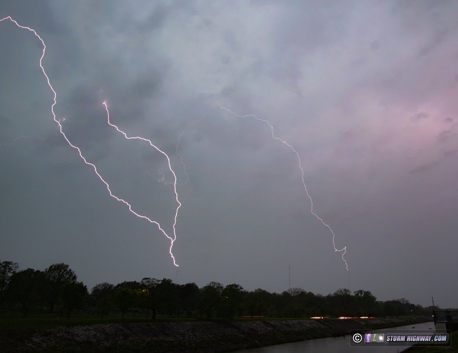
There were a few crazy "sidewinding" positive CG lightning strikes during this time:
With the hail-filled RFD racing toward me, I could not stay and observe this for very long without risking losing a window and/or being slowed from reaching any other storms. I ducked out of its way back to I-55 and headed down to Portageville. The couplet on radar appeared strong enough to indicate a tornado crossing I-55 near Matthews. When I passed through on the way home northbound, I did not find any damage and the power appeared to still be on everywhere: no sign of a tornado.
The next storm at Portageville attempted a few cycles as it approached, but the squall line behind it was quickly catching up. It was now getting dark and very difficult to make out any storm features. I stayed on the storm in case a "nudger" tornado developed (it's been observed that supercells can be kickstarted into a brief tornado production when overtaken and absorbed into a squall line). This didn't happen.
I was ready to give up and go home at this point, until seeing photos of the new tail-end storm way down near Harrisburg, Arkansas producing a highly-visible tornado. This storm seemed to be maintaining isolation, so I decided to go after it. It was on course to cross I-55 near Gilmore, but that was quite a long way south and it appeared I might not make it in time. So I headed east into Tennessee at Dyersville and dropped south from there. After I'd driven south for about 30 miles, radar started showing a pronounced gust front was now leading the storm's mesocyclone by an increasing distance. This meant that it was likely done producing tornadoes. That was my cue to finally call the chase and begin the drive back.
As I passed through Sikeston, I noticed data showing the electrified stratiform about 150 miles to the east was producing lightning. I saw stars out overhead, so that all looked like a potential sprite opportunity. I went a couple more exits north to get into a rural area, but a cloud deck rapidly moved over and ended the view and the active part of my chase. I arrived home just after midnight.
April 2: Elberfeld, Indiana tornado
A long and mostly-fruitless chase (quality photo/video-wise) along the I-64 corridor from Fairview Heights, IL to Lynnville, Indiana. Models seemed to be correct about a potent tornado environment in the St. Louis metro and points east, which made it an easier decision to stay here rather than drive 6 hours south into yet another High Risk.
I waited at home until 3pm to begin this day's chase. I initially positioned in Fairview Heights to intercept the supercell that produced the Potosi, Missouri tornado as it crossed the river into Illinois. As this storm approached, it was mostly swallowed by surrounding convection which interrupted its organization (a very good thing, as it was heading through populated areas). After leaving that storm, I moved east on I-64 to intercept several other embedded supercells to the south of the first one as they crossed the interstate between Okawville and Irvington. I could not get a visual on anything interesting, everything circulation-wise was buried deep in precipitation behind RFD gust fronts (unlike a few visible tornadoes photographed farther north by other chasers and locals).
After this first line moved northeast away from me at 80mph, I continued east on I-64 to Burnt Prairie to intercept a new supercell that was beginning to organize right as it crossed the interstate. This raced away to my north, appearing to not do much as it did. With daylight almost gone, I moved east to Griffin to watch a small storm pass by to the west:
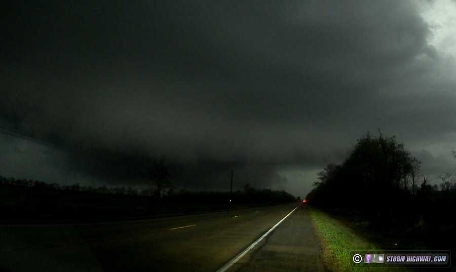
The final isolated supercell play (not embedded in the main squall line to the west) was the storm moving toward the Evansville area. I made my intercept of this at Wheatonville at Highway 58 and I-69. The storm had a beefy RFD hook, but little in the way of a low-level circulation. This is my lightning-illuminated view of it on Highway 58 (around a mile or less from where the tornado with the next storm would track):
I stayed ahead of this to Lynnville before letting it go.
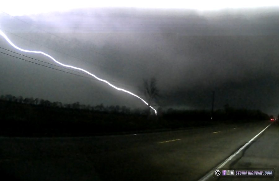
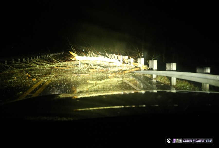
One final tornado threat would be with the northern end of a bowing segment within the main squall line, headed generally in the same area as the previous supercell. I intercepted this area back along I-69 and Highway 58 at Wheatonville. Two circulations spun up near each other to my immediate south and southwest, with the southern one producing power flashes as it damaged lines near I-69 just south of the I-64 interchange at Elberfeld:
The two circulations appeared to begin a Fujiwara interaction here, which made their paths start to curve unpredictably. I bailed north on I-69 to ensure I was out of the way of all of that, then returned to Highway 58 to look for damage. The tornado crossed Highway 58 east of I-69 just across the railroad tracks, with a very clear tornado damage signature: a tree felled southward onto the road was followed immediately by a tree felled northward just to the east, the latter crushing the guardrail:
On the way home, I had hoped for a sprite photo opportunity with the expansive and active stratiform region - but as is typical in the Midwest, our skies were cloudy behind the line. I arrived home at midnight.
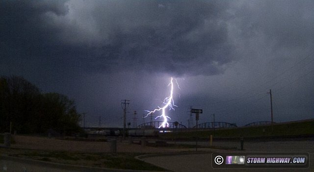
 April 3: New Baden, Illinois thunderstorm April 3: New Baden, Illinois thunderstorm
A short drive down the road to shoot an incoming elevated thunderstorm that had fired up among the stratiform rain shield. The lightning channels were all inside of the clouds, so no footage or video was captured.
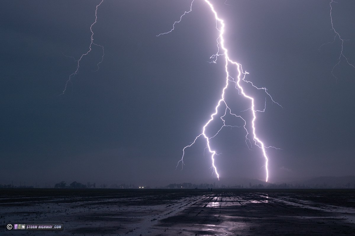
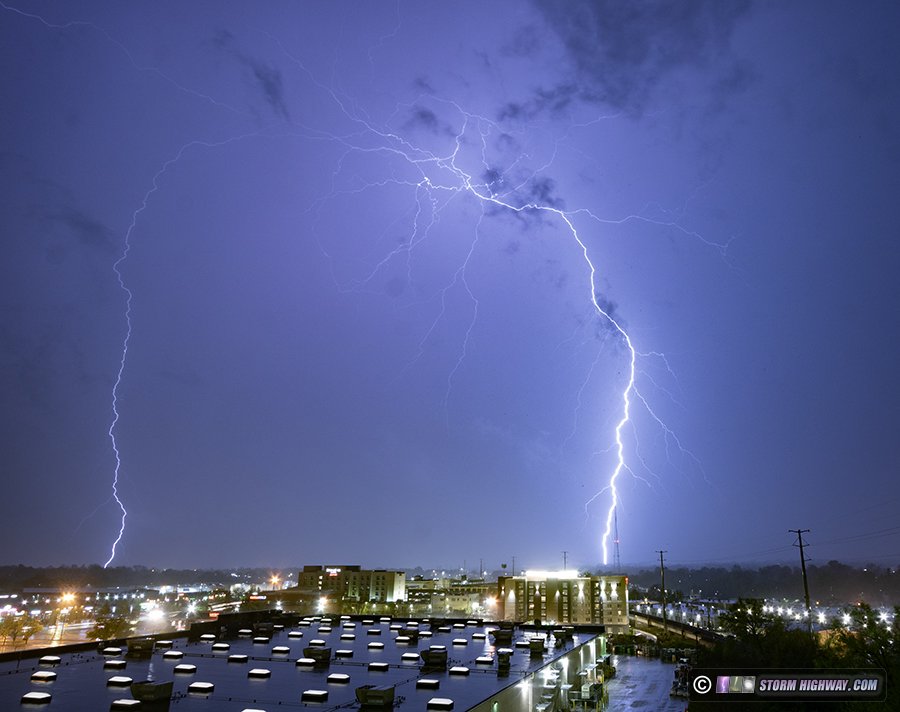
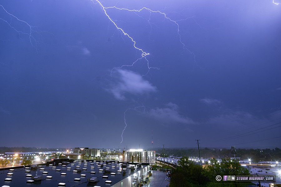
April 4: Supercell lightning barrage at Delta, Missouri
A top-quality lightning barrage from an elevated supercell in the Cape Girardeau area. This event resulted in a large number of photos that was enough to give it its own log page here.
 April 9: St. Louis lightning bust April 9: St. Louis lightning bust
On the way into work this evening, I saw distant-but-visible lightning channels with what I had expected to be only rain showers on the cold front about 40 miles to the north. Mesoanalysis only showed 250 MUCAPE in that area. The lightning was clearly visible even at that distance, but with my full schedule this week I wasn't feeling like taking time off to shoot faraway storms. During a break later, I saw new model runs suggesting similar storms firing on the front right in the metro at any moment and passing over downtown. A bubble of 500 MUCAPE on mesoanalysis just ahead of the front in the metro seemed to lend support to that. If those storms were anything like the distant one I saw earlier, the lightning had the potential to be very photogenic over the city. That was enough to get me on a run into downtown just in case that did occur.
On the way west, I could see that there were no towering cumulus in the metro, and Lambert's ASOS showed the cold front had already passed there. After 15 more minutes with no signs of thunderstorm development on the front and the newest run of the HRRR now showing no storms, I went back to work. While technically I did see lightning and my dashcams did capture it, I consider it a bust in the sense that I didn't see anything when I actually decided to chase.  April 10: St. Louis storms April 10: St. Louis storms
As I was still in the middle of a full work week, I didn't have much planned for this event other than to intercept storms if they came through either downtown or right overhead at home. The second round of convection - the day's strongest - was on a course to come through the city, so I went downtown at 2PM to await its arrival. A gust front led the original storms by a long distance, and this boundary fired new storms along it just south of downtown. This produced a few nice bolts, but a little too far away to get good leader exposures on the high speed camera. This was the return stroke of one of them:
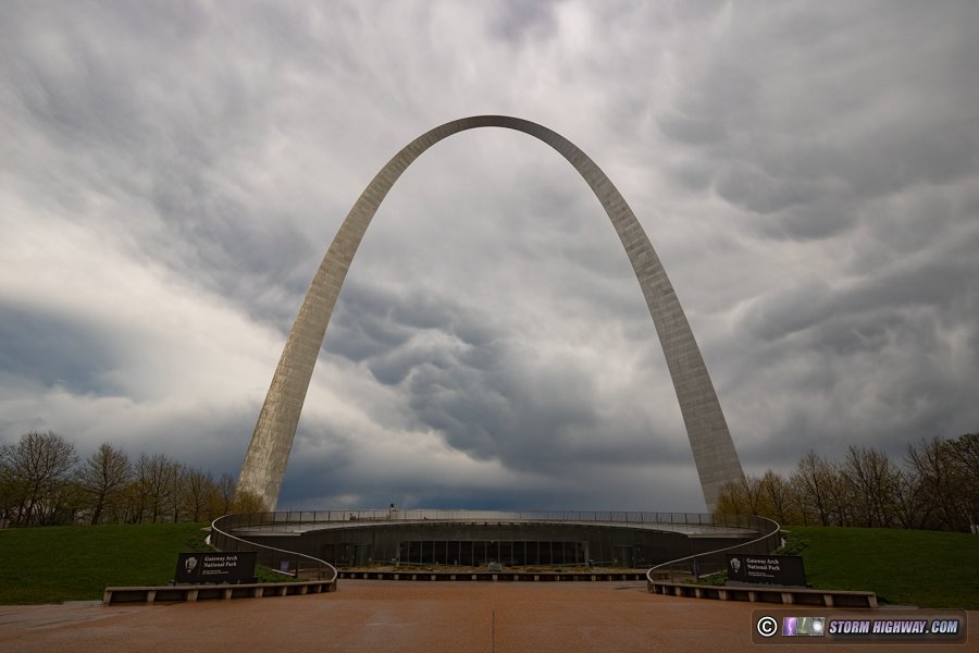
The original storms to the west weakened, but reports and photos were coming in on social media of a dramatic mammatus cloud display on their trailing anvils. I decided this was worth waiting for at the Arch grounds. It took a long 90 minutes for this region of the storm to arrive, and by the time it did, it had faded almost completely. This was the best it looked over downtown:
Still more rounds of storms were upstream to the northwest, but it was too late for recovery of any instability by the time that second round cleared out. Lightning data was also sporadic and unfocused on any one storm, so I decided I was done for the day at 4:30.
April 15: New Baden, Illinois aurora bust
Twitter reports of bright aurora at high latitudes were coming in, so I went out in town after 10pm and did a single test exposure on the DSLR. The camera didn't pick up anything.
April 17: St. Louis lightning bust
I went into the city on my way home from work just after midnight as new elevated convection started blooming across the metro area from warm air advection. Cloud bases were very high and lightning would be photogenic if it happened. Some of the cells to the west in St. Charles County were producing a few strikes, but none of the ones close to downtown were. Eventually the cells in a more distant band to the southwest cut off the inflow to the St. Louis ones, causing them to fade.
April 19: St. Louis lightning
With every new run, models diminished the storm potential for the metro area for Friday night into Saturday morning. The strongest activity ended up going well south of the city after midnight. So, I decided the best option was upward lightning from the Shrewsbury/Brentwood towers. There was a burst of intense CG lightning on the west edge of the cores of the storms. The first flash here was mostly off to the side of the high speed camera frame, so unfortunately I only saved one of its four ground connections. I saved 6,002 fps sequences of all three of these.
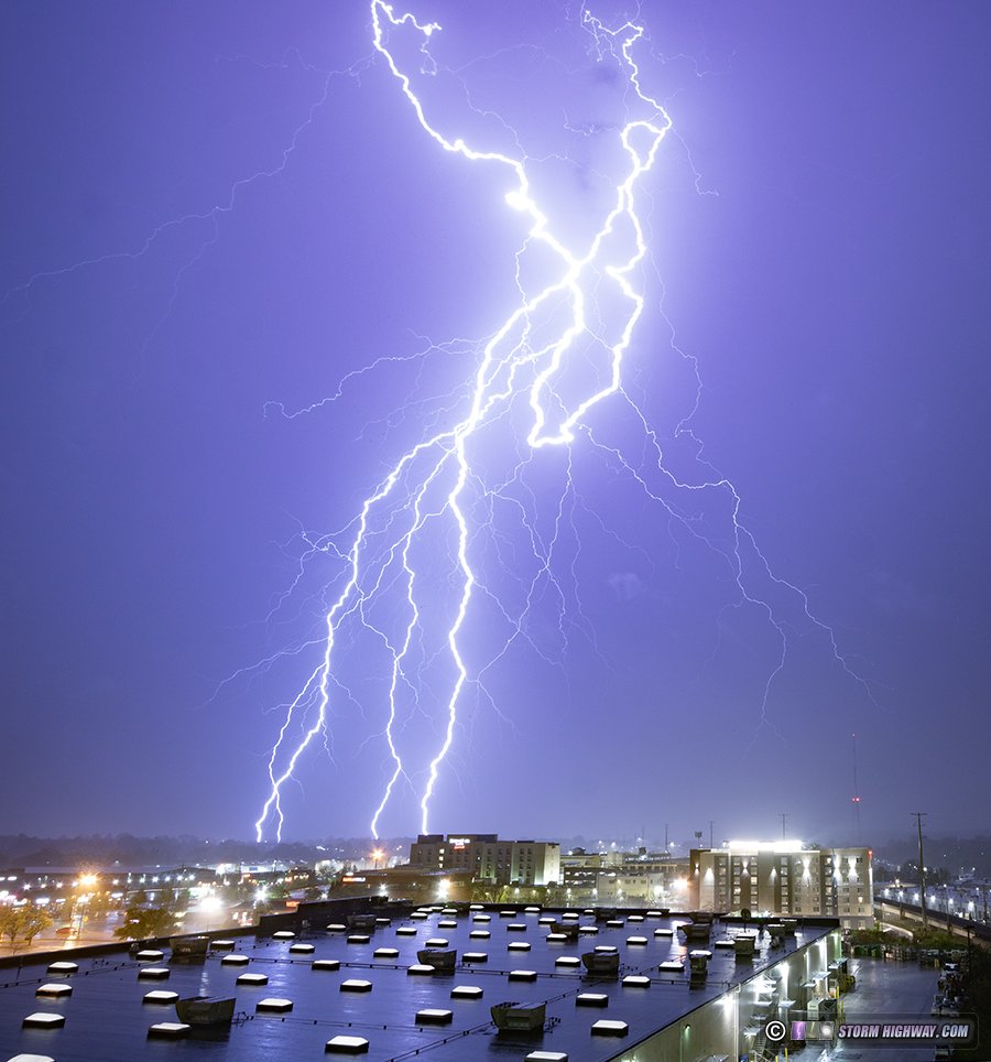
The stratiform region of these storms was not very active, with only one upward flash to the KMOV tower in South County and none from the ones in Shrewsbury/Brentwood:
I was exhausted from a long work week, so I didn't stay out for the subsequent rounds of storms that didn't look as impressive. There was also low stratus moving in behind the cold front toward the end of the first round of storms, obscuring the tops of the towers and most of the sky.
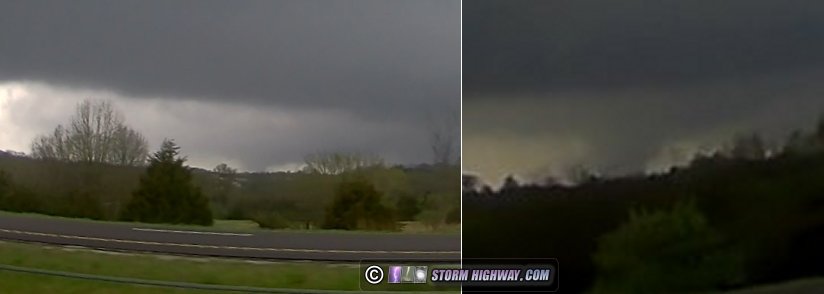
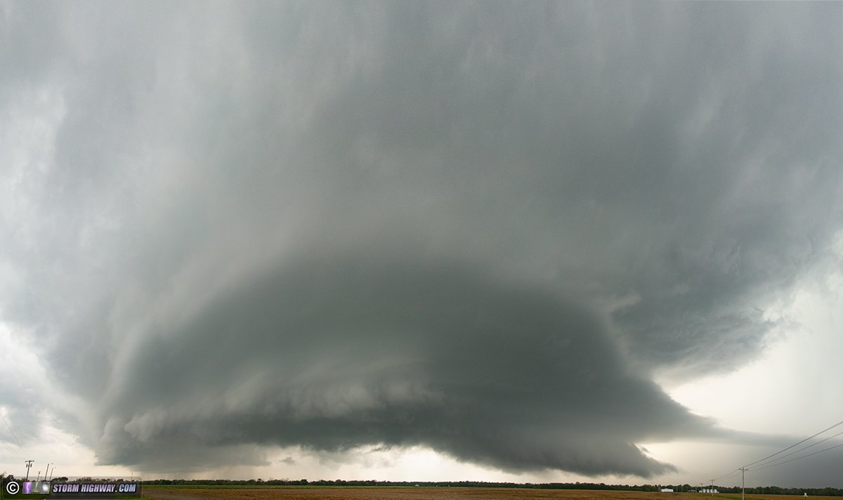
April 20: Fulton, Missouri tornado
The no-brainer tornado target this day was supercells along a warm front in central Missouri that most models showed getting started around noon. The same front stretched east through the St. Louis area, and was a threat for tornadoes there if any storms were to develop that far east. I was willing to ditch the sure-thing target farther west for that backyard chance, but as the morning progressed all model and realtime data (including visible satellite) pointed to those storms being very unlikely.
I departed just after the morning church service in O'Fallon and headed west, stopping only to get gas right after church. I then drove straight to the intercept of the storm in Jefferson City that had already developed and produced a tornado earlier. The plan was to intercept just across the river from town and follow the storm north on Highway 54. I reached the storm's updraft as planned, but made a mistake in not realizing that Highway 63 northbound didn't have a turnaround for 3 miles. This allowed the storm to get ahead of me.
The terrain is hilly and forested here, with very few views. For this reason I missed seeing the second short-lived tornado the storm produced near New Bloomfield as I caught up on Highway 54. A few minutes later, the storm developed a massive RFD surge and produced its third and largest tornado southwest of Fulton as it tracked a few miles west of the highway. I could see it from the highway, and my dashcams captured possibly my most pitiful images of a tornado:
Rather than pulling over on the highway and getting distant video through the trees, I decided I wanted to try getting closer at the next west road option and launch the drone once I was within a mile or so of it. But when I reached that road, the tornado had already dissipated quickly as the previous two had done.
The next RFD surge was already racing overhead, and it appeared the next tornado might be happening soon along the highway somewhere near Fulton. However, the storm could never get another good surface inflow channel established before it finally crossed over to the cool side of the warm front and began weakening near I-70. Meanwhile a new updraft went up just to the east of the original storm, appearing to be the next tornado threat. Alas though, this storm too was already north of the front and gradually weakened to nothing near Mexico.
I hung around waiting to see if new updrafts to the south near Columbia could get established, but these also struggled and never appeared to be headed for supercell status. After letting those go, there was nothing else within intercept range other than the main squall line to the west that had a few QLCS circulations. Those are rarely chaseworthy: usually short-lived, wrapped in rain, hard to see and visually unimpressive even if you do manage to get a glimpse. So, I decided to just go back to St. Louis and see if the line would perhaps separate into discrete cells as the low-level jet ramped up into the evening.
The line failed to separate as it approached the city, but there was lead stratiform precip far ahead of it - and it was producing lightning. I set up at the Shrewsbury towers for this. Only one upward flash was produced, I captured it on all 3 cameras:
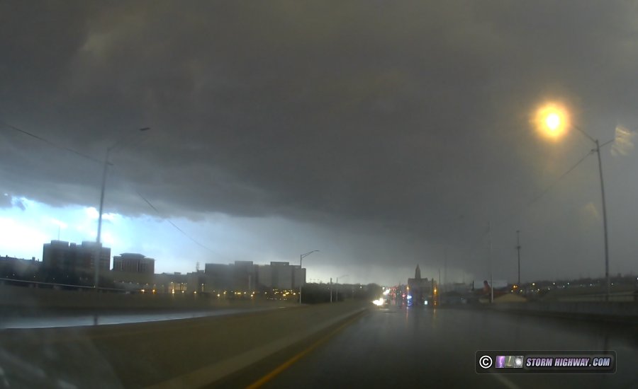
Mesoanalysis suggested the storms were outrunning the surface-based instability axis, and a dramatic decrease in the lighntning flash rates seemed to be validating this. On radar, the portion of the main squall line heading into the city was clearly weakening and diaorganized. To the south, though, a portion of the line was intensifying with several strong-looking couplets, each tornado-warned. These were heading toward home, so I packed up at the towers and made my way east.
I parked near I-64 at O'Fallon to watch the line approach. A very strong-looking couplet developed near Waterloo and was heading directly at O'Fallon. This area faded fast (as QLCS circulations often do), but a new one took shape near Mascoutah - tracking very close to the path of the March 14 tornado. Power flashes started bursting on the other side of MidAmerica Airport, very close to where they did on March 14! As I cautiously made my way east on the interstate, I could make out an ill-defined cloud feature racing overhead as winds shifted from easterly to southerly, but nothing definitive.
There was some shredded tree/leaf debris on the interstate near Summerfield Road - again, right where the March 14 tornado tracked. But, I did not find any damage indicative of a tornado. I made passes on Perrin Road, Highway 4, Highway 161 and the interstate looking for tornado damage, but found none. The power was also still on everywhere. After that short damage survey, I was done for the day and arrived home before 10pm. April 24: Shiloh, Illinois lightning bust
Thunderstorms were shown by models to begin increasing in number and intensity in the metro area after midnight. Cells to the west and east of the city became active with strikes, and the area in between looked like it might fill in with new storms. I went out to Shiloh along I-64 as these cells drifted overhead, but they didn't produce any lightning.
April 25: Alorton, Illinois lightning bust
Weak thunderstorms were expected along a cold front this evening, but nothing I thought would be worth chasing. Before leaving for work, some weak convection fired and dissipated over the city, leaving an outflow roughly along I-70 and north of I-64 into Illinois. A new cell developed on this boundary and became strong briefly just north of downtown St. Louis, producing lightning and even having a bit of a supercell look on radar for a couple of scans. I decided to take a look at this storm on my way into work, heading down to I-255 south to Alorton to get a look at the updraft. The base was small and shrinking, and it had stopped producing bolts by the time I arrived on it.
April 27: Cherry County, Nebraska tornado
A nighttime intercept of a significant tornado in the Nebraska Sandhills. This log has its own page here.
April 28: Abilene to Topeka, Kansas supercells
April 29: St. Louis lightning
I missed the first round of very lightning-active storms that passed through the city after 2am. By the time they formed and got my attention, they were already entering the city and I would not make it in time. I walked outside to watch them for a few minutes, but with my need for sleep before the next event that afternoon, I decided to let them go.
The evolution of next round of storms went mostly as expected, with the storms intensifying east of St. Louis after noon. The front side of these looked like garbage and the environment didn't support any improvement, so I decided to just go to Brentwood for upward lightning in the stratiform region. This activity dwindled as I approached, and lots of low stratus was moving in from the northwest behind the cold front. I never made it to my setup spot before turning around and heading home. No images or video captured. April 30: Supercell from Hecker to Carlyle, Illinois
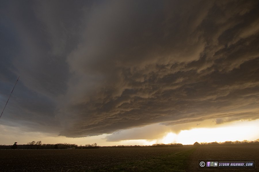
I stayed with a supercell from Hecker to Carlyle, Illinois as it tracked northeast along an outflow boundary lifting north. The storm was outflow dominant the entire time, though it attemped some low-level mesos a few times without success. This was the best the storm looked, at Beckmeyer:
There were a couple of short intervals of good CG lightning in the forward flank. I captured this close bolt at 6,002 FPS near Smithton:
There was a risk for another round of supercells back in the St. Louis metro during the late evening. So, when the Carlyle storm started a weakening trend, I decided it would likely continue to struggle and bailed on it to head back into the city. The storm did manage to produce at least one tornado along I-70 about 45 minutes after I left it.
I drove all the way to Dardenne Prairie to intercept another storm, intending to cell-hop my way back east as storms traversed to the St. Louis metro. None of these were organizing into supercells and all of them dissipated by sunset, so I was done at 8pm.
< February 2025 Recap | All Storm Chase Logs | May-June 2025 Recap >
GO: Home | Storm Chase Logs | Photography | Extreme Weather Library | Stock Footage | Blog
Featured Weather Library Article:
|


