|
Home | Blog Index | Blog Archives | Christianity & Faith Essays | Storm Chasing Essays
Great Plains 2024 Storm Chasing Expedition Logs
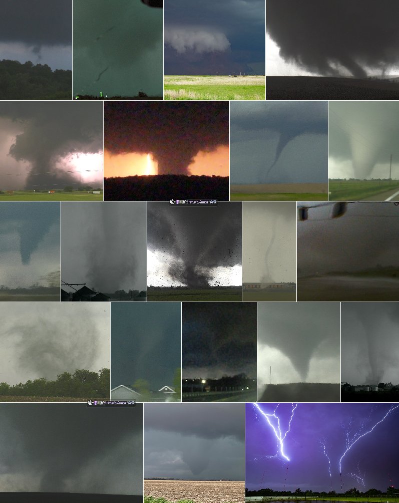
Season Epilogue: The 2024 spring tornado season was one for the ages. Not only did it rank among the most prolific in United States history, it was a personal record-breaker for me in many ways: some good, but many bad. I captured 23 tornadoes this spring, 20 of those during Plains expeditions. Both of those totals are career highs by a long shot - beating the previous leader of 2016 which yielded 17 (15 in the Plains). Unfortunately, my feeling is that the bad overshadows much of the good. Tornadoes I saw this year hit towns and brought much death, destruction, human suffering and loss. Three of the tornadoes I witnessed were violent killers that wiped out large sections of towns: Minden and Greenfield, Iowa, Barnsdall, Oklahoma. The Waverly, Nebraska tornado destroyed a business right before my eyes, putting dozens of people out of work.
As always, there are many things to be thankful for. I recognize that my own damage and injury incidents (on April 16 and May 21) could have been far worse - if not catastrophic - instead of the relatively minor annoyances they turned out to be. And while I suffered several daunting video documentation failures, I did manage some of my most dramatic and compelling tornado footage. Does that counter all of the bad? It feels trite to say it, but of course not. In fact, like 2013 and 2007, the human impact of the tornadoes I saw this spring puts a lot of it among events I would rather just move on from and not even speak of much of moving forward. So despite 2024's stats looking great on paper, it's not going to ever rank among what I consider to be my "good" seasons.
2024 Great Plains Season Stats:
- Expedition trips: 5*
- Total days on the road: 20
- Expedition chase days: 15
- Plains Tornadoes: 20*
- All Tornadoes: 23*
Including:
- Two (2) EF4s
- Five (5) EF3s
- States: 8 (MO, KS, NE, IA, OK, CO, IL, TX)
- Miles: 11,885*
- Most Miles in a Day: 1,082*
* Career record high.
2024 Great Plains Chase Day List
- Day 1: April 14: St. Louis to Junction City, Kansas (Trip #1 Start)
- Day 2: April 15: Dodge City, Kansas supercell
- Day 3: April 16: Supercells from Topeka, Kansas through northern Missouri (Trip #1 End)
- Day 4: April 24: St. Louis to Salina, Kansas, Council Grove lightning (Trip #2 Start)
- Day 5: April 25: Supercells from Goodland to Scott City, Kansas
- Day 6: April 26: Numerous tornadoes from Lincoln, Nebraska to Osceola, Iowa
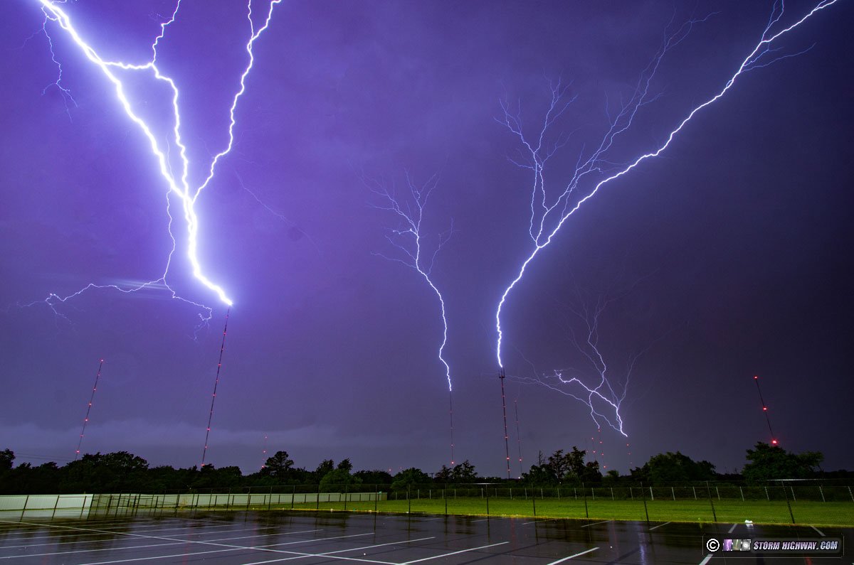
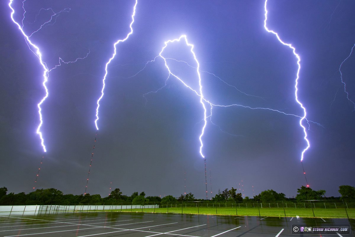
- Day 7: April 27: Foraker, Oklahoma tornado, Oklahoma City upward lightning
- Day 8: April 28: Marginal thunderstorms in eastern Oklahoma/Missouri (Trip #2 End)
- Day 9: May 5: St. Louis to Emporia, Kansas (Trip #3 Start)
- Day 10: May 6: Barnsdall, Oklahoma nighttime strong tornado
- Day 11: May 7: Marshfield, Missouri to St. Louis (Trip #3 End)
- Day 12: May 18: St. Louis to Salina, Kansas (Trip #4 Start)
- Day 13: May 19: Russell and Dorrance, Kansas tornadoes
- Day 14: May 20: Akron, Colorado supercell
- Day 15: May 21: Southwestern Iowa tornadoes (Trip #4 End)
- Day 16: May 22: St. Louis to Ottawa, Kansas (Trip #5 Start)
- Day 17: May 23: Blue-sky bust in southwestern Kansas
- Day 18: May 24: Wentzville, Missouri supercell and lightning
- Day 19: May 25: Windthorst, Texas tornado
- Day 20: May 26: St. Louis metro tornado (Trip #5 End)
 Day 1: April 14: St. Louis to Junction City, Kansas (Trip #1 Start) Day 1: April 14: St. Louis to Junction City, Kansas (Trip #1 Start)
I left St. Louis at 11PM in order to make the transit across Missouri on I-70 at the minimum traffic time. The drive was uneventful, and I stopped for the night at Junction City, Kansas.
 Day 2: April 15: Dodge City, Kansas supercell Day 2: April 15: Dodge City, Kansas supercell
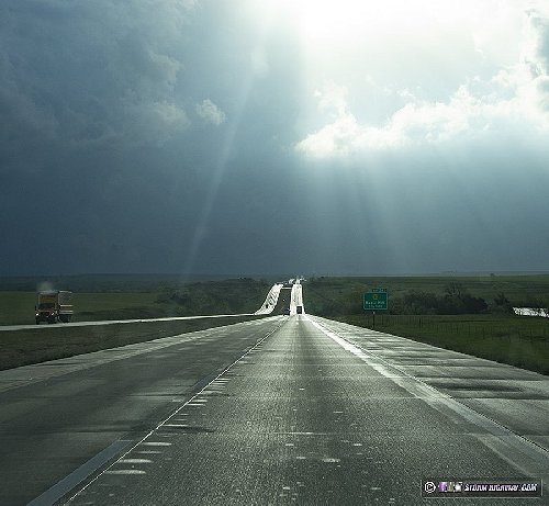
I awoke in Junction City, grabbed a coffee and headed west after doing my morning data check. There were three areas of interest this day (four if you count the Midwest). The first and primary target was dryline supercells in central Kansas that would have the better upper support and moisture, with the drawback of them potentially not firing until after sunset. The second was the warm front in Nebraska, where daytime supercells were more likely but with meager moisture. The third was north Texas, where daytime storms and better moisture were shown, but only for a short time before the cap squashed them. The cap was very strong this day, and looked to impact all three of those areas to some degree. To add another complication, models had been showing warm front storms back home around St. Louis that I was on a hair-trigger to turn around for. In addition, Tuesday's event in the Midwest looked volatile and worth chasing, so I wanted to be able to make it back for that.
The Texas target was too far away to consider - it was too far away to allow me to get back to the Midwest setup with enough sleep. Models continued a trend of backing way off of the Midwest activity, so by noon, I was committed to the Plains. Nebraska's moisture issues looked too much to overcome for good storms there. By early afternoon, I had more or less committed to the Kansas target. With those storms not expected to fire until sunset or afterward, there was a lot of time to make the drive and take in the beloved Plains scenery and landscapes. I went to Russell, then headed south on US 281.
I passed through Hoisington in the late afternoon light...
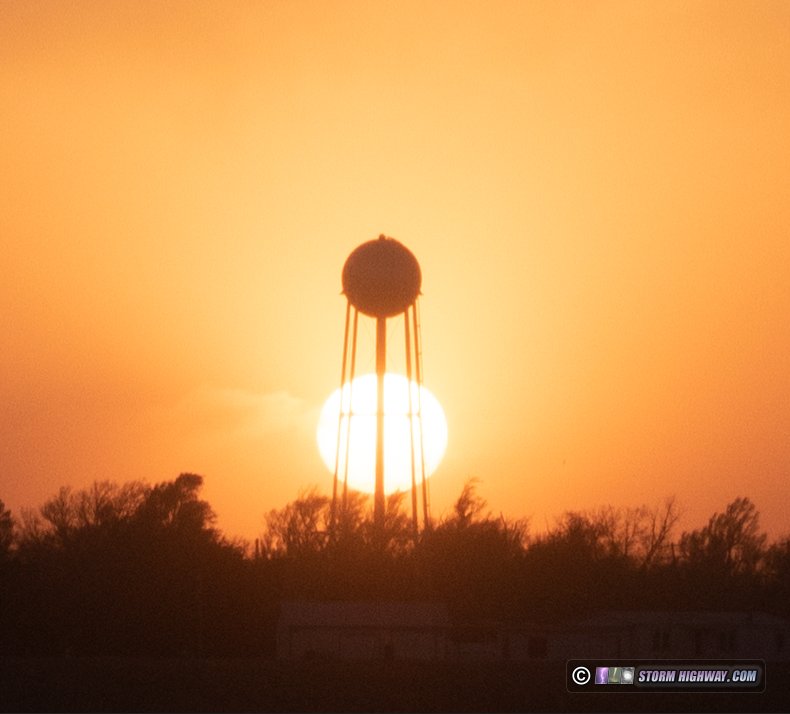
...then drove through Rozel at sunset.
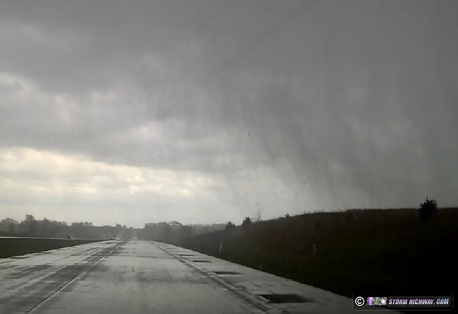
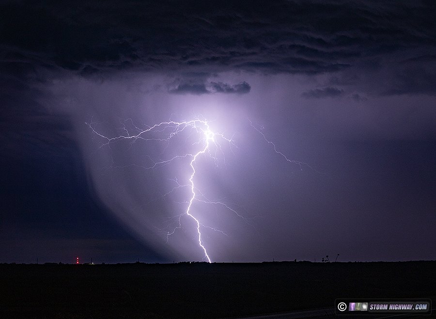
Radar showed the dryline was retreating to west of a Dodge City to Wakeeney line, and the last few visible satellite images before darkness fell showed agitated cumulus starting to appear along it. I headed west to Jetmore, then south to Dodge City as the first storm finally fired at 10PM. Lightning was starting to pick up, so I set up on the east side of town to shoot some stills. I couldn't see the updraft base yet from this point, and lightning channels weren't all that photogenic. There was this interesting pattern in the cascading forward flank precip illuminated by lightning:
I had expected the storm to start turning right enough to make US 50 the better route to stay with the storm, but it was struggling to organize and still moving mostly north. So, I headed north on 283 to stay with it. I had to transect the core in Jetmore to get back ahead of the storm on 156 east. After this, the storm was not looking like it was going to do anything interesting in tornado, structure or lightning, so I decided to call the chase and start heading northeast so I'd still have about 7 hours to sleep before Tuesday's event. I stopped at Salina for the night.
Day 3: April 16: Supercells from Topeka, Kansas through northern Missouri (Trip #1 End)
This was technically a Midwest chase day - but my personal criteria is that if it's at the start or finish of a Great Plains trip without me going home in between, it counts as part of the Plains expedition.
I awoke at 7AM in Salina, Kansas and did my morning data check. Where supercells interacted with the warm front in Iowa looked like the best target. The wind fields, though, supported supercells and tornadoes throughout the warm sector in Missouri in two waves of storms. The second wave would develop thanks to a midlevel dry slot that was clearing the skies behind the first wave. Both the first and second waves were shown potentially affecting St. Louis, the better and later ones at sunset, so I wanted to keep my home area within range if that occurred. Overnight supercells that would constitute the first wave of these storms were still in progress, and were now just to my east. I approached a pair of them at Topeka, with the first one already crossing the highway ahead of me.
There was some interesting light as the sun broke through in between the cells.
I just barely beat the second cell to Topeka, but only found a fairly uninteresting RFD gust frunt shelf cloud and not much else in the way of structure.
More supercells and QLCS circulations were approaching from the southwest, and I stayed ahead of these through Kansas City. One of these circulations intensified suddenly near Lathrop, just to my west along I-35. I did not have a visual on it, but I was in the tornado warning polygon. Another circulation began developing at Cameron, Missouri. This had a pronounced RFD surge, and after it passed, a well-defined clear slot was visible. Motion was weak, however.
I moved east on Highway 36 to Hamilton to intercept the next circulation in the line. This one ramped up rapidly as it approached Highway 36, with very fast rain curtains crossing the highway at the leading edge of the RFD:
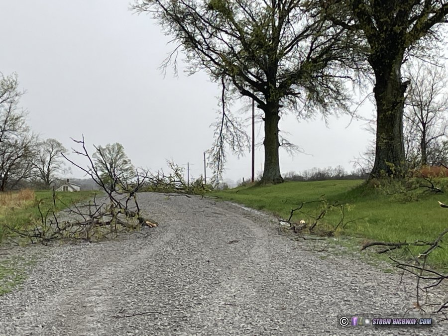
The circulation center was just to my east here. Southerly RFD winds became intense, possibly as high as 80 or 90mph. Radar showed a tight couplet had developed just north of the highway, possibly right over it, but this was completely rain-wrapped even at my close vantage point. After the circulation faded and moved off to the northeast, I backtracked through the path to see if I could find tornado damage. I found several large tree limbs snapped and pieces of sheet metal in a field along a narrow 100-yard wide corridor on either side of US 36, 3 miles east of Hamilton.
The storms to the southwest were beginning to show signs of organizing, so I moved northeast to Kirksville to get into position. These were struggling against a tendency to line out. I positioned ahead of one along Highway 63 north of Kirksville that had a cold, linear look with strong outflow all along it. The next cell to the southwest looked more isolated, so I moved over to Greensburg to intercept it. This had more interesting structure, with an RFD gust front curling back into where a lowering was evident. Motion in this feature was weak, however.
Storms were moving too fast to keep up with now, so I let this one go and moved south for the next one. The Greensburg cell went tornado-warned just 10 minutes after I left it, but I couldn't see anything due to the dense RFD precip. The next cell at Edina was also beginning to organize, but was high based when I arrived on it. I let this storm go, knowing I wouldn't be able to keep up with it. I had a good view of it to the northeast as it departed. Although it was remaining high based, an RFD clear slot was evident on its southwest flank:
I turned north out of La Belle intending to position ahead of new storms beginning to develop to the southwest, just as models had indicated. About 7 miles north of town, a turkey on the east side of the road took flight toward the road.
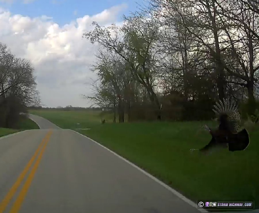
I hit it squarely on the right side of the windshield, creating a massive 6-inch deep crater spanning the entire height of the glass as shards exploded inward. The turkey had wedged against the hail guards, bending the main rails upward before it managed to free itself and somehow fly away. This obviously meant my chase was over.
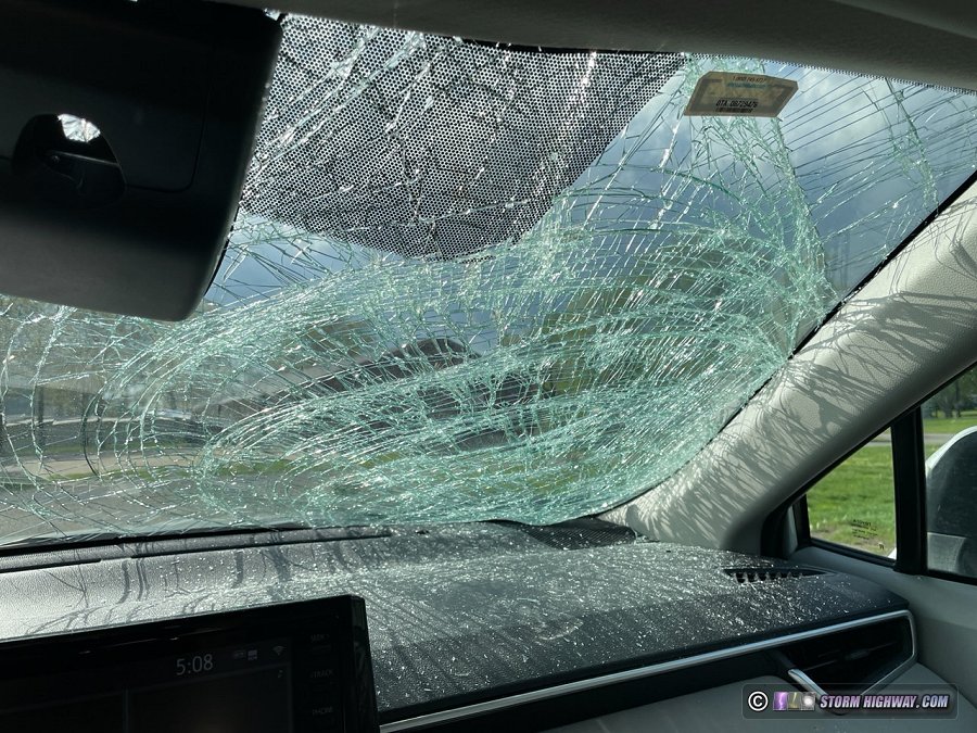
I immediately started looking for options to replace the glass, but it was just after 5PM and nothing was open in Quincy (the closest metro area that had any auto glass shops). With the driver's side of the glass thankfully still intact, I could see reasonably enough to slowly make my way south at 35mph on back roads (having to ford a creek at one point). New storms were continuing to form to my west and southwest, and I wanted to avoid them at all costs to keep water damage from making the incident worse. I managed to get south of the closest one at Palmyra, with was high-based and not doing much that made me want to stay and keep shooting.
Another high-based supercell organized to my west at Bowling Green, which I could see flickering in the twilight. At this point though, I was more concerned about getting home - so I let it go.
The damage to the hail shield rig was limited to the main rails, meaning the repair will be very simple: just two new rails and some drilling for the holes. And other than the glass cleanup and the cost of the new windshield and sensor calibration, there were no other effects to my car or equipment. All in all, this could have definitely been much worse, and I'm thankful for that. These incidents, and overall bad trips like this, are a part of chasing just as much as the good ones. I later found out that another chaser had suffered the same fate in Iowa.  Day 4: April 24: St. Louis to Salina, Kansas, Council Grove lightning (Trip #2 Start) Day 4: April 24: St. Louis to Salina, Kansas, Council Grove lightning (Trip #2 Start)
I left after church on Wednesday night and made the drive to Salina on either side of midnight. On the way there, I stopped to shoot thunderstorms that were passing near Council Grove, Kansas.
Day 5: April 25: Supercells from Goodland to Scott City, Kansas
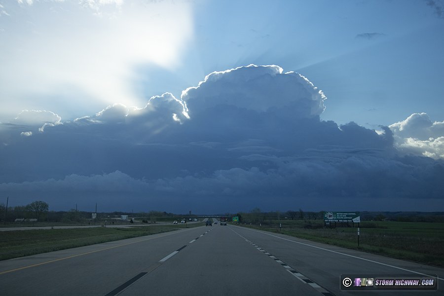
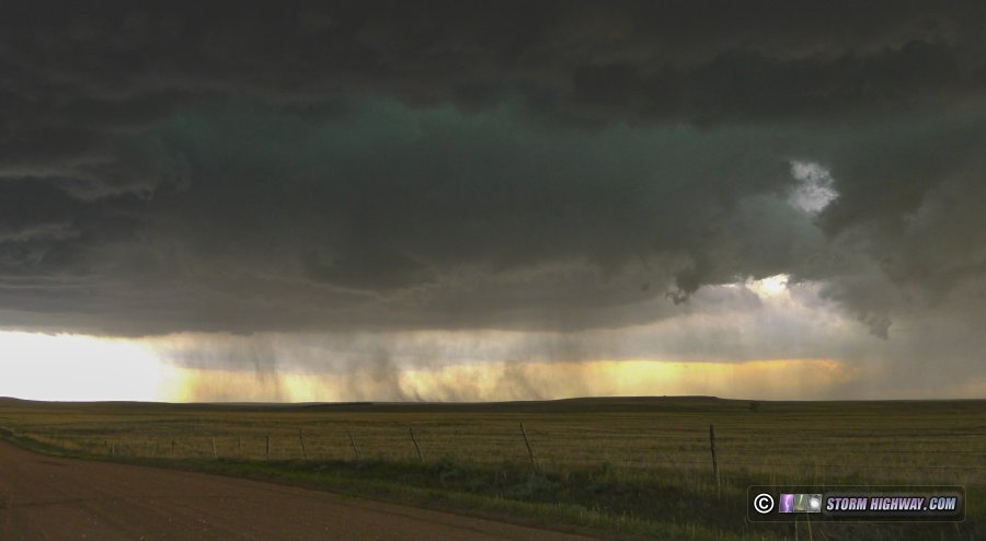
I slept late, grabbed a coffee and departed Salina after noon. My target was northwestern Kansas where storms would interact with a stationary frontal boundary, but I was also watching for development down the dryline to the south. As I approached Colby, agitated cumulus developed into a thunderstorm south of Goodland, so I continued west to it. This storm reached the frontal boundary about 10 miles north of town, at which point it began exhibiting signs of a mesocyclone. An RFD clear slot cut in a couple of cycles, one producing this funnel:
I did not see the reported rope tornado around this time. After the storm was completely across the boundary, its structure diminished considerably. So, I turned my attention to new storms farther south. Some were already across the boundary south of Oakley, and more were traversing it - but none were developing good low-level mesos. One was producing some decent cloud-to-ground lightning here, so I decided to spend some time trying to catch a few. None cooperated for my camera.
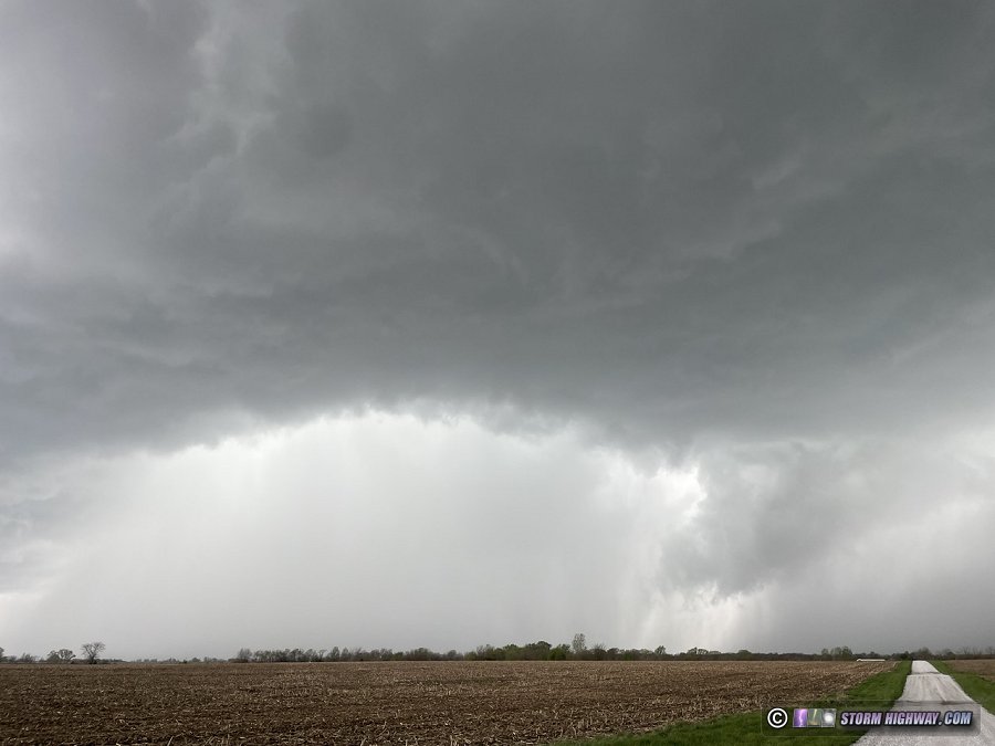
At this point, radar showed the boundary was being reinforced by storm outflow and actually sinking southward as a cold front. This pretty well spelled the end to any real tornado potential for the day. My oly play left was to get away from the boundary, down to the southernmost dryline storm near Syracuse. At Scott City, a new storm went up right over me that looked like it was in just as good of a position as the one near Syracuse. I decided to follow this one northeast, but it was high-based and never had a good look in its low levels.
I had just reached I-70 at Grainfield when a new storm went up just south of the old one. This one intensified rapidly, with a couplet developing south of the interstate. The storm could not wrap up at ground level, as it was already north of the boundary with cold, stable air at the surface. It was also getting dark, and the grungy environment north of the boundary was making it difficult to see much of anything structure-wise. After this storm moved north of the highway, I called the chase and started heading east. I once again stopped in Salina for the night. I could have gone farther, but I wasn't sure which road I would need to take in the morning (either Highway 81 north or I-70 east).  Day 6: April 26: Numerous tornadoes from Lincoln, Nebraska to Osceola, Iowa Day 6: April 26: Numerous tornadoes from Lincoln, Nebraska to Osceola, Iowa
A top-5 chase day with 10 tornadoes in Nebraska and Iowa, with three close intercepts. This event has its own page here
 Day 7: April 27: Foraker, Oklahoma tornado, Oklahoma City upward lightning Day 7: April 27: Foraker, Oklahoma tornado, Oklahoma City upward lightning
A tornado followed by a prolific upward lightning event in Oklahoma City. This event has its own page here
 Day 8: April 28: Marginal thunderstorms in eastern Oklahoma/Missouri (Trip #2 End) Day 8: April 28: Marginal thunderstorms in eastern Oklahoma/Missouri (Trip #2 End)
This originally did not appear to be a day worth expending time and money to stay another day in the Plains. The previous night's MCS had scoured moisture away from the dryline, and clouds/precip looked to prevent any good recovery from occurring in Oklahoma before sunset. So, I left Oklahoma City on I-44 toward home. At Bristow, I stopped for a data check to see that clearing was rapidly taking place in southeast Oklahoma, mainly south of I-40. I decided it looked interesting enough to go south to Henryetta and see what would happen. Storms initiated to the southwest as I arrived, and when I got my first look at them, they were cold and outflow-dominant messes without even much lightning. Thick cloud cover had also started building back in across the area ahead of these, and I decided it didn't look good enough to further delay my trip home. I turned north back to I-44 at Tulsa and continued the trek home. After passing through Tulsa, I saw reports of the photogenic tornado that had occurred just east of Henryetta over Lake Eufala (only a few miles from where I'd been). A small lead storm somehow was able to defy what looked like a very marginal environment.
I was watching for additional development along the line through Missouri as I drive northeast. Despite several tornado warnings south of the interstate, the storms continued to be messy with very little visible lightning. I didn't stop again for any of them, and arrived home at 11PM to officially bring the memorable Plains trip #2 to a close. Day 9: May 5: St. Louis to Emporia, Kansas (Trip #3 Start)
I left St. Louis at 8PM and made another uneventful late-night drive into Kansas. I stopped for the night at Emporia.
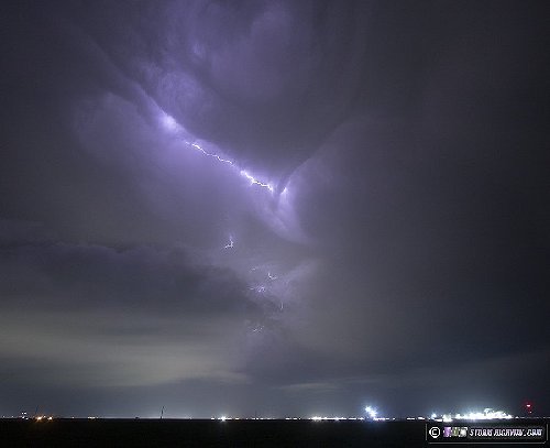
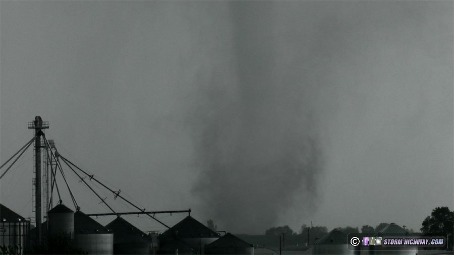
 Day 10: May 6: Barnsdall, Oklahoma nighttime EF4 tornado Day 10: May 6: Barnsdall, Oklahoma nighttime EF4 tornado
A long day ending with a significant tornado after dark. This event has its own page here
Day 11: May 7: Marshfield, Missouri to St. Louis (Trip #3 End)
I made the rest of the drive home on Tuesday morning, arriving at 2:30pm to bring the third Plains trip of the 2024 season to a close.
Day 12: May 18: St. Louis to Salina, Kansas (Trip #4 Start)
I left St. Louis at 8:30PM for another uneventful night drive across Missouri, stopping for the night at Salina, Kansas.
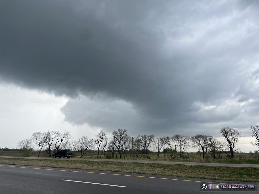
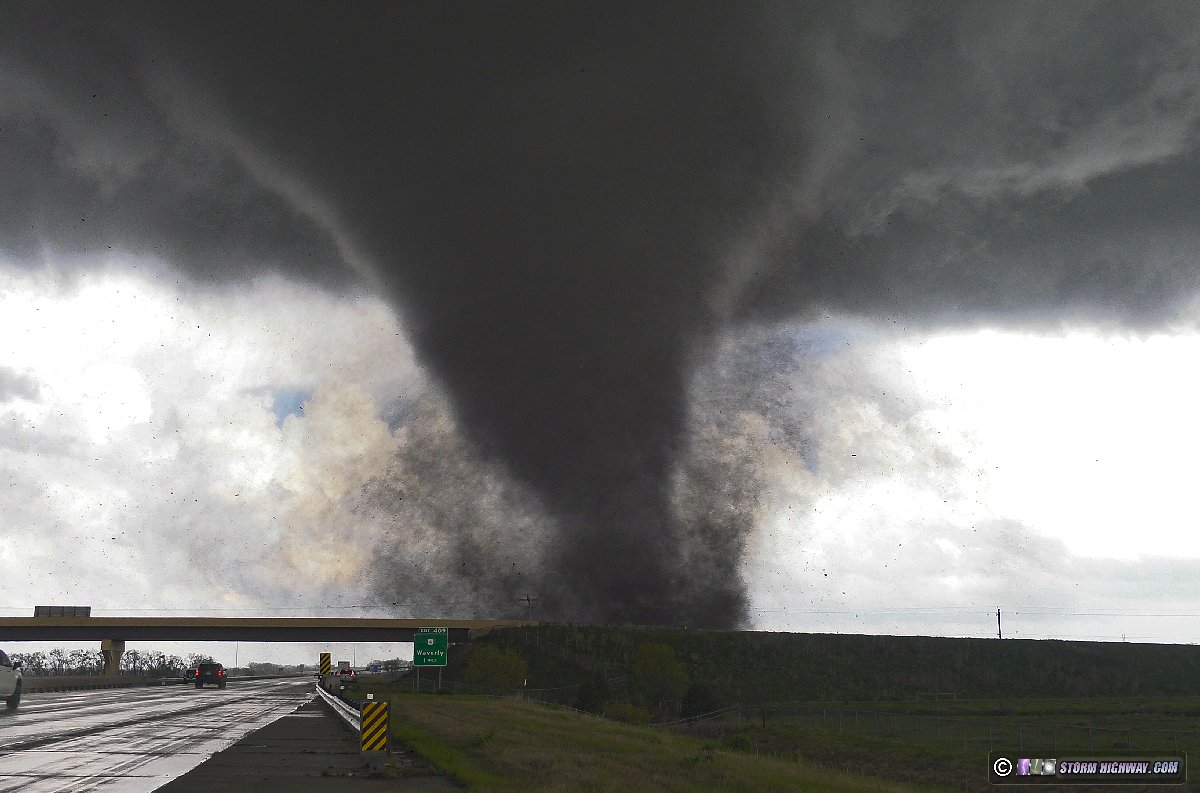
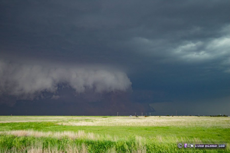
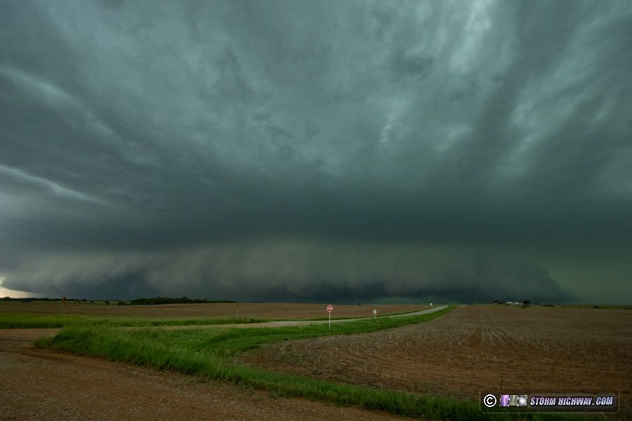
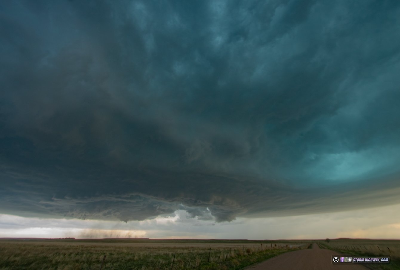
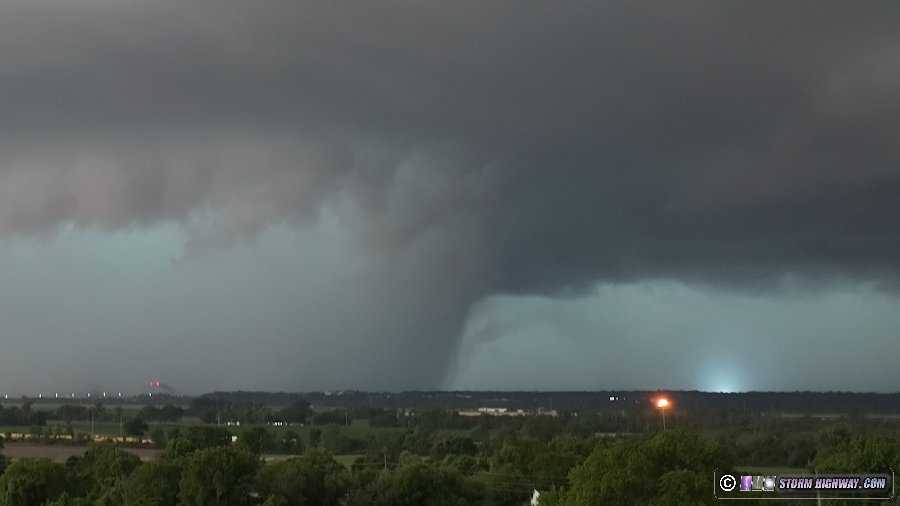
Day 13: May 19: Russell and Dorrance, Kansas tornadoes
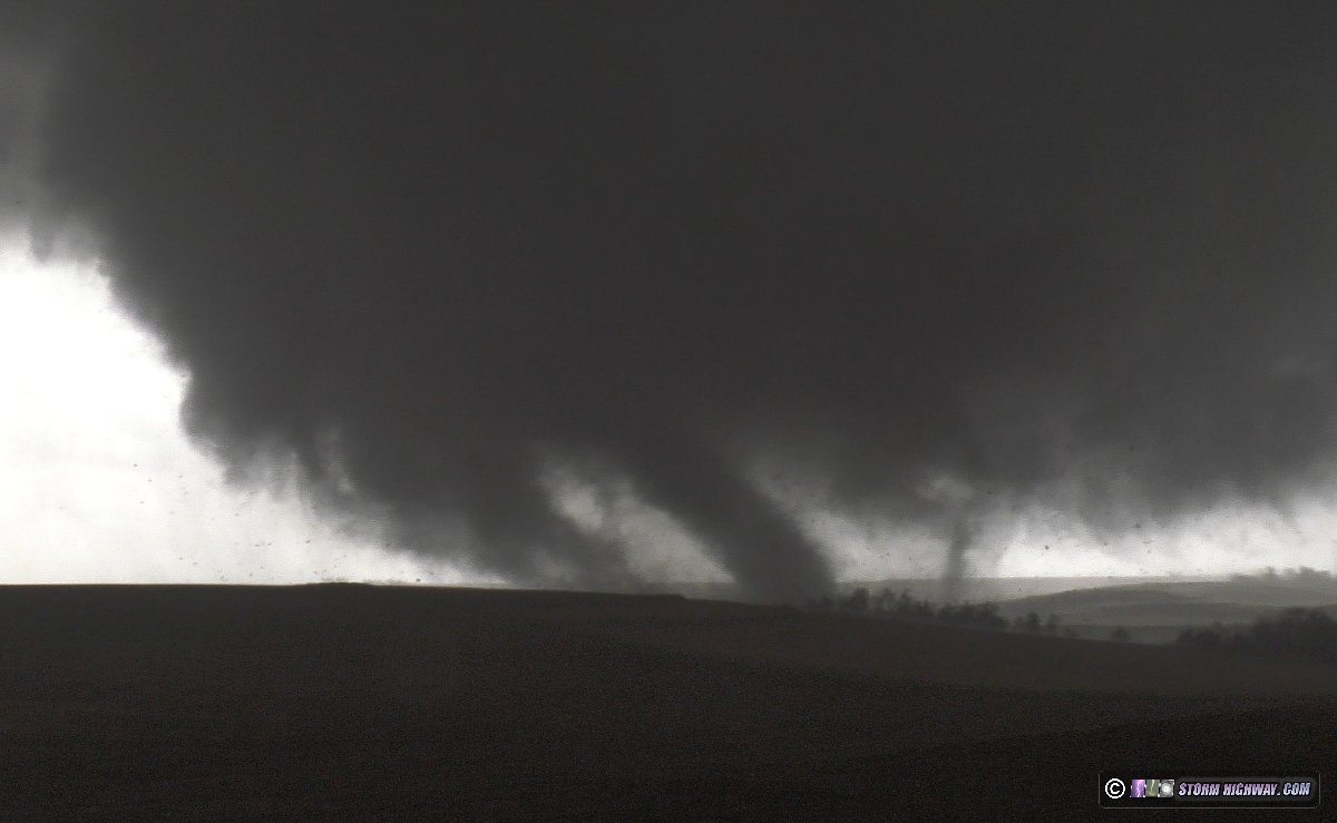
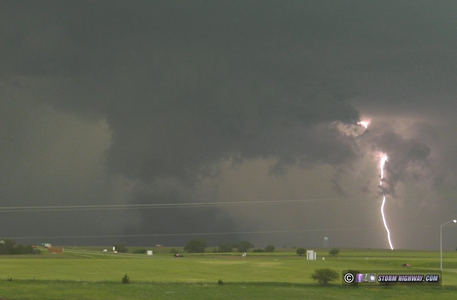
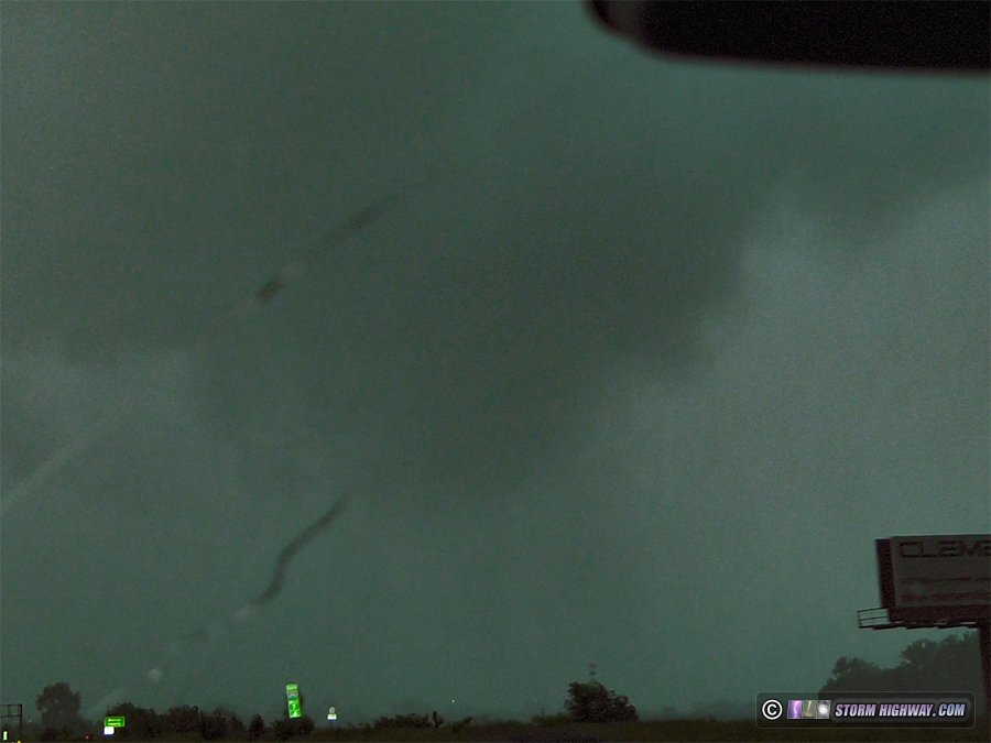
A significant straight-line wind-producing storm manages to spin up a couple of mesovortex tornadoes near Interstate 70 east of Russell, Kansas. Started the day in Salina and initially headed toward Pratt. I intended to just stay ahead of the derecho while keeping the Oklahoma suercell as an option. After some indecision, I changed course at Hutchinson and went northwest to intercept the supercell along I-70 at Hays. It was tracking along an outflow boundary, with easterly surface winds and increasing instability ahead of it. I reached this storm at Russell. I stayed ahead of it on the interstate eastbound to Salina. The storm was pushing outflow far ahead, but it managed to kink the outflow a couple of times and spin up some mesovortex tornadoes - at least one of which looked strong. The first one west of Russell I wasn't certain of until seeing video from other chasers. This was my view of it:
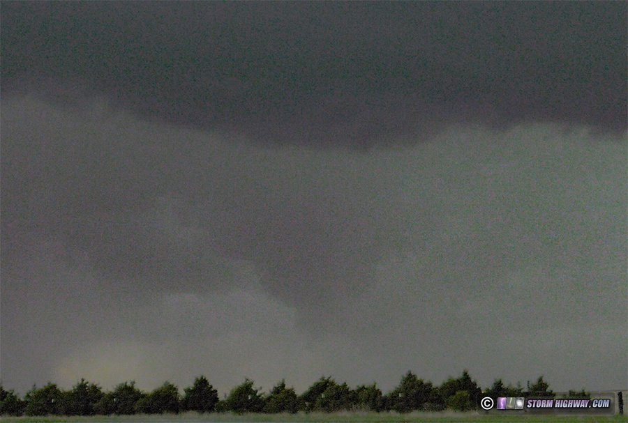
The second one, a big dusty tornado northwest of Dorrance, was very distinct:
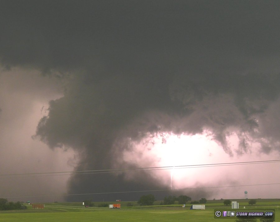
I went north to get closer, but the tornado became rain wrapped fairly quickly:
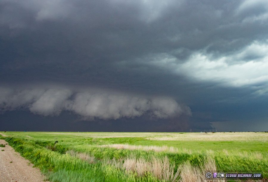
Shortly thereafter, the outflow consolidated as the storm evolved into a 100mph-gust producing bow echo:
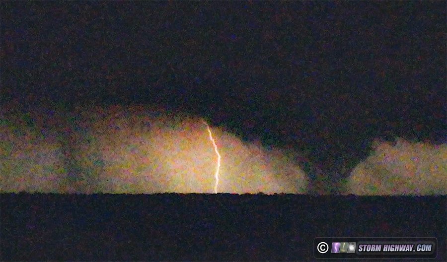
I went south on I-135 to get out of the way of this and headed down to Wichita to let the main derecho (not sure if it met that criteria yet) pass over. This was somewhat disappointing, with no structure or haboob on the leading edge as I watched it approach via drone. I waited for the stratiform region to arrive so I could shoot upward lightning at the towers in Colwich, but the southern part of the MCS was retreating northward and no stratiform was upstream. I went back north to Newton to try and find some wind turbines or other towers, locating one on the south side of Newton. Two upward flashes happened to it as I approached. One was visible on my dashcam, along with a more distant one possibly from the Colwich towers:
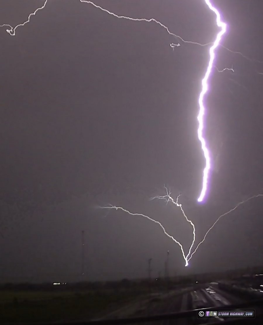
After I set up my main cameras, the storm would not do it again. New storms continued to go up behind the line over Newton. Again, most of this lightning was uncooperative, but I did catch one nice slow positive CG on both a still and 6,000fps high speed.
I drove up to Russell for the night in preparation for the next day's event.
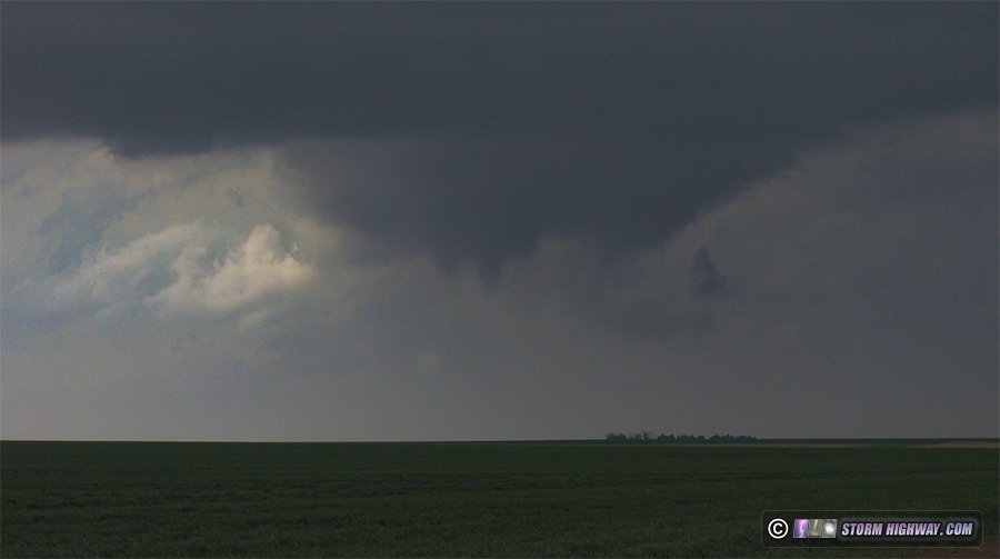
Day 14: May 20: Akron, Colorado supercell
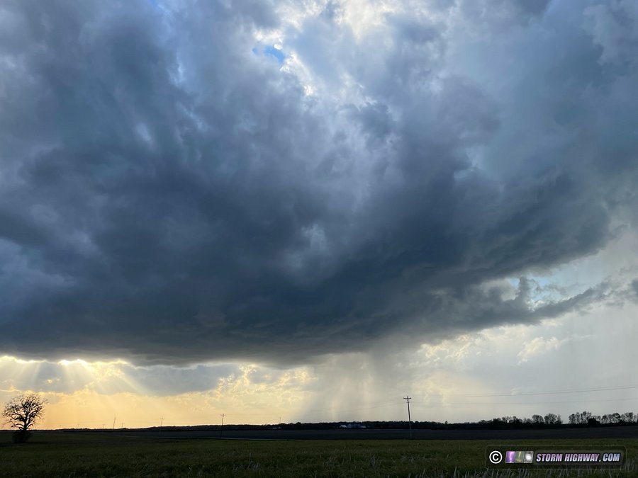
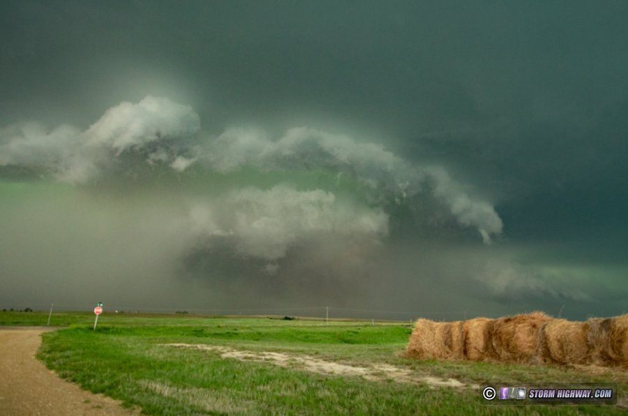
I observed a supercell near Akron in northeastern Colorado. I started the day in Russell and headed west into Colorado for the obvious target of the day. I waited for hours at Bennett watching weak storms struggle, until the storm of the day finally emerged. I got into position on this storm south of Fort Morgan, but decided I wanted to top off my gas tank in Brush before heading into a possible no-mans-land to stay with the storm. When I got back on the storm on dirt roads southeast of Brush, it was displaying great structure with a large RFD surge kicking up a lot of dirt. The north end of the RFD was wrapping up into a classic clear slot and meso that displayed intermittent funnels, and it appeared there were additional circulations to its southeast.
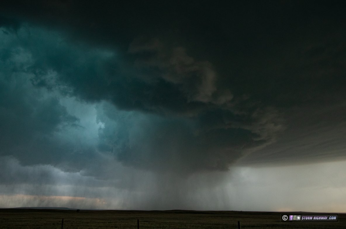
Structure and strong RFD lofting dirt:
I had a great viewing position in the notch of the storm, but I'd been in mostly-continuous dime to nickel sized hail since arriving on it. Soon, golfball and larger hail started mixing in to the point that I had to move east. My hail shields protect the windows, but my headlights and taillights have no protection and I wasn't interested in hanging around in that situation. I never got completely out of hail for the next hour - my hood, roof and guards were taking sporadic golfballs and larger well into the forward flank of the storm east of Akron. Before I went through Akron eastbound, the couplet on the meso just to my west-southwest became very strong, but was completely rain-wrapped. This funnel-looking feature appeared in the rain to the southwest near Akron, but it was well to the south of where the couplet on radar was.
I decided to drop south ahead of the storm at Otis. When I got downstream of the updraft, I could hardly see anything due to copious blowing dust and low stratus screaming into the storm from the east. I could see the RFD gust front and some scuddly features under it in lightning flashes, but couldn't make out anything discernable.
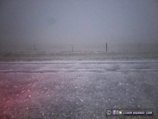
I finally decided since it was 9pm, I needed to start heading north to I-76/I-80 then east so I'd have some time to sleep before Tuesday's chase. I drove back north on Highway RR toward Otis, but encountered 2.5" hail from the core peskily stalling over the road. I stopped to let this pass, then continued north. Almost immediately I encountered hail covering the road with a very thick hail fog. It was impossible to see the road. Even after slowing to a 5mph crawl, I was constantly driving off the road and down toward toward the ditches. With potentially 10 more miles of this ahead that likely would get worse the farther I went, I gave up and turned around after only 1000 feet of that..
I had to go all the way south to Highway 36, then go east to Bird City, KS to get far enough ahead of the storms so I could go north. I made it to Grand Island for the night at 3am.
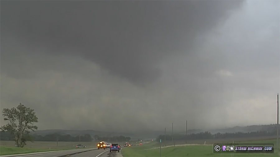
Day 15: May 21: Southwestern Iowa tornadoes (Trip #4 End)
Four strong tornadoes in southwestern Iowa. This event has its own page here
Day 16: May 22: St. Louis to Ottawa, Kansas (Trip #5 Start)
After only 1 day and night at home at the end of trip #4, what appears to be quality setups in the Plains on Thursday and Saturday prompted the fifth expedition of the season: the first time in my career that I've done more than 4 Plains trips in the spring. I left St. Louis at 9PM and made another uneventful late-night drive into Kansas. I stopped for the night at Ottawa.
 Day 17: May 23: Blue-sky bust in southwestern Kansas Day 17: May 23: Blue-sky bust in southwestern Kansas
Blue-sky bust in Dodge City (that means no storms developed in my target). I wanted to be able to get back to St. Louis for Friday's setup. I feared that the cap would squash the Oklahoma storm before it could get going per consistent model guidance. Those two factors conspired to keep me on the SW Kansas target despite tons of evidence that it was going to bust (Iowa State special sounding showing a huge cap, the diminishing cumulus on the dryline and model consensus on increasing cap temps). Had it not been for my home target bias and fear of missing a big event there, I would have headed down to Oklahoma.
The only good thing about a blue-sky bust is that you can start the drive to the next day's target much earlier. I turned back to the east an hour before sunset, and stopped for the night in Boonville, Missouri at 2AM.
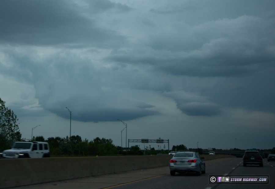
Day 18: May 24: Wentzville, Missouri supercell and lightning
After a short night's sleep, I started the day in Boonville at 6:30AM so I could get some important routine vehicle maintenance done in Columbia. This was finished at 11AM, and I began heading east. My target was an outflow boundary from a storm complex in southern Missouri that was out in clear skies and slowing down near St. Louis. Storms fired on this boundary just after noon, much earlier than I'd expected. Usually storms that early are not very good, as sufficient instability has not yet had time to develop. Nonetheless, I kept going to intercept the southernmost cell just southeast of downtown. I nearly didn't make it thanks to long traffic backups from accidents and a stopped train that blocked the only route around the jams. It was all for nought, as the storm died as I arrived on it at Fairview Heights.
The rest of the day was spent going back and forth across the metro area for supercells that were approaching/crossing boundaries. None of these did anything interesting and most dissipated shortly after or before I arrived on them. The most interesting thing I saw during this time was some LP-ish updraft bases that briefly appeared over Town and Country:
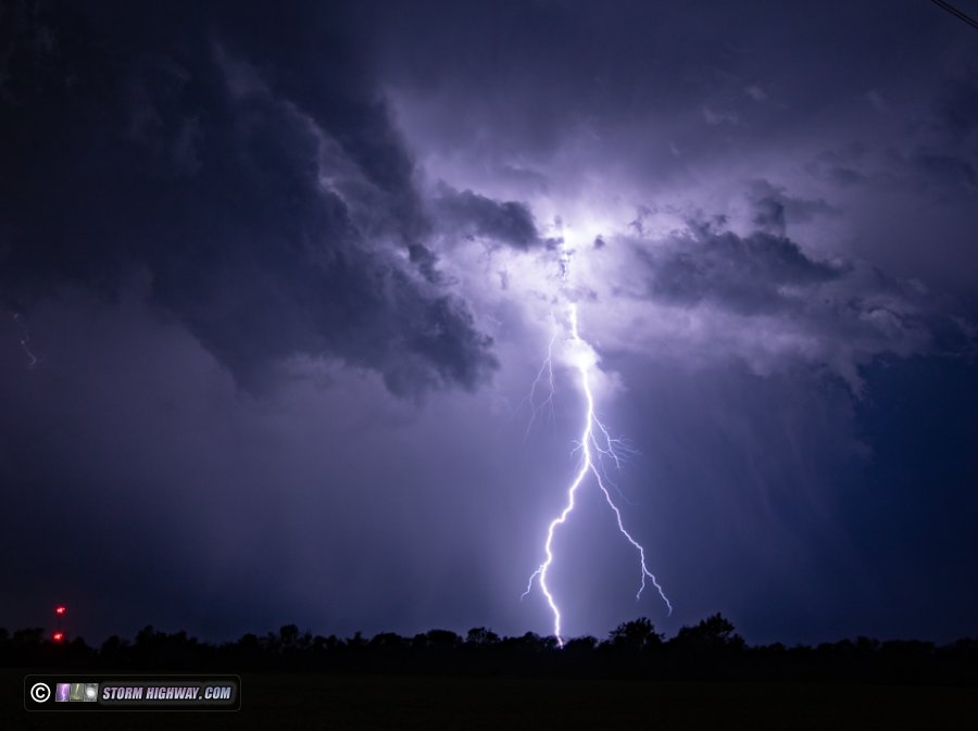
At sunset, a new area of storms fired along I-270 and drifted toward downtown - but the cores stayed to the north, and lightning was nearly nonexistent. I decided to call it a day and start heading west to position for Saturday's event in the Plains. I had one more line of storms to go through in the far western metro. At first, these were not producing much lightning. But as I passed through Dardenne Prairie, a supercell structure emerged in the distance over Wentzville while lightning flashes picked up to one every few seconds. I stopped and sent the drone up to record this scene for a while, which ended up being a really nice show.
I posted a video of this on Youtube.
This activity started weakening shortly therafter, so after the precip started moving over me, I packed up and continued west. I went back to Ottawa, Kansas for the night. Even though I was in St. Louis, I never went back home - so this was simply another chase day of Plains trip #5. Day 19: May 25: Windthorst, Texas tornado
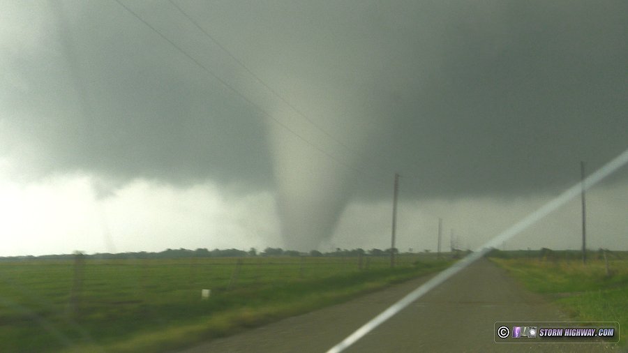
A strong tornado in north Texas. This event has its own page here
Day 20: May 26: St. Louis metro tornado (Trip #5 End)
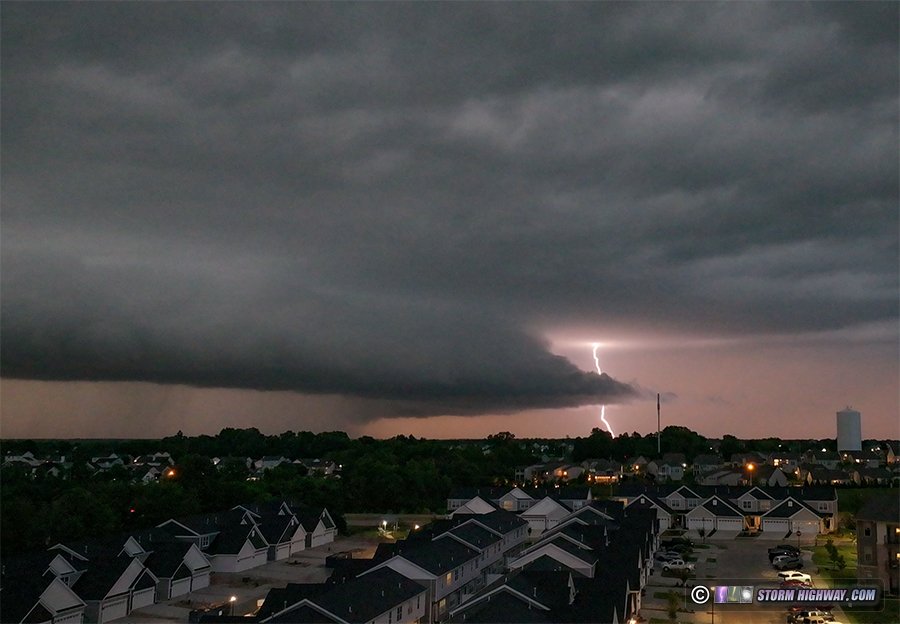
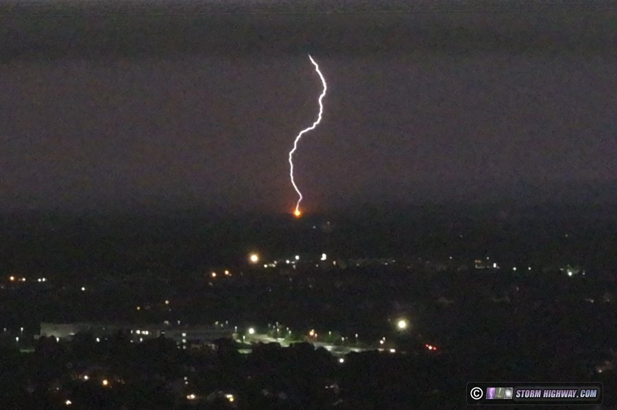
I blew off the obvious outflow boundary target to cover the tornado threat in St. Louis. I observed two supercells moving through the metro area. I started the day in Marshfield, Missouri and drove into St. Louis to intercept supercells moving in from the west. The first storm's mesocyclone tracked from St. Charles County into St. Louis just north of Page Avenue. It had broad rotation at one point, but could not tighten up (a good thing as it was in the heart of the metro area). The second storm moved from Pacific into South County through Fenton, Mehlville/Oakville and then through Columbia, Illinois.
I sent the drone up to capture the second storm from Dupo, Illinois. I witnessed this power flash north of the storm's main meso (the JB Bridge across the Mississippi River is visible at lower left):
Video from the drone and ground level, with a few timelapse scenes.
A later NWS survey confirmed there was a tornado in progress from along I-55 through Oakville, continuing across the river into Columbia. I intercepted the tornado at Columbia. I encountered some minor tree damage in town.
The storms quickly developed into a QLCS line that produced numerous small mesovortex tornadoes, including one at New Baden about a mile from home (See Andrew Pritchard's report here). I could not get back ahead of the rapidly-surging storms, so I let them overtake me at Sparta - calling the chase.
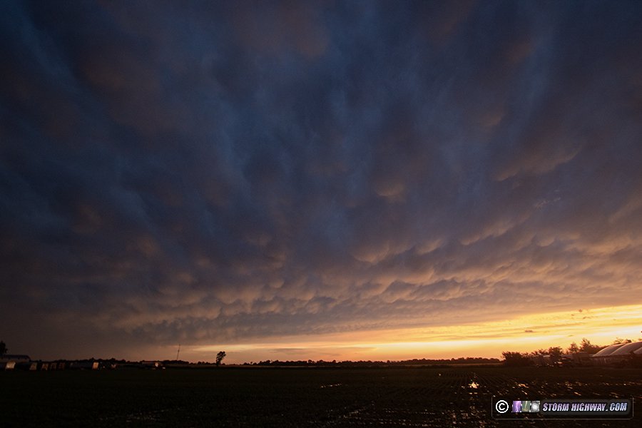
I arrived home at 8:30PM. Before I went inside, I walked across the road to watch a display of sunset mammatus over town. This is the last photo of the trip (and likely my Plains season), a good way to wrap up what has been an incredible spring of Great Plains expeditions.
GO: Home | Storm Chase Logs | Photography | Extreme Weather Library | Stock Footage | Blog
Featured Weather Library Article:
|


