|
Home | Blog Index | Blog Archives | Christianity & Faith Essays | Storm Chasing Essays
New Baden, Illinois EF1 tornado on May 26, 2024: Aerial damage photos
An EF1 tornado passed over the west end of New Baden on Sunday, May 26, 2024 during a regional severe weather outbreak. The National Weather Service survey found a 10-mile path that generally parallelled I-64 and ended past Damiansville. The tornado passed about a quarter-mile south of my place on County Line Road. Other than the crop damage, there was no damage to my residence or my surrounding neighborhood.
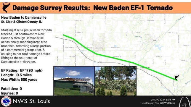
National Weather Service survey results and tornado track
Chaser Andrew Pritchard captured the tornado from the north along Highway 160. His video can be viewed on Youtube. I was chasing this day, but was on the southern supercell and tornado in St. Louis County from Oakville, MO to Columbia, IL. I tried to make it north to I-64 to get back ahead of the storms before they struck my town, but they were moving too fast and overtook me as I reached Highway 4 south of Mascoutah.
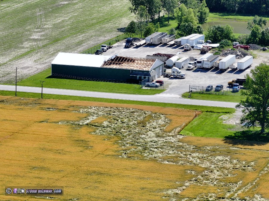
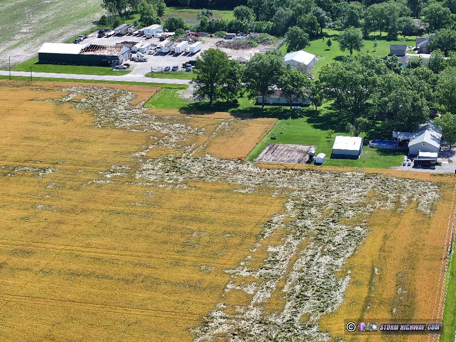
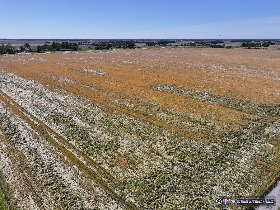
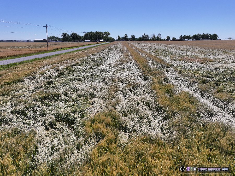
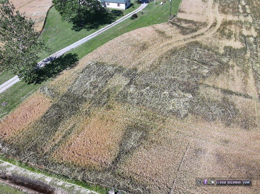
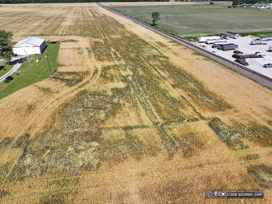
On Wednesday, I took these drone photos of the tornado damage along Haselhorst Road south of New Baden. The most significant damage was to a commercial building that had part of its roof removed. Power poles were also toppled, but had already been repaired when I shot these pictures. Large areas of flattened winter wheat crop extended from near County Line Road to Highway 160. Areas of flattened wheat crop extended well south of I-64, which suggests that the southern three-quarters of this damage was caused by RFD (rear flank downdraft) winds south of the tornado. These views are looking east (northeast to southeast) from Haselhorst Road about a half-mile west of Highway 160.
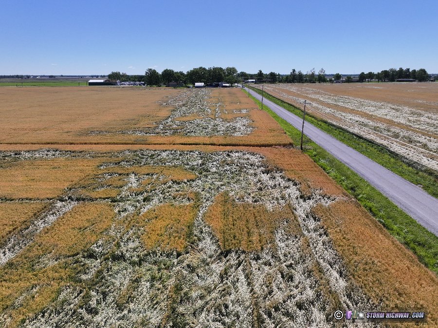
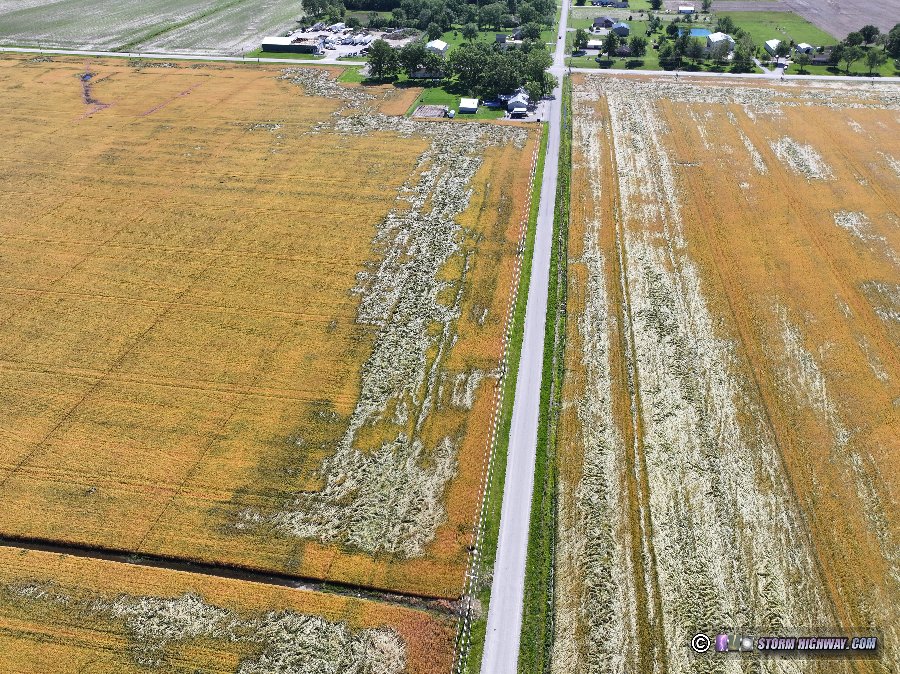
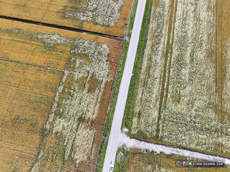
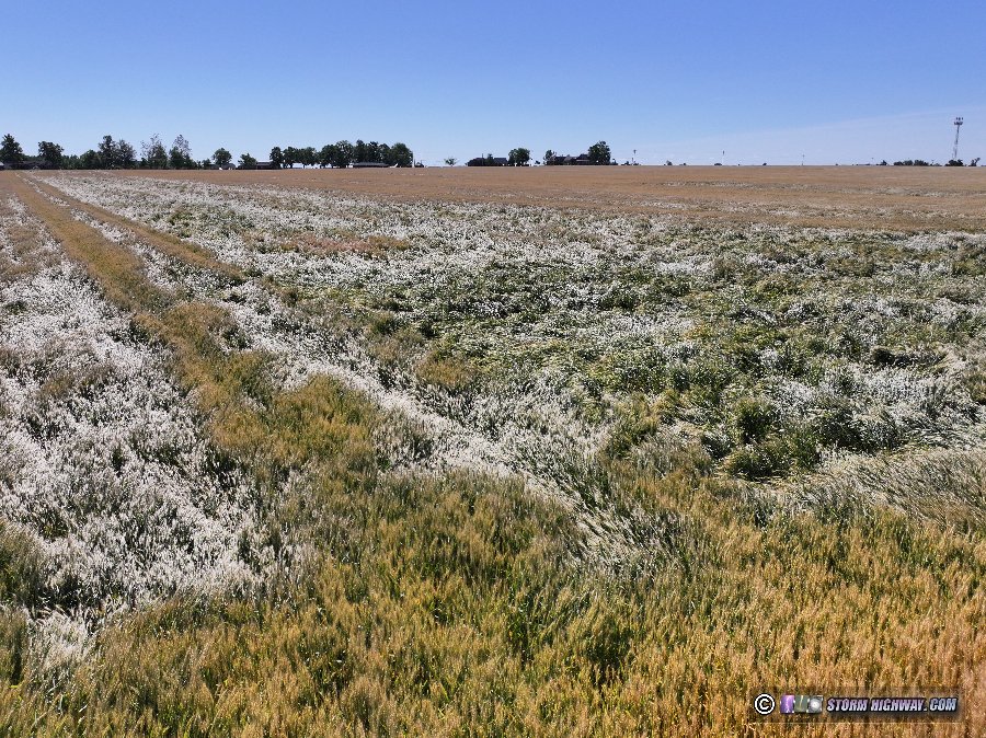
These two views are along County Line Road looking west just south of the Norfolk Southern railroad tracks. Only winter wheat crop damage was evident at this location.
GO: Home | Storm Chase Logs | Photography | Extreme Weather Library | Stock Footage | Blog
Featured Weather Library Article:
|


