|
Home | Blog Index | Blog Archives | Christianity & Faith Essays | Storm Chasing Essays
September-October 2024 Storm Chasing Recap
September and October of 2024 were very quiet in the Midwest for thunderstorms and severe weather. September's only storm event was on the 20th, with more than a month until the next one on October 24. Celestial events made up for the dry spell, with several significant aurora outbursts and a rare comet appearance providing several days of night sky shooting. October 24's sprite event was the best one I've seen to date.
September-October 2024 Event List
 September 16: O'Fallon, IL aurora bust September 16: O'Fallon, IL aurora bust
As I've said before, routine northern lights are sort of a "been there, done that" thing for me these days. Seeing the best of any given aurora event requires staying out for hours, sometimes all night, to await the unpredictable (and many times brief) substorms. Not only that, but I really don't have any interesting low-light-pollution foregrounds near me, and my go-to rural railroad crossing spot has become a little played out in my opinion.
For those reasons, I'm not usually motivated to pay any attention to all but the most epic of events. This one wasn't close to meeting that criteria, but when I saw reports of a good substorm happening, I went out for about 20 minutes to take a couple of exposures. The substorm didn't last long enough for me to pick up even the green horizon arc. After only three test exposures, I went home.  September 20: Southern Illinois bolts-from-the-blue September 20: Southern Illinois bolts-from-the-blue
These storms far overperformed from expectations and model predictions, producing a prolific bolt-from-the-blue fest south of St. Louis. I started at dusk shooting this storm that was down near Red Bud from near Mascoutah. It produced at least 6 bolts-from-the-blue, but a stubborn band of clouds blocked the storm. I drove down to near Freeburg to try to get a clearer view, but the clouds kept developing in the way. I finally gave up and stopped to try and get what I could. The cloud band finally dissipated by the time the second catch happened.
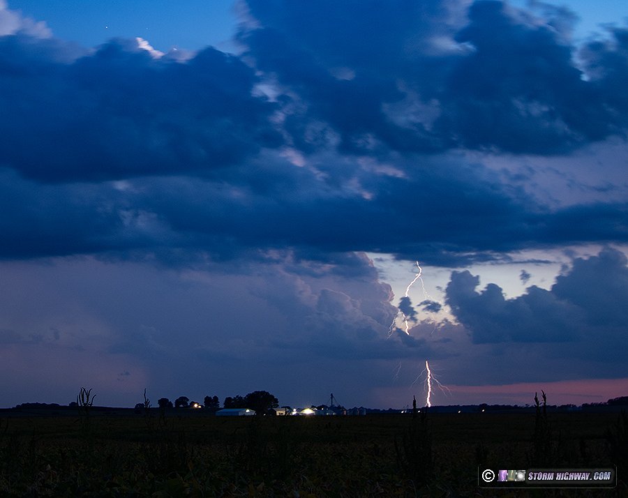
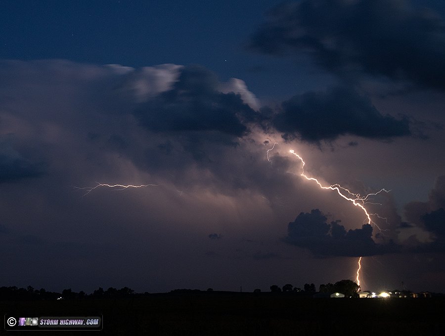
As darkness fell, new cells went up right overhead and began producing flashes. I was too close and started getting precip, so I moved west and set up wide. But the better show was with the original cells to the southwest, which were producing a flurry of clear-air channels. This one is the only time I've captured a true "cloud-to-cloud" flash, meaning lightning connecting two separate storm updrafts/cores:
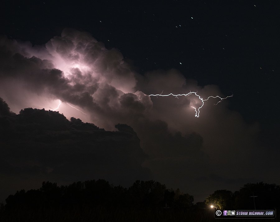
More cloud-to-air channels. These are "failed" bolts-from-the-blue negative leaders that stopped propagating before the channel could travel all the way to the ground:
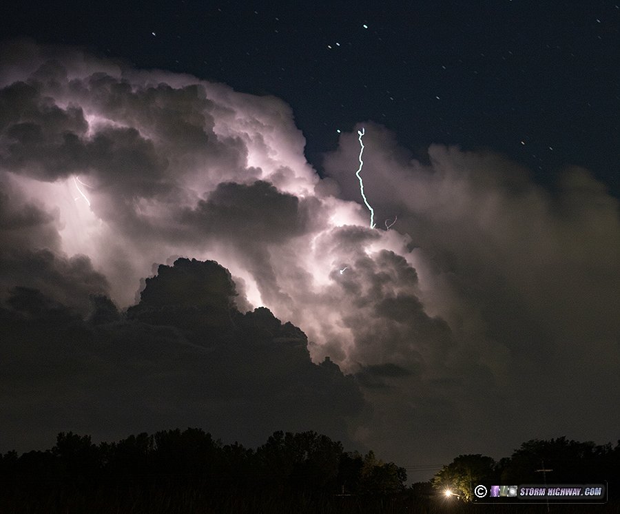
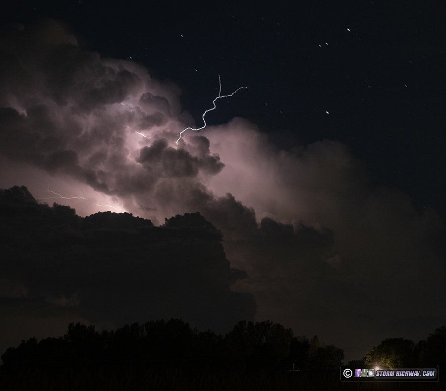
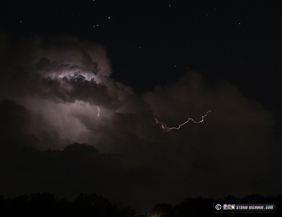
The closer storm to my north had continued producing bolts (likely bolts-from-the-blue), but all on the north (opposite of my) side of the cores. I tried circumnavigating the storm north of New Baden to get a view of them, but it dissipated as I arrived at that position.
 September 27: Tropical Depression Helene September 27: Tropical Depression Helene
I made some preparations to travel to Florida to cover Hurricane Helene, but decided against it. The storm was coming into the Big Bend region, an area with no substantial shelter options and a notoriously-aggressive anti-chaser law enforcement regime. Furthermore, the storm landfalling after sunset would mean there would be no good video subjects available. In hurricanes, the power is usually knocked out long before the eyewall arrives, meaning at night it is pitch black during the most dramatic conditions. Had the storm come in during the day, I likely would have headed to Tallahassee or somewhere along the I-10 corridor to the east.
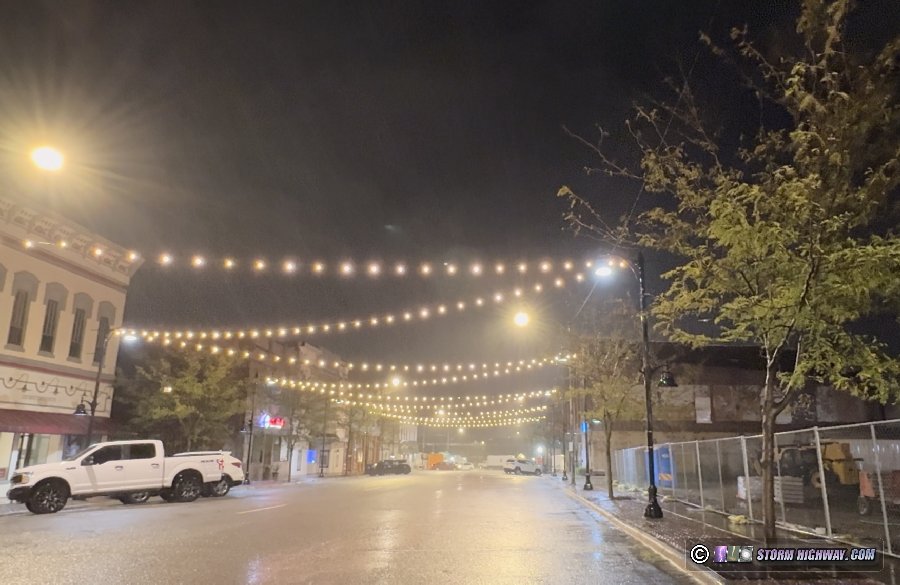
I then turned my attention to what models showed as a potent gradient wind event in the Midwest as the center of the hurricane's remnants stalled just to our south. I initially considered heading to Lexington, Kentucky on Friday morning for model-indicated 70mph wind gusts. However, models slightly bumped up the peak wind gust forecasts for central/southern Illinois, showing 60mph gusts along the I-57 corridor on Friday night. That would make the 45-minute trip to Mount Vernon a much more practical option. I arrived there at 8PM and stayed until 10:30pm as the precip band with the highest wind potential rotated through. Despite 66mph gusts reported just to the north in Mattoon, winds barely reached 40mph in Mount Vernon and I saw no impacts there. Despite that, it certainly had the 'feel' of the first stages of a tropical storm/hurricane chase with the steady winds slowly ramping up and whistling through the trees and power lines.
 October 6: O'Fallon, IL aurora borealis October 6: O'Fallon, IL aurora borealis
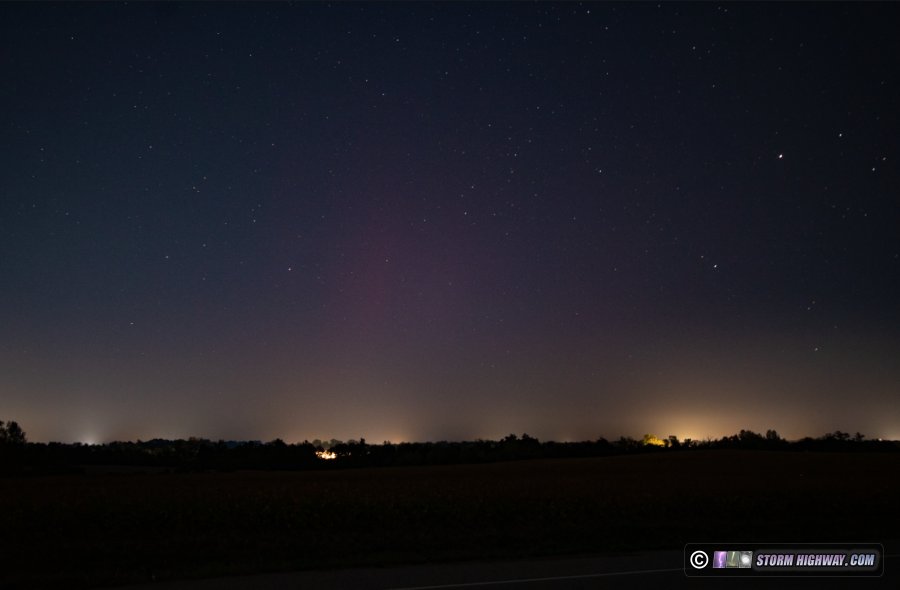
This was mostly a bust, if not for the fact that I technically did get aurora on camera. Upon hearing the reports of a substorm in progress, I went out and set up for about 15 minutes. As is typical, the substorm had mostly faded by the time I started doing exposures. You really have to stay out all night to catch the best activity, and I just couldn't do that tonight. This is looking north from O'Fallon just after 10pm.
 October 8: New Baden, IL aurora borealis October 8: New Baden, IL aurora borealis
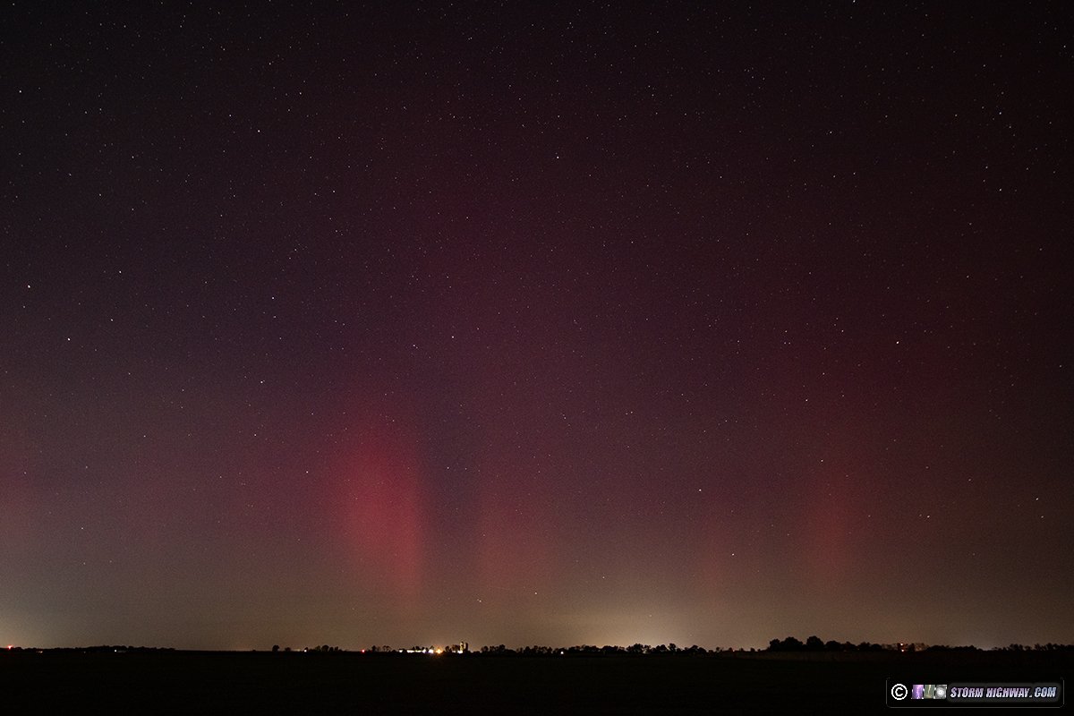
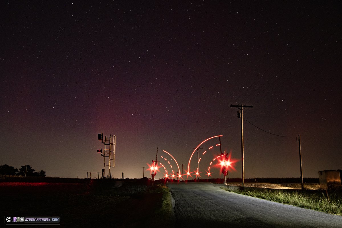
Another halfhearted aurora outing, going out again only after seeing Twitter reports of a substorm for the second night in a row. This one just after midnight lasted long enough for me to get the tail end of the brighter pillars. The red coloring filled my frame at 10mm wide angle. I moved down to the railroad crossing location for a more interesting foreground, but the pillars had mostly faded by the time I got set up there. The second image is a multi-image stack with the crossing gates done in another exposure at a smaller aperture setting.
 October 9: Hurricane Milton no-go October 9: Hurricane Milton no-go
I went off of Hurricane Milton chase standby mode on Monday afternoon. Models finally settled on an after-dark landfall and the potential for the stronger half of the storm to weaken significantly just prior to landfall - both of which made a chase less likely to yield noteworthy captures. I was also concerned about the mass evacuations from the Tampa region greatly expanding the fuel shorrtage zones as far north as southern Goergia, making the required fuel reserves beyond the capacity to safety carry in containers.
 October 10: St. Louis aurora borealis October 10: St. Louis aurora borealis
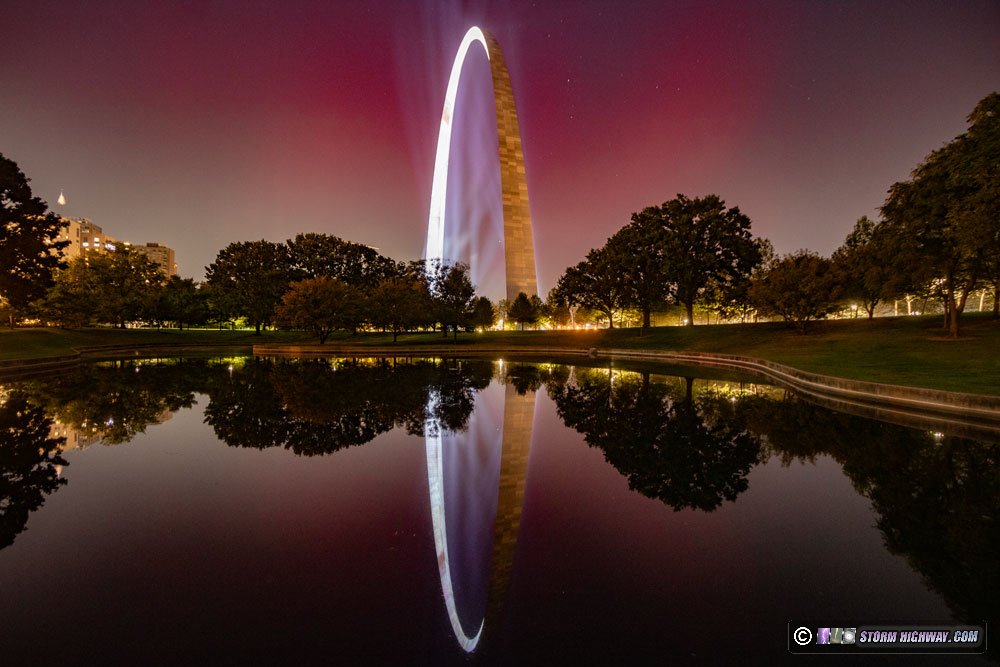
For the second time this year, a rare-in-intensity northern lights display was visible in St. Louis. Like the May 10 event, I chose to set up at the Arch in downtown St. Louis. Unlike a dark spot out in a rural area, only the brighest aurora will be visible against the light pollution in the middle of a large city - so there is a risk of not being able to see and capture anything. While this event was not as intense as the May 10 display, it was bright enough for visual observers and cameras to see in the city. The other challenge this time was that the Arch's floodlight illumination was on, which limited exposures to only 8 seconds. Even then, the brighter parts of the Arch were still overexposing. It was a trade-off I thought was worth it to get the aurora to show up.
Click to order a print
I took exposures for 25 minutes in order to assemble this timelapse:
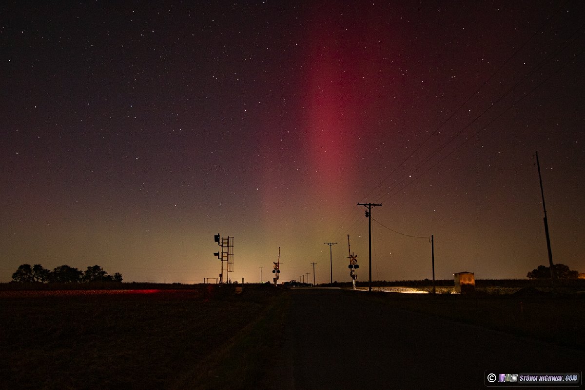
After the Arch grounds closed at 11pm, I went outside of New Baden to continue shooting until the pillars of the next substorm began fading at 1:30am.
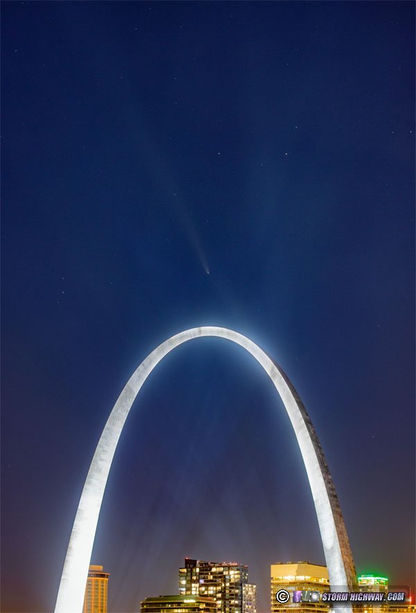
 October 13-18: Comet C/2023 A3 (Tsuchinshan-ATLAS) October 13-18: Comet C/2023 A3 (Tsuchinshan-ATLAS)
I went into downtown St. Louis five times for this, successfully capturing the comet on the second through the fifth outings. The comet has its own log page here.
Click to order a print
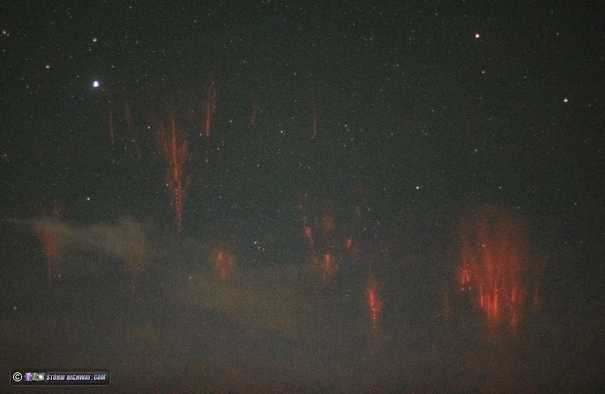
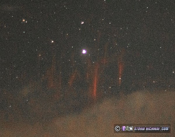
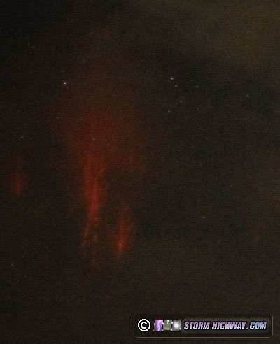
 October 24: Sprites from storms in northeastern Missouri October 24: Sprites from storms in northeastern Missouri
Sprites have been an elusive phenomenon for me. This is mainly because they require clear skies overhead while a mature storm complex (MCS or mesoscale convective system) with a large trailing stratiform region is positioned between 100 and 200 miles away. These are typically best viewed in the western Great Plains behind dryline storms looking east, where clear skies are most likely to be adjacent to large MCSs. For most storm events in the Midwest, clouds typically lead and trail large nighttime MCSs by great distances, blocking the view of any sprites. I hadn't experienced a good setup for these the entire time I've lived here. That changed tonight when an MCS the right distance away was remarkably not sending high cirrus clouds far ahead of it. I drove up to Worden, Illinois to shoot the skies over the complex in northeastern Missouri. Sprites were visible to the eyes and to the camera, which captured four of them. These were the best:
 October 30: Tornado warning during sprite/lightning bust October 30: Tornado warning during sprite/lightning bust
This chase was a bust, even though I did end up in a tornado warning. This event had not been looking good for a chase in the days leading up to it. A crashing cold front appeared to make the tornado risk in eastern Kansas and Oklahoma too low for the distance required, and models all showed those storms weakening long before arriving in St. Louis in the overnight hours. Furthermore, clouds ahead of the system looked to squash the sprite photography chances in typical Midwest fashion. I also had afternoon/evening plans, and I didn't think it was worth skipping out on those for anything this system looked to offer. I took all of my chasing gear with me just in case.
At 10pm, a few holes in the clouds made it look like there might be some sprite opportunities after all. I headed west to Dardenne Prairie, then north of St. Charles trying to position for a view of sprites in this clear-sky gap, but clouds quickly filled in. Seeing a larger gap to the northeast, I went back to the Worden, IL spot from the last event - but by the time I made it over there, a solid deck of cirrostratus had raced overhead on the jet and completely shut down any sprite views. With the storms rapidly outrunning the CAPE axis and still a few hours away, I was thinking they might dissipate by the time they arrived in the metro. So, I went home.
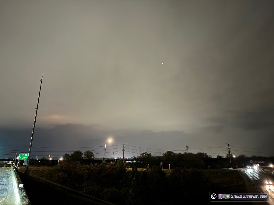
I went back out after midnight and headed west to intercept the rogue supercell that was defying the marginal CAPE on course for Chesterfield. It appeared it was trying to spin up a meso as it ingested the squall line's own leading outflow boundary, and became tornado warned. I intercepted this area in Earth City at the Highway 370 and 141 interchange. As the storm moved over St. Charles, another tornado warning was issued. Both the KLSX and TSTL radars were suffering from some sort of velocity data block, masking much of what this storm was doing. All that was visible to my west and southwest was a flat, featureless shelf:

Reflectivity appeared to show a small hook echo developing just to the southwest. While I didn't see any power flashes, the southern end of this shelf cloud appeared to be rapidly surging east along a developing RFD (rear-flank downdraft) down along I-70, with the circulation possibly moving right overhead of where I was or slightly south. As I got ready to move, a driver pulled over in the opposite lanes of 141 and began talking to me - in my haste and apprehension I probably didn't sound very nice when I had to shout across the highway that there was a tornado warning. If you're that driver reading this, please accept my apologies if I seemed harsh, you just caught me at a tense moment. I'm not very friendly at times like that during an active intercept when I'm trying to stay focused on a rapidly changing and potentially dangerous situation unfolding.
I got back on 370 east to ensure I didn't get overtaken by the RFD precip, barely escaping just ahead of it onto I-270 eastbound. By that time, the storm was finally out of the weird velocity data blackout zone and I could see there wasn't any circulation lurking behind the wall of RFD precip. The portion of the line in the metro area was rapidly weakening, but lightning data showed that the incoming stratiform region was still active thanks to the stronger cores to the south. I decided to head down to Brentwood to set up for upward lightning. A few stratiform lightning flashes made it overhead in the next 2 hours, but no upward flashes occurred to the towers. I started heading home just after 4am.
< August 2024 Recap | All Storm Chase Logs | November 2024 Recap >
| View 1,609 storm chases: |
| by year: |
|
| by type: |
|
|
|
GO: Home | Storm Chase Logs | Photography | Extreme Weather Library | Stock Footage | Blog
Featured Weather Library Article:
|


 October 9: Hurricane Milton no-go


 October 30: Tornado warning during sprite/lightning bust