|
Home | Blog Index | Blog Archives | Christianity & Faith Essays | Storm Chasing Essays
January 2025 Storm Chasing Recap
January 2025 was one of my best and busiest months for winter weather captures, just over 5,600 miles covered across 11 states including stops in Dallas, Wichita and Pensacola. Right out of the gate, the new year stepped on the gas with significant winter weather in the first week. The historic Gulf coast storm on the 20th through the 22nd resulted in once-in-a-lifetime chance to shoot icy road action footage in Florida.
January 2025 Event List
 January 4: Wichita, Kansas freezing rain bridge icing January 4: Wichita, Kansas freezing rain bridge icing
This major winter storm would present a challenge in how best to maximize the documentation of the highest impacts, while still being able to make it eastward for the next day. I decided to stay on the southern end of the critical temperatures for icing (29°F or below) so that I could simply move south into above-freezing temperatures that would be safer to reposition east in. I left St. Louis at 10PM Friday night and made it to McPherson, Kansas at daybreak as the first rounds of freezing drizzle began overspreading the area. I eventually moved south into the northern Wichita metro where temperatures had fallen below critical, icing bridges from the heavier freezing rain. I captured this footage at Park City:
I moved east through El Dorado to Iola, but encountered no further issues. I made the planned move south to I-44 in Joplin, and ended the night at Marshfield, MO at 7PM.
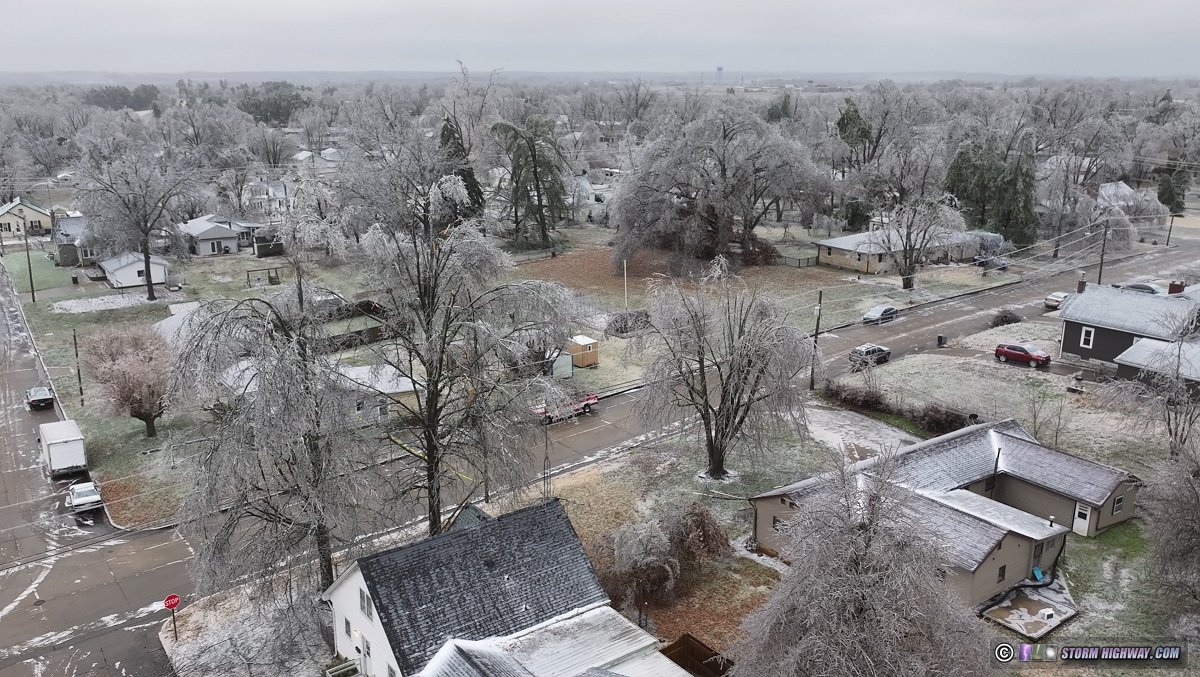
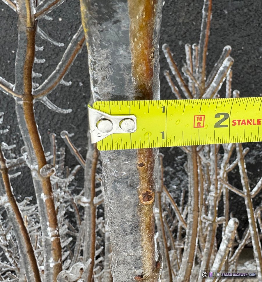
January 5: Perryville, Missouri ice storm
I started the day in Marshfield, MO at 11:30PM. I dropped the 12 miles south to use Highway 61 across the southern part of the state to safely get to the zone of the highest expected icing totals in the Cape Girardeau area. Upon finding little icing there, I moved north to Perryville where I found more substantial ice accretions of over 1/2 inch, breaking tree branches across the town. By 4PM, the cracking and popping sounds of breaking tree branches was nearly continuous across town. I could have stood anywhere in the area and captured tree branches breaking in clear view every 2 or 3 minutes. This is the video I captured:
This 4-hour timelapse shows the trees bending (and the state of my camera afterward):
At sunset, the plan was to send the drone up to capture power flashes after dark, but those were relatively few in number and the freezing drizzle still in progress made flying too risky (it doesn't take much icing to bring down a drone).
My original plan was to head down to central Mississippi for light snow/freezing rain that models showed possible the next morning. But, I had only 9 hours before that would start, and a 5 hour drive to get there - leaving only 4 hours to sleep. After two 23-hour plus days, I decided that wasn't realistic or safe. St. Louis would still have some interesting material to shoot anyway. I began the rest of the slow drive home and arrived at 10PM. January 6: St. Louis winter storm aftermath
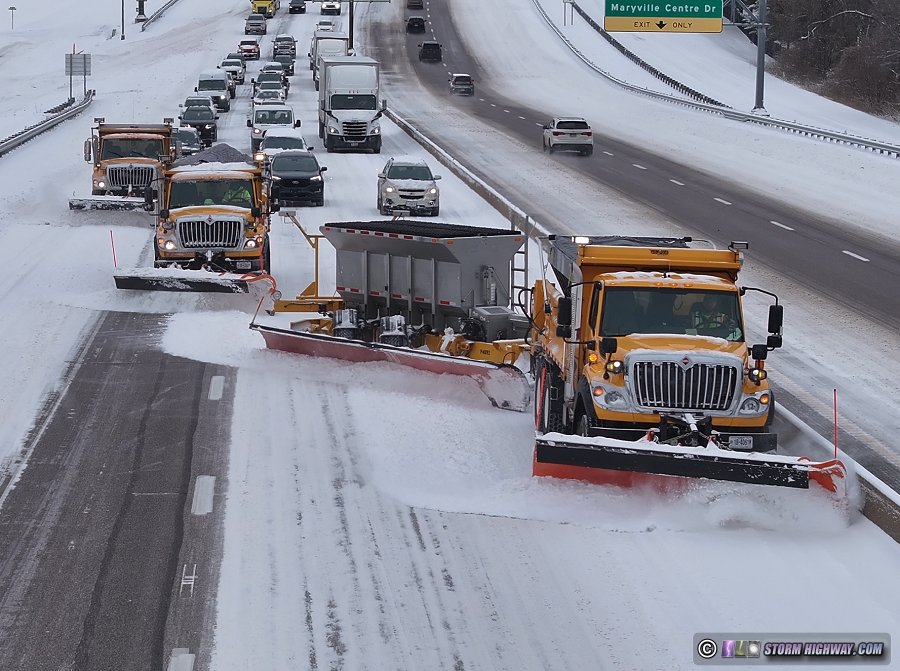
I awoke at 6AM and headed into the city to spend the daylight hours looking for anything interesting happening in the hours immediatly following the storm in the St. Louis metro area. The snow had finally stopped in the predawn hours, but the roads were still covered and crews were working to clear things up. Accumulations ranged between 4 and 7 inches, increasing to the west with more sleet mixed in to the east.
I made my usual winter storm circuits around the metro area, but found very little issues happening. This was mostly because the traffic numbers were very light and most of the metro area actually shut down for the storm: grocery stores, shopping centers and most restaurants were closed. I hadn't seen that done here on such a scale before, it was very much like how the Southern USA regions handle their storms. I was able to get a good drone tracking shot of a MODOT plow brigade on I-64 near Chesterfield including the towplow:
When I arrived home at 8PM, it marked the end of my coverage effort for this storm with 63 work hours and 1,528 miles logged in a little over 3 days. It takes me, on average, 6 winter storms to capture one usable/compelling piece of footage. That is, it's a lot of work and expense to capture the videos that I do, and why I enforce copyright so strictly. After that amount of work and expense, all of the benefit will be taken from me by pirates, reuploaders and Fair Use abusers if I did nothing.
 January 9: Dallas, Texas freezing rain and sleet January 9: Dallas, Texas freezing rain and sleet
For the fourth year in a row, a southern US winter storm promps another trip to Texas. After an oil change, I departed St. Louis at 2:30PM and arrived in Gainesville for the night. I then spent the daylight hours Thursday shooting the rounds of sleet and freezing rain moving through the Dallas-Fort Worth metroplex. Temperatures hovering right at freezing kept this event from being more impactful, but there were more slick conditions than I'd been anticipating. I captured this footage on the west side of Dallas on Highway 12 just after noon:
Models had been in decent agreement showing the bulk of the storm being overnight into the morning, with 4 to 8 inches of snow in the Metroplex. So, I went to bed early in Rockwall so I could begin another day of shooting in the predawn hours. But when I got up at 4AM and went outside, no new snow had fallen - it turns out the precip type had stayed rain thanks to warmer-than-forecast temperatures.
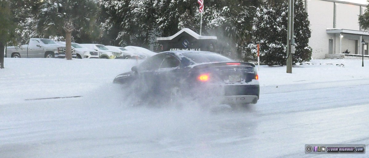
I didn't have any good alternate options. The storm had peaked in Arkansas, where the interstates were already shut down - I'd likely have trouble making it there. Atlanta was out of range, leaving central Alabama and Northern Mississippi as the only other possibilities that I could make it to before mid-afternoon (and still have some daylight shooting time left). I headed east on I-20 with the plan to make the choice before the Jackson, Mississippi fork in the routes. As I drove east, both areas were rapidly clearing up with temperatures right at freezing or just above - conditions that don't usually cause huge impacts. At Jackson, I turned north toward home to arrive Friday evening.  January 20-22: Florida icy roads during historic winter storm January 20-22: Florida icy roads during historic winter storm
A 3-day, 10-state, 2,300-mile trip to cover the historic snowstorm along the Gulf Coast, with a less-than-once-in-a-generation icy road event in Florida. This event has its own page here.
< December 2024 Recap | All Storm Chase Logs | February 2025 Recap >
GO: Home | Storm Chase Logs | Photography | Extreme Weather Library | Stock Footage | Blog
Featured Weather Library Article:
|


