HD EXPEDITION VIDEO: May 25 long-lived EF4 tornado: Watch Video
4K EXPEDITION VIDEO: 4-Way Dashcam Timelapse of the chase: Watch Video
HD EXPEDITION VIDEO: Front Dashcam timelapse of the chase: Watch Video
Click any thumbnail on this page to view a larger version.
ABILENE, KS - After the tornado show of a lifetime at Dodge City the previous day, it was hard to imagine my third Great Plains storm chase expedition of the year becoming even more incredible. That happened in a big way on Wednesday the 25th, with the tracking of a rare breed of tornado in central Kansas.
GPS LOG: Click to view the GPS track for this chase
I awoke in Dodge City, expecting a marginal setup to the east. But, when you're out in the Great Plains on a chase in May and there is *any* type of setup within reach, you go out - period. If you have any experience, you know that things just happen here this time of year. So even though I was still 'full' on tornadoes from Tuesday's bonanza, there was no good reason to take a down day.
This day's setup featured several outflow boundaries ahead of the dryline along the I-135 corridor from Salina to Wichita. A surface low to the west would back the low levels in an environment with extreme instability. There was no question that if something went, it could go big. Two main targets emerged - a triple point of sorts along I-70 with an outflow boundary oriented generally east-west, or the CAPE max down south near Wichita. Either area looked decent to me, and I was indecisive. Even though I initially favored the northern target early, heading up to Holyrood - I later decided to play it safe and pick the middle ground at McPherson, as the distance between the two targets was small enough that I could target halfway and still make it to either one in short order.
By late afternoon, cumulus was starting to bubble up - first in the southern target, but followed soon by the northern one, too. Two storms finally initiated, one in each target. Which one to pick? I watched visible satellite carefully, looking for clues. First, the southern cumulus field seemed to be drying up around the new storm, which itself was not really taking off. Usually a surrounding cu field will fade once a nearby storm really matures, but in this case, the new storm hadn't taken root to that point. The southern target really looked to be too capped. By contrast, the northern target's cumulus field was much more dense and agitated, even with a storm going up. After two more radar scans of the northern storm intensifying and the southern one still struggling, the choice became clear: north!
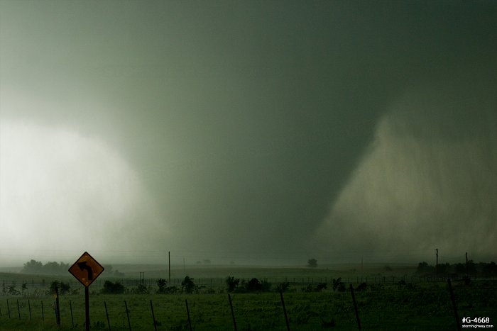
I made it to Bennington just as the storm produced a small tornado east of Highway 81:
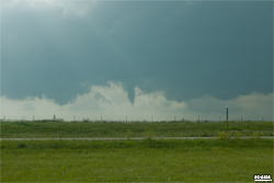
Its funnel extended about halfway down. It was an eerie deja-vu from May 28, 2013, when the famous Bennington storm produced a small tornado in nearly the same location - and even it too wasn't fully condensed! Was this a foreshadowing of events to come?
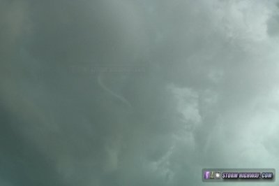
I arrived under the base of the storm minutes later. From here I watched several RFD cuts make their way into the base, one focusing a nice circulation that appeared it was about 10 minutes from producing. It wasn't to be, as the circulation occluded and faded. Rain pushed me east, as another circulation produced a needle funnel directly overhead:
I heard some nearby storm chasers exclaiming that they could see a ground circulation, but I couldn't see it from my vantage point.
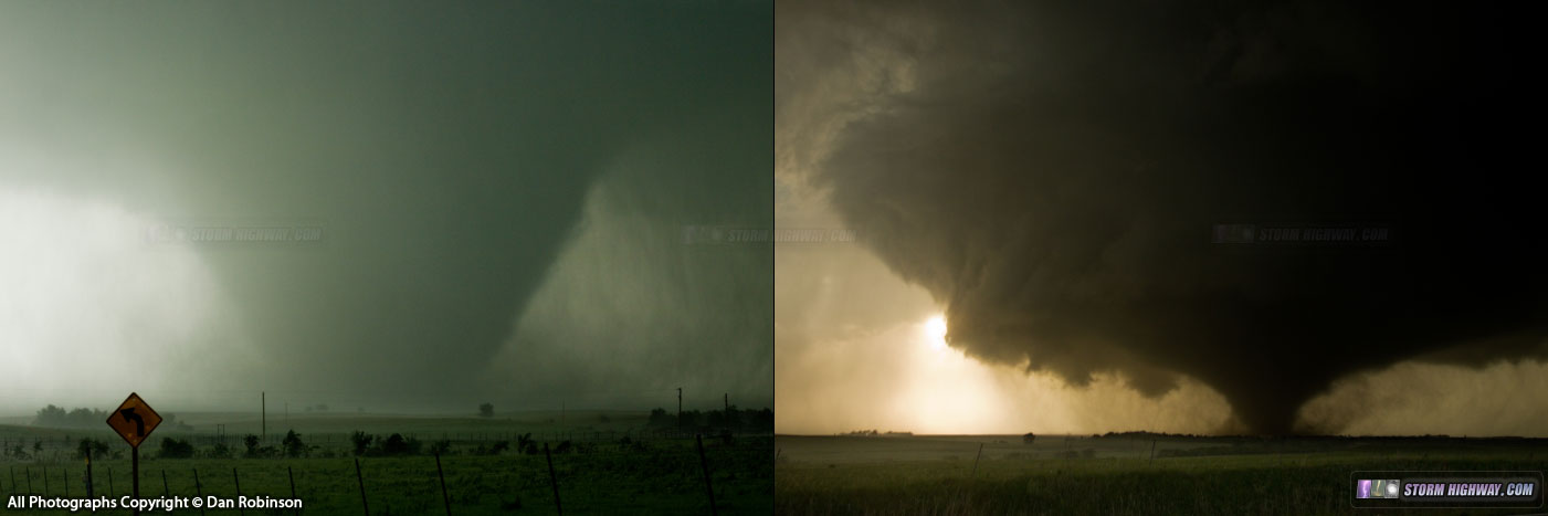
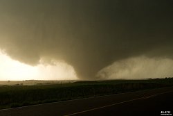
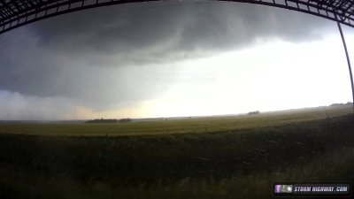
From here on, it was simply a task of staying with the storm. It was moving slowly, so that was a plus. The road network in this part of Kansas is decent, but there are many gravel roads that effectively dead-end into impassable stretches of mud. After a couple of backtracks due to encountering these, I decided to stick to paved roads for the rest of the day. As I approached Niles, the meso exhibited a rounded mothership shape, with a strong RFD cut making its way eastward. Rain curtains began wrapping around the new circulation, with a small bowl in the center. It appeared the show was about to begin:
At Niles, I turned east onto a gravel road, intending to backtrack to the highway after watching the circulation pass. This worked out well, as the tornado rapidly developed to my west here. I had a great backlit view from my vantage point:
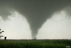
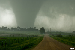
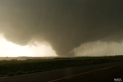
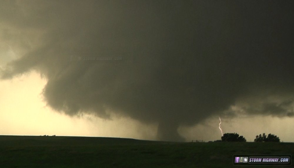
The tornado was not moving left or right, and it soon became apparent it was time to move out of the way. I drove about a half mile south, parked, and had a great view as the tornado crossed to my north, growing larger and more powerful as it did:
As the tornado strengthened, it began producing the most impressive sound I've heard so far. First the typical waterfall, then a crescendo into a deep, thundering low-bass roar. I assumed it was passing through a wooded area, as I've heard smaller tornadoes get noisier as they encounter trees. As the tornado moved east, the entire rounded meso became visible:
After this, I rapidly lost contrast due to the wrapping rain. Not wanting to take any more chances with the county roads suddenly becoming mud, I chose to go south to I-70 to head east. At this stage, I expected this tornado to dissipate and be replaced by a new tornado/meso farther east by the time I could get back to the storm. Boy, was I wrong!
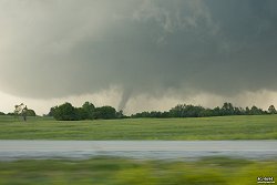
As I moved east on I-70, I gradually regained visual. Eventually, I could see the tornado still in progress:
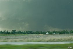
My views of the tornado from I-70 were brief in between extended stretches blocked by trees. The next visual on the tornado was as a narrow cylinder with frighteningly violent motion, even from several miles away. The tornado continued to shrink into a fat rope, and it appeared it was beginning a dissipation (rope out) sequence.
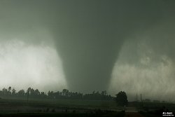
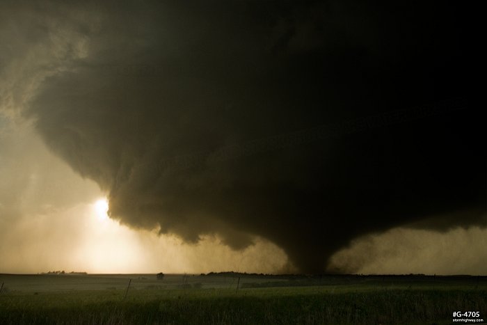
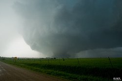
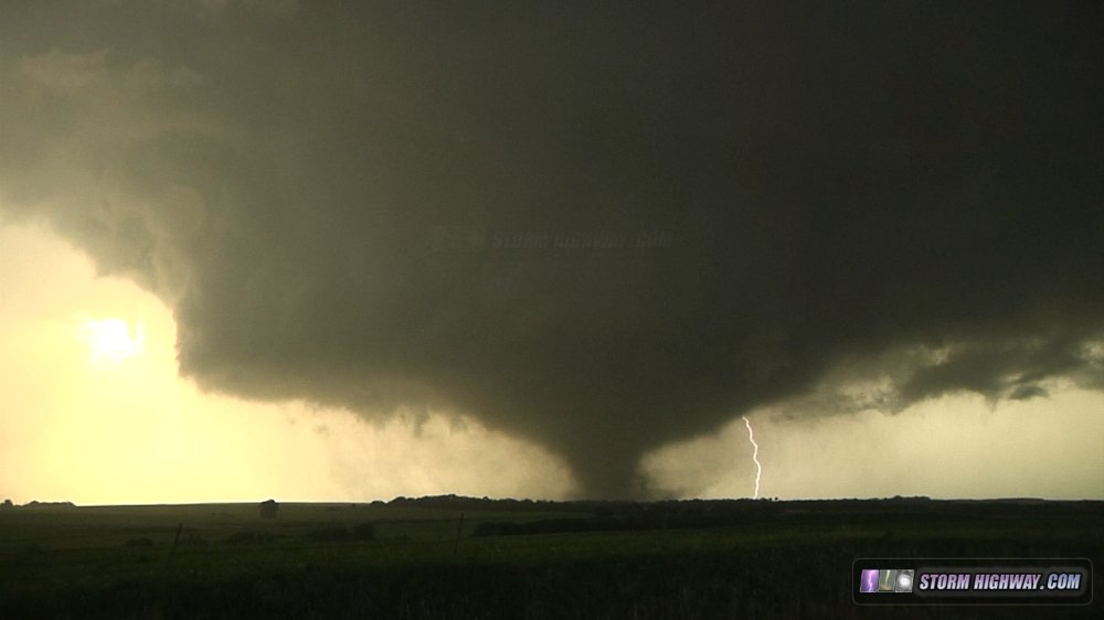
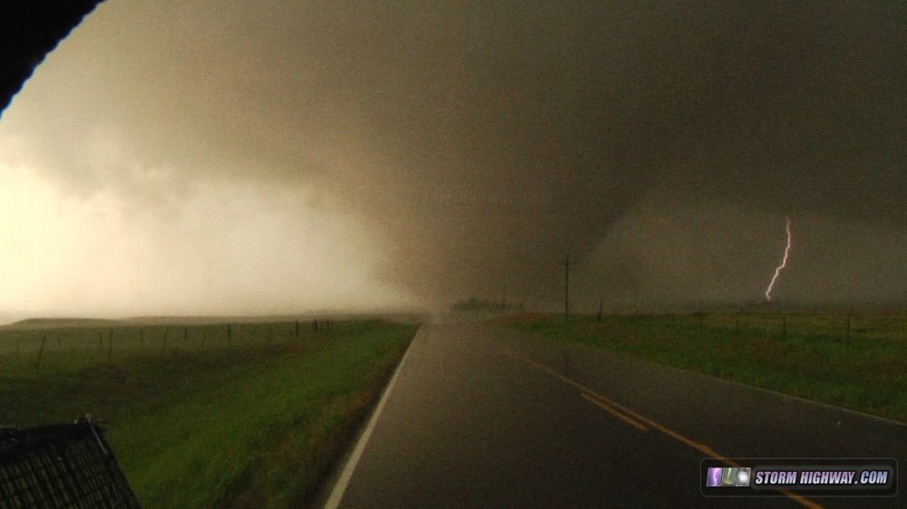
However, at the next gap in the trees, a fat barrel tornado was visible. My next planned intercept was Jeep Road, north of Abilene. Once I exited the interstate, I had a good and more or less continuous view of the tornado as it re-expanded back into a wedge:
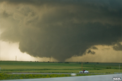
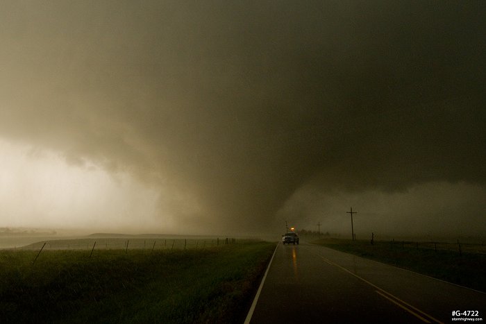
I finally made it to a good vantage point, and watched the tornado approach. The meso, tornado and RFD clear slot were spectacular, with the sun shining directly through the RFD. As the tornado moved closer, I observed several structures impacted, with large amounts debris being lofted each time. The tornado crossed the road about 1/4 mile to my north. I took the following stills during this interval:
Here are video grabs with lightning strikes:
After the tornado crossed the road to my north and was safely east of the road, I drove up to the path to check on the occupants of the houses in this area. While some of the homes had significant damage, all appeared intact enough to be survivable for anyone sheltering inside. Seeing nothing I could realistically do to help and wanting to stay out of the way of responding emergency vehicles, I turned around and headed back south.
I briefly considered a third intercept on I-70, but knowing that exits were few and far between and that an emergency turnaround would be difficult, I decided against it. I drove south to try and regain a visual on the tornado, but with the fading light and being west of the storm, it was a futile endeavor. As darkness fell and I headed west to my overnight stay in Salina, I looked back to see the storm's atomic-bomb structure lit up with continuous lightning. I stopped for a few minutes to shoot this scene.
Other photographer accounts from this event:
NEXT PLAINS CHASE: May 26, 2016 outflow mess >
|