|
Home | Blog Index | Blog Archives | Christianity & Faith Essays | Storm Chasing Essays
Major Plains/Midwest ice storm, snow possible here
Prospects for snow are looking better for West Virginia and the surrounding central Appalachians starting on Monday and lasting through the better part of the week. This is thanks mostly to the frigid air mass currently sinking southward that should infiltrate much of the northern two thirds of the US by mid-week. Temperatures on Monday morning will be at or near freezing, and will continue to fall through the day as the cold air pours in.
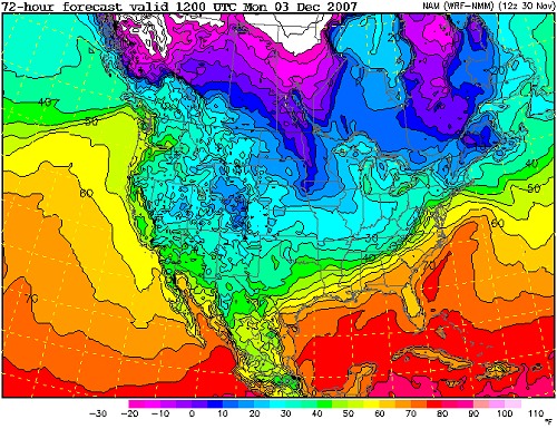
WRF temperature forecast for Monday morning
A good amount of precip is indicated by the models for Monday. As temperatures drop below freezing, this will mean rain should change to snow, and the snow could begin to stick sometime Monday.
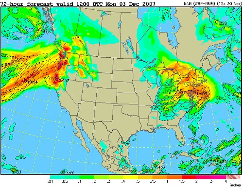
WRF precip (QPF) forecast for Monday morning
Meanwhile, a major ice storm is taking shape for the Midwest and Plains for tomorrow. A warm layer of air will overrun the frigid layer at the surface, meaning that raindrops will fall into the freezing air and turn to ice as soon as they reach the ground (freezing rain). The eastward extent of this ice storm looks to be limited to Illinois, with the worst in the Plains states. However, the models hint at the possibility of Ohio and Pennsylvania seeing some freezing rain on Saturday night.
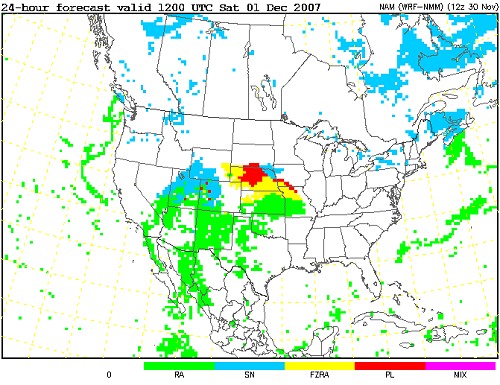
WRF precip type forecast for Saturday morning
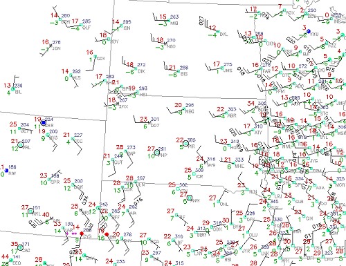
Current (2:13PM EST) observations over the Northern Plains states
GO: Home | Storm Chase Logs | Photography | Extreme Weather Library | Stock Footage | Blog
Featured Weather Library Article:
|


