|
Home | Blog Index | Blog Archives | Christianity & Faith Essays | Storm Chasing Essays
Below-average severe storm activity to continue: Plains forecast update 8, for May 10
Medium-to-long range models continue to paint a well-below-average picture of severe storm activity in the Great Plains and Midwest for as far out as we can reasonably forecast (roughly 10 days out). Models agree on a persistent jet pattern marked by either more eastern US troughing (at worst) to weak southwest flow (at best) over the Plains, with Gulf moisture struggling to move north underneath any of these blips of faster flow.
The best in the medium range is this little ripple in the flow ejecting over the Plains on Thursday evening:
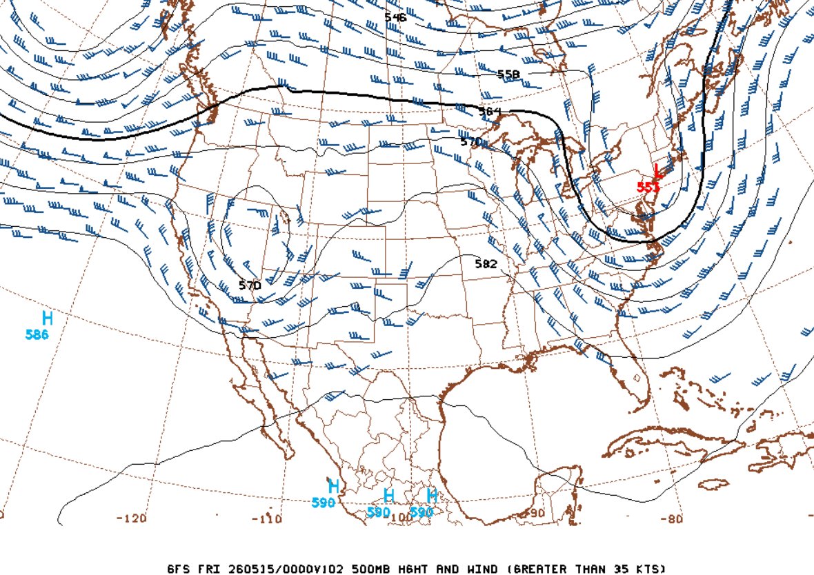 GFS 500mb forecast for 7pm Thursday evening the 14th GFS 500mb forecast for 7pm Thursday evening the 14th
Normally this wouldn't be a terrible wave, just looking at the 500mb chart - but the models also depict meager moisture, a diffuse dryline and warm midlevel temps (strong cap) leading to little to no daytime convection.
During this interval, the best chances for storms and the occasional supercell - and maybe the odd surprise tornado - look to be confined to the far southern Plains, mostly south of the Red River. That's where scheduled chase tours will probably end up for most of the middle parts of May. And while the rest of the Plains and Midwest look to be mostly shut out during this time, a potential one-hit-wonder system is shown in the Sunday-Monday timeframe that could be the lone exception to all of this - but models don't agree very well on it, so we can't really say much about it yet.
For me, Plains activity staying south of the Red River usually means I'm staying home. I want to see richer moisture (high 60s to 70s dewpoints) persistently making it to I-70 and beyond underneath a more solid stream of southwesterly to westerly flow at or greater than 35 knots. When we don't have that, it's usually an interval during which I'll sit on the sidelines. That's especially true this year, with my already-limited travel funds further strained by high gas prices. As a result, Plains chase expedition probabilties will remain low for the foreseable future.
The following table plots the probabilities* of a Great Plains chase expedition taking place for the date ranges shown:
| 2026 Plains Chase Expeditions - Probabilities as of May 10* |
| May 10-15 | 5% | |
| May 15-20 | 10% | |
|
*Base/normal-season probability values are shown. Subtract 35 to 45 percentage points for effective copyright infringement imposed probability values.
GO: Home | Storm Chase Logs | Photography | Extreme Weather Library | Stock Footage | Blog
Featured Weather Library Article:
|


