|
Home | Blog Index | Blog Archives | Christianity & Faith Essays | Storm Chasing Essays
The active supercell interval continues: Plains forecast update 6, for April 20
Models continue to show a somewhat active pattern across the southern Plains and Mid-South as moisture and fast upper-level flow are colocated. But, the timing, configuration and location of those overlaps leave much to be desired, in my opinion. Case in point is this wave shown ejecting over the Plains on Wednesday:
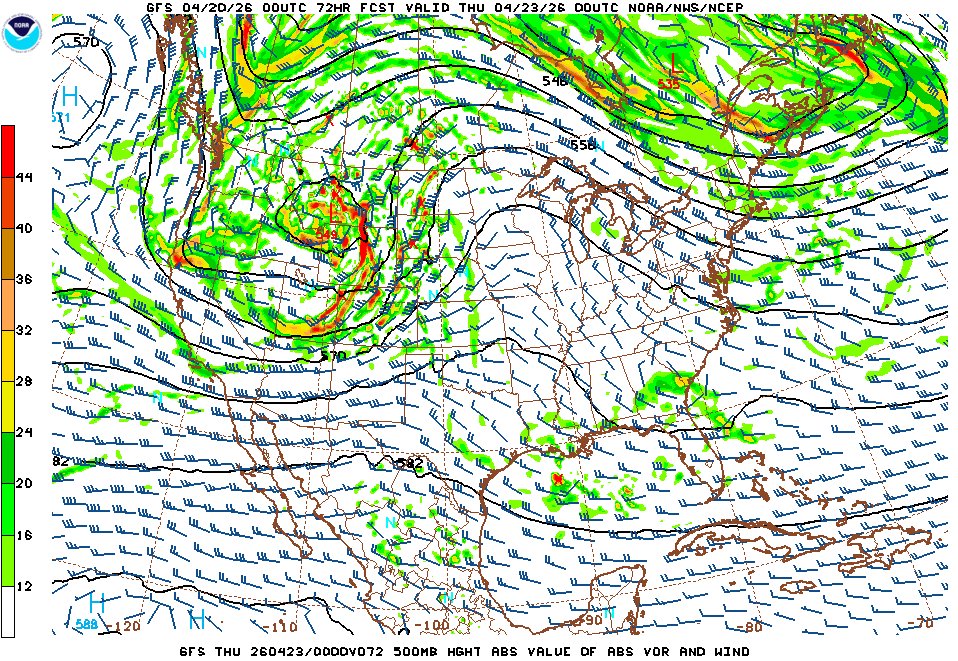
GFS 500mb forecast for 7pm Wednesday evening
This shortwave is shown coming in late and far to the north of the deeper moisture, with the best shear over meager moisture up in the northern Plains. Following this, some better synergy of these factors is shown in Oklahoma on Thursday and Saturday, with more setups possible in the ArkLaTex region in the days after. None of these have me very interested in terms of a trip. The leftovers of Thursday's wave will sweep through the Midwest on Friday as a cold frontal event, not much to look at right now, but at least enough to offer a local chase.
Beyond that, the jet remains active over the CONUS with random northward moisture surges, indicating some action to continue into next week and beyond. But model agreement and consistency isn't very good on that period, so it's a toss-up right now on anything beyond the weekend.
To summarize, I'm not very optimistic for a Plains trip-worthy setup at any point in the near future.
The following table plots the probabilities* of a Great Plains chase expedition taking place for the date ranges shown:
| 2026 Plains Chase Expeditions - Probabilities as of April 20* |
| April 20-24 | 35% | |
| April 25-30 | 45% | |
|
*Base/normal-season probability values are shown. Subtract 30 to 35 percentage points for effective copyright infringement imposed probability values.
GO: Home | Storm Chase Logs | Photography | Extreme Weather Library | Stock Footage | Blog
Featured Weather Library Article:
|


