|
Home | Blog Index | Blog Archives | Christianity & Faith Essays | Storm Chasing Essays
May-June 2025 Storm Chasing Recap
The peak of spring severe weather season this year was a challenging one, with several big misses and no "catch of the year" to speak of. Despite that, several tornado intercepts and high-speed lightning captures made it a productive 2 months.
May-June 2025 Event List
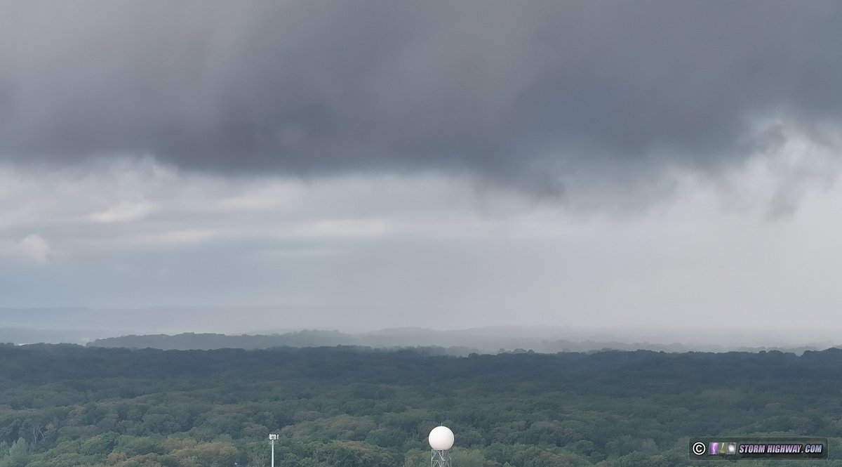
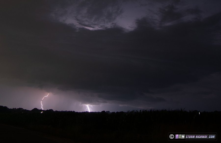
 May 8: Close lightning barrage at Germantown, Illinois May 8: Close lightning barrage at Germantown, Illinois
Another nondescript setup produces a lightning barrage of rare intensity near home on Thursday morning. Models had not portrayed this setup favorably for anything worth chasing here, and after a long night at work, I was not planning on staying awake for it. Before going to bed, I checked radar to see echoes right outside much stronger than models had suggested earlier. So, I went out to take a look.
These were initially slow to produce lightning, but after sunrise, the flash rates ramped up rapidly. I moved east to Germantown to find myself in the middle of one of the more intense barrages of cloud-to-ground lightning I've experienced. It was enough that I moved locations to shoot under high-tension power lines to protect my car! It's rare that I feel the risk of a strike is that high to take that action. I captured a few nice 6,002 FPS high speed shots here. The dashcams also captured several close bolts. This Youtube edit has the best captures:
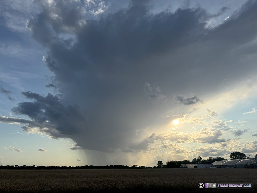
 May 8: Whale's mouth outflow at New Baden, Illinois May 8: Whale's mouth outflow at New Baden, Illinois
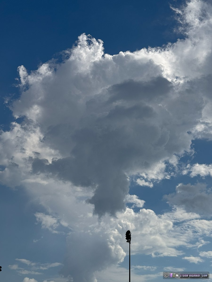
Storms were expected to develop on a "back door" cold front (one coming in from the northeast) this evening. However, the intensity and longevity of the morning rounds of storms (see the previous log entry) left us with very little instability for the evening round. The storms weakened as they arrived in the eastern St. Louis metro area, producing this nice "whale's mouth" formation on the outflow. I saw a couple of flashes of lightning, but not enough to try shooting.
 May 15: Supercell from Springfield to Decatur, Illinois May 15: Supercell from Springfield to Decatur, Illinois
The first in a multi-day Plains/Midwest severe weather sequence was this setup as a split-flow jet ejected across the central USA. The primary risk area for tornadoes was from northern Illinois into Wisconsin, but models portrayed a secondary risk all the way down into southern Illinois and Indiana along a quasi-dryline/cold front. As usual, I favored the home option, which in this case appeared to have similar potential as the primary area thanks to deeper moisture. Dewpoints were significantly "mixing out" in northern Illinois by mid-afternoon, tempering the tornado threat up there and making staying local appear even more reasonable.
As I awiated storm development at home during the afternoon, an outflow was generated from a messy complex of storms and rain way down in northern Arkansas/far southern Missouri. This cooler air surged north rapidly and was nearly at I-64 by 4PM. This would essentially trash our environment for tornadoes and severe storms in the St. Louis metro area and eastward. So, I turned my attention to areas farther north that were out of reach of the outflow and in more sunny skies.
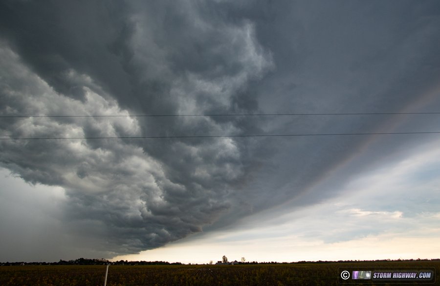
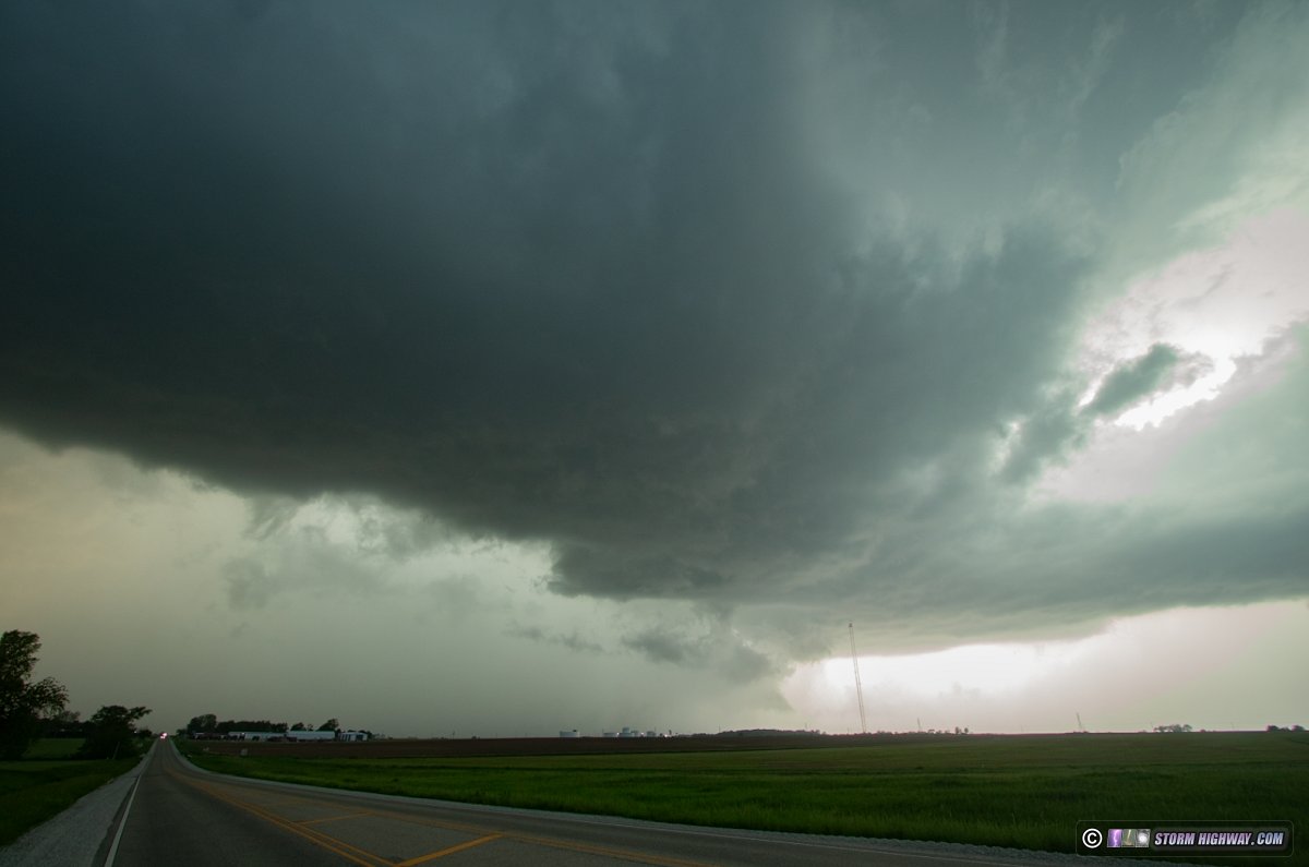
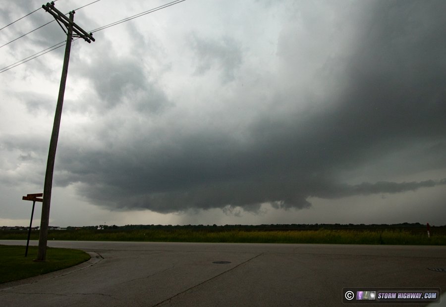
I left home at 4PM with the intention to head to Springfield, then evaluate things from there. After passing Litchfield, convection was visible firing on the front to my west and northwest. By the time I reached Springfield, these were full-fledged thunderstorms. They however were initially struggling to organize into supercells, appearing to have more dominant updrafts on ther north/west sides as if they were "left movers". I stayed just ahead of this activity on I-72 eastbound. I stopped at Mechanicsburg to observe a dominant storm finally establishing an updraft in the right place, with a rear-flank downdraft beginning to surge eastward.
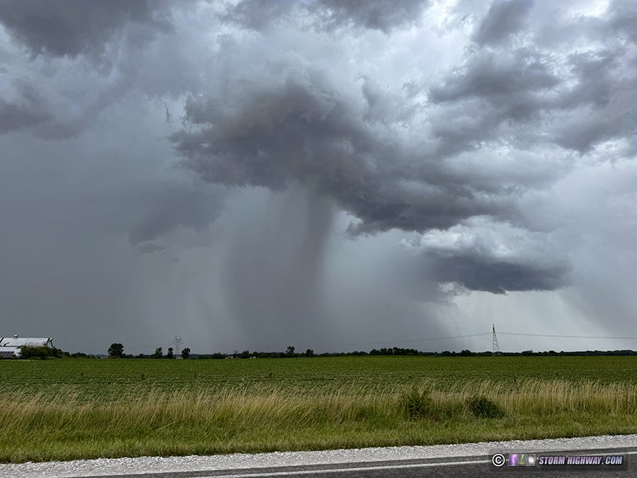
The RFD push became a huge precip-filled slug forming a classic hook. The north side of the surge where a tornado would form was not as organized, with weak surface inflow and a few disorganized wall clouds and lowerings taking shape from time to time. This view was at Illiopolis where a tornado was reported from a small area of dust and dirt getting kicked up on the RFD gust front:
A closer view of the dirt plume:
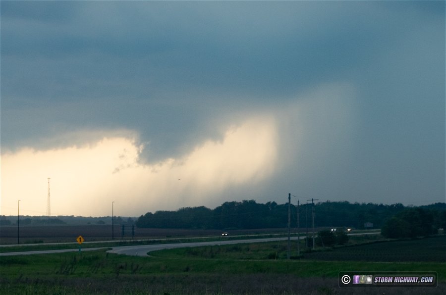
This was a gustnado at best, and I didn't really notice any rotation with it from my vantage point. I didn't have much time to watch here as the storm was now racing eastward, boosted by the surging RFD. I wasn't gaining much ground on the storm at 65mph, and the warning text indicated a 70mph northeastward motion! It certainly looked like it. I grabbed one more shot of the storm at Niantic before diving south out of its way (as radar showed there could be hail in the RFD winds):
The storm was tornado warned right as I left it, but radar didn't suggest a tornado had occurred during that time. While a broken line of storms with some supercell potential existed all the way down to I-70, none of these were taking off. I stopped to take a look at updraft bases at Oconee and Ramsey, but they were falling apart and no longer producing lightning. I called the chase at Vandalia and arrived home at 10pm.
 May 16: EF4 tornado at Marion, Illinois during historic outbreak May 16: EF4 tornado at Marion, Illinois during historic outbreak
I didn't bust, but today was possibly the biggest failure of my career thus far. I started at home, awaiting confirmation that St. Louis would indeed be in the clear before heading east/south to the most favored area for tornadoes in southern Illinois. The dewpoint at Lambert Airport was 52°F at 1pm, and although a supercell was organizing and entering the western metro, I thought that there was no way it would be able to do much. Additionally, the storm was initially tracking northeast and it appeared it would miss the city altogether.
When the storm produced a big RFD surge near Chesterfield, I started heading into downtown just in case it had visible structure over the city. I made it to O'Fallon, 15 miles out, when the RFD surge appeared it would be a HP mess. Also about that time, the storm resumed a northeasterly motion on the next couple of radar scans. It appeared to be on course to move harmlessly off to the north (aside from hail). Another rapidly organizing storm was just to my south and heading for an I-64 crossing to my east, so I turned around and began heading that way.
About 10 miles later, I saw the south end of the RFD surge of the STL supercell was relaxing and developing a strong convergence signal - right over I-64, due west of downtown. It was obvious what was about to happen, and I frantically exited at the first opportunity and headed back west. It was too late.
I've posted before about how many tornadoes and great storms I've missed (in both the Plains and the Midwest) due to my home target bias - a bias I practiced with fervor, specifically to prevent me from missing events like today. And I still missed it. Why? Because STL storms often do these fake-outs and last-minute about-faces that seem designed to make a chaser miss them. Or maybe I'm just a horrible forecaster and chaser. It's probably the latter, but it sure does feel like St. Louis storms don't like giving you much of a heads up when they're about to do something noteworthy.
Anyway. I ended up on a storm at Irvington that slowly shriveled as I kept pace with it to Salem. I gave up on it there and dropped back south to Mount Vernon to regroup. There were no good options within 70 miles, and I was ready to just give up and go home. As I pondered the calamity of the day, I realized a new supercell down near Sikeston was within striking distance at Marion, so I thought I'd go keep it honest. I expected it to die right as i arrived on it, as instability was dropping off to its east on mesoanalysis. Plus, a lot of days like this tend to not get better as they go.
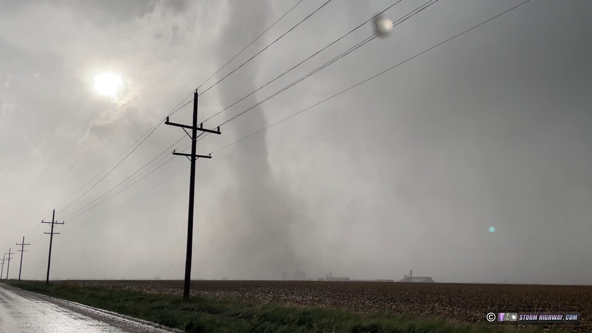
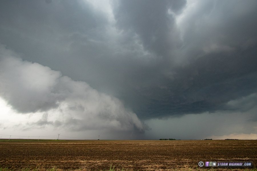
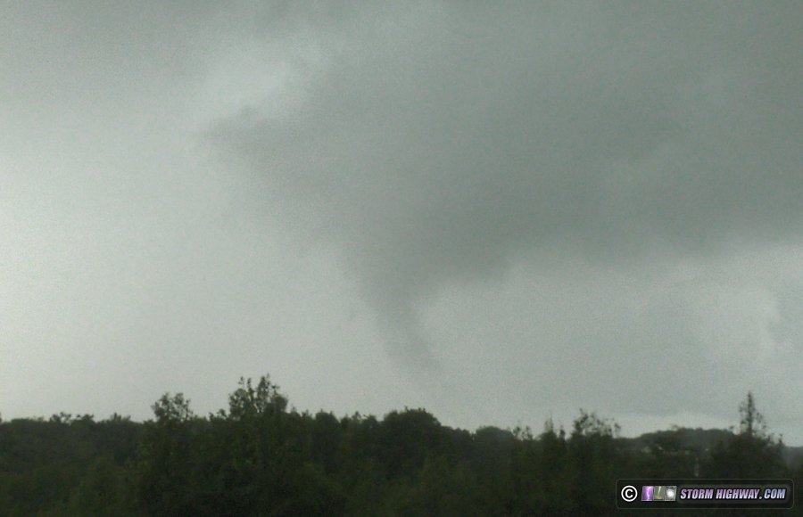
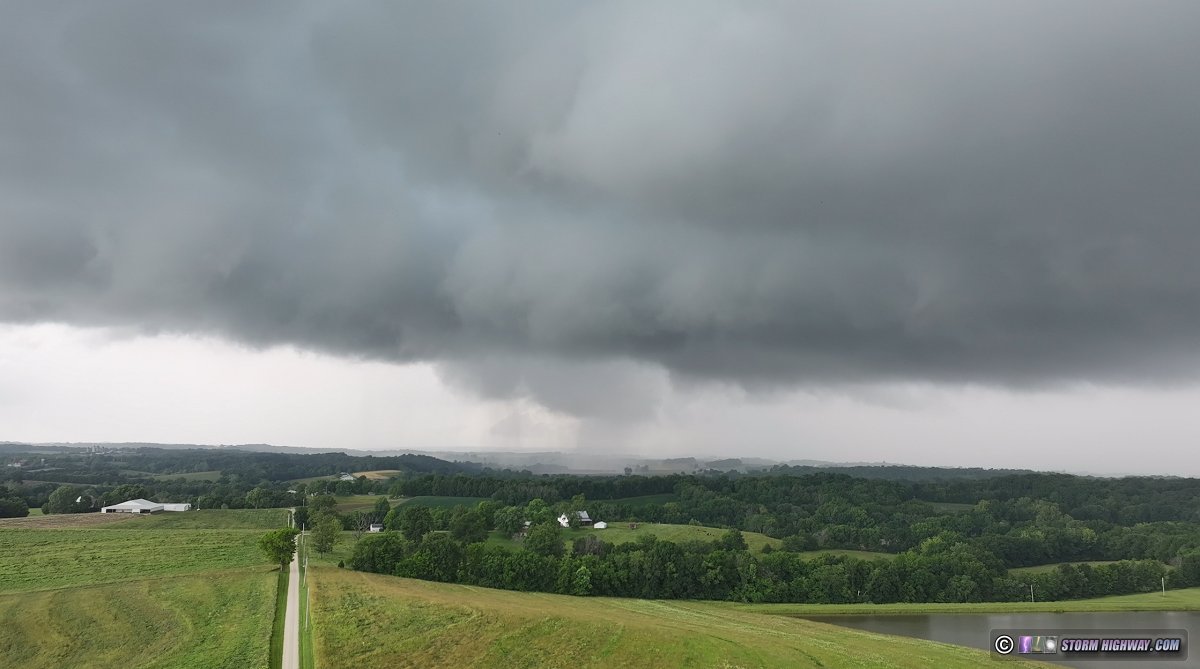
I arrived in Marion to see the storm organizing rapidly, with an RFD surge focusing a circulation to the southwest as the entire storm began a hard right turn.
A few larger hailstones began crashing onto Highway 13, and I felt I risked getting cored staying at that latitude. I dropped south on North Refuge Road and managed to get a close-up of the tornado developing and crossing the road:
There was no way to keep up with this, so I headed down to Paducah for the next supercell in the line. The cold front caught up to it and undercut it before it arrived, ending my chase.
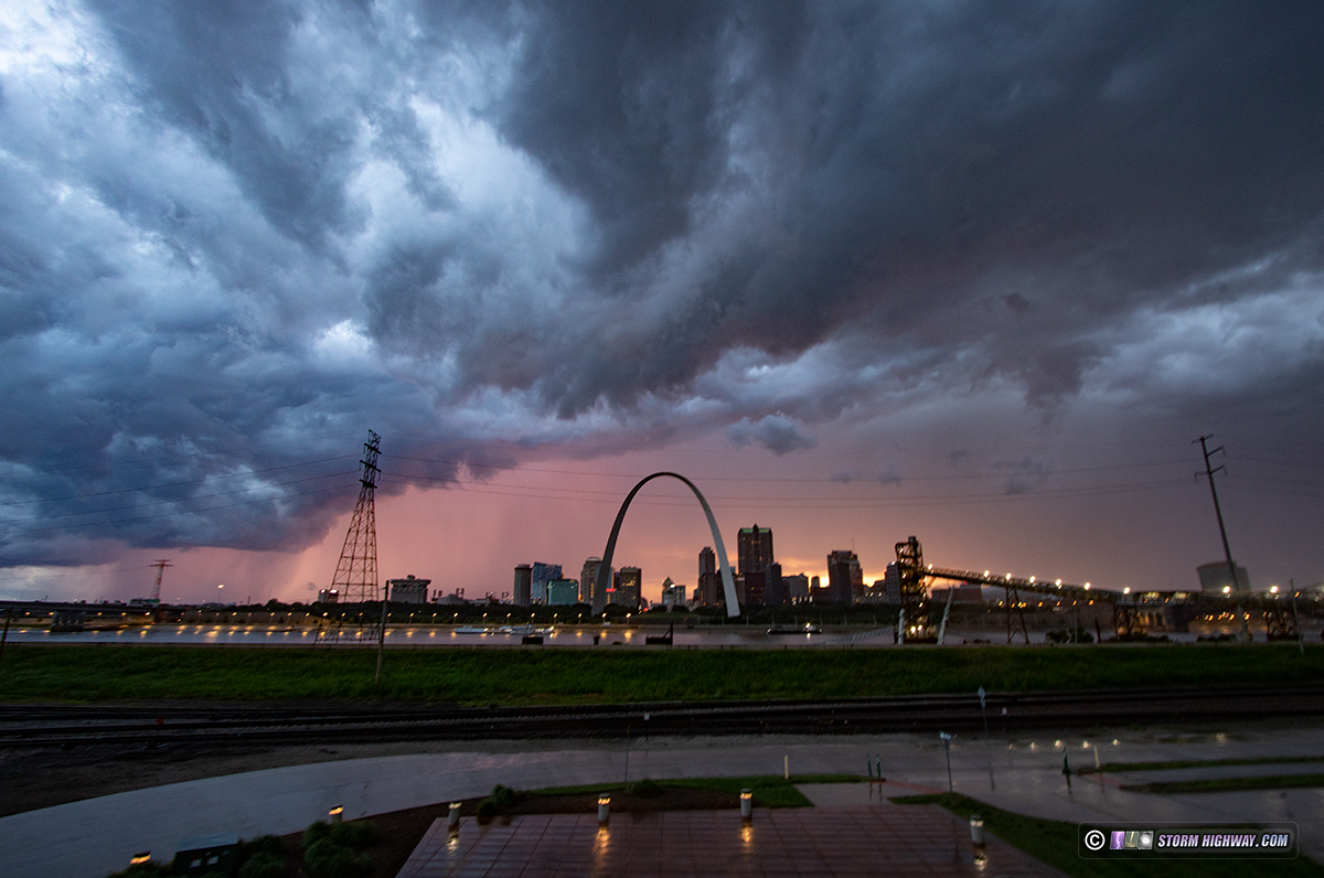
To summarize, I saw a tornado and avoided a bust during this historic outbreak. But I also failed in my 14-year quest to not miss a historic/significant tornado in St. Louis visible behind the skyline. Will I keep my home target bias after it's not only cost me so much, but ended up failing anyway? Who knows. I know it will be 60-70 years before something like that happens again, if history is any indication. It's the first time a tornado was visible behind the Arch since it was built 62 years ago. It likely won't happen again in my lifetime. The silver lining is that it wasn't a highly photogenic tornado (like Waverly, Nebraska on April 26, 2024), but a rather poor-contrast view, at least from the typical skyline angles. It was also a killer tornado and quite a destructive one at that, one I would not really celebrate if I had been there.  May 17: Distant lightning in western Missouri and eastern Kansas May 17: Distant lightning in western Missouri and eastern Kansas
May 18: Grinnell, Kansas tornado
May 19: Du Bois, Nebraska tornado
May 20: Supercells from Springfield to Decatur, Illinois
This day was a deja-vu closely resembling my May 15 chase. I had decided on targeting this system close to home instead of the more potent environment down south in Kentucky and Tennessee. Vorticity near the surface low and a warm front would be the main players in Illinois. The warm front was slightly more favored for tornadoes, but was another 2 hours away, and I wasn't feeling like it was quite enough to be worth having a 4-5 hour drive home afterward. I instead settled for the much closer cold frontal cells that would be firing along I-55 about 60-90 minutes from home.
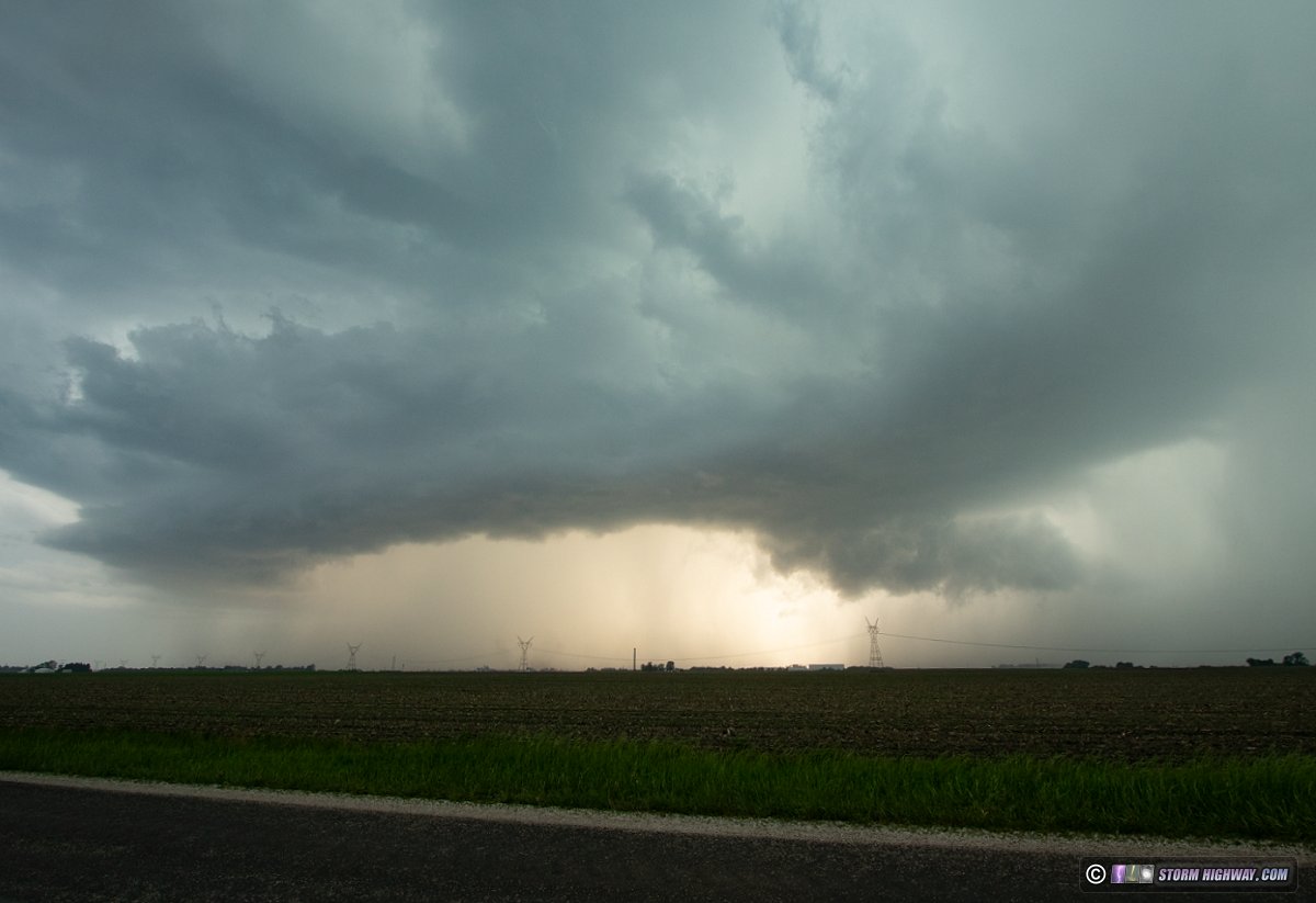
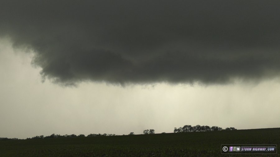
I started out watching new convection try to get going near Litchfield. This didn't last, so I headed up to Springfield to intercept a string of three supercells that had been rapidly strengthening. The northernmost two weakened as I approached them on the north side of Springfield. This was the middle cell in the line just west of Sherman as it was becoming outflow dominant:
The southernmost storm was maintaining strength and prompted several tornado warnings. So, mirroring the May 15 chase sequence, I stayed ahead of the storm eastward along I-72. While the RFD surges were strong, inflow at the surface was weak and the storm remained outflow dominant. Despite the constant warnings, I didn't see any signs of it being close to producing a tornado while I was on it. This is looking west in front of the storm at Buffalo:
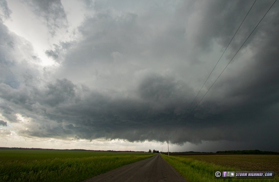
While storm speeds weren't crazy today, they were fast enough that I couldn't stop for very long. After the storm's character hadn't changed in 40 minutes, I finally decided to let it go south of Latham with this view looking north:
Another supercell was organizing to the southeast over Decatur, and it appeared to be the next in line to become dominant:
This new storm was high-based and didn't have any look of organizing much in the low levels. I expected it to just be a repeat of the last one. Since following it farther would just lengthen my drive home for just more of the same, I decided the continued pursuit would not be worth it. I turned toward home at 3:30pm, bringing an early end to the chase day and this recent string of active severe weather in the Plains and Midwest.
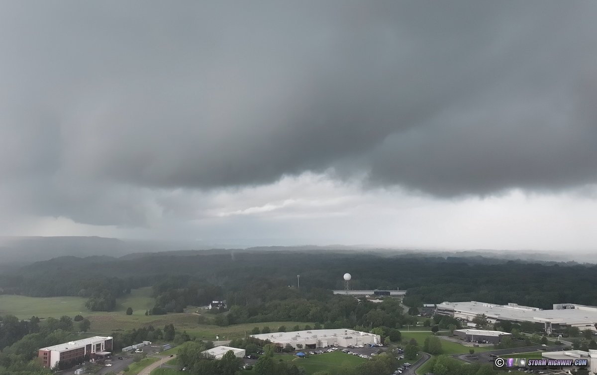
 June 4: St. Louis metro supercell and tornado-producing QLCS June 4: St. Louis metro supercell and tornado-producing QLCS
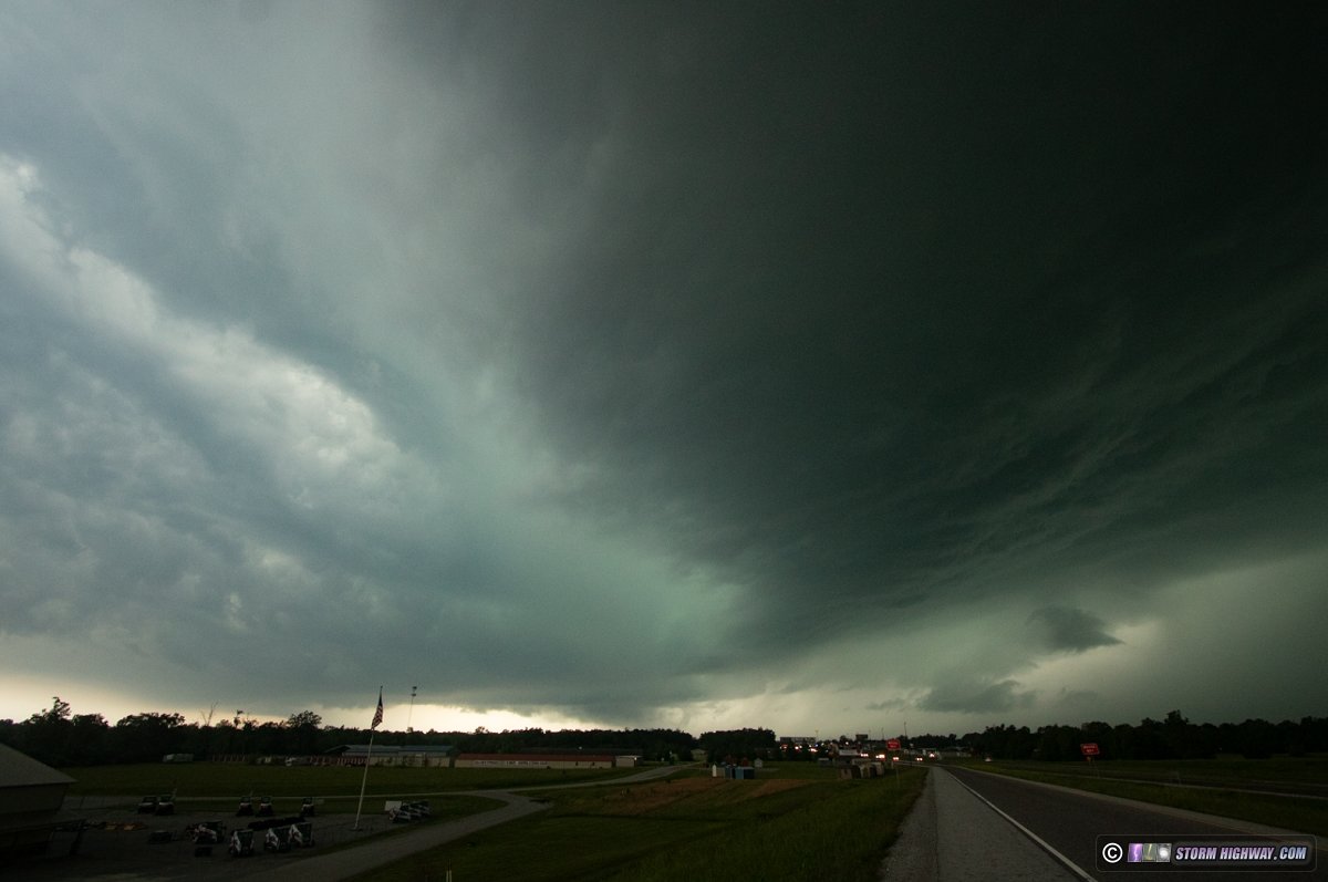
Storms along a slow-moving cold front would provide some tornado potential in the St. Louis metro area this afternoon, much like the previous day in the Kansas City and Oklahoma City metro areas. The first storm of the day organized along the Missouri River and started a hard right turn as it developed a pronounced RFD and hook echo west of Chesterfield. I watched this approach via drone (with LAANC approval to operate in the KSUS Class D airspace) at the Weldon Spring exit of Highway 40 (I-64). Several areas of weak rotation were noted, the strongest of which developed on the south end of the RFD surge - viewed here over the KLSX NEXRAD radar and the St. Louis National Weather Service office:
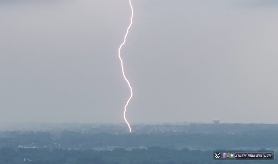
Cloud-to-ground lightning was plentiful in the forward flank:
After landing and preparing to move east, I saw this scud finger appear under one of the weakly-rotating areas south of the interstate. This was just east of the St. Louis NWS office and close enough that they could have seen it from their front door. I don't think this was tornadic, as the motion was too weak.
I moved east on Highway 40 then north on 141 to Maryland Heights as the QLCS tornado began near Wildwood and headed for Chesterfield. I expected this to cross 141 near the 364 interchange, but it ended up occluding and curving westward over the river. I did not have any visual on the tornado from my vantage point, only the RFD gust front curving back into the rain-wrapped meso.
A new circulation developed just north of this to my due west over St. Charles. I moved north to intercept what was left of this at 141 and Highway 370, but I had no visual on the (again) rain-wrapped meso. I don't know if the St. Charles circulation produced a tornado.
The storm had wrapped up into an impressive "comma head" on radar heading toward Jerseyville, but I didn't think there would be anything visible (out of the rain) worth heading up there to intercept again. I dropped back south into downtown to see if new storms would fire along the outflow. This didn't happen. As the original line to the west weakened, I decided I was done with the storms at 5PM. June 7: Marginal supercell from New Haven to Villa Ridge, Missouri
Vorticity close to the center of an MCV/weak surface low tracking across central Missouri would bring a very small tornado risk with any supercells that managed to sustain. This isn't a setup I'd normally travel far for, but it was close enough to home to go check out. A warm/stationary front was positioned about 30 miles south of I-70 from Jefferson City to the southern St. Louis metro, more or less right along the Missouri River. The plan was to catch any strong storms that were in the vicinity of this boundary. The main limitation today was meager instability, thanks to thick cloud cover and early-day precip. At my place, the fog and drizzle was still in progress when I left at 2pm.
As I departed home, storms were already in progress in Columbia and Jefferson City, but a few cells were going up ahead of these along the boundary. Initially I headed west on I-70 out of Wentzville, thinking that the boundary might lift north with time, but after a while it was apparent the leading storms were going to track along it long before then. I dropped south to Washington and then west to New Haven to position ahead of the stronger storm that displayed a hook echo and a surging RFD.
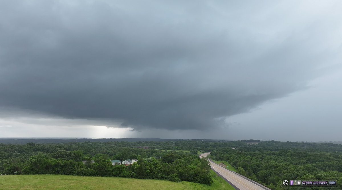
I got into position on this storm south of New Haven. There are very few open views in this part of the state, so I had to rely on the drone for good visuals. The storm was strongly outflow dominant, a state it would not be able to get out of the entire time I was on it. This drone view is looking west from near Campbellton. There was nice downward cascading motion on the most distant cloud edge here, which marked the leading edge of the RFD forming a hook echo on radar. Everything in front of that was pushing south rapidly with the forward flank outflow.
I stayed ahead of the storm along rural roads to Villa Ridge, not seeing any change in the storm's character. I decided that I'd let the storm go at I-44, as it was already exiting the instability max and had likely already peaked in intensity (I ended up being wrong about that). The road network and terrain wouldn't get any better south of there anyway. This was the drone view of the storm looking northwest from Highway 100 and Route 66:
The location I stopped at here was at the gas station hit by the March 14 tornado, still standing but with the damage not yet repaired or even much of the debris cleaned up. I kept the drone in the air until the rain picked up, ending the flight and this chase. The storm had a few lightning strikes per the data, but I didn't see any of them and never heard any thunder.
After arriving home, I pulled up the radar to see that the storm had managed to re-intensify after crossing the Mississippi River, with frequent lightning and a better-looking low-level meso than anything I had when I was on it. Furthermore, the storm to its south had just produced a tornado near De Soto, MO. So, I jumped back in the car and began heading south to intercept the storm south of Sparta, despite knowing that it would likely dissipate before I arrived on it. I made it to Venedy before seeing the VIL core on radar shrink and the lightning strike data slow down. That, coupled with the fact that it would be after dark by the time I'd be on the storm, was enough to call the chase for the second time. June 17: Lightning near Roxana, Illinois
Storms were expected to weaken upon entering the St. Louis metro this evening. Some stronger cells persisted across the northern metro area, which I got ahead of at Roxana. There was better lightning with the more distant cell to the north (in this photo), but the closer southern (severe-warned) storm did not cooperate with visible bolts when I had the camera's shutter open.
June 18: Central Illinois supercells and St. Louis sunset storms
A surface low/MCV spinning through the Midwest would bring a good tornado threat to the area this day. The primary target appeared to be setting up along I-72 somewhere near Champaign-Urbana and points east, as an arc of supercells in the northeast quadrant of the low tracked through. Storms would also be getting going very early in the day, with the tornado risk becoming potent as early as 11AM. This meant a 9AM departure from home.
My initial thinking was to start heading east toward Effingham and re-evaluate once we had incipient storms. But the environment where these storms would form - now passing overhead of me - seemed very cold, with lots of stratus and low clouds indicative of stable air. Convection-allowing models like the HRRR had been insistent on supercells firing in this band near I-57. However, storms were beginning to form much closer to the surface low center in Missouri, a scenario that these models were not picking up on at all. So, I made it to Greenville before turning around and opting to go north on I-55 closer to that activity.
By that time, a new storm had gone up near Alton and was looking like it could be the main play of the day. It was in a good environment, isolated and was not very separated from the storm near Jacksonville that was producing tornadoes already. I initially misjudged the storm speeds and set up Carlinville as the intercept point. But the storm raced north, fast enough that I had to return to I-55 to catch up to it. The storm beat me across the interstate, but I was able to flank it through Springfield and "hook slice" on I-72 to make it into position at Buffalo.
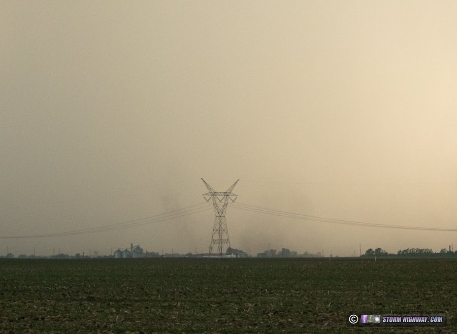
Like the movie Groundhog Day, for the *third* time this spring I'm at Illiopolis, looking west down I-72 at the RFD of an outflow-dominant supercell.

Just like the May 15 and May 20 chases, I stair-stepped on the road grid to keep up with this to Latham. The storm was moving very fast, enough that I was losing significant ground on it every time I stopped to look. And, it just wasn't doing much to warrant going crazy trying to keep up. Finally, a new storm developed down along I-72 that was enough for me to give up on the Latham storm. I intercepted this south of Maroa. It had a slightly better look, with a clear slot and occluded mesocyclone apparent. At one point, a narrow rope funnel appeared in this area (driver's side dashcam view):

By the time I stopped and got a better camera on it, it was less distinct:
The appearance of this storm's updraft diminished after this. Another rain-wrapped meso about 15 miles to the north on the next storm produced a tornado, but I could not see it. Due to the storm speeds, I was losing ground on the southern storm despite the good road grid. I decided I was done with that futile pursuit - all I could hope to get would only be a distant view of any tornadoes the storm would manage to produce in the next 30 minutes. I turned around and headed toward home.
Another round of storms was expected in the St. Louis metro area close to sunset. These would likely be non-severe, but worth going out for lightning and possibly a shelf cloud over the city. I was not home for long before heading out for these. A line of cells was moving in from the west, and new storms were firing out ahead of that activity. This was the view of a short-lived cell west of New Baden:
I initially headed up to Roxana to take a look at the stronger cell in the line. There wasn't enough lightning for high speed shooting, and most of it was buried in rain. I dropped south to downtown for the rest of the line. These were uneventful, with some nice color appearing briefly courtesy of the sunset light filtering through the rain:
This only produced one flash of lightning, and that after it had already moved east of downtown. I made it home ahead of the further-weakening storms to brring an end to this 12+ hour chase day.
June 25: O'Fallon, Illinois pop-up convection
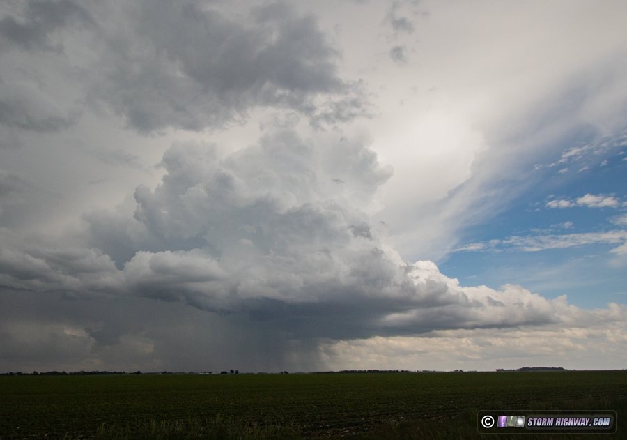
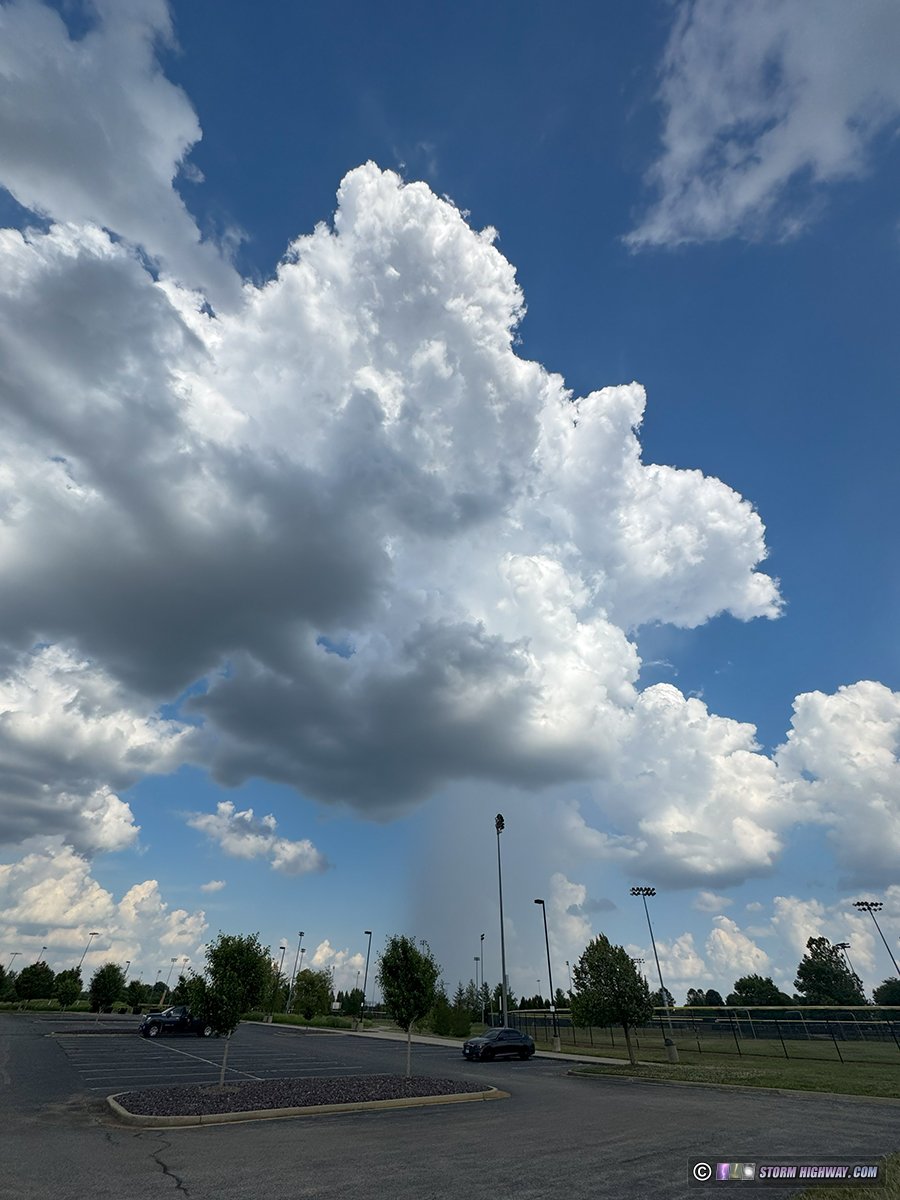
This type of convection is common in the summer months, and rarely is worth doing any serious chasing to go after. This activity was bubbling up overhead right as I left work, so I took a short diversion on the way home with my high-speed camera in case any of them produced lightning strikes. Despite developing healthy precip cores for 10-15 minutes at a time, these did not produce any lightning. This one is in the process of dissipating over Fairview Heights, viewed from O'Fallon Family Sports Park. The fizzling updraft is visible to the right of the rain shaft:
Another cell of similar peak strength to the east, this one still hanging on to a functioning updraft. The narrow rain shaft is descending straight down right through the already-tiny updraft base, illustrating why storms often struggle to maintain in these low-shear environments:
A funnel-like appendage in the middle of an "orphan anvil", the remains of another short-lived updraft. It didn't last very long and don't know if it was rotating:
30 minutes later, all of this was gone and skies were clear again.
 June 27: St. Louis Metro-East storms June 27: St. Louis Metro-East storms
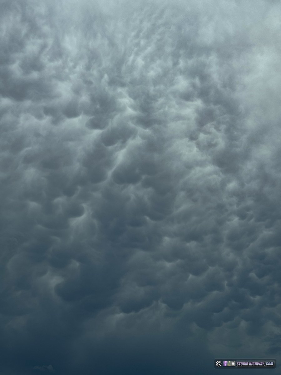
Slightly better-organized pop-up convection developed around the metro area this day, focused more on the Illinois side of the river. As I left work in Shiloh, mammatus was overhead from storms to the northeast:
Outflow from these short-lived storms pushed south across I-64 while outflow from dissipating storms west of St. Louis was pushing east across the river. These two intersected near Waterloo, so I went down there in case an updraft was able to fire right on the boundary intersection (a common landspout tornado situation). Both outflows were pushing too hard to allow any surface organization, and storms ended up firing south and east of the boundaries. Ony the heaviest cores were producing lightning, and there wasn't anough to get any high-speed video. This core near Freeburg was illustative of a stronger cell producing no lightning:
June 28: Lightning near Cincinnati, Ohio
Storms went up along my drive from near Evansville, Indiana to near Columbus, Ohio to our family get-together in Pennsylvania. None were doing anything worth diverting from my travel route. The only one that prompted a stop to shoot was in the Cincinnati metro area, when I encountered a lightning-active cell along I-71 near Sixteen Mile Stand, Ohio. I rolled the high speed camera for 15 minutes, but the storm didn't produce any more bolts after I was set up and recording.
June 30: Lightning near Washington, Pennsyvania
Lightning in these storms was mostly uncooperative, either buried in heavy rain or with the wind blowing raindrops from the same direction the lightning was happening. I captured one visible negative CG at 6,000fps from Cameron Road over I-70 as the storm moved off to the southeast:
< March-April 2025 Recap | All Storm Chase Logs | July-August 2025 Recap >
GO: Home | Storm Chase Logs | Photography | Extreme Weather Library | Stock Footage | Blog
Featured Weather Library Article:
|


