|
Home | Blog Index | Blog Archives | Christianity & Faith Essays | Storm Chasing Essays
July-August-September 2025 Storm Chasing Recap
The final months of my professional storm chasing operation were mostly quiet, dominated by a major drought in the last two thirds of the July, August and September period.
July-August 2025 Event List
- July 6: Lightning and flooding in Lebanon, Illinois
- July 8: Shelf cloud over St. Louis
- July 11: St. Louis metro thunderstorms
- July 13: Supercells from Shiloh to Beckmeyer, Illinois
- July 15: Thunderstorms from New Memphis to Bartelso, Illinois
- July 15: Lightning from New Memphis to St. Jacob, Illinois
- July 16: Lightning from Roxana to Hoyleton, Illinois
- July 16: Bolts-from-the-blue near New Baden, Illinois
- July 17: Lightning at New Baden, Illinois
- July 19: Lightning from New Baden to Trenton, Illinois
- July 20: Bolts-from-the-blue viewed from New Baden, Illinois
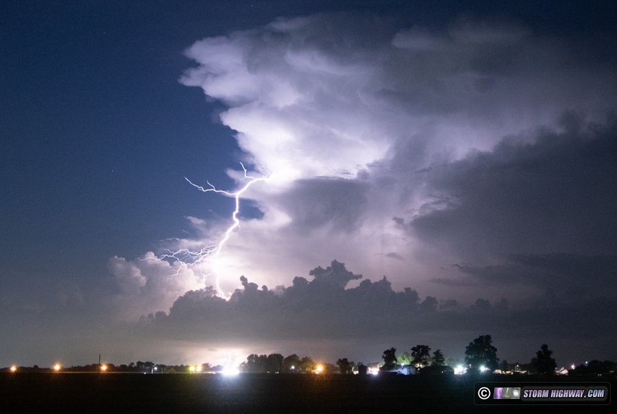
- July 27: Lightning near Troy, Illinois
- July 28: New Baden, Illinois sprites bust
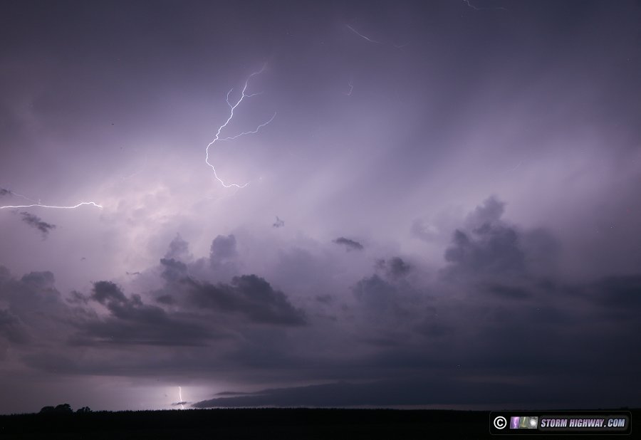
  July 6: Lightning and flooding in Lebanon, Illinois July 6: Lightning and flooding in Lebanon, Illinois
This was a low-expectations chase that yielded some good high speed lightning captures. Convection was already firing overhead on my way to church in the morning, which usually is not a good sign for storm prospects later in the afternoon. Early-day convection means a weak cap and the potential for too many storms to develop very early before peak heating, using up the instability and cluttering of the region with stable outflow. This activity continued after I arrived home around 1pm. Towering cumulus were everywhere in the St. Louis metro, and models were not doing very well with the day's evolution. I decided to just stay at home until something interesting happened either nearby or heading for downtown St. Louis.
Finally a storm went up just to the northwest near Lebanon and produced a few lightning strikes, the thunder of which I could hear from home. I went out to take a look at this, but the lightning-production window of the cell had already ended as the updraft evaporated. A new updraft to the west of the first one over O'Fallon appeared to be poised to do something similar, so I headed to north Rieder Road to set up. Its updraft fizzled before it could produce any lightning. At this point, nothing else was happenning within an hour's drive, so I went back home.
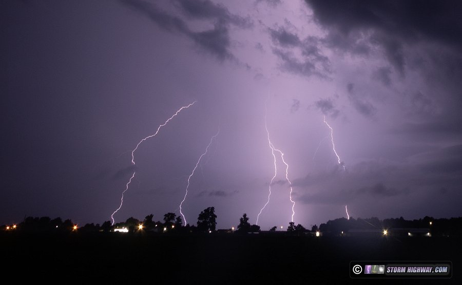
After about 45 minutes, the O'Fallon cell's remnants managed to regenerate along Highway 50 west of Trenton, producing a few lightning strikes. I headed back out northwest of town, west of Summerfield Road, to watch this new activity. This storm and a new one to its west had several healthy updrafts, and all were producing lightning with more reliable frequency. I captured a couple of 6,000fps high speed shots here:
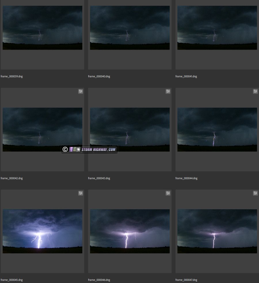
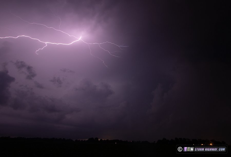
After this, new storms to the west developed and merged with the Lebanon-Trenton action as yet another new storm developed over New Baden just behind a northward-moving outflow from earlier storms in southern Illinois. This created a complex surface situation with merging/colliding outflows right overhead. As this situation evolved with multiple outflows washing back and forth, new updrafts and precip cores developed and expanded in several locations to the north and east with some rapid rising motion that had me looking for landspouts.
Lightning strikes were mostly buried in the heavy precip cores to the north, but a few random areas produced bolts out of the rain enough to grab the best high-speed shot of the day (at 6,000 fps):
Radar now showed the heavy precip core of the storm sitting over Lebanon had already produced more than 3 inches of rain in less than an hour. I decided to go north into town to see if anything interesting was happening. As I did this, the storms to the west had intensified and were now producing a strong westerly downburst that sent a tree down across the highway.
Traffic data showed jams forming on Highway 4 and Highway 50 north, east and west of town where radar-estimated 5 inches of rain had fallen. Fearing Little Silver Creek would soon cut off Highway 4 south with high water, I dropped south to circumvent the heavy precip upstream to Summerfield. West of Summerfield, field flooding was covering Highway 50 into Lebanon with enough water that I didn't think it was safe to continue.
Going back through Summerfield, water had risen off of the fields to cover the intersection of Summerfield Road and old Highway 50 in that 10-minute window. I thought this might signal a flash flood wave on the tributary just downstream, so I headed southwest of town to get a camera on the creek. The water rose steadily over the next hour (more than a foot), but there was no wave. As this was going on, the stratiform region of the departing storms was producing horizontal lightning flashes with occasional ground connections, providing a few more high speed lightning shots. I decided I'd had enough with waiting for flood waves and arrived home at 6pm.
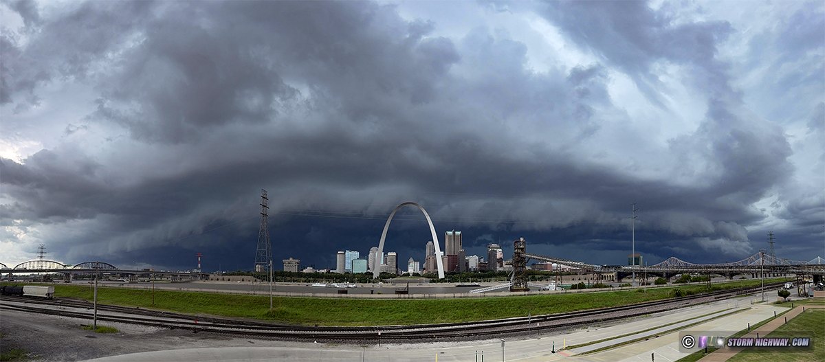
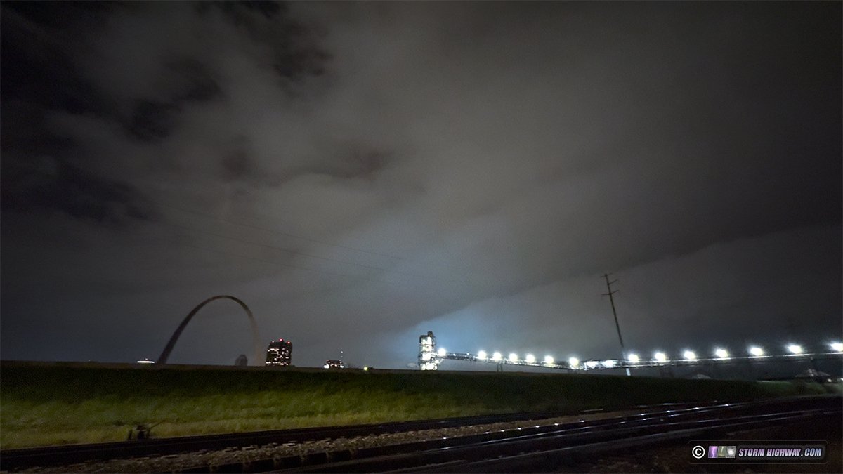
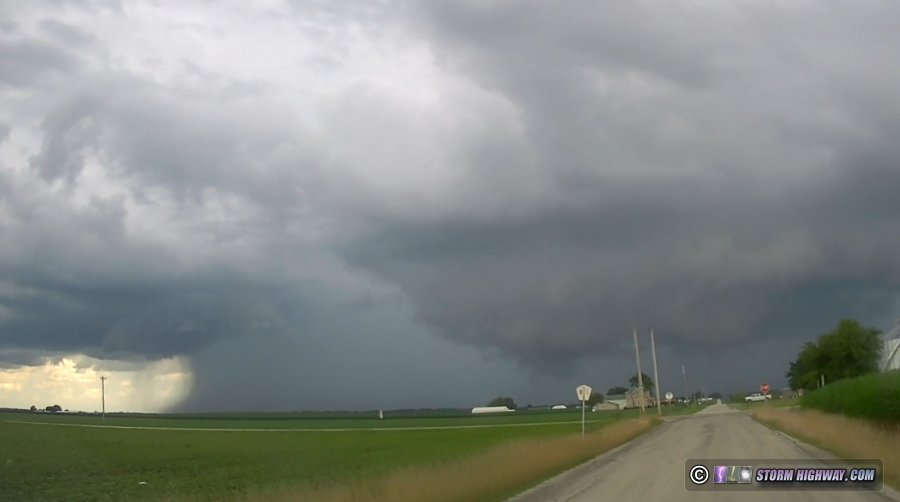
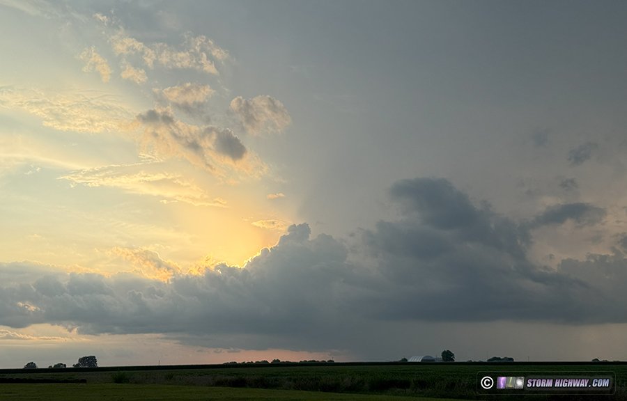
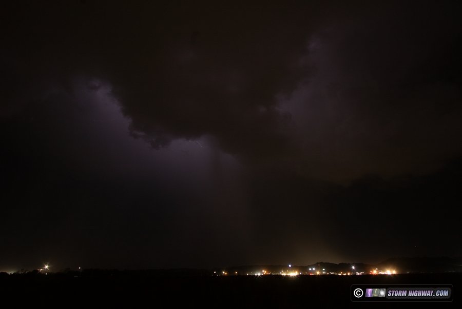
 July 8: Shelf cloud over St. Louis July 8: Shelf cloud over St. Louis
This was another weak flow, weak forcing low-expectations day that more or less lived up to that. Slow-moving storms developed north and west of the metro by 2pm and were not producing much lightning. It appeared the only thing of interest these would generate was a southeast-moving outflow that could produce a shelf cloud over the city, so I went downtown and waited. This happened pretty much as expected, with a mediocre (3 out of 10) shelf cloud moving over downtown at 4pm:
There wasn't anough lightning in these storms to justify staying out after this. After arriving home, the leading edge of the dissipated storms' outflow was visible in the distant east and south with towering cumulus along it. Undulatus asperatus and rain shafts from just-disspated convection also hovered above the outflow:
These old outflows have a lot of "spin" and vorticity on their leading edges, and if they are able to avoid washing out overnight, they can be the focus for new storms the following day.
 July 11: St. Louis metro thunderstorms July 11: St. Louis metro thunderstorms
I didn't expect to chase this day. The main action area was in Iowa and northern Illinois where a supercell/tornado risk had set up, too far away to consider with my full schedule this week. I wasn't paying much attention until after I'd been home from work for a couple of hours. At late evening, I looked outside and saw these two new storms that had just gone up on the river (thankfully just north of downtown St. Louis). I headed north on Route 4 to catch up to them as the setting sun behind the storms created some nice color and light:
The storms were producing periodic bolts, so once I was in satisfactory position near Hamel, I set up for stills and high speed video:

The storms didn't produce any further visible bolts, and began a slow weakening. I returned home, then once we had full darkness, I went back out to attempt shooting sprites with the main large MCS to the north. This line was not only maintaining intensity, but was much farther south and earlier than models had suggested. Lightning in the leading cores of the line was visible in the distance, but the high clouds were blocking the much more distant sprite activity:
I stayed out shooting this for the next hour. I only saw one sprite visible to my eyes, and it was a large one. But it occurred in the short gap in between my camera's exposures! Given the probabilities, it's incredible how often that happens in storm chasing.
During this time, the outflow ahead of the complex was racing south toward St. Louis, and it appeared it would not be slowing down as it passed through the metro. I gave up on the sprites and headed downtown. The resulting shelf cloud would be coming in at a bad angle (almost due north) for skyline shots, and at that hour, the Malcom Martin overlook is not open and the street-level views to the north/northwest are very poor. But, I figured there was a chance for the shelf to be quite dramatic given the speed of the outflow still strongly surging through the humid night air. The outflow arrived over the city just after midnight, with a few power flashes illuminating the front side of the multi-tiered shelf:
That would have been quite a sight had it been during the day. The cores behind the outflow had weakended to the point that they were no longer producing lightning, so the shelf cloud was the last subject of note to cover. I arrived home at 1AM.
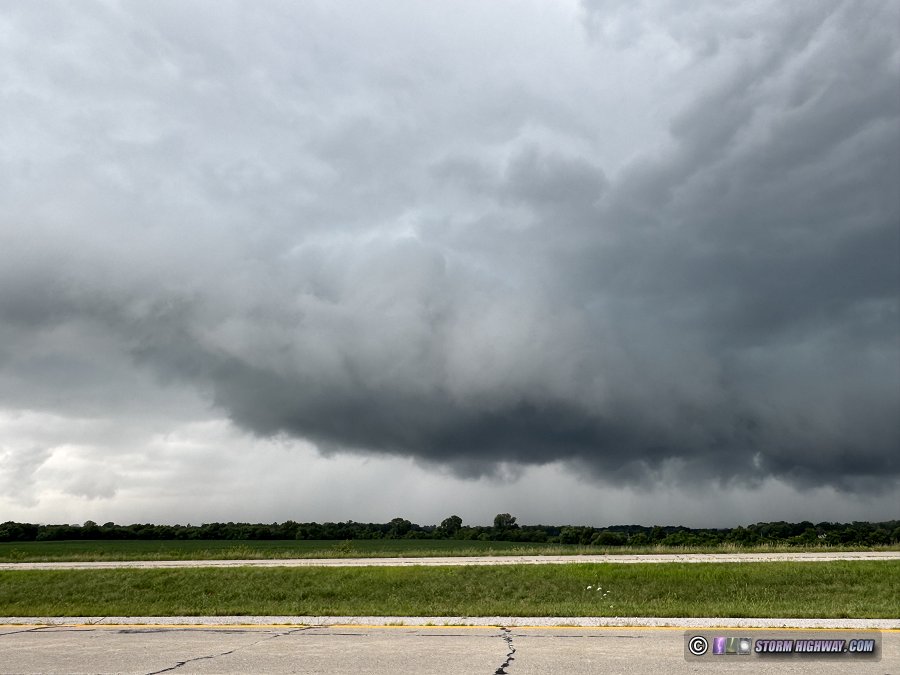
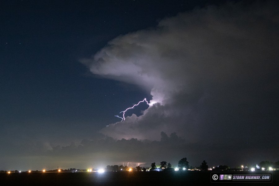
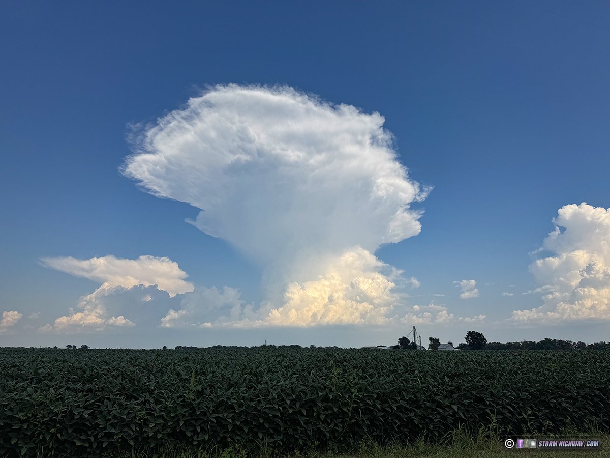
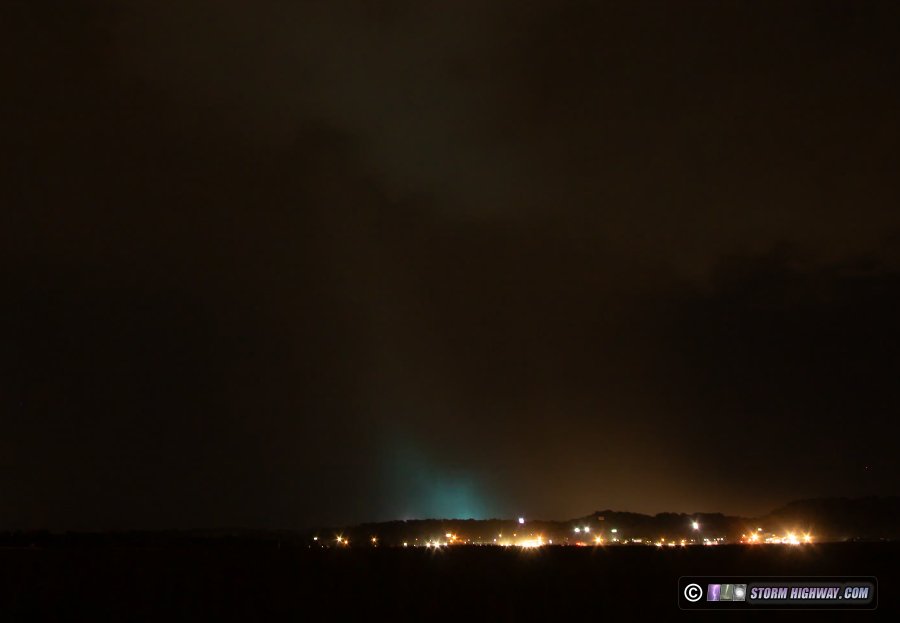
 July 13: Supercells from Shiloh to Beckmeyer, Illinois July 13: Supercells from Shiloh to Beckmeyer, Illinois
Storms with some brief severe potential were expected to fire around 1 or 2pm this day, so I took my cameras with me to church in case this action started early. Lightning and thunder were already in progress outside at 11:50AM, so the chase began immediately after I left church. I dropped south at Shiloh to see a rather healthy supercell getting organized just west of Scott-Troy road, with frequent lightning in the vault region and some moderate rotation as the RFD made several attempts to cut in.
The lightning was not very cooperative, with only a couple strikes captured and all of the very nice center-of-frame bolts missed in brief intervals where I was messing with camera settings or driving to new locations.
This eventually became mired in an area of new storms going up to its east and southeast. I headed to Trenton on the eastern edge of this mess, where a new supercell managed to spin up. This featured another burst of lightning and a strong RFD surge that produced moderate cloud base rotation. The outflow was just too overpowering, undercutting and outracing the meso by a large distance. The lightning continued to be uncooperative, with the better strikes all happening while I was repositioning to stay ahead of the rain.
With more messy storms developing in the inflow of this supercell, the entire region ahead of the storm was soon filled with rain, poor visibility and no good lightning. I called the chase at Beckmeyer and headed home.
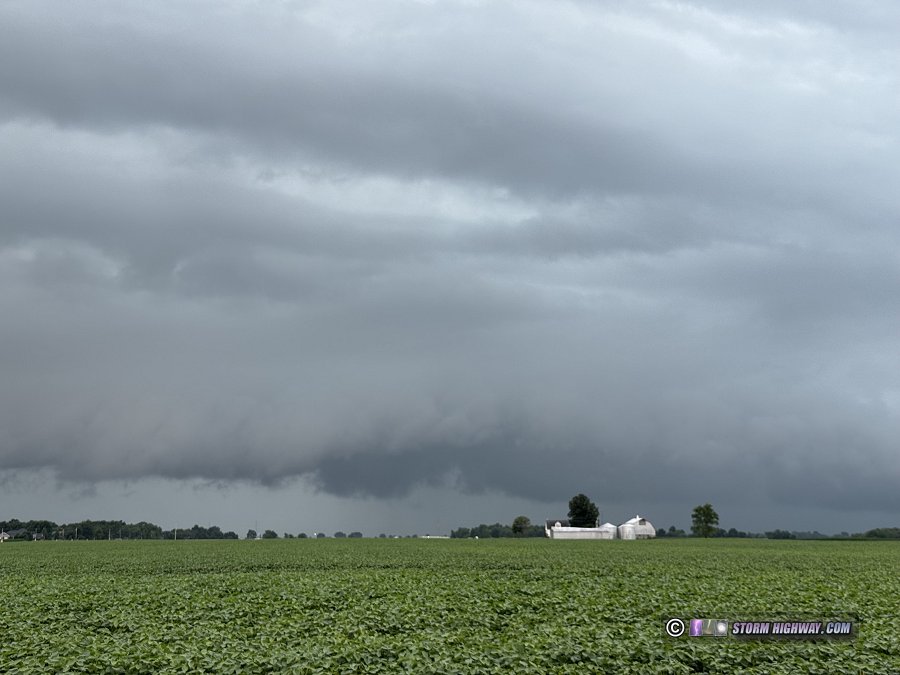
As I arrived in New Baden, some new cells had gone up to the south of town and over downtown St. Louis, though producing no lightning. A new structured updraft began taking shape on the northwest-moving outflow over Mascoutah. It had a dramatic appearance, but no potential to do anything with the cold outflow racing northwest.
Outflow from the St. Louis storm was pushing southeast through o'Fallon, with the collision point of both of these gust fronts poised to take place between Mascoutah and Lebanon. I headed over to Highway 4 near the airport to see if this would produce a stronger busrst of convection. This indeed happened, but with no corresponding burst of lightning activity. I was back at home by 3pm.
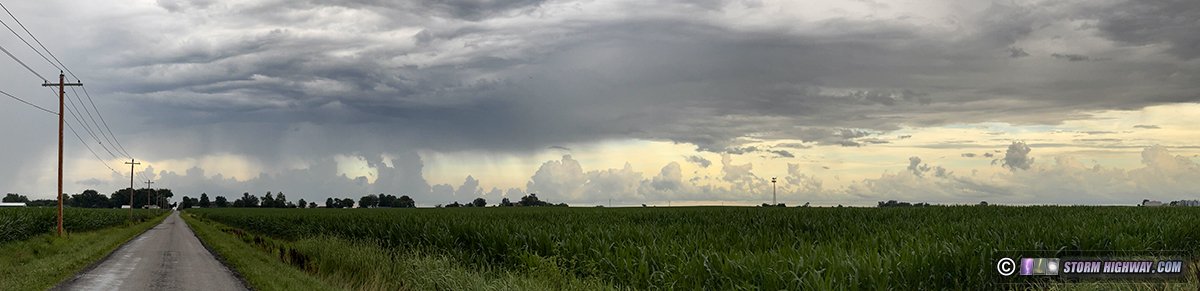
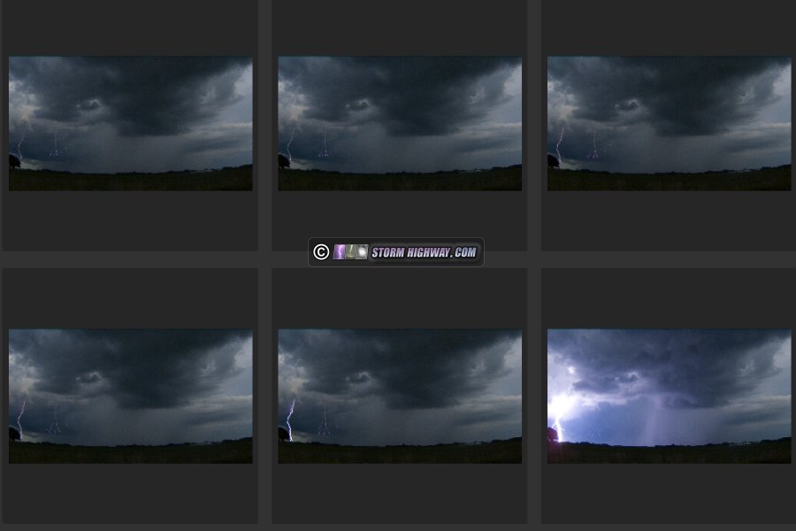
 July 15: Thunderstorms from New Memphis to Bartelso, Illinois July 15: Thunderstorms from New Memphis to Bartelso, Illinois
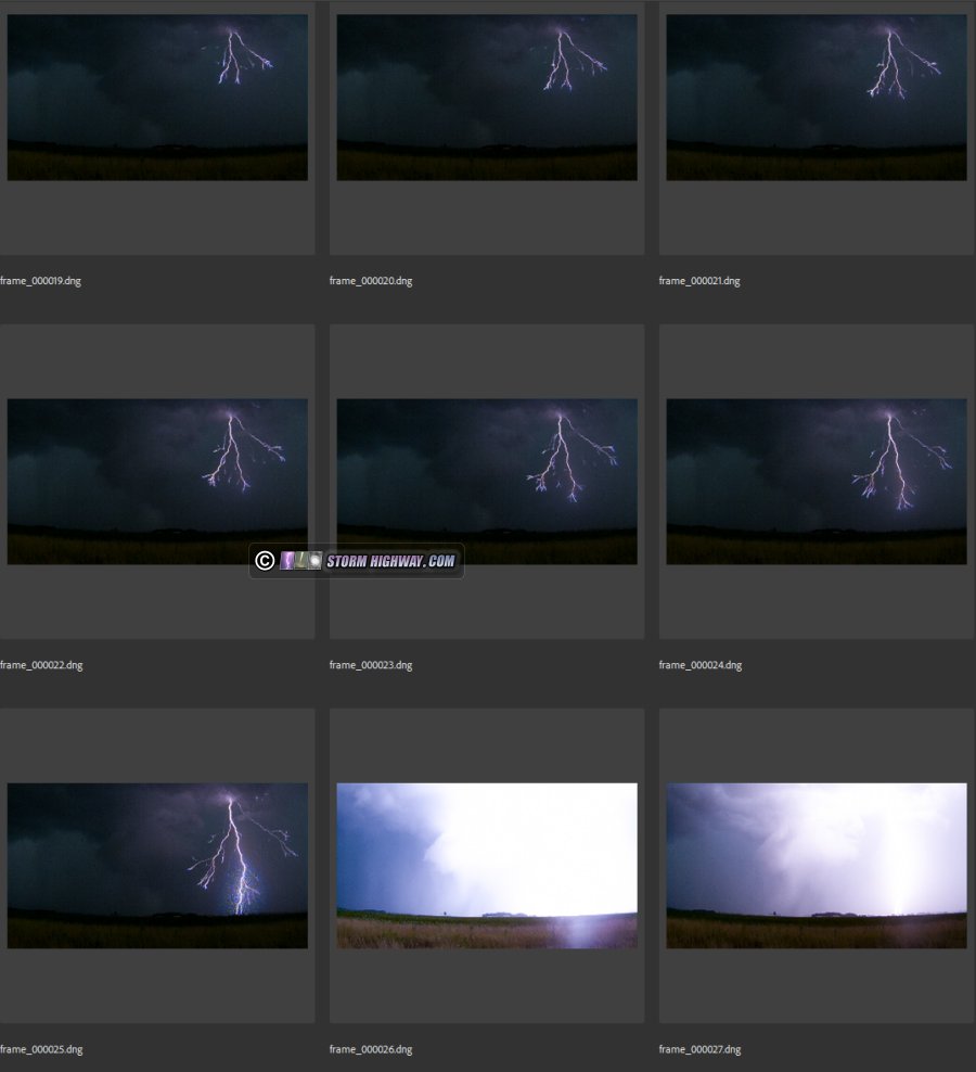
Another typical seasonal non-severe storm day with weak flow and low expectations - rinse and repeat for this summer so far. Storms went up south of home and slowly approached, producing sporadic lightning. I missed the only real shot I had at catching anything with this storm due to a slow driver on IL Route 177 that I couldn't pass. I made it to a location with a view and stopped, but the lone photogenic strike occured seconds before I had my camera on and shooting. The storm didn't cooperate for the rest of the chase to Bartelso and back, with wind-blown rain, low scud clouds and infrequent visible bolts making even trying to shoot a lost cause. I didn't try going after any other storms in the metro area, as I expected to just see more of the same. This was the dashcam view of the storm, looking south from County Line Road and 177 near New Memphis:
July 15: Lightning from New Memphis to St. Jacob, Illinois
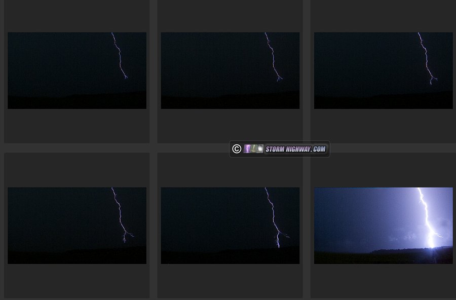
A second chase this day as an outflow boundary collision from earlier storms fired new convection right on I-64 from Okawville to O'Fallon. These produced more lightning than the first round earlier in the day, but remained just as uncooperative for high speed captures. I did manage to get one distant bolt on camera north of New Memphis on the far left edge of the frame - I saved it only to illustrate the frustrations of capturing lightning this day.
A slow-moving train at Albers stopped me from getting back into position north of these cells, the delay forcing a move north to near Breese to get back out ahead. By then, the storms were done producing bolts. New convection then went up from Trenton through O'Fallon, appearing on course for similar behavior. I got into a good position on these north of Lebanon, staying ahead of them to St. Jacob - but they just refused to produce any bolts out of the rain.
July 16: Lightning from Roxana to Hoyleton, Illinois
A too-long-for-the-setup chase of storms moving into St. Louis. When the line of cells was evidently going to pass north of the city, I headed up to Roxana to meet the strongest portion. This was not producing much lightning, so I headed back home where the outflow from these storms would collide with a northwestward-moving outflow from earlier storms in southern Illinois (the third such boundary collision event within 5 miles of home in 10 days).
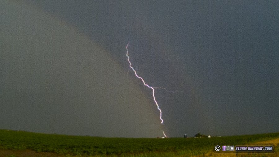
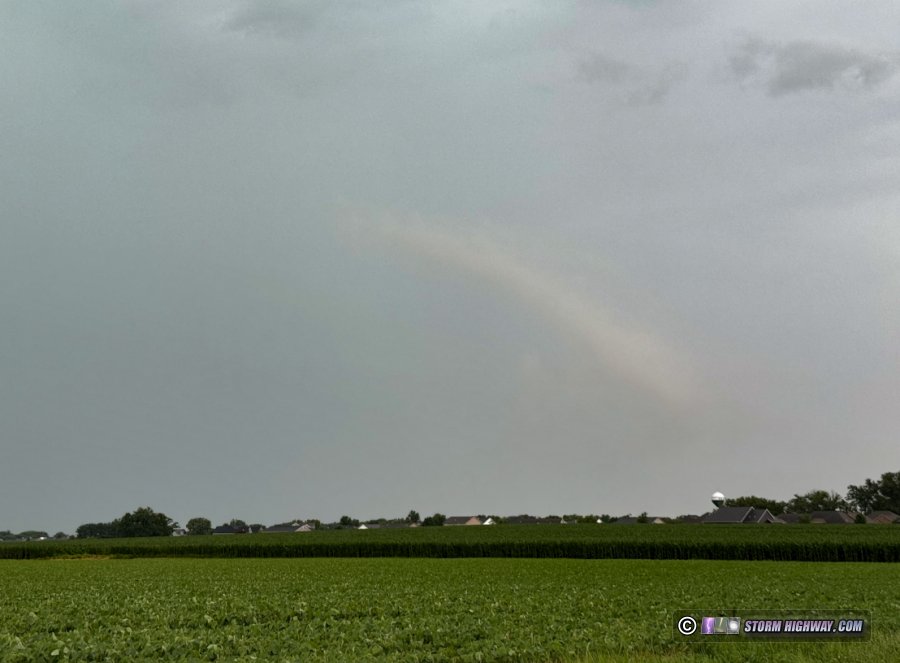
The boundary collision storms fired a little farther east than I'd expected, in a line from Okawville to Bartelso. These began producing lightning, but mostly buried in rain and uncooperative (once again) for high speed shooting. I only saved two short captures of distant bolts because of this rainbow in the foreground, an otherwise throwaway shot at the low 6,002fps resolution.
July 16: Bolts-from-the-blue near New Baden, Illinois
The second round of thunderstorms this day fired just before midnight. With a full work schedule this week, I didn't have time for another out-of-area chase, only a short run a mile north of town to watch these cells go by to the north along I-70 from Troy to Highland. A new leading cell over Highland began threatening bolts-from-the-blue with this clear-air channel:
...but one never happened. The storms were too far away for nighttime high speed shooting - I filmed anyway the entire time, but didn't get anything worth saving. The visible channels were mostly high-altitude, distant positive leaders in the anvil. These two were the best that the DSLR, clicking away on the tripod, captured:
After these faded, I arrived home only to go right back out for a new cell that had rapidly developed near Marine, just behind the first storms. This cell was firing off multiple bolts-from-the-blue before I could make it to my setup spot a half mile down the road. Unbeknownst to me, the short interval of air conditioning during the trip home and back had cooled the camera enough to cause the lens to fog almost immediately after taking it outside. I captured this double BFB on one 13-second exposure before the lens condensation covered the entire frame:
I got the camera inside and ran the heater on the lens to clear up the condensation, then took it back outside. By then, the storm was blocked by low/midlevel clouds to its south. Just an example of another one of the many ways you can lose a shot.
Yet another round of convection developed soon after this on the Highway 50 corridor, much closer to town. There were no bolts-from-the-blue with this round, but a few nice negative cloud-to-ground strikes:
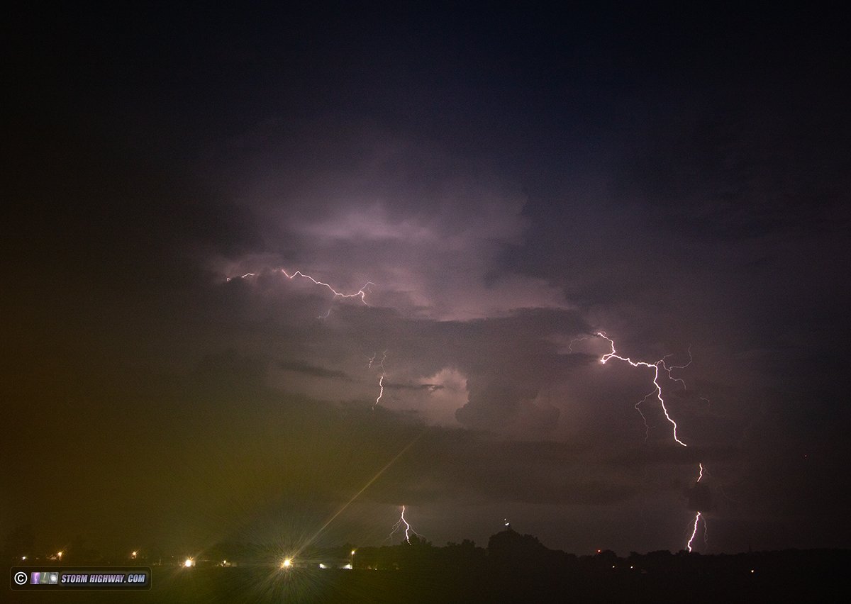
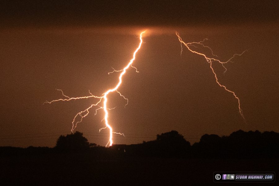
July 17: Lightning at New Baden, Illinois
A third straight day of thunderstorms in St. Louis, once again centered on the eastern side of the metro close to home. I began this chase on the way home from work, ending up at St. Morgan trying to stay ahead of new thunderstorms developing on the north side of a cluster of cells to the south.
The lightning, however, was concentrated on the back side of the storms near New Baden, so I gave up on the leading northern edge and returned to town.
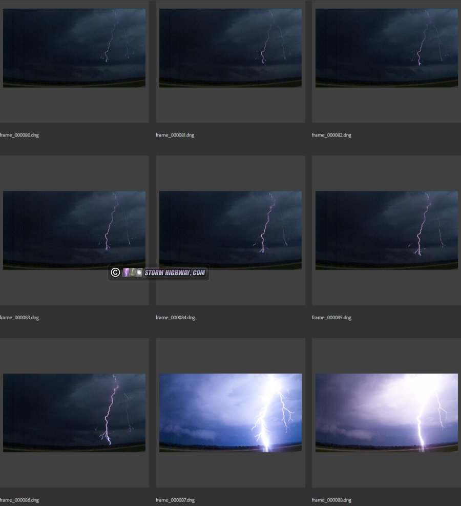
There was quite the barrage of bolts here, but once again, the best shot eluded me for a new reason: I had accidentally turned on the "auto record" function of the high speed camera. The touch screen menu is very sensitive on this camera, bumping it in just the wrong way will go into the main menu and change random settings without me realizing it. When I caught this great dart-to-stepped leader example, I saved the dart-to-stepped section first. Then, when I went back to save the first return stroke and spectacular main negative leader tree, the camera auto-recorded after the first save ended, erasing the memory buffer! I'm finding all kinds of creative ways to lose good shots this year.
Anyway, here is the dart-to-stepped leader segment of this bolt. These happen when the channel decays to the point of being non-conductive while the dart leader is still descending. At the time the channel becomes non-conductive, the dart leader following the old return stroke channel will suddenly transition to a normal stepped leader that forges a new branching path to the ground:
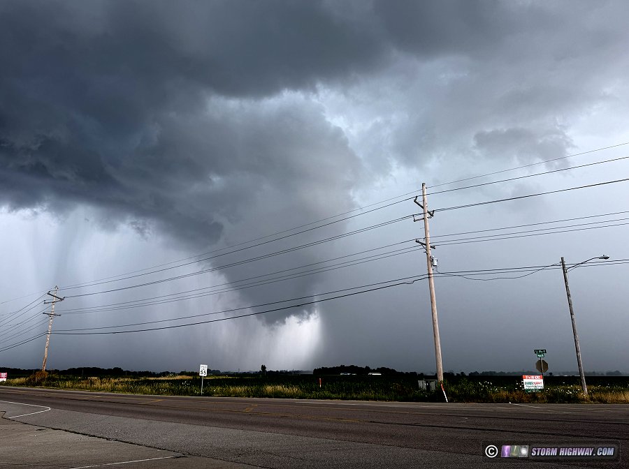
Near the end of the storm, this rope tornado look-alike, a harmless arcing scud cloud south of New Baden, probably made a few people do a double-take:
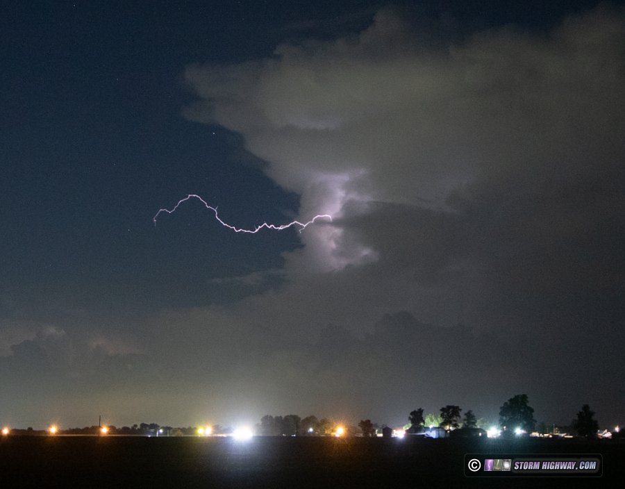
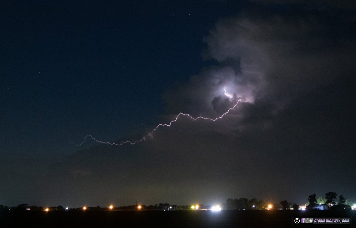
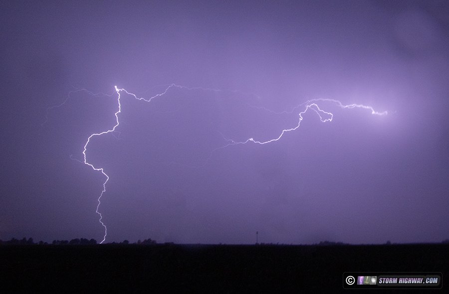
July 19: Lightning from New Baden to Trenton, Illinois
This storm woke me up at 6AM. I spent the next 90 minutes shooting the storm to the north of town as it backbuilt new uprafts on its western side. The lightning was mostly in the heavy cores, but every 5 minutes or so a bolt-from-the-blue would strike well south of the rain, sometimes as far as a mile to my south.
One of these bolts-from-the-blue struck a power line a quarter-mile away, complete with a bright flashover arc event that lingered for a full 2 seconds after the bolt. I missed this on the high speed camera, but it was squarely in the view of my driver's side dashcam.
Continuing the theme for this summer, the lightning was perplexingly uncooperative for my high speed camera, with everything striking out of frame on either side. Finally I managed to get a complete bolt in frame after more than an hour, but even it was far to the right side of the frame:
At the end of the chase, I went to retrieve the dashcam's MicroSD card - and promptly dropped it. It fell deep into the recesses of the rear seat back, impossibly far down in a small gap between metal and plastic. To get to it, I had to remove all of my equipment from the back of the car - a 20-minute task. I finally fished the card out with considerable difficulty.
I inserted it into the laptop to copy the file, but the card wouldn't read. I tried again to no avail. I took the card out and inspected it closely to see scratches are present from the top of the card to the bottom: damage as a result of its difficult extraction from deep in the seat back crevice.
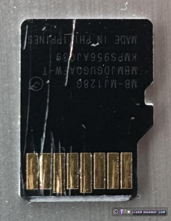
I learned a lot about data recovery from SD cards as a result of my January corrupted SD card ordeal (which I did get the data from, at a cost of $1,200 for the recovery services). Unlike full-size SD cards, the mass of a MicroSD card is almost entirely circuitry (monolithic) with only a tiny amount of plastic mass. That means that even a tiny scratch or crack can damage their circuitry beyond repair - no data recovery is possible when physical damage like this is present. This means the great shot of the close power line strike was lost. Incredibly, yet *another* valuable shot lost due to some crazy circumstance, leaving me with nothing but mediocrity to show for all of the effort. It's just been one of those years. July 20: Bolts-from-the-blue viewed from New Baden, Illinois
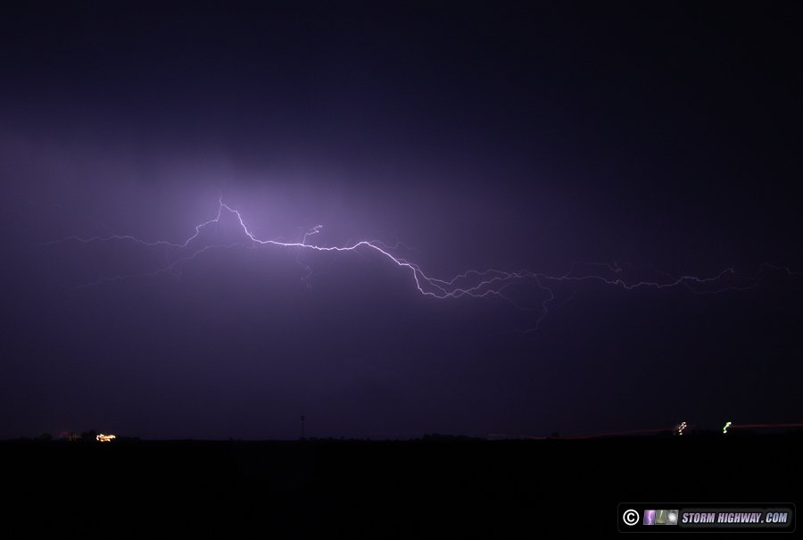
This storm north of St. Louis near Godfrey and Bethalto, Illinois produced numerous bolts-from-the-blue Sunday evening between 9:30 and 10:15PM CDT, viewed from 35 miles away at New Baden. Video and a few stills:

After this storm dissipated, I awaited a strong MCS (meso-convective complex) approaching from the northwest. Despite looking very promising with lightning as it approached, it mostly dissipated before arriving in the St. Louis metro, with not much visible lightning and no real photo/video opportunities. This was actually a good thing, as if it had persisted through the metro in the configuration it had been in, there would have likely been significant flash flooding.
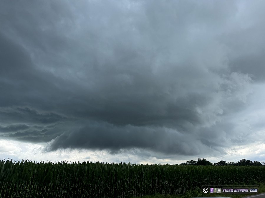
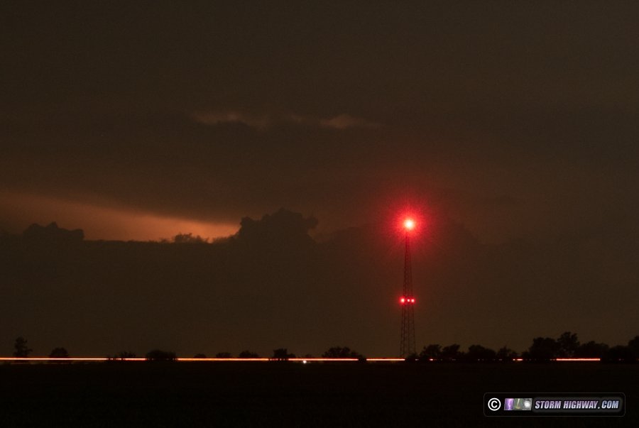
July 27: Lightning near Troy, Illinois
With my car in the shop since Wednesday, a limited-mileage rental car as well as a very busy workweek with long hours, I have not been able to chase the past few days despite daily thunderstorms in the St. Louis area. Most of those storms have been low-quality 'pulse' type cells with little in the way of photogenic lightning. Friday night's overnight storms were visible with frequent flashes to the north of the metro, but I didn't have time to try shooting anything. Sunday was the first day off I've had since Tuesday, and storms this afternoon near Troy were close enough to go up to near Trenton to watch it approach. The storm's updrafts ended up backbuilding to the west and staying pretty much stationary near Troy. The lightning never got close enough to attempt shooting. This was the view of the cell looking to tne northwest from near Trenton:
 July 28: New Baden, Illinois sprites bust July 28: New Baden, Illinois sprites bust
Another day off, but with no storms close by. That was fine with me while still limited in range by my rental car situation. At sunset, radar showed a large MCS in the Louisville, KY/southeastern Indiana area. The stratiform region was a little too far away for good sprite views (about 250-300 miles), but I set up just outside of town for about 20 minutes to do a few test exposures to see if any might show up. I couldn't see for sure, but it looked like a cirrus deck had drifted westward over southern Illinois, blocking the view of the sky over the distant storms. I couldn't even see any lightning flashes much less sprites, and the camera didn't pick up anything. With the high summer-in-the-corn-fields Midwestern dewpoints, it would have been difficult to see much that far away even if skies had been clear.
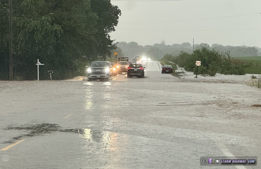
August 10: St. Louis lightning and flooding
This was my first chase exceeding 15 miles in 3 weeks, thanks mostly to the lack of storms and my a busy work schedule. I wasn't liking this day's setup. Any storms, period, were in question: weak flow, lots of cloud cover and the only source of low-level convergence being an old outflow from yesterday's big Plains thunderstorm complex settling in the metro by mid-morning. Some storms had fired behind this boundary southwest of the metro after noon. Given the weak flow, I didn't expect them to last. I didn't leave home until new cells fired right over downtown on the edge of the old outflow. I arrived to find these not producing much lightning of any quality, most of it was buried in heavy rain and no areas were producing bolts with the repetitive-ness needed to capture high speed video. The heavy rain also meant that I had no option but to shoot through the windshield. I rolled on the Arch for a while, capturing a distant bolt behind it that happened right when the windshield wiper passed through the frame - making it non-save worthy. No other visible bolts presented themselves.
The storms were barely moving, dumping 2 inches plus of rain within 90 minutes. Streets were beginning to flood in numerous places around the city, including on the riverfront. My return home had to detour around flooded spots plus the severely-jammed interstates caused by I-55/70 northbound being underwater in the usual spot at the I-64 junction. The storms dissipated as expected by mid-afternoon. August 16: St. Louis metro-east thunderstorms
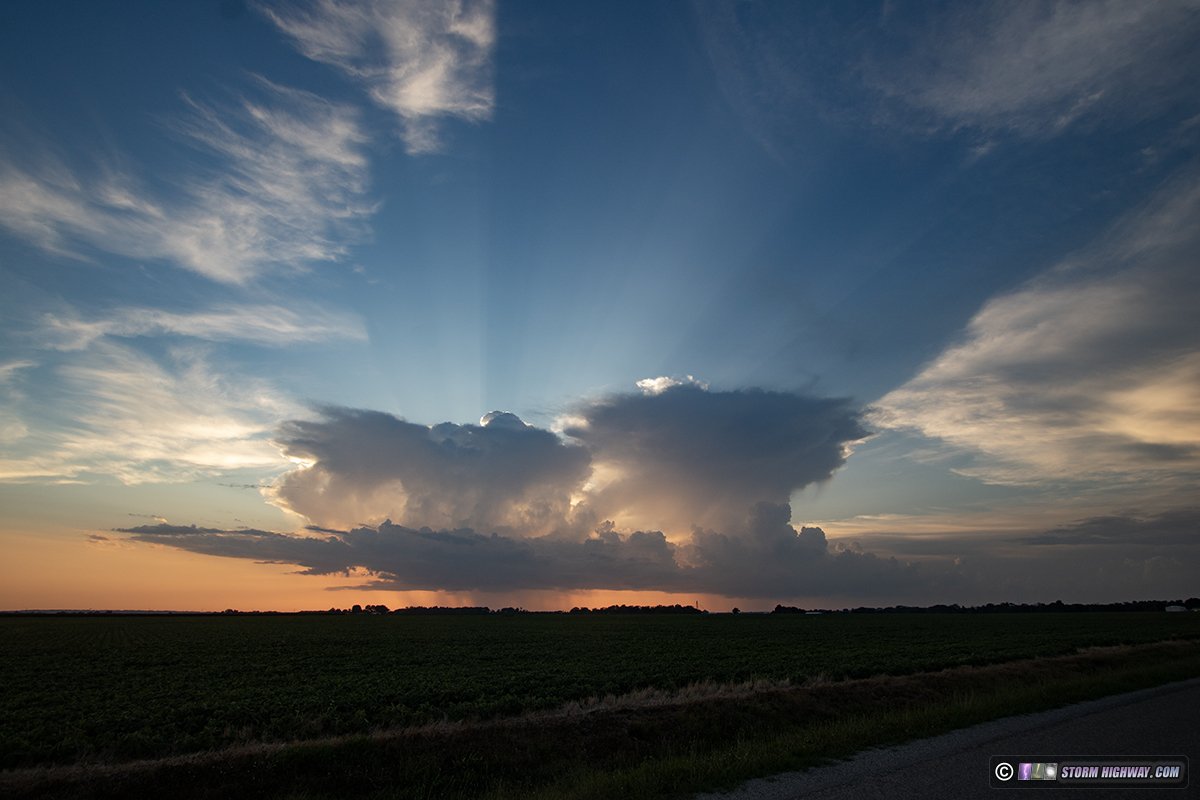
We've had numerous days this month with afternoon pop-up thunderstorms in the St. Louis metro, but none with the longevity or intensity to make chasing worthwhile during my latest interval of career commitments. Storms fired this day before I was able to leave work, and they apparently weren't going to last long enough for me to go home, get my cameras, and head back into the city. Instead, I drove over to Lebanon to watch a new storm go up that produced exactly one visible lightning bolt as I headed toward it. Its updraft dried up and vanished, leaving the core to slowly fade away. To the east, a stronger storm north of Nashville persisted for about 20 minutes. This classic "cumulonimbus with anvil" view of it from Summerfield was probably the best thing anyone was going to see from it, as it certainly wasn't going to last long enough for me to get closer:
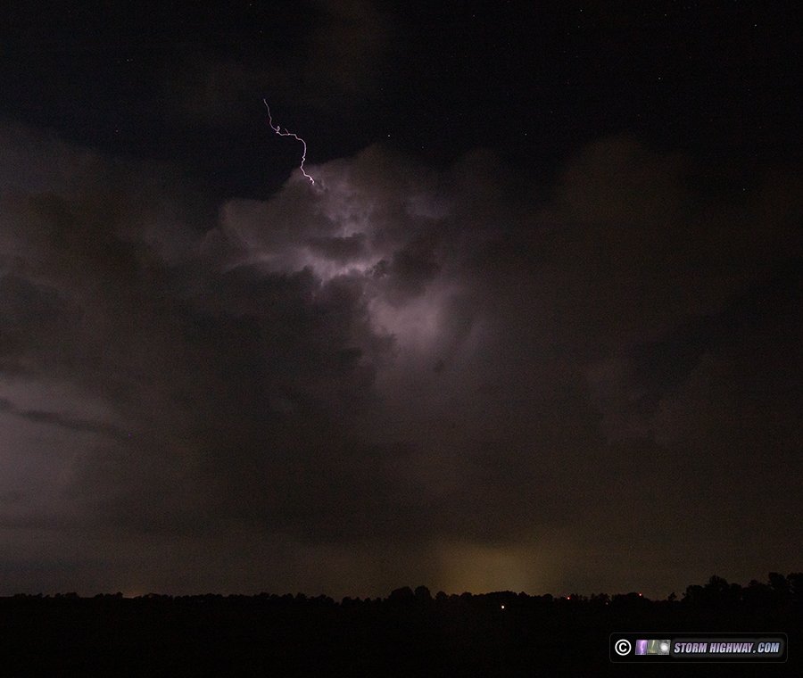
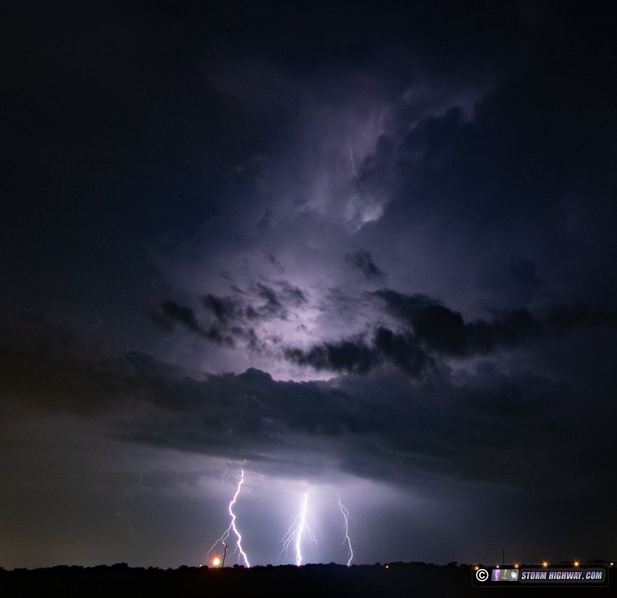
September 3: Lightning at New Baden, Illinois
The first autumn-ish cold front of meteorological fall brought the St. Louis metro the first nighttime lightning still photo opportunity in nearly 7 weeks. This was a low-effort (handheld, balancing the camera on the window frame) backyard outing just outside of town before and after midnight as several rounds of weak thunderstorms rolled through. The stronger activity in the metro was behind the front, with a few channels showing on the back side of the cells.
September 14: Lightning, aurora bust in eastern St. Louis metro
The sparse chase logs in the past two months is one of the indicators of our worsening drought here in the lower Midwest. Tonight's storms were the first in the metro area in 11 days, finally pushing me over the 20,000 chase miles mark for the year. I missed the first round of these down near Coulterville at sunset, but caught the second round after dark in Fairview Heights. These high-based storms had crisp high-contrast rain shafts, but only produced a couple of cloud-to-ground flashes (none of which I caught) along with mostly-above-cloud-base intracloud flashes. This at Caseyville:
The outflow winds caused a bright power flash near I-64, intense enough to show up clearly (along with the cloud illumination above it) on this 15-second exposure at F11:
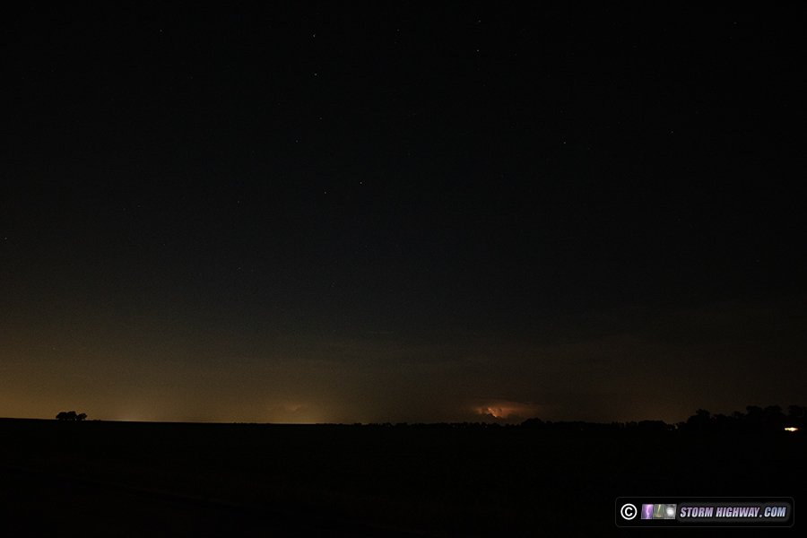
At home later in the evening, I went just outside of town to do a couple of test exposures for the aurora that had been reported visible at mid-latitudes. Though thickening clouds were starting to block the sky to the north, I could see through them to observe that no aurora were visible at the time I was out:
With most aurora events, you have to stay out for a long period of time to see the best bursts of activity associated with unpredictable substorms. This event didn't seem worth that even if we'd had clear skies, so I didn't stay out watching any longer than it took to do those three test exposures. To the southeast, flashes from distant thunderstorms (near Farmington, MO, about 90 miles away) were visible, so I set up with the 50mm lens for a few frames. No visible lightning channels showed themselves:
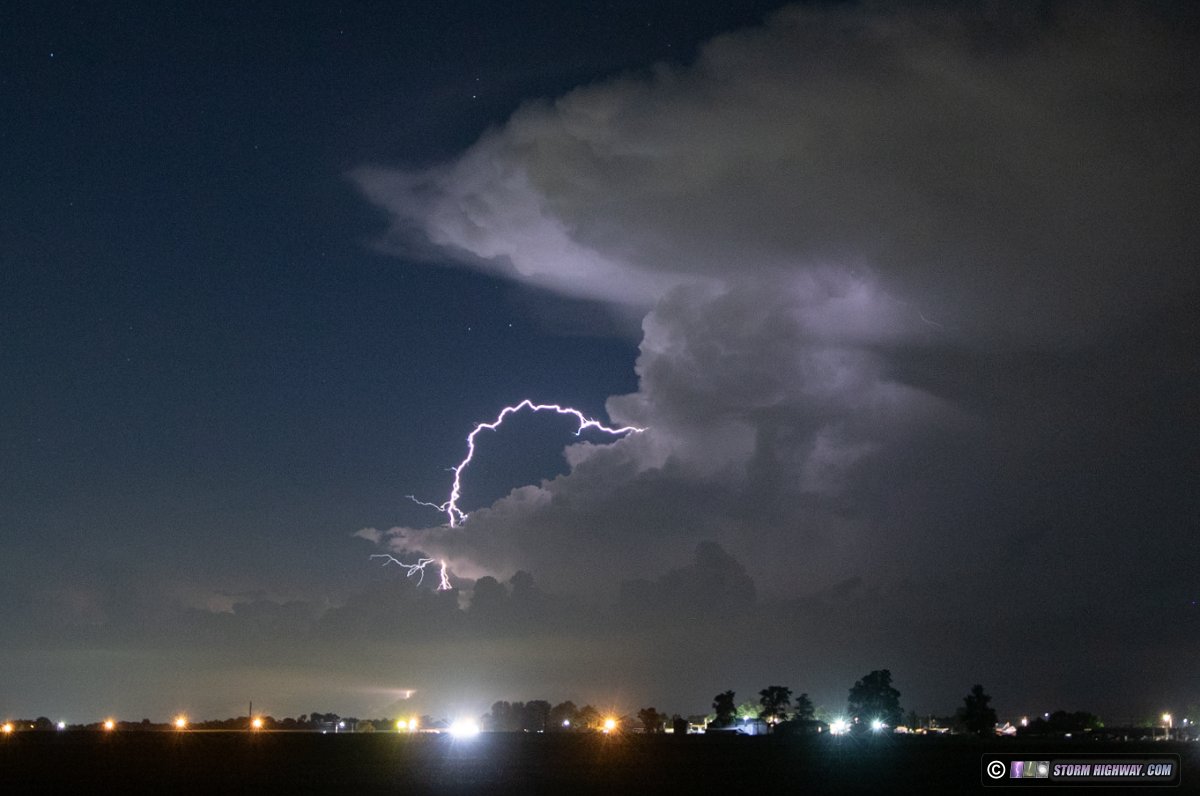
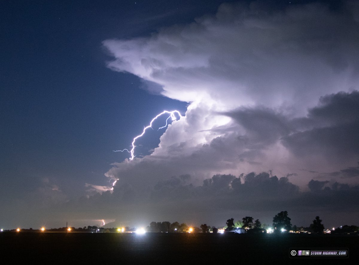
September 21: Lightning southwest of New Baden, Illinois
The final shoot of my professional storm chasing operation was this distant lightning southwest of New Baden. This storm has its own page here with a few more photos.
< May-June 2025 Recap | All Storm Chase Logs | October-November 2025 Recap >
GO: Home | Storm Chase Logs | Photography | Extreme Weather Library | Stock Footage | Blog
Featured Weather Library Article:
|


