|
Home | Blog Index | Blog Archives | Christianity & Faith Essays | Storm Chasing Essays
Cool and inactive period the for next 10 days: Plains forecast update 2, for March 17
I know it's been an uncharacteristically long gap in spring Plains forecast updates since the annual March 1 post, but I have a good reason for that. There hasn't been a lot of time to look at Plains weather when the Midwest has been so active! I'm on the board already with 4 tornadoes in my home state and Indiana. Those were the earliest in meteorological spring I've seen tornadoes (not counting winter severe weather events) and only the second time I've seen daytime tornadoes in March.
So, on to the upcoming weather! As is often the case with early active severe weather patterns, we'll 'pay for it' with an extended period of downtime afterward. Medium-range models are in decent agreement on two things persisting through at least the next 10 days. One, the upper jet pattern will be characterized by mostly northwest flow over the central and eastern continental US, and two, moisture will have a hard time staying in place north of Interstate 40 as strong cold fronts repeatedly push into the Gulf.
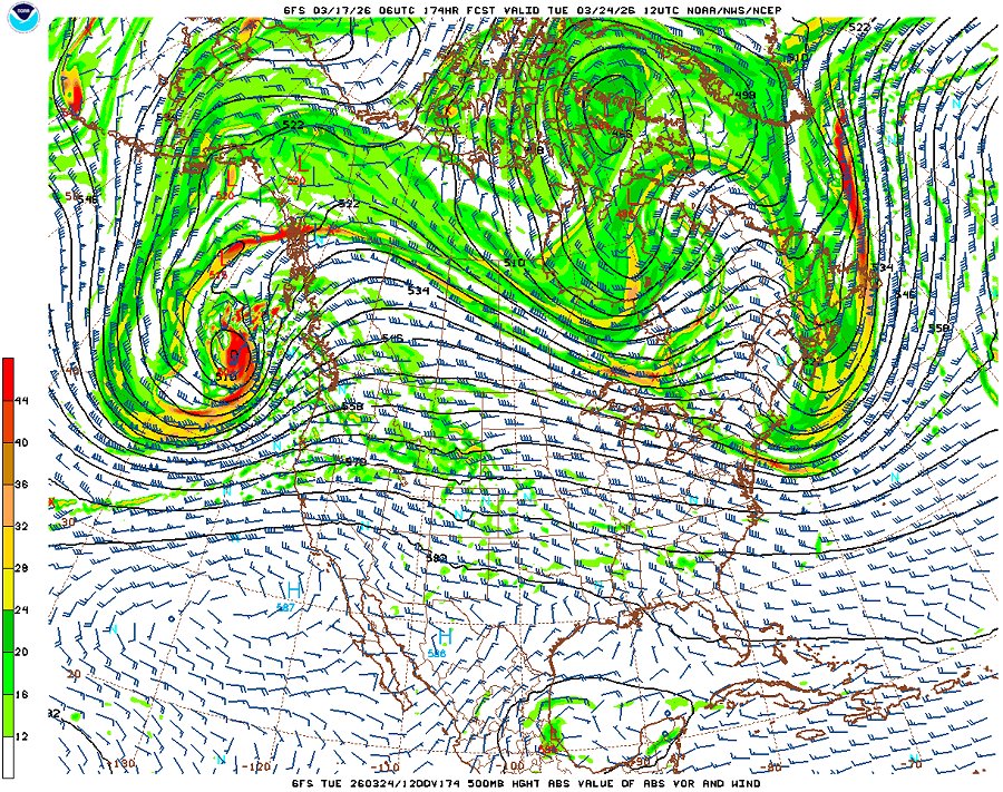
GFS 500mb forecast for March 24
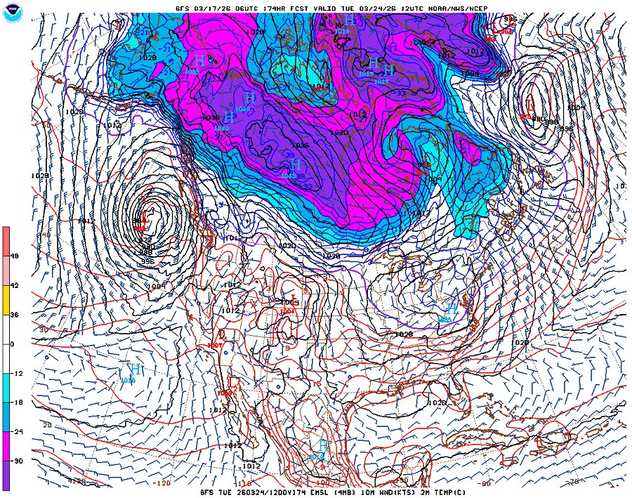
GFS surface temperature forecast for March 24
This pattern favors further cool/cold temperatures across the Great Plains and Midwest, and virtually nonexistent chances for severe storms. Despite that, some pooling of thinned moisture here and there across the Midwest is indicated as ripples in the jet pass through. That may bring us a couple of marginal cold-front generated lightning days, but even those doesn't look all that great.
Furthermore, as it's shown now, the threat of winter is far from over. As you can see by the temperature chart above, there is plenty of cold air hanging out in Canada that could surge south behind any strong system. What we have going for us is the higher sun angle of late March, which will quickly warm any frigid air masses that make it that far. All of this is not unusual or unexpected this time of year, of course. We know spring will win eventually.
In a nutshell, a Great Plains expedition appears very unlikely during the remainder of March.
| 2026 Plains Chase Expeditions - Probabilities as of March 17 |
| March 17-24 | 0% | |
| March 24-31 | 5% | |
|
GO: Home | Storm Chase Logs | Photography | Extreme Weather Library | Stock Footage | Blog
Featured Weather Library Article:
|


