|
Home | Blog Index | Blog Archives | Christianity & Faith Essays | Storm Chasing Essays
Model flip-flops improve weekend supercell/tornado chances: Plains forecast update 9, for May 13
I've you've followed my chase forecast blog updates over the years, you know why I don't go very far beyond 7 days in terms of chase trip planning. That's because the springtime jet patterns over the USA are notoriously difficult to forecast very far in advance. The only way you can say much about the 7 to 10 day period is when you have really good and consistent agreement among all of the various models. If you don't have that, dramatic flip-flops in the medium-range are possible. This week's pattern evolution is a good example of that.
In my last post, I mentioned the possibility of a system this weekend that could bring a chase day or two. Newer model runs have flip-flopped to improving those prospects and increasing their duration. The Saturday to Tuesday timeframe (May 16 to 19) appears to be shaping up to be potentially Plains-trip worthy.
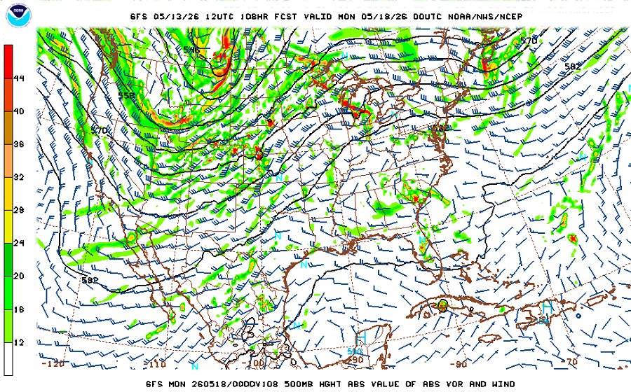 GFS 500mb forecast for 7pm Sunday evening the 17th GFS 500mb forecast for 7pm Sunday evening the 17th
Right now this doesn't look like a blockbuster system, but it's got the basics of what supercells and tornadoes need: fast upper-level flow overtop of good-enough moisture at the surface, and indicated convective precipitation during the daytime hours. But, it also has the typical caveats of potential mistimed upper level support, a strong cap and moisture quality up against the dryline.
Again, my personal Plains expedition criteria for the severe weather patterns are anomalously high this year, with $5/gallon gas and my inability to depart until Sunday, among the other issues. A one-to-three-day trip from Sunday to Tuesday might be doable if these conditions can make it to the I-70 latitude. The Midwest also appears to be poised to be included in some of this system's tornado potential, further complicating the idea of a westward trip. For now, I'll place Plains trip probabilities in the 65% range for the weekend.
The end-of-the-month period following this weekend's wave is still very much indeterminate, with models not agreeing much on what appears to be a complex and nebulous upper jet configuration. We'll just have to wait until models settle in to say anything more about it.
The following table plots the probabilities* of a Great Plains chase expedition taking place for the date ranges shown:
| 2026 Plains Chase Expeditions - Probabilities as of May 13* |
| May 13-16 | 0% | |
| May 17-19 | 65% | |
|
*Base/normal-season probability values are shown. Subtract 35 to 45 percentage points for effective copyright infringement imposed probability values.
GO: Home | Storm Chase Logs | Photography | Extreme Weather Library | Stock Footage | Blog
Featured Weather Library Article:
|


