|
Home | Blog Index | Blog Archives | Christianity & Faith Essays | Storm Chasing Essays
Great Plains 2026 Storm Chasing Expeditions: Epilogue and Logs
Season Epilogue: The decision to not chase the setup in Kansas on Thursday, June 25 marked the end of my 2026 Great Plains storm chasing season. The summer ridge looks to be settling in by next week, bringing the peak tornado season in the central and southern Plains to a close. The Northern Plains looks to remain active for a while, but those areas are outside of my normal travel range.
What a strange and remarkable spring this was! It was a much longer season that normal, with much of the action away from the typical areas. Late June is well past my typical end-of-Plains-season chase trip standby period - but the unusual persistence of the upper jet at mid-latitudes this month meant that Plains expeditions were on the table for a much longer timeframe.
The defining characteristic of this year's chase season wasn't in the Plains. Instead, it was the Midwest's historic levels of tornado activity. With multiple major outbreaks, Illinois has already obliterated its all-time annual tornado record, passing the 200 mark before the year's halfway point. Not only that, Illinois sits leagues ahead of all othere states in total tornado counts. My own stats reflect this unusual season: 10 tornadoes in Illinos/Indiana and only 3 in the Plains (Kansas). It's the first season in my career when I chased both the Great Plains and the Midwest, and saw more tornadoes here than in the Plains! As I consider the Midwest as my 'home area' distinct from the Plains, those chases aren't a part of this summary page. Those can be found on my 2026 logs page if you're interested.
Most of my Plains chase season this year was limited by the copyright infringement/piracy issue. I only made three relatively short trips to the Plains for a total of four chase days, all within the states of Kansas and Missouri. One of those days resulted in a 3-tornado event. Thankfully, the successful resolution of multiple infringement cases in early June brought a small infusion of financial support for the remainder of this month's operations and through the summertime. But it was the Midwest - particularly Indiana and my home state of Illinois - that ended up with all of my mileage during this time.
All in all, it was a good season. The May 18 Kansas tornadoes helped me reach my personal 200th tornado in Indiana on June 11. I'm always thankful to be able to make it out west and spend some time in one of my favorite states (Kansas). Now it's on to see what the summer months will bring!
2026 Spring Plains Season Totals:
- Plains expedition trips: 3
- Plains days on the road: 6
- Plains chase days: 4
- Plains tornadoes: 3
- Plains trip mileage: 3,524
- States covered: 2
2026 Great Plains Chase Day List
 Day 1: April 26: Supercells and close lightning from Riverton to Altamont, Kansas (Trip #1) Day 1: April 26: Supercells and close lightning from Riverton to Altamont, Kansas (Trip #1)
I was working a string of midnight shifts during this past week, and consequently wasn't expecting to be able to chase any of these events away from home. After a coworker graciously swapped shifts with me, I was able to get some sleep on Saturday night, go to the early church service and depart St. Louis after 11am for the first Great Plains trip of the year.
This day's setup was rather complex. Multiple outflow boundaries, two parallel warm frontal zones and a dryline-stationary front intersection were expected to provide opportunities for tornadic supercells mostly east of I-35 along the Kansas-Oklahoma border into western Missouri. Despite my late departure from St. Louis, all of these areas were within my reach, so I began the trek down Interstate 44 for a starting target of Baxter Springs, Kansas.
The primary warm front was located to my west, but a second parallel warm front was apparent on surface observations directly overhead. Soon after I arrived in Baxter Springs, thunderstorms began firing on the latter boundary directly overhead, with a nice supercell taking shape. This was producing some good negative cloud-to-ground lightning, allowing for a really nice 6,000fps high speed capture near Riverton:

This storm initially had a healthy-looking updraft base, but soon it became apparent it had crossed the boundary and gone elevated. A low ground-scraping arcus developed on the outflow that looked ominous, but was actually a harbinger of the storm's long-term cessation of tornado potential. I stayed with the storm to near Jasper, MO before breaking off and heading west to the better-looking supercell that had gone tornadic near Independence, Kansas.
I arrived on this storm at dusk near Altamont, south of Parsons. It was now a high-precipitation (HP) blob, with any visible tornado chances looking slim to none. It was producing some decent lightning, so I set up for stills as tornado sirens wailed in the distance:


I moved east after the RFD precip began catching up. At this point, multiple storms were forming to the south and merging with the supercell in its forward flank. This happened 6 or 7 times as I stopped to watch at Hallowell. There were a few bursts of negative CG lightning here, and I caught a couple of OK 6,000fps shots.
After the final merger, the storm rapidly developed a new RFD surge that overtook me here. I scrambled east to get back out ahead as new tornado warnings were issued. Lightning ahead of the storm picked up, with numerous close bolts. I stopped several times to attempt high speed shots, but all of these bolts were uncooperative in the very short intervals I had to keep ahead of the RFD. I only captured them on the dashcams. This one near Sherwin struck a power line just to my east:

Another in the field just to my west near Columbus:

The storm was continually tornado-warned from this point on, but anything would be hopelessly rain-wrapped. I decided to just call the chase and begin the drive home. I wanted to ensure I was rested for what was potentially a very big event back home the next day. I stopped one more time south of Carthage to watch this storm move over Joplin, but the good lightning had become much more sporadic and there wasn't anything else worth shooting.
I caught up to some of the earlier supercells at Waynesville, encountering some pings of what sounded like quarter-sized hail. I ended up in yet another tornado warning near Rolla for a circulation well south of the interstate that I wasn't in position to have a view on.
The drive between here and St. Louis was very difficult. I just could not get out ahead of the heavy precip cores. I finally broke free of these at Fenton, making it home at 3:30am.  Day 2: May 17: Supercell and Mammatus near Lincoln, Kansas (Trip #2 start) Day 2: May 17: Supercell and Mammatus near Lincoln, Kansas (Trip #2 start)
This two-day severe weather episode was configured optimally for a second Great Plains trip. Both day's targets were fairly close together (north-central Kansas to southeast Nebraska) and it would be a limited-mileage transit out and back on Interstate 70: ideal for my current limitations.
The primary target this day was farther north in Nebraska, but I would not be able to make this area as I couldn't leave until Sunday morning. So, I planned to cover the secondary target along the dryline farther south in central Kansas. Upper support was weaker in this area, but sustained convection was indicated and supercells were likely.
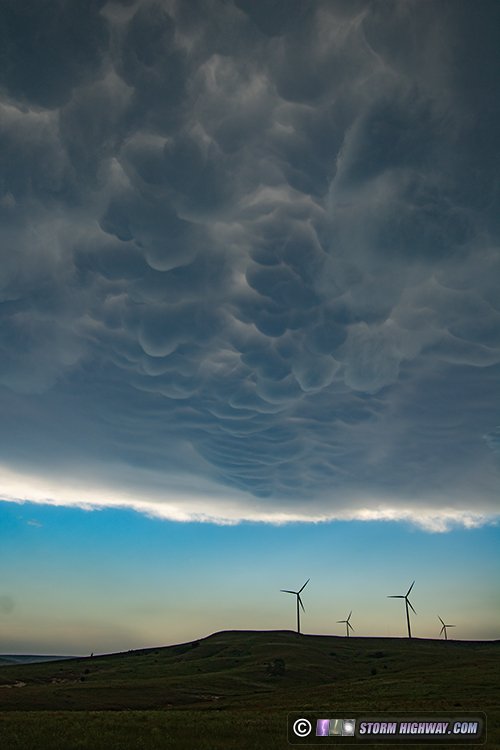
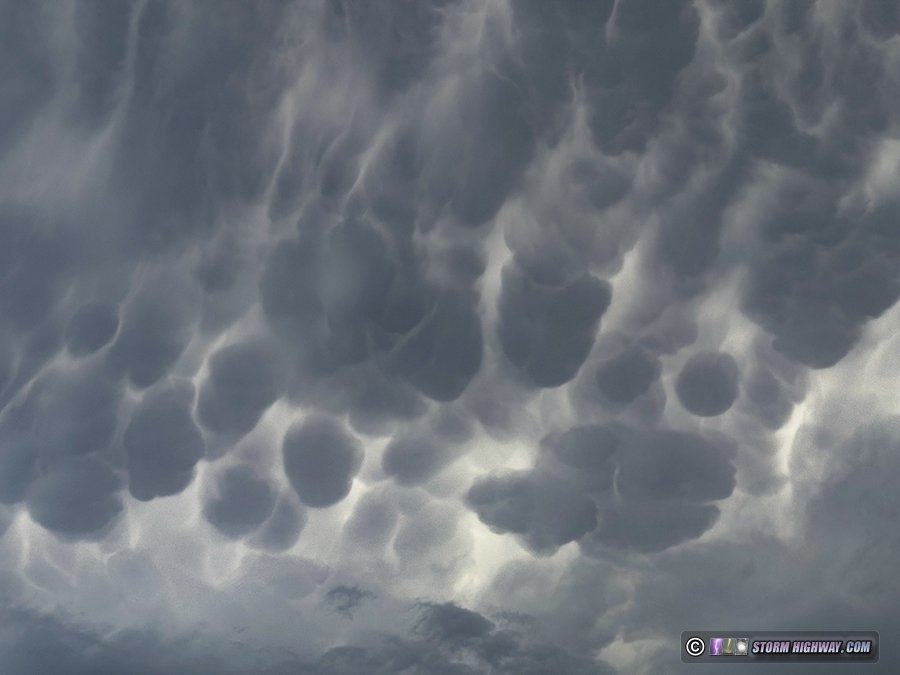
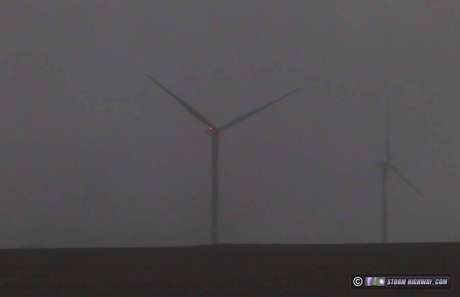
I departed St. Louis in the morning and arrived on the storms in progress south of Lincoln, KS. Already, the supercell/tornado threat was mostly over thanks to the storms being high-based and outflow dominant. There was a great display of mammatus in the leading anvils. I parked ahead of the storms and watched this for about an hour:
Eventually, several kinks in the outflow developed and the storm was attempting to fight back the linear evolution. The northernmost area managed to develop a nice RFD which cut into the base with a visible clear slot to the north.
This became tornado warned, but I did not see any evidence of a tornado. The storm was simply too high-based with the outflow pushing too hard.
I headed up to Tescott to stay with this area, encountering low visibility due to RFD-lofted dirt. By the time I reached Highway 81 at Minneapolis, this RFD surge had weakened. The outflow from the entire complex now led every other storm in the line by at least 10 miles, completely ending any further tornado threat.
This storm to the southwest intensified briefly, but it was competely north of the outflow and had no chance of producing a tornado. The lightning and lighting was nice as the setting sun peeked through the core:
My original plan had been to shoot upward lightning the the storms' trailing stratiform region, but overall lightning in the complex was not very impressive and the bulk of the stratiform region was far to the northeast. Thinking this wouldn't be worth the extra 2-hour drive northeast, I decided to call the chase and head to Salina for the night.
  Day 3: May 18: Palmer, Blue Rapids and Holton, Kansas tornadoes (Trip #2 end) Day 3: May 18: Palmer, Blue Rapids and Holton, Kansas tornadoes (Trip #2 end)
VIDEO: Close intercept of tornado near Blue Rapids, Kansas
VIDEO: Drone view of power flashes over Kansas City
A successful chase in north-central Kansas! Three tornadoes observed, one south of Palmer, one on the north side of Blue Rapids and a QLCS tornado at Holton.
I started the day in Salina. The day's primary target was where storms encountered the outflow boundary positioned roughly along Interstate 70, which as essentially right overhead of where I was. So, I had plenty of time to get an oil change and go through some of the photos and videos from yesterday's chase.
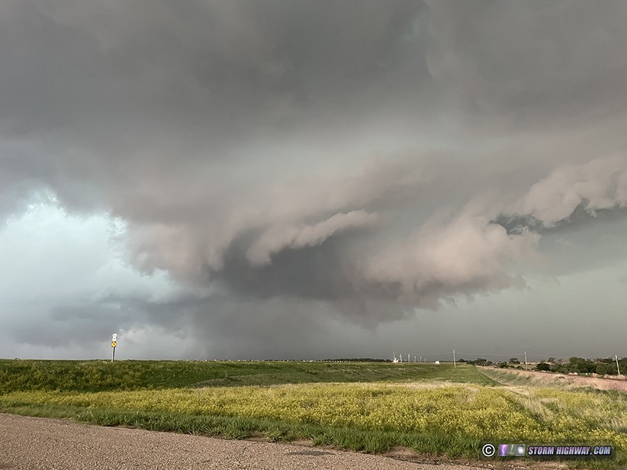
As the morning progressed, the main problem for this day's tornado potential was evident: the upper-level wave was already arriving before noon. At 11AM, visible satellite showed a cumulus field was already agitated to the west and north along the dryline and the frontal boundary. Storms would likely fire very early, with a risk for them to become outflow-dominant before they could organize and before strong instability could develop. I made my way slowly north and west to position for the cells that began firing just after noon. A dominant cell emerged to the west near Lincoln, so I made the quick jump over to it.
I arrived on this storm just south of Lincoln to find a strong RFD surge already cutting in. Eventually, a mesocyclone occluded and rotation began to tighten up:
This fell apart, leaving a ragged horizontal funnel rotating directly overhead, which dissipated before I could stop and get a camera on it.
The new meso cycle was taking shape to the east, so at first I intended to use the unpaved roads to stay with it. But every secondary road was dirt and saturated from the previous day's rain, so they were total no-gos. I had to just go north to Lincoln and then east on Highway 18 to reintercept the storm. The new meso spun up at Beverly with a classic RFD clear slot, but motion was weak and high-based. A well-graveled road to the north allowed me to stay with this for a few minutes, but again, all of the eastward roads were mud. I had to turn around and go back to Highway 18.
Chaser numbers were expected to be high on this day due to it being peak season and a well-advertised strong tornado risk. The strategy to deal with this is to stay close to or just ahead of the storm, as the vast majority of chaser traffic is located behind the storm. My short move north at Beverly allowed the leading edge of the chaser crowds to catch up, and I had to join the beginnings of the "conga line" on Highway 18.
The main problem I've found with these lines of chaser traffic is that most are unwilling to pass slower-moving vehicles, even with the long, straight and safe passing zones common in the Great Plains. This means if you want to pass the slow vehicle, you'll have to make a long pass of sometimes as many as 10-15 vehicles.
The line of chasers on Highway 18 was moving east at a good enough clip to not be an issue until just east of Tescott, where a utility truck traveling at 55mph (speed limit was 65mph) slowed the line significantly. But no one would pass it! Highway 18 here is perfectly straight and flat, with miles-long passing zones. And oncoming traffic was sparse. After 10 minutes of no one passing the truck, I finally was able to pass the entire block during one of the miles-long stretches with no oncoming traffic. Had it not been for those long passing zones, I may not have been able to stay with the storm. Many other chasers got mired in this increasing chaser traffic jam as it reached critical mass east of Highway 81.
The four-lane Highway 81 allowed me to get ahead of both the storm and the chaser crowds, most of which stopped to watch the storm cross the highway. I reintercepted the updraft at Miltonvale, but it still appeared to be having trouble focusing a low-level circulation. As I was now ahead of the storm and the crowds, it was fairly easy to stay with the updraft region.
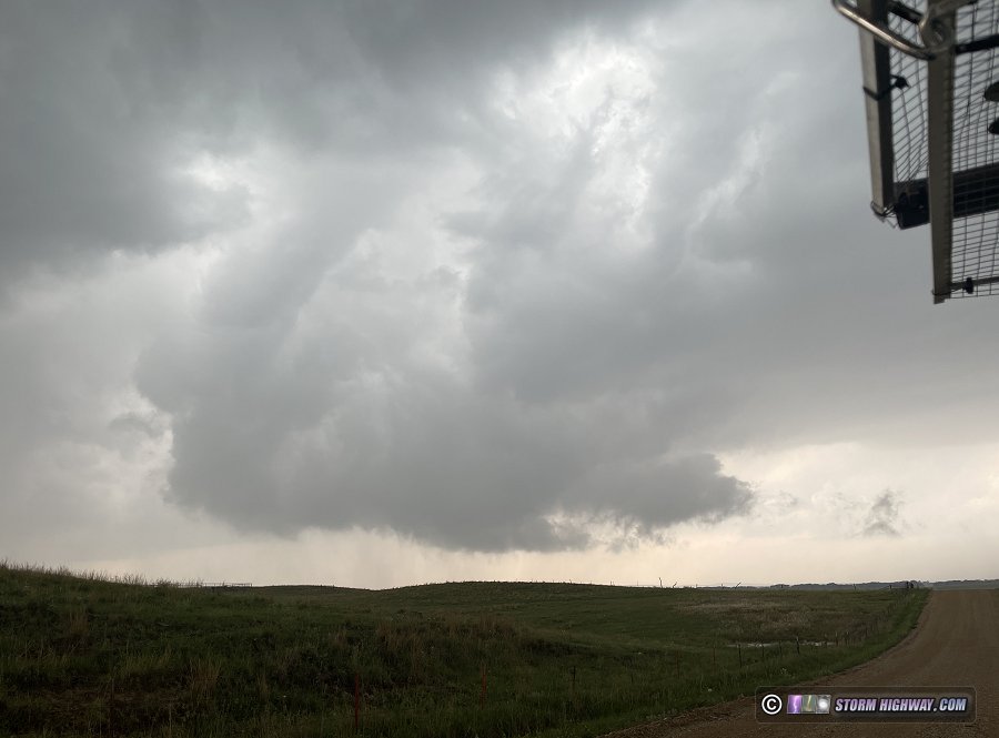
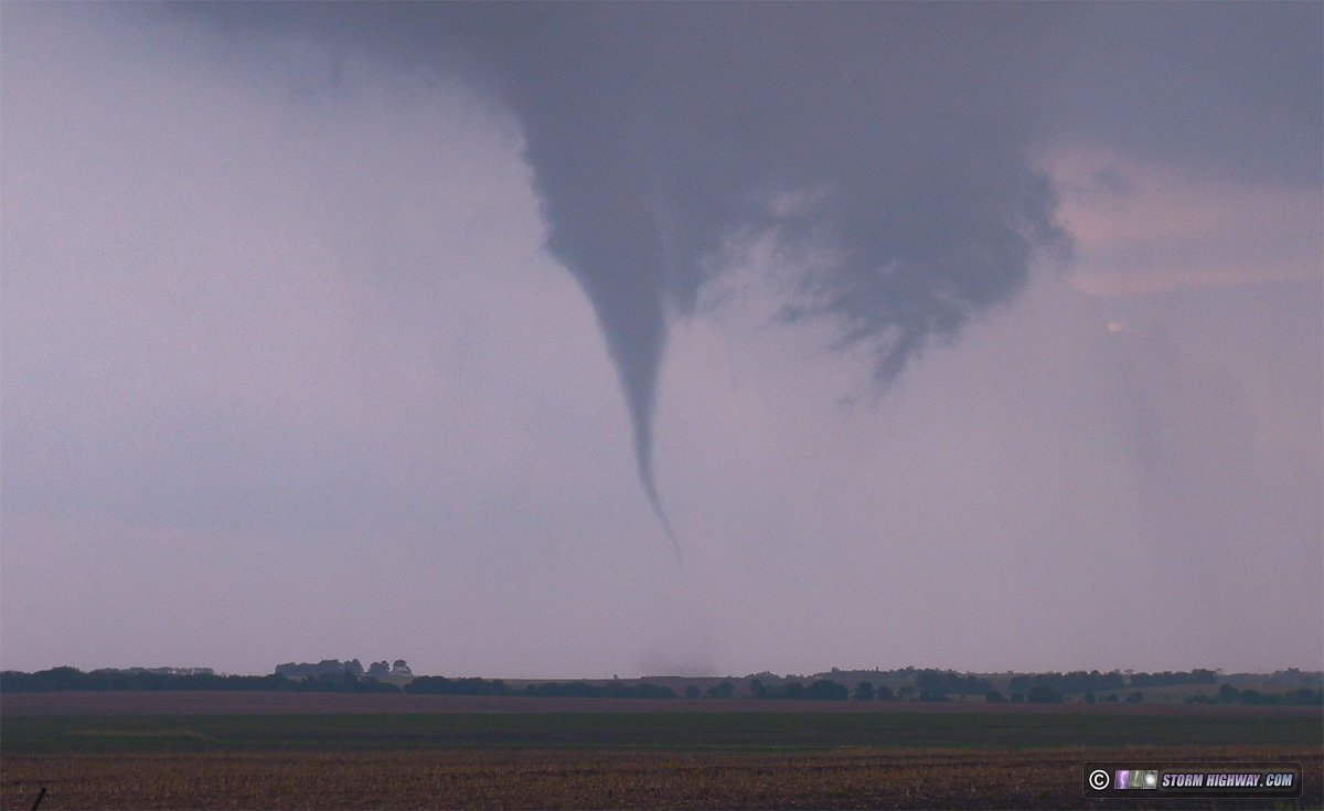
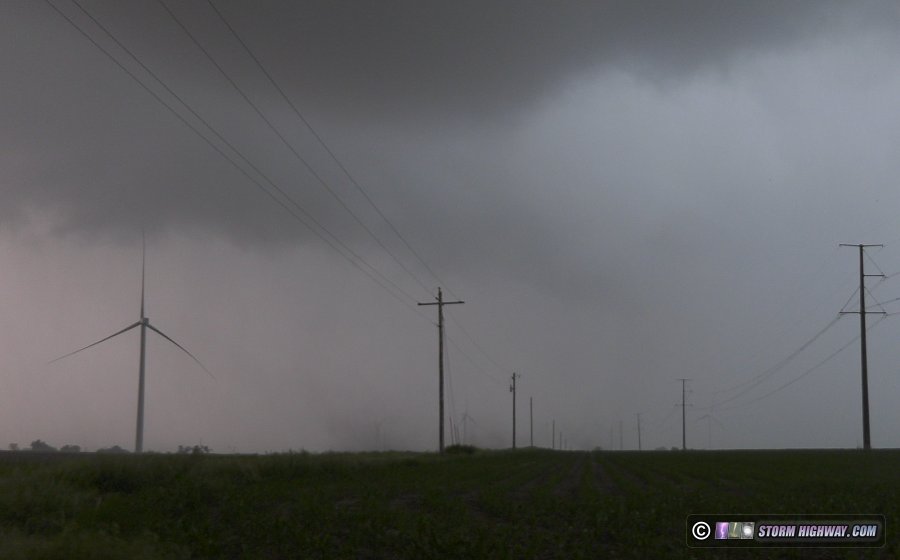
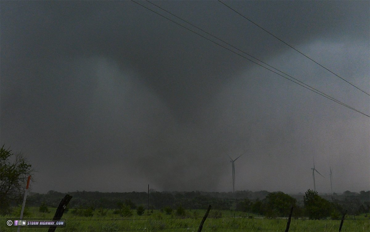
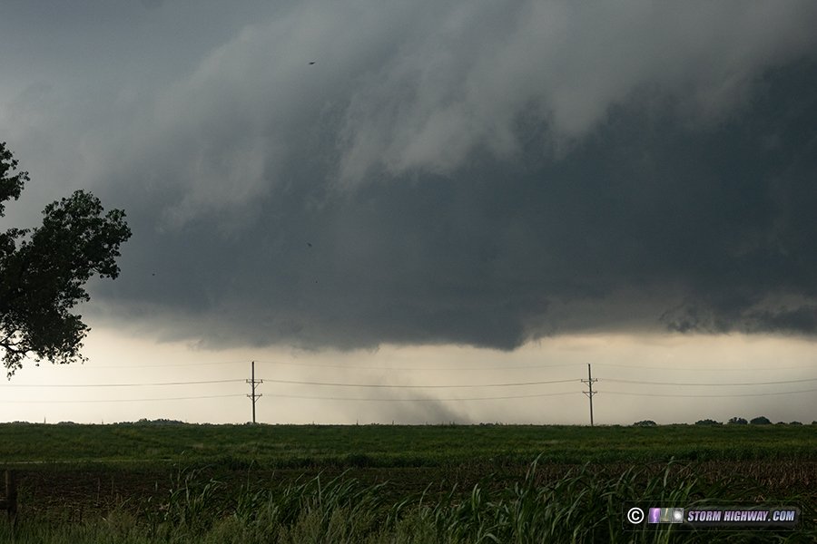
Just south of Palmer, the next RFD surge began and a circulation quickly developed nearly overhead as I turned north on Highway 15. The updraft base was very narrow, but the leading edge was rounded and the rotation at the eastern side was rapid and imminently tornadic. The tornado developed just east of the road and remained steady-state as a narrow cone for several minutes:
I wasn't willing to risk possible mud on the unpaved road grid, so I decided to go north then east to Greenleaf to reintercept the (hopefully) still-in-progress tornado. But, by the time I emerged from the rain on Highway 9, the tornado had dissipated.
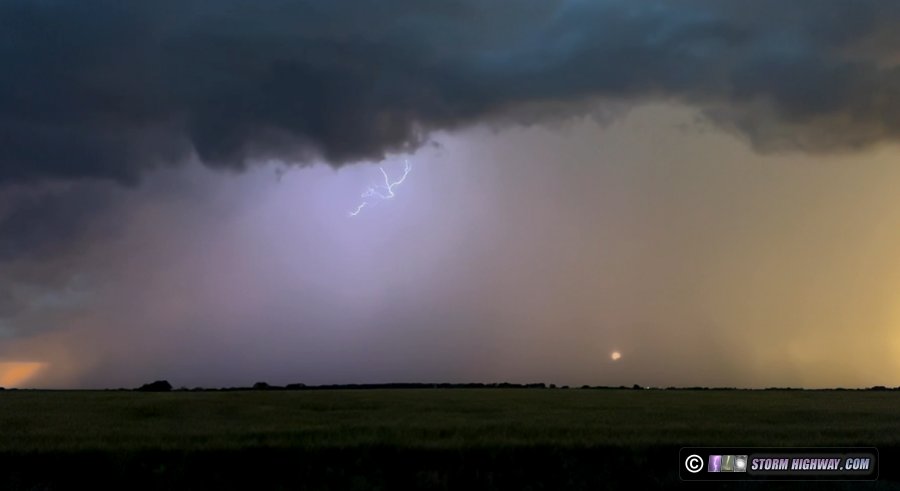
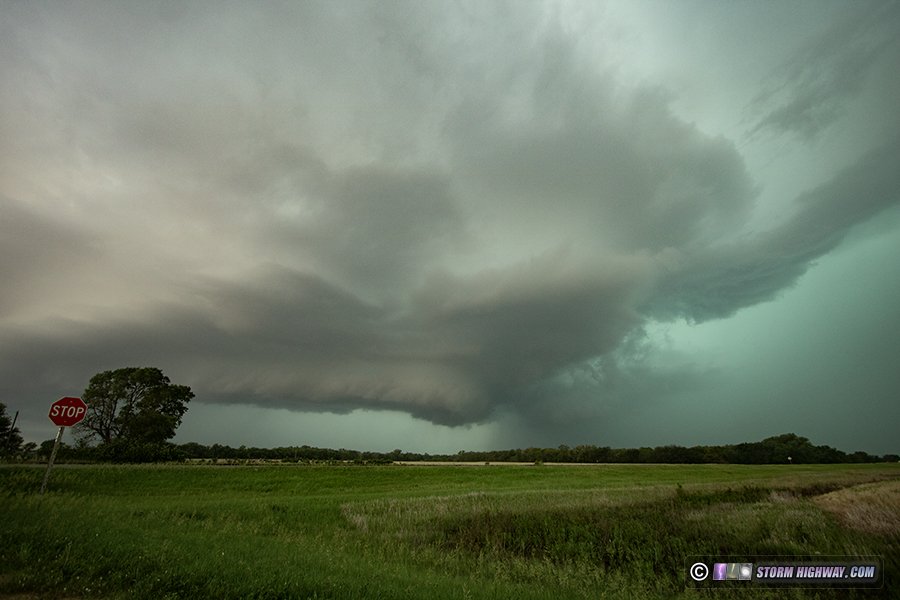
I refueled in Waterville. The original tornadic storm appeared to be weakening with another storm to the south taking over. I went a few miles of town to watch this approach. After several cell mergers were complete, the storm began ramping up in intensity. A long-duration barrage of positive CG lightning began as the updraft became visible. A strong RFD was surging, and a tornado appeared to be minutes away. I played tag with the RFD precip a few times, only able to stop for about 10-15 seconds at a time to look back and up at the action area very close. A tornado was reported close to me here, but I did not see it due to having to focus on driving (sometimes I need eyes in the back of my head)!
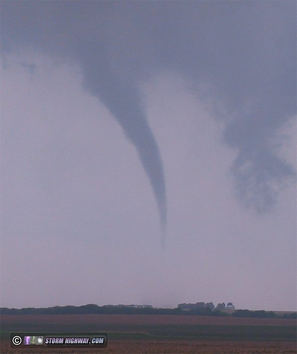
The road I was on was thankfully paved to the east, so I again had an easy time staying ahead of the storm to Blue Rapids where the its low-level organization rapidly increased. A tornado developed very close as I turned east on Highway 9. I could see a lot of chaser traffic behind me, so rather than immediately stop and shoot video here, I decided to get ahead a little more so I could position for a more precise and less-chaotic intercept. A gravel road to the north was positioned perfectly for this. As I moved north, the tornado in rope form periodically condensed up and down to my west:
I moved up ahead of the tornado and watched it approach. At this stage, it was in truncated cone/bowl form with intermittent subvorticies appearing at ground level:
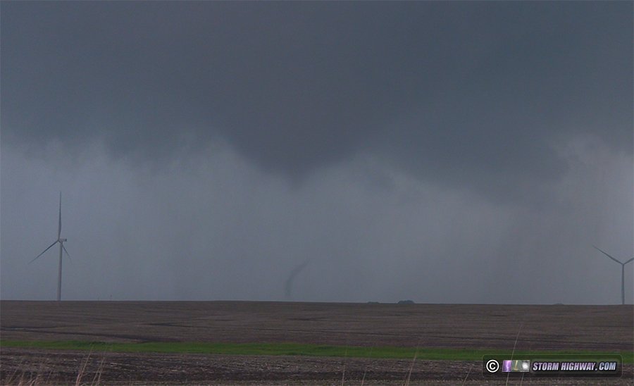
I zoomed in on a couple of the wind turbines as the debris cloud passed close by them. The tornado was still relatively weak here and none of the turbines appeared to get hit:
The tornado ended up moving directly at me here, so I had to move north a few hundred yards to get out of the way. I stopped to watch it cross the road to the south. Again, it was very weak, leaving two rows of power lines unscathed:
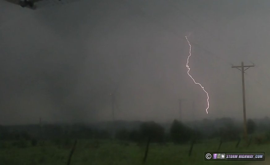
The road east here was thankfully well-graveled, allowing me and a handful of other chasers to trail just behind the tornado. It underwent a short interval of intensification as it crossed this road, with multiple strong subvortices and an audible roar as it entered a wooded area to the north. This was its peak intensity, at least during the time I had a visual. Rain wrap was getting heavy, reducing the lighting and contrast even at this close of a range:
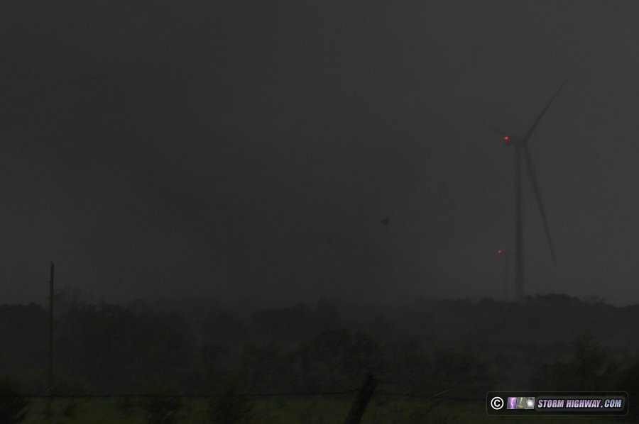
Lightning struck a wind turbine behind the tornado:
Dashcam timelapse of this intercept:
The tornado weakened, and I didn't have a great option to stay with it northeast. Another cell to the south appeared to be the next play, so I decided to just head to the next north-south road to the east. Thankfully, the unpaved road was graveled all the way to this point at Centralia.
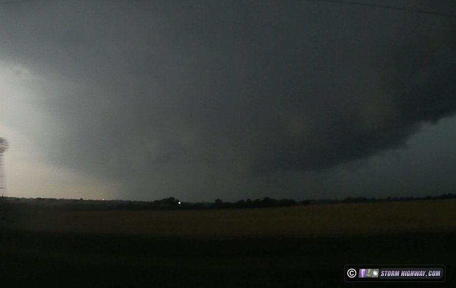
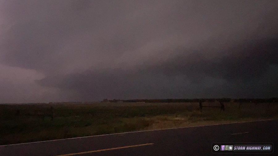
By now, the outflow was starting to win the battle, managing to push south and east several miles ahead of the updrafts. The storms made a few more attempts to re-establish surface inflow, but could not stop the transition to a squall line. A good barrage of negative CG lightning at Kelly was uncooperative for my high speed camera, and when that was over, the tornado portion of the chase was done - or so I thought.
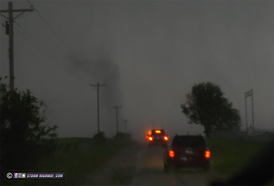
A developing line segment overtook me as I drove south, and when I broke free of the precip to its east, a tornado warning sounded for a QLCS tornado as I was passing through Netawaka. This was approaching me rapidly, and I felt like I didn't have time to stop or else risk getting caught by it. I did not have a good visual on this area as I drove east, only grabbing glimpses of it (it was on the passenger side of the car). It looked like there might have been something interesting going on at the time, but I just could not safely get a good enough look at it. After seeing the damage survey for the EF1 tornado near Holton, I reviewed my dashcam after arriving home to see the tornado was clearly visible on the dashcam. I'd seen this with my eyes, I just didn't have a good enough look at it from the wrong side of the car to say anything definitive:
After this passed, I decided to continue south to Lawrence to pick up I-70 to go home, ensuring I'd stay ahead of the storms for a rain-free drive east. A large stratiform precip region behind the storms offered great upward lightning potential, but shooting that would mean another night on the road and having to use another day of PTO for Tuesday.
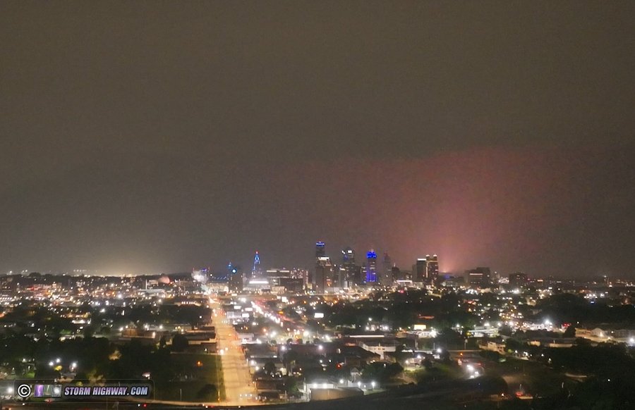
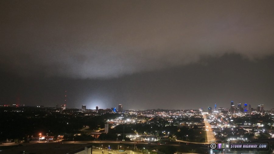
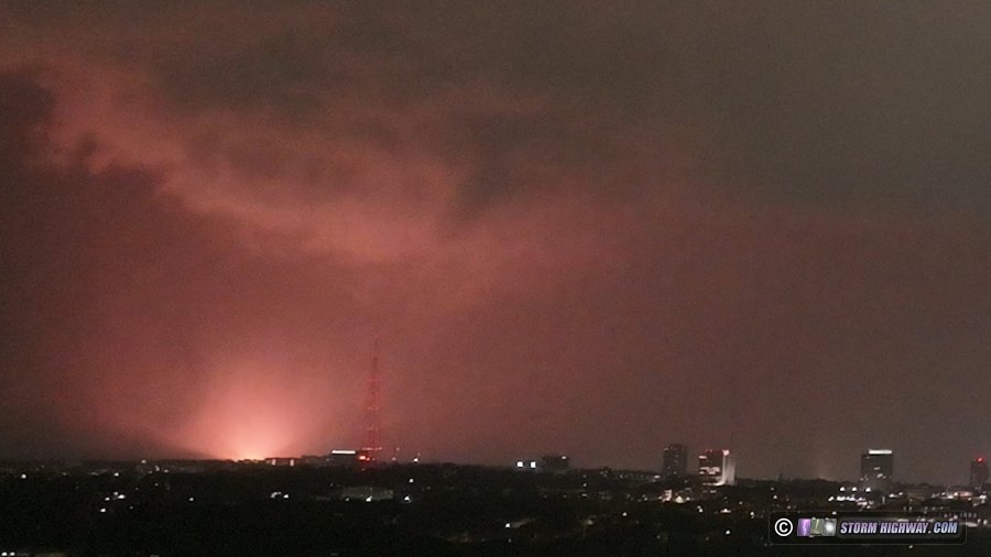
As I drove through Kansas City, the line appeared to accelerate eastward with 80mph winds reported. I thought this might produce power flashes as it moved through the city, so I found a spot east of downtown where I could get LAANC clearance to fly my drone at 400 feet. I sent the drone up and filmed the line approaching downtown. As expected, there were numerous power flashes.
Video of this:
After reviewing the video, a well-defined funnel was visible above one of the more prolific clusters of power flashes:
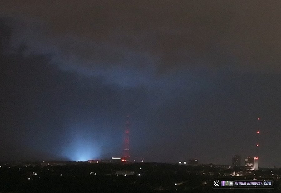
I had thought this could have been a mesovortex tornado along the leading edge of the gust front. After arriving home and looking at the video more closely (applying brightness and contrast to enhance the cloud features), the funnel feature appears to be simply a developing scud finger pushing outward on the outflow. I don't see any concentrated area of rotation in that vicinity.
The line overtook me here, and I got stuck on I-70 when it was closed for flooding near Grain Valley. After the road was reopened, I eventually got ahead of the line at Wentzville and made it home at 4am.  Day 4: June 7: St. Louis to Wakeeney, Kansas (Trip #3 start) Day 4: June 7: St. Louis to Wakeeney, Kansas (Trip #3 start)
I left St. Louis Sunday afternoon the 7th to begin the third Great Plains trip of the year, stopping for the night in Wakeeney, Kansas.
 Day 5: June 8: Supercells from Woodston to Woodbine, Kansas Day 5: June 8: Supercells from Woodston to Woodbine, Kansas
I observed two supercells from Woodbine, Kansas (east of Stockton) to just east of Salina. There were two targets this day, one in eastern Colorado along I-70 and a second in northern-central Kansas. I chose the Kansas target because it had better roads, fewer chasers and had a better surface environment with southeasterly surface winds on the northeast quadraft of a surface low to the south.
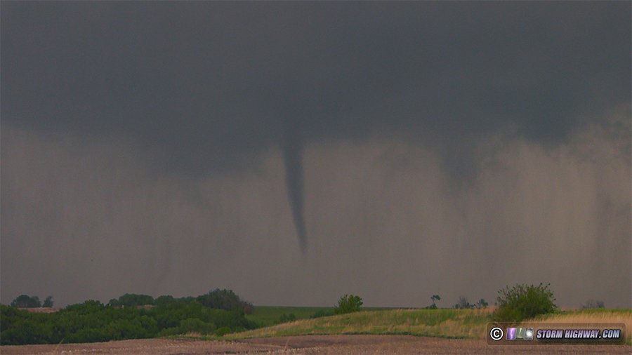
The first storm was mostly outflow-dominant, managing to produce a strong RFD surge and wrap up once at Cawker City. It did not produce a tornado from my vantage point:
As this activity transitioned to a linear complex, I dropped south to the supercell at Salina, arriving on it south of Abilene as it was wrapped up an an impressive curl on radar. This was all completely rain-wrapped, however, and based on reports it dodn't appear that this managed to produce a tornado.
I had wanted to try shooting sprites with this complex as it moved off to the east, so I let the now-QLCS line overtake me at Junction City. I hadn't slept well the previous night, so the plan was to take a nap as the storms rolled overhead and wake up when they were distant enough to the east for sprites. Again I wasn't able to sleep, so I got back on the road.
New storms had gone up behind the line, fouling the view for sprites. With that play gone, I decided to just keep driving east until I was tired enough to stop for the night. As I approached Topeka, nice highly-branched upward lightning was occurring to the clusters of towers west of the city. I stopped to shoot these for 45 minutes, but no further upward flashes occurred after I had set up.
I continued east, thinking there would be another good chance for upward flashes to the towers in Kansas City. But the stratiform region was becoming disconnected from the leading cores of the line, and accordingly the energetic horizontal flashes had diminished to the point that I didn't see any further upward flashes.
I finally stopped for the night in Concordia, Missouri. Day 6: June 9: Concordia, Missouri to St. Louis (Trip #3 end)
I made the rest of the drive home from Columbia, Missouri, arriving at 4pm.
GO: Home | Storm Chase Logs | Photography | Extreme Weather Library | Stock Footage | Blog
Featured Weather Library Article:
|


