Days 10,11: June 2,3 - Cap busts, nighttime wall cloud
Thursday, June 2: Thursay's setup looked good for western Kansas. We targeted Liberal, Kansas, which was good since that was where we were staying Wednesday night. We waited all day for storms to fire on the dryline bulge, and finally at 5PM we had a cell developing to the west. As we drove west to intercept, it died quickly. I called it a day and headed to Manhattan to pick up Matt, who had just flown in from Raleigh.
Friday, June 3: We headed south to Lawton and watched towering cumulus try to get going. Finally, we had a storm develop north of Lawton, and we drove north to intercept. Just like Thursday's storm, however, it also had trouble organizing. It was also racing north out of our reach. We called it a day in Minco and stopped in OKC for a steak dinner!
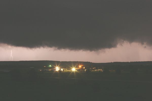
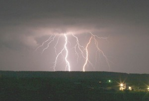
Later that night, supercells developed in northern Oklahoma near Bartlesville, and Bill, Matt and I headed north for lightning photos. We ended up seeing our storm morph into a monster supercell with frequent lightning, a persistent wall cloud and several funnels:
Video Captures:
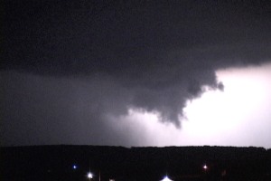
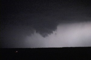
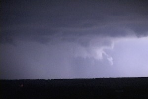
Digital Photos by Matt Robinson - click to enlarge

We called it a night after 3AM and spent the night in Bartlesville. We are heading to Kansas on Saturday for a possible significant tornado outbreak.
GO: Home | Storm Expeditions | Photography | Extreme Weather Library | Stock Footage | Blog
Featured Weather Library Article:
|