|
Home | Blog Index | Blog Archives | Christianity & Faith Essays | Storm Chasing Essays
December 5 snowstorm: Tuesday 3:10PM update
The forecast track of the clipper system continues to shift slightly southward, which may keep most of West Virginia below freezing and in an accumulating snow scenario for much of Wednesday. Four to five inches is not out of the question for Charleston by tomorrow evening.
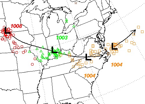
Clipper low forecast track
The clipper is currently visible on radar in the upper Midwest, with a broad swath of good snowfall rates across Minnesota and Wisconsin. All of this activity is heading straight toward West Virginia:
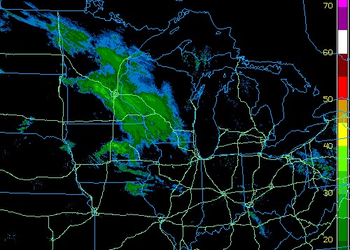
3:15PM EST radar image
Many stations across MN and WI are reporting moderate snow as the clipper passes:
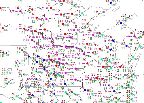
3:15PM EST surface observations
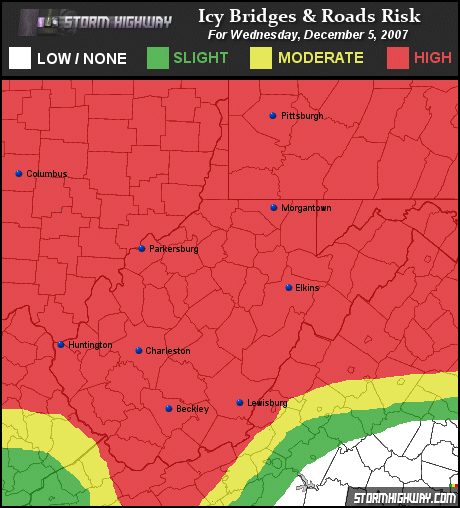
With the clipper taking a more southerly track, icy roads will be a widespread hazard from Tuesday night through Wednesday night.
GO: Home | Storm Chase Logs | Photography | Extreme Weather Library | Stock Footage | Blog
Featured Weather Library Article:
|


